
Loading article…


_(filtered).jpg/500px-King's_Highway_401_-_Ontario_(4118726412)_(filtered).jpg)
アクセス制限付き高速道路は、高速車両交通向けに設計された高速道路の一種で、すべての交通の流れ(出入り)が規制されています。一般的な英語の用語には、 freeway、[a]、 motorway、[b]、expresswayなどがあります。[c]その他の類似の用語には、 throughwayまたはthruway 、[d]、parkwayなどがあります。これらの中には、limited-access highwayもありますが、この用語は、他の交通からの隔離がやや少ない高速道路のクラスを指す場合もあります。
ウィーン条約に従う国では、高速道路の資格は歩行と駐車が禁止されていることを意味します。
完全にアクセスが制限された高速道路では、交通信号、交差点、敷地への立ち入りがなく、交通の流れが妨げられません。他の道路、鉄道、歩行者道との平面交差はなく、代わりに高架や地下道で横断されています。高速道路の出入り口はインターチェンジのスリップロード(ランプ)によって提供され、高速道路と幹線道路や集散道路との間で速度を変えることができます。アクセスが制限された高速道路では、反対方向の通行は通常、交通バリアまたは芝生を含む中央分離帯または中央分離帯によって分離されています。他の方向の交通との衝突がなくなると、安全性が劇的に向上し、[2]交通容量と速度が向上します。
アクセス制限付き高速道路は、20世紀前半に発展した。イタリアは、世界で初めて高速交通と自動車専用のアクセス制限付き高速道路を建設した国である。[3] [4]イタリアは1924年にミラノとヴァレーゼを結ぶA8号線で初のアウトストラーダを開通させた。ドイツは1932年にケルンとボンの間に、速度制限のない初のアクセス制限付きアウトバーン(当時はデュアルハイウェイと呼ばれていた、現在のA555号線の30キロメートル[19マイル])の建設を開始した。その後、ドイツはそのような道路の最初の[5]全国的なシステムを急速に構築した。北米初のフリーウェイ(パークウェイとして知られる)は、1920年代にニューヨーク市地域で開通した。鉄道の影響を強く受けた英国は、 1958年まで 初の高速道路であるプレストンバイパス(M6 )を建設しなかった。
技術的に先進的な国のほとんどは、大規模な都市部の移動、または高速の地方部の移動、あるいはその両方を可能にするために、高速道路やモーターウェイの広範なネットワークを備えています。多くの国では、国内レベル、さらには国際レベル(例:ヨーロッパのEルート)の路線番号システムを採用しています。
定義基準


「高速道路」などの単語の定義を示す国際規格はいくつかありますが、「フリーウェイ」、「モーターウェイ」、 「高速道路」などの英語の単語や、 「オートルート」、 「アウトバーン」、 「オートストラーダ」 、 「オートチェスタ」 、「オートプット」などの他の言語の同等の単語については、世界中で受け入れられている正式な定義はありません。ほとんどの場合、これらの単語は、現地の法令や設計規格、または地域の国際条約によって定義されています。広く使用されている説明には、次のものがあります。
- 「高速道路」とは、隣接する土地に役立たない自動車交通のために特別に設計および建設された道路であり、次の条件を満たすものを指します。
- 特別な地点または一時的な場合を除き、交通を目的としない分離帯によって、または例外的に他の手段によって相互に分離された、2方向の交通のための別々の車道が設けられていること。
- 道路、鉄道、路面電車の線路、歩道と交差していないこと。
- 高速道路として特別に標識が設置されている。[6]
緑または青のシンボル(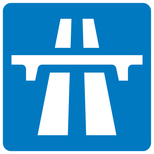 ) は、ウィーン条約に従う国の高速道路の入口に表示されます。出口には別のシンボルが表示されます。
 。
。
OECD [7]とPIARC [8]の「高速道路」の定義はほぼ同じです。
- ITE ( CITEを含む)
-
- フリーウェイ: 完全にアクセスが制御され、平面交差のない分離された主要道路。この定義は、有料道路と無料道路の両方に適用されます。
- フリーウェイ A : 見た目が複雑で交通量が多い道路を指します。通常、このタイプのフリーウェイは大都市の中心部またはその付近にあり、設計容量またはそれに近い容量で夕方の早い時間帯のほとんどを運行します。
- 高速道路 B : 照明が必要なアクセスを完全に制御するその他のすべての分離道路を指定します。
- フリーウェイ: 完全にアクセスが制御され、平面交差のない分離された主要道路。この定義は、有料道路と無料道路の両方に適用されます。
欧州連合では、統計上および安全上の理由から、高速道路と高速道路を区別する場合があります。たとえば、主要幹線道路は次のように考えられます。
長距離および主に都市間の移動に使われる道路。高速道路(都市または農村)と高速道路(隣接する土地にサービスを提供せず、2方向の交通に別々の車道が用意されている道路)が含まれます。主要幹線道路は都市部を横断し、郊外の移動に使われます。交通は高速と完全または部分的なアクセス制御(信号で制御されるインターチェンジまたはジャンクション)が特徴です。主要幹線道路につながる他の道路は、側道を介して接続されます。[9]
この見解では、CAREの定義では高速道路は次のように理解されている。
片側2車線以上の2車線道路がある公道。すべての出入口に標識があり、すべてのインターチェンジは立体交差している。道路全体に中央分離帯がある。横断は禁止、停止は緊急時のみ許可される。自動車の通行は制限され、歩行者、動物、自転車、モペット、農業用車両の通行は禁止されている。最低速度は50 km/h [31 mph]以上、最高速度は130 km/h [81 mph]以下である(制限速度が定められていないドイツを除く)。 [9]
高速道路は、事故をできるだけ少なくして、大量の交通を高速で運ぶように設計されています。また、長距離交通とローカル交通の衝突を避けるために、他の道路から長距離交通を集めるように設計されています。[10]ヨーロッパの共通定義によると、高速道路は「自動車交通のために特別に設計および建設された道路で、隣接する土地にサービスを提供せず、次の条件を満たす道路」と定義されています。(a) 特別な場所または一時的な場合を除き、2 方向の交通に別々の車道が設けられ、交通を目的としない分離帯によって、または例外的に他の手段によって、互いに分離されている。(b) 道路、鉄道、路面電車の線路、または歩道と平面的に交差していない。(c) 高速道路として特別に標識が立てられており、特定の種類の道路用自動車専用である。」[11]都市高速道路もこの定義に含まれます。ただし、それぞれの国の定義と対象となる道路の種類は、EU 諸国によって若干異なる場合があります。[12]
歴史
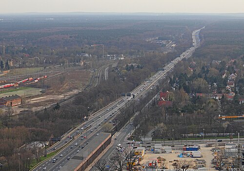

現代のアクセス制限付き高速道路の最初のバージョンは、20世紀前半に開発されました。ニューヨーク州ロングアイランドのロングアイランド・モーター・パークウェイは、1908年に民間事業として開通し、世界初の制限付き道路でした。バンクターン、ガードレール、鉄筋コンクリート舗装など、多くの現代的な設備が備わっていました。[21]パークウェイとコネクターの間では、対向車線を横切って左折できるため、アクセス制限付き高速道路(または、後に連邦政府の統一交通管制装置マニュアルで定義された「フリーウェイ」 )ではありませんでした。
現代のアクセス制限付き高速道路は、自動車の急速な利用の増加、都市間のより速い移動の需要、舗装工程、技術、材料の改良の結果として、1920 年代初頭に誕生しました。これらの当初の高速道路は「デュアル ハイウェイ」と呼ばれていましたが、近代化されて現在も使用されています。
イタリアは、高速道路と自動車専用道路を建設した世界初の国である。[3] [4]ミラノとコモ湖、マッジョーレ湖を結び、現在はA8とA9高速道路の一部となっているアウトストラーダ・デイ・ラーギ (「湖沼高速道路」)は、世界で初めて建設された道路で、ピエロ・プリチェッリによって考案され、1924年に開通した。[4]アウトストラーダと呼ばれるこの高速道路には、片側1車線のみでインターチェンジはなかった。ブロンクスリバーパークウェイは、公園を通って建設され、交差する道路が橋を渡る場所に、対向車線を分ける中央分離帯を採用した北米初の道路である。[22] [23]サザン・ステート・パークウェイは1927年に開通し、ロングアイランド・モーター・パークウェイは1937年に閉鎖され、ノーザン・ステート・パークウェイ(1931年開通)とそれに続くグランド・セントラル・パークウェイ(1936年開通)に置き換えられた。ドイツでは、ボン・ケルン・アウトバーンの建設が1929年に始まり、1932年に当時のケルン市長コンラート・アデナウアーによって開通した。[24]ドイツのアウトバーンは全国初の高速道路システムとなった。[25]
カナダでは、半制御アクセスの最初の先駆けは、ハミルトンとトロントの間のミドルロードであり、対向車線を隔てる中央分離帯と、国内初のクローバーリーフインターチェンジが特徴であった。このハイウェイは、 1937年の開通時にクローバーリーフとトランペットのインターチェンジを特徴とするクイーンエリザベスウェイに発展し、第二次世界大戦まで、建設された最長の照明付き道路を誇った。[26] 10年後、以前の設計に基づいてハイウェイ401の最初のセクションが開通した。それ以来、このハイウェイは世界で最も交通量の多いハイウェイとなった。
フリーウェイという言葉は、1930年2月にエドワード・M・バセットによって初めて使用されました。[27] [28] [29] [30]バセットは、道路は3つの基本的なタイプ、つまりハイウェイ、パークウェイ、フリーウェイに分類されるべきだと主張しました。[27]バセットのゾーニングと財産法に基づくシステムでは、隣接する不動産所有者は採光、通気、ハイウェイへのアクセスの権利を有しますが、パークウェイとフリーウェイには権利がありません。後者の2つは、パークウェイの目的がレクリエーションであるのに対し、フリーウェイの目的は移動であるという点で区別されます。[27]したがって、当初考えられていたように、フリーウェイは、隣接する不動産所有者が採光、通気、アクセスの権利を持たない、移動に充てられた公有地の単なる細長い部分です。[27]
デザイン

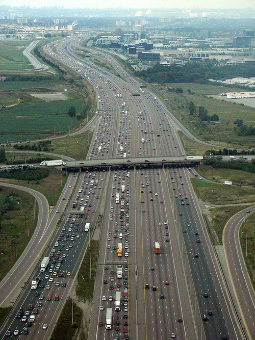

定義上、フリーウェイには他の道路、鉄道、多目的歩道との平面交差がありません。したがって、交通信号は必要なく、フリーウェイを通過する交通は通常、交通信号で停止する必要はありません。米国などの一部の国では、限定的な例外が認められています。たとえば、オレゴン州とワシントン州間の州間高速道路5号線の州間高速道路橋など、一部の可動橋では、船舶の通行 のために運転者が停止する必要があります。
他のルートによる高速道路の横断は、通常、アンダーパスまたはオーバーパスの形態で立体交差によって実現されます。高速道路を横断する道路に付属する歩道(舗装)に加えて、専用の歩行者用 橋またはトンネルが設けられることもあります。これらの構造により、歩行者や自転車は、最も近い道路横断地点まで迂回することなく、その地点で高速道路を横断できます。
高速道路へのアクセスは、通常、立体交差インターチェンジでのみ提供されるが、低基準の右入右出(左側通行の国では左入左出)アクセスを使用して、側道に直接接続することができる。多くの場合、洗練されたインターチェンジにより、交差する高速道路と混雑した幹線道路との間でスムーズで中断のない移行が可能になる。しかし、高速道路から別の高速道路に乗り換えるには、一般道に出る必要がある場合もある。米国の一例(結果として生じる渋滞で悪名高い)は、ペンシルベニア州ブリーズウッドの町を通る州間高速道路70号線からペンシルベニア・ターンパイク(州間高速道路70号線と州間高速道路76号線)への接続である。[31]
高速道路では一般的に速度制限が高く、時には制限がないこともあります (ドイツのアウトバーンネットワークの多くでそうであるように)。速度が速いと判断時間が短くなるため、高速道路には通常、他の道路よりも多くの案内標識が備え付けられており、標識自体も物理的に大きくなっています。案内標識は、ドライバーが各車線の行き先を確認できるように、高架または頭上ガントリーに設置されることがよくあります。出口番号は、高速道路の始点からの出口までの距離 (マイルまたはキロメートル) から算出されるのが一般的です。一部の地域では、高速道路に公共の休憩所やサービス エリアがあり、路肩に一定間隔で緊急電話が設置されています。
米国では、マイルポストは通常、高速道路の最南端または最西端 (高速道路の終点または州境) から始まります。カリフォルニア州、オハイオ州、ネバダ州では、州内の各郡を通るマイル数を示すポストマイルシステムを使用しています。ただし、ネバダ州とオハイオ州では、それぞれのポストマイル システムと同時に標準マイルポスト システムも使用しています。カリフォルニア州では、高速道路の出口にマイルポスト システムに従って番号を付けていますが、マイルポスト マーカーは使用していません。
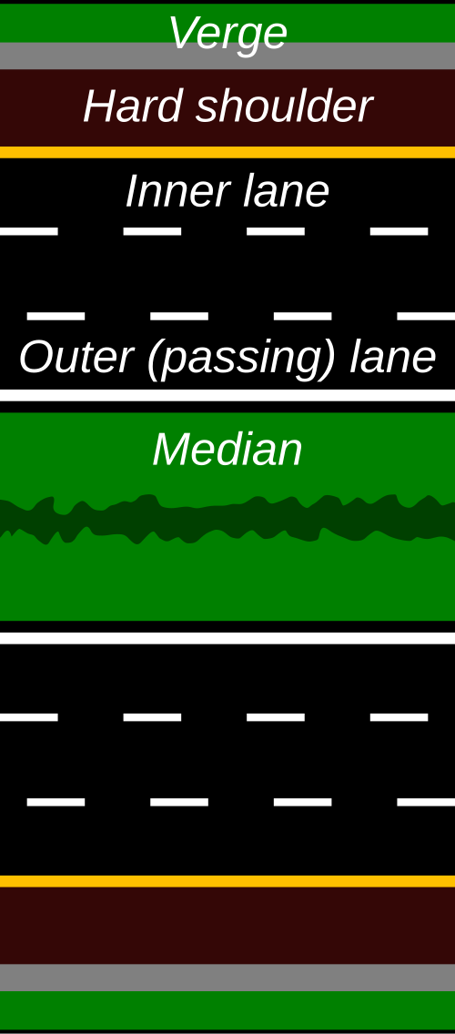
ヨーロッパやその他の国では、高速道路は一般的に次のような類似した特徴を持っています。
- 典型的な設計速度は100~130 km/h(62~81 mph)の範囲です。
- 水平曲線半径の最小値は約 750 ~ 900 m (2,460 ~ 2,950 フィート) です。
- 最大縦勾配は通常 4% ~ 5% を超えません。
- 横断面は、各走行方向に最低 2 車線の通過交通レーンを組み込んでおり、各レーンの標準幅は 3.50 ~ 3.75 m (11 フィート 6 インチ ~ 12 フィート 4 インチ) で、中央分離帯で区切られています。
- 4.5~10 m (15~33 フィート) の障害物のないゾーン、または適切な車両拘束システムの設置。
- 異なるレベルの 2 つ以上の道路間の交通の流れを可能にする高架インターチェンジの適切な設計。
- 他の道路タイプと比較して、トンネルや高架道路の建設がより頻繁に行われ、複雑な設備と操作方法が必要になります。
- 高効率道路設備および交通管制装置の設置[32]
断面
2車線のフリーウェイは、多くの場合は分離されておらず、交通量が少ない場合や優先権が限られている場合に建設されることがあります。4車線のフリーウェイの片側に簡単に転換できるように設計されていることもあります。(たとえば、ケンタッキー州東部のバート・T・コームズ・マウンテン・パークウェイのほとんどは2車線ですが、すべてを4車線にする作業が始まっています。) これらは、しばしばスーパー2道路と呼ばれます。このような道路のいくつかは、致命的な衝突の発生率が高いことで悪名高いです。これは、これらの道路が短い視程距離(対向車がいないフリーウェイには十分ですが、対向車が来る2車線道路として何年も使用された場合、不十分)を考慮して設計されているためです。このような「地獄へのハイウェイ」の例は、スウェーデンのイェブレからアクスマルタヴランまでのヨーロッパのルートE4です。この道路(および同様の道路)での重傷を伴う衝突の発生率の高さは、中央分離帯の衝突防止柵が設置され、致命的な衝突が非致命的な衝突に変わるまで続きました。それ以外の場合、高速道路には通常、各方向に少なくとも2車線があり、混雑した道路では合計で16車線以上になることもあります[e]。
カリフォルニア州サンディエゴでは、州間高速道路5号線に、州間高速道路805号線とカリフォルニア州道56号線の間の2マイル (3.2 km) の区間に最大幅21車線の急行車線と一般車線の同様のシステムがあります。オンタリオ州ミシサガでは、ハイウェイ401号線がハイウェイ403号線/ハイウェイ410号線およびハイウェイ427号線との交差点を通る合計18車線の集合急行車線を使用しています。
これらの広いフリーウェイでは、通過交通をローカル交通から分離するために別のコレクターレーンとエクスプレスレーンを使用したり、最内側の車線または別の道路に特別な制限を設けて、相乗りを奨励するために特別な高乗車率車両レーンを使用したりすることがあります。これらのHOV レーン、つまりすべての交通に開かれた道路は、可逆レーンにすることができ、交通量の多い方向に容量を増やし、交通が切り替わる前に方向を反転します。ローカルレーンの短縮版であるコレクター/ディストリビューター道路により、密集したインターチェンジ間の蛇行が別の道路に移行したり、蛇行が完全に排除されることもあります。
世界の一部の地域、特に米国の一部では、側道が高速道路システムの不可欠な部分を形成しています。これらの平行した路面道路は、高速の「通過」交通と地元の交通の間の移行を提供します。頻繁にスリップランプが高速道路と側道へのアクセスを提供し、今度は地元の道路や企業に直接アクセスできるようにします。[33]
一部の2車線高速道路(および非常にまれに幅の広い高速道路)を除き、中央分離帯が反対方向の交通を分離します。この帯は芝生のエリアのように単純な場合もあれば、 「ジャージーバリア」や「オンタリオトールウォール」などの衝突防止バリアを含む場合もあります。正面衝突を防ぐためです。 [34]一部の高速道路では、2車線が異なる線形で建設されています。これは、山岳地帯の利用可能な通路を利用したり、密集した都市部を通る狭い通路を提供する目的で行われることがあります。[要出典]
アクセス制御
アクセス制御は、高速道路を使用できる車両の種類を制限する法的地位、および高速道路にアクセスできるポイントを制限する 道路設計に関係します。
主要幹線道路には、多くの場合、部分的な通行規制が設けられています。つまり、側道はインターチェンジを使用せずに、平面で主要道路と交差しますが、私道は主要道路に直接接続していない可能性があり、ドライバーは隣接する土地にアクセスするには交差道路を使用する必要があります。 比較的静かな側道がある幹線道路のジャンクションでは、交通は主に双方向の一時停止標識によって制御されており、主要高速道路を使用する交通に大きな支障をきたしません。ヨーロッパでは、交通量の多い交差点でラウンドアバウトがよく使用されます。これは、流れの中断を最小限に抑えるのに役立つためです。一方、北米では、交通に大きな支障をきたす交通信号が依然として好まれています。 他の主要幹線道路とのインターチェンジが時々ある場合があります。例としては、SR 15の東端とオハイオ州デラウェアの間のUS 23 、およびオハイオ州西部と中央部のSR 15の東端とI-75、US 30、SR 29 / US 33、およびUS 35があります。 このタイプの道路は、高速道路と呼ばれることもあります。
高速道路での非自動車アクセス
高速道路は通常、最低出力または最低重量の自動車のみ通行可能で、標識で自転車、歩行者、乗馬を禁止したり、最低速度を定めたりすることがあります。自動車以外の交通が、高速道路規格の橋に沿って建設された歩道や、フロリダ州のサンコースト パークウェイ沿いのサンコースト トレイルなど高速道路に隣接する多目的歩道など、同じ通行権内の施設を使用することは可能です。

米国の一部の管轄区域、特にフリーウェイが既存の道路に取って代わる地域では、フリーウェイへの非自動車のアクセスが許可されています。米国では州によって法律が異なります。アリゾナ州では、自転車にとって同等かより良い代替ルートがある場合にのみ、フリーウェイでの自転車の走行が禁止される場合があります。[35] 人口密度が2番目に低いワイオミング州では、すべてのフリーウェイでの自転車の走行が許可されています。オレゴン州では、ポートランドとメドフォードの特定の都市フリーウェイを除き、自転車の走行が許可されています。[36]
英国などの国では、新しい高速道路には、制限付き通行権を確保するための議会法が必要である。既存の道路(「キングス・ハイウェイ」)を完全な高速道路にアップグレードすると、歩行者、自転車、低速車両などの特定のグループのアクセス権が消滅するため、多くの制限付きアクセス道路は完全な高速道路ではない。 [37]場合によっては、ダートフォード・クロッシング(テムズ川の最下流の公共横断橋)のように代替の通行権が実行不可能な短い道路で高速道路が接続されていたり、旧カンバーランド・ギャップのように既存の道路に沿って高速道路を建設することが経済的でなかったりする場所もある。 A1は、段階的に高速道路規格にアップグレードする良い例です。2013 年 1 月の時点で、全長 639 キロメートル (397 マイル) のルートには 5 つの高速道路区間 (A1(M) として指定) がありましたが、2018 年 3 月にノース ヨークシャーを通る A1(M) が完成し、4 つの区間に減少しました。
建設技術

高速道路を敷設する最も一般的な方法は、森林や建物などの障害物を撤去した後、地面から建設することです。農地が枯渇することもあります。しかし、経済的、社会的、さらには環境的理由から、他の方法が開発されてきました。
完全なフリーウェイは、平面高速道路を改造したり、平面交差点を高架に置き換えたりすることで作られることがあります。しかし、米国では、フリーウェイの終点となる平面交差点は、多くの場合、平面交差点のままです。多くの場合、2車線の分離されていないフリーウェイまたは高速道路がある場合、平行するツイン通路を建設し、2つの移動方向の間に中央分離帯を残すことで改造されます。古い双方向通路の中央分離帯側の移動車線は、追い越し車線になります。
その他の手法としては、特に田舎の地域では拡幅のための地役権が設けられるため、片側には多くの私道があり、反対側には長い私道があることもある、分離された高速道路の側に新しい車道を建設するというものがあります。
3 つ目の車道が追加されると、片側をもう片側よりも優先する私道を確保するために、方向指定車道を 20 ~ 60 メートル (50 ~ 200 フィート) (土地の空き状況によってはそれ以上) ずらすことがあります。その他の方法としては、長い私道を短くするサービス ドライブウェイを建設する方法があります (通常は 100 メートル (330 フィート) 未満)。
インターチェンジとアクセスポイント
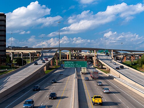

インターチェンジまたはジャンクションは、1 つのアクセス制限付き高速道路からの交通が別のアクセス制限付き高速道路にアクセスでき、その逆も同様である高速道路のレイアウトです。一方、アクセス ポイントは、ディストリビューターまたは地方道路からの交通がアクセス制限付き高速道路に合流できる高速道路のレイアウトです。英国など一部の国では、この 2 つを区別していませんが、他の国では区別しています。たとえば、ドイツでは、前者をKreuz (交差) またはDreieck (三角形) と呼び、後者をAusfahrt (出口) と呼びます。いずれの場合も、1 つの道路が他の道路と交差するのは、平面交差ではなく、橋またはトンネルを介してです。
2 つの道路を結ぶ相互接続道路、またはスリップロードは、いくつかのパターンのいずれかに従うことができます。実際のパターンは、地域の地形、交通密度、土地コスト、建築コスト、道路の種類など、いくつかの要因によって決まります。一部の管轄区域では、特にクローバーリーフ インターチェンジでは、フィーダー/ディストリビューター レーンが一般的ですが、ラウンドアバウト インターチェンジが一般的な英国などの他の地域では、フィーダー/ディストリビューター レーンはほとんど見られません。
ヨーロッパの高速道路は、一般的に出口とジャンクションが異なります。出口は高速道路システムから出るところで、ジャンクションは高速道路同士の交差点、または 2 つの高速道路の分岐/合流点です。高速道路のルールは出口で終わりますが、ジャンクションでは終わりません。ただし、一部の橋では、高速道路は見た目を変えずに、橋 (またはトンネル) に最も近い 2 つの出口の間で一時的に終了し、2 車線道路として続きます。これは、低速車両が橋を通行できるようにするためです。ロンドン オービタルのクイーン エリザベス 2 世橋/ダートフォード トンネルがその一例です。ロンドン オービタルまたは M25 はロンドンを取り囲む高速道路ですが、テムズ川河口前の最後の交差点では高速道路のルールは適用されません (この交差点では、ロンドン オービタルは A282 と表示されています)。
より一般的なジャンクションの種類をいくつか以下に示します。[38] [39] [40]
さまざまなインターチェンジレイアウト
-
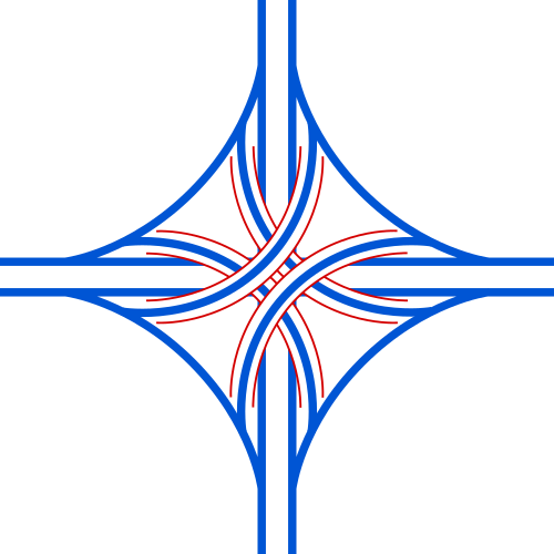 4 段スタック: 通常は高速道路のジャンクションの主要なジャンクションとして使用されます。
 -
 ラウンドアバウトインターチェンジ:イギリスではジャンクションまたは出口として非常に一般的です
 -
 クローバーリーフ:主に接合部として使用される
 -
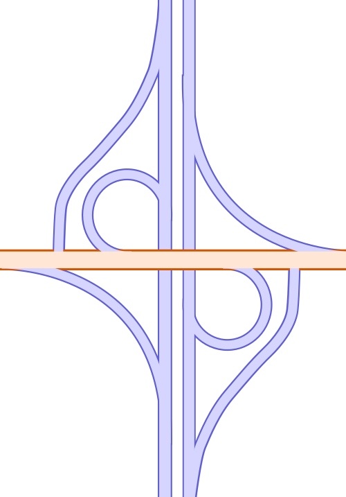 パルクロ(部分クローバーリーフ)インターチェンジ:小道とジャンクションを結ぶためによく使用される
 -
 トランペットインターチェンジ: 高速道路の「T」字路。インターチェンジが 2 つの道路の一方の終点を表す場合に使用されます。料金所が 1 つだけ必要なため、有料道路でもよく使用されます。
 -
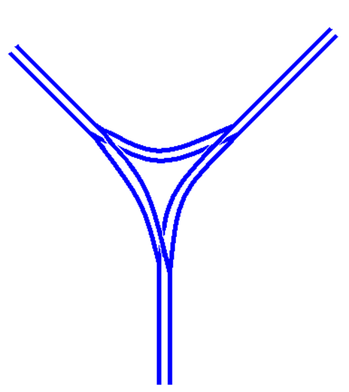 高速道路の分岐または合流。基本的なロジックはT字路に似ている
 -
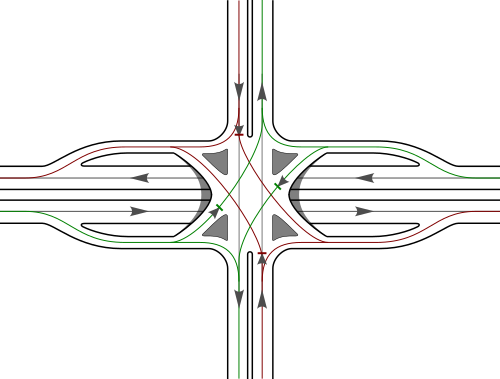 シングルポイント都市インターチェンジ(SPUI)は、密集した都市部でジャンクションの土地占有面積を減らすために使用されます。
 -
 分岐ダイヤモンドインターチェンジ。対向車線を横切る曲がり角を最小限に抑えることで、交通の流れと安全性を向上させるように設計されています。
安全性
国によって地理、経済、交通量の増加、高速道路システムの規模、都市化と自動車化の程度など多くの違いがあり、比較を行う際にはこれらすべてを考慮する必要がある。[41] EUのいくつかの論文によると、高速道路の安全性の向上は、インフラの安全性や道路利用者の行動(速度やシートベルトの使用)など、いくつかの変化の結果であるが、車両の安全性や移動パターンなどの他の事項も定量化されていない影響を持っている。[42]
高速道路と他の道路の比較
高速道路は、設計上最も安全な道路です。走行距離の4分の1以上を占めるにもかかわらず、2006年のヨーロッパの交通事故死者総数のわずか8%を占めています。[2]ドイツ連邦道路研究所は、 2010年の国際道路交通事故データベース(IRTAD)統計を提供し、全体の死亡率と高速道路の死亡率(交通量に関係なく)を比較しています。
ドイツのアウトバーン網は、アクセス制限のある高速道路の安全性のトレードオフを如実に表している。アウトバーンの負傷事故率は非常に低いが[45] 、負傷事故1,000件につき22人が死亡している。アウトバーンの死亡率は、従来の田舎道の負傷事故1,000件につき29人より低いものの、都市部の道路よりも高い。田舎道やアウトバーンの速度は都市部の道路よりも速いため、事故の重大性が高まる可能性がある。[46]
ETSCによると、制限速度がないものの130km/h(81mph)の速度を推奨しているドイツの高速道路は、制限速度のある高速道路よりも25%も危険度が高いとのことです。[47]
ドイツでは、これまで制限速度がなかった高速道路のさまざまな区間に時速130キロ(81マイル)の速度制限を導入した。これにより、これらの区間での死亡者数は20~50%減少した。[48]
事故の原因
ヨーロッパでは、速度は衝突事故の主な要因の1つと考えられています。フランスやスイスなどの一部の国では、速度の監視を改善することで死亡者数を削減しました。速度を監視するために使用されるツールとしては、交通密度の増加、速度違反の取り締まりの改善、運転免許の取り消しにつながる規制の強化、安全カメラ、ペナルティポイント、罰金の引き上げなどが挙げられます。他の国では、速度を管理するために自動時間オーバーディスタンスカメラ(セクションコントロールとも呼ばれる)を使用しています。[42]
疲労は高速道路のような単調な道路に特有の危険因子と考えられているが、多くの国ではそのようなデータは監視・記録されていない。[42] Vinci Autoroutesによると、フランスの高速道路での事故の3分の1は居眠り運転によるものである。[49]
フランスの高速道路で死亡した人の23%はシートベルトを着用していなかったが、前部座席の乗客の98%と後部座席の乗客の87%はシートベルトを着用していた。[42]
死亡者数の傾向
安全性の結果は年によってあまり変わらないが、ヨーロッパではいくつかの変化が観察されている。高速道路での死亡者数は2006年から2015年の10年間で41%減少したが、2014年から2015年の間には10%増加した。しかし、高速道路網の長さを考慮に入れて曝露を反映させると、データによると1000キロメートルあたりの死亡者数は2006年から2015年の間に半減した。[50]
通行料効果
バルセロナ大学の研究によると、アクセス制限のある高速道路に通行料が導入されると、ドライバーは通行料の支払いを避けるために別のルートを探す可能性があるという。これにより、交通量が多い道路を想定していない道路の安全性が低下する可能性がある。[51]
都市部の安全性
英国では、既存および新規の都市高速道路による交通事故の影響に関する研究はほとんど行われていない。[52]特に、新規の都市高速道路は交通事故の減少をもたらさない。[要出典]
イタリアでは、都市高速道路A56 タンジェンツィアーレ・ディ・ナポリで行われた調査で、速度を落とすと事故が減少することが示されました。[53]
フランスのマルセイユでは、2009年6月から2010年5月にかけて、リスク、モビリティ、環境に関する研究を行うフランスのセンターであるCEREMAが、都市高速道路網であるマリウスに関する研究を実施した。この研究では、事故と交通変数との関連性が明らかになった。[54]
- 単独車両事故の場合、高速車線の6分間平均速度、車間時間(各車線)
- 多重事故の場合、乗車人数、車間時間(中央車線の場合)。
全長150キロメートル(93マイル)のマリウス道路網では、15億車両キロメートルあたり292件の負傷事故または死亡事故が発生しており、これは10億車両キロメートルあたり189件の負傷事故または死亡事故が発生しているという計算になります。
一部のヨーロッパ諸国では、変化する交通量、速度、事故に応じて交通の流れを動的に管理する一連の対策により、都市高速道路の安全性を向上させています。
- 可変速度制限、ライン制御、速度調整
- 緊急避難場所のある路肩走行
- キュー警告と可変メッセージ
- カメラや路面センサーによる交通の24時間365日の監視(事故の検出と速度制限を下げるタイミングの特定の両方)
- インシデント管理
- 自動執行
- 一時的な路肩走行、可変速度制限、および/または事故検出と管理のための特殊なアルゴリズム
- ランプメータリング(協調機能または独立機能)[55]
1994年には、都市部の高速道路に照明を付けると、照明のない高速道路よりも安全性が向上すると想定されました。[56]
カリフォルニア州では、2001年に都市高速道路における事故、交通量、天候、照明条件の関係性を明らかにする研究が行われた。[57]
- それは、日中の乾いた高速道路と暗闇の濡れた高速道路の違いを明確にする。
- この研究では、左車線の衝突は交通量の影響によって引き起こされる可能性が高く、右車線の衝突は隣接車線の速度変動とより密接に関係していることが明らかになっています (カリフォルニア州では、追い越し時以外は右車線を走行します)。
環境への影響
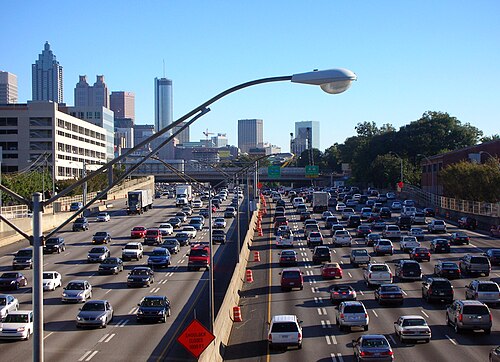


主要都市間および主要都市内部の両方に、アクセス制限のある高速道路が建設され、ほとんどの近代都市の近くに見られる郊外開発の広がりにつながっています。高速道路は、騒音、 [58]汚染、およびそれがもたらす経済的変化について、環境保護論者、都市計画者、および保存論者から厳しく批判されてきました。[59]さらに、高速道路は、ピーク時の交通を処理する際の非効率性について、運転者から批判されてきました。[60] [61] [62]
多くの場合、地方の高速道路は広大な地域を経済発展や自治体のサービスに開放し、一般的に不動産価値を高めます。これとは対照的に、都市部の地上高速道路は不動産価値の低下の原因となることが多く、都市の荒廃につながります。高架や地下道があっても、近隣地域は分断されています。特に貧困地域では、住民が車を所有する可能性は低く、建設に抵抗する政治的、経済的影響力を持つ可能性も低いためです。[63] 1970年代初頭から、米国議会は、米国民の騒音暴露の大部分はフリーウェイやその他の都市高速道路によるものであると特定しました。[64]その後、フリーウェイの騒音を分析し、騒音暴露を最小限に抑えるための設計を支援するためのコンピュータモデルが開発されました。[65]
いくつかの都市では高速道路撤去政策を実施しており、その政策では高速道路が取り壊されて大通りや公園として再利用されています。代表的なものとしては、ソウル(清渓川)、ポートランド(ハーバー ドライブ)、ニューヨーク市(ウエスト サイド高架道路)、ボストン(セントラル アーテリー)、サンフランシスコ(エンバーカデロ フリーウェイ)、シアトル(アラスカン ウェイ高架橋)、ミルウォーキー(パーク イースト フリーウェイ) などがあります。
地上または地上の高速道路建設の代替案として、トンネル技術を使用した地下都市高速道路の建設がある。これは、マドリードやプラハのほか、オーストラリアのシドニー(5つの高速道路がある)、ブリスベン(3つ)、メルボルン(2つ)の各都市で採用されている。これにより、交通量の多い地上道路を作らないという利点があり、メルボルンのイーストリンク高速道路の場合には、生態学的に敏感な地域の破壊を防ぐことができた。
オーストラリアの他の都市も同様の問題(利用可能な土地の不足、住宅取得の費用、美観上の問題、地域の反対)に直面している。物理的な境界(ブリスベン川)と急速な人口増加にも対処しなければならないブリスベンは、地下高速道路を採用した。現在、3つが開通しており(クレムジョーンズトンネル(CLEM7)、エアポートリンク、レガシーウェイ)、1つ(イーストウェストリンク)が現在計画中である。すべてのトンネルは、都心部の環状道路またはバイパスシステムとして機能するように設計されており、地下であろうと地上の埋め立て地であろうと、公共交通機関のための設備が含まれている。[66]しかし、高速道路は道路ベースの公共交通サービスには有益ではない。道路へのアクセスが制限されているため、乗客が車でない限り、限られた数の乗車ポイントに到達するのが不便であり、目的が達成されないためである。[67]
カナダでは、ハーブ グレイ パークウェイとして知られる、デトロイト方面へのハイウェイ 401 の延長線に、公園やレクリエーション用の土地を提供する多数のトンネルと地下道が設計されています。
高速道路反対派は、高速道路の拡張は往々にして自滅的であることに気づいている。拡張は単に交通量を増やすだけである。つまり、当初は交通渋滞が地元の道路から新しい高速道路や拡張された高速道路に移行したとしても、人々は車をもっと使い始め、より遠隔地から通勤するようになる。時間が経つにつれて、高速道路とその周辺は、平均的な移動回数と移動距離の両方が増加するにつれて再び混雑するようになる。この現象は誘発需要として知られている。[68] [69]
ドゥルシラ・ヴァン・ヘンゲル、ジョセフ・ディメント、シェリー・ライアンなどの都市計画の専門家は、適切に設計され維持されている高速道路は、少なくとも管理されていない道路と比較すると便利で安全かもしれないが、異なる民族グループや特定の都市の特定の地域に住む人々にとってレクリエーション、雇用、教育の機会を平等に拡大するわけではないと主張している。[70]それでも、一部の中小企業に新しい市場を開く可能性がある。[71]
1950年代後半に始まった米国州間高速道路システムの都市高速道路建設は、何千もの街区の取り壊しと何千人もの人々の移住を招いた。多くの都心部の住民は、高速道路や高速道路への反乱でこれに反応した。ワシントンの対応を研究すると、最も効果的な変化は行政や立法によるものではなく、政策の実施によるものであることがわかる。米国運輸省(USDOT)設立の最大の論拠の1つは、州間高速道路と都市の利害対立を調停する機関が必要だったことだった。当初、これらの政策は州の高速道路部門の規制として実施された。時が経つにつれ、USDOTの職員は高速道路建設を国家レベルから地方レベルへと再び焦点を当てるようになった。この視点の転換により、代替交通機関や地方に拠点を置く計画機関が奨励されるようになった。[72]
現在、米国では高速道路の拡張は、1970年代に重なったさまざまな要因により、ほぼ停滞している。その要因には、私有財産を取得する前の適正手続き要件の厳格化、土地価値の上昇、建設資材のコスト上昇、都市中心部の新しい高速道路に対する地元の反対、国家環境政策法の可決(連邦政府の資金による新しいプロジェクトには環境影響評価書または報告書が必要であるという要件を課した)、一律税の性質(インフレに合わせて自動的に調整されない)によるガソリン税収入の減少、税金反対運動、[73]、新しい高速道路の代わりに高速大量輸送機関を支持する世論の高まりなどがある。[要出典]
路線番号
イギリス
イギリス

イングランドとウェールズ
イングランドとウェールズでは、主要高速道路の番号は、A道路網とは別の番号体系に従っていたが、同じゾーンの原則に基づいていた。[要出典] M1から時計回りに、提案されたM2、M3、M4高速道路に基づいてゾーン1から4が定義された。M5とM6の番号は、計画されている他の2つの長距離高速道路用に予約されていた。[要出典]英国初の高速道路であるプレストンバイパスは、決定された計画ではA6(M)の番号が付けられるはずだったが、すでに適用されていたM6の番号を維持することが決定された。[要出典]
1946年、戦争運輸省は、道路を特定クラスの車両のみに制限することを許可する法律(1949年特別道路法)が可決される直前に、主要国道の将来パターンを示す地図を発行しました。最初の高速道路区間であるM6プレストンバイパスは1958年に開通し、続いて最初の主要高速道路区間(ワトフォードのクリックとベリーグローブ間のM1)が1959年に開通しました。それ以降1980年代まで、高速道路は頻繁に開通し、1972年までには最初の1,600キロメートル(1,000マイル)の高速道路が建設されました。
1970 年代を通じて都市部以外の道路は建設され続けましたが、都市部の道路に対する反対はより顕著になりました。最も顕著なのは、グレーターロンドン カウンシルによる一連の環状道路の計画が、大規模な道路反対運動とコストの上昇を受けて中止されたことです。1986 年、妥協案として単一環状道路のM25 高速道路が完成しました。1996 年、高速道路の総延長は 3,200 キロメートル (2,000 マイル) に達しました。
英国の高速道路は、他の多くのヨーロッパ諸国と同様に、ほぼ常に次のような特徴を備えています。
- 信号はありません(ただし、主要道路に到達する前のスリップロードでは時々信号があります)。
- 出口は、まれに小さな例外はあるものの、ほとんどの場合、番号付きのジャンクションとスリップロードを経由します。
- 歩行者、自転車、指定されたエンジンサイズ以下の車両は禁止されています。
- 反対方向に流れる交通を分離する中央分離帯があります。(唯一の例外はバーミンガムの A38(M) で、中央分離帯が別の車線に置き換えられ、時間帯によって交通の方向が変わります。マンチェスターの近くには中央分離帯のない別の小さな支線高速道路がありましたが、2000 年代に高速道路としての分類が解除されました。)
- 主要車道にラウンドアバウトはありません。これは、M で始まる高速道路 (いわゆる「M」クラス) にのみ当てはまります。番号が M で終わるアップグレードされた A 道路 (つまり Ax(M)) の場合、主要車道が「M」クラスの高速道路と交差する場所にラウンドアバウトが存在することがあります。2 か所を除くすべての「M」クラスの高速道路では、高速道路の終点または高速道路の指定が終了する地点以外にラウンドアバウトはありません。英国では、次の例外のみがあります。
- サウサンプトンのM271は、M27 と合流する主要車線にラウンドアバウトがありますが、ジャンクション後は M271 として続きます。
- M60にあります。これは、マンチェスター近郊のM62およびM66高速道路の一部を M60 として番号変更し、市の周囲を環状に形成した結果生じたものです。以前は M62 と M66 のジャンクションだった場所では、現在時計回りの M60 がラウンドアバウトを通過し、東行きの M62 と北行きの M66 の交通は M60 から直進します。シミスター島として知られるこのジャンクションは、ラウンドアバウトの存在と番号付きルートの分岐点として批判されてきました。
- ノースヨークシャーのM62とタイン・アンド・ウィアのワシントンを結ぶA1(M)は、ラウンドアバウトのない完全な「M」クラス基準で建設されている。A1(M)のこのセクションは、M1の北延長として再分類されるべきであると提案されている。[74]
2013 年に、Ax(M) 形式の番号を、イングランドで「高速道路」と呼ばれる新しい道路分類の最高基準として使用することが提案されました。高速道路とは、通常のラウンドアバウトや中央分離帯を横切る右折がなく、等級付けされたジャンクションがある道路です。このような道路には、高速道路のような規制がありますが、標準的な主要高速道路の標準の路肩ではなく、緊急用地があります。
スコットランド
スコットランドでは、運輸民間航空省ではなくスコットランド庁(1999年にスコットランド政府に取って代わられた)が決定権を持っていたため、ゾーンパターンはなく、むしろA道路ルールが厳格に施行されている。スコットランドのために7、8、9の番号を予約することが決定された。[要出典] M8はA8のルートをたどり、A90はA85の経路に沿ってA90が再ルートされたときにM90の一部となった。
高速道路は「M」字型ですが、例外が 2 つあります。A823と M90 を接続するロサイス近くの A823(M) と、グレトナのイングランド M6 とアビントンの M74の間の A74(M) です。
北アイルランド
北アイルランドでは、英国の他の地域とは別の独自の番号体系が使用されているが、A、B、Cに沿った道路の分類は、英国とマン島全体で共通である。北アイルランド地域開発大臣への議会質問に対する書面による回答によると、北アイルランドの道路番号体系がどのように考案されたかについては知られていない。[75]しかし、英国の他の地域と同様に、高速道路はMで番号付けされ、ベルファストから来る2つの主要な高速道路はM1とM2で番号付けされている。M12はM1の短い支線であり、M22はM2の短い延長線(当初は支線となる予定だった)である。他の2つの高速道路、短いM3、M5 、およびA8道路の高速道路部分であるA8(M)がある。
アイルランド共和国

アイルランド共和国では、高速道路や国道の番号付けは英国の慣例とはまったく異なります。1993年の道路法の可決以降、すべての高速道路は国道の一部であるか、国道を形成しています。これらのルートは、1から33(およびシリーズとは別に50)までの番号を使用して、連続して番号付けされています(通常、ダブリンから反時計回りに放射状に、N1/M1から始まります)。高速道路は、それが一部を形成しているルートの番号を使用し、国道のNではなくMの接頭辞を付けます(理論上は、地方道路のRではなくMの接頭辞を付けます)。[76]ほとんどの場合、高速道路は以前は国道を形成していた道路のバイパスとして建設されています(例:M7は以前はN7を形成していた道路をバイパスしています)。バイパスされた道路は地方道路として再分類されますが、更新された標識はしばらく提供されない可能性があり、標識の色の慣習の順守は緩いです(地方道路では白地に黒の方向標識が使用され、国道では緑地に白が使用されています)。
以前の法律である 1974 年地方自治体 (道路および高速道路) 法では、高速道路は理論上、国道とは独立して存在していました。しかし、この法律の施行中に開通した高速道路の短い区間は、M50 を除き、常に迂回する国道の番号が付けられていました。この時点では、古い道路は格下げされていませんでした (実際、この段階では地方道路は法律で定められていませんでした)。M7 と M11 の特定のジャンクションにある古い標識は、この以前の制度を反映しており、たとえば N11 と M11 が共存しているのが見られます。
完全に新しい国道であるM50は、以前にN番号が付けられていた道路に代わるものではないため、通常の継承プロセスの例外です。それでもM50は1994年にN50ルートとして制定されました(サザンクロス高速道路として延長されるまで、ジャンクション11タラトからジャンクション12ファーハウスまでの非高速道路セクションは短かった)。M50の指定は、認識可能な番号として選ばれました。2010年現在、N34は次に使用されていない国道の指定です。理論上、アイルランドの高速道路は地方道路の一部を構成できます。[76]
オーストラリア
オーストラリアでは、高速道路やモーターウェイ(フリーウェイまたはエクスプレスウェイとも呼ばれる)の番号には、モーターウェイ、フリーウェイ、エクスプレスウェイを表す M が付いた英数字のルートマーカー、または国道/州のルートマーカーが使用されます。
英数字のルートマーカーが導入される前は、アクセス制限のある幹線道路には、メトロード、国道、国道、または州道マーカーが付けられていました。シドニーでは、パシフィック モーターウェイ(当時は F3 フリーウェイ)を除き、メトロード ルートマーカーが高速道路とフリーウェイに使用されていました。パシフィック モーターウェイには国道マーカーが付けられていました。ブリスベンでは、メトロード、州道が高速道路とフリーウェイに使用されていました。メルボルンでは、すべての高速道路とフリーウェイで州道マーカーが使用されていました。西オーストラリア州では、高速道路とフリーウェイに国道マーカーが使用されています。
英数字のルートマーカーの導入後、シドニーとメルボルンの高速道路とフリーウェイで使用されているすべてのルートマーカーが M マーカーに置き換えられました。ブリスベンでは、1 つの高速道路 ( Western Fwy ) を除くすべての高速道路のルートマーカーが置き換えられました。西オーストラリア州では、新しいシステムはまだ導入されていません。
-
 メトロロードは、アルファ数字ルートマーカーが導入される前にシドニー大都市圏とブリスベンで使用されていました。
 -
 シドニーのウェスタン フリーウェイとプリンセス モーターウェイ (当時は F6 フリーウェイ) に使用されている国道標識。西オーストラリア州では現在も使用されています。
 -
 ブリスベンと西オーストラリアの高速道路に使用される州道標識
 -
 国道、パシフィック・モーターウェイ(当時はF3高速道路)とヒューム・フリーウェイ/ハイウェイとして使用
 -
 英数字のルート マーカー。シドニーとビクトリアの以前のルート マーカーをすべて置き換えました。ブリスベンでは部分的に置き換えました。
.svg/500px-Australian_alpha-numeric_route_shield_(M1).svg.png)
その他
ハンガリーでは、アイルランドと同様に、高速道路の番号は元々の国道の番号(1~7)にMの接頭辞を付けて付けられます。例えば、M7はブダペストからバラトン湖とクロアチアに向かう旧国道7号線のルート上にあります。元々のブダペスト中心の放射状高速道路システムに従わない新しい高速道路には、M8、M9などの番号が付けられ、ブダペスト周辺の環状道路の場合はM0になります。
オランダでは、高速道路の番号は元の国道の番号から派生しますが、A9のように、先頭に A ( Autosnelweg ) が付きます。

ドイツでは、連邦高速道路の先頭に A (アウトバーン)が付きます。その次の数字が奇数の場合、高速道路は一般に南北方向に走り、偶数の場合は一般に東西方向に走ります。ドイツのその他の規制道路 (2 車線道路) には、連邦高速道路 ( Bundesstraßen )、州高速道路( Landesstraßen )、地区高速道路 ( Kreisstraßen )、市高速道路 ( Stadtstraßen ) があり、それぞれに番号体系があります。

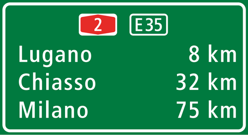
イタリアでは、たとえ異なるコンセッション会社が管理していたとしても、高速道路には単一の番号が付けられている。つまり、高速道路にはすべて「A」(アウトストラーダの場合は「A」、高速道路ジャンクションの場合は「RA」(ベレグアルド・パヴィアジャンクションは標識にアウトストラーダA53と番号が付けられている) 、国際アルプストンネルの場合は「T」)の文字に続いて数字が付けられている。そのため、同じ番号の高速道路でも、異なるコンセッション会社が管理していることがある(例えば、アウトストラーダA23は、一部区間はソシエタ・アウトストラーデ・アルト・アドリアティコが管理し、残りの区間はアウトストラーデ・ペル・リタリア[77] [78]が管理している)。
ニュージーランド、ブラジル、ロシア、フィンランド、スカンジナビア諸国では、高速道路の番号は、その高速道路が属する国道のルートに由来するが、ハンガリーやアイルランドとは異なり、同じ国道のルートの非高速道路部分と区別されない。新しい高速道路が国道のルートのバイパスとして機能する場合、元の国道はそのステータスを剥奪されるか、番号が再割り当てされる。道路番号が低い道路は、長距離運転に適した道路であることを意味する。
ベルギーでは、高速道路だけでなく一部の2車線道路にも、先頭にAが付く番号が付けられています。ただし、E番号も付いている道路は、通常、その番号で参照されます。都市環状道路とバイパスには、先頭にRが付く番号が付けられており、これらも高速道路または2車線道路のいずれかになります。
クロアチアでは、高速道路の番号付けは国道の番号付けとは独立しています。他の多くのヨーロッパ諸国と同様に、高速道路には A ( autocestaの略) という接頭辞が付きます。一部の高速道路は、古い2車線道路を改良してできたもので、国道と並行しています。A2 などの他のケースでは、改良後、国道が側道にルート変更されました。
国別
上記の設計特性は世界中で一般的に適用可能ですが、各管轄区域ではアクセス制限付き高速道路に関する独自の仕様と設計基準を定めています。
アフリカ
アルジェリア


アルジェリアでは、高速道路網は2x3車線で約2,318km(1,440マイル)あります。このネットワークは他の種類のインフラとともにますます拡大していますが、これは国の人口のほとんどが住む北部地域にのみ当てはまります。そして、このインフラは北アフリカの基準としてはかなりよく発達しています。
現時点では、アルジェリアの高速道路網全体は無料です。料金所は現在最終調整中で、高速道路の通行料の導入は 2021 年初頭に予定されています。ネットワーク全体で許可されている最高速度は 120 km/h (75 mph) です。
.jpg/500px-Autoroute_A1_%C3%A0_Oran_(Alg%C3%A9rie).jpg)


エジプト
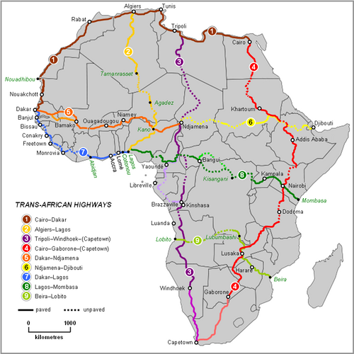
エジプトには、複数車線の高速高速道路が多数あります。トランスアフリカハイウェイ ネットワークの 2 つのルートはカイロを起点としています。エジプトには、アラブ マスレク国際道路ネットワークを通じてアジアとつながる高速道路も複数あります。エジプトには、カイロとアレクサンドリアなどの都市を結ぶ高速道路ネットワークが発展途上です。国内の輸送のほとんどは依然として国道で行われていますが、高速道路は国内の道路輸送の選択肢としてますます増えています。国内の既存の高速道路は次のとおりです。
- カイロ・アレクサンドリア砂漠道路: カイロとアレクサンドリアの間を走り、全長 215 km (134 マイル) のこの道路は、エジプトの主要高速道路です。
- 国際海岸道路: アレクサンドリアからポートサイドまで、ナイル川デルタ北部に沿って走っています。全長は 280 km (170 マイル) です。また、他の都市の中でも、ダミエッタとバルティムを結んでいます。
- ゲイシュ道路:ヘルワンとアシュートの間をナイル川に沿って走り、ベニ・スエフとミニヤも結びます。全長は 306 km (190 マイル) です。
- 環状道路: カイロの内環状道路として機能します。長さは 103 km (64 マイル) です。
- 地域環状道路: カイロの外環状道路として機能し、ヘルワンやラマダン10市などの郊外も結んでいます。長さは130 km (81 マイル) です。
エチオピア
.jpg/500px-Adama_(3).jpg)
エチオピアの高速道路網の多くは開発中です。道路プロジェクトは現在、エチオピア政府の年間インフラ予算の約 4 分の 1 を占めています。さらに、道路セクター開発プログラム (RSDP) を通じて、政府は今後 10 年間で道路の建設、修理、アップグレードに 40 億ドルを割り当てています。エチオピアには 100,000 km (62,000 マイル) を超える道路があります。2014 年には、アディスアベバ – アダマ高速道路が開通し、エチオピア初の高速道路となりました。
ケニア

ケニア国道庁は、高速道路の維持、管理、開発、修復を担当しています。ケニア道路委員会によると、ケニアには 160,886 キロメートル (99,970 マイル) の道路があります。トランスアフリカハイウェイネットワークの 2 つのルートがケニアを横断しています。カイロ - ケープタウンハイウェイとラゴス - モンバサハイウェイです。ケニアの道路は、次のクラスに分けられます。
- クラス S: 「2 つ以上の都市を結び、大量の交通を最高速度で安全に運ぶ高速道路」
- クラス A: 「特定の入国管理出入国地点と国際空港や国際海港などの国際ターミナルで国際境界を結ぶ戦略的なルートと回廊を形成する高速道路。」
- クラス B: 「国内の貿易または経済の中心地、郡庁舎、その他の国内的に重要な中心地を相互に、また首都またはクラス A 道路に結び付ける重要な国内ルートを形成する高速道路。」
[79] [80]
モロッコ

モロッコの高速道路と幹線道路は、複数車線の高速でアクセスが制限された幹線道路のネットワークです。
2016 年 11 月現在、モロッコの高速道路の総延長は 1,808 km (1,123 マイル)、高速道路は 1,093 km (679 マイル) です。モロッコは道路網の拡張を計画しています。現在、国内のさまざまな場所で 3,400 km (2,100 マイル) の高速道路と 2,100 km (1,300 マイル) の高速道路が建設中です。
2035年には、高速道路の総延長は5,185km(3,222マイル)の高速道路と3,700km(2,300マイル)の高速道路になる予定だ。モロッコの大臣によると、この計画には300億ディルハムを投資して30,000km(19,000マイル)の道路を建設するという地方道路に特化したプログラムも含まれている。
-
 モロッコ初の高速道路 - A1 カサブランカ - ラバト
 -
 ブズニカの料金所
 -

モザンビーク
モザンビークの高速道路は、国道または主要道路 ( estrada nacionalまたはestrada primária )、または地方道路 ( estradas secundáriasおよびestradas terciárias ) に分類されます。国道には、接頭辞「N」または「EN」が付き、その後に 1 桁または 2 桁の番号が続きます。番号は、一般的に国の南部から北部に向かうにつれて大きくなります。地方道路には、接頭辞「R」が付き、その後に 3 桁の番号が続きます。モザンビークには、32,000 キロメートル (20,000 マイル) を超える舗装道路があります。
ナイジェリア
ナイジェリアは西アフリカ最大の高速道路網を有する。高速道路の多くは整備が行き届いていないが、連邦道路整備局が大幅な改善を行った。ナイジェリアの戦略的な位置により、トランスアフリカハイウェイネットワークの4つのルートが国内に位置している。アルジェリアへのトランスサハラハイウェイ、セネガルのダカールへのトランスサヘルハイウェイ、トランス西アフリカ沿岸ハイウェイ、ラゴス・モンバサハイウェイである。
南アフリカ

南アフリカでは、フリーウェイという用語は世界の他のほとんどの地域とは異なります。フリーウェイとは、一定の規制が適用される道路のことです。[81]
以下の者は高速道路の利用が禁止されています。
- 動物に引かれる乗り物。
- ペダル式自転車(自転車など)
- シリンダー容積が50cm3以下のエンジンを有するか、または電気で駆動されるオートバイ。
- モーター三輪車またはモーター四輪車。
- 歩行者
ドライバーは高速道路で手信号を使用することはできません (緊急時を除く)。高速道路の最低速度は 60 km/h (37 mph) です。複数車線がある高速道路の右端の車線にいるドライバーは、後ろからより速い車が追い越しに近づいてきた場合、左に移動する必要があります。
「フリーウェイ」とは少なくとも2車線以上の道路を指すという一般的な見解にもかかわらず、片側1車線のフリーウェイも存在し、「[南アフリカの]道路には、1,400 km (870 mi) の2車線フリーウェイ、440 km (270 mi) の片側1車線のフリーウェイ、無制限にアクセス可能な5,300 km (3,300 mi) の片側1車線の幹線道路がある」という記述からもそれがわかる。[82]
アメリカ大陸

アルゼンチン
アルゼンチンには国道網があり、パンアメリカンハイウェイとつながっている。アルゼンチンには合計82,000km(51,000マイル)以上の舗装道路がある。[83]
ブラジル

ブラジルの高速道路[84]の約 14,000 km (8,700 マイル) はフリーウェイ基準で建設されているが、ブラジルの連邦および州の高速道路システムには、アクセス制限付き高速道路の明確な指定はない。ブラジルでは、アウトエストラーダ(ポルトガル語で「フリーウェイ」または「モーターウェイ」) という用語はあまり使用されず、代わりにエストラーダ(「道路」)、特にロドビア(「高速道路」) という用語が好まれている。しかし、ブラジルで最も技術的に進歩したフリーウェイは、国家運輸インフラ局 (DNIT) によってクラス 0 フリーウェイとして定義されている。これらのフリーウェイは、車両が最高時速 130 km (81 mph) まで安全に走行できるように建設されている。山岳地帯では、最大許容勾配は 5%、最小許容曲率半径は 665 m (2,182 フィート) (12% の片勾配) である。
サンパウロ州は、5,000 km (3,100 マイル) の高速道路を有し、国内最長の州です。また、民間部門に譲渡された高速道路が最も多い州でもあります。
ブラジル初の高速道路であるサンパウロ州のロドビア・アンハングエラは、以前の分割されていない高速道路の改良版として 1953 年に完成しました。同年、サンパウロと大西洋岸を結ぶ2 番目の高速道路、ロドヴィア アンシエタの建設が始まりました。高速道路の建設は、そのほとんどが分割されていない古い高速道路の改良工事であり、その後数十年間で加速しました。現在のクラス 0 高速道路には、ロドヴィア ドス バンデイランテス、ロドヴィア ドス イミグランテス、ロドヴィア カステロ ブランコ、ロドヴィア アイルトン セナ/カルヴァーリョ ピント、ロドヴィア オスバルド アラニャ (「フリーウェイ」としても知られています)、サンパウロのメトロポリタン環状道路ロドアネル マリオ コバスが含まれます。これらはすべて現代的です。 、現代のヨーロッパの基準を満たす1970年代以降の高速道路。建設中の南 BR-101 やRodovia Régis Bittencourtなどの高速道路の他の区間は、古い設計基準に基づいています。
-

-

-
 セアラ州のBR-116
イギリス海外領土

タークス・カイコス諸島やケイマン諸島など、英国の海外領土の多くには、アクセスが制限された高速道路がある。
カナダ
.svg/500px-BC-1_(TCH).svg.png)
カナダには現在、アクセス制限付き高速道路に関する全国的なシステムはありません。トランスカナダハイウェイの一部を形成するセクションを含むすべてのアクセス制限付きフリーウェイは州の管轄下にあり、州境を越えて番号が続くことはありません。国内最大のネットワークは、オンタリオ州( 400 シリーズ高速道路) とケベック州(オートルート) にあります。速度制限は連邦政府によって設定されておらず、各州政府がそれぞれの地域の速度制限を設定しています。これらの道路は米国の基準の影響を受けており、また影響を与えてきましたが、設計上の革新と違いがあります。カナダにおける出入り制限のある2車線道路の総延長は6,350 km (3,950 マイル)で、そのうち564 km (350 マイル)はブリティッシュコロンビア州、642 km (399 マイル)はアルバータ州、59 km (37 マイル)はサスカチュワン州、2,135 km (1,327 マイル)はオンタリオ州、1,941 km (1,206 マイル)はケベック州、1,000 km (620 マイル)は沿海地方にあります。
エルサルバドル
RN -21(東西、モンセニョール・ロメロ大通り)は、エルサルバドルおよび中央アメリカで建設された最初の高速道路です。この高速道路は、ラ・リベルタッドのサンタ・テクラ市の北部を通過します。アンティグオ・クスカトラン、ラ・リベルタッドにサービスを提供する短い部分があり、サンサルバドルでRN-5(東西、ロス・プロセレス大通り/空港高速道路)と合流します。RN-21の全長は9.35 km(5.81 mi)で、現在は首都圏の交通緩和策として機能しています。RN-21はサンサルバドルの初代市長ディエゴ・デ・オルギンに敬意を表して命名される予定でしたが、政治的な理由から、オスカル・ロメロに敬意を表してモンセニョール・ロメロ大通りに改名されました。高速道路の第一フェーズは2009年に完了し、第二フェーズは2012年11月に完了して開通しました。
メキシコ


メキシコでは、連邦高速道路(スペイン語:Carretera Federal)は、外国からの道路と接続したり、連邦の2つ以上の州を結ぶ一連の高速道路です。
-

-
 テワンテペック、バハ・カリフォルニア州
 -
 バハ・カリフォルニア・スル州サン・イグナシオのメキシコ連邦高速道路1号線のジャンクション
 -
 夏の雨の後、ソノラ州アルター郊外の東行きの連邦道路2号線

アメリカ合衆国
2桁の州間高速道路
選択された3桁の州間高速道路
計画中の州間高速道路
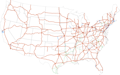
アメリカ合衆国では、フリーウェイは、米国政府の統一交通管制装置マニュアルによって、アクセスが完全に制御された分離された高速道路と定義されています。[85]これは2つのことを意味します。第一に、隣接する土地所有者には法的アクセス権がないため、[86]既存の私道はすべて撤去し、隣接する私有地へのアクセスはフェンスや壁で遮断する必要があります。代わりに、多くの場所では側道がフリーウェイに隣接する土地へのアクセスを提供しています。
第二に、高速道路の交通は「自由に流れている」ということです。すべての交差交通 (および左折交通) は高架または地下道に追いやられるため、信号、一時停止標識、またはその他の交通管制装置によって規制される高速道路のメイン ラインでの交通衝突は発生しません。このような自由な流れを実現するには、多くの高架、地下道、およびランプ システムを建設する必要があります。立体交差インターチェンジの利点は、高速道路のドライバーがメイン ラインの交通に垂直に交差する車両に道を譲る必要がないため、ジャンクションでほぼ常に速度を維持できることです。
対照的に、高速道路は部分的にアクセスが制御されている分離された高速道路として定義されます。[87]高速道路には私道や平面交差点がある場合もありますが、これらは通常の幹線道路よりも数が少ないのが普通です。
この区別は、1949年に現在のアメリカ州間高速道路交通局の命名法特別委員会によって初めて考案されたようです[要出典]。[88]その区別に先立ち、最初のフリーウェイは1940年に完成し、ペンシルバニア・ターンパイクとアロヨ・セコ・パークウェイ(パサデナ・フリーウェイ)でした。[89]
次に、その定義はAASHTOの公式規格書である「統一交通管制装置マニュアル」に組み込まれ、これは1966年の連邦法の下で米国運輸省の国家規格書となった。同じ区別は、カリフォルニア州[90] 、ミネソタ州[91] 、ミシシッピ州[92] 、ミズーリ州[ 93] 、ネブラスカ州[94 ] 、ノースダコタ州[95] 、オハイオ州[ 96]、ウィスコンシン州[97]の8つの州の制定法にも成文化されている。
しかし、各州は連邦の区別を少しずつ異なった形で法典化した。カリフォルニア州の高速道路は必ずしも分離されている必要はないが、少なくとも部分的にはアクセス制御がなければならない。ウィスコンシン州では、両方の用語が適用されるには、分離高速道路は少なくとも4車線の幅でなければならない。ミズーリ州では、両方の用語は、州間高速道路システムの一部ではない、長さが16 km (10 mi)以上の分離高速道路にのみ適用される。ノースダコタ州とミシシッピ州では、高速道路は「完全または部分的な」アクセス制御があり、「一般的に」交差点で立体交差がある。フリーウェイは、完全なアクセス制御を備えた高速道路と定義されている。オハイオ州の法律は似ているが、「一般的に」という漠然とした言葉の代わりに、用語が適用されるには高速道路の交差点の50%が立体交差でなければならないという要件を課している。[98]ミネソタ州だけが、2008年5月にMUTCDの正確な定義を制定した。
「高速道路」という用語は、連邦政府が「フリーウェイ」と呼ぶものに対して、国内の一部の地域で使用されている。[99]用語が区別されている場合、フリーウェイは完全なアクセス制御にアップグレードされた高速道路として特徴付けられるが、すべての高速道路がフリーウェイであるわけではない。
米国では、厳密には高速道路(連邦の定義による)であるが、名前に「フリーウェイ」という単語を含む道路の例としては、カンザス州のステート フェア フリーウェイ、カリフォルニア州のチノ バレー フリーウェイ、ニューヨーク州のロッカウェイ フリーウェイ、ペンシルベニア州のシェナンゴ バレー フリーウェイ( US 62の一部)などがあります。
一部の管轄区域とは異なり、米国のすべてのフリーウェイが単一の全国フリーウェイネットワークの一部というわけではありません(ただし、フリーウェイ以外の道路と合わせて、国道システムを形成しています)。たとえば、カリフォルニア州道99号線などの多くの州道には、重要なフリーウェイセクションがあります。古い米国高速道路番号システムの多くのセクションは、フリーウェイにアップグレードされましたが、既存の米国高速道路番号は保持されています。[引用が必要]
プエルトリコでは、アクセスが制限された高速道路はアウトピスタと呼ばれています。[100]アウトピスタは島内の有料道路ですが、他の種類の道路にも料金所が存在します。プエルトリコで最も有名なアウトピスタの1つは、北の首都サンファンから南の島で2番目に大きな都市 ポンセまでを結ぶ、アウトピスタ・ルイス・A・フェレ(ルイス・A・フェレ高速道路)です。
-
 ヒューストンのダウンタウンに隣接する I-45 と I-10/US 90
 -

-
 I-70 は、サンラファエル スウェルの東端にあるスポッテッド ウルフ キャニオンを通過します。
 -
 ワシントン湖を渡るI-90
 -

-
 ラスベガス渓谷のサンセットロードから南を見た I-15 の航空写真
 -

-

.jpg/500px-Interstate_15,_Las_Vegas,_South_of_Flight_Path_on_Departure_(14203692275).jpg)
アジア
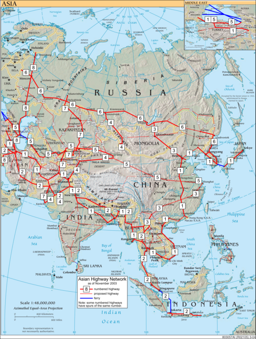

アフガニスタン

アフガニスタンの多くの高速道路は、1960年代にアメリカとソ連の支援を受けて建設されました。ソ連は1964年にサラン峠を通る道路とトンネルを建設し、アフガニスタンの北部と東部を結びました。主要都市であるヘラート、カンダハル、ガズニ、カブールを結び、隣国パキスタンの高速道路につながる高速道路が主要高速道路となりました。歴史的なハイウェイ1号線は現在、主要都市を結んでいます。アフガニスタンには42,000 km (26,000 マイル) を超える道路があり、12,000 km (7,500 マイル) が舗装されています。高速道路のインフラは現在再建中であり、国の不安定さからしばしば危険を伴うことがあります。
アルメニア
アルメニアには約 8,140 km (5,060 マイル) の舗装道路があり、そのうち 96% がアスファルト舗装されています。アルメニアは、国際 E 道路ネットワークを通じてヨーロッパと、アジア高速道路ネットワークを通じてアジアとつながっています。アルメニアは、国際道路運輸連合および TIR 条約の加盟国です。
アゼルバイジャン
アゼルバイジャンには約 29,000 km (18,000 マイル) の舗装道路があり、最初の舗装道路はロシア帝国時代に建設されました。農村道路から高速道路まで、道路網は現在、修復と拡張により急速に近代化されています。国土 1,000 km 2 (390 平方マイル) ごとに 334 km (208 マイル) の道路があります。アゼルバイジャンは、 国際 E 道路ネットワークを通じてヨーロッパと、アジア高速道路ネットワークを通じてアジアと接続されています。
中国


The expressway network of China, with the national-level expressway system officially known as the National Trunk Highway System (Chinese: 中国国家干线公路系统; pinyin: Zhōngguó Guójiā Gànxiàn Gōnglù Xìtǒng; abbreviated as NTHS), is an integrated system of national and provincial-level expressways in China.[101][102]
By the end of 2019, the total length of China's expressway network reached 149,600 km (93,000 mi),[103] the world's largest expressway system by length, having surpassed the overall length of the American Interstate Highway System in 2011.[104] Planned length is 168,478 km (104,687 mi) by 2020.[104]
Expressways in China are a fairly recent addition to a complicated network of roads. According to Chinese government sources, China did not have any expressways before 1988.[105] One of the earliest expressways nationwide was the Jingshi Expressway between Beijing and Shijiazhuang in Hebei province. This expressway now forms part of the Jingzhu Expressway, currently one of the longest expressways nationwide at over 2,000 km (1,200 mi).
-
 The expressway crosses the Yangtze River over the Jiangyin Suspension Bridge
 -
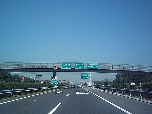 G106, Jingkai Expressway section in southern Beijing
 -
 G6 expressway at the interchange with the Fifth Ring Road in northern Beijing
 -
 Signs using the new numbering system as seen on China National Expressway 1 in Tianjin

Georgia

The road network in Georgia consists of 1,595 km (991 mi) of main or international highways in good condition, of which by 2021 roughly 230 kilometres (140 mi) are controlled-access highway, while further expansion is ongoing. The 7,000 kilometres (4,300 mi) of domestic main roads are of mixed quality, although the conditions are improving. Some 12,400 kilometres (7,700 mi) of local roads are generally in poor condition. Georgia is connected to Europe via the International E-road network and Asia through the Asian Highway Network.
Hong Kong

In Hong Kong major motorways are numbered from 1 to 10 in addition to their names. Speed limits on expressways typically range from 70 to 110 km/h (43 to 68 mph).
-
 North Lantau Highway on Lantau Island
 -
 Tolo Highway in Ma Liu Shui
 -
 Fanling Highway in Sheung Shui
 -
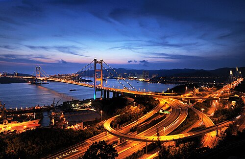 North West Tsing Yi Interchange near Tsing Ma Bridge (Lantau Link)
.jpg/500px-Tolo_Highway_at_night_(Street_Light_rays_improved).jpg)
India
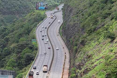
Expressways (known as "Gatimarg/गतिमार्ग", or "Speedways" in Hindi and other Indian languages) are the highest class of roads in India's road network and currently make up around 45,890 km (28,510 mi) of the National Highway System, with additional 21,637 km (13,445 mi) under various phases of implementation. They have a minimum of six or eight-lane controlled-access highways where entrance and exit is controlled by the use of slip roads. The expressways are operated and maintained by the Union, through the National Highways Authority of India.
-
 Section of the Delhi Gurgaon Expressway
 -
-

-
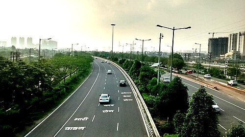 A section of Noida–Greater Noida Expressway

Indonesia


In Indonesia all expressways (Indonesian: Jalan Bebas Hambatan, "obstacle-free road") are tolled, so they are better known as toll road (Jalan Tol). Indonesia has 1,710 km (1,060 mi) expressway length so far, almost 70% of its expressways are in Java island.
In 2009, the Indonesian government had planned to expand more expressway network in Java island by connecting Merak to Banyuwangi which is the total length of Trans-Java toll road including large cities expressway in Java such as Jakarta, Surabaya, Bandung and its complements is more than 1,000 km (620 mi). The Indonesian government also had planned to build the Trans-Sumatra toll road which connects Banda Aceh to Bakauheni spanning 2,700 km (1,700 mi). In 2012, the government allocated 150 trillion rupiah for the construction of the toll roads. There are three stages of construction of Trans-Sumatra toll road which is expected to be connected together in 2025.[106]
The other islands in Indonesia such as Kalimantan, Sulawesi also has begun constructed its expressways including connecting Manado to Makassar in Sulawesi and also Pontianak to Balikpapan in Kalimantan.[107] However, there are still no plans to build an expressway in Western New Guinea due to its slow population growth. Indonesia is expected to have at least 7,000 km (4,300 mi) of expressway in 2030.
Iran

The history of freeways in Iran goes back to before the Iranian Revolution. The first freeway in Iran was built at that time, between Tehran and Karaj with additional construction and the studies of many other freeways started as well. Today Iran has about 2,160 km (1,340 mi) of freeway.
Iraq

Iraq's network of highways connects it from the inside to neighboring countries such as Syria, Turkey, Kuwait, Saudi Arabia, Jordan and Iran. When Saddam Hussein visited the United States, he was impressed at the highway style and ordered the highways to be built in American form. Freeway 1 is the longest freeway in the country, connecting from Umm Qasr Port in Basra to Ar Rutba in Anbar, spreading to a new freeway connecting it to Syria and Jordan. Iraq has about 45,550 km (28,300 mi) of highways, with 38,400 km (23,900 mi) of them paved.
Israel

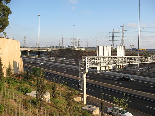
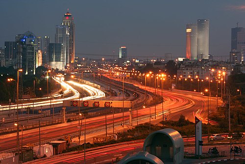
Controlled-access highways in Israel are designated by a blue color. Blue highways are completely grade-separated but may include bus stops and other elements that may slow down traffic on the right lane. Highway 6 is Israel's longest freeway. It will extend to 260 km (160 mi) in length, from Shlomi in the north to the Negev Junction in the south.[108]
Japan

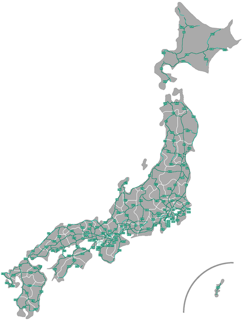

National expressways (高速自動車国道, Kōsoku Jidōsha Kokudō), generally known as 高速道路 (Kōsoku Dōro), make up the majority of controlled-access highways in Japan. The network boasts an uninterrupted link between Aomori Prefecture at the northern part of Honshū and Kagoshima Prefecture at the southern part of Kyūshū, linking Shikoku as well. Additional expressways serve travellers in Hokkaidō and on Okinawa Island, although those are not connected to the Honshū-Kyūshū-Shikoku grid. Expressways have a combined length of 9,429 km (5,859 mi) as of April 2018[update].[109][110][111]
-
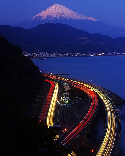 Many Japanese expressways go through the steep mountains.
 -
 A group of green-colored directional signs on a Japanese expressway
 -
 Toll gates are placed at most of the entrances and exits of Japanese expressways.
 -
 Aerial view of Toyota Junction, connecting Tomei Expressway and Ise-Wangan Expressway
 -

Lebanon
Lebanon has an extensive network of highway that in varying condition throughout the country. Many highways are part of the Arab Mashreq International Road Network. Some highways have been upgraded to 4-lane motorway, including the Beirut-Tripoli highway.
Malaysia


Controlled-access highways in Malaysia are known as expressways (Malay: lebuhraya – this is also the name for highways). However, some expressways, particularly bridges and tunnels such as the Penang Bridge, do not formally use the expressway name; a small number confusingly use the term highway, which is normally the designation for limited-access roads. Route numbers of designated expressways begin with the letter E. All expressways (excluding a section of the South Klang Valley Expressway, which is a two-lane expressway) are built with dual carriageways and at least two lanes in each direction; urban expressways generally have three or more lanes in each direction.
While all expressways are grade separated at major roadways, many urban expressways in the Greater Kuala Lumpur region often have at-grade intersections, including with residential roads and shopfronts, thus do not meet the strict definition of a controlled-access highway. These expressways were previously normal arterial or collector roads that had such intersections, and were not removed when the roads were converted to expressways due to the resulting accessibility and sometimes political issues. Despite this, no expressway allows traffic to cross the median strip (apart from U-turns on a limited number of expressways) and expressways do not have at-grade traffic signals or roundabouts. Expressways have a maximum speed limit of 110 km/h (68 mph), while speed limits of 90 km/h (56 mph) or lower are typical in built-up areas.
As of 2017, expressways have only been designated in Peninsular Malaysia. There are 34 fully or partially open expressways with an approximate total length of 1,821 km (1,132 mi).[112][113] The vast majority of expressways are tolled; the North–South Expressway network, East Coast Expressway and West Coast Expressway predominantly use the ticket system of toll collection, while all other expressways use the barrier system. The construction and operation of expressways in Malaysia are usually privatised via concession agreements with the federal government, using the build–operate–transfer system.
Pakistan

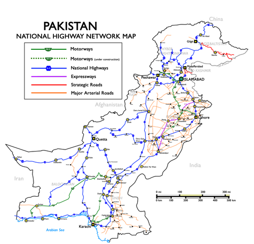
The motorways of Pakistan and expressways of Pakistan are a network of multiple-lane, high-speed, limited-access or controlled-access highways in Pakistan, which are owned, maintained and operated federally by Pakistan's National Highway Authority. The total length of Pakistan's motorways and expressways is 1,670 km (1,040 mi) as of November 2016.[114] Around 3,690 km (2,290 mi) of motorways are currently under construction in different parts of the country. Most of these motorway projects will be complete between 2018 and 2020.[115]
Pakistan's motorways are part of Pakistan's National Trade Corridor project that aims to link Pakistan's three Arabian Sea ports of Karachi, Port Qasim and Gwadar to the rest of the country. These would further link with Central Asia and China, as proposed in the China Pakistan Economic Corridor.
Pakistan's first motorway, the M-2, was inaugurated in November 1997; it is a 367-kilometre-long (228 mi), six-lane motorway that links Pakistan's federal capital, Islamabad, with Punjab's provincial capital, Lahore.[116] It is ranked among the world's top five speed highways/motorways. Other completed motorways and expressways are M1 Peshawar–Islamabad Motorway, M4 PindiBhattian–Faisalabad-Multan Motorway, E75 Islamabad-Murree–Kashmir Expressway, M3 Lahore–Multan Motorway, M8 Ratadero–Gawader Motorway, E8 Islamabad Expressway, M5 Multan-Sukkur Motorway, M9 Karachi-Hyderabad, Sindh and few others.[117]
-
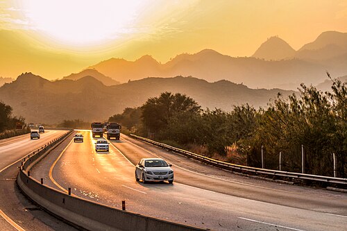 The motorway M-2 passes through the Salt Range mountains.
 -
 M-1 motorway westbound towards Peshawar
 -
 M-1 Peshawar Toll Plaza
 -

-
 The Makran Coastal Highway (N10) passing through Balochistan

Philippines
.svg/500px-E1_(Philippines).svg.png)

Full control-access highways in the Philippines are referred to as expressways, which are usually toll roads. The expressway network is concentrated in Luzon, with the North Luzon Expressway and South Luzon Expressway being the most important ones. The expressway network in Luzon do not form an integrated network, but there are ongoing construction projects to interconnect those highways as well as to decongest the existing roads in the areas they serve. Expressways are being introduced to Visayas and Mindanao through the construction of the Cebu–Cordova Link Expressway in Metro Cebu and Davao City Expressway in Davao City.
-
 A portion of North Luzon Expressway in Guiguinto, Bulacan
 -
 South Luzon Expressway in the Philippines


Saudi Arabia
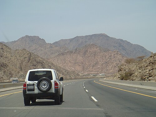
Highways in Saudi Arabia vary from eight-laned roads to small two-lane roads in rural areas. The city highways and other major highways are well maintained, especially the roads in the capital Riyadh. The roads have been constructed to resist the consistently high temperatures and do not reflect the strong sunshine. The other city highways such as the one linking coast to coast are not as great as the inner-city highways but the government is now working on rebuilding those roads. Saudi Arabia is part of the Arab-Mashreq Highway Network and connects to the rest of Asia through the Asian Highway Network.
Singapore

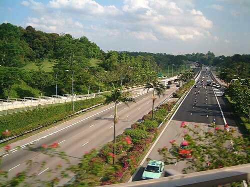
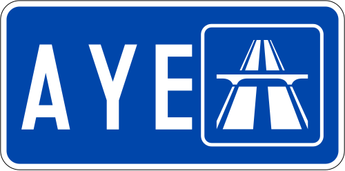
The expressways of Singapore are special roads that allow motorists to travel quickly from one urban area to another. All of them are dual carriageways with grade-separated access. They usually have three to four lanes in each direction, although there are two-lane carriageways at many expressway—expressway intersections and five-lane carriageways in some places. There are ten expressways, including the new Marina Coastal Expressway. Studies about the feasibility of additional expressways are ongoing.
Construction on the first expressway, the Pan Island Expressway, started in 1966. As of 2014[update], there are 163 km (101 mi) of expressways in Singapore.[118]
The Singaporean expressway networks are connected with Malaysian expressway networks via Ayer Rajah Expressway (connects with the Second Link Expressway via the Malaysia–Singapore Second Link) and Bukit Timah Expressway (connects with the Eastern Dispersal Link via the Johor–Singapore Causeway).
South Korea


Since Gyeongin Expressway linking Seoul and Incheon opened in 1968, national expressway system in South Korea has been expanded into 36 routes, with total length of 4,481 km (2,784 mi) as of 2017. Most of expressways are four-lane roads, while 1,030 km (640 mi) (26%) have six to ten lanes. Speed limit is typically 100 km/h (62 mph) for routes with four or more lanes, while some sections having fewer curves have limit of 110 km/h (68 mph).
Expressways in South Korea were originally numbered in order of construction. Since 24 August 2001, they have been numbered in a scheme somewhat similar to that of the Interstate Highway System in the United States. Furthermore, the symbols of the South Korean highways are similar to the US red, white and blue.
- Arterial routes are designated by two-digit numbers, with north–south routes having odd numbers, and east–west routes having even numbers. Primary routes (i.e. major thoroughfares) have 5 or 0 as their last digit, while secondary routes end in other digits.
- Branch routes have three-digit route numbers, where the first two digits match the route number of an arterial route. This differs from the American system, whose last two digits match the primary route.
- Belt lines have three-digit route numbers where the first digit matches the respective city's postal code. This also differs from American numbering.
- Route numbers in the range 70–99 are not used in South Korea; they are reserved for designations in the event of Korean reunification.
- The Gyeongbu Expressway kept its Route 1 designation, as it is South Korea's first and most important expressway.
-
 Approaching Seoul from Incheon Airport
 -
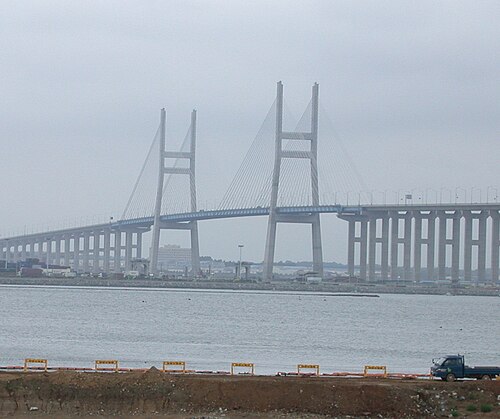
-
 Airport Town Square junction
 -
 Incheon Bridge Toll Gate
Sri Lanka

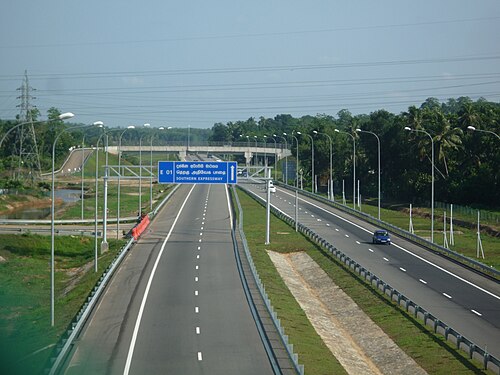

Sri Lanka currently has over 350 km (220 mi) of designated expressways serving the southern part of the country. The first stage of the E01 Expressway (Southern Expressway) which opened in 2011 was Sri Lanka's first expressway spanning a distance of 95.3 km (59.2 mi). The second stage of the Southern Expressway opened in 2014 and extends to Matara. The E03 Expressway (Colombo–Katunayake Expressway) opened in 2013 and connects Sri Lanka's largest city Colombo with the Bandaranaike International Airport covering a distance of 25.8 km (16.0 mi). All E-Grade highways in Sri Lanka are access controlled, toll roads with speeds limits in the range of 80–110 km/h (50–68 mph). The network is to be expanded to 518.5 km (322.2 mi) by 2024.
Operational (fully or partially):
- E01 Kottawa-Hambantota
 E02 Kottawa-Kerawalapitiya
 E03 Colombo-Katunayake
 E04 Enderamulla-Kurunegala-Kandy
 E06 Kahatuduwa-Pelmadulla
Planned:
- Colombo Metropolitan expressway (Colombo Fort to Peliyagoda, connecting Colombo with the E03 expressway (Sri Lanka) Colombo-Katunayaka expressway.)
Syria
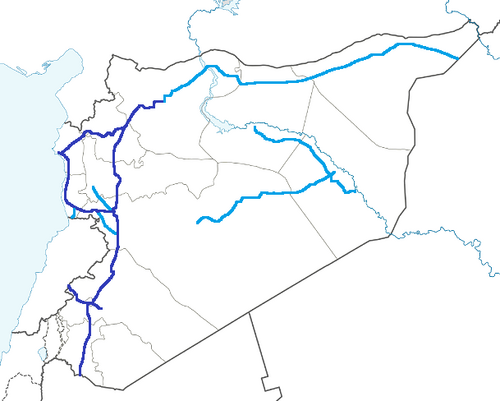
Syria has a well-developed system of motorways in the western half of the country. As the Eastern part is underpopulated, it only has 2 lanes. Highways have been important in terms of transport for the ongoing civil war. The main motorways are:
- M1 - Runs from Homs to Latakia. It also connects Tartus, Baniyas and Jableh. Its length is 174 km (108 mi).
- M2 - Runs from Damascus to Jdeidat Yabous, on the border with Lebanon. It also connects Al-Sabboura. Its length is 38 km (24 mi).
- M4 - Runs from Latakia to Saraqib. It also connects Arihah and Jisr al-Shughur. Its length is 120 km (75 mi). It continues to the Iraqi border all the way to Mosul.
- M5 - Often describes as the most important highway, it runs through much of the major cities in Syria and runs to the Jordanian border.
Taiwan (Republic of China)

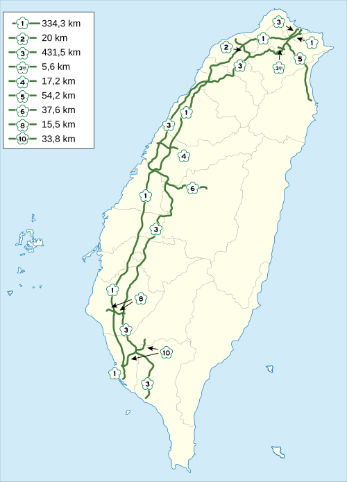
Taiwan has an extensive road network that includes two types of controlled-access highway: freeways and expressways. Only cars and trucks are allowed onto freeways, the first of which — Freeway 1 — was completed in 1974. Expressways allow car and truck traffic as well as motorcycles with engines of 250cc or more.
Expressways in Taiwan may be controlled-access highways similar to national freeways or limited-access roads. Most have urban roads and intra-city expressways (as opposed to Highway system) status, although some are built and maintained by cities.
-

-
 Taichung section
 -
 Freeway entrance
Thailand
Signs for Motorway 7 and Motorway 9 (Kanchanaphisek Road)
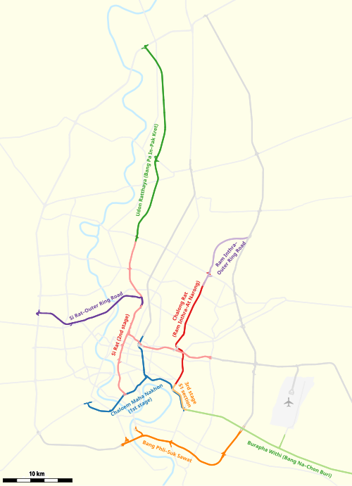
Controlled-access highways in Thailand are separated into urban expressways called expressways, which are operated by the Expressway Authority of Thailand and BEM (except Don Mueang Tollway, which is operated by Don Muang Tollway Public Company Limited) and have a span of 280.4 km (174.2 mi), while intercity expressways are called motorways, which have a span of 187 km (116 mi). The network is to be extended to 4,154.7 km (2,581.6 mi) according to the master plan.
-
 A motorway interchange in Makkasan, Bangkok
 -
 Srinagarindra Interchange head to Rama IX Road
Uzbekistan

Uzbekistan has 84,400 km (52,400 mi) of roads, about 72,000 km (45,000 mi) of which were paved. Much of the highways are in need of repair, although the condition has been improving. In 2017, the governments of Kazakhstan and Uzbekistan agreed to open a section of the M39 Highway by the Kazakh border.
Vietnam


At present, the expressway system of Vietnam is 895 km (556 mi) long. Under the government's plan, the national expressway system will have a total length of 6,411 km (3,984 mi). The expressway system in Vietnam is separate from the national highway system.[119]
Most of the expressways are located in the North, especially around Hanoi. Of the 21 expressways in Vietnam, 8 emanate from Hanoi and 14 are in the north, with a length of 1,368 km (850 mi). The first expressway in Vietnam is the Ho Chi Minh City - Trung Luong Expressway, which is inaugurated and opened for traffic on February 3, 2010.
Currently, most of the expressways in Vietnam are four-lane highways, with some routes like Ha Noi - Haiphong, and Phap Van - Cau Gie being six-lane. The only elevated expressway in Vietnam is Mai Dich - Thanh Tri Bridge (also known as the third beltway in Hanoi). The cost of building Vietnam's highways is one of the most expensive in the world, with an average cost of $12 million per kilometer. Compared with China, where there are similarities, their highway costs only $5 million per kilometer, where in the US and European countries, costs $3–4 million per kilometer.[120]
According to road traffic laws of Vietnam, an expressway is a road for motor vehicles, with a divider separating opposing traffic directions, no at-grade crossings with intersecting roads, fully equipped facilities to ensure continuous traffic flow, safety and short journey times, and access allowed only at interchanges.
-
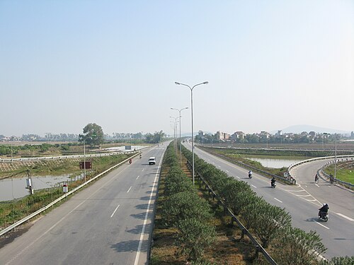 Ha Noi - Bac Giang Expressway in Bac Ninh
 -
 Long Thanh bridge of Ho Chi Minh City - Long Thanh - Dau Giay Expressway
 -
 Cho Dem - Ben Luc Viaduct of Ho Chi Minh City - Trung Luong Expressway
 -
 Lien Khuong - Prenn Pass Expressway
 -
 Van Tien bridge of Hai Phong - Mong Cai Expressway
Europe
Regarding road function, motorways serve exclusively the function of flow. They allow for efficient throughput of, usually long distance, motorized traffic, with unhindered flow of traffic, no traffic signals, at-grade intersections or property access and elimination of conflicts with other directions of traffic, thus, dramatically improving both safety and capacity.[32]
Although roads are under the responsibility of each individual state, including within the European Union, there are some legal conventions (international treaties) and some European directives which give a legal framework for roads of a European importance with the goal to introduce some kind of homogenization between various members. They basically consider, at European level, three types of roads: motorways, express roads, and ordinary roads.[121]
Some European treaties also define aspects such as the range of speed limit, or for some geometric aspects of roads, in particularly for the International E-road network.
According to Eurostat:
A motorway is a road specially designed and built for motor vehicle traffic, which does not directly provide access to the properties bordering on it.
Other characteristics of motorways include:
- two separated carriageways for the opposing directions of traffic, except at special points or, temporarily, due to carriageway repairs etc.;
- carriageways that are not crossed at the level of the carriageway by any other road, railway or tramway track, or footpath; and
- the use of special signposting to indicate the road as a motorway and to exclude specific categories of road vehicles and/ or road users.
In determining the extent of a motorway its entry and exit lanes are included irrespective of the location of the motorway signposts. Urban motorways are also included in this term.
Most of the European countries use the above motorway definition but different national definitions of motorways can be found in some countries.[32]
It is usually[32] considered that:
- Motorways serve exclusively motorised traffic.
- Motorways have separate carriageways for the two directions of traffic.
- Motorways are not crossed at the same level by other roads, footpaths, railways
- Traffic entrance and exit is performed at interchanges only.
- Motorways have no access for traffic between interchanges and do not provide access to adjacent land.
- Motorways are especially sign-posted
Motorways status is signaled at the entry and exit of the motorway by a symbol conforming to international agreements, but specific to each country.[122]
-
 Sweden
 -
 Spain
Spain -
 Germany
 -
 United Kingdom, Ireland
 -
Switzerland
-
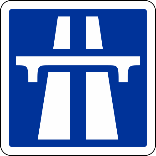 France (sometimes used in Portugal)
 -
 Italy and Albania
 -
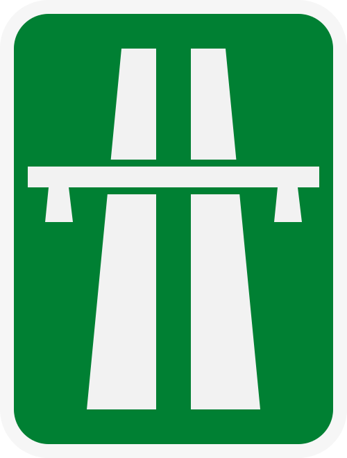 Romania
 -
 Slovakia
 -
 Portugal
The peripheral northern and eastern regions of the EU have a lower density motorway network. Within the European Union, there are 26 regions (NUTS level 2) with no motorway network in 2013. Those regions are islands or remote regions, for instance four overseas French regions and Corsica. The Baltic member state of Latvia, as well as four regions from Poland, and two regions from each of Bulgaria and Romania also reported no motorway network; several of these regions bordered onto non-member neighbouring countries to the east of the EU.[123]
European motorways provide reduced accident risks: 50% to 90% lower compared to standard roads, when new motorways only reduce injuries by 7%.[32]
Some of the things which are considered as providing safety in the European motorways are central medians, grade separated interchanges, and access restrictions.[32]
Nonetheless, some specific conditions provide a height risk of a more severe accidents, such as:
- improper use of emergency lane,
- cross-median head-on accidents,
- wrong direction accidents.[32]
Albania
.svg/500px-Italian_traffic_signs_-_inizio_autostrada_(figura_II_345).svg.png)


Highways in Albania form part of the recent Albanian road system. Following the collapse of communism in 1991, the first highways in Albania started being constructed, The first was SH2, connecting Tirane with Durrës via Vora. Since the 2000s, main roadways have drastically improved, though lacking standards in design and road safety.[124][125] This involved the construction of new roadways and the putting of contemporary signs. However, some state roads continue to deteriorate from lack of maintenance while others remain unfinished.
-
 A1 Nation's Highway in Northern Albania connecting Albania with Kosovo
 -
 Krraba Tunnel on the A3 Tirana, Elbasan, Albania
 -
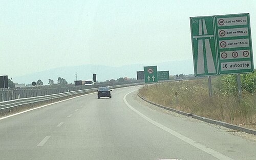 A2 Fier - Vlore known as the Independence Highway
Austria

The Austrian autobahns (German: Autobahnen) are controlled-access highways in Austria. They are officially called Bundesstraßen A (Bundesautobahnen) under the authority of the federal government according to the Austrian Federal Road Act (Bundesstraßengesetz),[126] not to be confused with the former Bundesstraßen highways maintained by the Austrian states since 2002.
Austria currently has 18 Autobahnen, since 1982 built and maintained by the self-financed ASFiNAG stock company in Vienna, which is wholly owned by the Austrian republic and earns revenue from road-user charges and tolls. Each route bears a number as well as an official name with local reference, which however is not displayed on road signs. Unusually for European countries, interchanges (between motorways called Knoten, "knots") are numbered by distance in kilometres starting from where the route begins; this arrangement is also used in the Czech Republic, Slovakia, Hungary, Spain, and most provinces of Canada (and in most American states, albeit in miles). The current Austrian Autobahn network has a total length of 1,720 km (1,070 mi).
-
 Brenner Autobahn near Innsbruck
 -
 A22 Donauuferautobahn, near the exit Floridsdorfer Brücke
Belgium


In 1937, the first motorway between Brussels and Ostend was completed, following the example of neighboring countries such as Germany. It mainly served local industries and tourism as a connection between the capital city and a coastal region. However, the Second World War and the reparation of the complete road network after the war caused a serious delay in the creation of other motorways. In 1949, the first plans were made to build a complete motorway network of 930 km (580 mi) that would be integrated with the neighboring networks. Although the plans were ready, the construction of the motorway network was much slower than in neighboring countries because the project was deemed not to be urgent.
Because of economic growth in the 1960s, more citizens could afford cars, and the call for good-quality roads was higher than ever before. In each year between 1965 and 1973, over 100 km (62 mi) of motorway were built. At the end of the 1970s, the construction of motorways slowed down again due to costs, combined with an economic crisis, more expensive fuel and changing public opinion. In the following years, the only investments done were to complete already started motorway constructions. But most important cities were already connected. In 1981, the responsibilities for construction and maintenance of the motorways shifted from the federal to the regional governments. This sometimes caused tensions between the governments. For example, the part of the ring road around Brussels that crosses Wallonian territory has never been finished, since only Flanders suffers from the unfinished ring.[127]
Belgium today has the longest total motorway length per area unit of any country in the world.[citation needed] Most motorway systems in Belgium have at least three lanes in each direction. Nearly all motorways have overhead lighting including those in rural areas. The dense population of Belgium and the still unfinished state of some motorways, such as the ring roads around Brussels and Antwerp cause major traffic congestion on motorways. On an average Monday morning in 2012, there was a total of 356 km (221 mi)[128] of traffic jams and the longest traffic jam of the year was 1,258 km (782 mi),[129] purely on the motorways.
Bosnia and Herzegovina


Bosnia and Herzegovina has more than 208 km (129 mi) of highway, which connects Kakanj-Sarajevo. There is a plan to build highway on Corridor Vc, which will go from river Sava, across Doboj, Sarajevo and Mostar to Adriatic Sea. Next sections are Kakanj-Drivuša 16 km (9.9 mi), Zenica Sjever-Drivuša 11 km (6.8 mi), Svilaj-Odžak 11 km (6.8 mi), Vlakovo-Tarčin 20 km (12 mi), Počitelj-Bijača 21 km (13 mi). The speed limit is 130 km/h (81 mph) or 100 km/h (62 mph) in tunnels.[130]
-

-
 Mahovljanska interchange
 -
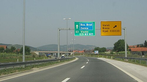 A1 motorway
Bulgaria


Legislation in Bulgaria defines two types of highways: motorways (Aвтомагистрала, Avtomagistrala) and expressways (Скоростен път, Skorosten pat). The main differences are that motorways have emergency lanes and the maximum allowed speed limit is 140 km/h (87 mph), while expressways do not have emergency lanes and the speed limit is 120 km/h (75 mph). As of June 2018[update], 777 km (483 mi) of motorways are in service, with another 62 km (39 mi) under various stages of construction. More than 590 km (370 mi) are planned. Also, several expressways are planned.
Croatia


The primary high-speed motorways in Croatia are called autoceste (singular: autocesta; Croatian pronunciation: [ˈaʊtotsesta]), and they are defined as roads with at least two lanes in each direction (including hard shoulder) and a speed limit of not less than 80 km/h (50 mph). The typical speed limit is 130 km/h (81 mph). As of 2017, there are 1,313 km (816 mi) of motorways in Croatia. There is also a category known as brza cesta, meaning "expressway". These roads have a speed limit up to 110 km/h (68 mph) and are not legally required to be grade-separated, but nearly all are.
Cyprus
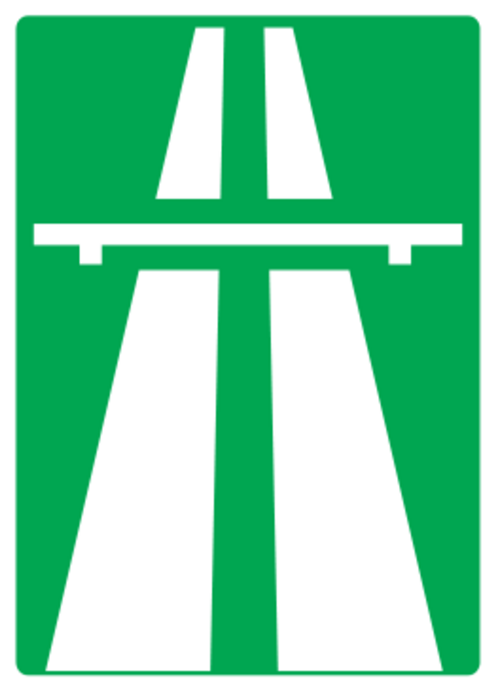
Motorways (Greek: αυτοκινητόδρομος, Turkish: Otoyol) connect all cities in Cyprus, although in the territory under de facto Turkish control these do not meet international standards for the definition of motorways. In the areas administered by the Republic of Cyprus, motorway numbers are prefaced with the letter A, and run from A1 to A6, to distinguish them from all other roads, designated B roads. Of the A roads, all are designated motorways, except for the A4, linking Larnaca with Larnaca Airport.
Motorways are also distinguishable by the use of green-backed road signs, with standard international graphics, and text in yellow in Greek and white in English, distinguishable from B road signage, which has signs with blue backgrounds.
Motorway junctions are theoretically designated with junction numbers, but signage is not consistent is indicating the exit numbers.
Czech Republic


The Czech Republic has currently (2023) 1,363 km (847 mi)[131] of motorways (dálnice) whose speed limit is 130 km/h (81 mph) (or 80 km/h (50 mph) within a town). The total length should be 2,000 km (1,200 mi) around 2030. The number of a motorway (in red) copies the number of the national route (in blue) which has been replaced by the motorway. There are also roads for motorcars (silnice pro motorová vozidla). Those common roads are not subject to a fee (in form of vignette) for vehicles with total weight up to 3.5 t (3.4 long tons; 3.9 short tons) and their speed limit is 110 km/h (68 mph), partially up to 130 km/h (81 mph).
Denmark

Denmark has a well covered motorway system today, which has been difficult to build due to the county's geography with many islands. The longest bridges are the Great Belt and the Øresund bridges to Skåne (Scania) in southern Sweden. Both are motorways with dual electrical train tracks added.
Finland

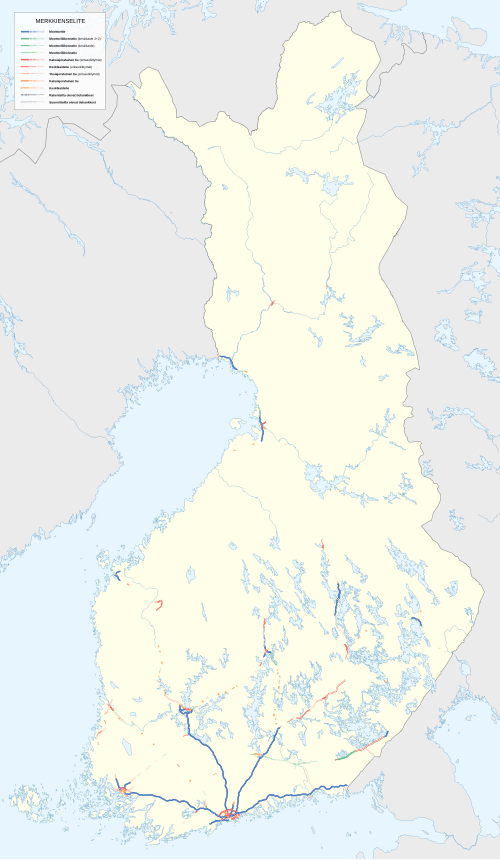

Finland has 863 km (536 mi) of motorway, which is only a small proportion of the whole highway network. More than half of the length of the motorway network consists of six radial motorways originating in Helsinki, to Kirkkonummi (Länsiväylä), Turku (Vt1/E18), Tampere (Vt3/E12), Tuusula (Kt45), Heinola (Vt4/E75) and Vaalimaa (Vt7/E18). These roads have a total length of 653 km (406 mi). The other motorways are rather short sections close to the biggest cities, often designed to be bypasses. The motorway section on national roads 4 and 29, between Simo and Tornio, is said to be the northernmost motorway in the world.
Finnish motorways do not have a separate road numbering scheme. Instead, they carry national highway numbers. In addition to signposted motorways, there are also some limited-access two-lane expressways, and other grade-separated four-lane expressways (perhaps the most significant example being Ring III near Helsinki).
-
 Valtatie 1 near Halikko
 -

-


France

The autoroute system in France consists largely of toll roads, except around large cities and in parts of the north. It is a network of 11,882 km (7,383 mi) worth of motorways. Autoroute destinations are shown in blue, while destinations reached through a combination of autoroutes are shown with an added autoroute logo. Toll autoroutes are signalled with the word péage (toll).
-
 Cross between A430 motorway and A43 motorway
 -
 Toll barrier in Hordain (south of Hordain), on autoroute A2
Germany


Germany's network of controlled-access expressways includes all federal Autobahnen and some parts of Bundesstraßen and usually no Landesstraßen (state highways), Kreisstraßen (district highways) nor Gemeindestraßen (municipal highways). The federal Autobahn network has a total length of 13,183 km (8,192 mi) in 2020, making it one of the densest networks in the world. The German autobahns have no general speed limit for some classes of vehicles (though nearly 30% of the total autobahn network is subject to local and/or conditional limits[132]), but the advisory speed limit (Richtgeschwindigkeit) is 130 km/h (81 mph). The lower class expressways usually have speed limits of 120 km/h (75 mph) or lower.
-
 German Motorway (Autobahn) - one of the world's earliest motorways
 -
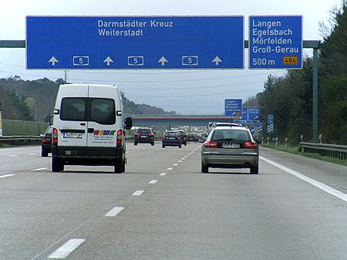 An autobahn with 4 lanes in each direction of travel for 21 km (13 mi). The section between Zeppelinheim and Darmstadt is the oldest Autobahn.
 -
 The A 3 in 1991
 -
 Dynamic traffic signs on an Autobahn

Greece


Greece's motorway network has been extensively modernised throughout the 1980s, 1990s and especially the 2000s, while part of it is still under construction. Most of it was completed by mid 2017 numbering around 2,500 km (1,600 mi) of motorways, making it the biggest highway network in Southeastern Europe and the Balkans and one of the most advanced in Europe.[133]
There are a total of 10 main routes throughout the Greek mainland and Crete, from which some feature numerous branches and auxiliary routes. Most important motorways are the A1 Motorway connecting Greece's two largest cities (Athens and Thessaloniki), the A2 motorway (Egnatia Odos), also known as the "horizontal road axis" of Greece, connecting almost all of Northern Greece from west to east and the A8 motorway (Olympia Odos) connecting Athens and Patras. Another important motorway is the A6 motorway (Attiki Odos), the main beltway of the Athens Metropolitan area.
_as_viewed_from_Katerini_South_interchange.png/500px-Motorway_1_(A1)_as_viewed_from_Katerini_South_interchange.png)


Hungary


in use
under construction
proposed
_Otszogletu_kek_tabla.svg/500px-M1_(Hu)_Otszogletu_kek_tabla.svg.png)
In Hungary, a controlled-access highway is called an autópálya (plural autópályák).
-
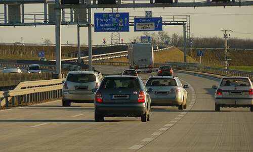 Eastern section of M0
 -
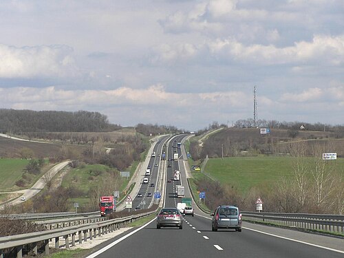
-
 M7 motorway in Köröshegyi völgyhíd
 -
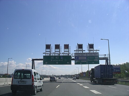 M1 - M7 common phase, near Budapest
Ireland
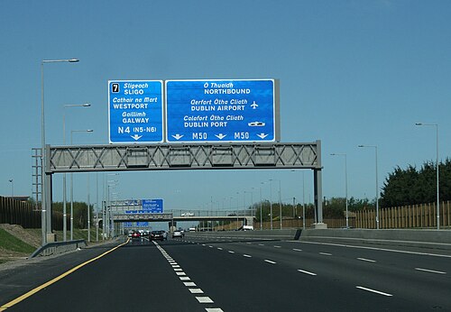
In Ireland the Local Government (Roads and Motorways) Act 1974 made motorways possible, although the first section, the M7 Naas Bypass, did not open until 1983. The first section of the M50 opened in 1990, a part of which was Ireland's first toll motorway, the West-Link. However it would be the 1990s before substantial sections of motorway were opened in Ireland, with the first completed motorway—the 83-kilometre (52 mi) M1 motorway—being finished in 2005.
Under the Transport 21 infrastructural plan,[134] motorways or high quality dual carriageways were built between Dublin and the major cities of Cork, Galway, Limerick and Waterford by the end of 2010. Other shorter sections of motorway either have been or will be built on some other main routes. In 2007 legislation (the Roads Bill 2007) was created to allow existing roads be designated motorways by order because previously legislation allowed only for newly built roads to be designated motorways.
As a result, most HQDCs nationwide (other than some sections near Dublin on the N4 and N7, which did not fully meet motorway standards) were reclassified as motorways. The first stage in this process occurred when all the HQDC schemes open or under construction on the N7 and N8, and between Kinnegad and Athlone on the N6 and Kilcullen and south of Carlow on the N9, were reclassified motorway on 24 September 2008. Further sections of dual carriageway were reclassified in 2009.
As of December 2011, the Republic of Ireland has around 1,017 km (632 mi) of motorways.

Italy


The world's first motorway was the Autostrada dei laghi, inaugurated on 21 September 1924 in Italy. It linked Milan to Varese; it was then extended to Como, near the border with Switzerland, inaugurated on 28 June 1925. Piero Puricelli, the engineer who designed this new type of road, decided to cover the expenses by introducing a toll.[135][136]
Other motorways (or autostrade) built before World War II in Italy were Naples-Pompeii, Florence-Pisa, Padua-Venice, Milan-Turin, Milan-Bergamo-Brescia and Rome-Ostia. The total length of the Italian motorway system is about 7,016 kilometres (4,360 mi), as of 30 July 2022.[137] To these data are added 13 motorway spur routes, which extend for 355 kilometres (221 mi).[138] The density is 22.4 kilometres (13.9 mi) of motorway for every 1,000 square kilometres (390 sq mi) of Italian territory.[139]
Italian motorways (or autostrade) are mostly managed by concessionaire companies. From 1 October 2012 the granting body is the Ministry of Infrastructure and Transport and no longer Anas[140] and the majority (5,773.4 kilometres (3,587.4 mi) in 2009[141]) are subject to toll payments. On Italian motorways, the toll applies to almost all motorways not managed by Anas. The collection of motorway tolls, from a tariff point of view, is managed mainly in two ways: either through the "closed motorway system" (km travelled) or through the "open motorway system" (flat-rate toll).[142]
Italy's motorways (or autostrade) have a standard speed limit of 130 km/h (80 mph) for cars. Limits for other vehicles (or when visibility is poor due to weather) are lower. Legal provisions allow operators to set the limit to 150 km/h (95 mph) on their concessions on a voluntary basis if there are three lanes in each direction and a working SICVE, or Safety Tutor, which is a speed-camera system that measures the average speed over a given distance.
Type B highway (Italian: strada extraurbana principale), commonly but unofficially known as superstrada (Italian equivalent for expressway), is a divided highway with at least two lanes in each direction, paved shoulder on the right, no cross-traffic and no at-grade intersections. Access restrictions on such highways are exactly the same as motorways (or autostrade). The signage at the beginning and the end of the strade extraurbane principali is the same, except the background colour is blue instead of green. The general speed limit on strade extraurbane principali is 110 km/h (70 mph), unless otherwise indicated. Strade extraurbane principali are not tolled.
-

-

-

-
 Autostrada A22 runs through Po Valley and Alps linking Modena to Brenner Pass, a mountain pass which forms the border between Italy and Austria
 -

-
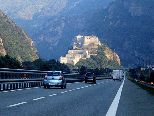
.jpg/500px-A22_Autostrada_-_Brenner_Pass_from_Verona_to_Bolzano_(5994736833).jpg)
Lithuania
There are two categories of controlled-access highways in Lithuania: expressways (Lithuanian: greitkeliai) with maximum speed 120 km/h (75 mph) and motorways (Lithuanian: automagistralės) with maximum speed 130 km/h (81 mph). The first section Vilnius–Kaunas of A1 highway was completed in 1970. Kaunas–Klaipėda section of A1 was completed in 1987.[143] Vilnius-Panevėžys (A2 highway) was completed in stages during the 1980s and finished in the 1990s. Complete length of the motorway network is 310 km (190 mi). Expressway network length - 80 km (50 mi). Motorway section between Kaunas and the Polish border is planned to be completed in the 2020s.
-
 A1 motorway near Kaunas
 -
 A2 motorway near Taujėnai
 -
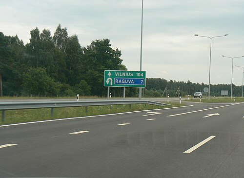 Motorway junction with U-turns. A2 motorway near Raguva.
Netherlands


Roads in the Netherlands include at least 2,758 km (1,714 mi) of motorways and expressways,[144] and with a motorway density of 64 kilometres per 1,000 km2 (103 mi/1,000 mi2), the country has one of the densest motorway networks in the world.[145] About 2,500 km (1,600 mi) are fully constructed to motorway standards,[146] These are called Autosnelweg or simply snelweg, and numbered and signposted with an A and up to three digits, like A12.
They are consistently built with at least two carriageways, guard rails and interchanges with grade separation. Since September 2012, the nationwide maximum speed has been raised to 130 km/h (81 mph), but on many stretches speed is still limited to 120 or 100 km/h (75 or 62 mph). Dutch motorways may only be used by motor vehicles both capable and legally allowed to go at least 60 km/h (37 mph).
In March 2020, the general speed limit on Dutch motorways was lowered to 100 km/h (62 mph) during the day (6 am until 7 pm). At night, the maximum speed is different per stretch, but 130 km/h (81 mph) remained the upper limit.
Dutch roads are used with a very high intensity in relation to the network length[145] and traffic congestion is common, due to the country's high population density. Therefore, since 1979 large portions of the motorway network have been equipped with variable message signs and dynamic electronic displays, both of which are aspects of intelligent transportation systems. These signs can show a lower speed limit, as low as 50 km/h (31 mph), to optimize the flow of heavy traffic, and a variety of other communications. Additionally there are peak, rushhour or plus lanes, which allow motorists to use the hard shoulder as an extra traffic lane in case of congestion. These extra lanes are observed by CCTV cameras from a traffic control center.
Less common, but increasingly, separate roadways are created for local/regional traffic and long-distance traffic. This way the number of weaving motions across lanes is reduced, and the traffic capacity per lane of the road is optimised. A special feature of Dutch motorways is the use of Porous Asphalt Concrete, which allows water to drain efficiently, and even in heavy rain no water will splash up, in contrast to concrete or other road surfaces. The Netherlands is the only country that uses PAC this extensively, and the goal is to cover 100% of the motorways with PAC, in spite of the high costs of construction and maintenance. All in all the Netherlands has one of the more advanced motorway networks in the world.
-
 Local and express lanes connected using a basketweave
 -
 Dynamic Route Information Panel (DRIP) on Dutch A13 freeway during evening rush hour
North Macedonia

The total motorway network length in North Macedonia is 317 km (197 mi) as of Spring 2019. Another 70 km (43 mi) are under construction, 57 km (35 mi) (Ohrid to Kicevo) and 13 km (8.1 mi) (Skopje to Kosovo border). The stretch from Gostivar to Kicevo is planned to start with construction in 2021. The three motorway routes are A1, which is part of the European corridor E-75, A2 (part of E-65) and the recently built A4 corridor that connects Skopje to Stip. A1 connects the northern border (Serbia) with the southern one (Greece), while A2 traverses the country from the East (Bulgaria border) to West (Albania border), but only the stretch from Kumanovo to Gostivar is a divided motorway, while the rest of the length is either an undivided two-way road or in the process of turning into a motorway.[147]
Norway

Norway has (2022) 770 km (480 mi) of motorways, in addition to 498 km (309 mi) of limited-access roads (in Norwegian motortrafikkvei) where pedestrians, bicycles, etc. are forbidden, though with a bit lower standard than true motorway. Most of the network serves the big cities, chiefly Oslo, Stavanger and Bergen. Northernmost motorway is, as of 2022, on E6 just south of Trondheim: see also the E6, E18 and the E39. Most motorways use four-ramp Dumbbell interchanges, but also Roundabout interchanges can be found. The first motorway was built in 1964, just outside Oslo. The motorways' road pattern layout is similar to those in the United States and Canada, featuring a yellow stripe towards the median, and white stripes between the lanes and on the edge. The speed limits are 90–110 km/h (56–68 mph).
Poland
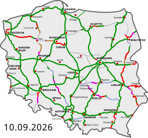
Completed
Under construction
Design-build contract
Under tender
Planned
The highways in Poland are divided into motorways and expressways, both types featuring grade-separated interchanges with all other roads, emergency lanes, feeder lanes, wildlife protection measures and dedicated roadside rest areas. Motorways can be only dual carriageways, while expressways can be dual or, rarely, single carriageways. The start of an expressway in Poland is marked with a sign of white car on blue background, while number sign for an expressway is of red background and white letters, with the letter S preceding a number. Speed limits in Poland are 140 km/h (87 mph) on motorways and 120 km/h (75 mph) on dual-carriageway expressways.
The Regulation of the Council of Ministers defines the network of motorways and expressways in Poland totalling about 7,980 km (4,960 mi) (including about 2,100 km (1,300 mi) of motorways).[148]
As of July 2022, there are 4,688 km (2,913 mi) of motorways and expressways in operation (58% of the intended network), while contracts for construction of further 1,170 km (727 mi) of motorways and expressways (15% of the intended network) are ongoing.[149]
-
 A4 near Zalas, opened in 1983
 -

-

-
 Wrocław Stadion junction
 -
 Expressway S5 near Bydgoszcz
.jpg/500px-New_bridge_(R%C4%99dzi%C5%84ski).jpg)
_-_fotopolska.eu_(239268).jpg/500px-Wroc%C5%82aw,_Autostradowa_obwodnica_Wroc%C5%82awia_A8_(AOW)_-_fotopolska.eu_(239268).jpg)
Portugal
Portugal was the third country in Europe—after Italy and Germany—to build a motorway (Portuguese: autoestrada, plural: autoestradas), opening, in 1944, the Lisbon-Estádio Nacional section of the present A5 (Autoestrada da Costa do Estoril).[150]
Additional motorway sections were built in the 1960s, 1970s and early 1980s. However, the large-scale building of motorways started only in the late 1980s. Currently, Portugal has a very well-developed network of motorways, with about a 3,000-kilometre (1,900 mi) extension, that connects all the highly populated coastal regions of the country and the main cities of the less populous interior. This means that 87% of the Portuguese population lives at less than 15 minutes' driving time from a motorway access.[151]
Unlike the neighbouring Spanish network, most of Portuguese motorways are tolled, although there are also some non-tolled highways, mostly in urban areas, like those of Greater Lisbon and Greater Oporto. In the late 1990s and early 2000s, the Government of Portugal created seven shadow toll concessions, the SCUT toll (Sem custos para o utilizador, no costs for the user). In those concessions it were included more than 900 km (560 mi) of motorways and highways, some of them already built, others which were built in the following years. However, due to economical and political reasons, the shadow toll concept was abolished between 2010 and 2011, with electronic toll equipment being installed in these motorways, to charge their users. Having only electronic tolls, former SCUT motorways can now only be used by vehicles equipped with electronic payment devices or vehicles registered in the system.
Portuguese motorways form an independent network (Rede Nacional de Autoestradas, National Motorway Network), that overlaps with the Fundamental and Complementary subnetworks of the National Highway Network (Rede Rodoviária Nacional). Each motorway section overlapping with the Fundamental subnetwork is part of an IP (Itinerário principal, Principal route) and each motorway section overlapping with the Complementary subnetwork is part of an IC (Itinerário complementar, Complementary route). Thus, a motorway can overlap with sections of different IP or IC routes and - on the other hand - an IP or IC route can overlap with sections of different motorways. An example is A22 motorway, which overlaps with sections of IP1 and of IC4 routes; another example is IP1 route, which overlaps with sections of the A22, A2, A12, A1 and A3 motorways.
The National Motorway Network has a proper numbering system in which each motorway has a number prefixed by the letter "A". In most cases, a motorway signage indicates only its A number. The number of the IP or IC of which a motorway section is a part is not signed except in some short motorways which lack a proper A number.
-
 A5 (Lisbon-Cascais) motorway, inaugurated in 1944 as the first motorway in Portugal
 -
 A1 (Lisbon-Oporto) motorway, the main road link between the two largest cities of the country
 -
 Corgo viaduct, part of the A4 (Oporto-Bragança) motorway
 -
 Tunnel at the A27 (Ponte de Lima-Viana do Castelo) motorway
,_Vila_Real,_Portugal_(2015-01)_(17679614363)2.jpg/500px-Viaduto_do_Corgo_(Corgo_Viaduct),_Vila_Real,_Portugal_(2015-01)_(17679614363)2.jpg)
Romania

As of 31 July 2024, Romania has 1,115 km (693 mi) of highways in use, with more under construction.[152]
The first motorway in Romania was completed in 1972, linking Bucharest and Pitești.[153] The Romanian Government has adopted a General Master Plan for Transport that was approved by the European Union in July 2015, containing the strategy for expanding the road (including motorway) network until 2040, using EU funding.[154]
-
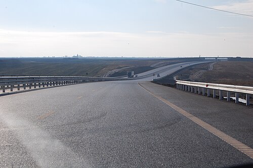 A1 motorway between Arad and Timișoara
 -
 A1 motorway near Sibiu
 -
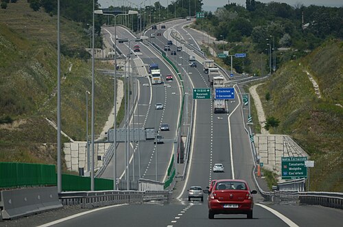 A2 motorway near Cernavodă interchange
 -
 A3 motorway between Gilău and Turda
 -
 A7 motorway near Bacău Bypass
 -
 A10 motorway and the hills of Transilvania
.jpg/500px-A3_(Romania).jpg)


Russia

Motorway
Motorway planned or under construction
Expressway
Expressway planned or under construction
In 2024, Russia will have a nationwide motorway network with a length of 1701 km and expressway network of 1826.4 km.
The motorways and expressways have the numbering of the Russian federal highway network or their own name, as there is no separate numbering system for motorways and expressways and their sections are mostly part of the Russian federal highway network. The legal speed limit on motorways and expressways is 110 km/h, and 130 km/h[155] on some newly upgraded sections of motorway. Sections of Russian federal highway that have been upgraded to motorway status are marked with green signs. Federal highway roads that have been upgraded to expressways or dual and single carriageway with road junction are marked with blue signs.
In the classification of Russian federal highway roads, motorways are assigned to technical category IA and expressways to technical category IB.[156]
-

-

-
 Motorway M4 in Novocherkassk
 -
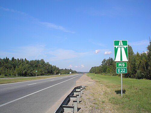
-

-
 The Western High-Speed Diameter next to the Krestovsky Stadium
.jpg/500px-thumbnail.jpg)
Serbia
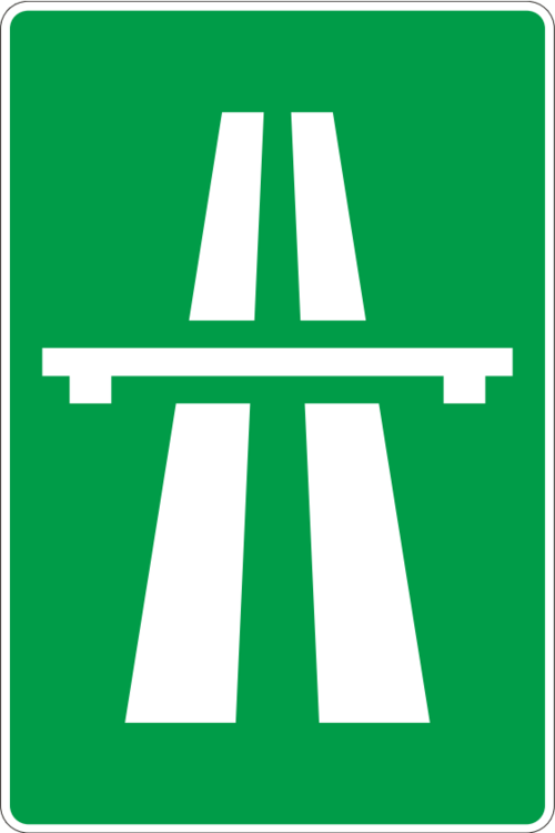

finished
under construction
planned
Motorways (Serbian: Аутопут, romanized: Autoput) and expressways (Serbian: Брзи пут, romanized: Brzi put) are the backbone of the road system in Serbia. There are around 906 km (563 mi) of motorways in total. Plan is 1,200 km (750 mi) by the end of 2018.
Motorways in Serbia have three lanes (including emergency lane) in each direction, signs are white-on-green, as in the rest of former Yugoslavia and the normal speed limit is 130 km/h (81 mph).
Expressways, unlike motorways, do not have emergency lanes, signs are white-on-blue and the normal speed limit is 100 km/h (62 mph).
As the Serbian word for motorway is autoput, the "A1", "A2" or "A3" road designations are used since November 2013.[157] All state roads categorized as class I, that are motorways currently of in the future, are marked with one-digit numbers and known as class Ia. All other roads, which belong to class I, are marked with two-digit numbers and known as class Ib. Expressways belong to class Ib, too. E-numeration is also widely used on motorways.
The core of the motorways is what was once called during Yugoslav period, the Brotherhood and Unity Highway, which was opened in 1950 and goes from the border with Croatia, through Belgrade, Central Serbia, Niš, and to border with North Macedonia. It was one of the first modern highways in Central-Eastern Europe. It is the most direct link between Central and Western Europe with Greece and Turkey, and subsequently the Middle-East.
-

-

-
 Motorway A2, Tunnel Savinac
,_Tunnel_Savinac.jpg/500px-Motorway_A2_(Serbia),_Tunnel_Savinac.jpg)
Slovakia
Slovakia has currently (2022) 854 km (531 mi) of motorways (Slovak: diaľnica, D) and expressways (rýchlostná cesta, R) whose speed limit is 130 km/h (81 mph).They are split into expressways and motorways like Poland with expressways starting with a R, short for "rýchlostná cesta", but from April 2020 all the expressways in Slovakia were known as motorways due to that the expressways are very similar to the motorways in Slovakia. You also pay a e-vignette to use the motorways in Slovakia. Before you used to pay a sticker vignette but from 2016 you pay electronically through the website.

-
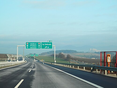
-
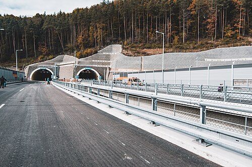 Považský Chlmec Tunnel on D3 before opening
 -
 View of the High Tatras from the D1 near Poprad
 -
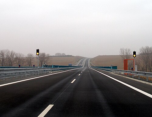
-
 Old sign for motorways
 -
 Old sign for expressways
 -

-
 The Považská Bystrica viaduct
Slovenia

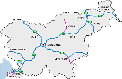
in use
under construction
planned
The highways in Slovenia are the central state roads in Slovenia and are divided into motorways (Slovene: avtocesta, AC) and expressways (hitra cesta, HC). Motorways are dual carriageways with a speed limit of 130 km/h (81 mph). They have white-on-green road signs as in Italy, Croatia and other countries nearby. Expressways are secondary roads, also dual carriageways, but without an emergency lane. They have a speed limit of 110 km/h (68 mph) and have white-on-blue road signs.
-

-
 The Medvedjek Slope on the eastern part of the A2 (Lower Carniola)
 -
 The toll station at Log pri Brezovici
 -
 A1 near Postojna

Spain


The Spanish network of autopistas and autovias has a length of 17,228 km (10,705 mi), making it the largest in Europe and the third in the world.[158] Autopistas are specifically reserved for automobile travel, so all vehicles not able to sustain at least 60 km/h (37 mph) are banned from them. General speed limits are mandated by the Spanish Traffic Law as 60–120 km/h (37–75 mph). Specific limits may be imposed based on road, meteorological or traffic conditions. Spanish legislation requires an alternate route to be provided for slower vehicles. Many, but not all, autopistas are toll roads, which also mandates an alternate toll-free route under the Spanish laws.
-
 The M-40 autopista (motorway) is one of the beltways serving Madrid. It is one of the few non-toll autopistas of significant length.
 -

-
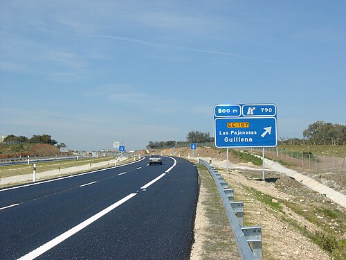 Modern autovías (expressway) such as the A-66 near Guillena, Seville, offer most, if not all, features that are required by an autopista (motorway).
Sweden
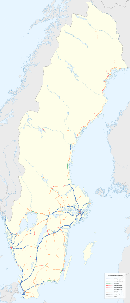
.svg/500px-E20_(Sverige).svg.png)
Sweden has the largest motorway network in Scandinavia (2,050 kilometres, 1,274 mi).[159] It is, however, unevenly allocated. Most motorways are located in the south of the country, where the population density is the highest.
The first motorway in Sweden opened in 1953, between Lund and Malmö. Four-lane expressways had been built before, an early example is E20 between Gothenburg and Alingsås, built in the early 1940s. Most of the current network was built in the 1970s and 1990s.
E6 starts i Trelleborg in southern Sweden, it then continues along the Swedish western coast, up to the Svinesund bridge which is where Sweden borders to Norway. Its length is close to 600 km (370 mi) on Swedish territory alone, and it connects four of Scandinavia's six largest cities, Copenhagen, Malmö, Gothenburg and Oslo together,[160][161][162] as well as around 20 other more or less notable towns and cities.
A Swedish (partly motorway) route (rather than road) that also has a significant portion of the Swedish motorway network, is European route E4, which runs from the border city of Tornio in northern Finland to Helsingborg in southern Sweden. E4 is the main route that connects the capital Stockholm with Scania. All of E4 south of the city Gävle is of motorway standard, with only the part passing Ljungby (32 kilometres, 20 mi) left, currently in expressway standard. Upgrade to motorway standard will start in 2017.[163] The part of E4 that runs through western Stockholm is called Essingeleden and is the busiest road in Sweden.
Other highways that have a significant portion of motorway standard are E20, E18 and E22. Motorways in Sweden are however not restricted to European routes; so called Riksvägar and other regional road types can also be of motorway standard. An example of this is Riksväg 40. Riksväg 40 is the main link between the largest cities in the country, Stockholm and Gothenburg. Notably, not even the majority of the European route- network in Sweden is motorway or even have expressway standard. All of this is because road numbering and road standard is separate in Sweden, as in the rest of Scandinavia.
-
 E22 Motorway westbound towards Karlskrona
 -
 The Södra länken Rv-75 ring road in Stockholm
Switzerland
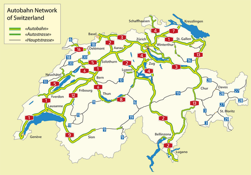

Switzerland has a two-class highway system: motorways with separated roads for oncoming traffic and a standard maximal speed limit of 120 km/h (75 mph), and expressways often with oncoming traffic and a standard maximal speed limit of 100 km/h (62 mph).
In Switzerland as of April 2011, there were 1,763.6 kilometres (1,095.9 mi) of a planned 1,893.5 kilometres (1,176.6 mi) of motorway completed. The country is mountainous with a high proportion of tunnels: there are 220 totaling 200 kilometres (120 mi), which is over 12% of the total motorway length.[164]
-
 Autobahn A2 near the northern portal of the Gotthard tunnel
 -

-
 Autobahn A1/A3 near Birrfeld
Turkey
.svg/500px-Turkey_road_sign_B-18_(2).svg.png)
.png/500px-Motorway_Map_of_Turkey_(revised).png)

Motorways (Turkish: Otoyol) of Turkey are a network in constant development. All motorways (O coded), except beltways, are toll roads (using only RFID methods for the roads that operated by KGM; cash and credit card payment is also possible for the roads that operated by private companies), mostly six lanes wide, illuminated and with 130 or 140 km/h (81 or 87 mph) speed limit. As of 2024, total length of the motorways is 3,726 km (2,315 mi) long in total.[165]


United Kingdom


Great Britain

A map Showing Future Pattern of Principal National Routes was issued by the Ministry of War Transport in 1946[166] shortly before the law that allowed roads to be restricted to specified classes of vehicle (the Special Roads Act 1949) was passed.[167] The first section of motorway, the M6 Preston Bypass, opened in 1958[168] followed by the first major section of motorway (the M1 between Crick and Berrygrove in Watford), which opened in 1959.[168] From then until the 1980s, motorways opened at frequent intervals;[169] by 1972 the first 1,600 km (1,000 mi) of motorway had been built.[170]
Whilst roads outside of urban areas continued to be built throughout the 1970s, opposition to urban routes became more pronounced. Most notably, plans by the Greater London Council for a series of ringways were cancelled following extensive road protests and a rise in costs.[citation needed] In 1986 the single-ring, M25 motorway was completed as a compromise.[171] In 1996 the total length of motorways reached 3,200 kilometres (2,000 mi).[172]
Motorways in Great Britain, as in numerous European countries, will nearly always have the following characteristics:
- No traffic lights (except occasionally on slip roads before reaching the main carriageway).
- Exit is nearly always via a numbered junction and slip road, with rare minor exceptions.
- Pedestrians, cyclists and vehicles below a specified engine size are banned.
- There is a central reservation separating traffic flowing in opposing directions (the only exception to this is the A38(M) in Birmingham where the central reservation is replaced by another lane in which the direction of traffic changes depending on the time of day. There was another small spur motorway near Manchester with no solid central reservation, but this was declassified as a motorway in the 2000s.)
- No roundabouts on the main carriageway. (This is only the case on motorways beginning with M (so called M class)). In the case of upgraded A roads with numbers ending with M (i.e. Ax(M)), roundabouts may exist on the main carriageway where they intersect 'M' class motorways. In all M class motorways bar two, there are no roundabouts except at the point at which the motorway ends or the motorway designation ends. The only exceptions to this in Great Britain are:
- the M271 in Southampton which has a roundabout on the main carriageway where it meets the M27, but then continues as the M271 after the junction.
- on the M60. This came about as a result of renumbering sections of the M62 and M66 motorways near Manchester as the M60, to form a ring around the city. What was formerly the junction between the M62 and M66 now involves the clockwise M60 negotiating a roundabout, while traffic for the eastbound M62 and northbound M66 carries straight on from the M60. This junction, known as Simister Island, has also been criticised for the presence of a roundabout and the numbered route turning off.[citation needed]
- the A1(M) between the M62 in North Yorkshire and Washington in Tyne and Wear is built to full 'M' class standards without any roundabouts.
- the A74(M) between Gretna and Abingdon in Scotland is similarly built to full 'M' class standards with no roundabouts.
On motorways in Great Britain there were 99 fatalities in 2017 for 69 billion vehicle miles travelled, a reduction from 183 fatalities in 2007.[173] which is equivalent to 1.43 fatalities per billion vehicle miles traveled.
Northern Ireland
Legal authority existed in the Special Roads Act (Northern Ireland) 1963 similar to that in the 1949 Act.[174] The first motorway to open was the M1 motorway, though it did so under temporary powers until the Special Roads Act had been passed.[175] Work on the motorways continued until the 1970s when the oil crisis and The Troubles both intervened causing the abandonment of many schemes.[176]
Oceania
Australia


Australia's major cities, Sydney, Melbourne, Brisbane and Perth, feature a network of freeways within their urban areas, while Canberra, Adelaide, Hobart and the regional centres of Newcastle, Geelong, Gold Coast and Wollongong feature a selection of limited-access routes. Outside these areas traffic volumes do not generally demand freeway-standard access, although heavily trafficked regional corridors such as Sydney–Newcastle (M1 Pacific Motorway (F3)), Sydney–Wollongong (M1 Princes Motorway (F6)), Brisbane–Gold Coast (M1 Pacific Motorway), Melbourne–Geelong (M1 Princes Freeway), Perth-Mandurah (SR2 Kwinana Freeway) and that form part of major long-distance routes feature high-standard freeway links.
The M31 Hume Highway/Freeway/Motorway connecting Sydney and Melbourne, the M23 Federal Highway spur route that connects Canberra with Sydney and the A1/M1 Pacific Highway/Motorway connecting Sydney and Brisbane are the only major interstate highways that are completed to a continuous dual carriageway standard. There are also plans to upgrade the A25 Barton Highway, another spur off the M31 that connects Canberra with Melbourne, to a dual carriageway highway. Although these inter-city highways are dual carriageway they are not all controlled access highways. Some of these inter-city highways have driveways to adjacent property and at-grade junctions with smaller roads.
Unlike many other countries, some of Australia's freeways are being opened to cyclists. As the respective state governments upgrade their state's freeways, bicycle lanes are being added and/or shoulders widened alongside the freeways. The state of Queensland is an exception however, as cyclists are banned from all freeways, including the breakdown lane.
Motorways referred to as an expressway in Australia include the Hunter Expressway, which connects the Hunter Valley with Newcastle, and the Southern Expressway, which connects Adelaide's outer southern suburbs to the southwestern suburbs.
-
 Aerial view of Tuggeranong Parkway in the Australian Capital Territory
 -
 Deer Park Bypass on the Western Freeway
 -
 The Tasman Highway in Tasmania
 -

New Zealand


The term motorway in New Zealand encompasses multilane divided freeways as well as narrower two- to four-lane undivided expressways with varying degrees of grade separation; the term motorway describes the legal traffic restrictions rather than the type of road.[177]
New Zealand's motorway network is small due to the nation's low population density and low traffic volumes making it uneconomical to build controlled-access highways outside the major urban centres.
New Zealand's first motorway opened in December 1950 near Wellington, running from Johnsonville to Tawa. This five-kilometre (3.1 mi) motorway now forms the southern part of the Johnsonville-Porirua Motorway and part of State Highway 1.[178] Auckland's first stretch of motorway was opened in 1953 between Ellerslie and Mount Wellington (between present-day exit 435 and exit 438), and now forms part of the Southern Motorway.[179]
Most major urban areas in New Zealand feature limited-access highways. Auckland, Wellington, Christchurch, Hamilton, Tauranga, and Dunedin contain motorways, with only Auckland having a substantial motorway network.
See also

Notes
- ^ Used in the western part of the United States, parts of Australia, parts of Canada, and South Africa.
- ^ Used in the United Kingdom, Hong Kong, Ireland, Pakistan, New Zealand, and parts of Australia.
- ^ Used in parts of the United States, parts of Canada, Australia, China, India, Japan, the Philippines, South Korea, and an official term in the UK and Hong Kong. In some parts of the United States, this also designates a type of limited-access road of lower class than a freeway. In the UK it officially refers to main roads of a lower class than a motorway.[1]
- ^ Columbia Guide to Standard American English: "Thruway is the Standard spelling of the word meaning a 'high-speed, limited access, multiple-lane highway. [...] Throughway is a variant."
- ^ Portions of the Downtown Connector in Atlanta, Georgia, have eight lanes in each direction.
References
- ^ Department for Transport. Road Investment Strategy: Strategic Vision (PDF). gov.uk (Report). p. 48.
- ^ a b Jost, Graziella & Pogorelov, Evgueni (19 February 2008). "Fate of EU Motorway Safety in Hands of MEPs" (PDF) (Press release). European Transport Safety Council. Archived (PDF) from the original on 8 April 2014. Retrieved 7 April 2014.
- ^ a b c Lenarduzzi, Thea (30 January 2016). "The motorway that built Italy: Piero Puricelli's masterpiece". The Independent. Retrieved 12 May 2022.
- ^ a b c d "The "Milano-Laghi" by Piero Puricelli, the first motorway in the world". Retrieved 10 May 2022.
- ^ "Avus highway | German expressway | Britannica".
- ^ "Convention on Road Signs and Signals, Done at Vienna on 8 November 1968" (PDF). Archived from the original (PDF) on 4 March 2016. Retrieved 13 May 2016.
- ^ "Glossary of Statistical Terms". OECD. 26 February 2004. Archived from the original on 10 August 2011. Retrieved 3 September 2009.
- ^ Dictionary: PIARC Road Dictionary/ English
- ^ a b "COMMON ACCIDENT DATA SET: Reference Guide" (PDF). Ec.europa.eu. Version. 3.4. April 2015. Archived from the original (PDF) on 4 June 2016. Retrieved 18 July 2017.
- ^ Elvik, Vaa, 2004[full citation needed]
- ^ Eurostat / UNECE / ECMT, 2003[full citation needed]
- ^ NTUA, 2005[full citation needed]
- ^ "The AVUS".
- ^ "AVUS Berlin: A most remarkable street circuit". 28 June 2018.
- ^ "AVUS 100: EIN RASANTES JAHRHUNDERT - by Schulz Ulf, Wedemeyer Sven".
- ^ "AVUS-Tribüne (Automobile Traffic and Practice Road)".
- ^ "Avus highway | German expressway | Britannica".
- ^ Schütz, Erhard; Gruber, Eckhard (1996). Mythos Reichsautobahn: Bau und Inszenierung der 'Straßen des Führers' 1933–1941 (in German). Berlin: Links. pp. 31–32. ISBN 978-386153117-3.
- ^ Kunze, Thomas; Stommer, Rainer (1982). "Geschichte der Reichsautobahn". In Stommer, Rainer; Philipp, Claudia Gabriele (eds.). Reichsautobahn: Pyramiden des Dritten Reichs. Analysen zur Ästhetik eines unbewältigten Mythos (in German). Marburg: Jonas. pp. 22–47. ISBN 9783922561125.
- ^ "Autobahn History - German-Autobahn.eu".
- ^ Patton, Phil (9 October 2008). "A 100-Year-Old Dream: A Road Just for Cars". The New York Times.
- ^ "Built to Meander, Parkway Fights to Keep Measured Pace". The New York Times. 6 June 1995. Archived from the original on 14 May 2013. Retrieved 13 April 2010.
- ^ Hershenson, Roberta (18 June 1995). "Bronx River Parkway on an Endangered List". The New York Times. Archived from the original on 14 May 2013. Retrieved 13 April 2010.
- ^ "German Myth 8: Hitler and the Autobahn". German.about.com. Archived from the original on 8 May 2006.
- ^ "Autobahn | High-Speed, Safety, Efficiency | Britannica". 16 August 2024.
- ^ Shragge, John & Bagnato, Sharon (1984). From Footpaths to Freeways. Ontario Ministry of Transportation and Communications, Historical Committee. p. 55. ISBN 978-0-7743-9388-1.
- ^ a b c d Bassett, Edward M. (February 1930). "The Freeway: A New Kind of Thoroughfare". American City. 42: 95.
- ^ Korr, Jeremy (2008). "Physical and Social Constructions of the Capital Beltway". In Mauch, Christof & Zeller, Thomas (eds.). The World Beyond the Windshield: Roads and Landscapes in the United States and Europe. Athens: Ohio University Press. p. 195. ISBN 9780821417676.
- ^ Karnes, Thomas L. (2009). Asphalt and Politics: A History of the American Highway System. Jefferson, NC: McFarland & Co. p. 131. ISBN 9780786442829.
- ^ Swift, Earl (2011). The Big Roads: The Untold Story of the Engineers, Visionaries, and Trailblazers Who Created the American Superhighways. Boston: Houghton Mifflin Harcourt. p. 110. ISBN 9780547549132. Retrieved 27 February 2023.
- ^ Roig-Franzia, Manuel (22 November 2001). "The Town That Stops Traffic: Travelers Encounter Way Station as Way of Life in Breezewood". The Washington Post. p. B1.
- ^ a b c d e f g "Motorways 2018" (PDF). European Road Safety Observatory. Archived (PDF) from the original on 8 June 2019. Retrieved 1 September 2021.
- ^ "Chapter 2, Section 5". Access Management Manual. Texas Department of Transportation. Archived from the original on 21 July 2011.
- ^ "Median Barriers Prove Their Worth". Public Works. 123 (3): 72–73. March 1992.
- ^ "Controlled-Access Highways as Bikeways" (PDF). Arizona Department of Transportation. PGP 1030. Archived from the original (PDF) on 24 December 2005.
- ^ "OAR Banning Non-Motorized Travel on Some Interstate Freeways in Oregon" (PDF). Oregon Department of Transportation. Archived from the original (PDF) on 31 May 2010. Retrieved 12 October 2009.
- ^ "Using the Highway". Your Rights: The Liberty Guide to Human Rights. Liberty. 18 August 2008. Archived from the original on 9 February 2013. Retrieved 31 January 2013.
- ^ "Roadway Design Manual". Texas Department of Transportation. March 2010. 6: Freeways. Archived from the original on 14 May 2013. Retrieved 28 March 2013.
- ^ "Woodruff Road Corridor Study" (PDF). 2013. Chapter 4*: Interchange Modifications. Archived from the original (PDF) on 1 June 2013. Retrieved 28 March 2013.
- ^ "13: Motorway Signs, Signals and Road Markings". Road Signs. ukmotorists.com. Archived from the original on 29 May 2012. Retrieved 24 April 2012.
- ^ "Introduction: Highway Statistics 2011, Highway Statistics Series". Federal Highway Administration. Archived from the original on 22 March 2014. Retrieved 21 March 2014.
- ^ a b c d Adminaite, Docile; Allsop, Richard & Jost, Graziella (March 2015). Ranking EE Progress on Improving Motorway Safety (PDF). European Transport Safety Council. PIN Flash Report 28. Retrieved 4 July 2018.[page needed]
- ^ "International Traffic and Accident Data: Selected Risk Values for the Year 2010" (PDF). Bundesanstalt für Straßenwesen (Federal Highway Research Institute). December 2012. Archived (PDF) from the original on 7 April 2014. Retrieved 10 September 2013.
- ^ "Highway Statistics: Table VM-2: Vehicle-miles of travel, by functional system; Table FI-10: Persons fatally injured in motor vehicle crashes, by Federal-aid highways". Federal Highway Administration. December 2012. Archived from the original on 7 September 2013. Retrieved 10 September 2013.
- ^ "Traffic and Accident Data: Summary Statistics: Germany" (PDF). Bundesanstalt für Straßenwesen (Federal Highway Research Institute). December 2012. Archived (PDF) from the original on 8 April 2014. Retrieved 7 April 2014.
- ^ "Unfallentwicklung auf deutschen Straßen 2012" [Crashes on German Roads 2012] (PDF). Statistisches Bundesamt (Federal Statistics Office). 10 July 2013. Archived (PDF) from the original on 14 November 2013. Retrieved 23 September 2013.
- ^ "German minister rules out end to unlimited motorway speeds | ETSC". Etsc.eu. Archived from the original on 25 May 2017. Retrieved 18 July 2017.
- ^ "German Autobahn: The Speed Limit Debate" (PDF). SPEED Fact Sheet. February 2008.
- ^ "Rapport d'activité 2012" (PDF) (in French). Vinci Autoroutes. Archived from the original (PDF) on 5 March 2016. Retrieved 14 May 2016.
- ^ a b European Road Safety Observatory (June 2017). Traffic Safety Basic Facts 2017: Motorways (PDF). European Road Safety Observatory. Retrieved 4 July 2018.[page needed]
- ^ Albalate, Daniel; Bel, Germà (2012). "Motorways, tolls and road safety: Evidence from Europe". SERIEs. 3 (4): 457–473. doi:10.1007/s13209-011-0071-6. hdl:10419/77726.
- ^ Olsen, Jonathan R.; Mitchell, Richard; MacKay, Daniel F.; Humphreys, David K.; Ogilvie, David (2016). "Effects of new urban motorway infrastructure on road traffic accidents in the local area: A retrospective longitudinal study in Scotland". Journal of Epidemiology and Community Health. 70 (11): 1088–1095. doi:10.1136/jech-2016-207378. PMC 5541177. PMID 27279082.
- ^ Montella, Alfonso; Imbriani, Lella Liana; Marzano, Vittorio; Mauriello, Filomena (2015). "Effects on speed and safety of point-to-point speed enforcement systems: Evaluation on the urban motorway A56 Tangenziale di Napoli". Accident Analysis & Prevention. 75: 164–178. doi:10.1016/j.aap.2014.11.022. PMID 25482322.
- ^ Aron, Maurice; Billot, Romain; Faouzi, Nour-Eddin EL; Seidowsky, Régine (2015). "Traffic Indicators, Accidents and Rain: Some Relationships Calibrated on a French Urban Motorway Network". Transportation Research Procedia. 10: 31–40. doi:10.1016/j.trpro.2015.09.053.
- ^ "Freeway Geometric Design for Active Traffic Management in Europe" (PDF). Federal Highway Administration. March 2011. Archived (PDF) from the original on 6 May 2017.
 This article incorporates text from this source, which is in the public domain.
- ^ "Public Roads - Comparison of The Safety of Lighting Options on Urban Freeways, Autumn 1994". Federal Highway Administration. 31 January 2017. Archived from the original on 4 September 2017. Retrieved 18 July 2017.
- ^ Recker, Wilfred W.; Golob, Thomas F. (December 2001). "MOU 3007 report.PDF" (PDF). Path.berkeley.edu. Archived (PDF) from the original on 9 August 2017. Retrieved 18 July 2017.
- ^ Martin, Hugo (20 April 2003). "Sounding Off on Noise: Freeways' Neighbors Struggle to Drown Out Road Racket, Experts Say the Din Creates Mental and Physical Hazards". Los Angeles Times. p. B1.
- ^ Jacobs, Jane. The Death and Life of Great American Cities.[full citation needed]
- ^ McCreery, Sandy (23 July 2001). "Don't just sit there, enjoy it!". New Statesman. p. 23.
- ^ Smilgis, Martha (20 July 1987). "Trapped Behind the Wheel: Clever Commuters Learn to Live in the Slow Lane". Time. pp. 64–65.
- ^ Coulombe, Gerard (6 July 1986). "Doing the Turnpike Crawl". The New York Times. p. CN16.
- ^ Spivak, Jeffrey (27 July 1999). "Today's Road Opening Represents Progress, Pain". Kansas City Star. p. A1.
- ^ Noise Pollution and Abatement Act of 1972. S. Rep. No. 1160, 92nd Cong. 2nd session.
- ^ Hogan, C. Michael & Latshaw, Gary L. (21–23 May 1973). The Relationship between Highway Planning and Urban Noise. Proceedings of the ASCE, Urban Transportation Division Specialty Conference. Chicago: American Society of Civil Engineers, Urban Transportation Division. Archived from the original on 18 May 2007.
- ^ "TransApex - Brisbane City Council". 17 June 2007. Archived from the original on 17 June 2007.
- ^ "Myth: We need big roads anyway, even for sustainable transport". Victoria: Public Transport Users Association. Archived from the original on 22 January 2018. Retrieved 22 January 2018.
- ^ Cervero, Robert (Spring 2003). "Road Expansion, Urban Growth, and Induced Travel: A Path Analysis" (PDF). Journal of the American Planning Association (Submitted manuscript). 69 (2): 145–164. doi:10.1080/01944360308976303. S2CID 18229524.
- ^ Martin, Hugo (10 April 2002). "Will More Freeways Bring More Traffic?". Los Angeles Times. p. B1.
- ^ Van Hengel, Drusilla; Dimento, Joseph; Ryan, Sherry (1999). "Equal Access? Travel Behaviour Change in the Century Freeway Corridor, Los Angeles". Urban Studies. 36 (3): 547–562. Bibcode:1999UrbSt..36..547V. doi:10.1080/0042098993529. S2CID 154924700.
- ^ Borth, Christy (1969). Mankind on the Move: The Story of Highways. Washington, DC: The Automobile Safety Foundation. pp. 248, 264.
- ^ Mohl, Raymond A. (2008). "The Interstates and the Cities: The US Department of Transportation and the Freeway Revolt, 1966–1973". The Journal of Policy History. 20 (2): 193–226. doi:10.1353/jph.0.0014.
- ^ Taylor, Brian D. (Winter 1995). "Public Perceptions, Fiscal Realities, and Freeway Planning: The California Case" (PDF). Journal of the American Planning Association (Submitted manuscript). 61 (1): 43–59. doi:10.1080/01944369508975618.
- ^ M1
- ^ "The Northern Ireland Assembly". Northern Ireland Assembly. Archived from the original on 23 December 2008. Retrieved 10 August 2009.
- ^ a b "Roads Act 1993 (Classification of National Roads) Order 2006" (PDF). Department of Transport (Republic of Ireland). 2006. Archived from the original (PDF) on 17 December 2008. Retrieved 8 April 2007.
- ^ "CIPE - Esito seduta del 24 luglio 2019" (PDF) (in Italian). Retrieved 27 September 2019.
- ^ "La Società - Società Autostradale Alto Adriatico" (in Italian). Retrieved 21 September 2019.
- ^ KeNHA (3 April 2016). "Kenya National Highway Authority: Who We Are". Nairobi: Kenya National Highway Authority (KeNHA). Retrieved 3 April 2016.
- ^ Muthoni, Sophia (27 January 2016). "How Kenya National Highways Authority plans to deal with vandalism". The Standard (Kenya). Nairobi. Retrieved 3 April 2016.
- ^ "Home - Department-of-Transport". www.transport.gov.za. Archived from the original on 17 June 2011.
- ^ "Transportation: Roads". South Africa: Stats and Facts. Archived from the original on 27 July 2011. Retrieved 15 June 2010.
- ^ "Argentina". Latin America and Caribbean Transport Working Group. Retrieved 13 January 2024.
- ^ "Infraestrutura rodoviária: estradas paulistas têm padrão internacional". Governo do Estado de São Paulo. 14 December 2016.
- ^ "Section 1A.13". Manual on Uniform Traffic Control Devices (Rev 1, 2003 ed.). Federal Highway Administration. para. 29. Archived from the original on 13 May 2006. See also 23 CFR 750.153(k).
- ^ This part of the word's meaning was codified in 1939 at Section 23.5 of the California Streets and Highways Code."California Code". Archived from the original on 27 July 2009. Retrieved 30 May 2011. See also People v. Scheinman, 248 Cal. App. 2d 180, 182, 56 Cal. Rptr. 168, 168–169 (1967) (interpreting Section 23.5 to find that a property owner had deeded to the State just the access from the side of his property directly abutting a future freeway but not the access through a connecting road that the state wished to close in order to upgrade an expressway to a freeway).
- ^ "Section 1A.13". Manual on Uniform Traffic Control Devices (Rev. 1, 2003 ed.). para. 27. Archived from the original on 13 May 2006.
- ^ AASHO Highway Definitions. Washington DC: American Association of State Highway Officials. 1962. pp. 1–3.
- ^ Raitz, Karl B.; Thompson, George F. (1996). The National Road. JHU Press. pp. 34–. ISBN 978-0-8018-5155-1.
Taylor, Craig; Mittler, Elliott; Lund, Le Val (1998). Overcoming Barriers: Lifeline Seismic Improvement Programs. ASCE Publications. pp. 173–174. ISBN 978-0-7844-7460-0.
Schwantes, Carlos A. (2003). Going Places: Transportation Redefines the Twentieth-Century West. Indiana University Press. pp. 272–273. ISBN 978-0-253-34202-7. - ^ California Streets & Highways Code § 257.
- ^ "§ 160.02, subds. 18b & 19". Minnesota Statutes.
- ^ "§ 65-5-3, subds. (b) and (c)". Mississippi Code Annotated.
- ^ "§ 304.010". Missouri Revised Statutes.
- ^ "§§ 60-618.01 and 60-621". Nebraska Revised Statutes.
- ^ "§ 24-01-01.1". North Dakota Century Code. 2006.
- ^ "§ 4511.01, subds. (YY) and (ZZ)". Ohio Revised Code Annotated. Archived from the original on 6 October 2014. Retrieved 4 October 2014.
- ^ "§§ 59.84(1)(b) and 346.57(1)(am)". Wisconsin Statutes.
- ^ "§ 4511.01, subd. (ZZ)". Ohio Revised Code Annotated. Archived from the original on 6 October 2014. Retrieved 4 October 2014.
- ^ "freeway". American Heritage Dictionary. Archived from the original on 24 August 2008 – via bartleby.com.
- ^ "Puerto Rico toll roads - Toll roads - the Group - Abertis".
- ^ Li, Si-ming and Shum, Yi-man. Impacts of the National Trunk Highway System on accessibility in China Archived 22 June 2010 at the Wayback Machine. Journal of Transport Geography.
- ^ 国家高速公路网规划 (National Trunk Highway System Planning) Archived 2014-01-14 at the Wayback Machine. 13 January 2005. (in Chinese)
- ^ "去年交通固定资产投资超3万亿 高速公路里程13.65万公里". 人民网. 30 March 2018. Archived from the original on 6 January 2019.
- ^ a b "我国高速公路通车里程位居世界第一 骨架网络正加快贯通". 第一财经日报. Archived from the original on 3 May 2019. Retrieved 7 December 2019.
- ^ MacLeod, Calum (29 January 2006). "China's Highways Go the Distance". USA Today. Archived from the original on 5 October 2010. Retrieved 2 May 2010.
- ^ "Portal Berita Info Publik - Kementerian Komunikasi dan Informatika". Archived from the original on 22 December 2015. Retrieved 13 October 2015.
- ^ "Manado people ask govt accelerate Trans Sulawesi". Antaranews.com. 22 April 2012. Archived from the original on 29 November 2016. Retrieved 5 September 2016.
- ^ MinistryOfFinance, MinistryOfFinance (11 September 2020). "Highway_6_MinistryOfFinance". Ministry Of Finance. Retrieved 29 December 2020.
- ^ "2014 Roads in Japan" (PDF). Archived from the original (PDF) on 3 April 2015. Retrieved 20 June 2015.
- ^ "Statistics Bureau Home Page/JAPAN STATISTICAL YEARBOOK 2016 - Chapter 12 Information and Communication". Stat.go.jp. Archived from the original on 25 May 2017. Retrieved 18 July 2017.
- ^ "道路:道の相談室:道に関する各種データ集". 国土交通省. Retrieved 16 March 2019.
- ^ "LLM-Senarai FAQ". Archived from the original on 21 March 2012. Retrieved 13 October 2015.
- ^ "TravelSmarter". TravelSmarter.com.my. Archived from the original on 25 June 2017. Retrieved 18 July 2017.
- ^ "National Highways Authority – Committed to Excellence". Retrieved 27 November 2020.
- ^ "Peshawar-Karachi Motorway (Multan-Sukkur Section) | China-Pakistan Economic Corridor (CPEC) Official Website". cpec.gov.pk. Retrieved 27 November 2020.
- ^ "Lahore-Islamabad Motorway (M-2) – National Highways Authority". Retrieved 27 November 2020.
- ^ "Karachi- Hyderabad Motorway (M-9) – National Highways Authority". Retrieved 27 November 2020.
- ^ "Expressways in Singapore: Did you know?". The Highway. Automobile Association of Singapore. July 2001. Archived from the original on 10 March 2006. Retrieved 5 April 2006.
- ^ "Quy hoạch phát triển mạng đường bộ cao tốc Việt Nam đến năm 2020 và định hướng đến năm 2030 ( Planning on development of Vietnam's expressway network up to 2020 and orientation to 2030)". Thư viện Pháp luật (in Vietnamese). 1 March 2016.
- ^ "Đường cao tốc Việt Nam đắt gấp 2-4 lần thế giới?". news.zing.vn (in Vietnamese). 15 June 2017. Archived from the original on 15 June 2017.
- ^ including European main international traffic arteries are defined by ECE/TRANS/SC 1/384
- ^ SitiosArgentina.com.ar. "Señales De Transito". Sitiosargentina.com.ar. Archived from the original on 25 May 2017. Retrieved 18 July 2017.
- ^ "Transport statistics at regional level - Statistics Explained". Ec.europa.eu. 18 January 2012. Archived from the original on 20 July 2017. Retrieved 18 July 2017.
- ^ "Archived copy" (PDF). Archived from the original (PDF) on 20 May 2013. Retrieved 19 June 2015.
{{cite web}}: CS1 maint: archived copy as title (link) - ^ "Albania – National Transport Plan Phase 2 Study Phase" (PDF). September 2004. Archived from the original (PDF) on 3 March 2016. Retrieved 19 June 2015.
- ^ "RIS - Gesamte Rechtsvorschrift für Bundesstraßengesetz 1971 - Bundesrecht konsolidiert, Fassung vom 18.07.2017". Ris.bka.gv.at. 29 November 2008. Archived from the original on 25 May 2017. Retrieved 18 July 2017.
- ^ "Wegen-routes.be". Archived from the original on 18 December 2014.
- ^ "OVERZICHT. Hier staan we het meest in de file - Het Nieuwsblad". Nieuwsblad.be. 22 March 2013. Archived from the original on 22 June 2017. Retrieved 18 July 2017.
- ^ "Nooit gezien: 1.258 km file door sneeuwval - België". Knack.be. 3 February 2012. Archived from the original on 27 June 2017. Retrieved 18 July 2017.
- ^ https://bihamk.ba/bs/vijesti/voznja-autocestom/112, (in Bosnian)
- ^ Délky a další data komunikací (in Czech) Archived 23 March 2023 at the Wayback Machine
- ^ "BASt 2017 – Publikationen – Tempolimits auf Bundesautobahnen 2015". www.bast.de.
- ^ "Greek Motorways: The country's "road Metro" has now emerged - ypodomes.com" (in Greek). Archived from the original on 4 August 2017. Retrieved 3 August 2017.
- ^ "Transport 21 Infrastructure Plan, Ireland". Transport21.ie. Archived from the original on 21 November 2010. Retrieved 15 December 2010.
- ^ "German Myth 8: Hitler's Autobahn?". Archived from the original on 8 May 2006. Retrieved 3 April 2006.
- ^ "1924 Mile Posts". Archived from the original on 12 March 2008. Retrieved 3 April 2006.
- ^ "Aggiornamenti sull'evoluzione del regolamento europeo (AFIR) per la modifica della direttiva europea in materia di combustibili alternativi (DAFI)" [Updates on the evolution of the European regulation (AFIR) for the amendment of the European directive on alternative fuels (DAFI)] (PDF) (in Italian). AISCAT.
- ^ LE AUTOSTRADE
- ^ "Le strade dell'informazione". Retrieved 3 March 2024.
- ^ "nas S.p.A. - Le società concessionarie". Retrieved 3 March 2024.
- ^ "Ispettorato Vigilanza Concessioni Autostradali - Attività ed obiettivi". Retrieved 3 March 2024.
- ^ Come si calcola il pedaggio - Autostrade per l'Italia S.p.A Archived 6 April 2010 at the Wayback Machine
- ^ "Magistralės jubiliejus". Transporto pasaulis. Archived from the original on 22 July 2011. Retrieved 25 March 2010.
- ^ "CIA World Factbook | Field listing: Roadways". Central Intelligence Agency. 2012. Archived from the original on 22 May 2014. Retrieved 7 July 2014.
- ^ a b "Road traffic, vehicles and networks | Environment at a Glance 2013: OECD Indicators" (PDF) (Press release). Paris, France: OECD Publishing. 2013. Retrieved 10 July 2014.
- ^ "Autosnelweg" [Motorway]. WegenWiki (in Dutch). 2012. Archived from the original on 11 July 2014. Retrieved 17 July 2014.
- ^ "Start Page | Public enterprise for state roads". Roads.org.mk. Archived from the original on 8 August 2017. Retrieved 18 July 2017.
- ^ "ROZPORZĄDZENIE RADY MINISTRÓW z dnia 15 maja 2004 r. w sprawie sieci autostrad i dróg ekspresowych".
- ^ "Autostrady :: Generalna Dyrekcja Dróg Krajowych i Autostrad - Strona Główna". www.gddkia.gov.pl.
- ^ "Portugal". IPIM. Archived from the original on 14 February 2015.
- ^ Portugal é dos países com mais autoestradas na Europa Diário de Notícias—acedido em 21 April 2009[full citation needed]
- ^ 1,114.74 Km (2024-07-31). "Motorway (A) and Expressway (DEx) in use [Rețea în trafic - Autostrăzi și Drumuri Expres]" (PDF). www.cnadnr.ro (in Romanian). Ministry of Transportation - Romania (CNAIR). Retrieved 3 August 2024.
{{cite web}}: CS1 maint: numeric names: authors list (link) - ^ "Iptana, 50 de ani de proiectare pentru infrastructura transporturilor" (PDF) (in Romanian). Iptana. 10 September 2003. Archived (PDF) from the original on 24 September 2015. Retrieved 8 August 2015.
- ^ "Documente Master Plan General de Transport" (in Romanian). Romanian Ministry of Transport. Archived from the original on 22 March 2015. Retrieved 8 August 2015.
- ^ "На трассах М-11 и М-4 повысят скоростной режим до 130 км/ч". Autonews (in Russian). Retrieved 30 August 2024.
- ^ "Классификация автомобильных дорог" (PDF) (in Russian). Retrieved 21 January 2024.
- ^ "Uredba o kategorizaciji državnih puteva". Official Gazette of the Republic of Serbia (105). 29 November 2013. Archived from the original on 24 September 2015.
- ^ "Catálogo y evolución de la red de carreteras | Ministerio de Transportes, Movilidad y Agenda Urbana". www.mitma.gob.es. Retrieved 10 March 2021.
- ^ "Sveriges vägnät - Trafikverket". Trafikverket.se. 28 June 2016. Archived from the original on 18 July 2015. Retrieved 18 July 2017.
- ^ "150706 Hela E6 motorväg från Köpenhamn till Oslo –". E6.se. Archived from the original on 25 May 2017. Retrieved 18 July 2017.
- ^ "I dag invigs sista etappen av E 6 | Göteborgs-Posten - Göteborg". Gp.se. 6 July 2015. Archived from the original on 25 May 2017. Retrieved 18 July 2017.
- ^ Linda Bergh (6 July 2015). "Tog 60 år att bygga klart motorvägen | GT". Expressen.se. Archived from the original on 25 May 2017. Retrieved 18 July 2017.
- ^ "E4, Ljungby–Toftanäs, motorväg - Trafikverket". Trafikverket.se. 20 September 2016. Archived from the original on 9 July 2017. Retrieved 18 July 2017.
- ^ "European Traffic Police Network (TISPOL)" (PDF). Archived (PDF) from the original on 2 June 2013. Retrieved 7 April 2012.
- ^ "YILLAR İTİBARIYLA YAPIMI TAMAMLANMIŞ OTOYOLLAR (MART 2022)" (PDF). Kgm.gov.tr (in Turkish). Retrieved 26 March 2022.
- ^ "A New Way to Travel". December 2008. Archived from the original on 24 November 2011.
- ^ "Special Roads Act 1949" (PDF). Office of Public Sector Information. Archived (PDF) from the original on 29 February 2008. Retrieved 31 December 2007.
- ^ a b "Statistics". Motorway Archive. The Motorway Archive Trust. Archived from the original on 3 October 2007. Retrieved 18 November 2007.
- ^ "Opening dates for Motorways in the UK in chronological order". Motorway Archive. The Motorway Archive Trust. Archived from the original on 2 December 2008. Retrieved 18 November 2007.
- ^ Porter, John & Bridle, Ron (2002). The Motorway Achievement. Thomas Telford. p. 223. ISBN 978-0-7277-3196-8.
- ^ "M25 London Orbital Motorway (Junctions 13 to 30)". Motorway Archive. The Motorway Archive Trust. Archived from the original on 22 December 2008. Retrieved 31 December 2007.
- ^ Porter, John & Bridle, Ron (2002). The Motorway Achievement. Thomas Telford. p. 189. ISBN 978-0-7277-3196-8.
- ^ "Reported road casualties in Great Britain: 2017 annual report" (PDF). Department for Transport. 27 September 2018. Archived (PDF) from the original on 10 November 2018. Retrieved 1 September 2021.
- ^ "Conceptions and early history of the motorways in Northern Ireland". Motorway Archive. The Motorway Archive Trust. Archived from the original on 11 October 2007. Retrieved 31 December 2007.
- ^ "M1 Belfast to Dungannon and M12 to Craigavon". Motorway Archive. The Motorway Archive Trust. Archived from the original on 9 October 2007. Retrieved 31 December 2007.
- ^ "Westlink (M1 to M2)". Motorway Archive. The Motorway Archive Trust. Archived from the original on 13 October 2007. Retrieved 31 December 2007.
- ^ "Part 3: Motorways and Expressways". Manual of Traffic Signs and Markings (MOTSAM). NZ Transport Agency. June 2009.
- ^ "FAQs". Transit New Zealand. Archived from the original on 19 June 2008. Retrieved 21 March 2007.
- ^ "CMI Transit". Archived from the original on 22 February 2008. Retrieved 7 June 2007.
External links
 Media related to Controlled-access highways at Wikimedia Commons