
Loading article…
ネバダ州 | |
|---|---|
| ニックネーム: シルバー州(正式名称); セージブラッシュ州; バトルボーン州 | |
| モットー: すべては国のために | |
| 国歌:「ホーム・ミーンズ・ネバダ」 | |
 ネバダ州が強調表示されたアメリカ合衆国の地図 | |
| 国 | アメリカ合衆国 |
| 州になる前 | ネバダ準州、ユタ準州、アリゾナ準州 |
| 連合に加入 | 1864年10月31日(第36回) |
| 資本 | カーソンシティ |
| 最大の都市 | ラスベガス |
| 最大の郡または同等の郡 | クラーク |
| 最大の大都市圏と都市圏 | ラスベガスバレー |
| 政府 | |
| • 知事 | ジョー・ロンバード(右) |
| • 副知事 | スタブロス・アンソニー(右) |
| 立法府 | ネバダ州議会 |
| • 上院 | 上院 |
| • 下院 | 組み立て |
| 司法 | ネバダ州最高裁判所 |
| 米国上院議員 | キャサリン・コルテス・マスト( D ) ジャッキー・ローゼン(D) |
| 米国下院代表団 | 民主党 3 共和党 1 (リスト) |
| エリア | |
| • 合計 | 110,577 平方マイル(286,382 km 2) |
| • 土地 | 109,781.18平方マイル(284,332 km 2) |
| • 水 | 791平方マイル(2,048 km 2) 0.72% |
| • ランク | 7日 |
| 寸法 | |
| • 長さ | 492 マイル (787 km) |
| • 幅 | 322 マイル (519 km) |
| 標高 | 5,500 フィート (1,680 メートル) |
| 最高標高 (境界峰[1] [2] [a] [b]) | 13,147 フィート (4,007.1 メートル) |
| 最低標高 (カリフォルニア州境のコロラド川[2] [a]) | 481フィート(147メートル) |
| 人口 (2020年) | |
| • 合計 | 3,104,614 |
| • ランク | 32日 |
| • 密度 | 26.8/平方マイル (10.3/km 2 ) |
| • ランク | 42位 |
| • 世帯収入の中央値 | 60,365ドル[3] |
| • 所得順位 | 24日 |
| 異名 | ネバダ州 |
| 言語 | |
| • 公用語 | なし |
| タイムゾーン | |
| 州の大部分 | UTC−08:00 (太平洋) |
| • 夏 ( DST ) | UTC−07:00 (太平洋標準時) |
| ウェストウェンドーバー | UTC−07:00 (山岳部) |
| • 夏 ( DST ) | UTC−06:00 ( MDT ) |
| USPSの略称 | ネバダ州 |
| ISO 3166 コード | 米国-ネバダ州 |
| 伝統的な略語 | ネヴ。 |
| 緯度 | 北緯35度から北緯42度 |
| 経度 | 西経114度2分から西経120度 |
| Webサイト | ネバダ州政府 |


| 州のシンボル一覧 | |
|---|---|
| 歌 | 故郷はネバダ州 |
| 生きた記章 | |
| 鳥 | マウンテンブルーバード( Sialia currucoides ) |
| 魚 | ラホンタン・カットスロート・トラウト( Oncorhynchus clarkii henshawi ) |
| 花 | セージブラシ( Artemisia tridentata ) |
| 草 | インドライスグラス |
| 昆虫 | ビビッドダンサーイトトンボ( Argia vivida ) |
| 哺乳類 | 砂漠のオオツノヒツジ |
| 爬虫類 | 砂漠ガメ( Gopherus agassizii ) |
| 木 | ブリスルコーンパイン、シングルリーフピニオン(Pinus monophylla) |
| 無生物の記章 | |
| 色 | シルバー、ブルー |
| 化石 | 魚竜(ショニサウルス・ポピュリス) |
| 宝石 | ヴァージンバレーブラックファイアオパール |
| ミネラル | 銀 |
| ロック | 砂岩 |
| 土壌 | オロバダシリーズ |
| 他の | 要素:ネオン |
| 州道標識 | |
 | |
| 州25セント硬貨 | |
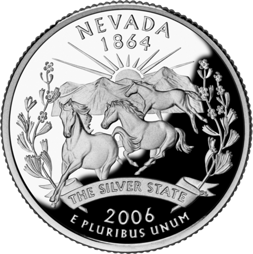 2006年にリリース | |
| アメリカ合衆国の州のシンボルのリスト | |
ネバダ( / n ə ˈ v æ d ə , - v ɑː -/ ネバダ州ネバダしゅうせい、英: Nevada、 スペイン語: [neˈβaða])は、アメリカ合衆国西部の内陸州である。 [c] 北西はオレゴン州、北東はアイダホ州、西はカリフォルニア州、南東はアリゾナ州、東はユタ州と接している。 ネバダ州は、アメリカ合衆国の州の中で7番目に面積が広く、32番目に人口が多く、9番目に人口密度の低いである。 ネバダ州の人口のほぼ4分の3がクラーク郡、この郡にはラスベガス・パラダイス大都市圏[6]、州で最大の4つの法人都市のうち3つが含まれている。[7]ネバダ州の州都はカーソンシティ。ラスベガスは州内最大の都市である。
ネバダ州は、歴史と経済において銀が重要なことから、公式には「銀の州」として知られている。また、南北戦争中に州に昇格したことから「戦闘生まれの州」としても知られている(「戦闘生まれ」という言葉は州旗にも描かれている)。エイブラハム・リンカーンの大統領職のおかげで、連邦は新たに州に昇格したことで、当時コムストック鉱脈で産出された銀鉱石による4億ドル近くの財政支援の注入という多大な恩恵を受けた。[8]また、同名の在来植物にちなんで「セージブラシ州」や「セージヘン州」としても知られている。[9]州名はスペイン語で「雪の多い」を意味し、ネバダ州がシエラネバダ山脈 とわずかに重なっていることに由来しているが、ネバダ州の残りの地域は大部分が砂漠と半乾燥地帯で、その多くはグレートベースン内にある。グレートベースンより南の地域はモハーベ砂漠内にあり、タホ湖とシエラネバダ山脈は西端に位置している。2020年、州の土地の80.1%が米国連邦政府の民間および軍のさまざまな管轄区域によって管理されていた。[10]
現在のネバダ州には、パイユート族、ショーショーニ族、ワショー族といったアメリカ先住民が住んでいます。この地域を最初に探検したヨーロッパ人はスペイン人でした。彼らは、冬には山々が雪に覆われ、スペインのシエラネバダ山脈に似ていることから、この地域をネバダ(雪の多い)と呼びました。この地域は主にアルタ・カリフォルニアと、 1821年にメキシコとして独立したヌエバ・スペイン副王領内のヌエボ・メキシコの領土の一部から形成されました。米国は米墨戦争での勝利後、1848年にこの地域を併合し、1850年にニューメキシコ・ユタ準州の一部として法人化されました。 1859年にコムストック・ロードで銀が発見されたことで人口が急増し、1861年にユタ準州西部からネバダ準州が設立されるきっかけとなりました。ネバダ州は1864年10月31日に南北戦争中に連邦に追加された2つの州(1つはウェストバージニア州)のうち2番目として、36番目の州になりました。[11]
ネバダ州は自由主義的な法律で知られている。1940年、人口が11万人強だったネバダ州は、圧倒的に人口の少ない州であり、次に人口の少ないワイオミング州の半分以下の人口であった。[12]しかし、賭博の合法化と結婚および離婚に関する寛大な法律により、20世紀にはネバダ州は主要な観光地となった。[13] [14]ネバダ州は売春が合法である唯一の米国の州であるが、最も人口の多い地域であるクラーク郡(ラスベガス)、ワショー郡(リノ)、カーソンシティ(独立都市であるため、どの郡の境界内にも入っていない)では違法である。観光産業は依然としてネバダ州最大の雇用主であり、[15]鉱業は引き続き経済の重要な部門であり、ネバダ州は世界第4位の金の産出国である。[16]ネバダ州は最も乾燥した州であり、時間の経過とともに、また気候変動の影響により、ネバダ州での干ばつの頻度と深刻さが増しており、[17]ネバダ州の水の安全保障にさらなる負担をかけています。
語源
「ネバダ」という名前は、スペイン語の形容詞nevada([neˈβaða])に由来し、「雪に覆われた」または「雪が降った」を意味します。[18]州名はネバダ準州に由来しており、ネバダ準州はシエラネバダ山脈にちなんで名付けられました。[19]
ネバダ州民は2番目の音節を「apple」の「a」で発音する(/ n ə ˈ v æ d ə /)。一方、州外の一部の人々は「palm」の「a」で発音する(/ n ə ˈ v ɑː d ə /)。[20]後者の発音は長さではなく質がスペイン語の発音に近い(スペイン語の/a/は中音開音[ä]である[21]のに対し、アメリカ英語の/ɑː/は後音[ɑː]から中音[äː]まで変化する)が、[22]ネバダ州民が使用する発音ではない。州議会議員のハリー・モーテンソンはネバダの代替発音を認める法案を提案したが[23] 、この法案はほとんどの議員の支持を得られず、投票には至らなかった。ネバダの発音は州議会で使用される発音である。かつて、州の公式観光団体TravelNevadaは、州名を「Nevăda」と表記し、aの上に短音を付けて地元で好まれる発音を示していた。[24]これは2007年までナンバープレートのデザインとしても利用されていた。[25]
歴史
先住民の歴史
ヨーロッパ人が到着する前、最も古い居住者はゴシュート族、南部パイユート族、モハーヴェ族、ワシシウ族(ワショー族)などの先住民族でした。[26] [27]
1861年以前
.png/500px-Mexico_1824_(equirectangular_projection).png)
フランシスコ・ガルセスは、この地域に住んだ最初のヨーロッパ人でした。[28]ネバダは、ヌエバ・エスパーニャの北西部にあるスペイン帝国の一部として併合されました。行政上、ネバダの地域はヌエバ・エスパーニャ副王領の州内総司令官の一部でした。ネバダは、1804年にカリフォルニアが分割されたときにアルタ・カリフォルニア(アッパー・カリフォルニア)州の一部になりました。1821年のメキシコ独立戦争で勝利したことで、アルタ・カリフォルニア州は人口の少ないメキシコの準州(州)になりました。
ジェデダイア・スミスは1827年にラスベガス渓谷に入り、ピーター・スキーン・オグデンは1828年にフンボルト川を旅し、1829年にはヌエボメキシコ出身の商人アントニオ・アルミホがオールド・スパニッシュ・トレイルに沿った旅を合理化した。アルミホのルートを記録した斥候ラファエル・リベラは、1830年にホセ・アントニオ・チャベス知事に提出した報告書の中で初めてラスベガスと名付けた。出版された探検隊の地図にラスベガス地域にある泉があるとリベラが示唆したことを受けて、ジョン・C・フレモントは1844年にラスベガス・スプリングスにキャンプを張った。 1847年、モルモン教徒はデゼレト州を設立し、グレートベースンとコロラド川流域内のネバダ州全域を領有した。彼らは1851年に現在のネバダ州にモルモンステーション(現在のジェノバ)と呼ばれる最初の恒久的な入植地を築きました。さらに1855年6月にはウィリアム・ブリングハーストと他の29人のモルモン宣教師が、ラスベガスのダウンタウンの北東、スペイン道路とモルモン道路が交わる場所に、最初の恒久的な建造物である150フィート四方のアドビ砦を築きました。砦は1858年から1859年の冬までソルトレイクシティの管理下にあり、ルートは主にソルトレイクシティとサンタフェの商人の管理下に置かれました。
このように、これらの開拓者たちは、シエラネバダ山脈とモハーベ砂漠の間、およびラスベガス渓谷内に最初の入植地が出現するための基礎を築きました。ニューメキシコとユタの文化の永続的な影響は、それ以来ネバダのアイデンティティに深く影響を及ぼし、ニューメキシコ料理やモルモンの食習慣、ニューメキシコとモルモンのフォークミュージックを通じて、ネバダ独自の文化的景観の構造に現れています。
米墨戦争とグアダルーペ・イダルゴ条約の結果、メキシコは1848年にアルタ・カリフォルニアを永久に失った。米国が獲得した新しい地域は引き続き領土として管理された。メキシコ割譲(1848年)と、その後の移民の道を使ったカリフォルニア・ゴールドラッシュの一環として、州の地域は最初はユタ準州とニューメキシコ準州の一部として発展し、その後ネバダ準州(1861年3月2日、シエラネバダ山脈にちなんで命名)となった。[29]

米国で最初の大規模な銀鉱石鉱床が発見されたのは、1859年、ネバダ州バージニアシティの地下にあるコムストック鉱脈でした。
ユタ準州からの分離

1861 年 3 月 2 日、ネバダ準州はユタ準州から分離し、シエラネバダ(スペイン語で「雪に覆われた山脈」) を短縮した現在の名称を採用しました。1861 年の南境界は、リンカーン郡とナイ郡の ネバダ州歴史標識57 と 58によって記念されています。
州昇格(1864年)

1864年の大統領選挙の8日前、ネバダ州は連邦議会が州になるために通常必要とする最低6万人の住民に満たなかったにもかかわらず、連邦の36番目の州となった。 [30]当時、ネバダ州の人口は4万人強だった。[31]ナイ知事は、陸路と海路で憲法を送ろうとする以前の試みが10月24日までに失敗したことに不満を抱き、10月26日に全文を電報で送ったが、費用は4,303ドル27だった。[32] [d] これは、1回の送信で当時記録されていた最も高額な電報であり、2023年の価値で83,831ドル36セントに相当する。最終的に、1864年10月31日にワシントンからの返答が届いた。「苦しみは終わり、子供が生まれ、ネバダ州はこの日連邦に加盟した」。ネバダ州の州昇格は、エイブラハム・リンカーンの11月8日の再選 と南北戦争後の共和党による議会での優位性を確保するため、10月31日まで急がれた。 [33]ネバダ州の鉱業を基盤とした経済は、より工業化された連邦と結びついていた。しかし、結局、リンカーンと共和党は選挙で楽勝し、ネバダ州の助けを必要としなかった。
ネバダ州は、合衆国加盟後に大幅に境界を拡大した2州のうちの1つである。もう1つはミズーリ州で、ミズーリ州は1837年にプラット購入により追加の領土を獲得した。1866年にユタ準州西部の別の部分がネバダ州東部に加わり、現在の東境界が確立した。ネバダ州が現在の南境界を獲得したのは、1867年1月18日で、コロラド川の西側、アリゾナ準州のパユテ郡の一部を吸収した時である。これは基本的に、現在のネバダ州の北緯37度線以南の全てにあたる。この譲渡は、その地域での金の発見によって促され、当局はネバダ州の方が予想される人口増加をうまく管理できると考えた。この地域には、現在のクラーク郡の大半とラスベガス都市圏が含まれる。

鉱業は長年ネバダ州の経済を形作ってきた (ネバダ州の銀鉱業を参照)。マーク・トウェインが『荒野の暮らし』で描写されている時期にネバダ州に住んでいたころ、鉱業は投機と莫大な富をもたらす産業となっていた。19 世紀後半には鉱業と人口はともに一時的に減少した。しかし、1900 年にトノパで銀の豊富な鉱脈が発見され、続いてゴールドフィールドとライオライトでも鉱脈が発見され、ネバダ州とネバダ州の人口に第二次鉱業ブームが起きた。
ギャンブルと労働
ネバダ州の初期の鉱山町では、規制のないギャンブルは当たり前のことだったが、1909年に全国的な賭博禁止運動の一環として非合法化された。その後の鉱山生産量の減少と大恐慌による農業の衰退により、ネバダ州は1931年3月19日に議会の承認を得てギャンブルを再び合法化した。フレッド・B・バルザール知事の署名により、国内で最も自由な離婚法と公然としたギャンブルが施行された。この改革は、連邦政府がボルダーダム(現在のフーバーダム )の4,900万ドルの建設契約を提示してからわずか8日後に行われた。[35]
核実験
ネバダ核実験場は、ラスベガス市の北西65マイル(105 km)にあり、1951年1月11日に核兵器のテストのために設立されました。この場所は、砂漠と山岳地帯の約1,350平方マイル(3,500 km 2)で構成されています。ネバダ核実験場での核実験は、1951年1月27日にフレンチマンフラットに投下された1キロトンのTNT(4.2 TJ)の核爆弾から始まりました。最後の大気圏内でのテストは1962年7月17日に実施され、兵器の地下テストは1992年9月23日まで続きました。この場所は、米国で最も核爆発した兵器が集中していることで知られています。
州の 80% 以上は連邦政府が所有しています。これは主に、砂漠地帯のネバダ州全体に広がる乾燥した気候に耐えられるほどの規模の開拓が許可されなかったためです。その代わりに、初期の開拓者は水源の周囲に開拓地を構え、隣接する公有地で家畜を放牧しました。この公有地は水がなければ農業には役に立ちません (この牧場経営のパターンは今でも一般的です)。
2020年代
ネバダ州では2020年3月5日にCOVID -19のパンデミックが確認されました。新型コロナウイルス感染症(COVID-19)への懸念から、ネバダ州知事のスティーブ・シソラック氏は2020年3月12日に非常事態を宣言しました。4日後、ネバダ州で初の死者が報告されました。2020年3月17日、シソラック知事はコロナウイルスの拡散防止のため、州内の必須ではない事業の閉鎖を命じました。
2020年4月から、シソラック知事の閉鎖命令に反対するさまざまな抗議活動が行われた。ネバダ州は2020年5月9日に再開の第一段階を開始した。レストラン、小売店、屋外モール、ヘアサロンなどは再開が許可されたが、収容人数を50%に制限するなどの予防措置が講じられた。第二段階は2020年5月29日に発効した。州立公園や、バー、ジム、映画館などの事業の再開が許可された。カジノは2020年6月4日に再開し始めた。
地理


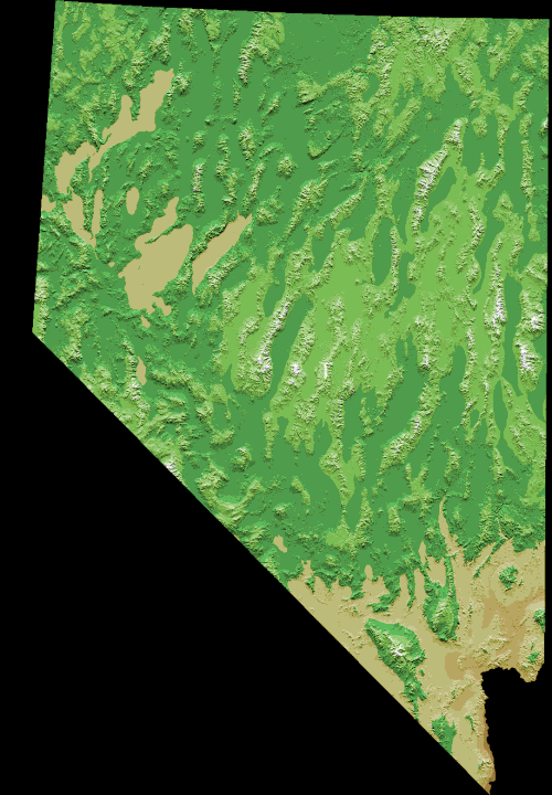
ネバダ州はほぼ全域がベイスン・アンド・レンジ州に属し、南北に伸びる多くの山脈によって分断されています。これらの山脈のほとんどの間には内陸渓谷があります。
州の北部の大部分はグレートベースンにあり、夏は暑く、冬は寒い穏やかな砂漠である。時折、アリゾナモンスーンの湿気が夏の雷雨を引き起こし、太平洋の嵐がこの地域を雪で覆うこともある。州の最高気温は、 1994年6月29日にラフリン(標高605フィートまたは184メートル)で記録された125°F(52°C)である。 [36]最低気温は 、1972年に州の北東部にあるサンジャシントで記録された−52 °F(−47 °C )である。 [36]
ハンボルト川は州北部を東から西に横断し、ラブロック近くのハンボルト・シンクに流れ込む。シエラネバダ山脈からはウォーカー川、トラッキー川、カーソン川などいくつかの川が東に流れ込む。これらの川はすべて内陸盆地で、それぞれウォーカー湖、ピラミッド湖、カーソン・シンクに流れ込む。しかし、ネバダ州全体がグレートベースン内にあるわけではない。スネーク川の支流は最北部を流れ、コロラド川はアリゾナ州との境界の大部分を形成し、ネバダ州南部の大部分を流れている。
標高 13,000 フィート (4,000 メートル) を超える山々もいくつかあり、砂漠の平原の上には緑豊かな森林が広がり、固有種の生息地となっている空の島を形成しています。谷の標高は 3,000 フィート (910 メートル) 以上になることが多く、ネバダ州中央部には 6,000 フィート (1,800 メートル) を超える谷もあります。

ラスベガス地区がある州の南3分の1はモハーベ砂漠内にあります。この地域は冬は雨が少なく、夏はアリゾナモンスーンに近くなります。地形も低く、ほとんどが標高4,000フィート(1,200メートル)以下であるため、夏の日中は暑く、冬の夜は涼しく肌寒い気候になります。
ネバダ州とカリフォルニア州は、州境として最も長い対角線(方位に関して)を持ち、その長さは 400 マイル(640 km)強です。この線は、(境界線の方向に)約 4 マイル(6.4 km)沖合のタホ湖から始まり、ネバダ州、カリフォルニア州、アリゾナ州の境界線がラフリン橋の南西 12 マイル(19 km)で合流するコロラド 川まで続きます。
州南部最大の山脈は、ラスベガスのすぐ西にある スプリング山脈です。州の最低地点は、ラフリンの南、コロラド川沿いにあります。
ネバダ州には、標高2,000フィート(610メートル)の山頂が172ある。ネバダ州は、アラスカ州に次いで米国で山の数が多い州であり、カリフォルニア州、モンタナ州、ワシントン州がそれに続く。[37]
気候

ネバダ州は米国で最も乾燥した州である。[38]ネバダ州は大部分が砂漠と半乾燥気候の地域で構成されており、ラスベガス渓谷を除いて、夏の平均日中気温は州の大部分で40 °F (22 °C) に近づく。ネバダ州北部の冬は長くかなり寒いが、州南部の冬は短く穏やかである傾向がある。ネバダ州のほとんどの地域では年間を通して降水量が少ない。州内で降る雨のほとんどはシエラネバダ山脈の東側と北東側の斜面に降る。
年間平均降水量は約 7 インチ (180 mm) で、最も雨の多い地域では約 40 インチ (1,000 mm) です。ネバダ州で記録された最高気温は、 1994 年 6 月 29 日にラフリンで記録された 125 °F (52 °C) で、最低気温は1937 年 1 月 8 日にサンジャシントで記録された -50 °F (-46 °C) です。ネバダ州の 125 °F (52 °C) は、アリゾナ州の 128 °F (53 °C) とカリフォルニア州の 134 °F (57 °C) に次いで、米国全土で 3 番目に高い最高気温記録です。
動植物
ネバダ州の植生は多様で、州の地域によって異なります。ネバダ州には、高山帯、亜高山帯、ポンデローサマツ、ピニオンジュニパー、セージブラシ、クレオソートブッシュの6つの生物圏があります。[40]
郡
.jpg/500px-The_Strip_from_Eiffel_Tower_(9176999807).jpg)
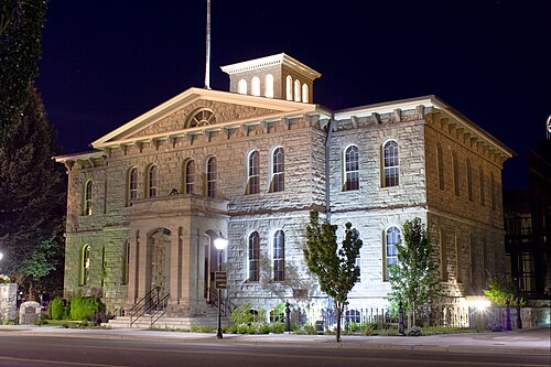
ネバダ州は、郡と呼ばれる行政管轄区に分かれています。カーソンシティは、正式には統合自治体であり、法的には市と郡の両方の役割を果たしています。1919年時点で、州内には17の郡があり、面積は146〜18,159平方マイル(380〜47,030 km 2)でした。
1861年に設立された当初の9つの郡のうちの1つであるレイク郡は、1862年にループ郡に改名されました。郡の一部は1864年にカリフォルニア州ラッセン郡となり、境界の不確実性が解消されました。1883年、ワショー郡はネバダ州に残っていた部分を併合しました。[41]
1969 年、オームズビー郡は解散され、その代わりにオームズビー郡の旧境界線と一致する場所に、州議会によって カーソンシティ統合自治体が設立されました。
ブルフロッグ郡は1987年にナイ郡の一部から設立された。この郡の設立は違憲と宣言され、1989年に廃止された。[41]
ハンボルト郡は 1856 年にユタ準州議会によって郡に指定され、1861 年に新しいネバダ州議会によって再び郡に指定されました。
クラーク郡はネバダ州で最も人口の多い郡で、同州の住民の約4分の3が住んでいる。ネバダ州で最も人口の多い都市ラスベガスは、 1909年にネバダ州リンカーン郡の一部から郡が創設されて以来、郡庁所在地となっている。それ以前は、アリゾナ準州の一部であった。クラーク郡は多くの観光客を惹きつけており、2014年には推定4400万人がクラーク郡を訪れた。[42]
ワショー郡はネバダ州で2番目に人口の多い郡です。郡庁所在地はリノです。ワショー郡にはリノ・スパークス大都市圏が含まれます。
ライオン郡は人口で3番目に多い郡である。1861年に創設された9つの郡のうちの1つである。郡名は南北戦争で戦死した最初の北軍将軍ナサニエル・ライオンにちなんで名付けられた。現在の郡庁所在地はイェリントンである。最初の郡庁所在地は1861年11月29日にデイトンに設立された。[43]
集落
公園とレクリエーションエリア


.jpg/500px-Valley_of_Fire_State_Park_(6882627246).jpg)
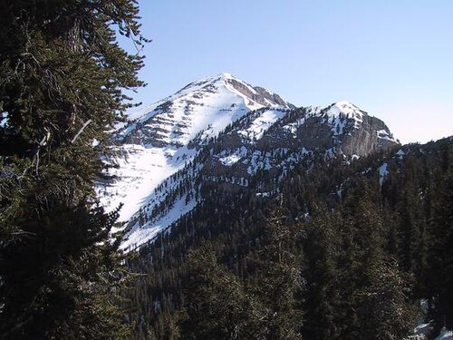
連邦政府が管理するレクリエーションエリア
北ネバダ州
- ベイスン・アンド・レンジ国定公園
- ブラックロック砂漠 - ハイロックキャニオンエミグラントトレイル国立保護区
- カリフォルニア国立歴史トレイル
- グレートベースン国立公園
- ハンボルト・トワヤベ国有林
- タホ湖流域管理ユニット
- ポニーエクスプレス国立歴史トレイル
- シェルドン国立野生生物保護区
南ネバダ州
- アッシュメドウズ国立野生生物保護区
- アヴィクワアメ国定公園
- ベイスン・アンド・レンジ国定公園
- ブートレッグ キャニオン マウンテン バイク パーク
- デスバレー国立公園
- デザート国立野生生物保護区
- ゴールドビュート国定公園
- ハンボルト・トワヤベ国有林
- インヨー国有林
- レイクミード国立レクリエーションエリア
- モアパ バレー国立野生動物保護区
- マウント チャールストンとマウント チャールストン荒野
- オールドスパニッシュ国立歴史トレイル
- パラナガット国立野生生物保護区
- レッドロックキャニオン国立保護区
- スローンキャニオン国立保護区
- スプリングマウンテンとスプリングマウンテン国立レクリエーションエリア
- トゥーリースプリングス化石層国定公園
荒野
ネバダ州には68の指定自然保護区があり、国立公園局、米国森林局、土地管理局の管轄下で約6,579,014エーカー(2,662,433ヘクタール)が保護されています。[46]
州立公園
ネバダ州立公園は、ネバダ州が管理する保護地域で構成されており、州立公園、州立史跡、州立レクリエーションエリアなどがある。2011年7月にオープンし、カリフォルニア州と提携して運営されているヴァン・シックル・バイステート・パークを含む24の州立公園ユニットがある。[47]
人口統計
人口
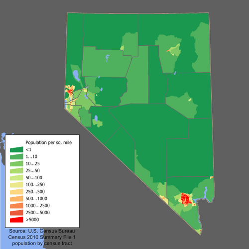

アメリカ合衆国国勢調査局は、2020年の国勢調査でネバダ州の人口を3,104,614人と決定した。2022年のネバダ州の推定人口は3,177,772人で、2020年の国勢調査から73,158人(2.36%)増加した。[49]ネバダ州は2017年から2018年にかけて人口の増加率が最も高かった。2020年の国勢調査では、州の人口の6.0%が5歳未満、22.5%が18歳未満、16.1%が65歳以上と報告された。女性は人口の約49.8%を占めた。人口の19.1%は外国生まれと報告された。
2020年の国勢調査以来、ネバダ州の人口は自然増で2,374人(出生数42,076人と死亡数39,702人の差)となり、移住による純増は36,605人(うち国内移住が34,280人、国際移住が2,325人)となった。[50]
ネバダ州の人口の中心はナイ郡南部にある。[51]この郡では、カリフォルニア州境のラスベガスから西に60マイル(97 km)離れた非法人都市パランプが1980年から2020年にかけて急速に成長した。2020年の国勢調査では、この町の住民は44,738人だった。[52]ラスベガスは、1900年の人口100人から1950年には10,000人、1970年には100,000人にまで増加し、1960年から2000年にかけてアメリカで最も急速に成長した都市および大都市圏であった。
1940 年代から 2003 年まで、ネバダ州は米国で人口増加率が最も高かった州でした。1990 年から 2000 年の間に、ネバダ州の人口は 66% 増加し、米国全体の人口は 13% 増加しました。人口の 3 分の 2 以上がクラーク郡に居住しており、この郡はラスベガス都市圏と同面積です。したがって、人口の点では、ネバダ州は米国で最も人口が集中している州の 1 つです。
ヘンダーソンとノースラスベガスは、人口10万人を超える米国の都市の中で、最も急速に成長している上位20位以内に入っています。ラスベガスの北東65マイル(105キロ)にある農村のメスキートは、1990年代と2000年代のマイクロポリタンの成長の一例です。ラスベガス郊外の インディアンスプリングスやサーチライトなどの他の砂漠の町でも、ある程度の成長が見られます。
1950年以降、ネバダ州で生まれた人口の割合は27%を超えたことがなく、これは全州の中で最も低い割合である。2012年には、ネバダ州民のわずか25%がネバダ州で生まれた。[53]
HUDの2022年ホームレス評価報告書によると、ネバダ州には推定7,618人のホームレスがいる。[54] [55]
人種と民族
2022年のアメリカ人コミュニティ調査によると、ネバダ州の人口の30.3%はヒスパニックまたはラテン系(あらゆる人種)であり、メキシコ人(22%)、 キューバ人(1.5% )、エルサルバドル人( 1.5%)、プエルトリコ人(1%)、その他のヒスパニックまたはラテン系(4.3%)でした。[60]ヨーロッパ系の祖先で最も多かったのは、ドイツ人(8.9%)、 イギリス人(8.1%)、アイルランド人(7.2%)、イタリア人(4.8%)でした。[61]州内で最も多かったアジア系の祖先は、フィリピン人(6.4%)と中国人(1.9%)でした。[62]

伝説
1980年には、非ヒスパニック系白人が州の人口の83.2%を占めていた。[63]
2011年時点で、ネバダ州の 1歳未満の人口の63.6%はマイノリティであった。[67]ラスベガスはマイノリティが多数を占める都市である。米国国勢調査局の推計によると、2018年7月1日現在、非ヒスパニック系白人はネバダ州の人口の48.7%を占めている。[68]
ダグラス郡、ミネラル郡、パーシング郡では、メキシコ系住民が多数を占める。ナイ郡とハンボルト郡では、住民のほとんどはドイツ系であり、ワショー郡にはアイルランド系アメリカ人が多い。リンカーン郡、チャーチル郡、ライオン郡、ホワイトパイン郡、ユーレカ郡では、イギリス系アメリカ人が多数を占める。
アジア系アメリカ人は、少なくとも1850年代からこの州に住んでいた。このとき、カリフォルニアのゴールドラッシュで何千人もの中国人鉱夫がワショー郡にやって来た。19世紀後半には、数百人の日本人農業労働者が続いた。20世紀後半までには、中国、日本、韓国、フィリピン、バングラデシュ、インド、ベトナムからの移民が多数、ラスベガス都市圏にやって来た。現在、この都市にはアジア系アメリカ人の大きなコミュニティがあり、I-15の西、スプリングマウンテンロード沿いには「チャイナタウン」として知られる、主に中国人と台湾人の地区がある。フィリピン系アメリカ人は州内で最大のアジア系アメリカ人グループを形成し、人口は202,000人を超える。ネバダ州のアジア系アメリカ人人口の59.8%を占め、州全体の人口の約6.4%を占めている。[69]
鉱業ブームにより多くのギリシャ人と東ヨーロッパ人がネバダ州に移住した。[70] 20世紀初頭には、ギリシャ人、スラブ人、デンマーク人、日本人、イタリア人、バスク人がネバダ州に流入した。[71] チリ人は1870年にはすでにこの州にいた。 [72] 1800年代半ばには、主にアイルランド、イギリス、ドイツからのヨーロッパ人移民が多数この州に移住し、この地域の鉱業の繁栄に乗じようとした。[73]
ネバダ州のネイティブアメリカンの部族には、北部パイユート族、南部パイユート族、西部ショーショーニ族、ゴシュート族、ワラパイ族、ワショー族、ユト族がある。[74]
白人は依然としてネバダ州で最大の人種または民族グループである。[75]ヒスパニックはネバダ州で最も急速に成長している民族グループである。 [76]ネバダ州ではメキシコ人と中米人の人口が増加している。ネバダ州のラテン系移民の多くはメキシコ、グアテマラ、エルサルバドル出身である。[77]ネバダ州では多民族人口も増加している。[78]
ネバダ州への移民の出身国上位はメキシコ(移民の39.5%)、フィリピン(14.3%)、エルサルバドル(5.2%)、中国(3.1%)、キューバ(3%)であった。[79]
ネバダ州の住民の大半は白人(ヨーロッパ系)の血統である。少数は羊飼いとして雇われたバスク人の血統をたどることができる。ネバダ州のヒスパニックは主にメキシコ系とキューバ系の血統である。ラテン系はネバダ州の住民の約4分の1を占め、ネバダ州南東部に集中している。アフリカ系アメリカ人は主にラスベガスとリノ地域に住んでおり、人口の10分の1以下を占める。パイユート族、ショショーニ族、ワショー族のネイティブアメリカンは州内のいくつかの居留地に住んでおり、ネバダ州の人口のわずかな割合を占めている。[80]
ネバダ州で最も一般的な祖先は、メキシコ人、ドイツ人、アイルランド人、イギリス人、イタリア人、アジア人です。[81]
ネバダ州はハワイ州とカリフォルニア州に次いで、アメリカで3番目に多様性に富んだ州である。[82] [83]
- 出生データ
注: 表内の出生数は一致しません。ヒスパニック系は民族と人種の両方でカウントされるため、全体の数は多くなります。
- 2016 年以降、白人ヒスパニック系の出生に関するデータは収集されておらず、1 つのヒスパニック系グループに含められています。ヒスパニック系の出生者は、どの人種でもかまいません。

.jpg/500px-Downtown_Reno,_Nevada_(17573535294).jpg)

ネバダ州の人口のごく一部は農村地域に住んでいる。これらの地域の文化は大都市圏とは大きく異なる。これらの農村郡の住民はネバダ州生まれの人が多いが、ラスベガスやリノ地域では人口の大半が他州生まれである。農村人口は人種や民族の面でも多様性に欠ける。鉱業は農村郡の経済において重要な役割を果たしており、観光業はそれほど目立っていない。[94]ネバダ州の農村部では牧畜も長い伝統がある。[95]
一人当たり所得別の所在地
宗教
ネバダ州の教会出席率は、米国の州の中で最も低い。2009年のギャラップ調査では、毎週またはほぼ毎週教会に通うと答えたネバダ州民はわずか30%だったが、全米では42%だった(ネバダ州よりも出席率が低い州は4州のみ)。[97] 2020年、公共宗教研究所は人口の67%がキリスト教徒であると判定した。[98]これは、 2014年のピュー研究所の別の調査から宗教心が1%増加したことを反映している。[99]
ピュー研究所の2014年の調査によると、ネバダ州民の主な宗教は、プロテスタントが35%、無宗教が28%、ローマカトリックが25%、末日聖徒が4%、ユダヤ教が2%、ヒンズー教徒が1%未満、仏教徒が0.5%、イスラム教が約0.2%となっている。ネバダ州の一部(州東部)はモルモン回廊に位置している。
2010年の信者数で最大の宗派は、ローマカトリック教会が451,070人、末日聖徒イエス・キリスト教会が175,149人、南部バプテスト連盟が45,535人、仏教会が14,727、バハイ教が1,723、イスラム教が1,700人であった。[100]ユダヤ人コミュニティは、ローア・ユダヤ教学習研究所とチャバドによって代表されている。[101] [102] 末日聖徒イエス・キリスト教会によると、ネバダ州民の6.2%が信者であり、合衆国で6番目に高い割合の州となっている。[103]
言語
ネバダ州で話されている英語以外の言語で最も一般的なのは、スペイン語、タガログ語、中国語です。[104] ネバダ州の先住民族の言語には、北部パイユート語、南部パイユート語、ショーショーニ語、ワショー語などがあります。[105]
米国国勢調査のデータによると、ネバダ州で話されている上位7言語は、スペイン語、タガログ語、中国語、ベトナム語、韓国語、アムハラ語、アラビア語、タイ語です。[106]
ネイティブアメリカンの部族
歴史的に、現在のネバダ州には主にパイユート族、ショショーニ族、ワショー族が住んでいた。[107]
2010年の国勢調査によると、ネバダ州で最大のネイティブアメリカン部族は以下の表の通りである。[108]
経済


_at_the_Bruneau_River,_about_38.6_miles_north_of_Deeth_in_Elko_County,_Nevada.jpg/500px-2013-06-28_15_48_26_Cattle_along_Deeth-Charleston_Road_(Elko_County_Route_747)_at_the_Bruneau_River,_about_38.6_miles_north_of_Deeth_in_Elko_County,_Nevada.jpg)
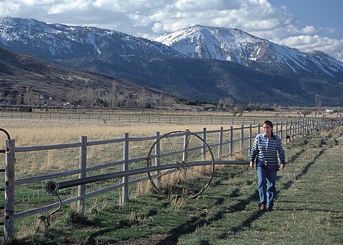
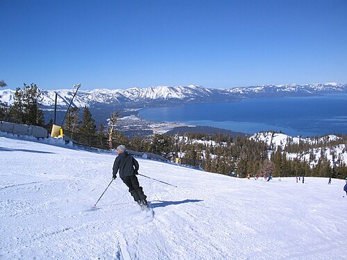
ネバダ州の経済は、観光業(特に娯楽とギャンブル関連)、鉱業、牧畜業と結びついています。ネバダ州の工業生産は、観光、娯楽、鉱業、機械、印刷出版、食品加工、電気機器です。経済分析局[110] [111]は、2018年のネバダ州の総生産は1,700 億ドルと推定しています。[112] 2020年の州の一人当たり個人所得は53,635ドルで、全国で31位でした。[113] 2012年のネバダ州の州債務は75億ドル、つまり納税者一人当たり3,100ドルと計算されました。 [114] 2021年5月現在、州の失業率は7.8%でした。[115]
鉱業
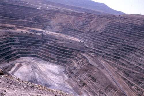
ラスベガスとリノの都市圏以外の州の一部では、鉱業が大きな経済的役割を果たしている。価値で見ると、金は圧倒的に最も重要な採掘鉱物である。2022年には、73億ドル相当の404万トロイオンス(126トン)の金が ネバダ州で採掘され、同州は世界の金生産量の4%を占めた。ネバダ州で採掘されるその他の鉱物には、建設用骨材、銅、石膏、珪藻土、リチウムなどがある。[116] [117]鉱床が豊富であるにもかかわらず、ネバダ州の採掘コストは一般的に高く、生産量は世界の商品価格に非常に左右される。
牛の牧場経営
ネバダ州の農村部では、牛の牧畜が主要な経済活動となっている。ネバダ州の農業生産物は、牛、干し草、アルファルファ、乳製品、玉ねぎ、ジャガイモである。2006年1月1日現在、ネバダ州には推定50万頭の牛と7万頭の羊がいた。[118]これらの動物のほとんどは、夏は放牧地で餌を探し、冬は補助飼料を食べる。子牛は通常、秋に州外の肥育場に出荷され、市場で太らされる。ネバダ州の484,000エーカー(196,000ヘクタール)の耕作地の90%以上が、家畜の飼料用の干し草(主にアルファルファ)の栽培に使用されている。この家畜は通常、食用として利用されている。
最大の雇用主
ネバダ州雇用訓練リハビリテーション局によると、2011年第1四半期時点での州内最大の雇用主は以下のとおりである。[119]
インフラストラクチャー
交通機関

アムトラックのカリフォルニア・ゼファー号は、ユニオン・パシフィックの元々の大陸横断鉄道線を利用してシカゴからカリフォルニア州エメリービルまで毎日運行しており、エルコ、ウィネムッカ、リノに停車している。1997年にアムトラックのデザート・ウィンド号が廃止されて以来、ラスベガスには旅客列車の運行はない。アムトラックのスルーウェイ・バスは、ラスベガスからカリフォルニア州ニードルズ、ロサンゼルス、ベーカーズフィールドの列車、およびネバダ州ステートラインからカリフォルニア州サクラメントへの接続サービスを提供している。ロサンゼルスまたは南カリフォルニアへのサービスを再開する提案が数多くあり、民営のブライトライン・ウェストが2024年に建設を開始している。
ユニオンパシフィック鉄道はネバダ州の北と南にいくつかの鉄道を所有しています。グレイハウンド ラインは同州にいくつかのバス サービスを提供しています。
州間高速道路15号線(I-15)は、ネバダ州の南端を通っており、ラスベガスやその他の地域にサービスを提供しています。I -215とI-515もラスベガス都市圏にサービスを提供しています。I -80はネバダ州北部を横切っており、東はユタ州から流れるハンボルト川と、西はリノからカリフォルニア州へと流れるトラッキー川の流れにほぼ沿っています。この道路にはI-580の支線があります。ネバダ州には、 US 6、US 50、US 93、US 95、US 395など、いくつかの米国高速道路も通っています。ネバダ州道も189本あります。ネバダ州の多くの郡にも郡道のシステムがありますが、田舎では標識や舗装がされていないものが多くあります。ネバダ州は、2つの主要な人口密集地を結ぶ州間高速道路が連続していない米国の数少ない州の1つです。ラスベガスとリノ地域を結ぶ道路は、いくつかの異なる州間高速道路と米国高速道路の組み合わせです。州間高速道路11号線の提案されたルートは、最終的にこの問題を解決する可能性があります。[120]
この州は、オーストラリアで「ロードトレイン」と呼ばれる、トレーラー3台を牽引するセミトレーラートラックを許可している国内でも数少ない州の一つだ。しかし、アメリカ版は、かなり急な山道を登ったり下ったりする必要があることもあり、通常、より小型である。
RTC トランジットは、ラスベガス都市圏の公共交通機関です。この機関は州最大の交通機関であり、ラスベガス バレー全域でバス サービスのネットワークを運営しています。これには、ラスベガス ストリップといくつかの郊外ルートでの2 階建てバスであるThe Deuceの使用が含まれます。RTC RIDE は、リノ スパークス都市圏全体でローカル トランジット バス サービスのシステムを運営しています。州内の他の交通機関には、カーソン シティの JAC があります。州内の他のほとんどの郡には、公共交通機関がまったくありません。
さらに、ラスベガスエリアでは全長 4 マイル (6.4 km) のモノレールシステムが公共交通機関として機能しています。ラスベガス モノレールラインは、ラスベガス ストリップの東側にあるいくつかのカジノ施設とラスベガス コンベンション センターにサービスを提供しており、パラダイス ロードの近くを走っています。将来的にはハリー リード国際空港まで延伸される可能性があります。いくつかのホテルも相互にモノレール ラインを運行しており、通常は数ブロックの長さになります。
ラスベガスのハリー・リード国際空港は、ネバダ州で最も利用者数の多い空港です。リノ・タホ国際空港(旧リノ・キャノン国際空港)は、同州のもう 1 つの主要空港です。
エネルギー
| 外観イメージ | |
|---|---|
 ネバダ州の電力網の地図 ネバダ州の電力網の地図 |
ネバダ州は太陽エネルギー産業が盛んである。2013年の独立調査では、太陽光パネルの利用者が3,600 万ドルの純利益を生み出したと結論づけられた。しかし、2015年12月、公益事業委員会は州唯一の電力会社であるNV Energyに太陽光パネル利用者に高い料金と手数料を課すことを許可し、屋上太陽光パネルの使用はすぐに減少した。[121]
1987年12月、議会は核廃棄物政策法を改正し、ユッカマウンテン核廃棄物貯蔵所を国内の高レベル放射性廃棄物の恒久的な貯蔵所として唯一の場所に指定した。[122]
手頃な価格の住宅
In 2018, the National Low Income Housing Coalition calculated the discrepancy between available affordable housing units and renters who earn below the poverty line. In Nevada, only 15 affordable rental homes are available per 100 extremely low income (ELI) households.[123] The shortage extended to a deficit in supply of 71,358 affordable rental homes. This was the largest discrepancy of any state. The most notable catalyst for this shortage was the Great Recession and housing crisis of 2007 and 2008. Since then, housing prices have increased while demand has increased, and supply has struggled to match the increase in demand. In addition, low-income service workers were slowly being pushed out by an influx of tech professionals. In Nevada there is essentially a standard of six-figure income to affordably rent a single-family home.[124] Considering the average salary in Nevada, $54,842 per year, this standard is on average, unaffordable.[125] The disproportionate cost of housing compared to average salary has led to 112,872 renters to be paying more than half of their yearly income towards housing.[126]
The definition of an affordable home is "one that a household can obtain for 30 percent or less of its annual income". So, there is clearly a long way to go in order to close the gap between housing prices and relative income in the state. Renters are looking for solutions to still be able to live in the state in a way that their income can support. As a result, single adults are being forced to split rent with other renters or move residences to farther outside metro areas. One solution being offered is to increase the supply of higher income positions within the state to make things more affordable. However, this would require Nevadans to retrain in new jobs or careers.
Education
Education in Nevada is achieved through public and private elementary, middle, and high schools, as well as colleges and universities.
A May 2015 educational reform law expanded school choice options to 450,000 Nevada students who are at up to 185% of the federal poverty level. Education savings accounts (ESAs) are enabled by the new law to help pay the tuition for private schools. Alternatively, families "can use funds in these accounts to also pay for textbooks and tutoring".[127][128]
Approximately 86.9% of Nevada residents have attained at least a high school degree or equivalent, which is below the national average of 88.6%.[129]
Public school districts
Public school districts in Nevada include:
- Carson City School District
- Churchill County School District
- Clark County School District, the fifth largest school district in the United States
- Douglas County School District
- Elko County School District
- Esmeralda County School District
- Eureka County School District
- Humboldt County School District
- Lander County School District
- Lincoln County School District
- Lyon County School District
- Mineral County School District
- Nye County School District
- Pershing County School District
- Storey County School District
- Washoe County School District
- White Pine County School District
Colleges and universities
Research institutes
The Nevada Aerospace Hall of Fame provides educational resources and promotes the aerospace and aviation history of the state.[130]
Law and government
Government
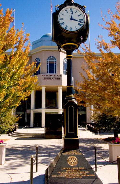
Under the Constitution of the State of Nevada, the powers of the Nevada government are divided among three separate departments: the executive consisting of the governor of Nevada and their cabinet along with the other elected constitutional officers; the legislative consisting of the Nevada Legislature, which includes the Assembly and the Senate; and the judicial consisting of the Supreme Court of Nevada and lower courts.
The governor is the chief magistrate of Nevada,[131] the head of the executive department of the state's government,[131] and the commander-in-chief of the state's military forces.[132] The current governor is Joe Lombardo, a Republican. The executive branch also consists of an independently elected lieutenant governor, secretary of state, state treasurer, state controller, and attorney general who function as a check and balance on the power of the governor.[133]
The Nevada Legislature is a bicameral body divided into an Assembly and Senate. Members of the Assembly serve two years, and members of the Senate serve four years. Both houses of the Nevada Legislature enacted term limits starting in 2010, with senators and assemblymen/women who are limited to a maximum of twelve years in each body (by appointment or election which is a lifetime limit) – a provision of the constitution which was upheld by the Supreme Court of Nevada in a unanimous decision. Each session of the legislature meets for a constitutionally mandated 120 days in every odd-numbered year, or longer if the governor calls a special session.
On December 18, 2018, Nevada became the first in the United States with a female majority in its legislature. Women hold nine of the 21 seats in the Nevada Senate, and 23 of the 42 seats in the Nevada Assembly.[134]
The Supreme Court of Nevada is the state supreme court and the head of the Nevada Judiciary. Original jurisdiction is divided between the district courts (with general jurisdiction), and justice courts and municipal courts (both of limited jurisdiction). Appeals from District Courts are made directly to the Nevada Supreme Court, which under a deflective model of jurisdiction, has the discretion to send cases to the Court of Appeals for final resolution.[135]
Incorporated towns in Nevada, known as cities, are given the authority to legislate anything not prohibited by law. A recent movement has begun to permit home rule to incorporate Nevada cities to give them more flexibility and fewer restrictions from the Legislature. Town Boards for unincorporated towns are limited local governments created by either the local county commission, or by referendum, and form a purely advisory role and in no way diminish the responsibilities of the county commission that creates them.
State agencies
- Attorney General
- Department of Business & Industry
- Department of Conservation & Natural Resources
- Consumer Health Assistance
- Controller's Office
- Department of Corrections
- Nevada Department of Cultural Affairs
- Nevada Commission on Economic Development
- Department of Education
- Nevada Secretary of State, Election Division
- Department of Employment, Training & Rehabilitation
- Gaming Control Board
- Governor's Office
- Nevada Film Office
- Department of Health and Human Services
- Department of Information Technology
- Department of Justice
- Lieutenant Governor
- Nevada Military Department
- Division of Minerals, Commission on Mineral Resources
- Department of Motor Vehicles
- Department of Personnel
- Advisory Council for Prosecuting Attorneys
- Public Employees Benefit Program
- Public Employees Retirement System
- Department of Public Safety
- Nevada Public Utilities Commission
- Department of Secretary of State
- Department of Taxation
- Commission on Tourism
- Department of Transportation
- Nevada State Treasurer
- Universities and Community Colleges of Nevada
- Nevada Office of Veterans' Services
- Western Interstate Commission for Higher Education
- Nevada Department of Wildlife
- Board of Museums and History
Law

In 1900, Nevada's population was the smallest of all states and was shrinking, as the difficulties of living in a "barren desert" began to outweigh the lure of silver for many early settlers. Historian Lawrence Friedman has explained what happened next:
Nevada, in a burst of ingenuity, built an economy by exploiting its sovereignty. Its strategy was to legalize all sorts of things that were illegal in California ... after the easy divorce came easy marriage and casino gaming. Even prostitution is legal in Nevada, in any county that decides to allow it. Quite a few of them do.[136]
With the advent of air conditioning for summertime use and Southern Nevada's mild winters, the fortunes of the state began to turn around, as it did for Arizona, making these two states the fastest growing in the Union.
Prostitution
Nevada is the only state where prostitution is legal – in a licensed brothel in a county which has specifically voted to permit it. It is illegal in larger jurisdictions such as Clark County (which contains Las Vegas), Washoe County (which contains Reno), and the independent city of Carson City.
Divorce
Nevada's early reputation as a "divorce haven" arose from the fact that before the no-fault divorce revolution in the 1970s, divorces were difficult to obtain in the United States. Already having legalized gambling and prostitution, Nevada continued the trend of boosting its profile by adopting one of the most liberal divorce statutes in the nation. This resulted in Williams v. North Carolina (1942), 317 U.S. 287 (1942), in which the U.S. Supreme Court ruled North Carolina had to give "full faith and credit" to a Nevada divorce. The Court modified its decision in Williams v. North Carolina (1945), 325 U.S. 226 (1945), by holding a state need not recognize a Nevada divorce unless one of the parties was domiciled there at the time the divorce was granted and the forum state was entitled to make its own determination.
As of 2009, Nevada's divorce rate was above the national average.[137]
Taxes
Nevada's tax laws are intended to draw new residents and businesses to the state. Nevada has no personal income tax or corporate income tax.[138] Since Nevada does not collect income data it cannot share such information with the federal government, the IRS.[139]
The state sales tax (similar to VAT or GST) in Nevada is variable depending upon the county. The statewide tax rate is 6.85%, with five counties (Elko, Esmeralda, Eureka, Humboldt, and Mineral) charging this amount. Counties may impose additional rates via voter approval or through approval of the state legislature; therefore, the applicable sales tax varies by county from 6.85% to 8.375% (Clark County). Clark County, which includes Las Vegas, imposes four separate county option taxes in addition to the statewide rate: 0.25% for flood control, 0.50% for mass transit, 0.25% for infrastructure, and 0.25% for more law enforcement. In Washoe County, which includes Reno, the sales tax rate is 7.725%, due to county option rates for flood control, the ReTRAC train trench project, and mass transit, and an additional county rate approved under the Local Government Tax Act of 1991.[140] The minimum Nevada sales tax rate changed on July 1, 2009.[141]
The lodging tax rate in unincorporated Clark County, which includes the Las Vegas Strip, is 12%. Within the boundaries of the cities of Las Vegas and Henderson, the lodging tax rate is 13%.
Corporations such as Apple Inc. allegedly have set up investment companies and funds in Nevada to avoid paying taxes.[142]
LGBT rights
In 2009, the Nevada Legislature passed a bill creating a domestic partnership registry which enables same-sex couples to enjoy the same rights as married couples. Due to the landmark decision in the case of Obergefell v. Hodges, 576 U.S. 644 (2015), same-sex marriage was outright legalized in the state.
Incorporation
Nevada provides a friendly environment for the formation of corporations, and many (especially California) businesses have incorporated in Nevada to take advantage of the benefits of the Nevada statute. Nevada corporations offer great flexibility to the board of directors and simplify or avoid many of the rules that are cumbersome to business managers in some other states. In addition, Nevada has no franchise tax, although it does require businesses to have a license for which the business has to pay the state.
Financial institutions
Similarly, many U.S. states have usury laws limiting the amount of interest a lender can charge, but federal law allows corporations to "import" these laws from their home state. Nevada has no cap on interest rates that may be agreed to in contracts.[143]
Alcohol and other drugs
Nevada has very liberal alcohol laws. Bars are permitted to remain open 24 hours, with no "last call". Liquor stores, convenience stores and supermarkets may also sell alcohol 24 hours per day and may sell beer, wine and spirits.
In 2016, Nevada voters approved Question 2, which legalized the possession, transportation and cultivation of personal use amounts of marijuana for adults age 21 years and older, and authorized the creation of a regulated market for the sale of marijuana to adults age 21 years and older through state-licensed retail outlets.[144] Nevada voters had previously approved medical marijuana in 2000, but rejected marijuana legalization in a similar referendum in 2006. Marijuana in all forms remains illegal under federal law.
Aside from cannabis legalization, non-alcohol drug laws are a notable exception to Nevada's otherwise libertarian principles. It is notable for having the harshest penalties for drug offenders in the country. Nevada remains the only state to still use mandatory minimum sentencing guidelines for possession of drugs.[145]
The Substance Abuse and Mental Health Services Administration (SAMHSA) reported, in their Behavioral Health Barometer for Nevada, published in 2014, changes to substance abuse patterns and addiction across the southwestern state.[146] Between 2012 and 2013, adolescents in Nevada abused illicit substances at a slightly higher percentage than nationally. 10.2 percent of Nevada's adolescents abused illicit drugs compared to 9.2 percent across the United States. Between 2009 and 2013, 11.7 percent of all adolescents in the state reported abusing illicit, intoxicating substances in the month prior to the survey; this represents 25,000 adolescents.
Smoking
Nevada voters enacted a smoking ban ("The Nevada Clean Indoor Air Act") in November 2006 which became effective on December 8, 2006. It outlaws smoking in most workplaces and public places. Smoking is permitted in bars, but only if the bar serves no food, or the bar is inside a larger casino. Smoking is also permitted in casinos, certain hotel rooms, tobacco shops, and brothels.[147] However, some businesses do not obey this law and the government tends not to enforce it.[148] In 2011, smoking restrictions in Nevada were relaxed for certain places which allow only people 21 or older inside.[149]
Crime
In 2006, the crime rate in Nevada was about 24% higher than the national average rate, though crime has since decreased. Property crimes accounted for about 85% of the total crime rate in Nevada, which was 21% higher than the national rate. The remaining 20.3% were violent crimes.[150] A complete listing of crime data in the state for 2013 can be found here:[151]
Politics
State politics
.svg/500px-Party_registration_by_county_(February_2023).svg.png)
Democrat >= 30%
Republican >= 30%
Republican >= 40%
Republican >= 50%
Republican >= 60%
Due to heavy growth in the southern portion of the state, there is a noticeable divide between the politics of northern and southern Nevada. Historically, northern Nevada has been very Republican. The more rural counties of the north are among the most conservative regions of the state. Carson City, the state's capital, is a Republican-leaning swing city/county. Washoe County, home to Reno, has historically been strongly Republican, but now has become a fairly balanced swing county, like the state as a whole. Clark County, home to Las Vegas, has been a stronghold for the Democratic Party since it was founded in 1909, having voted Republican only six times and once for a third-party candidate.[citation needed] Clark and Washoe counties have long dominated the state's politics. Between them, they cast 87% of Nevada's vote, and elect a substantial majority of the state legislature. The last Republican to carry Clark County was George H. W. Bush in 1988, and the last Republican to carry Washoe County was George W. Bush in 2004. The great majority of the state's elected officials are from either Las Vegas or Reno.[153]
In 2014, Republican Adam Laxalt, despite losing both Clark and Washoe counties, was elected Attorney General. However, he had lost Clark County only by 5.6% and Washoe County by 1.4%, attributable to lower turnout in these counties.[154]
National politics
Nevada has been won by the winner of nearly every presidential election since its first in 1864, only being carried by the defeated candidate eight times since statehood, most of which were before 1900. Since 1912 Nevada has been carried by the presidential victor the most out of any state (27 of 29 elections), the only exceptions being 1976 when it voted for Gerald Ford over Jimmy Carter and 2016 when the state was carried by Hillary Clinton over Donald Trump. This gives the state status as a political bellwether. It was one of only three states won by John F. Kennedy in the American West in the election of 1960, albeit narrowly.[155]
The state's U.S. Senators are Democrats Catherine Cortez Masto and Jacky Rosen. The Governorship is held by Joe Lombardo, a Republican.
Elections
Nevada is the only U.S. state to have a none of the above option available on its ballots. Officially called None of These Candidates, the option was first added to the ballot in 1975 and is used in all statewide elections, including president, US Senate and all state constitutional positions. In the event "None of These Candidates" receives a plurality of votes in the election, the candidate with the next-highest total is elected.[157]
In a 2020 study, Nevada was ranked as the 23rd on the "Cost of Voting Index", which is a measure of "the ease of voting across the United States."[158]
Culture
Entertainment and tourism
Resort areas like Las Vegas, Reno, Lake Tahoe, and Laughlin attract visitors from around the nation and world. In fiscal year 2022 Nevada casinos (not counting those with annual revenue under a million dollars) brought in US$10.7 billion in gaming revenue and another US$15.7 billion in non-gaming revenue.[159]
Nevada has by far the most hotel rooms per capita in the United States. According to the American Hotel and Lodging Association, there were 187,301 rooms in 584 hotels (of 15 or more rooms). The state is ranked just below California, Texas, Florida, and New York in the total number of rooms, but those states have much larger populations. Nevada has one hotel room for every 14 residents, far above the national average of one hotel room per 67 residents.[160]
Prostitution is legal in parts of Nevada in licensed brothels, but only counties with populations under 400,000 have the option to legalize it. Although prostitution is not a major part of the Nevada economy, employing roughly 300 women as independent contractors, it is a very visible endeavor. Of the 14 counties permitted to legalize prostitution under state law, eight have chosen to legalize brothels. State law prohibits prostitution in Clark County (which contains Las Vegas), and Washoe County (which contains Reno). However, prostitution is legal in Storey County, which is part of the Reno–Sparks metropolitan area.
Sports
The Las Vegas Valley is home to the Vegas Golden Knights of the National Hockey League who began to play in the 2017–18 NHL season at T-Mobile Arena on the Las Vegas Strip in Paradise, the Las Vegas Raiders of the National Football League who began play at Allegiant Stadium in Paradise in 2020 after moving from Oakland, California, and the Las Vegas Aces of the WNBA who began playing in 2018 at Mandalay Bay Events Center after relocating from San Antonio. The Oakland Athletics of Major League Baseball plan to move to Las Vegas by 2027.[161][162]
Nevada takes pride in college sports, most notably its college football. College teams in the state include the Nevada Wolf Pack (representing the University of Nevada, Reno) and the UNLV Rebels (representing the University of Nevada, Las Vegas), both in the Mountain West Conference (MW).
UNLV is most remembered for its men's basketball program, which experienced its height of supremacy in the late 1980s and early 1990s. Coached by Jerry Tarkanian, the Runnin' Rebels became one of the most elite programs in the country. In 1990, UNLV won the Men's Division I Championship by defeating Duke 103–73, which set tournament records for most points scored by a team and largest margin of victory in the national title game.
In 1991, UNLV finished the regular season undefeated, a feat that would not be matched in Division I men's basketball for more than 20 years. Forward Larry Johnson won several awards, including the Naismith Award. UNLV reached the Final Four yet again, but lost their national semifinal against Duke 79–77. The Runnin' Rebels were the Associated Press pre-season No. 1 back to back (1989–90, 1990–91). North Carolina is the only other team to accomplish that (2007–08, 2008–09).
The state's involvement in major-college sports is not limited to its local schools. In the 21st century, the Las Vegas area has become a significant regional center for college basketball conference tournaments. The MW, West Coast Conference, and Western Athletic Conference all hold their men's and women's tournaments in the area, and the Pac-12 holds its men's tournament there as well. The Big Sky Conference, after decades of holding its men's and women's conference tournaments at campus sites, began holding both tournaments in Reno in 2016.
Las Vegas has hosted several professional boxing matches, most recently at the MGM Grand Garden Arena with bouts such as Mike Tyson vs. Evander Holyfield, Evander Holyfield vs. Mike Tyson II, Oscar De La Hoya vs. Floyd Mayweather and Oscar De La Hoya vs. Manny Pacquiao and at the newer T-Mobile Arena with Canelo Álvarez vs. Amir Khan.
Along with significant rises in popularity in mixed martial arts (MMA), a number of fight leagues such as the UFC have taken interest in Las Vegas as a primary event location due to the number of suitable host venues. The Mandalay Bay Events Center and MGM Grand Garden Arena are among some of the more popular venues for fighting events such as MMA and have hosted several UFC and other MMA title fights. The city has held the most UFC events with 86 events.
The state is also home to the Las Vegas Motor Speedway, which hosts NASCAR's Pennzoil 400 and South Point 400. Two venues in the immediate Las Vegas area host major annual events in rodeo. The Thomas & Mack Center, built for UNLV men's basketball, hosts the National Finals Rodeo. The PBR World Finals, operated by the bull riding-only Professional Bull Riders, was also held at the Thomas & Mack Center before moving to T-Mobile Arena in 2016.
The state is also home to famous tennis player, Andre Agassi, and current baseball superstar Bryce Harper.
List of teams
Major professional teams
Minor professional teams
Amateur teams
College teams
Military

Several United States Navy ships have been named USS Nevada in honor of the state. They include:
Area 51 is near Groom Lake, a dry salt lake bed. The much smaller Creech Air Force Base is in Indian Springs, Nevada; Hawthorne Army Depot in Hawthorne; the Tonopah Test Range near Tonopah; and Nellis AFB in the northeast part of the Las Vegas Valley. Naval Air Station Fallon in Fallon; NSAWC, (pronounced "EN-SOCK") in western Nevada. NSAWC consolidated three Command Centers into a single Command Structure under a flag officer on July 11, 1996. The Naval Strike Warfare Center based at NAS Fallon since 1984, was joined with the Navy Fighter Weapons School (TOPGUN) and the Carrier Airborne Early Warning Weapons School, which both moved from NAS Miramar as a result of a Base Realignment and Closure decision in 1993 which transferred that installation back to the Marine Corps as MCAS Miramar. The Seahawk Weapon School was added in 1998 to provide tactical training for Navy helicopters.
These bases host a number of activities including the Joint Unmanned Aerial Systems Center of Excellence, the Naval Strike and Air Warfare Center, Nevada Test and Training Range, Red Flag, the U.S. Air Force Thunderbirds, the United States Air Force Warfare Center, the United States Air Force Weapons School, and the United States Navy Fighter Weapons School.
See also

- Index of Nevada-related articles
- Outline of Nevada – organized list of topics about Nevada
- List of people from Nevada
Notes
- ^ a b Elevation to North American Vertical Datum of 1988.
- ^ The distinction of highest point in Nevada goes to the summit of Boundary Peak, so named because it is very near the Nevada–California border, at the northern terminus of the White Mountains. However, Boundary Peak can be considered a subsidiary summit of Montgomery Peak, whose summit is in California, since the topographic prominence of Boundary Peak is only 253 feet (77 m), which falls under the often used 300-foot (91 m) cutoff for an independent peak. Also, Boundary Peak is less than 1 mile (1.6 km) away from its higher neighbor. Hence Boundary Peak can be described as not being wholly within Nevada. By contrast, the prominence of Wheeler Peak, 13,063 feet (3,982 m), is quite large and in fact it is the twelfth largest in the contiguous United States. Wheeler Peak is the highest point in a radius of more than 200 square miles (520 km2) and is entirely within the state of Nevada.
- ^ Also sometimes placed in the Mountain West and Southwestern United States.
- ^ The National Archives press release states that the cost was $4,313.27, but the amount $4,303.27 is actually written on the document.
- ^ Persons of Hispanic or Latino origin are not distinguished between total and partial ancestry.
- ^ Five titles were won when the team was based in Philadelphia, Pennsylvania and four were won during the team's time in Oakland, California.
- ^ Two titles were won when the team was based in Oakland, California and one was won when they were based in Los Angeles, California.
References
- ^ "Boundary". NGS Data Sheet. National Geodetic Survey, National Oceanic and Atmospheric Administration, United States Department of Commerce. Retrieved October 20, 2011.
- ^ a b "Elevations and Distances in the United States". United States Geological Survey. 2009. Archived from the original on October 15, 2011. Retrieved October 24, 2011.
- ^ "United States Median Household Income". United States Census Bureau. Archived from the original on April 27, 2021. Retrieved April 27, 2021.
- ^ "Nevada". Merriam-Webster.com Dictionary. Merriam-Webster.
- ^ Wells, John C. (2008). Longman Pronunciation Dictionary (3rd ed.). Longman. ISBN 978-1-4058-8118-0.
- ^ "Metropolitan and Micropolitan Statistical Areas Population Totals: 2010-2017". 2017 Population Estimates. United States Census Bureau, Population Division. Archived from the original on September 26, 2018. Retrieved March 2, 2019.
- ^ "City and Town Population Totals: 2010-2017". United States Census Bureau. Archived from the original on March 28, 2019. Retrieved March 2, 2019.
- ^ "The Almanac of American Politics on Nevada and Lombardo". July 13, 2023.
- ^ Rines, George Edwin, ed. (1920). . Encyclopedia Americana.
- ^ Federal Land Ownership: Overview and Data (Report). Congressional Research Service. February 21, 2020. Retrieved September 8, 2024.
- ^ Rocha, Guy "Myth No. 12 – Why Did Nevada Become a State?" Archived October 24, 2013, at the Wayback Machine, Nevada State Library and Archives, accessed January 9, 2011
- ^ "Race and Hispanic Origin: 1790 to 1990 by State" (PDF). US Census. Archived from the original (PDF) on November 21, 2014. Retrieved July 16, 2014.
- ^ Bill Bible (August 11, 2000). "Protect gaming's legacy". Las Vegas Sun. Where I Stand (opinion). Archived from the original on July 12, 2017. Retrieved March 17, 2023.
- ^ Jain, Priya (July 21, 2010). "Betty Goes Reno". Slate. ISSN 1091-2339. Archived from the original on December 29, 2017. Retrieved March 17, 2023.
- ^ "Nevada Employment & Unemployment Estimates for November 2010" Archived May 25, 2017, at the Wayback Machine, Nevada Department of Employment, Training, and Rehabilitation.
- ^ "Mining FAQs". Nevada Mining Association. February 23, 2018. Archived from the original on January 23, 2018. Retrieved March 17, 2023.
- ^ Bornstein, Seth (February 15, 2022). "West megadrought worsens to driest in at least 1,200 years". Las Vegas Sun. Associated Press. Archived from the original on March 6, 2022. Retrieved September 12, 2022.
- ^ "Nevada". WordReference.com. Archived from the original on December 25, 2007. Retrieved February 24, 2007.
- ^ "Nevada". Online Etymology Dictionary. Archived from the original on September 1, 2021. Retrieved September 1, 2021.
- ^ McCabe, Francis (October 18, 2018). "You Say Nevada, I Say Nevada…". University of Nevada, Las Vegas. Archived from the original on August 1, 2019. Retrieved November 26, 2019.
- ^ Ladefoged, Peter; Johnson, Keith (2010), A Course in Phonetics (6th ed.), Boston, Massachusetts: Wadsworth Publishing, p. 227, ISBN 978-1-4282-3126-9
- ^ Wells, John C. (1982). Accents of English. Vol. 3: Beyond the British Isles (pp. i–xx, 467–674). Cambridge University Press. doi:10.1017/CBO9780511611766. ISBN 0-52128541-0.. Page 476.
- ^ Clifton, Guy (August 22, 2010). "You heard it right: Bill would let them say Ne-VAH-da". Reno Gazette-Journal.
- ^ "Nevada: A World Within. A State Apart. | Nevada Travel & Tourism". Travel Nevada. Archived from the original on December 29, 2013. Retrieved October 7, 2016.
- ^ "Nevada Tourism License Plate". Nevada Department of Motor Vehicles. Archived from the original on July 3, 2019. Retrieved July 3, 2019.
- ^ "History of Nevada". Archived from the original on November 6, 2021. Retrieved March 14, 2022.
- ^ Sapp, Rick (October 16, 2018). Native Americans State by State. Book Sales. ISBN 9780785835875. Archived from the original on April 17, 2022. Retrieved March 25, 2022.
- ^ "Explorers and Settlers in Nevada" (PDF). Washoe County School District. p. 2. Archived (PDF) from the original on July 16, 2011. Retrieved May 20, 2010.
- ^ "Online Etymology Dictionary". Archived from the original on June 6, 2011. Retrieved May 20, 2010.
- ^ Zorn, Roman J.; McNamee, Gregory Lewis; et al. (2023). "Nevada". Britannica. Retrieved March 17, 2023.
- ^ "The U.S. Congress admits Nevada as the 36th state". The History Channel. October 29, 2020. Retrieved September 30, 2023.
- ^ "National Archives Celebrates the 145th Anniversary of Nevada Statehood". National Archives of the United States. September 23, 2009. Archived from the original on October 20, 2011. Retrieved November 4, 2011.
- ^ Rocha Guy, Historical Myth a Month: Why Did Nevada Become A State? Archived January 13, 2008, at the Wayback Machine
- ^ Coffin, Laura A. (9 March 2012). The Bottle Houses of the Old West (archive). New Bedford Museum of Glass. Retrieved 13 February 2024. "In 1906, at the age of 76...[Tom Kelly] laid all the bottles on their sides, with the bottoms facing out, and mortared them together with adobe mud."
- ^ Moe, Al W. Nevada's Golden Age of Gambling, Puget Sound Books Archived March 13, 2020, at the Wayback Machine, 2002, p. 18
- ^ a b National Climatic Data Center, Asheville, N.C., and Storm Phillips, Stormfax, Inc.
- ^ "Nevada Mountains". PeakVisor. Retrieved March 17, 2023.
- ^ Osborn, Liz. "Driest states". Currentresults.com. Archived from the original on January 17, 2013. Retrieved January 17, 2013.
- ^ "Nevada climate averages". Weatherbase. Archived from the original on October 9, 2015. Retrieved November 11, 2015.
- ^ Federal Writers' Project (1940). Nevada: a guide to the Silver state. US History Publishers. p. 11. ISBN 978-1-60354-027-8.
- ^ a b "Political History of Nevada". Nevada State Library and Archives. Archived from the original on September 27, 2007. Retrieved August 17, 2007.
- ^ "Visitors". Clarkcountynv.gov. Archived from the original on July 17, 2014. Retrieved July 27, 2014.
- ^ Laws of the Territory of Nevada passed at the first regular session of the Legislative Assembly. San Francisco, CA: Valentine & Co. 1862. pp. 289–291. Archived from the original on July 7, 2014. Retrieved May 14, 2014.
- ^ "Nevada's Census Population By County 2020 and 2022". Archived from the original on April 22, 2022. Retrieved July 2, 2023.
- ^ "2020 Nevada QuickFacts". U.S. Census Bureau. August 18, 2021. Archived from the original on April 22, 2022. Retrieved April 12, 2022.
- ^ "Wilderness.net". Wilderness.net. Archived from the original on July 22, 2010. Retrieved July 31, 2010.
- ^ O'Daly, Lisa. "Van Sickle Bi-State Park – Sierra Nevada Geotourism MapGuide". Sierranevadageotourism.org. Archived from the original on September 26, 2018. Retrieved September 25, 2018.
- ^ "Historical Population Change Data (1910–2020)". Census.gov. United States Census Bureau. Archived from the original on April 29, 2021. Retrieved May 1, 2021.
- ^ "QuickFacts Nevada; United States". 2022 Population Estimates. United States Census Bureau, Population Division. July 1, 2022. Archived from the original on April 6, 2022. Retrieved January 2, 2023.
- ^ "Cumulative Estimates of the Components of Resident Population Change for the United States, Regions, States, and Puerto Rico: April 1, 2020 to July 1, 2021" (xlsx). U.S. Census Bureau. December 21, 2021. Archived from the original on March 24, 2022. Retrieved April 12, 2022.
- ^ "Download the Centers of Population by State: 2020" (txt). U.S. Census Bureau. Archived from the original on April 1, 2022. Retrieved April 12, 2022.
- ^ "Pahrump CDP QuickFacts from the US Census Bureau". Quickfacts.census.gov. Archived from the original on May 9, 2022. Retrieved April 12, 2022.
- ^ Aisch, Gregor; Gebeloff, Robert; Quealy, Kevin (August 14, 2014). "Where We Came from and Where We Went, State by State". The New York Times. Archived from the original on March 31, 2019. Retrieved March 16, 2019.
- ^ "2007-2022 PIT Counts by State".
- ^ "The 2022 Annual Homelessness Assessment Report (AHAR) to Congress" (PDF).
- ^ "P004HISPANIC OR LATINO, AND NOT HISPANIC OR LATINO BY RACE [73] - Nevada". United States Census Bureau.
- ^ "P2 HISPANIC OR LATINO, AND NOT HISPANIC OR LATINO BY RACE - 2010: DEC Redistricting Data (PL 94-171) - Nevada". United States Census Bureau.
- ^ "P2 HISPANIC OR LATINO, AND NOT HISPANIC OR LATINO BY RACE - 2020: DEC Redistricting Data (PL 94-171) - Nevada". United States Census Bureau.
- ^ "Race and Ethnicity in the United States: 2010 Census and 2020 Census". census.gov. United States Census Bureau. August 12, 2021. Archived from the original on August 15, 2021. Retrieved September 26, 2021.
- ^ "Grid View: Table B03001 - Census Reporter". censusreporter.org. Retrieved June 28, 2024.
- ^ "Grid View: Table B04006 - Census Reporter". censusreporter.org. Retrieved June 28, 2024.
- ^ "Grid View: Table B02018 - Census Reporter". censusreporter.org. Retrieved June 28, 2024.
- ^ a b c "Historical Census Statistics on Population Totals By Race, 1790 to 1990, and By Hispanic Origin, 1970 to 1990, For The United States, Regions, Divisions, and States". Census.gov. Archived from the original on July 25, 2008. Retrieved July 27, 2014.
"Table 43. Nevada Race and Hispanic Origin: 1860 to 1990 Archived May 14, 2015, at the Wayback Machine". (PDF) - ^ "Profile of General Demographic Characteristics: 2000 Archived July 24, 2017, at the Wayback Machine" (PDF). United States Census Bureau
- ^ "2010 Census Data". Census.gov. Archived from the original on May 22, 2017. Retrieved July 27, 2014.
- ^ "Profile of General Population and Housing Characteristics: 2020 Demographic Profile Data (DP-1): Nevada". United States Census Bureau. Retrieved April 16, 2024.
- ^ Exner, Rich (June 3, 2012). "Americans under age 1 now mostly minorities, but not in Ohio: Statistical Snapshot". cleveland.com. Advance Digital. Archived from the original on July 15, 2016. Retrieved March 17, 2023.
- ^ "U.S. Census Bureau QuickFacts: Nevada". United States Census Bureau. Archived from the original on November 30, 2018. Retrieved November 29, 2018.
- ^ "Grid View: Table B02018 - Census Reporter". censusreporter.org. Retrieved June 28, 2024.
- ^ Stefoff, Rebecca (2010). Nevada. Marshall Cavendish. ISBN 9780761447283. Archived from the original on February 20, 2021. Retrieved October 19, 2020.
- ^ Shepperson, Wilbur (1970). "The Immigrant in Nevada's Short Stories and Biographical Essays" (PDF). Nevada Historical Society Quarterly. 13 (3): 3. Archived (PDF) from the original on July 26, 2021. Retrieved July 26, 2021.
- ^ "Immigration and Ethnic Diversity in Nevada* Introduction".
- ^ "A HISTORICAL OVERVIEW OF IMMIGRATION IN NEVADA".
- ^ "History of Nevada Indians **". Archived from the original on February 17, 2020. Retrieved February 17, 2020.
- ^ "Census data shows communities of color are the new Nevada". August 16, 2021.
- ^ "Census: Nevada ranks high in diversity, Hispanics fuel growth". August 12, 2021.
- ^ Tuman, John; Damore, David; Agreda, Maria (June 1, 2013). "Immigration and the Contours of Nevada's Latino Population". Brookings Mountain West Publications: 1–18.
- ^ "First cut on census data: Nevada is diversifying, but it's complicated". Guinn Center For Policy Priorities. August 25, 2021.
- ^ "Immigrants in Nevada". June 2015. Archived from the original on February 24, 2020. Retrieved March 15, 2020.
- ^ "Desert, Wildlife, Flora". Encyclopedia Britannica. July 26, 1999.
- ^ "Nevada". info-america-usa.com.
- ^ "Hawaii is most diverse state in the US, census shows". The Hill. August 12, 2021.
- ^ "Census: Nevada becomes more populous and diverse, but growth slows". August 12, 2021.
- ^ "data" (PDF). www.cdc.gov. Archived (PDF) from the original on September 25, 2018. Retrieved September 25, 2018.
- ^ "data" (PDF). www.cdc.gov. Archived (PDF) from the original on September 26, 2018. Retrieved September 25, 2018.
- ^ "data" (PDF). www.cdc.gov. Archived (PDF) from the original on September 26, 2018. Retrieved September 25, 2018.
- ^ "data" (PDF). www.cdc.gov. Archived (PDF) from the original on June 3, 2018. Retrieved May 5, 2018.
- ^ "Births: Final Data for 2017" (PDF). Archived (PDF) from the original on February 1, 2019. Retrieved February 21, 2019.
- ^ "Data" (PDF). www.cdc.gov. Archived (PDF) from the original on November 28, 2019. Retrieved December 21, 2019.
- ^ "Data" (PDF). www.cdc.gov. Archived (PDF) from the original on June 23, 2021. Retrieved March 30, 2021.
- ^ "Data" (PDF). www.cdc.gov. Archived (PDF) from the original on February 10, 2022. Retrieved February 20, 2022.
- ^ "Data" (PDF). www.cdc.gov. Retrieved February 3, 2022.
- ^ "Data" (PDF). www.cdc.gov. Retrieved April 5, 2024.
- ^ "$1.3 billion for 288 jobs: The failure of government-subsidized renewable energy". Nevadabusiness.com. October 1, 2012. Archived from the original on January 17, 2013. Retrieved January 17, 2013.
- ^ Robison, Jennifer (May 3, 2014). "Before mining and gambling, ranching shaped Nevada's culture". Las Vegas Review-Journal. Archived from the original on November 7, 2014. Retrieved November 7, 2014.
- ^ "2022 American Values Atlas: Religious Tradition". Public Religion Research Institute. February 24, 2023. Retrieved March 30, 2023.
- ^ "Mississippians Go to Church the Most; Vermonters, Least". Gallup.com. February 17, 2010. Archived from the original on September 27, 2013. Retrieved July 27, 2014.
- ^ "PRRI – American Values Atlas". ava.prri.org. Retrieved September 17, 2022.
- ^ "Religious Landscape Study". Pew Research Center's Religion & Public Life Project. Retrieved September 17, 2022.
- ^ "The Association of Religion Data Archives | State Membership Report". www.thearda.com. Archived from the original on December 2, 2013. Retrieved November 22, 2013.
- ^ "Summerlin Area Community Events Calendar, Oct. 22–28, 2015". GateHouse Media, Inc. Las Vegas Review-Journal. Archived from the original on November 2, 2015. Retrieved November 8, 2015.
- ^ Chabad of Summerlin (December 26, 2012). "Are you an Ethical Person?". Las Vegas Sun. Archived from the original on January 1, 2016. Retrieved November 8, 2015.
- ^ "Where do the largest percentages of Latter-day Saints live? Check out these stats on states, provinces and territories". June 11, 2021. Archived from the original on June 11, 2021. Retrieved June 11, 2021.
- ^ "Nevada | Data USA".
- ^ "Preserve Nevada: Indigenous Languages, Cultural Landmarks Among State's 'Most Endangered'". October 15, 2021.
- ^ "Ballots for All: Improving Language Access for Nevada Voters" (PDF).
- ^ "Nevada Indian Tribes and Languages". www.native-languages.org. Retrieved September 2, 2024.
- ^ "American Indian and Alaska Native Tribes in the United States and Puerto Rico: 2010".
- ^ Frank, Dave. "Western Region Gold Deposits (completed project)". Archived from the original on June 7, 2013. Retrieved August 17, 2013.
- ^ "Bureau of Economic Analysis". Bea.gov. Archived from the original on January 16, 2013. Retrieved January 17, 2013.
- ^ "GDP by State". Greyhill Advisors. Archived from the original on January 13, 2013. Retrieved September 23, 2011.
- ^ "GDP and Personal Income". Regional Data. Bureau of Economic Analysis. Archived from the original on March 29, 2019. Retrieved April 25, 2019.
- ^ "Per Capita Personal Income by State, Annual". FRED. St. Louis, MO: Federal Reserve Bank of St. Louis. Archived from the original on July 13, 2021. Retrieved July 13, 2021.
- ^ ""The 34th worst state" Truth in Accounting" (PDF). statedatalab.org. Archived (PDF) from the original on August 10, 2014. Retrieved July 27, 2014.
- ^ "Nevada Economy at a Glance". U.S. Bureau of Labor Statistics. United States Department of Labor. Archived from the original on July 13, 2021. Retrieved July 13, 2021.
- ^ Harding, Adella (August 17, 2023). "Gold Production in Nevada slips in 2022". Elko Daily Free Press. Retrieved November 26, 2023.
- ^ Sheaffer, Kristin N. (January 31, 2023). Mineral Commodity Summaries 2023 (PDF). Reston, Virginia: U.S. Geological Survey. pp. 80–81. ISBN 978-1-4113-4504-1. Retrieved November 26, 2023.
- ^ United States Department of Agriculture Nevada State Agriculture Overview – 2005 Archived May 23, 2006, at the Wayback Machine
- ^ "Nevada's Largest Employers – Statewide Archived April 25, 2012, at the Wayback Machine." Nevada Workforce Informer. Nevada Department of Employment, Training and Rehabilitation.
- ^ Rogers, Carl (September 2005). Pictures of Highway Shields: Nevada!. Lulu.com. ISBN 9781411663183.
- ^ Hernandez, Dan (January 13, 2016). "Nevada solar industry collapses after state lets power company raise fees". The Guardian. ISSN 0261-3077. Retrieved March 17, 2023.
- ^ "Congress works to revive long-delayed plan to store nuclear waste in Yucca Mountain". USA Today. June 3, 2018. Archived from the original on August 1, 2019. Retrieved November 14, 2019.
- ^ Holder, Sarah (March 13, 2018). "For Low-Income Renters, the Affordable Housing Gap Persists". Bloomberg. Archived from the original on January 31, 2022. Retrieved December 6, 2021.
- ^ "Can Nevadans afford Nevada? A look at the state's housing, rental markets". FOX5 Las Vegas. Archived from the original on December 6, 2021. Retrieved December 6, 2021.
- ^ "American Community Survey (ACS)". Census.gov. Archived from the original on December 5, 2021. Retrieved December 6, 2021.
- ^ "Affordable Housing - Nevada HAND | Affordable Housing | Las Vegas". Nevada HAND. Archived from the original on December 6, 2021. Retrieved December 6, 2021.
- ^ "School Choice: Full Education Competition Comes To Nevada". Investors Business Daily. June 1, 2015. Archived from the original on July 15, 2015. Retrieved June 2, 2015.
- ^ "Nevada – Education Savings Accounts". Edchoice. Archived from the original on July 7, 2015. Retrieved June 5, 2015.
- ^ "Nevada". U.S. Census Bureau – Nevada. U.S. Census Bureau. Archived from the original on June 15, 2020. Retrieved July 28, 2021.
- ^ "Nevada Aerospace Hall of Fame". Nvahof.org. Archived from the original on January 17, 2013. Retrieved January 17, 2013.
- ^ a b NV Const. art. V, § 1.
- ^ NV Const. art. V, § 5.
- ^ Stewart, Michael J. "The Structure of Government: Executive Branch" (PDF). Nevada Legislative Counsel Bureau. Retrieved September 12, 2023.
- ^ Price, Michelle L. (December 18, 2018). "Nevada becomes 1st US state with female-majority Legislature". Associated Press. Archived from the original on December 20, 2018. Retrieved December 20, 2018.
- ^ "Court of Appeals". Nevada Judiciary. Archived from the original on August 12, 2017. Retrieved August 12, 2017.
- ^ Lawrence M. Friedman, American Law in the Twentieth Century (New Haven: Yale University Press, 2002), pp. 596–597.
- ^ "Nevada's divorce rate exceeds national average – News – ReviewJournal.com". Lvrj.com. August 25, 2011. Archived from the original on May 24, 2013. Retrieved January 17, 2013.
- ^ "The Tax Foundation – Tax Research Areas > Nevada". Tax Foundation. Archived from the original on June 22, 2012. Retrieved September 15, 2010.
- ^ Nicholas Shaxson: Treasure Islands, Tax Havens and the Men Who Stole the World; The Bodley Head, London, 2011
- ^ "Sales Tax Map" (PDF). Archived from the original (PDF) on January 29, 2013. Retrieved May 4, 2013.
- ^ "Taxation Publications". Tax.state.nv.us. Archived from the original on August 13, 2010. Retrieved July 31, 2010.
- ^ "The Agony and Ecstasy – and 'Disgrace' – of Steve Jobs". The Nation. November 9, 2011. Archived from the original on January 23, 2013. Retrieved January 17, 2013.
- ^ "Nevada Interest Rates Laws". Archived from the original on December 31, 2021. Retrieved December 31, 2021.
- ^ "Initiative to Regulate and Tax Marijuana". Nevada Secretary of State. April 23, 2014. Archived from the original on August 17, 2016. Retrieved May 23, 2016.
- ^ "Las Vegas, Nevada "Possession of a Controlled Substance (Drug)" Laws". www.shouselaw.com. Archived from the original on November 27, 2018. Retrieved November 26, 2018.
- ^ "Addiction and Mental Health in Nevada". Desert Hope. Archived from the original on January 11, 2021. Retrieved January 28, 2021.
- ^ "State smoking ban sparks zone-change request for Gardnerville parcel Nevada Appeal serving Carson City, Nevada". Nevadaappeal.com. October 6, 2007. Archived from the original on December 11, 2011. Retrieved July 31, 2010.
- ^ "Have Nevada bars given up the smoking habit?". Kvbc.com. Archived from the original on September 29, 2011. Retrieved July 31, 2010.
- ^ "Black & LoBello smoking ban loosened Archives " Black & LoBello". Blacklobellolaw.com. June 17, 2011. Archived from the original on November 29, 2014. Retrieved July 27, 2014.
- ^ "Overview of Nevada's CorrectionalSystem". NICIC. January 4, 2009. Archived from the original on February 16, 2008. Retrieved January 4, 2009.
- ^ "2013 Crime In Nevada Annual Report" (PDF). NV Repository. 2013. Archived from the original (PDF) on November 29, 2014. Retrieved November 21, 2014.
- ^ "Voter Registration Statistics". Retrieved September 11, 2024.
- ^ "Political History of Nevada" (PDF).
- ^ "2014 Attorney General General Election Results". Dave Leip's Atlas of U.S. Presidential Elections. Archived from the original on July 9, 2021. Retrieved July 6, 2021.
- ^ "2012 vs 1960". Daily Kos. November 9, 2012. Archived from the original on March 9, 2013. Retrieved January 17, 2013.
- ^ Leip, David. "Presidential General Election Results Comparison – Nevada". US Election Atlas. Retrieved January 1, 2023.
- ^ "Not a fan of any candidate? In Nevada, you can vote for 'None of These Candidates'". PBS NewsHour. October 18, 2016. Archived from the original on September 12, 2018. Retrieved September 12, 2018.
- ^ Pomante II, Michael J.; Li, Quan (December 15, 2020). "Cost of Voting in the American States: 2020". Election Law Journal: Rules, Politics, and Policy. 19 (4): 503–509. doi:10.1089/elj.2020.0666. ISSN 1533-1296. S2CID 225139517.
- ^ "Nevada Gaming Abstract 2022". Nevada Gaming Control Board. 2022. Retrieved January 17, 2024.
- ^ "State-by-State Fact Sheets on Lodging Industry". Archived from the original on May 2, 2010.
- ^ "Oakland A's close in on move to Las Vegas after signing land deal for stadium". The Guardian. April 20, 2023. ISSN 0261-3077. Retrieved April 20, 2023.
- ^ Dubow, Josh (April 20, 2023). "Oakland A's purchase land for new stadium in Las Vegas". SFGATE. Retrieved April 20, 2023.
External links
Nevada at Wikipedia's sister projects
 Definitions from Wiktionary
 Media from Commons
 News from Wikinews
 Quotations from Wikiquote
 Texts from Wikisource
 Textbooks from Wikibooks
 Resources from Wikiversity
 Travel information from Wikivoyage
- "Nevada" (official state website).
- "Nevada State Guide". Library of Congress.
- "Nevada State Databases". ALA. Archived from the original on January 6, 2014. Retrieved May 11, 2008. Annotated list of searchable databases produced by Nevada state agencies and compiled by the Government Documents Roundtable of the American Library Association.
- State Tourism website
- Nevada State Library and Archives
- Energy Profile for Nevada
- USGS real-time, geographic, and other scientific resources of Nevada
- US Census Bureau
- 1875 County Map at Texas Tech Southwest Collection
- County Maps of Nevada Full color maps. List of cities, towns and county seats
- Nevada State Facts from USDA
- Forgotten Nevada – Ghost Towns and Mining Camps of Nevada
- Nevada's Historical Markers
- Nevada State Seal
- Nevada at Curlie
 Geographic data related to Nevada at OpenStreetMap
- Online Nevada Encyclopedia, Nevada Humanities
- Nevada Corporation Headquarters
39°N 117°W / 39°N 117°W / 39; -117 (State of Nevada)