Loading article…
サンフランシスコ | |
|---|---|
| サンフランシスコ市および郡 | |
| ニックネーム: リストを参照[1] | |
| モットー: | |
| 国歌: 公式ソング:サンフランシスコのテーマ("Open Your Golden Gate") 公式バラード: " I Left My Heart in San Francisco " [2] [3] | |
 サンフランシスコの輪郭を描くインタラクティブマップ | |
  サンフランシスコ カリフォルニア州内の位置  サンフランシスコ 米国内の所在地 | |
| 座標: 37°46′39″N 122°24′59″W / 37.77750°N 122.41639°W / 37.77750; -122.41639 | |
| 国 | アメリカ合衆国 |
| 州 | カリフォルニア |
| 郡 | サンフランシスコ |
| 地下鉄 | サンフランシスコ・オークランド・ヘイワード |
| CSAA の | サンノゼ・サンフランシスコ・オークランド |
| ミッション | 1776年6月29日[4] |
| 法人化 | 1848年12月16日[5] |
| 設立者 | フアン・バウティスタ・デ・アンサ ホセ ・ホアキン・モラガ フランシスコ・パロウ |
| 名前の由来 | アッシジの聖フランチェスコ |
| 政府 | |
| • タイプ | 強力な市長・議会 |
| • 体 | 監督委員会 |
| • 市長 | ロンドンブリード(D)[6] |
| • 監督者[10] | リスト
|
| • 議会議員[11] [12] | マット・ヘイニー( D ) フィル・ティン( D ) |
| • 州上院議員 | スコット・ウィーナー(民主党)[7] |
| • 米国下院議員 | ナンシー・ペロシ(民主党)[8] ケビン・マリン(民主党)[9] |
| エリア [13] | |
| • 市と郡 | 231.89平方マイル(600.59 km 2) |
| • 土地 | 46.9平方マイル(121.48 km 2) |
| • 水 | 184.99平方マイル(479.11 km 2) 80.00% |
| • メトロ | 3,524.4平方マイル(9,128 km 2) |
| 標高 [14] | 52フィート(16メートル) |
| 最高標高 [15] (マウント・デイビッドソン) | 934フィート(285メートル) |
| 最低標高 [15](太平洋) | 0 フィート (0 メートル) |
| 人口 (2020年)[16] | |
| • 市と郡 | 873,965 |
| • 見積もり (2023年)[16] | 808,988 |
| • ランク | 北米39位米国 17位カリフォルニア州 4位 |
| • 密度 | 18,634.65/平方マイル (7,194.88/km 2 ) |
| • 都会的な [17] [α] | 3,515,933 (米国: 14位) |
| • 都市の密度 | 6,843.0/平方マイル (2,642.1/km 2 ) |
| • メトロ [18] | 4,566,961 (米国: 13位) |
| • CSAA [19] | 9,225,160 (米国: 5位) |
| 異名 | サンフランシスコ[20] |
| 言語 | |
| • 公式[21] | 英語、スペイン語、中国語、フィリピン語、ベトナム語 |
| • その他の非公用語 | ロシア語、ペルシャ語、ポルトガル語など |
| 国内総生産 [22] | |
| • 市と郡 | 2,522億ドル(2022年) |
| • メトロ | 7,291億ドル(2022年) |
| • CSAA | 1兆3,180億ドル(2022年) |
| タイムゾーン | UTC–08:00 (太平洋標準時) |
| • 夏 ( DST ) | UTC–07:00 (太平洋標準時) |
| 郵便番号[23] | リスト
|
| 市外局番 | 415/628 [24] |
| FIPS コード | 06-67000 |
| GNISフィーチャ ID | 277593, 2411786 |
| Webサイト | sf.gov |
| |

.jpg/500px-Palace_of_Fine_Arts_(16794p).jpg)


サンフランシスコ[25]は、正式にはサンフランシスコ市および郡と呼ばれ、北カリフォルニアの商業、金融、文化の中心地です。2023年時点で人口808,988人を擁するサンフランシスコは、 [16]ロサンゼルス、サンディエゴ、サンノゼに次いで米国カリフォルニア州で4番目に人口の多い都市です。この都市はサンフランシスコ半島の上部に位置し、面積46.9平方マイル(121平方キロメートル)[26]の都市であり、ニューヨーク市に次いで米国で2番目に人口密度の高い大都市であり、ニューヨーク市の4つの行政区に次いで米国で5番目に人口密度の高い郡となっています。 25万人以上の住民を抱える米国の92の都市の中で、サンフランシスコは2022年現在、一人当たりの所得で第1位、総所得で第6位にランクされています。[27] 2023年現在、サンノゼ・サンフランシスコ・オークランドCSAは、推定人口9,001,024人を超え、国内で5番目に大きい都市です。
ヨーロッパ人が入植する以前、現在の市街地にはイェラム族が住んでおり、彼らは現在ラマヤトゥシュ・オロネ語と呼ばれる言語を話していた。1776年6月29日、ヌエバ・エスパーニャからの入植者がゴールデンゲートにサンフランシスコ・プレシディオを、数マイル離れた場所にサン・フランシスコ・デ・アシス伝道所を建設した。どちらもアッシジのフランチェスコにちなんで名付けられた。[4] 1849年のカリフォルニアのゴールドラッシュで急速な成長がもたらされ、取るに足らない小さな村落がにぎやかな港町に変貌し、当時西海岸最大の都市となった。1870年から1900年の間、カリフォルニアの人口の約4分の1が市街地に住んでいた。 [27] 1856年、サンフランシスコは統合された市郡となった。[28] 1906年の地震と火災で市の4分の3が破壊された後、[29]すぐに再建され、9年後にはパナマ・パシフィック国際博覧会が開催された。第二次世界大戦では、太平洋戦域へ出征する海軍兵士の主要乗船港であった。[30] 1945年、サンフランシスコで国際連合憲章が調印され、国際連合が設立され、1951年にはサンフランシスコ条約により日本と連合国間の平和関係が再構築された。[31] [32] [33]戦後、帰還兵、大量の移民、自由主義的態度、ビートニクやヒッピーのカウンターカルチャーの台頭、性革命、ベトナム戦争への米国の関与に反対して高まった平和運動などの要因が重なり、サマー・オブ・ラブや同性愛者の権利運動が起こり、サンフランシスコは米国におけるリベラル運動の中心地としての地位を固めた。
サンフランシスコとその周辺のサンフランシスコ湾岸地域は、一流大学、[36] 、ハイテク、ヘルスケア、金融、保険、不動産、専門サービス部門によって支えられ、経済活動と芸術科学の世界的な中心地となっています。 [37] 2020年現在、670万人の住民を抱えるこの大都市圏は、 OECD諸国の中でGDP(8,740億ドル)では第5位、一人当たりGDP(131,082ドル)では第2位にランクされており、パリ、ロンドン、シンガポールなどの世界都市を上回っています。[38] [39] [40]サンフランシスコは、460万人の住民を擁する米国で13番目に人口の多い大都市統計地域を担っており、総所得と経済生産高では第4位であり、2022年のGDPは7,290億ドルとなります。[41]サンノゼ・サンフランシスコ・オークランド統合統計地域は、約900万人の住民を抱え、国内で5番目に人口が多く、経済生産高では3番目に大きく、2022年のGDPは1兆3,200億ドルに達する。同年、サンフランシスコ市のGDPは2,522億ドル、一人当たりGDPは31万2,000ドルだった。[41] 2023年9月現在、サンフランシスコは世界金融センター指数で世界第5位、米国第2位にランクされている。[42]サンフランシスコのダウンタウンから企業が撤退し続けているにもかかわらず、 [43] [44]セールスフォース・ドットコム、ウーバー、エアビーアンドビー、リーバイス、ギャップ、ドロップボックス、リフトなど、テクノロジー業界内外の多くの企業がこの都市に拠点を置いている。 [update][update][update][update]
2022年、サンフランシスコには170万人を超える海外からの訪問者が訪れ、ニューヨーク、マイアミ、オーランド、ロサンゼルスに次いで米国で5番目に海外から多く訪問された都市となりました。また、国内からの訪問者は約2000万人で、合計2190万人となりました。[45] [46]この都市は、急峻な丘陵地帯と、さまざまな地区にまたがる多様な建築物、涼しい夏、霧、ゴールデンゲートブリッジ、ケーブルカー、アルカトラズ島などの有名なランドマーク、チャイナタウン、ミッション地区で知られています。[47]市内には、カリフォルニア大学サンフランシスコ校、サンフランシスコ大学、サンフランシスコ州立大学、サンフランシスコ音楽院、デ・ヤング美術館、サンフランシスコ近代美術館、サンフランシスコ交響楽団、サンフランシスコバレエ団、サンフランシスコオペラ、SFJAZZセンター、カリフォルニア科学アカデミーなど、数多くの教育・文化施設がある。 2つのメジャーリーグスポーツチーム、サンフランシスコジャイアンツとゴールデンステートウォリアーズは、サンフランシスコ市内を本拠地としている。 サンフランシスコ国際空港( SFO )は125以上の目的地へのフライトを提供しており、ライトレールとバスネットワークは、 BARTとカルトレインシステムと連携して、サンフランシスコのほぼすべての地域と広域地域を結んでいる。[48] [49]
語源
サンフランシスコはスペイン語で「聖フランシスコ」を意味し、その名はアッシジの聖フランシスコにちなんで名付けられたサンフランシスコ・デ・アシス伝道所に由来しています。伝道所は1776年にフランシスコ・パロウ神父の指導の下、スペイン人によって設立され、その名が付けられました。この都市は1847年、当時市の市長を務めていたワシントン・アロン・バートレットによって、スペイン統治時代とメキシコ統治時代を通じて1776年頃から使用されていたイエルバ・ブエナ(スペイン語で「良質のハーブ」)から改名されて以来、正式にサンフランシスコとして知られています。イエルバ・ブエナという名前は、イエルバ・ブエナ島やイエルバ・ブエナ芸術センター、イエルバ・ブエナ・ガーデンなど、市内のさまざまな場所で引き続き使用されています。
サンフランシスコ湾岸地域外に住む人々は「フリスコ」や「サンフラン」などのニックネームを使用するが、湾岸地域の地元住民はサンフランシスコを「ザ・シティ」または「SF」と呼ぶことがある。[1] [50]ニックネームの選択は、地元民が長年の住民と観光客や最近来た人を区別するための一般的な方法である。サンフランシスコ住民の間では、「サンフラン」や「フリスコ」はニックネームとして物議を醸すことがある。[51] [52] [50]
歴史
先住民の歴史
サンフランシスコの領土に人間が居住していたことを示す最古の考古学的証拠は、紀元前3000年に遡る。 [53] 1769年11月2日、陸路を旅したスペインの探検隊が到着した時、ラマヤトゥシュ族のイェラム族はいくつかの小さな村に居住していた。これがサンフランシスコ湾への最初のヨーロッパ人の訪問記録となった。[54]サンフランシスコはオローニ語でアフワステと呼ばれ、「湾岸の場所」を意味する。[55]スペイン人入植者の到着と宣教システムの実施は、ラマヤトゥシュ族の大量虐殺と、彼らの言語と文化の剥奪の始まりとなった。[56] [57] [58]
スペイン時代
.jpg/500px-Victor_Adam_after_Louis_Choris_-_Vue_du_Presidio_san_Francisco,_1822_(cropped).jpg)
_(cropped).jpg/500px-Mission_San_Francisco_de_As%C3%ADs_(Oriana_Day)_(cropped).jpg)
スペイン帝国は、サンフランシスコをヌエバ・エスパーニャ副王領の属州であるラス・カリフォルニアスの一部であると主張した。スペイン人が現在のサンフランシスコに初めて到着したのは、1769年11月2日、ドン・ガスパル・デ・ポルトラとフアン・クレスピ率いるポルトラ遠征隊がサンフランシスコ湾に到着したときだった。この地域の大きな天然の港による戦略的利点に注目したスペイン人は、モントレーからサンフランシスコ半島へのより直接的なルートを見つけるために、1770年にペドロ・ファジェスを派遣した。このルートはエル・カミノ・レアル・ルートの一部となった。 1774年までに、フアン・バウティスタ・デ・アンサがこの地域に到着し、伝道所とプレシディオの場所を選定した。サンフランシスコ湾における最初のヨーロッパの海上存在は、1775年8月5日に起こり、フアン・マヌエル・デ・アヤラが指揮するスペイン船サン・カルロスが湾に停泊した最初の船となった。[59]
その後まもなく、1776年3月28日、アンザはサンフランシスコ・プレシディオを設立した。10月9日、サンフランシスコ・デ・アシス伝道所、別名ドロレス伝道所がフランシスコ・パロウ神父によって設立された。[4] 1794年、プレシディオはゴールデンゲートの南側に要塞であるサンホアキン城を設立し、後にフォートポイントとして知られるようになった。
1804年、アルタ・カリフォルニア州が創設され、その中にはサンフランシスコの旧名であるイエルバ・ブエナが含まれていた。1810年から1820年にかけてのピーク時には、ミッション・ドロレス集落の平均人口は約1,100人であった。[60]
メキシコ時代
_(cropped).jpg/500px-Do%C3%B1a_Juana_Briones_de_Miranda_(7222900876)_(cropped).jpg)
1821年、カリフォルニアはスペインからメキシコに割譲された。メキシコ統治時代にカリフォルニアの広大な伝道所は徐々に影響力を失った。カリフォルニアの他の地域と同様に、農地はランチョとして大部分が私有化された。沿岸貿易が増加し、大西洋のさまざまな港からカリフォルニア海域を定期的に航行する半ダースのバーク船が誕生した。[62] [63]
イエルバブエナ(在来のハーブにちなんで名付けられた)は、プレシディオとミッションの間の集落と交易拠点であり、イエルバブエナ広場の周囲に発達した。この広場は後にポーツマス広場(現在は市内のチャイナタウンと金融街に位置する)に改名された。プレシディオは1833年にマリアーノ・G・ヴァレーホ大尉によって指揮された。[62]
1833年、フアナ・ブリオネス・デ・ミランダはエル・ポリン・スプリングの近くに牧場を建設し、サンフランシスコで最初の民間人の世帯を設立しました。それまではプレシディオの軍事入植地とミッション・ドロレスの宗教入植地のみで構成されていました。[61]
1834年、フランシスコ・デ・ハロがイエルバ・ブエナの初代市長となった。デ・ハロはメキシコ出身で、同国西海岸の都市コンポステーラ、ナヤリットの出身である。イエルバ・ブエナの土地測量は、都市計画の前段階としてスイス移民のジャン・ジャック・ヴィオジェによって行われた。2代目の市長ホセ・ホアキン・エストゥディージョは、著名なモントレー一家の出身のカリフォルニオであった。在任中の1835年、彼はイエルバ・ブエナで最初の土地の譲渡を承認した。譲渡先は、イギリス生まれの帰化メキシコ市民ウィリアム・リチャードソンであった。リチャードソンは1822年に捕鯨船に乗ってサンフランシスコに到着していた。 1825年、彼はカリフォルニオのイグナシオ・マルティネスの長女マリア・アントニア・マルティネスと結婚した。[64] [a]
._On_July_9,_1846,_Capt._Montgomery_of_the_Sloop_of_War_Portsmouth,_raised_the_American_Flag_in_the_plaza_and_seized_the_region_of_the_United_States_LCCN2004666425.jpg/500px-thumbnail.jpg)
イエルバブエナはアメリカ人とヨーロッパ人の入植者を引きつけ始めた。1842年の国勢調査では、米国またはヨーロッパ生まれの住民が21人(11%)、フィリピン人商人が1人記載されていた。[65]ソノマでのベアフラッグ反乱と米国によるカリフォルニア征服の開始に続いて、ジョン・B・モンゴメリー指揮下のアメリカ軍は、地元のカリフォルニア住民からの抵抗をほとんど受けずに、1846年7月9日にイエルバブエナを占領した。その月の終わりに、ブルックリンが、6か月前にニューヨーク市を出発したモルモン教徒の入植者のグループを乗せて到着した。占領後、米国軍はホセ・デ・ヘスス・ノエとワシントン・アロン・バートレット両名を共同市長に任命し、カリフォルニアの残りの地域では征服が続けられた。1848年 のグアダルーペ・イダルゴ条約
征服後時代

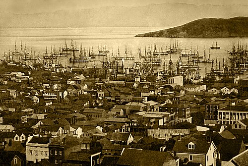
港と海軍基地として魅力的な立地であったにもかかわらず、征服後のサンフランシスコは依然として住みにくい地形の小さな集落であった。[66] 1847年の人口は459人だったと言われている。 [62]
カリフォルニアのゴールドラッシュは、宝探しをする人々を大量に呼び寄せた(「1849」にちなんで「フォーティナイナーズ」と呼ばれた)。サワードウパンを携えた探鉱者たちは、[67]ライバルのベニシアよりもサンフランシスコに押し寄せ、[68]人口は1848年の1,000人から1849年12月までに25,000人にまで増加した。[69]富が約束されていたため、到着した船の乗組員は船を捨てて金鉱へと急ぎ去り、サンフランシスコ港にはマストの森が残された。 [70]約500隻の放棄された船の一部は、倉庫船、酒場、ホテルとして使われたが、多くは朽ちるにまかせられ、一部は海中の土地の所有権を確立するために沈められた。1851年までに、港は湾に埠頭によって拡張され、船の間に杭を打って建物が建てられた。 1870年までにイエルバブエナ湾は埋め立てられ、新たな土地が造られた。新しい建物の基礎を掘る際に、埋もれていた船が露出することもある。[71]
カリフォルニアは1850年にすぐに州に昇格し、米軍はサンフランシスコ湾の警備のためゴールデンゲートブリッジにフォートポイントを、アルカトラズ島に砦を建設した。サンフランシスコ郡は、1850年にカリフォルニアが州に昇格した際に設立された18の郡のうちの1つであった。 [72] 1856年まで、サンフランシスコの市域は西はディビサデロ通りとカストロ通り、南は20番街まで広がっていた。1856年、カリフォルニア州政府は郡を分割した。その後、サンブルーノ山のすぐ北にあるサンフランシスコ半島の先端を横切る直線が引かれた。線の南側はすべて新しいサンマテオ郡となり、線の北側はすべて新しい統合されたサンフランシスコ市および郡となった。[73]
.jpg/500px-Bank_of_California_Building_San_Francisco_(cropped).jpg)
カリフォルニアのゴールドラッシュは、個人が新たに発見した富を活用しようとしたため、起業活動の波を引き起こしました。1859年にネバダ州でコムストック鉱床が発見されたことで、急速な人口増加と経済拡大が促進されました。[75]
サンフランシスコは金鉱への玄関口として、人口と商業活動の急増を経験しました。しかし、富を求める人々の流入は課題ももたらしました。無法が蔓延し、バーバリ海岸地区は悪徳の代名詞となり、犯罪者、売春婦、売春、密造酒、ギャンブルなどの違法行為を引き寄せました。 [76]
この時代で最も影響力のあった人物の一人がウィリアム・チャップマン・ラルストンである。抜け目のない銀行家で投資家だったラルストンは、サンフランシスコでかなりの富と影響力を蓄積した。彼はコムストック・ロードの金と銀の鉱山のかなりの部分を支配し、事実上の独占を確立した。ラルストンはその信じられないほどの影響力を使って、好景気の時代にサンフランシスコに何百万ドルもの利益をもたらすことができた。[77]彼はアメリカ西部で最初の銀行であるカリフォルニア銀行を設立し、サンフランシスコの新たな繁栄の象徴であり当時国内最大のホテルであった豪華なパレス・ホテルを建設した。[78]しかし、彼の金融帝国は1873年恐慌の結果1875年に崩壊し、サンフランシスコで大きな経済危機を引き起こした。
サンフランシスコ港の開発と、1869年に完成したばかりのパシフィック鉄道(市は渋々建設を支援しただけだった[79])による米国東部鉄道システムへの陸路アクセスの確立は、ベイエリアを貿易の中心地にするのに役立った。増加する人口のニーズと嗜好に応えるため、リーバイ・ストラウスは乾物店を開き、ドミンゴ・ギラデリはチョコレートの製造を始めた。中国人移民は「オールド・ゴールド・マウンテン」に惹かれ、市内にチャイナタウン地区を作った多言語文化をもたらした。1880年までに、中国人は人口の9.3%を占めた。[80]
.jpg/500px-The_City_of_San_Francisco,_panorama_by_Currier_&_Ives,_1878_(cropped).jpg)
1873年、最初のケーブルカーがサンフランシスコの住民をクレイ ストリートまで運んだ。市内のビクトリア朝様式の家々が形になり始め、市民の指導者たちは広々とした公共公園の建設を訴え、ゴールデン ゲート パークの計画が生まれた。サンフランシスコの住民は学校、教会、劇場など、市民生活のあらゆる特徴を建設した。プレシディオは太平洋岸で最も重要なアメリカ軍施設に発展した。[81] 1890年までにサンフランシスコの人口は30万人に近づき、当時アメリカで8番目に大きな都市となった。1901年頃、サンフランシスコは派手なスタイル、風格のあるホテル、ノブ ヒルの派手な邸宅、そして活気ある芸術シーンで知られる大都市だった。[82]北米で最初のペスト流行は、 1900年から1904年にかけてのサンフランシスコ ペストだった。[83]
1906年の地震と戦間期

1906年4月18日午前5時12分、サンフランシスコと北カリフォルニアを大地震が襲った。揺れで建物が倒壊し、破裂したガス管に引火して火災が市内に広がり、数日間制御不能に陥った。水道本管が使えなくなったため、プレシディオ砲兵隊は建物の一部を爆破して防火帯を作り、炎を封じ込めようとした。 [84]市内の4分の3以上が廃墟となり、ダウンタウンの中心部もほぼすべて焼失した。[29]当時の記録では498人が死亡したとされているが、現代の推計では数千人に上るという。[85]市の人口40万人のうち半数以上が家を失った。[86] 難民はゴールデンゲートパーク、プレシディオ、海岸などにある間に合わせのテント村に一時的に定住した。多くはイーストベイに永久に逃れた。ジャック・ロンドンは地震を次のように讃えたことで知られている。「歴史上、近代帝国都市がこれほど完全に破壊されたことはない。サンフランシスコは消滅した。」[87]
.jpg/500px-General_View_of_Civic_Center_and_New_City_Hall_(Engineering_News-Record,_vol_75_no_26_p_1222_fig_2).jpg)
再建は迅速かつ大規模に行われた。サンフランシスコ市民は、街路網を完全に作り直すという要求を拒否し、スピードを選んだ。[88] アマデオ・ジャンニーニのイタリア銀行(後にバンク・オブ・アメリカとなる)は、生活が破壊された多くの人々に融資を行った。影響力のあるサンフランシスコ計画都市研究協会(SPUR)は、地震後の住宅の質に取り組むために1910年に設立された。[89]地震により、火災を生き延びた西部地区の開発が加速した。その中には、市の富裕層の多くが家を再建したパシフィックハイツも含まれている。 [90]ノブヒルの破壊された邸宅は、今度は豪華なホテルになった。市庁舎はボザール様式で再建され、市は1915年のパナマ・パシフィック国際博覧会で復興を祝った。[91]

この時期に、サンフランシスコは最も重要なインフラのいくつかを建設した。土木技師のマイケル・オショーネシーは、1912年9月にサンフランシスコ市長ジェームズ・ロルフによって市の主任技師として雇われ、ツインピークス貯水池、ストックトンストリートトンネル、ツインピークストンネル、サンフランシスコ市営鉄道、補助給水システム、新しい下水道の建設を監督した。サンフランシスコの路面電車システム(現在も残っているJ、K、L、M、Nの各ライン)は、1915年から1927年の間にオショーネシーによって完成まで推進された。サンフランシスコに最も大きな影響を与えたのは、オショーネシーダム、ヘッチ・ヘッチー貯水池、ヘッチ・ヘッチー導水路であった。[92]豊富な水供給により、サンフランシスコは今日の都市へと発展することができた。

その後の数年間で、サンフランシスコは金融の中心地としての地位を固め、1929年の株式市場の暴落の後も、サンフランシスコに本拠を置く銀行は一つも破綻しなかった。[93]実際、大恐慌の真っ只中、サンフランシスコは2つの大規模な土木工事に着手し、サンフランシスコ・オークランド・ベイブリッジとゴールデンゲートブリッジを同時に建設し、それぞれ1936年と1937年に完成した。この時期に、元軍の柵だったアルカトラズ島が連邦最高警備刑務所として使用され始め、アル・カポネやアルカトラズの鳥男ロバート・フランクリン・ストラウドなどの悪名高い囚人を収容した。サンフランシスコはその後、1939年から1940年にかけてゴールデンゲート国際博覧会という世界博覧会を開催し、湾の真ん中に宝島を造ってその開催地として栄えた。 [94]
現代
_van_der_Plas_en_andere_leden_van_de_Nederlandse_delegatie_het_handvast_van_de_Uni,_KITLV_403000.tiff/lossy-page1-1280px-thumbnail.tiff.jpg)
第二次世界大戦中、パシフィカにある市営のシャープ・パークは日系アメリカ人を収容する収容所として使用された。[95]ハンターズ・ポイント海軍造船所は活動の中心地となり、フォート・メイソンは太平洋作戦地域へ向かう軍人たちの主要乗船港となった。[30]雇用の急増により、多くの人々、特に南部のアフリカ系アメリカ人がこの地域に引き寄せられた。終戦後、海外での任務から帰還した多くの軍人や、もともと仕事のために来ていた民間人が留まることを決めた。国際連合を設立する国際連合憲章は1945年にサンフランシスコで起草・調印され、1951年にはサンフランシスコ条約により日本と連合国間の平和関係が回復された。[96]
1950年代と1960年代の都市計画プロジェクトには、西側地域の広範な破壊と再開発、および新しい高速道路の建設が含まれていたが、市民主導の反対によって中止されるまで、一連の短い区間のみが建設された。[97]コンテナ化の始まりにより、サンフランシスコの小さな埠頭は時代遅れになり、貨物活動はより大きなオークランド港に移った。[98]市は工業雇用を失い始め、経済の最も重要な分野は観光業に変わった。[99]郊外は急速な成長を経験し、サンフランシスコは大きな人口動態の変化を経験した。白人人口の大部分が市を去り、アジアとラテンアメリカからの移民の波が増加するようになった。 [100] [101] 1950年から1980年にかけて、市の人口は10%以上減少した。

この時期、サンフランシスコはアメリカのカウンターカルチャー運動の磁石となった。ビートジェネレーションの作家たちはサンフランシスコ・ルネッサンスを煽り、 1950年代にはノースビーチ地区を中心にした。 [102] ヒッピーたちは1960年代にヘイト・アシュベリーに集まり、1967年のサマー・オブ・ラブでピークに達した。[103] 1974年、ゼブラ殺人事件で少なくとも16人が死亡した。[104] 1970年代には、カストロが都市型ゲイ・ビレッジとして出現し、ハーヴェイ・ミルクが監督委員会に選出され、1978年にミルクとジョージ・モスコーニ市長が暗殺されたことで、この都市はゲイの権利運動の中心地となった。 [105]
現在ノースカロライナ州シャーロットに本社を置くバンク・オブ・アメリカはサンフランシスコで設立され、1969年にカリフォルニア・ストリート555番地を完成させた。トランスアメリカ・ピラミッドは1972年に完成し、[106] 1980年代後半まで続いた「マンハッタン化」の波を引き起こし、ダウンタウンでは大規模な高層ビル開発が進んだ。[107] 1980年代には市内のホームレスの数も劇的に増加し、多くの取り組みにもかかわらず、今日まで問題となっている。[108]

1989年のロマ・プリエタ地震はベイエリア全域で破壊と死者を出した。サンフランシスコでは、地震によりマリーナ地区とサウス・オブ・マーケット地区の建物が甚大な被害を受け、被害を受けたエンバカデロ・フリーウェイとセントラル・フリーウェイの大部分が取り壊された。これにより、市はエンバカデロを歴史的なダウンタウンのウォーターフロントとして再生し、ヘイズ・バレー地区を再活性化することができた。[109]
最近の20年間は、インターネット産業が牽引した好況が見られました。1990年代後半のドットコム・ブームの間、新興企業がサンフランシスコ経済を活性化させました。多数の起業家やコンピュータ・アプリケーション開発者が市内に移り住み、続いてマーケティング、デザイン、営業の専門家が移り住み、かつては貧しかった地域がますます高級化していく中で社会情勢を変えていきました。[110]新しい住宅とオフィススペースの需要が、今度はサウス・オブ・マーケット地区で高層ビル開発の第二波を引き起こしました。[111] 2000年までに、市の人口は過去最高を記録し、1950年の記録を上回りました。2001年と2023年にバブルが崩壊すると、これらの企業の多くは倒産し、従業員は解雇されました。しかし、ハイテクと起業家精神はサンフランシスコ経済の主力であり続けています。 2000年代半ばまでにソーシャルメディアブームが始まり、サンフランシスコはテクノロジー企業のオフィスの人気拠点となり、アップルやグーグルなどのシリコンバレーの企業に勤務する人々が住む一般的な場所となった。[112]
2020年代初頭は、COVID-19パンデミックの影響でサンフランシスコのダウンタウンからハイテク企業が一斉に撤退し、ホームレスや公衆での薬物使用との闘いが目立った。一部の観察者は、オフィスの空室と税収の減少によりサンフランシスコが経済破滅のループに陥る可能性があると指摘しているが[113] [114]、他の情報源は、懸念される問題は主にサンフランシスコの都市中心部に限定されていると主張し、市全体に対するこの広範な特徴づけに反論している。[43] [115] 2024年3月の時点で、ユニオンスクエアは「悲惨な状況」にあり、ベイエリアの地域ショッピングハブとしての伝統的な地位をサンノゼのウェストフィールドバレーフェアに奪われていた[116] 。 [117]
サンフランシスコの国家歴史登録財のリストによると、フェリーステーション郵便局ビル、アーマー&カンパニービル、アサートンハウス、YMCAホテルは、市内の数十の歴史的建造物の中の歴史的建造物です。[118]
地理
.jpg/500px-San_Francisco_Peninsula_by_Sentinel-2,_2019-03-11_(cropped).jpg)
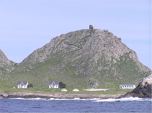
サンフランシスコは、アメリカ合衆国の西海岸、サンフランシスコ半島の北端に位置し、その境界内に太平洋とサンフランシスコ湾のかなりの部分が広がっています。アルカトラズ島、トレジャー島、隣接するイエルバブエナ島、アラメダ島、レッドロック島、エンジェル島の一部など、絵のように美しい島々が市域に含まれます。また、太平洋の沖合27マイル (43 km) にある無人島のファラロン諸島も市域に含まれます。市域内の本土は、おおよそ「7マイル四方の正方形」を形成しています。これは、市の形状を指す地元の一般的な口語表現ですが、水域を含む総面積は約232平方マイル (600 km 2 ) です。
市内には50を超える丘がある。[119]いくつかの地区は、ノブ・ヒル、ポトレロ・ヒル、ロシアン・ヒルなど、位置する丘にちなんで名付けられている。市の地理的中心付近、ダウンタウンの南西には、人口密度の低い丘が連なっている。市内で最も高い地点の1つを形成する一対の丘、ツインピークスは、展望スポットとなっている。サンフランシスコで最も高い丘であるマウント・デイビッドソンは、高さ928フィート(283メートル)で、頂上には1934年に建てられた高さ103フィート(31メートル)の十字架がある。 [120]このエリアを見下ろすのは、海抜1,811フィート(552メートル)に達する赤と白の大きなラジオとテレビの送信塔、スートロ ・タワーである。
.jpg/500px-Lake_Merced_Park,_Fort_Funston,_and_SF_Zoo_(cropped).jpg)
近くのサンアンドレアス断層とヘイワード断層は、どちらも市自体を通過していないにもかかわらず、多くの地震活動の原因となっている。サンアンドレアス断層は1906年と1989年の地震を引き起こした。小規模な地震は定期的に発生している。大地震の脅威は、市のインフラ開発に大きな役割を果たしている。市は補助給水システムを構築し、繰り返し建築基準をアップグレードして、古い建物の改修と新築の建築に対するより高い技術基準を義務付けている。[121]しかし、地震被害を受けやすい小規模な建物がまだ何千もある。[122] USGSは、カリフォルニアでの地震発生をモデル化したカリフォルニア地震予報を発表した。[123]
サンフランシスコの海岸線は、自然の限界を超えて拡大しています。マリーナ、ミッションベイ、ハンターズポイントなどの地区全体、およびエンバーカデロの大部分は、埋め立て地にあります。トレジャーアイランドは、ベイブリッジの建設中にイエルバブエナ島を通るイエルバブエナトンネルを掘削したときに生じた材料と、湾から浚渫された土砂で建設されました。このような土地は地震の際に不安定になりがちです。その結果生じる土壌の液状化は、 1989年のロマプリエタ地震の際にマリーナ地区で明らかになったように、その上に建てられた建物に多大な損害をもたらします。[124]いくつかの自然湖と小川(マーセド湖、マウンテン湖、パイン湖、ロボスクリーク、エルポリンスプリング)は公園内にあり、基本的に元の形で保護されていますが、アイライスクリークやミッションクリークなど、市内の自然水路のほとんどは、部分的または完全に暗渠化され、建物で覆われています。しかし、1990年代以降、公益事業委員会は、いくつかの小川を日光に当てるか復元する提案を検討してきました。[125]
近隣地域
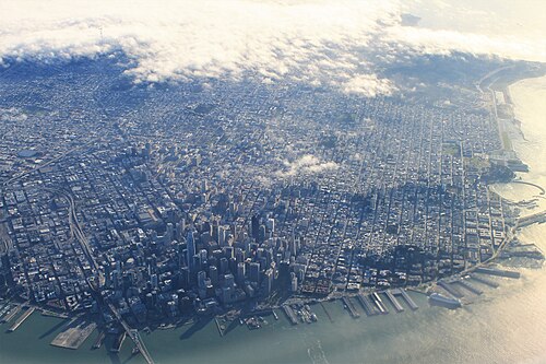
サンフランシスコの歴史的中心地は、マーケット ストリートとウォーターフロントに支えられた市の北東の象限です。ここは金融街の中心で、主要なショッピングとホテル街であるユニオン スクエアとテンダーロインが近くにあります。ケーブルカーに乗ると、かつて市のビジネス界の大物が住んでいたノブ ヒルの頂上まで急な坂を登り、フィッシャーマンズ ワーフやピア 39などのウォーターフロントの観光名所まで降りることができます。ピア 39 には現在も漁業が盛んな場所で獲れたアメリカイチョウクラブを提供するレストランがたくさんあります。この象限には、また、曲がりくねった街として有名なロンバード ストリートがある住宅街のロシアン ヒル、市内のリトル イタリーでかつてビート ジェネレーションの中心地だったノース ビーチ、コイト タワーがあるテレグラフ ヒルもあります。ロシアン ヒルとノース ビーチに隣接するのは、北米最古のチャイナタウンであるサンフランシスコチャイナタウンです。 [126] [127] [128] [129]かつてサンフランシスコの産業中心地であったサウス・オブ・マーケットは、オラクル・パークの建設と新興企業の流入を受けて、大幅な再開発が行われた。新しい高層ビル、住居兼仕事場、マンションがこのエリアに点在している。さらに開発が進んでいるのは、かつての鉄道操車場だったミッションベイ地区の南側で、現在はカリフォルニア大学サンフランシスコ校の第2キャンパスと、2019年にゴールデンステート・ウォリアーズの新本拠地としてオープンしたチェイスセンターがある。[130]
ダウンタウンの西、ヴァンネスアベニューの向かい側には、第二次世界大戦後に多くのアフリカ系アメリカ人が住むようになった大きなウェスタンアディション地区がある。ウェスタンアディションは通常、ヘイズバレー、フィルモア、ジャパンタウンなどの小さな地区に分かれている。ジャパンタウンはかつて北米最大のジャパンタウンだったが、第二次世界大戦中に日系アメリカ人住民が強制的に立ち退き、収容されたことで被害を受けた。ウェスタンアディションは、1906年の地震を生き延び、アラモスクエアの横に建つ有名な「ペインテッドレディ」など、ビクトリア朝様式の建物がほぼ無傷のまま残っている。南、市の中心近くには、 1960年代のヒッピー文化で有名なヘイトアシュベリーがある。 [131]ヘイトは現在[時期は? ]、いくつかの高級ブティック[132] [より適切な情報源が必要]といくつかの物議を醸すチェーン店[133]の本拠地となっているが、依然として[時期は? ] [出典が必要]、ボヘミアンな雰囲気も残っている。
.jpg/500px-SF_Chinatown_CA_(cropped).jpg)
ウェスタン・アディションの北にはパシフィック・ハイツがあり、1906年の地震後に裕福なサンフランシスコ市民が建てた家々が並ぶ裕福な地区である。パシフィック・ハイツのすぐ北、ウォーターフロントに面したマリーナは、主に湾岸の埋め立て地に建てられた、若い専門家に人気の地区である。[134]
市の南東の四半部にはミッション地区があり、 19世紀にはカリフォルニア出身者やドイツ、アイルランド、イタリア、スカンジナビアからの労働者階級の移民が住んでいた。1910年代には、中央アメリカからの移民の波がミッション地区に定住し、1950年代にはメキシコからの移民が主流になり始めた。[135]近年のジェントリフィケーションにより、ミッション地区の一部の人口構成はラテン系から20代の専門職層へと変化した。南西のノエ・バレーや南のバーナル・ハイツは、どちらも子供連れの若い家族にますます人気が高まっている。ミッション地区の東には、サンフランシスコのダウンタウンを一望できる住宅街が広がるポトレロ・ヒル地区がある。ミッション地区の西側、歴史的にはユーレカ・バレーとして知られ、現在では一般にカストロと呼ばれているエリアは、かつては労働者階級のスカンジナビア人とアイルランド人のエリアだった。ここは北米初のゲイビレッジとなり、現在では市内のゲイライフの中心地となっている。 [136]市の南端近くにあるエクセルシオール地区は、サンフランシスコで最も民族的に多様な地区の一つである。市の南東端にあるベイビュー・ハンターズポイントは最も貧しい地区の一つであるが、この地域はいくつかの再活性化と都市再開発プロジェクトの中心となってきた。
1918年にツインピークストンネルが建設され、南西部の地区が路面電車でダウンタウンとつながり、ウェストポータル、近くの裕福なフォレストヒルとセントフランシスウッドの発展が加速しました。さらに西には太平洋まで、北はゴールデンゲートパークまで広がる広大なサンセット地区があり、主にアジア人の人口を抱える大規模な中流階級の地域です。[137]
市の北西の四分円には、ゴールデン ゲート パークの北にある、主に中流階級の地区であるリッチモンドがあり、他のアジア諸国からの移民や、多くのロシア人とウクライナ人の移民が住んでいます。これらのエリアはまとめて、ザ アベニューとして知られています。これらの 2 つの地区は、それぞれさらに 2 つの地域に分けられることがあります。アウター リッチモンドとアウター サンセットは、それぞれの地区のより西側を指し、インナー リッチモンドとインナー サンセットは、より東側を指します。
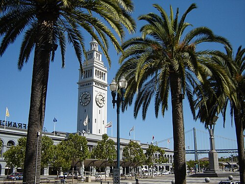
多くの桟橋は、エンバーカデロ フリーウェイの解体によりダウンタウンのウォーターフロントが再開され、再開発が可能になるまで、何年も放置されていました。港の中心であるフェリー ビルディングは、通勤フェリーの往来が今も行われているものの、グルメ マーケットプレイスとして修復され、再開発されました。
気候

サンフランシスコは、カリフォルニア沿岸特有の、冬は湿気が多く夏は乾燥する温暖な地中海性気候(ケッペン:Csb、トレワーサ:Csll)である。 [138]サンフランシスコの天候は、市の西側にある太平洋の冷たい海流と、北と東にあるサンフランシスコ湾の水の影響を強く受けている。これにより気温の変動が緩和され、季節による気温の変化がほとんどなく、年間を通じて非常に穏やかな気候となっている。[139]
米国の主要都市の中で、サンフランシスコは6月、7月、8月の平均気温、最高気温、最低気温が最も低い。[140] 夏の間、カリフォルニア州内陸部の谷で上昇する熱気によって低気圧が形成され、北太平洋高気圧からゴールデンゲートブリッジを通る風が引き寄せられ、サンフランシスコ特有の涼しい風と霧が発生する。[141]霧は東部の地区や晩夏から初秋にかけてはそれほど顕著ではない。その結果、年間で最も暖かい月は平均して9月で、平均して10月は特に日中は7月よりも暖かい。
ダウンタウンとサンフランシスコ国際空港(SFO)では、気温が80 °F(27 °C)に達するかそれを超えるのは、年間平均でそれぞれわずか21日と23日である。 [142 ] 5月から10月の乾期は穏やかから暖かく、通常の月平均気温は9月に62.7 °F(17.1 °C)でピークに達する。[142] 11月から4月の雨期は若干涼しく、通常の月平均気温は1月に51.3 °F(10.7 °C)で最低に達する。[142]平均して、年間73日の雨があり、年間降水量は平均23.65インチ(601 mm)である。[142]年ごとの降水量の変動は大きい。例年より雨が多い年は太平洋の温暖なエルニーニョ現象と関連していることが多く、 2013年(ラニーニャ現象の年)には、1849年以来記録が残っているサンフランシスコのダウンタウンで、過去最低の5.59インチ(142 mm)の降雨量が記録された。[142]市内の降雪は非常に稀で、1852年以降、測定可能な積雪は10回しか記録されておらず、最も最近では1976年にツインピークスで最大5インチ(13 cm)の降雪があった。[143] [144]
国立気象局のダウンタウンの公式観測所[b]で記録された最高気温は、2017年9月1日の106°F(41°C)でした。[146]この猛暑の間に、史上最も暖かい夜71°F(22°C)も記録されました。[147]記録された最低気温は、1932年12月11日の27°F(-3°C)でした。[148]
1991年から2020年までの平均的な年では、サンフランシスコでは夜間の最高気温が64°F(18°C)で、日中の最低気温が49°F(9°C)でした。[142] 1945年の観測所開設以来、日中の最低気温は1972年12月の37°F(3°C)でした。[142]
沿岸都市であるサンフランシスコは、気候変動の影響を大きく受けるでしょう。2021年現在[update]、海面は5フィート(1.5メートル)も上昇すると予測されており、定期的な洪水、地下水位の上昇、そしてより激しい嵐による低地の洪水が発生します。[149]
サンフランシスコはUSDA植物耐寒性ゾーン10bに該当しますが、一部の地域、特にダウンタウンはゾーン11aに該当します。[150] [151]
エコロジー

歴史的に、サンフランシスコ郡にはトゥーレヘラジカが存在していた。これは、ハンターズポイント、フォートメイソン、スティーブンソンストリート、マーケットストリート、イエルバブエナの少なくとも5つの異なるネイティブアメリカンの貝塚でヘラジカの遺骸が見つかったという考古学的証拠に基づく。 [157] [158]おそらく最初の歴史的観察記録は、1776年3月23日のデアンザ遠征隊によるものである。ハーバート・ユージン・ボルトンは、今日のプレシディオの南端近くにあるマウンテンレイクの遠征キャンプについて次のように書いている。「周囲には鹿が草を食んでおり、あちこちに大きなヘラジカの角が散らばっていた。」[159]また、リチャード・ヘンリー・ダナ・ジュニアが1835年にサンフランシスコ湾を訪れたとき、ゴールデンゲート近くの巨大なヘラジカの群れについて次のように書いている。12月27日、「…私たちは湾口近くの高くて美しい傾斜の丘の下に錨を下ろした。その丘の上には何百頭ものアカシカ[注: 「アカシカ」は「ヘラジカ」のヨーロッパ語]の群れと、高く枝分かれした角を持つ雄鹿が跳ね回っていた…」ただし、これがマリン側だったのかサンフランシスコ側だったのかは明らかではない。[160]
人口統計
2020年のアメリカ合衆国国勢調査によると、サンフランシスコの人口は873,965人で、 2010年の国勢調査から8.5%増加した。[16]マンハッタンの約4分の1の人口密度であるサンフランシスコは、人口20万人以上の都市の中ではニューヨーク市に次いでアメリカで2番目に人口密度の高い大都市であり、ニューヨーク市の5つの行政区のうち4つの行政区に次いでアメリカで5番目に人口密度の高い郡である。
サンフランシスコは、5つの郡からなるサンフランシスコ・オークランド・ヘイワード大都市統計地域の一部であり、人口は470万人(米国で13番目に人口が多い)の地域で、伝統的に人口の中心地となっています。また、14の郡からなるサンノゼ・サンフランシスコ・オークランド複合統計地域の一部でもあり、その人口は960万人を超え、2018年時点で米国で5番目に大きい[update]都市となっています。[161] [検証失敗]
人種、民族、宗教、言語

2020年の国勢調査時点で[update]、サンフランシスコの人種構成と人口は、白人361,382人(41.3%)、アジア人296,505人(33.9%)、アフリカ系アメリカ人46,725人(5.3%)、多民族アメリカ人86,233人(9.9%)、ネイティブアメリカンとアラスカ先住民6,475人(0.7%)、ネイティブハワイアンとその他の太平洋諸島民3,476人(0.4%)、その他の人種73,169人(8.4%)でした。あらゆる人種のヒスパニックまたはラテン系の住民は136,761人(15.6%)でした。
サンフランシスコは少数民族が多数を占める都市であり、非ヒスパニック系白人住民は人口の半分以下を占めている。1940年には非ヒスパニック系白人が人口の92.5%を占めていた。[162]
2010年、サンフランシスコの人口の21%を占める中国系住民は、最大の単一民族グループを構成している。その他のアジア系グループとしては、フィリピン人(5%)とベトナム人(2%)が挙げられ、日本人、韓国人、その他多くのアジア系および太平洋諸島系グループが市内に居住している。[163] 中国系の人口は、チャイナタウン、サンセット地区、リッチモンド地区に最も集中している。フィリピン人は、 SOMAとクロッカー・アマゾン地区に最も集中している。後者の地区は、北米で最もフィリピン人が集中しているデイリー・シティと接している。 [163] [164]テンダーロイン地区には、市内のベトナム人人口の大部分が居住しており、企業やレストランも集まっており、市内のリトル・サイゴンとして知られている。[163]
市内の主なヒスパニック系グループは、メキシコ系(7%)とエルサルバドル系(2%)である。ヒスパニック系人口は、ミッション地区、テンダーロイン地区、エクセルシオール地区に最も集中している。[165]市内のヒスパニック系住民の割合は、州全体の半分以下である。
2020年のサンフランシスコの人口の約5%をアフリカ系アメリカ人が占めていますが、市の人口に占める割合は1970年代から減少しています。[166]市の黒人住民の大半は、ベイビュー・ハンターズ・ポイント、ビジタシオン・バレー、フィルモア地区の近隣に住んでいます。[165]ダイアモンド・ハイツ、グレン・パーク、ミッション地区には小規模な黒人コミュニティがあります。
この都市には長い間、重要なユダヤ人コミュニティが存在してきた。2018年には、ユダヤ系アメリカ人が市の人口の約10%(8万人)を占めたと推定されている。人口比で見ると、ニューヨーク市とロサンゼルスに次いで米国で3番目に大きいユダヤ人コミュニティであり、米国の他の主要都市と比較すると比較的新しい都市でもある。[167]ユダヤ人コミュニティは市内全域に存在しているが、リッチモンド地区には主にロシア系ユダヤ人の民族集落がある。[168]フィルモア地区は、1920年代から1970年代まで、主にユダヤ人が住む地区であったが、その後、多くのユダヤ人住民が市内の他の地区や近くのマリン郡の郊外に移住した。[169]
_(cropped).png/500px-Race_and_ethnicity_2010-_San_Francisco,_Oakland,_Berkeley_(5560477152)_(cropped).png)
サンフランシスコ・ユダヤ人コミュニティ連盟による2018年の調査によると、ユダヤ人は市の人口の10%(8万人)を占めており、ユダヤ教はキリスト教に次いでサンフランシスコで2番目に多い宗教となっている。[167]ピュー研究所による2014年の以前の調査では、サンフランシスコ都市圏の最大の宗教グループはキリスト教徒(48%)であり、無宗教(35%)、ヒンズー教徒(5%)、ユダヤ教徒(3%)、仏教徒(2%)、イスラム教徒(1%)がそれに続き、その他の様々な宗教の信者は少数であった。ピュー研究所による同じ調査によると、この地域の住民の約20%がプロテスタントであり、25%がローマカトリックの信仰を公言している。一方、サンフランシスコ都市圏の住民の10%は不可知論者を自認し、5%は無神論者を自認している。[172] [173]
2010年時点で[update]、サンフランシスコ住民の55% (411,728人) は自宅で英語のみを話し、19% (140,302人) は様々な中国語(主に台山語と広東語[174] [175] )、12% (88,147) はスペイン語、3% (25,767) はタガログ語、2% (14,017) はロシア語を話していた。合計すると、サンフランシスコの人口の45% (342,693) は自宅で英語以外の言語を話していた。[176]
民族の集積
サンフランシスコにはチャイナタウンやミッション地区など、中国系、メキシコ系、フィリピン系の著名な地区がいくつかある。市内の移民クラスターに関する調査によると、サンフランシスコのアジア系人口の半分以上は中国生まれ(40.3%)またはフィリピン生まれ(13.1%)であり、メキシコ系人口の21%はメキシコ生まれであり、これらは米国に最近移住した人々である。[177] 1990年から2000年の間に、外国生まれの居住者の数は33%から40%近くに増加した。[177]同じ期間に、サンフランシスコ都市圏は85万人の移民を受け入れ、ロサンゼルスとニューヨークに次いで米国で3番目にランクされました。[177]
教育、世帯、収入

米国の主要都市の中で、サンフランシスコはシアトルに次いで大学卒業者の割合が2番目に高い。成人の44%以上が学士号以上の学位を取得している。[179]サンフランシスコは1平方マイルあたり7,031人という最も高い割合で、市の面積46.7平方マイル(121 km 2 ) に344,000人以上の卒業生がいる。[180]
サンフランシスコは、米国の50大都市の中で同性愛者の割合が最も高く、15%と推定されています。[181]サンフランシスコは、米国の郡の中で同性愛世帯の割合が最も高く、ベイエリアは他のどの大都市圏 よりも同性愛者の集中度が高いです。[182]
サンフランシスコは、世帯収入の中央値でアメリカの都市の中で3位にランクされており[183]、 2007年の値は65,519ドルです。[184]世帯収入の中央値は81,136ドルです。[184] 中流階級の家族の移住により、この都市は他のどのアメリカの大都市よりも子供の割合が低くなり、[185] 2018年には犬の数が子供の人口115,000を超えたと言われています。[186] この都市の貧困率は12%で、全国平均よりも低いです。[187] ホームレスは、 1970年代初頭からサンフランシスコの慢性的な問題となっています。 [188] この都市は、米国の主要都市の中で人口1人あたりのホームレスの数が最も多いと考えられています。[189] [190]
市内には345,811世帯があり、そのうち133,366世帯(39%)は個人、109,437世帯(32%)は異性同士の結婚したカップル、63,577世帯(18%)には18歳未満の子供が住んでいて、21,677世帯(6%)は未婚の異性同士のパートナーシップ、10,384世帯(3%)は同性同士の結婚したカップルまたはパートナーシップです。平均世帯人数は2.26人、平均家族人数は3.11人です。452,986人(56%)が賃貸住宅に住み、327,985人(41%)が持ち家住宅に住んでいます。市の人口の平均年齢は38歳です。
サンフランシスコは1989年に聖域都市であると宣言し、市当局は2013年に「すべての人に正当な手続き」条例でその立場を強化した。同法は、移民の記録に暴力犯罪がなく、現在起訴されていない場合、地方当局は移民を移民犯罪で拘留できないと規定した。[191]市は申請者の移民ステータスに関係なく、住民IDカードを発行する。 [192]
ホームレス
.jpg/500px-San_Francisco_Homeless_Tents_(cropped).jpg)
サンフランシスコのホームレス問題は20世紀後半に大きな問題として浮上し、現代でも依然として深刻化しています。[193]
サンフランシスコの2019年の路上およびシェルターの調査では、8,035人のホームレスが数えられました。これは、2017年の6,858人から17%以上の増加です。5,180人が路上や公園で無宿生活を送っていました。[194] 2019年の調査では、回答者の26%がホームレスの主な原因として失業を挙げ、18%がアルコールまたは薬物使用、13%が住居からの立ち退きを挙げました。[194] サンフランシスコ市は、増加する人口のホームレス危機に対応するための支出を大幅に増やしています。2016〜2017年の支出は、前年の予算3,400万ドルから2億4,100万ドル増加して合計2億7,500万ドルになりました。2017〜2018年のホームレス対策予算は3億500万ドルでした。[195] 2019~2020年度予算では、市はホームレス支援サービスに3億6,800万ドルを計上した。提案された2020~2021年度予算では、市はホームレス支援サービスに8億5,000万ドルを予算計上した。[196]
2018年1月、ホームレス問題に関する国連特別報告者のレイラニ・ファルハ氏は、サンフランシスコを訪問した際、同市のホームレス危機に「完全にショックを受けた」と述べた。ファルハ氏は、サンフランシスコの路上で目撃したホームレスキャンプの「悲惨な状況」を、ムンバイで見たものと比較した。[195] 2020年5月、サンフランシスコはホームレス キャンプを正式に認可した。[197]
犯罪
.jpg/500px-Police_Horse_with_Giants_Hat_(8146841565).jpg)
サンフランシスコの暴力犯罪率は他の大都市に比べると低いが、多くの住民は依然としてそれを懸念している。[198]
2011年には50件の殺人事件が報告されており、これは10万人あたり6.1件に相当します。[199]強姦は約134件、強盗は3,142件、暴行は約2,139件ありました。また、約4,469件の住居侵入窃盗、25,100件の窃盗、4,210件の自動車窃盗がありました。[200]テンダーロイン地区はサンフランシスコで最も犯罪率が高く、市内の暴力犯罪の70%、市内の殺人の約4分の1がこの地区で発生しています。テンダーロインでは、薬物乱用、ギャングの暴力、売春の発生率も高くなっています。[201]犯罪率が高い別の地域は、ベイビュー・ハンターズポイント地区です。 2015年上半期の殺人事件は25件で、2014年上半期の14件を大きく上回っている。しかし、殺人率は過去数十年に比べると依然としてかなり低い。[202]しかし、2016年末までに再び上昇した。サンフランシスコ市警察によると、2016年には市内で59件の殺人事件が発生し、年間合計では2015年(52件)から13.5%増加した。[203]また、この都市は車の盗難が多いことでも知られており、2021年には19,000件を超える車の盗難が発生している。[204]
2018年上半期、サンフランシスコの歩道に人間の排泄物が散乱しているという苦情は、1日あたり約65件の通報があり、市の住民から2番目に多い苦情となった。市は、この問題と戦うために「排泄物パトロール」を結成した。[205]

2022年1月、CBSニュースは、1人の容疑者が「昨年サンフランシスコで報告されたアジア系アメリカ人コミュニティに対するヘイトクライムの半分以上を犯した」と報じ、その容疑者は「多数の容疑にもかかわらず、拘留されないままであった」と報じた。[206]
数十年にわたって、 MS-13、[207]、ミッション地区のSureñosとNorteñosを含むいくつかのストリートギャングが市内で活動してきました。 [208]
ブラッズやクリップスとその仲間を含む、他の都市ではおなじみのアフリカ系アメリカ人のストリートギャングはサンフランシスコで拠点を確立するのに苦労しており、[209]警察と検察は若いアフリカ系アメリカ人男性をギャングのメンバーとして自由に分類していると非難されている。[210]
20世紀には、ウー・ホップ・トーなどの三合会を含む、中国に指揮官がいる犯罪組織がサンフランシスコで活動していた。 [211] 2024年4月にサンフランシスコ警察が発表した統計によると、年初100日間の犯罪件数は、強盗、窃盗、窃盗の点で減少した。[212] 2024年上半期、サンフランシスコでは前年比で全体的な犯罪が32%減少した。私物窃盗は41%減少し、銃関連事件を含む暴力犯罪は30%減少した。[213]
経済

サンフランシスコは多様なサービス経済を有しており、雇用は観光、金融サービス、(ますます増えている)ハイテクなど、幅広い専門サービスに広がっています。[215] 2016年には、労働者の約27%が専門的なビジネスサービスに従事し、14%がレジャーとホスピタリティ、13%が政府サービス、12%が教育とヘルスケア、11%が貿易、運輸、公共事業、8%が金融活動に従事していました。[215] 2019年、5つの郡からなるサンフランシスコ都市圏のGDPは実質3.8%増加して5,920億ドルとなりました。[216] [217]さらに、2019年には14の郡からなるサンノゼ・サンフランシスコ・オークランド 総合統計地域のGDPは1兆860億ドルとなり、[217] CSAの中で3位となり、16か国を除くすべての国を上回りました。 2019年現在[update]、サンフランシスコ郡はアメリカ国内で7番目に所得の高い郡(3,142郡中)であり、一人当たりの個人所得は139,405ドルである。[218] ゴールデンゲートブリッジを渡ってすぐ北にあるマリン郡と半島のすぐ南にあるサンマテオ郡は、それぞれ6番目と9番目に所得の高い郡であった。
.jpg/500px-San_Francisco,_California_April_2022_skyline_(cropped2).jpg)
カリフォルニアのゴールドラッシュの遺産により、サンフランシスコは20世紀初頭に西海岸の主要な銀行・金融の中心地となった。 [219] 金融地区のモンゴメリー通りは「西のウォール街」として知られるようになり、サンフランシスコ連邦準備銀行の本拠地であり、現在は廃止されたパシフィックコースト証券取引所の所在地でもある。[219]中流階級が銀行サービスを利用できるようにした先駆者であるバンク・オブ・アメリカはサンフランシスコで設立され、1960年代に本社としてカリフォルニア通り555番地にランドマーク的な近代的な超高層ビルを建設した。その後、このビルはノースカロライナ州シャーロットに移転した。多くの大手金融機関、多国籍銀行、ベンチャーキャピタル会社がサンフランシスコに本拠地を置いているか、地域本部を置いている。30を超える国際金融機関、[220] 6つのフォーチュン500企業、[221]法律、広報、建築、デザインなどの専門サービスの大規模な支援インフラストラクチャを備えたサンフランシスコは、アルファ(-)ワールドシティに指定されている。[222] 2017年の世界金融センター指数では、サンフランシスコは世界で6番目に競争力のある金融センターとしてランク付けされました。[223]
1990年代初頭、サンフランシスコの経済は金融と観光からハイテク、バイオテクノロジー、医療研究などの成長分野へと多様化しました。[224] 1990年にはテクノロジー関連の仕事がサンフランシスコの経済のわずか1%を占めていましたが、2010年には4%に成長し、2013年末には推定8%になりました。 [225]サンフランシスコは、1990年代のドットコムバブルとそれに続く2000年代後半のソーシャルメディアブームの間に、インターネットの新興企業の中心地になりました。[226] 2010年以降、サンフランシスコ市は近隣のシリコンバレーに比べてベンチャーキャピタル投資の割合が増加しており、2013年には423件、45億8000万ドルの資金調達が行われた。[227] [228] [229] 2004年、市はバイオテクノロジー企業に対する給与税免除を承認し[230] 、カリフォルニア大学サンフランシスコ校(UCSF)の第2キャンパスと病院があるミッションベイ地区の成長を促進した。ミッションベイには、 UCSFメディカルセンター、カリフォルニア再生医療研究所、カリフォルニア定量生命科学研究所、グラッドストーン研究所があり、[231] 40社以上の民間ライフサイエンス企業が拠点を置いている。 [232]
.jpg/500px-Union_Square_-_San_Francisco_(cropped).jpg)
学者のロブ・ウィルソンによると、サンフランシスコはグローバル都市であり、カリフォルニアのゴールドラッシュの時代に人気が高まった以前からその地位にあった。[234]しかし、COVID-19のパンデミックにより、サンフランシスコのダウンタウン中心部ではオフィス空室率が高くなり、多くの小売店やハイテク企業が閉鎖された。[235] [236]その原因としては、テクノロジーおよび専門サービス部門でのリモートワークへの移行、テンダーロインやミッドマーケット地区などサンフランシスコのダウンタウン周辺の地域でのホームレス、薬物使用、犯罪率の高さなどが挙げられている。[237] [238]
サンフランシスコの最大の雇用主は市政府であり、市の労働力の5.6%(31,000人以上)を雇用しており、UCSFが25,000人以上の従業員を抱えてそれに続いている。[239]民間部門の最大の雇用主はセールスフォース・ドットコムで、2018年時点で従業員数は8,500人である[update]。[240] 2006年には従業員10人未満の中小企業と自営業が市内の事業所の85%を占め、[241]従業員1,000人以上の企業に雇用されているサンフランシスコ市民の数は1977年以来半減している。[242]国内の大型小売店や定型小売チェーンの市内への進出は、政治的および市民的合意によって意図的に困難にされている。サンフランシスコの小規模な個人経営の企業を支え、この都市のユニークな小売業の個性を維持するため、中小企業委員会は2004年に地元経済における小売業の売上のより大きな割合を維持するための宣伝キャンペーンを開始した。 [243]また、監督委員会は計画コードを使用して、定型的な小売店が店を構えることができる地域を制限しており、[244]サンフランシスコの有権者もこの取り組みを支持している。[245]しかし、2016年までに、サンフランシスコは中小企業によるビジネスフレンドリー度調査で低い評価を受けた。[246]
.jpg/500px-San_Francisco_Ferry_Building_January_2014_002_(cropped).jpg)
米国の多くの都市と同様に、サンフランシスコにもかつては1969年に6万人近くの労働者を雇用する重要な製造業があったが、1980年代までにほぼすべての製造業がより安価な場所へと移転した。[247] 2014年現在[update]、サンフランシスコでは製造業が小規模ながら復活し、500社で4,000人以上の製造業の雇用があり、2011年以降倍増している。市内最大の製造業雇用主はアンカー・ブリューイング・カンパニーで、収益最大はティンバック2である。[247]
2022年第1四半期時点で[update]、サンフランシスコ郡の住宅価格の中央値は1,297,030ドルであった。同郡は、マサチューセッツ州ナンタケット島とカリフォルニア州サンマテオ郡に次いで、米国で住宅価格の中央値が最も高い郡として3位にランクされている。[248]
テクノロジー

San Francisco became a hub for technological driven economic growth during the internet boom of the 1990s, and still holds an important position in the world city network today.[177][249] Intense redevelopment towards the "new economy" makes business more technologically minded. Between the years of 1999 and 2000, the job growth rate was 4.9%, creating over 50,000 jobs in technology firms and internet content production.[177] However, the technology industry has become geographically dispersed.[250][251]
In the second technological boom driven by social media in the mid-2000s, San Francisco became a location for companies such as Apple, Google, Ubisoft, Facebook, and Twitter to base their tech offices and for their employees to live.[252]
Tourism and conventions

Tourism is one of San Francisco's most important private-sector industries, accounting for more than one out of seven jobs in the city.[224][253] The city's frequent portrayal in music, film, and popular culture has made the city and its landmarks recognizable worldwide. In 2016, it attracted the fifth-highest number of foreign tourists of any city in the United States.[254] More than 25 million visitors arrived in San Francisco in 2016, adding US$9.96 billion to the economy.[255] With a large hotel infrastructure and a major convention facility in the Moscone Center, San Francisco is a popular destination for annual conventions and conferences.[256]
Some of the most popular tourist attractions in San Francisco, as noted by the Travel Channel, include the Golden Gate Bridge and Alamo Square Park, home to the famous "Painted Ladies." Both of these locations were often used as landscape shots for the hit American television sitcom Full House. There is also Lombard Street, known for its "crookedness" and extensive views. Tourists also visit Pier 39, which offers dining, shopping, entertainment, and views of the bay, sunbathing California sea lions, the Aquarium of the Bay, and the famous Alcatraz Island.[257]

San Francisco also offers tourists varied nightlife in its neighborhoods.[258][259]
The new Terminal Project at Pier 27 opened September 25, 2014, as a replacement for the old Pier 35.[260] Itineraries from San Francisco usually include round-trip cruises to Alaska and Mexico.
A heightened interest in conventioneering in San Francisco, marked by the establishment of convention centers such as Yerba Buena, acted as a feeder into the local tourist economy and resulted in an increase in the hotel industry: "In 1959, the city had fewer than thirty-three hundred first-class hotel rooms; by 1970, the number was nine thousand; and by 1999, there were more than thirty thousand."[261] The commodification of the Castro District has contributed to San Francisco's tourist economy.[262]
Arts and culture

Although the Financial District, Union Square, and Fisherman's Wharf are well known around the world, San Francisco is also characterized by its numerous culturally rich streetscapes featuring mixed-use neighborhoods anchored around central commercial corridors to which residents and visitors alike can walk.[citation needed] Because of these characteristics,[original research?] San Francisco is ranked the "most walkable" city in the United States by Walkscore.com.[263] Many neighborhoods feature a mix of businesses, restaurants and venues that cater to the daily needs of local residents while also serving many visitors and tourists. Some neighborhoods are dotted with boutiques, cafés and nightlife such as Union Street in Cow Hollow, 24th Street in Noe Valley, Valencia Street in the Mission, Grant Avenue in North Beach, and Irving Street in the Inner Sunset. This approach especially has influenced the continuing South of Market neighborhood redevelopment with businesses and neighborhood services rising alongside high-rise residences.[264][failed verification]
_(cropped).jpg/500px-Entering_the_Castro_district,_San_Francisco_(31984322697)_(cropped).jpg)
Since the 1990s, the demand for skilled information technology workers from local startups and nearby Silicon Valley has attracted white-collar workers from all over the world and created a high standard of living in San Francisco.[266] Many neighborhoods that were once blue-collar, middle, and lower class have been gentrifying, as many of the city's traditional business and industrial districts have experienced a renaissance driven by the redevelopment of the Embarcadero, including the neighborhoods South Beach and Mission Bay. The city's property values and household income have risen to among the highest in the nation,[267][268][269] creating a large and upscale restaurant, retail, and entertainment scene. According to a 2014 quality of life survey of global cities, San Francisco has the highest quality of living of any U.S. city.[270] However, due to the exceptionally high cost of living, many of the city's middle and lower-class families have been leaving the city for the outer suburbs of the Bay Area, or for California's Central Valley.[271] By June 2, 2015, the median rent was reported to be as high as $4,225.[272] The high cost of living is due in part to restrictive planning laws which limit new residential construction.[273]
_(cropped).jpg/500px-2019_San_Francisco_Carnaval_Grand_Parade_431_(49490263633)_(cropped).jpg)
The international character that San Francisco has enjoyed since its founding is continued today by large numbers of immigrants from Asia and Latin America. With 39% of its residents born overseas,[242] San Francisco has numerous neighborhoods filled with businesses and civic institutions catering to new arrivals. In particular, the arrival of many ethnic Chinese, which began to accelerate in the 1970s, has complemented the long-established community historically based in Chinatown throughout the city and has transformed the annual Chinese New Year Parade into the largest event of its kind on the West Coast.
With the arrival of the "beat" writers and artists of the 1950s and societal changes culminating in the Summer of Love in the Haight-Ashbury district during the 1960s, San Francisco became a center of liberal activism and of the counterculture that arose at that time. The Democrats and to a lesser extent the Green Party have dominated city politics since the late 1970s, after the last serious Republican challenger for city office lost the 1975 mayoral election by a narrow margin. San Francisco has not voted more than 20% for a Republican presidential or senatorial candidate since 1988.[274] In 2007, the city expanded its Medicaid and other indigent medical programs into the Healthy San Francisco program,[275] which subsidizes certain medical services for eligible residents.[276][277][278]

Since 1993, the San Francisco Department of Public Health has distributed 400,000 free syringes every month aimed at reducing HIV and other health risks for drug users, as well as providing disposal sites and services.[279][280][281]
San Francisco also has had a very active environmental community. Starting with the founding of the Sierra Club in 1892 to the establishment of the non-profit Friends of the Urban Forest in 1981, San Francisco has been at the forefront of many global discussions regarding the environment.[282][283] The 1980 San Francisco Recycling Program was one of the earliest curbside recycling programs.[284] The city's GoSolarSF incentive promotes solar installations and the San Francisco Public Utilities Commission is rolling out the CleanPowerSF program to sell electricity from local renewable sources.[285][286] SF Greasecycle is a program to recycle used cooking oil for conversion to biodiesel.[287]
The Sunset Reservoir Solar Project, completed in 2010, installed 24,000 solar panels on the roof of the reservoir. The 5-megawatt plant more than tripled the city's 2-megawatt solar generation capacity when it opened in December 2010.[288][289]
LGBT

San Francisco has long had an LGBT-friendly history. It was home to the first lesbian-rights organization in the United States, Daughters of Bilitis; the first openly gay person to run for public office in the United States, José Sarria; the first openly gay man to be elected to public office in California, Harvey Milk; the first openly lesbian judge appointed in the U.S., Mary C. Morgan; and the first transgender police commissioner, Theresa Sparks. The city's large gay population has created and sustained a politically and culturally active community over many decades, developing a powerful presence in San Francisco's civic life.[290] Survey data released in 2015 by Gallup places the proportion of LGBT adults in the San Francisco metro area at 6.2%, which is the highest proportion of the 50 most populous metropolitan areas as measured by the polling organization.[291]
.jpg/500px-The_Castro_(6163133524).jpg)
One of the most popular destinations for gay tourists internationally, the city hosts San Francisco Pride, one of the largest and oldest pride parades. San Francisco Pride events have been held continuously since 1972. The events are themed and a new theme is created each year.[292] In 2013, over 1.5 million people attended, around 500,000 more than the previous year.[293] Pink Saturday is an annual street party held the Saturday before the pride parade, which coincides with the Dyke march.
The Folsom Street Fair (FSF) is an annual BDSM and leather subculture street fair that is held in September, endcapping San Francisco's "Leather Pride Week."[294] It started in 1984 and is California's third-largest single-day, outdoor spectator event and the world's largest leather event and showcase for BDSM products and culture.[295]
Performing arts
.jpg/500px-San_Francisco_Opera_House_(cropped).jpg)
.jpg/500px-Golden_Gate_Theatre_-_San_Francisco,_CA_-_DSC06532_(cropped).jpg)
San Francisco's War Memorial and Performing Arts Center hosts some of the most enduring performing arts companies in the country. The War Memorial Opera House houses the San Francisco Opera, the second-largest opera company in North America[296] as well as the San Francisco Ballet, while the San Francisco Symphony plays in Davies Symphony Hall. Opened in 2013, the SFJAZZ Center hosts jazz performances year round.[297]
The Fillmore is a music venue located in the Western Addition. It is the second incarnation of the historic venue that gained fame in the 1960s, housing the stage where now-famous musicians such as the Grateful Dead, Janis Joplin, Led Zeppelin, and Jefferson Airplane first performed, fostering the San Francisco Sound.[298] It closed its doors in 1971 with a final performance by Santana and reopened in 1994 with a show by the Smashing Pumpkins.[299]
San Francisco has a large number of theaters and live performance venues. Local theater companies have been noted for risk taking and innovation.[300] The Tony Award-winning non-profit American Conservatory Theater (A.C.T.) is a member of the national League of Resident Theatres. Other local winners of the Regional Theatre Tony Award include the San Francisco Mime Troupe.[301] San Francisco theaters frequently host pre-Broadway engagements and tryout runs,[302] and some original San Francisco productions have later moved to Broadway.[303]
Museums

The San Francisco Museum of Modern Art (SFMOMA) houses 20th century and contemporary works of art. It moved to its current building in the South of Market neighborhood in 1995 and attracted more than 600,000 visitors annually.[304] SFMOMA closed for renovation and expansion in 2013. The museum reopened on May 14, 2016, with an addition, designed by Snøhetta, that has doubled the museum's size.[305]
The Palace of the Legion of Honor holds primarily European antiquities and works of art at its Lincoln Park building modeled after its Parisian namesake. The de Young Museum in Golden Gate Park features American decorative pieces and anthropological holdings from Africa, Oceania and the Americas, while Asian art is housed in the Asian Art Museum. Opposite the de Young stands the California Academy of Sciences, a natural history museum that also hosts the Morrison Planetarium and Steinhart Aquarium. Located on Pier 15 on the Embarcadero, the Exploratorium is an interactive science museum. The Contemporary Jewish Museum is a non-collecting institution that hosts a broad array of temporary exhibitions. On Nob Hill, the Cable Car Museum is a working museum featuring the cable car powerhouse, which drives the cables.[306] Wattis Institute for Contemporary Arts was founded in 1998 and is part of the California College of the Arts.[307]
Sports
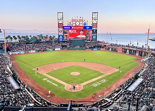
Major League Baseball's San Francisco Giants have played in San Francisco since moving from New York in 1958. The Giants play at Oracle Park, which opened in 2000.[308] The Giants won World Series titles in 2010, 2012, and in 2014. The Giants have boasted stars such as Willie Mays, Willie McCovey, and Barry Bonds (MLB's career home run leader). In 2012, San Francisco was ranked No. 1 in a study that examined which U.S. metro areas have produced the most Major Leaguers since 1920.[309]
The San Francisco 49ers of the National Football League (NFL) began playing in 1946 as an All-America Football Conference (AAFC) league charter member, moved to the NFL in 1950 and into Candlestick Park in 1971. The team left San Francisco in 2014, moving approximately 50 miles south to Santa Clara, and began playing its home games at Levi's Stadium,[310][311] Despite this, the 49ers are still branded as a San Francisco team, and when the team hosted Super Bowl 50 events were hosted in San Francisco such as The annual NFL Experience which was held at the Moscone Center and "Super Bowl City" which opened on January 30 at Justin Herman Plaza on The Embarcadero.[312][313] The 49ers have won five Super Bowl titles between 1982 and 1995.

The NBA's Golden State Warriors have played in the San Francisco Bay Area since moving from Philadelphia in 1962. The Warriors played as the San Francisco Warriors, from 1962 to 1971, before being renamed the Golden State Warriors prior to the 1971–1972 season in an attempt to present the team as a representation of the whole state of California, which had already adopted "The Golden State" nickname.[314] The Warriors' arena, Chase Center, is located in San Francisco.[315] After winning two championships in Philadelphia, they have won five championships since moving to the San Francisco Bay Area,[316] and made five consecutive NBA Finals from 2015 to 2019, winning three of them. They won again in 2022, the franchise's first championship while residing in San Francisco proper.
At the collegiate level, the San Francisco Dons compete in NCAA Division I. Bill Russell led the Dons basketball team to NCAA championships in 1955 and 1956. There is also the San Francisco State Gators, who compete in NCAA Division II.[317] Oracle Park hosted the annual Fight Hunger Bowl college football game from 2002 through 2013 before it moved to Santa Clara.
There are a handful of lower-league soccer clubs in San Francisco playing mostly from April – June.

The Bay to Breakers footrace, held annually since 1912, is best known for colorful costumes and a celebratory community spirit.[318] The San Francisco Marathon attracts more than 21,000 participants.[319] The Escape from Alcatraz triathlon has, since 1980, attracted 2,000 top professional and amateur triathletes for its annual race.[320] The Olympic Club, founded in 1860, is the oldest athletic club in the United States. Its private golf course has hosted the U.S. Open on five occasions. San Francisco hosted the 2013 America's Cup yacht racing competition.[321]
With an ideal climate for outdoor activities, San Francisco has ample resources and opportunities for amateur and participatory sports and recreation. There are more than 200 miles (320 km) of bicycle paths, lanes and bike routes in the city.[322] San Francisco residents have often ranked among the fittest in the country.[323] Golden Gate Park has miles of paved and unpaved running trails as well as a golf course and disc golf course. Boating, sailing, windsurfing and kitesurfing are among the popular activities on San Francisco Bay, and the city maintains a yacht harbor in the Marina District.
San Francisco also has had Esports teams, such as the Overwatch League's San Francisco Shock. Established in 2017,[324] they won two back-to-back championship titles in 2019 and 2020.[325][326]
Parks and recreation
.jpg/500px-Aerial_view_of_San_Francisco,_30_Jun_2018_(cropped).jpg)
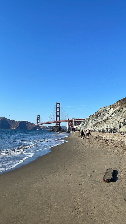
Several of San Francisco's parks and nearly all of its beaches form part of the regional Golden Gate National Recreation Area, one of the most visited units of the National Park system in the United States with over 13 million visitors a year. Among the GGNRA's attractions within the city are Ocean Beach, which runs along the Pacific Ocean shoreline and is frequented by a vibrant surfing community, and Baker Beach, which is located in a cove west of the Golden Gate Bridge, as well as the California Academy of Sciences, a research institute and natural history museum.
The Presidio of San Francisco is the former 18th century Spanish military base, which today is one of the city's largest parks and home to numerous museums and institutions. Also within the Presidio is Crissy Field, a former airfield that was restored to its natural salt marsh ecosystem. The GGNRA also administers Fort Funston, Lands End, Fort Mason, and Alcatraz. The National Park Service separately administers the San Francisco Maritime National Historical Park – a fleet of historic ships and waterfront property around Aquatic Park.[citation needed]


There are more than 220 parks maintained by the San Francisco Recreation & Parks Department.[328] The largest and best-known city park is Golden Gate Park,[329] which stretches from the center of the city west to the Pacific Ocean. Once covered in native grasses and sand dunes, the park was conceived in the 1860s and was created by the extensive planting of thousands of non-native trees and plants. The large park is rich with cultural and natural attractions such as the Conservatory of Flowers, Japanese Tea Garden and San Francisco Botanical Garden.[citation needed]
Lake Merced is a fresh-water lake surrounded by parkland[citation needed] and near the San Francisco Zoo, a city-owned park that houses more than 250 animal species, many of which are endangered.[330] The only park managed by the California State Park system located principally in San Francisco, Candlestick Point was the state's first urban recreation area.[331]
Most of San Francisco's islands are protected as parkland or nature reserves. Alcatraz Island, operated by the National Park Service, is open to the public. The Farallon Islands are protected wildlife refuges. The Seal Rocks are protected as part of Golden Gate National Recreation Area. Red Rock Island is the only privately owned island in San Francisco Bay, but is uninhabited. Yerba Buena Island is largely utilized by the military.
San Francisco is the first city in the U.S. to have a park within a 10-Minute Walk of every resident.[332][333] It also ranks fifth in the U.S. for park access and quality in the 2018 ParkScore ranking of the top 100 park systems across the United States, according to the nonprofit Trust for Public Land.[334]
Government
_(cropped).jpg/500px-San_Francisco_City_Hall_(front)_(cropped).jpg)
The mayor is also the county executive, and the county Board of Supervisors acts as the city council. The government of San Francisco is a charter city and is constituted of two co-equal branches: the executive branch is headed by the mayor and includes other citywide elected and appointed officials as well as the civil service; the 11-member Board of Supervisors, the legislative branch, is headed by a president and is responsible for passing laws and budgets, though San Franciscans also make use of direct ballot initiatives to pass legislation.[335]
Because of its unique city-county status, the local government is able to exercise jurisdiction over certain property outside city limits. San Francisco International Airport, though located in San Mateo County, is owned and operated by the City and County of San Francisco. San Francisco's largest jail complex (County Jail No. 5) is located in San Mateo County, in an unincorporated area adjacent to San Bruno. San Francisco was also granted a perpetual leasehold over the Hetch Hetchy Valley and watershed in Yosemite National Park by the Raker Act in 1913.[336]

The members of the Board of Supervisors are elected as representatives of specific districts within the city.[337] Upon the death or resignation of the mayor, the President of the Board of Supervisors becomes acting mayor until the full Board elects an interim replacement for the remainder of the term. In 1978, Dianne Feinstein assumed the office following the assassination of George Moscone and was later selected by the board to finish the term.[citation needed] In 2011, Ed Lee was selected by the board to finish the term of Gavin Newsom, who resigned to take office as Lieutenant Governor of California.[338] Lee (who won two elections to remain mayor) was temporarily replaced by San Francisco Board of Supervisors President London Breed after he died on December 12, 2017. Supervisor Mark Farrell was appointed by the Board of Supervisors to finish Lee's term on January 23, 2018.
Most local offices in San Francisco are elected using ranked choice voting.[339]
.jpg/500px-San_Francisco_Federal_Building_(main_structure,_seen_from_Mission_and_7th,_2020).jpg)
San Francisco serves as the regional hub for many arms of the federal bureaucracy, including the U.S. Court of Appeals, the Federal Reserve Bank, and the U.S. Mint. Until decommissioning in the early 1990s, the city had major military installations at the Presidio, Treasure Island, and Hunters Point—a legacy still reflected in the annual celebration of Fleet Week. The State of California uses San Francisco as the home of the state supreme court and other state agencies. Foreign governments maintain more than seventy consulates in San Francisco.[340]
The municipal budget for fiscal year 2015–16 was $8.99 billion,[341] and is one of the largest city budgets in the United States.[342] The City of San Francisco spends more per resident than any city other than Washington, D.C., over $10,000 in FY 2015–2016.[342] The city employs around 27,000 workers.[343]
_(cropped).jpg/500px-U.S._Post_Office_&_Courthouse_(San_Francisco)_(cropped).jpg)
In the California State Senate, San Francisco is in the 11th Senate District, represented by Democrat Scott Wiener. In the California State Assembly, it is split between the 17th Assembly District, represented by Democrat Matt Haney, and the 19th Assembly District, represented by Democrat Phil Ting.[344]
In the United States House of Representatives, San Francisco is split between two congressional districts. Most of the city is in the 11th District, represented by Nancy Pelosi (D–San Francisco). A sliver in the southwest is part of the 15th District represented by Kevin Mullin (D–South San Francisco).[345] Pelosi served as the House Speaker from January 3, 2019, to January 3, 2023, a post she also held from 2007 through 2011. She has also held the post of House Minority Leader, from 2003 to 2007 and 2011 to 2019.
Education
Colleges and universities
.jpg/500px-Lone_Mountain_Campus_(cropped).jpg)
The University of California, San Francisco is the sole campus of the University of California system entirely dedicated to graduate education in health and biomedical sciences. It is ranked among the top five medical schools in the United States[346] and operates the UCSF Medical Center, which ranks as the number one hospital in California and the number 5 in the country.[347] UCSF is a major local employer, second in size only to the city and county government.[348][349][350] A 43-acre (17 ha) Mission Bay campus was opened in 2003, complementing its original facility in Parnassus Heights. It contains research space and facilities to foster biotechnology and life sciences entrepreneurship and will double the size of UCSF's research enterprise.[351] All in all, UCSF operates more than 20 facilities across San Francisco.[352]
The University of California College of the Law, San Francisco, founded in Civic Center in 1878, is the oldest law school in California and claims more judges on the state bench than any other institution.[353] San Francisco's two University of California institutions have recently formed an official affiliation in the UCSF/UC Law SF Consortium on Law, Science & Health Policy.[354]
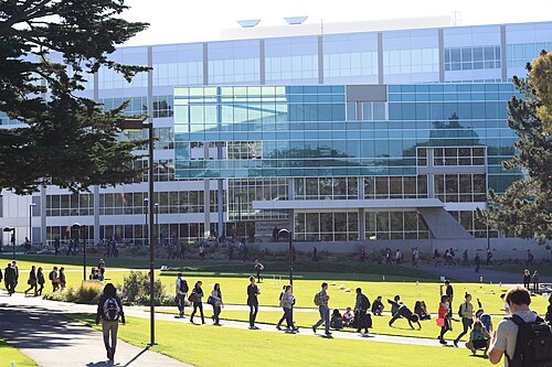
San Francisco State University is part of the California State University system and is located near Lake Merced.[355] The school has approximately 30,000 students and awards undergraduate, master's and doctoral degrees in more than 100 disciplines.[355] The City College of San Francisco, with its main facility in the Ingleside district, is one of the largest two-year community colleges in the country. It has an enrollment of about 100,000 students and offers an extensive continuing education program.[356]

Founded in 1855, the University of San Francisco, a private Jesuit university located on Lone Mountain, is the oldest institution of higher education in San Francisco and one of the oldest universities established west of the Mississippi River.[357] Golden Gate University is a private, nonsectarian university formed in 1901 and located in the Financial District.
With an enrollment of 13,000 students, the Academy of Art University is the largest institute of art and design in the nation.[358] The California College of the Arts, located north of Potrero Hill, has programs in architecture, fine arts, design, and writing.[359] The San Francisco Conservatory of Music, the only independent music school on the West Coast, grants degrees in orchestral instruments, chamber music, composition, and conducting. The San Francisco Art Institute, founded in 1871 and the oldest art school west of the Mississippi,[360] closed in 2022.
The California Culinary Academy, associated with the Le Cordon Bleu program, offers programs in the culinary arts, baking and pastry arts, and hospitality and restaurant management. California Institute of Integral Studies, founded in 1968, offers a variety of graduate programs in its Schools of Professional Psychology & Health, and Consciousness and Transformation.
Primary and secondary schools

Public schools are run by the San Francisco Unified School District, which covers the entire city and county,[361] as well as the California State Board of Education for some charter schools. Lowell High School, the oldest public high school in the U.S. west of the Mississippi,[362] and the smaller School of the Arts High School are two of San Francisco's magnet schools at the secondary level. Public school students attend schools based on an assignment system rather than neighborhood proximity.[363]
Just under 30% of the city's school-age population attends one of San Francisco's more than 100 private or parochial schools, compared to a 10% rate nationwide.[364] Nearly 40 of those schools are Catholic schools managed by the Archdiocese of San Francisco.[365]
San Francisco has nearly 300 preschool programs primarily operated by Head Start, San Francisco Unified School District, private for-profit, private non-profit and family child care providers.[366] All four-year-old children living in San Francisco are offered universal access to preschool through the Preschool for All program.[367]
Media
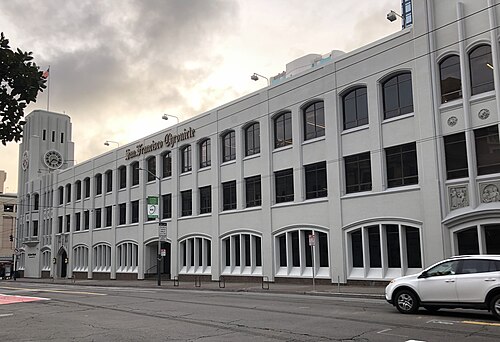
The major daily newspaper in San Francisco is the San Francisco Chronicle, which is currently Northern California's most widely circulated newspaper.[368] The Chronicle is most famous for a former columnist, the late Herb Caen, whose daily musings attracted critical acclaim and represented the "voice of San Francisco." The San Francisco Examiner, once the cornerstone of William Randolph Hearst's media empire and the home of Ambrose Bierce, declined in circulation over the years and now takes the form of a free daily tabloid, under new ownership.[369][370]
Sing Tao Daily claims to be the largest of several Chinese language dailies that serve the Bay Area.[371] SF Weekly is the city's alternative weekly newspaper. San Francisco and 7x7 are major glossy magazines about San Francisco. The national newsmagazine Mother Jones is also based in San Francisco. San Francisco is home to online-only media publications such as SFist, and AsianWeek.

The San Francisco Bay Area is the sixth-largest television market.[372] It is the fourth-largest radio market after that of New York City, Los Angeles, and Chicago.[373] in the U.S.
All major U.S. television networks have affiliates serving the region, with most of them based in the city. CNN, MSNBC, BBC, Russia Today, and CCTV America also have regional news bureaus in San Francisco. Bloomberg West was launched in 2011 from a studio on the Embarcadero and CNBC broadcasts from One Market Plaza since 2015. ESPN uses the local ABC studio for their broadcasting. The regional sports network, Comcast SportsNet Bay Area and its sister station Comcast SportsNet California, are both located in San Francisco. The Pac-12 Network is also based in San Francisco.

Public broadcasting outlets include both a television station and a radio station, both broadcasting under the call letters KQED from a facility near the Potrero Hill neighborhood. KQED-FM is the most-listened-to National Public Radio affiliate in the country.[374]
KUSF is a student-run radio station by college students from the University of San Francisco.[375] Another local broadcaster, KPOO, is an independent, African-American owned and operated noncommercial radio station established in 1971.[376] CNET, founded 1994, and Salon.com, 1995, are based in San Francisco. Sutro Tower is an important broadcast tower located between Mount Sutro and the Twin Peaks, built in 1973 for KTVU, KRON, and KPIX.
Infrastructure
Transportation
Public transportation

Transit is the most used form of transportation every day in San Francisco. Every weekday, more than 560,000 people travel on Muni's 69 bus routes and more than 140,000 customers ride the Muni Metro light rail system.[377] 32% of San Francisco residents use public transportation for their daily commute to work, ranking it fourth in the United States and first on the West Coast.[378] The San Francisco Municipal Railway, primarily known as Muni, is the primary public transit system of San Francisco. As of 2023, Muni is the eighth-largest transit system in the United States.[379] The system operates a combined light rail and subway system, the Muni Metro, as well as large bus and trolley coach networks.[380] Additionally, it runs a historic streetcar line, which runs on Market Street from Castro Street to Fisherman's Wharf.[380] It also operates the famous cable cars,[380] which have been designated as a National Historic Landmark and are a major tourist attraction.[381]
Bay Area Rapid Transit (BART), a regional Rapid Transit system, connects San Francisco with the East Bay and San Jose through the underwater Transbay Tube. The line, which contains all except the Orange Line, runs under Market Street to Civic Center where it turns south to the Mission District, the southern part of the city, and through northern San Mateo County, to the San Francisco International Airport, and Millbrae.[380]BART also shares stations with SFMTA Muni Metro under Market Street.

Another commuter rail system, Caltrain, runs from San Francisco along the San Francisco Peninsula to San Jose.[380] Historically, trains operated by Southern Pacific Lines ran from San Francisco to Los Angeles, via Palo Alto and San Jose.
Amtrak Thruway runs a shuttle bus from three locations in San Francisco to its station across the bay in Emeryville.[382] Additionally, BART offers connections to San Francisco from Amtrak's stations in Emeryville, Oakland and Richmond, and Caltrain offers connections in San Jose and Santa Clara. Thruway service also runs south to San Luis Obispo with connection to the Pacific Surfliner.
San Francisco was an early adopter of carsharing in America. The non-profit City CarShare opened in 2001[383] and Zipcar closely followed.[384]
.jpg/500px-The_Larkspur_Ferry_%E2%80%9CMendocino%E2%80%9D_at_the_San_Francisco_Ferry_Terminal_in_June_of_2023_(cropped).jpg)
San Francisco Bay Ferry operates from the Ferry Building and Pier 39 to points in Oakland, Alameda, Bay Farm Island, South San Francisco, Richmond, and north to Vallejo in Solano County.[385] The Golden Gate Ferry is the other ferry operator with service between San Francisco and Marin County.[386] SolTrans runs supplemental bus service between the Ferry Building and Vallejo.
To accommodate the large amount of San Francisco citizens who commute to the Silicon Valley daily, employers like Genentech, Google, and Apple have begun to provide private bus transportation for their employees, from San Francisco locations. These buses have quickly become a heated topic of debate within the city, as protesters claim they block bus lanes and delay public buses.[387]
Freeways and roads

In 2014, only 41.3% of residents commuted by driving alone or carpooling in private vehicles in San Francisco, a decline from 48.6% in 2000.[388] There are 1,088 miles of streets in San Francisco with 946 miles of these streets being surface streets, and 59 miles of freeways.[388] Due to its unique geography, and the freeway revolts of the late 1950s,[389] Interstate 80 begins at the approach to the Bay Bridge and is the only direct automobile link to the East Bay. U.S. Route 101 connects to the western terminus of Interstate 80 and provides access to the south of the city along San Francisco Bay toward Silicon Valley. Northward, the routing for U.S. 101 uses arterial streets to connect to the Golden Gate Bridge, the only direct automobile link to Marin County and the North Bay.
As part of the retrofitting of the Golden Gate Bridge and installation of a suicide barrier, starting in 2019 the railings on the west side of the pedestrian walkway were replaced with thinner, more flexible slats in order to improve the bridge's aerodynamic tolerance of high wind to 100 mph (161 km/h). Starting in June 2020, reports were received of a loud hum produced by the new railing slats, heard across the city when a strong west wind was blowing.[390]

State Route 1 also enters San Francisco from the north via the Golden Gate Bridge and bisects the city as the 19th Avenue arterial thoroughfare, joining with Interstate 280 at the city's southern border. Interstate 280 continues south from San Francisco, and also turns to the east along the southern edge of the city, terminating just south of the Bay Bridge in the South of Market neighborhood. After the 1989 Loma Prieta earthquake, city leaders demolished the Embarcadero Freeway and a portion of the Central Freeway, converting them into street-level boulevards.[389]
State Route 35 enters the city from the south as Skyline Boulevard and terminates at its intersection with Highway 1. State Route 82 enters San Francisco from the south as Mission Street, and terminates shortly thereafter at its junction with 280. The western terminus of the historic transcontinental Lincoln Highway, the first road across America, is in San Francisco's Lincoln Park.
Vision Zero
In 2014, San Francisco committed to Vision Zero, with the goal of ending all traffic fatalities caused by motor vehicles within the city by 2024.[391] San Francisco's Vision Zero plan calls for investing in engineering, enforcement, and education, and focusing on dangerous intersections. In 2013, 25 people were killed by car and truck drivers while walking and biking in the city and 9 car drivers and passengers were killed in collisions. In 2019, 42 people were killed in traffic collisions in San Francisco.[392]
Airports

Though located 13 miles (21 km) south of downtown in unincorporated San Mateo County, San Francisco International Airport (SFO) is under the jurisdiction of the City and County of San Francisco. SFO is a hub for United Airlines[393] and Alaska Airlines.[394] SFO is a major international gateway to Asia and Europe, with the largest international terminal in North America.[395] In 2011, SFO was the eighth-busiest airport in the U.S. and the 22nd-busiest in the world, handling over 40.9 million passengers.[396]
Located in the South Bay, the San Jose International Airport (SJC) is the second-busiest airport in the Bay Area, followed by San Francisco Bay Oakland International Airport, which is a popular, low-cost alternative to SFO. Geographically, San Francisco Bay Oakland Airport is approximately the same distance from downtown San Francisco as SFO, but due to its location across San Francisco Bay, it is greater driving distance from San Francisco.[citation needed]
Cycling and walking
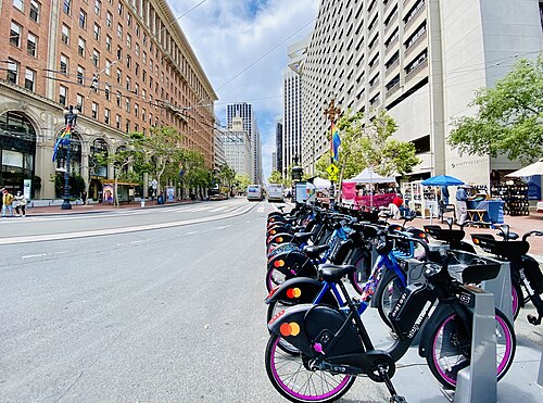
Cycling is a popular mode of transportation in San Francisco, with 75,000 residents commuting by bicycle each day.[397] In recent years,[when?] the city has installed better cycling infrastructure such as protected bike lanes and parking racks.[398] Bay Wheels, previously named Bay Area Bike Share at inception, launched in August 2013 with 700 bikes in downtown San Francisco, selected cities in the East Bay, and San Jose. The San Francisco Municipal Transportation Agency and Bay Area Air Quality Management District are responsible for the operation with management provided by Motivate.[399] A major expansion started in 2017, along with a rebranding as Ford GoBike; the company received its current name in 2019.[400] Pedestrian traffic is also widespread. In 2015, Walk Score ranked San Francisco the second-most walkable city in the United States.[401][402][403]
San Francisco has significantly higher rates of pedestrian and bicyclist traffic deaths than the United States on average. In 2013, 21 pedestrians were killed in vehicle collisions, the highest since 2001,[404] which is 2.5 deaths per 100,000 population – 70% higher than the national average of 1.5.[405]
.jpg/500px-Critical_Mass,_San_Francisco,_April_29,_2005_(cropped).jpg)
Cycling is becoming increasingly popular in the city. The 2010 Municipal Transportation Agency (MTA) annual bicycle count showed the number of cyclists at 33 locations had increased 58% from the 2006 baseline counts.[406] In 2008, the MTA estimated that about 128,000 trips were made by bicycle each day in the city, or 6% of total trips.[407] As of 2019[update], 2.6% of the city's streets have protected bike lanes, with 28 miles of protected bike lanes in the city.[377] Since 2006, San Francisco has received a Bicycle Friendly Community status of "Gold" from the League of American Bicyclists.[408] In 2022 a measure on the ballot passed to protect JFK drive in Golden Gate Park as a pedestrian and biking space with 59% of voters in favor.[409]
Public safety
The San Francisco Police Department was founded in 1849.[410] The portions of the Golden Gate National Recreation Area located within the city, including the Presidio and Ocean Beach, are patrolled by the United States Park Police.
The San Francisco Fire Department provides both fire suppression and emergency medical services to the city.[411]
Sister cities
San Francisco participates in the Sister Cities program.[412] A total of 41 consulates general and 23 honorary consulates have offices in the San Francisco Bay Area.[413]
In January 1980, Mayor Dianne Feinstein signed a sister cities agreement with Shanghai during a visit to China.[414]
Notable people
See also


Notes
- ^ The land grant was near a boat anchorage around what is today Portsmouth Square.
- ^ Station currently at the United States Mint building[145][self-published source?]
- ^ The coordinates of the station are 37°46′14″N 122°25′37″W / 37.7706°N 122.4269°W / 37.7706; -122.4269. Precipitation, high temperature, low temperature, snow, and snow depth records date from October 1, 1849; June 1, 1874; January 1, 1875; January 1, 1876; and January 1, 1922; respectively.
- ^ Mean monthly maxima and minima (i.e. the expected highest and lowest temperature readings at any point during the year or given month) calculated based on data at said location from 1991 to 2020.
- ^ Those not born in the 50 states or D.C., excluding California, Nevada, Utah, Arizona, New Mexico, and Texas before 1850.
References
- ^ a b Garling, Caleb (June 30, 2013). "Don't Call It Frisco: The History of San Francisco's Nicknames". The Bold Italic. Retrieved June 18, 2016.
- ^ "San Francisco's Official Songs". Museum of San Francisco. Retrieved June 17, 2020.
- ^ 'Be it resolved: The official song of the City and County of San Francisco is, and shall remain, "San Francisco." Be it further resolved that henceforth: "I Left My Heart in San Francisco" shall be the official ballad.' San Francisco Administrative Code — Steven Short, KALW Public Media, May 10, 2021, "San Francisco's Two Official Songs Or, The Day Tony Bennett Hid In His Hotel" [1]
- ^ a b c O'Day, Edward F. (October 1926). "The Founding of San Francisco". San Francisco Water. Spring Valley Water Authority. Archived from the original on July 27, 2010. Retrieved February 14, 2009.
- ^ "San Francisco: Government". SFGov.org. Archived from the original on March 16, 2012. Retrieved March 8, 2012.
San Francisco was incorporated as a City on April 15th, 1850 by act of the Legislature.
- ^ "Office of the Mayor : Home". City & County of San Francisco. Archived from the original on October 24, 2009. Retrieved July 11, 2018.
- ^ "Statewide Database". UC Regents. Archived from the original on February 1, 2015. Retrieved November 21, 2014.
- ^ "California's 11th Congressional District". GovTrack. Retrieved January 8, 2023.
- ^ "California's 15th Congressional District". GovTrack. Retrieved January 8, 2023.
- ^ "Board of Supervisors". City and County of San Francisco. Retrieved January 28, 2017.
- ^ "Communities of Interest – City". California Citizens Redistricting Commission. Archived from the original on October 23, 2015. Retrieved September 23, 2014.
- ^ "Members Assembly". California State Assembly. Retrieved September 23, 2014.
- ^ "2019 U.S. Gazetteer Files". United States Census Bureau. Retrieved July 1, 2020.
- ^ "San Francisco". Geographic Names Information System. United States Geological Survey, United States Department of the Interior.
- ^ a b "Elevations and Distances in the United States". US Geological Survey. April 29, 2005. Archived from the original on November 9, 2013. Retrieved October 29, 2014.
- ^ a b c d "QuickFacts: San Francisco city, California". www.census.gov. United States Census Bureau. Retrieved September 10, 2024.
- ^ "List of 2020 Census Urban Areas". census.gov. United States Census Bureau. Retrieved January 8, 2023.
- ^ "Personal Income by County, Metro, and Other Areas". United States Bureau of Economic Analysis. Retrieved December 8, 2022.
- ^ "Metropolitan and Micropolitan Statistical Areas Population Totals and Components of Change: 2020–2021". United States Census Bureau. February 24, 2022. Retrieved August 13, 2022.
- ^ Massara, Graph (February 20, 2018). "If you're from SF, you're a 'San Franciscan.' But what if you're from Fremont? Berkeley? Livermore?". SFGATE. San Francisco. Retrieved July 29, 2023.
- ^ Yip, Isabel (June 20, 2024). "Vietnamese becomes one of San Francisco's official languages". NBC News. Retrieved September 28, 2024.
- ^ "Gross Domestic Product by County and Metropolitan Area". fred.stlouisfed.org.
- ^ "ZIP Codes for City of San Francisco, CA". 2010 United States census. 2010. Archived from the original on October 30, 2020. Retrieved March 14, 2021 – via Zip-Codes.com.
- ^ "NPA City Report". North American Numbering Plan Administration. Archived from the original on November 4, 2014. Retrieved November 5, 2014.
- ^ (/ˌsæn frənˈsɪskoʊ/ SAN frən-SISS-koh; Spanish for 'Saint Francis')
- ^ "GCT-PH1 – Population, Housing Units, Area, and Density: 2010 – County – Census Tract". 2010 United States Census Summary File 1. United States Census Bureau. Archived from the original on February 13, 2020. Retrieved February 8, 2018.
- ^ a b "IPUMS NHGIS | National Historical Geographic Information System". www.nhgis.org. Retrieved December 8, 2023.
- ^ Coy, Owen Cochran (1919). Guide to the County Archives of California. Sacramento, California: California Historical Survey Commission. p. 409.
- ^ a b Montagne, Renée (April 11, 2006). "Remembering the 1906 San Francisco Earthquake". People & Places. NPR. Retrieved June 13, 2008.
- ^ a b "Port of Embarkation Essay—World War II in the San Francisco Bay Area". A National Register of Historic Places Travel Itinerary. US Department of the Interior. August 28, 2007. Archived from the original on June 24, 2011. Retrieved June 22, 2011.
- ^ "Charter of the United Nations | United Nations". Un.org. August 10, 2015. Retrieved December 29, 2016.
- ^ "History of the United Nations". Un.org. United Nations. August 21, 2015. Archived from the original on December 12, 2016. Retrieved December 29, 2016.
- ^ Schlesinger, Stephen (June 19, 2015). "San Francisco – the birthplace of the United Nations". San Francisco Chronicle. Retrieved December 29, 2016.
- ^ "Top 200 Science cities". Nature Index. Retrieved August 17, 2019.
- ^ "The Global Creative Economy Is Big Business". Retrieved August 17, 2019.
- ^ "2022 Best Global Universities Rankings". U.S. News & World Report.
- ^ "Regional Data: GDP and Personal Income". apps.bea.gov. Retrieved June 18, 2022.
- ^ "Metropolitan areas". stats.oecd.org. Retrieved September 17, 2022.
- ^ U.S. Bureau of Labor Statistics (January 1, 1947). "Consumer Price Index for All Urban Consumers: All Items in U.S. City Average". FRED, Federal Reserve Bank of St. Louis. Retrieved June 18, 2022.
- ^ "World Economic Outlook Database, April 2022". IMF. Retrieved June 18, 2022.
- ^ a b "Gross Domestic Product by County, 2022 | U.S. Bureau of Economic Analysis (BEA)". www.bea.gov. Retrieved December 8, 2023.
- ^ "The Global Financial Centres Index 34". www.longfinance.net. Retrieved December 8, 2023.
- ^ a b Morris, J.D. (October 30, 2023). "London Breed vs. the 'doom loop': How will S.F.'s mayor solve her biggest political problem?". San Francisco Chronicle. Retrieved November 5, 2023.
- ^ Wiley, Hannah (May 22, 2024). "All is lost in San Francisco? City loyalists take issue with naysayers. Data may back them up". Los Angeles Times. Retrieved April 4, 2024.
- ^ "America's 10 most visited cities", World Atlas, November 14, 2023
- ^ "San Francisco Travel Association Announces 2022 Results and 2023 Forecast" (Press release). San Francisco Travel. March 21, 2023. Retrieved December 7, 2023.
- ^ "Top U.S. Destinations for International Visitors". The Hotel Price Index. Archived from the original on March 27, 2014. Retrieved April 12, 2014.
- ^ Leins, Casey (April 3, 2019). "The 10 Best Cities for Public Transportation". USNews. Retrieved February 7, 2023.
- ^ "Direct flights from San Francisco (SFO) – FlightConnections". www.flightconnections.com. Retrieved February 7, 2023.
- ^ a b Brinklow, Adam (January 26, 2018). "Is it ever okay to use "San Fran?"". Curbed SF. Retrieved February 17, 2020.
- ^ "Don't Call It 'Frisco': The History of San Francisco's Nicknames". The Bold Italic. December 20, 2019. Retrieved February 17, 2020.
- ^ Gilson, Dave. "Why San Francisco's "Frisco" debate will never, ever die". Mother Jones. Retrieved February 17, 2020.
- ^ Stewart, Suzanne B. (November 2003). "Archaeological Research Issues for the Point Reyes National Seashore – Golden Gate National Recreation Area" (PDF). Sonoma State University – Anthropological Studies Center. Retrieved June 12, 2008.
- ^ "Visitors: San Francisco Historical Information". City and County of San Francisco. n.d. Archived from the original on March 1, 2006. Retrieved June 10, 2008.
- ^ Billiter, Bill (January 1, 1985). "3,000-Year-Old Connection Claimed : Siberia Tie to California Tribes Cited". Los Angeles Times. Retrieved September 25, 2023.
- ^ "Indigenous Peoples of San Mateo County". San Mateo County Office of Education. Retrieved January 18, 2024.
- ^ "The Association of Ramaytush Ohlone". The Association of Ramaytush Ohlone. Retrieved January 18, 2024.
- ^ "The Ramaytush Ohlone – Lessons on stewardship from the ancestral stewards of the Peninsula". Golden Gate National Parks Conservancy. December 4, 2018. Retrieved January 18, 2024.
- ^ Raup, H. F. (1948). "The Delayed Discovery of San Francisco Bay". California Historical Society Quarterly. 27 (4): 293. doi:10.2307/25156125. JSTOR 3816007. Retrieved November 12, 2020.
- ^ Cleary, Brother Guire (January 31, 2003). "Mission Dolores Links San Francisco with its 18th Century Roots – Founded as La Mission San Francisco De Asis by Franciscans, it survived earthquake and fire". Catholic San Francisco. Archived from the original on February 5, 2007. Retrieved March 23, 2007.
- ^ a b Kamiya, Gary (August 23, 2013). "Juana Briones – San Francisco's founding mother". SFGATE.
- ^ a b c "From 1820 to the Gold Rush", at San Francisco Museum.org, accessed 2022.06.03.
- ^ Cf., Richard Henry Dana Jr., Two Years before the Mast (1840).
- ^ The Virtual Museum of the City of San Francisco (July 16, 2004). "From the 1820s to the Gold Rush". The Virtual Museum of the City of San Francisco. Archived from the original on October 22, 2009. Retrieved June 13, 2008.
- ^ "san_francisco_history:san_francisco_census_1842 [SFgenealogy]". www.sfgenealogy.org. Retrieved June 18, 2022.
- ^ Wiley, Peter Booth (2000). National trust guide- San Francisco: America's guide for architecture and history travelers. New York: John Wiley & Sons, Inc. pp. 4–5. ISBN 978-0-471-19120-9. OCLC 44313415.
- ^ Sourdough bread was a staple of western explorers and miners of the 19th century. It became an iconic symbol of San Francisco, and is still a staple of city life today.Tamony, Peter (October 1973). "Sourdough and French Bread". Western Folklore. 32 (4): 265–270. doi:10.2307/1498306. ISSN 0043-373X. JSTOR 1498306.
- ^ "San Francisco's First Brick Building". The Virtual Museum of the City of San Francisco. July 16, 2004. Retrieved June 13, 2008.
- ^ Richards, Rand (1992). Historic San Francisco: A Concise History and Guide. Heritage House. ISBN 978-1-879367-00-5. OCLC 214330849.
- ^ Harris, Ron (November 14, 2005). "Crews Unearth Shipwreck on San Francisco Condo Project". Associated Press. Retrieved September 4, 2006.
- ^ Filion, Ron S. "Buried Ships". SFgenealogy. Retrieved April 19, 2016.
- ^ Report of Committee on Counties, January 4, 1850, revised to 27 counties on February 18, 1850 – Coy, Owen C. (1923). California County Boundaries. Berkeley: California Historical Survey Commission. pp. 1–2.
- ^ Statutes of California and Digests of Measures. J. Winchester. 1856. p. 145.
- ^ Mathews, Joe (April 16, 2023). "Don't bank on California, especially when banks are involved". San Francisco Chronicle.
- ^ Wiley, Peter Booth (2000). National trust guide- San Francisco: America's guide for architecture and history travelers. New York: John Wiley & Sons, Inc. pp. 31–33. ISBN 978-0-471-19120-9. OCLC 44313415.
- ^ "The miners came in forty-nine, / The whores in fifty-one, / And when they got together / They produced the native son." Wiley, Peter Booth (2000). National trust guide- San Francisco: America's guide for architecture and history travelers. New York: John Wiley & Sons, Inc. pp. 237–238. ISBN 978-0-471-19120-9. OCLC 44313415.
- ^ "William Ralston - FoundSF". www.foundsf.org. Retrieved August 8, 2024.
- ^ Calic, Dan (January 5, 2024). "Blog: How The Mighty Fall. The Story of William C. Ralston". Redwood City Pulse. Retrieved August 8, 2024.
- ^ Construction of the Pacific Railroad was partially (albeit reluctantly) funded by the City and County of San Francisco Pacific Railroad Bond issue under the provisions of "An Act to Authorize the Board of Supervisors of the City and County of San Francisco to take and subscribe One Million Dollars to the Capital Stock of the Western Pacific Rail Road Company and the Central Pacific Rail Road Company of California and to provide for the payment of the same and other matters relating thereto." approved on April 22, 1863, as amended by §5 of the "Compromise Act of 1864" approved on April 4, 1864. The bond issue was objected to by the Mayor and the Board of Supervisors, however, and they were not delivered to the WPRR and CPRR until 1865 after Writs of Mandamus ordering such were issued by the Supreme Court of the State of California in 1864 ("The People of the State of California on the relation of the Central Pacific Railroad Company vs. Henry P. Coon, Mayor; Henry M. Hale, Auditor; and Joseph S. Paxson, Treasurer, of the City and County of San Francisco" 25 Cal 635) and 1865 ("The People ex rel The Central Pacific Railroad Company of California vs. The Board of Supervisors of the City and County of San Francisco, and Wilhelm Lowey, Clerk" 27 Cal 655)
- ^ "IPUMS USA". usa.ipums.org. Retrieved June 18, 2022.
- ^ "Under Three Flags" (PDF). Golden Gate National Recreation Area Brochures. US Department of the Interior. November 2004. Retrieved June 22, 2011.
- ^ Wiley, Peter Booth (2000). National trust guide- San Francisco: America's guide for architecture and history travelers. New York: John Wiley & Sons, Inc. pp. 44–55. ISBN 978-0-471-19120-9. OCLC 44313415.
- ^ Kalisch, Philip A. (Summer 1972). "The Black Death in Chinatown: Plague and Politics in San Francisco 1900–1904". Arizona and the West. 14 (2): 113–136. JSTOR 40168068. PMID 11614219.
- ^ "1906 Earthquake: Fire Fighting". Golden Gate National Recreation Area. US Department of the Interior. December 24, 2003. Retrieved June 13, 2008.
- ^ "Casualties and Damage after the 1906 earthquake". Earthquake Hazards Program – Northern California. US Geological Survey. January 25, 2008. Retrieved June 13, 2008.
- ^ "1906 Earthquake and the Army". Golden Gate National Recreation Area. US Department of the Interior. August 25, 2004. Retrieved June 13, 2008.
- ^ "Jack London Writes of the 1906 San Francisco Earthquake and Fire". Sfmuseum.org. May 5, 1906. Retrieved June 15, 2013.
- ^ Wiley, Peter Booth (2000). National trust guide- San Francisco: America's guide for architecture and history travelers. New York: John Wiley & Sons, Inc. pp. 56–62. ISBN 978-0-471-19120-9. OCLC 44313415.
- ^ "SPUR Our Mission and History". Retrieved March 26, 2013.
- ^ O'Brien, Tricia (2008). San Francisco's Pacific Heights and Presidio Heights. San Francisco: Arcadia Publishing. p. 7. ISBN 978-0-7385-5980-3.
- ^ Wiley, Peter Booth (2000). National trust guide- San Francisco: America's guide for architecture and history travelers. New York: John Wiley & Sons, Inc. p. 9. ISBN 978-0-471-19120-9. OCLC 44313415.
- ^ "Virtual Museum of the City of San Francisco – M.M. O'Shaughnessy Employed as City Engineer". Retrieved March 16, 2013.
- ^ "San Francisco Gold Rush Banking – 1849". The Virtual Museum of the City of San Francisco. June 24, 2004. Archived from the original on May 9, 2008. Retrieved June 13, 2008.
- ^ "Treasure Island History". timuseum. Retrieved August 5, 2021.
- ^ Kamiya, Gary (August 19, 2022). "The dark past of San Francisco's Sharp Park". San Francisco Chronicle. Archived from the original on August 19, 2022. Retrieved June 9, 2023.
- ^ Price, John (June 2001). "A Just Peace? The 1951 San Francisco Peace Treaty in Historical Perspective". Japan Policy Research Institute. Archived from the original on December 7, 2020. Retrieved December 8, 2020.
- ^ Fang, Eric (February 1999). "Urban Renewal Revisited: A Design Critique". SPUR Newsletter. San Francisco Planning and Urban Research Association. Archived from the original on October 11, 2009. Retrieved August 3, 2009.
- ^ Rubin, Jasper (November 1999). "The Decline of the Port – A look at the transformation of the Port of San Francisco". SPUR Newsletter. Retrieved January 5, 2013.
The final, insurmountable decline in San Francisco's shipping activity was heralded in 1958 by the departure of the first containerized freighter from San Francisco Bay.
- ^ Terplan, Egon (June 7, 2010). "Organizing for Economic Growth – A new approach to business attraction and retention in San Francisco". SPUR Report. Retrieved January 5, 2013.
During the 1960s and 1970s San Francisco's historic maritime industry relocated to Oakland. ... San Francisco remained a center for business and professional services (such as consulting, law, accounting and finance) and also successfully developed its tourism sector, which became the leading local industry.
- ^ Willis, James; Habib, Jerry; Brittan, Jeremy (April 19, 2004). "San Francisco Planning Department Census Data Analysis". San Francisco State University. Archived from the original (PPT) on July 18, 2011. Retrieved June 13, 2008.
- ^ Minton, Torri (September 20, 1998). "Race Through Time". San Francisco Chronicle. p. SC-4. Retrieved September 11, 2013.
- ^ Wiley, Peter Booth (2000). National trust guide- San Francisco: America's guide for architecture and history travelers. New York: John Wiley & Sons, Inc. pp. 240–242. ISBN 978-0-471-19120-9. OCLC 44313415.
- ^ "American Experience: Summer of Love: Film Description". Website for American Experience documentary on the Summer of Love. PBS. March 14, 2007. Archived from the original on June 5, 2008. Retrieved June 17, 2008.
- ^ "Fear in the Streets of San Francisco". Time. April 29, 1974. Archived from the original on December 3, 2008. Retrieved August 28, 2006.
- ^ "San Francisco History: The 1970s and 1980s: Gay Rights". Destinations: San Francisco. Frommers.com. Archived from the original on July 18, 2001. Retrieved June 17, 2008.
- ^ "Pyramid Facts and Figures". Company Profile. Transamerica Insurance and Investment Group. Retrieved June 13, 2008.
- ^ Wiley, Peter Booth (2000). National trust guide- San Francisco: America's guide for architecture and history travelers. New York: John Wiley & Sons, Inc. pp. 95–96. ISBN 978-0-471-19120-9. OCLC 44313415.
- ^ Fagan, Kevin (August 4, 2006). "S.F.'s Homeless Aging on the Street / Chronic health problems on the rise as median age nears 50". San Francisco Chronicle. Retrieved March 6, 2012.
The findings support what many social workers have long suspected – that there was a "big bang" homeless population explosion as federal housing programs were slashed and the closing of mental hospitals hit home in the mid-1980s and that this core group constitutes the bulk of the street population.
- ^ "Hayes Valley Neighborhood Association". Hayes Valley Neighborhood Association. Retrieved August 5, 2021.
- ^ Nieves, Evelyn (November 5, 2000). "Mission District Fights Case of Dot-Com Fever". The New York Times. Retrieved March 5, 2012.
- ^ Nolte, Carl (January 2, 2008). "High-rises are a sign of the times in changing San Francisco". San Francisco Chronicle. Retrieved July 9, 2012.
- ^ Egan, Ted (April 3, 2006). "City and County of San Francisco: An Overview of San Francisco's Recent Economic Performance" (PDF). Report prepared for Mayor's Office of Economic and Workforce Development. ICF Consulting. Archived from the original (PDF) on February 1, 2009. Retrieved June 19, 2008.
Another positive trend for the future is San Francisco's highly entrepreneurial, flexible and innovative economy...San Francisco's very high reliance on small business and self-employment is typical of other dynamic, fast-growing, high-technology areas across the country.
- ^ Carlton, Jim; Bindley, Katherine (August 13, 2023). "Can San Francisco Save Itself From the Doom Loop?". The Wall Street Journal. Retrieved November 5, 2023.
- ^ Weil, Elizabeth (May 10, 2023). "Spiraling in San Francisco's Doom Loop". Curbed. Retrieved November 5, 2023.
What it's like to live in a city that no longer believes its problems can be fixed.
- ^ Wiley, Hannah (January 16, 2024). "All is lost in San Francisco? City loyalists take issue with naysayers. Data may back them up". Los Angeles Times. Retrieved April 4, 2024.
- ^ King, John (March 3, 2024). "Union Square once was the center of San Francisco. Now it's off the map". San Francisco Chronicle. Retrieved March 9, 2024.
- ^ Li, Roland (June 16, 2023). "Westfield gives up on SF while Silicon Valley mall has record sales". San Francisco Chronicle. Retrieved March 9, 2024.
- ^ "NPGallery Search". National Park Service. Retrieved April 2, 2023.
- ^ Graham, Tom (November 7, 2004). "Peak Experience". San Francisco Chronicle. Hearst Communications. p. PK-23. Retrieved June 13, 2008.
- ^ Lee, Henry K. (January 16, 1997). "Mount Davidson Cross Called Landmark by Panel". San Francisco Chronicle. Retrieved June 17, 2008.
- ^ Smith, Charles (April 15, 2006). "What San Francisco didn't learn from the '06 quake". San Francisco Chronicle. Retrieved June 30, 2008.
- ^ Selna, Robert (June 29, 2008). "S.F. leaders ignore weak buildings' quake risk". San Francisco Chronicle. p. A-1. Retrieved June 30, 2008.
- ^ California Earthquake forecast – UCERF3 – USGS Factsheet (non-technical) Mar, 2015. predicts Earthquake risk for 30 years in California, California earthquake forecast.
- ^ "Liquefaction Damage in the Marina District during the 1989 Loma Prieta earthquake" (PDF). California Geological Survey. Retrieved June 17, 2008.
- ^ Baume, Matt (April 14, 2010). "The Lure of the Creeks Buried Beneath San Francisco's Streets". Streetsblog San Francisco. Retrieved January 31, 2013.
- ^ The Official San Francisco Chinatown Website. Sanfranciscochinatown.com. Retrieved February 16, 2012.
- ^ Depicting Otherness: Images of San Francisco's Chinatown. College Street Journal (October 11, 2002). Retrieved February 16, 2012.
- ^ Bacon, Daniel: Walking the Barbary Coast Trail 2nd ed., pp. 52–53, Quicksilver Press, 1997
- ^ "Chinatown/Grant Avenue". Archived from the original on June 15, 2011. Retrieved August 31, 2010.. San Francisco Days
- ^ Dineen, J.K. (December 9, 2015). "S.F. supervisors OK Warriors arena for Mission Bay". SFGATE. Hearst Communications, Inc. Retrieved February 8, 2016.
- ^ "Haight-Ashbury's Hippie House: Preserving San Francisco's 1960s Counterculture | National Trust for Historic Preservation". savingplaces.org. Retrieved August 5, 2021.
- ^ "The Haight". The San Francisco Chronicle. Retrieved August 3, 2009.
- ^ Bishop, Katherine (October 13, 1988). "Haight-Ashbury Journal; Love and Hate Linger in Ex-Hippie District". The New York Times. Retrieved August 3, 2009.
- ^ "The Marina". SFGate San Francisco Neighborhood Guide. October 27, 2011. Retrieved August 20, 2013.
- ^ Morgan, Benjamin (Director) (2007). "Quality of Life (film website)". Mission District History. Retrieved July 25, 2010.
- ^ "The Castro". The San Francisco Chronicle. Retrieved August 3, 2009.
- ^ Chow, Andrew (March 22, 2002). "Dismal APA Turnout at First Redistricting Meetings". Asian Week.
- ^ Climate of San Francisco: Narrative Description Golden Gate Weather Services. Retrieved September 5, 2006.
- ^ "San Francisco climate: Average Temperature, weather by month, San Francisco water temperature - Climate-Data.org". en.climate-data.org. Retrieved August 5, 2021.
- ^ Osborn, Liz. "Coolest US Cities in Summer". Weather Extremes. Current Results Nexus. Archived from the original on July 24, 2010. Retrieved July 25, 2010.
- ^ Gilliam, Harold (July–September 2002). "Cutting Through the Fog: Demystifying the Summer Spectacle". Bay Nature.
- ^ a b c d e f g h "NOAA Climate Data". National Oceanic and Atmospheric Administration. Retrieved February 6, 2019.
- ^ Climate of San Francisco: Snowfall Golden Gate Weather Services. Retrieved December 3, 2006.
- ^ Hartlaub, Peter (November 29, 2012). "Blizzard of awesome: The San Francisco snowfall of 1976". San Francisco Chronicle. Retrieved February 1, 2013.
- ^ Dudley, Andrew (May 1, 2014). "Secretly Awesome: The Lower Haight Weather Station". hoodline.
- ^ Ruberstein, Steve; Asimov, Nanette; Lyons, Jenna (September 1, 2017). "San Francisco hits 106 degrees – shatters all-time record". San Francisco Chronicle. Retrieved September 2, 2017.
- ^ "NOWData for San Francisco, CA forecast office". NOAA. Retrieved July 26, 2022.
- ^ "San Fran Mission Dolore, California (047772) Period of Record General Climate Summary – Temperature". Western Regional Climate Center. Desert Research Institute. 2010. Archived from the original on May 13, 2011. Retrieved July 25, 2010. (Main page)
- ^ Tuma, Drew; Didion, Tim (August 10, 2021). "UN climate report puts focus on sea level rise threat to San Francisco Bay". ABC7 San Francisco. Retrieved January 31, 2022.
- ^ Agricultural Research Center, PRISM Climate Group Oregon State University. "USDA Plant Hardiness Zone Map". USDA. Archived from the original on February 27, 2014. Retrieved February 24, 2014.
- ^ "California Interactive USDA Plant Hardiness Zone Map". Retrieved December 19, 2016.
- ^ "Summary of Monthly Normals 1991–2020". National Oceanic and Atmospheric Administration. Retrieved May 5, 2021.
- ^ "Station Name: CA SAN FRANCISCO DWTN". National Oceanic and Atmospheric Administration. Retrieved March 18, 2014.
- ^ "San Francisco/Mission Dolores, CA Climate Normals 1961–1990". National Oceanic and Atmospheric Administration. Retrieved April 23, 2013.
- ^ "San Francisco holiday weather". Met Office. Retrieved September 18, 2017.
- ^ "Climate and monthly weather forecast San Francisco, CA". Retrieved August 16, 2022.
- ^ Broughton, Jack M. (1994). "Declines in Mammalian Foraging Efficiency during the Late Holocene, San Francisco Bay, California". Journal of Anthropological Archaeology. 13 (4): 371–401. doi:10.1006/jaar.1994.1019. Retrieved May 27, 2020.
- ^ McCrossin, M. (1982). "Paleoecological inferences from a faunal analysis of CA-SFr-07". Journal of California and Great Basin Anthropology. 4: 138–141.
- ^ Bolton, Herbert Eugene (1930). Anza's California Expeditions. Vol. I. An Outpost of Empire. Berkeley, California: University of California Press. p. 393.
- ^ Dana Jr., Richard Henry (1840). Two Years Before the Mast. A Personal Narrative. New York: Harper and Brothers. p. 270. ISBN 9781441405401.
- ^ "QuickFacts: San Francisco County, California". US Census Bureau. Archived from the original on January 16, 2019. Retrieved April 5, 2019.
- ^ "Historical Census Statistics on Population Totals By Race, 1790 to 1990, and By Hispanic Origin, 1970 to 1990, For Large Cities And Other Urban Places in the United States". U.S. Census Bureau. Archived from the original on August 12, 2012. Retrieved December 18, 2011.
- ^ a b c "QT-P3 – Race and Hispanic or Latino Origin: 2010". 2010 United States Census Summary File 1. United States Census Bureau. Archived from the original on February 12, 2020. Retrieved July 11, 2011.
- ^ "Training and Education /PET". Filipino-American Law Enforcement Officers Association. Archived from the original on January 16, 2013. Retrieved April 28, 2012.
- ^ a b "Interactive: Mapping the census". The Washington Post. Archived from the original on May 13, 2011. Retrieved February 9, 2012.
- ^ "2020 Census: As San Francisco grew, the ethnic makeup of its neighborhoods changed. Here's how". September 27, 2021.
- ^ a b Ghert Zand, Renee (February 14, 2018). "Vast, young San Fran Jewish community is growing — but unaffiliated, says study". The Times of Israel. Times of Israel. Retrieved July 13, 2022.
- ^ "THE GUIDE TO JEWISH HERITAGE IN SAN FRANCISCO". San Francisco Travel Association. SF Travel. Retrieved July 13, 2022.
- ^ Shvetsky, Kate. "The Fillmore: A Jewish Neighborhood in the 1920s". Found SF. Retrieved July 13, 2022.
- ^ a b "IPUMS USA". usa.ipums.org. Retrieved February 25, 2022.
- ^ Bureau, US Census. "Race and Ethnicity in the United States: 2010 Census and 2020 Census". Census.gov. Retrieved February 25, 2022.
{{cite web}}:|last=has generic name (help) - ^ Major U.S. metropolitan areas differ in their religious profiles, Pew Research Center
- ^ "America's Changing Religious Landscape". Pew Research Center: Religion & Public Life. May 12, 2015.
- ^ "Chung: Chinese 'peasant' dialect redeemed – The Mercury News". December 22, 2007. Retrieved December 19, 2016.
- ^ "Chinatown Decoded: What Language Is Everybody Speaking?". Retrieved December 19, 2016.
- ^ "San Francisco County, California". Modern Language Association. Retrieved April 25, 2023.
- ^ a b c d e Pamuk, Ayse (Fall 2017). "Geography of immigrant clusters in global cities: a case study of San Francisco". International Journal of Urban and Regional Research. 28 (2): 287–307. doi:10.1111/j.0309-1317.2004.00520.x.
- ^ "A Guide to San Francisco's Most Expensive Neighborhoods". www.california.com.
- ^ "The brainpower of America's largest cities". Bizjournals.com (data interpreted from U.S. Census). 2006. Archived from the original on July 1, 2006. Retrieved August 5, 2010.
- ^ Winter, Michael (June 9, 2010). "New measure ranks San Francisco the 'smartest' U.S. city". USA Today. Retrieved August 5, 2010.
- ^ Gates, Gary (October 2006). "Same-sex Couples and the Gay, Lesbian, Bisexual Population: New Estimates from the American Community Survey" (PDF). The Williams Institute, UCLA School of Law. Archived from the original (PDF) on July 2, 2007. Retrieved July 10, 2008.
- ^ "Gay and Lesbian Families in the United States: Same-Sex Unmarried Partner Households" (PDF). Human Rights Campaign. Archived from the original (PDF) on April 13, 2008. Retrieved August 26, 2006.
- ^ "Median Household Income (In 2003 Inflation-adjusted Dollars) (Place Level)". U.S. Census Bureau. August 22, 2007. Archived from the original on December 9, 2004. Retrieved June 23, 2009.
- ^ a b "QuickFacts: San Francisco County, California". United States Census Bureau. Archived from the original on July 13, 2011. Retrieved July 11, 2011.
- ^ Sankin, Aaron (March 9, 2012). "Families Flee San Francisco: City Has Lowest Percentage Of Kids Of Any Major U.S. City". HuffPost. Retrieved August 8, 2018.
- ^ Hendrix, Michael (November 21, 2018). "Young Americans' loneliness sets the table for Friendsgiving". The Washington Post. Retrieved November 21, 2018.
- ^ "Economic Characteristics". 2005–2009 American Community Survey 5-Year Estimates – Data Profile Highlights. U.S. Census Bureau. 2007. Archived from the original on February 11, 2020. Retrieved January 9, 2015.
- ^ "Deinstitutionalization: A Psychiatric 'Titanic'". PBS. Archived from the original on July 20, 2014. Retrieved August 9, 2014.
- ^ "San Francisco Program Combats Homelessness with Innovation". PBS. April 5, 2005. Archived from the original on January 10, 2012. Retrieved September 6, 2007.
- ^ Pratt, Timothy (August 12, 2006). "Critics say regional plan won't solve the problem". Las Vegas Sun. Retrieved August 30, 2006.
- ^ Carcamo, Cindy; Mather, Kate; Smith, Dakota (November 15, 2016). "Trump's crackdown on illegal immigration leaves a lot unanswered for sanctuary cities like L.A." Los Angeles Times. Retrieved December 5, 2019.
- ^ Buchanan, Wyatt (November 14, 2007). "S.F. supervisors approve ID cards for residents". San Francisco Chronicle. Retrieved April 17, 2019.
- ^ Saunders, Debra (August 9, 2015). "San Francisco's summer of urine and drug-addicted homeless". San Francisco Gate. Retrieved March 17, 2017.
- ^ a b "2019 San Francisco Homeless Count Report" (PDF). 2019.
- ^ a b Graff, Amy (January 24, 2018). "UN expert on San Francisco homelessness: 'I couldn't help but be completely shocked'". SFGATE. Retrieved August 6, 2018.
- ^ "City & County of San Francisco, California Mayor's 2020–2021 & 2021–2022 Proposed Budget" (PDF). Archived from the original (PDF) on October 21, 2023.
- ^ "San Francisco sanctions once-shunned homeless encampments". ABC News. May 23, 2020.[dead link]
- ^ Zaveri, Paayal (April 5, 2023). "San Francisco's homicide rate is low compared to other big cities, but the killing of tech founder Bob Lee shows that doesn't tell the whole story". Business Insider. Insider Inc.
- ^ Bulwa, Demian (January 5, 2012). "Through hard times, S.F. killings at historic lows". San Francisco Chronicle. Retrieved July 29, 2013.
- ^ "San Francisco crime rates and statistics". NeighborhoodScout. Retrieved July 29, 2013.
- ^ "The Tenderloin". FoundSF. Retrieved July 29, 2013.
- ^ Ho, Vivian (July 4, 2015). "Bay Area homicide rates remain low". San Francisco Chronicle.
- ^ Bodley, Michael (January 4, 2017). "SF cops say they notch 2 arrests in last 2 homicides of 2016." SFGate. Retrieved January 17, 2017.
- ^ Shaban, Bigad; Campos, Robert; Carroll, Jeremy; Villarreal, Mark (November 17, 2021). "Breaking Point: SF Suffers Highest Rate of Car Break-Ins Compared to Atlanta, DC, Dallas, LA". nbcbayarea.com. Retrieved July 12, 2022.
- ^ Knight, Heather (August 14, 2018). "It's no laughing matter — SF forming Poop Patrol to keep sidewalks clean". San Francisco Chronicle. Retrieved August 15, 2018.
- ^ Questions Raised After Suspect In Dozens Of Hate Crimes On SF Asian Businesses Found To Be Out Of Custody, CBS News, January 26, 2022, Archive
- ^ "La Mara Salvatrucha Street Gang". SF Weekly. Archived from the original on July 26, 2013. Retrieved July 29, 2013.
- ^ Bulwa, Demian (May 27, 2005). "SAN FRANCISCO / Sureño gang's threat growing in Bay Area / Widow's apartment is at heart of group's Mission District turf". San Francisco Chronicle. Retrieved March 29, 2014.
- ^ Samaha, Albert (September 26, 2012). "Crip-less: S.F.'s Dislike of Franchises Extends to Street Gangs – Page 1 – News – San Francisco". SF Weekly. Retrieved July 29, 2013.
- ^ Roberts, Chris (December 2015). "Mario Woods and Gang Injunctions". SF Weekly. Archived from the original on September 18, 2016. Retrieved September 5, 2016.
- ^ Mary Spicuzza (August 1, 2007). "Enter The Dragon". SF Weekly. Archived from the original on September 19, 2016. Retrieved September 5, 2016.
- ^ Greschler, Gabe (April 23, 2024). "Crime is falling in San Francisco. Try telling that to voters". The San Francisco Standard. Retrieved July 25, 2024.
{{cite news}}: CS1 maint: url-status (link) - ^ "San Francisco Crime 2024 - KQED". kqed.org. July 18, 2024. Retrieved September 5, 2024.
- ^ Arroyo, Noah (June 10, 2022). "Downtown S.F. on the brink: It's worse than it looks". San Francisco Chronicle. Retrieved September 8, 2023.
- ^ a b "Industry Employment & Labor Force – by Annual Average for San Francisco County". California Employment Development Department. 2016.
- ^ U.S. Bureau of Economic Analysis (January 1, 2001). "Total Real Gross Domestic Product for San Francisco-Oakland-Hayward, CA (MSA)". FRED, Federal Reserve Bank of St. Louis. Retrieved January 5, 2021.
- ^ a b "GDP by County, Metro, and Other Areas". Bea.gov. Retrieved March 27, 2021.
- ^ "Personal Income by County, Metro, and Other Areas | U.S. Bureau of Economic Analysis (BEA)". Bea.gov. Retrieved January 5, 2021.
- ^ a b Federal Writers' Project of the Works Progress Administration of Northern California (2011). San Francisco in the 1930s: The WPA Guide to the City by the Bay. University of California Press. p. 114. ISBN 978-0-520-26880-7.
- ^ "San Francisco: Economy". City-Data.com. Retrieved June 15, 2008.
- ^ "Fortune 500". Fortune magazine, Time Inc. 2013. Archived from the original on March 27, 2014. Retrieved April 6, 2014.
- ^ "The World According to GaWC 2012". Globalization and World Cities (GaWC) Study Group and Network. Loughborough University. Retrieved January 25, 2014.
- ^ "The Global Financial Centres Index 21" (PDF). China Development Institute. March 2017. Archived from the original (PDF) on September 18, 2018. Retrieved September 4, 2018.
- ^ a b Waters, Rob (May 15, 2009). "Biotech Jobs Germinate as San Francisco Diversifies Economy". Bloomberg. Archived from the original on October 23, 2015.
- ^ Warburg, Jennifer (February 27, 2014). "Forecasting San Francisco's Economic Fortunes". SPUR. Retrieved April 6, 2014.
- ^ Selna, Robert (May 15, 2008). "New jobs, houses spur S.F. population in 2007". San Francisco Chronicle. p. B-1. Retrieved June 14, 2008.
- ^ Garland, Russ (February 27, 2014). "As Bay Area Investment Shifts North, Institutional Venture Partners Opens San Francisco Office". The Wall Street Journal. Retrieved April 11, 2014.
- ^ Florida, Richard (March 31, 2014). "Startup City: The Urban Shift in Venture Capital and High Technology". Martin Prosperity Institute, Rotman School of Management, University of Toronto. Archived from the original on April 5, 2014. Retrieved April 6, 2014.
- ^ Florida, Richard (September 8, 2012). "San Francisco's urban tech boom". San Francisco Chronicle. Retrieved April 6, 2014.
- ^ Young, Eric (May 4, 2010). "S.F. extends biotech payroll tax exemption". San Francisco Business Times. Retrieved April 6, 2014.
- ^ "Life Sciences & Biotech" (Press release). San Francisco Center for Economic Development. Retrieved April 6, 2014.
- ^ "Mayor Lee Announces New Biotech Incubator in Mission Bay". Office of the Mayor, City and County of San Francisco. September 10, 2013. Retrieved April 6, 2014.
- ^ King, John (March 3, 2024). "Union Square once was the center of San Francisco. Now it's off the map". San Francisco Chronicle. Retrieved March 3, 2024.
- ^ Wilson, Rob (November 2008). "Spectral city: San Francisco as Pacific Rim city and counter-cultural contado". Inter-Asia Cultural Studies. 9 (4): 583–597. doi:10.1080/14649370802386503. S2CID 145302676.
- ^ Dougherty, Conor; Goldberg, Emma (December 17, 2022). "What Comes Next for the Most Empty Downtown in America – Tech workers are still at home. The $17 salad place is expanding into the suburbs. So what is left in San Francisco?". The New York Times. Retrieved December 17, 2022.
On any given week in San Francisco, office buildings are at about 40 percent of their prepandemic occupancy.
- ^ D'Innocenzio, Anne; Har, Janie (July 16, 2023). "Diversify or die: San Francisco's downtown is a wake-up call for other cities". AP News. Retrieved October 10, 2023.
- ^ Bowles, Nellie (June 8, 2022). "HOW SAN FRANCISCO BECAME A FAILED CITY". The Atlantic. Retrieved June 27, 2023.
- ^ Truong, Kevin (October 24, 2022). "As Twitter Goes, So Goes a Revival of the Neighborhood It Helped Transform". The San Francisco Standard. Retrieved October 10, 2023.
- ^ "City and County of San Francisco, California Comprehensive Annual Financial Report, for the Year ended June 30, 2018" (PDF). p. 243. Retrieved May 10, 2019.
- ^ Li, Roland (November 14, 2018). "Salesforce to house 1,500 more workers in second Transbay tower". San Francisco Chronicle. Retrieved May 10, 2019.
- ^ Tan, Aldrich M. (April 12, 2006). "San Francisco is gateway city for immigrants and Silicon Valley Technology". Fogcityjournal.com. Retrieved June 15, 2008.
- ^ a b Egan, Ted (April 3, 2006). "An Overview of San Francisco's Recent Economic Performance – Executive Summary" (PDF). ICF Consulting. Archived from the original (PDF) on July 10, 2007. Retrieved June 14, 2008.
- ^ Said, Carolyn (November 29, 2005). "Main Street Fights Chain Street". San Francisco Chronicle. Retrieved August 27, 2006.
- ^ Hetter, Katia (March 21, 2004). "Supervisors OK limits on chain-store expansion". San Francisco Chronicle. Retrieved January 19, 2007.
- ^ "Proposition G: Limitations on Formula Retail Stores, City of San Francisco". smartvoter.org. Retrieved January 19, 2007.
- ^ "Nevada". Thumbtack. Retrieved October 21, 2016.
- ^ a b Frojo, Renée (February 14, 2014). "Made in San Francisco: Manufacturing a comeback". Retrieved April 6, 2014.
- ^ "County Median Home Price". National Association of Realtors. 2022. Archived from the original on April 20, 2022. Retrieved October 26, 2022.
- ^ Aranya, Rolee (Fall 2017). "A Global 'Urban Roller Coaster'? Connectivity Changes in the World City Network, 2000–2004". Regional Studies. 42 (1): 1–16. doi:10.1080/00343400601145202. S2CID 154611136.
- ^ Eisenpress, Cara (April 28, 2023). "New York is closer than ever to beating the Bay Area on tech". Crain Communications. Retrieved May 29, 2023.
- ^ Eisenpress, Cara (May 22, 2023). "For the first time, Manhattan edges out San Francisco in new early-stage startups". Crain Communications. Retrieved October 14, 2023.
- ^ Egan (April 3, 2006). "City and County of San Francisco: An Overview of San Francisco's Recent Economic Performance" (PDF). Report prepared for Mayor's Office of Economic and Workforce Development. ICF Consulting. Archived from the original (PDF) on February 1, 2009. Retrieved December 6, 2017.
- ^ Flinn, Ryan (September 3, 2010). "S.F. tourism picks up, but spending stays flat". San Francisco Chronicle. p. D-1. Archived from the original on May 24, 2017. Retrieved February 4, 2012.
- ^ "Overseas Visitors to Select U.S. Cities 2015–2016" (PDF). National Travel and Tourism Office. International Trade Administration, US Department of Commerce. 2016. Archived from the original (PDF) on February 22, 2018. Retrieved February 22, 2018.
- ^ "San Francisco Travel Reports Record-Breaking Tourism in 2016". San Francisco Travel Association (Press release). January 18, 2017. Retrieved December 8, 2017.
- ^ "San Francisco Visitor Industry Statistics". San Francisco Travel Association. 2013. Retrieved April 5, 2014.
- ^ "Alcatraz Island : Explore Sensational San Francisco : TravelChannel.com". Travel Channel. Retrieved November 9, 2016.
- ^ "Top 20 Attractions in San Francisco". San Francisco Travel. Retrieved November 9, 2016.
- ^ McLean, Tessa (August 16, 2021). "San Francisco has almost 200 tiny streets. This is my favorite". SFGATE. Retrieved October 26, 2022.
- ^ "SFPort – James R. Herman Cruise Terminal Project at Pier 27". Retrieved March 16, 2013.
- ^ Hartman, Chester (2002). City for sale: The transformation of San Francisco. University of California Press. p. 24.
- ^ Boyd, Nan Alamilla (2011). "San Francisco's Castro district: from gay liberation to tourist destination". Journal of Tourism and Cultural Change. 9 (3): 237–248. doi:10.1080/14766825.2011.620122. S2CID 143916613.
- ^ "Most Walkable Cities in the U.S." Walkscore.com. Retrieved August 23, 2022.
- ^ Wach, Bonnie (October 3, 2003). "Fog City rises from the funk". USA Today. Archived from the original on May 15, 2006. Retrieved September 4, 2006.
- ^ "What's the Castro Like?". SFGate. Archived from the original on September 4, 2014. Retrieved July 30, 2014.
- ^ Schwarzer, Michelle (July 2001). "San Francisco by the Numbers: Planning After the 2000 Census". SPUR Newsletter. San Francisco Planning and Urban Research Association. Archived from the original on February 11, 2005. Retrieved July 25, 2010.
- ^ Sadovi, Maura Webber (April 12, 2006). "San Francisco's Home Prices Remain Among the Highest in U.S." The Wall Street Journal. Archived from the original on March 1, 2007. Retrieved June 14, 2008.
- ^ "Median Family Income (In 2003 Inflation-adjusted Dollars)". American Community Survey. US Census Bureau. August 22, 2007. Archived from the original on October 13, 2004. Retrieved June 14, 2008.
- ^ Hawn, Carleen (March 2007). "It may not feel like it, but your shot at the good life is getting better. Here's why". San Francisco magazine. Modern Luxury. Archived from the original on February 24, 2007. Retrieved June 14, 2008.
- ^ ""2014 Quality of Living worldwide city rankings – Mercer survey". Mercer Consulting. February 2014. Retrieved November 4, 2015.
- ^ Hendricks, Tyche (June 22, 2006). "Rich City Poor City: Middle-class neighborhoods are disappearing from the nation's cities, leaving only high- and low-income districts, new study says". San Francisco Chronicle. p. A-1. Retrieved June 14, 2008.
- ^ Anna Marie Erwert (June 2, 2015). "San Francisco's median rent hits a ridiculous $4,225". On The Block.
- ^ "Hot in the City." The Economist April 2, 2016: 71. print.
- ^ Leip, Dave (June 4, 2008). "Dave Leip's Atlas of U.S. Presidential Elections". Dave Leip. Retrieved June 14, 2008.
- ^ Reform Law Could Curb Healthy San Francisco's Enrollment by Up to 60% – California Healthline. Californiahealthline.org. Retrieved February 16, 2012.
- ^ Locke, Laura A. (June 23, 2006). "San Francisco's Latest Innovation: Universal Health Care". Time. TIME USA, LLC. Archived from the original on July 3, 2006. Retrieved July 21, 2021.
- ^ "Participant Costs" Archived March 27, 2010, at the Wayback Machine, healthysanfrancisco.org. Retrieved April 10, 2010.
- ^ "Universal Health Care Plan Approved in San Francisco", Insurance Journal, July 20, 2006.
- ^ Those needles littering the streets? The city gave them out, San Francisco Chronicle, May 8, 2018
- ^ San Francisco's Free Syringes Are Littering Its Streets, CBS San Francisco, May 10, 2018
- ^ Johnson, Sydney (July 5, 2022). "Second-chance city: San Francisco's plan to reduce overdose crisis". The San Francisco Examiner. Archived from the original on March 19, 2022. Retrieved December 7, 2022.
- ^ "About the Sierra Club". Retrieved March 26, 2013.
- ^ "Friends of the Urban Forest – About us". Retrieved March 26, 2013.
- ^ "Recology Residential Service Program". Retrieved March 26, 2013.
- ^ "SFPUC GoSolarSF". Retrieved March 26, 2013.
- ^ "About Clean Power SF". Archived from the original on February 20, 2015. Retrieved February 21, 2015.
- ^ "SFPUC Greasecycle". Retrieved March 26, 2013.
- ^ "Mayor Newsom Praises SFPUC For Approving New Five Megawatt Solar Project at Sunset Reservoir" (Press release). Office of the Mayor, San Francisco. December 12, 2008. Retrieved September 29, 2009.
- ^ Glaser, Leigh (December 7, 2010). "SF gets new way to generate renewable energy". KGO ABC7 News. Archived from the original on April 10, 2014. Retrieved April 13, 2013.
- ^ Ang, Alexis (July 12, 2022). "Cultures Explained: How did San Francisco become The World's Gay Mecca". The Travel Intern. Singapore: The Travel Intern Pte. Ltd. Retrieved July 28, 2024.
- ^ Newport, Frank; Gates, Gary J. (March 20, 2015). "San Francisco Metro Area Ranks Highest in LGBT Percentage". Gallup. Gallup, Inc.
- ^ "San Francisco Pride". March 2023. Archived from the original on March 26, 2023. Retrieved March 26, 2023.
- ^ "Court victories boost gay pride parades". USA Today.
- ^ Rababy, Michael (2018). Folsom Street Food Court. Los Angeles, California: Delancey Street Press. p. 64. ISBN 978-0692183731.
- ^ "Cheap date – what to do?". CNN.[permanent dead link]
- ^ "San Francisco Opera | San Francisco Classical Voice". www.sfcv.org. Retrieved December 29, 2021.
- ^ "SFJAZZ.org | About". www.sfjazz.org. Retrieved December 29, 2021.
- ^ "SAN FRANCISCO SOUND". www.shsu.edu. Retrieved August 5, 2021.
- ^ "Remembering The Most Iconic Classic Rock Venue On The West Coast". May 24, 2018. Retrieved April 2, 2023.
- ^ "Stage Left: San Francisco's Theater History". 7x7 Bay Area. November 9, 2012.
- ^ Jones, Chad. "Tonys By the Bay". Theatre Bay Area Magazine, May/June 2014.
- ^ Sanders, Adrienne, "S.F. Raises Curtain For Broadway Hits" San Francisco Business Times, April 3, 2005. [2]
- ^ Jones, Chad. "Tonys By the Bay". Theatre Bay Area Magazine, May/June 2014. [3]
- ^ "Corporate Sponsorship – Why Sponsor". San Francisco Museum of Modern Art. Archived from the original on December 29, 2007. Retrieved June 14, 2008.
- ^ "Our Expansion · SFMOMA". SFMOMA.
- ^ "Museums in San Francisco". SanFrancisco.net. Retrieved November 15, 2015.
- ^ "CCA Wattis Institute for Contemporary Arts". wattis.org. Retrieved February 20, 2024.
- ^ "Federal Brownfields Tax Incentive: SBC Park" (PDF). Brownfields. US Environmental Protection Agency. May 2005. Archived from the original (PDF) on September 21, 2006. Retrieved June 15, 2008.
- ^ Sperling, Bert (October 25, 2012). "Best Baseball Cities". Retrieved October 29, 2012.
- ^ Matier, Phillip; Ross, Andrew (November 9, 2006). "SAN FRANCISCO / 49ers say they are moving to Santa Clara". San Francisco Chronicle. Retrieved March 28, 2012.
- ^ "San Francisco mayor: 49ers move to Santa Clara all but assured". PressDemocrat.com. December 6, 2011. Retrieved March 28, 2012.
- ^ Roberts, Chris; News • •, Bay City (June 6, 2014). "Super Bowl 50 Gets Financial Boost from Big Tech". NBC Bay Area. Retrieved August 23, 2024.
- ^ "Super Bowl 50 fan village details revealed". ABC7 San Francisco. Retrieved August 23, 2024.
- ^ "Behind The Name – Warriors | THE OFFICIAL SITE OF THE GOLDEN STATE WARRIORS". Nba.com. Retrieved November 9, 2016.
- ^ Coliseum, Oracle Arena and Oakland-Alameda County. "Golden State Warriors | Oracle Arena and Oakland-Alameda County Coliseum". Oraclearena.com. Archived from the original on December 9, 2016. Retrieved November 9, 2016.
- ^ "Golden State Warriors Win 2022 NBA Championship: Warriors Earn Seventh Title in Franchise History". NBA. June 16, 2022. Retrieved June 17, 2022.
- ^ "Athletics and Sports – San Francisco State University Bulletin 2013 – 2014". Sfsu.edu. Retrieved November 9, 2016.
- ^ "About Us – History". ING Bay to Breakers. ING Group. March 11, 2008. Archived from the original on November 24, 2012. Retrieved July 25, 2010.
- ^ Bulwa, Demian (July 27, 2009). "S.F. Marathon: 26.2 miles of feel-good pain". Press Release. Retrieved September 7, 2010.
- ^ "Fact Sheet" (PDF). Press Release. Accenture Escape from Alcatraz Triathlon. May 23, 2008. Archived from the original (PDF) on January 25, 2009. Retrieved January 19, 2009.
- ^ Cote, John (2010). "San Francisco selected to host America's Cup". San Francisco Chronicle. Retrieved September 11, 2013.
- ^ "Bicycle Network Facilities". Commuting and Resources. SF Municipal Transportation Authority. May 12, 2008. Archived from the original on April 4, 2013. Retrieved June 15, 2008.
- ^ Hübler, Eric (2008). "The Fittest and Fattest Cities in America". Men's Fitness. Archived from the original on October 11, 2008. Retrieved June 15, 2008.
- ^ Lautenbach, Brett (October 16, 2017). "Esports Comes to Shake Up Northern California: Meet the San Francisco Shock". www.businesswire.com. Retrieved April 23, 2021.
- ^ Samples, Rachel (September 29, 2019). "San Francisco Shock crowned 2019 Overwatch League champions". Dot Esports. Retrieved April 23, 2021.
- ^ Amin, Justin (October 10, 2020). "San Francisco Shock are 2020 Overwatch League Champions". Esportz Network. Archived from the original on June 7, 2023. Retrieved April 23, 2021.
- ^ Brinklow, Adam (August 22, 2018). "Golden Gate Park ranked third most popular park in US". Curbed SF. Retrieved November 13, 2019.
- ^ "Facility Listings". San Francisco Recreation and Parks Department. City and County of San Francisco. Archived from the original on August 16, 2010. Retrieved July 25, 2010.
- ^ "The Most Visited City Parks" (PDF). Center for City Park Excellence. The Trust for Public Land. October 11, 2007. Archived from the original (PDF) on March 18, 2009. Retrieved June 17, 2008.
- ^ "What to See at the Zoo". San Francisco Zoo. Archived from the original on July 19, 2011. Retrieved June 14, 2008.
- ^ "Candlestick Point SRA". California State Parks Department. Retrieved January 27, 2009.
- ^ "SF 1st city in nation with a park 10-minute walk from every home". San Francisco Chronicle. Retrieved May 23, 2018.
- ^ "In San Francisco, Everyone Lives Within A 10-Minute Walk of a Park". CBS SF Bay Area. May 16, 2017. Retrieved May 23, 2018.
- ^ "ParkScore". Parkscore.tpl.org. Archived from the original on May 24, 2018. Retrieved May 23, 2018.
- ^ "Board of Supervisors – Does San Francisco have a City Council?". Archived from the original on August 26, 2008. Retrieved October 28, 2015.
- ^ "Board of Supervisors – Does San Francisco have a City Council?". SFGov SF311. Archived from the original on November 29, 2010. Retrieved June 16, 2008.
- ^ "Board of Supervisors District Information". City and County of San Francisco, Board of Supervisors. Archived from the original on July 14, 2007. Retrieved January 29, 2006.
- ^ Coté, John (January 11, 2011). "Ed Lee becomes the city's first Chinese American mayor". The San Francisco Chronicle. Archived from the original on October 12, 2013.
- ^ "Ranked-choice voting | San Francisco". sf.gov. Retrieved September 13, 2023.
- ^ "Foreign Consular Offices in the United States, 2007" (PDF). United States Department of State. Retrieved December 12, 2008.
- ^ "Budget and Appropriation Ordinance as of July 21, 2015 – Fiscal Years Ending June 30, 2016 and June 30, 2017" (PDF). SF Controller. July 21, 2015. Retrieved April 16, 2020.
- ^ a b "Analysis of spending in America's largest cities – Ballotpedia". Retrieved March 16, 2017.
- ^ Gordon, Rachel (April 26, 2010). "1 in 3 San Francisco employees earned $100,000". San Francisco Chronicle. Retrieved March 7, 2012.
- ^ "Communities of Interest — County". California Citizens Redistricting Commission. Archived from the original on October 23, 2015. Retrieved September 28, 2014.
- ^ "California's 12th Congressional District - Representatives & District Map". Civic Impulse, LLC. Retrieved March 12, 2013.
- ^ "America's Best Graduate Schools: Best Medical Schools". U.S. News & World Report. 2010. Archived from the original on April 21, 2010. Retrieved July 25, 2010.
- ^ Comarow, Avery (July 14, 2010). "Best Hospitals 2011–12: the Honor Roll". U.S. News & World Report. Retrieved July 25, 2010.
- ^ "San Francisco Business Information: Largest Employers in San Francisco". San Francisco Business Times Book of Lists, 2007. San Francisco Center for Economic Development. Archived from the original (Microsoft Word) on August 17, 2007. Retrieved June 9, 2008.
- ^ Leuty, Ron (June 11, 2010). "UCSF packs a $6B punch for economy". San Francisco Business Times. Archived from the original on June 16, 2010. Retrieved July 26, 2010.
- ^ "Employment & Economic Stimulus". 2010 Economic Impact Report. University of California, San Francisco. Archived from the original on July 1, 2010. Retrieved July 26, 2010.
- ^ Ravven, Wallace (July 22, 2003). "New UCSF Mission Bay campus: country's largest biomedical university expansion". University of California, San Francisco. Retrieved June 9, 2008.
- ^ UCSF (2015). "Locations". Retrieved February 21, 2015.
- ^ "Hastings Quick Facts". University of California, Hastings College of the Law. Retrieved August 30, 2006.
- ^ "UCSF/UC Hastings Consortium". University of California, Hastings College of the Law. Archived from the original on April 26, 2013. Retrieved June 2, 2013.
- ^ a b "SF State Facts 2008–2009" (PDF). SFSU. Archived from the original (PDF) on March 3, 2016. Retrieved March 7, 2009.
- ^ "City College of San Francisco Fact Sheet". City College of San Francisco. April 2008. Archived from the original (PDF) on December 2, 2008. Retrieved June 16, 2008.
- ^ "University of San Francisco Fact Book and Almanac 2007" (PDF). University of San Francisco. December 31, 2007. Archived from the original (PDF) on June 24, 2008. Retrieved July 25, 2010.
- ^ "Who We Are". Academy of Art University. 2008. Retrieved February 18, 2009.
- ^ "Oakland & San Francisco Campuses". California College of the Arts. 2012. Retrieved May 23, 2012.
- ^ Let's Go: Roadtripping USA. MacMillan. 2007. p. 489. ISBN 9780312361822. Retrieved February 18, 2009.
- ^ "2020 CENSUS – SCHOOL DISTRICT REFERENCE MAP: San Francisco County, CA" (PDF). U.S. Census Bureau. Retrieved July 22, 2022. – Text list
- ^ "The Oldest Public High School West of the Mississippi". About Lowell: Lowell History. San Francisco Unified School District. February 22, 2002. Archived from the original on April 14, 2002. Retrieved July 25, 2010.
- ^ Tucker, Jill (June 10, 2015). "S.F. board sticks with school-assignment system". SFGATE. Hearst Communications, Inc.
- ^ Knight, Heather (May 31, 2006). "Many reluctantly chose private schools". San Francisco Chronicle. p. A-1. Retrieved June 16, 2008.
- ^ "School Directory August 2010" (PDF). Roman Catholic Archdiocese of San Francisco. August 2010. Archived from the original (PDF) on November 27, 2010. Retrieved January 23, 2011.
- ^ "Preschools in San Francisco". Winnie. Retrieved May 18, 2017.
- ^ "Preschool for All". San Francisco Office of Early Care and Education. Archived from the original on May 24, 2017. Retrieved May 18, 2017.
- ^ "Top 200 Newspapers by Largest Reported Circulation". Audit Bureau of Circulations. March 31, 2007. Archived from the original on August 13, 2007. Retrieved June 14, 2008.
- ^ Rosenberg, Scott (March 21, 2000). "The San Francisco Examiner, 1887–2000". Salon. Archived from the original on June 27, 2009. Retrieved June 15, 2008.
- ^ Nolte, Carl (November 22, 2000). "Examiner Staff Ends an Era With Tears, Newsroom Tales". San Francisco Chronicle. p. A-1. Retrieved June 15, 2008.
- ^ Hua, Vanessa (August 3, 2004). "Newspaper war in the Bay Area: Ming Pao becomes 6th Chinese-language daily". San Francisco Chronicle. p. B-1. Retrieved June 14, 2008.
- ^ "Local Television Market Universe Estimates". September 22, 2007. Archived from the original (XLS) on September 27, 2007. Retrieved June 15, 2008.
- ^ "Arbitron Radio Market Rankings: Spring 2008". Arbitron. April 16, 2008. Archived from the original on July 10, 2007. Retrieved June 14, 2008.
- ^ "Top 30 Public Radio Subscribers – Winter 2004 Arbitron" (PDF). Radio Research Consortium. Arbitron Media Research. June 17, 2004. Archived from the original (PDF) on April 23, 2005. Retrieved June 14, 2008.
- ^ "About – KUSF". www.kusf.org. Retrieved April 2, 2023.
- ^ "KPOO – About Us". kpoo.com.
- ^ a b "SFMTA 2019 Annual Report" (PDF). Sfmta.com. Retrieved April 16, 2021.
- ^ Christie, Les (June 29, 2007). "New Yorkers are Top Transit Users". CNNMoney.com. Retrieved August 20, 2008.
- ^ "Largest U.S. transit agencies based on passenger trips". Statista. Retrieved January 1, 2024.
- ^ a b c d e "Bay Area Traveler: Transportation Information". San Francisco Chronicle Inc. March 2007. Archived from the original on August 30, 2008. Retrieved June 16, 2008.
- ^ "Report on San Francisco's Cable Cars" (PDF). San Francisco Beautiful. May 2007. Retrieved June 16, 2008.
- ^ "Emeryville Station (EMY)". Amtrak. Retrieved July 25, 2010.
- ^ "City CarShare Out Mission". Retrieved March 26, 2013.
- ^ "Zipcar Our Mission". Retrieved March 26, 2013.
- ^ "San Francisco Bay Ferry". Retrieved March 26, 2013.
- ^ "Golden Gate Ferry". Retrieved March 26, 2013.
- ^ "Google bus blocked in San Francisco protest vs gentrification". Reuters. December 9, 2016. Retrieved November 9, 2016.
- ^ a b "SFMTA Transportation Fact Sheet" (PDF). 2015.
- ^ a b Gordon, Rachel (September 8, 2005). "Boulevard of dreams, the premiere". San Francisco Chronicle. p. B-1. Retrieved June 16, 2008.
- ^ Ting, Eric (June 6, 2020). "Why the Golden Gate Bridge made strange noises with the wind Friday". San Francisco Chronicle. Archived from the original on July 5, 2020. Retrieved July 5, 2020.
- ^ Kwong, Jessica (February 19, 2014). "SF takes step forward in education for pedestrians, cyclists and drivers". San Francisco Examiner. Archived from the original on February 26, 2014. Retrieved February 26, 2014.
- ^ "Vision Zero 2019 End of Year Traffic Fatality Report" (PDF). 2019.
- ^ Young, Eric (April 2, 2004). "Pact keeps United from flying away". San Francisco Business Times. Retrieved June 16, 2008.
- ^ "Alaska Air Group closes acquisition of Virgin America, becomes the 5th largest U.S. airline". December 14, 2016. Retrieved February 24, 2019.
- ^ "Fact Sheet: International Terminal" (PDF). San Francisco International Airport. May 2007. Archived from the original (PDF) on August 7, 2013. Retrieved June 16, 2008.
- ^ "Preliminary World Airport Traffic 2011 (Table 2 – Total Passenger Traffic 2011)" (PDF). Airports Council International. March 27, 2012. Retrieved April 22, 2012.
- ^ "2011 Bicycle Count Report" (PDF). SFMTA. City of San Francisco. December 2011. Retrieved May 17, 2012.
- ^ 2012 San Francisco State of Cycling Report (PDF) (Report). San Francisco Municipal Transportation Agency. 2012. p. 2. Retrieved October 24, 2015.
- ^ Bialick, Aaron (June 29, 2017). "Ford GoBike Launches, Bringing Bike-Share to New SF Neighborhoods". SFMTA: Municipal Transportation Agency. Retrieved April 30, 2018.
- ^ "Grab an ebike and go". Ford GoBike. Archived from the original on December 17, 2017. Retrieved April 30, 2018.
- ^ Said, Carolyn (July 20, 2011). "S.F., Oakland in top 10 most walkable U.S. cities". San Francisco Chronicle. Retrieved July 20, 2011.
- ^ "The 10 most walkable U.S. cities". MarketWatch. 2011. Retrieved July 20, 2011.
- ^ "Walk Score Ranks The Most Walkable Cities of 2015 – @Redfin". April 7, 2015. Retrieved September 25, 2015.
- ^ Sabatini, Joshua (January 16, 2014). "Lee unveils push for pedestrian safety". SF Examiner. Retrieved January 19, 2014.
- ^ "Traffic Safety Facts, 2012 Motor Vehicle Crashes: Overview" (PDF). National Highway Traffic Safety Administration. Retrieved January 19, 2014.
- ^ "City of San Francisco 2010 Bicycle Count Report" (PDF). San Francisco Municipal Transportation Agency, 2010, p. 3.
- ^ "2008 San Francisco State of Cycling Report" (PDF). San Francisco Municipal Transportation Agency. 2008. p. 9. Retrieved October 1, 2014.
- ^ "Bicycle Friendly America 2010" (PDF). American Bicyclist: 17. 2010. Retrieved October 24, 2015.
- ^ Cano, Ricardo (November 9, 2022). "JFK Drive will remain car-free after S.F. voters reject Prop. I, pass Prop. J". San Francisco Chronicle. Retrieved December 5, 2022.
- ^ "SFPD History". San Francisco Police Department. Archived from the original on March 1, 2017. Retrieved February 28, 2017.
- ^ "Fire Commission Response to Grand Jury Report". San Francisco Fire Department. Archived from the original on February 13, 2017. Retrieved February 12, 2017.
- ^ "San Francisco Sister Cities". Archived from the original on March 11, 2017. Retrieved February 1, 2017.
- ^ "REGISTER OF FOREIGN CONSULATES IN SAN FRANCISCO" (PDF). Archived from the original (PDF) on November 23, 2014. Retrieved March 11, 2013.
- ^ Lampton, David M. (2024). Living U.S.-China Relations: From Cold War to Cold War. Lanham, MD: Rowman & Littlefield. p. 200. ISBN 978-1-5381-8725-8.
Bibliography
- De La Perouse, Jean Francois; Yamane, Linda Gonsalves; Margolin, Malcolm (1989). Life in a California Mission: Monterey in 1786: The Journals of Jean Francois De La Perouse. Heyday Books. ISBN 978-0-930588-39-7. OCLC 20368802.
- Hansen, Gladys (1995). San Francisco Almanac: Everything you want to know about the city. Chronicle Books. ISBN 978-0-8118-0841-5. OCLC 30702907.
- London, Jack (May 5, 1906). "The Story of an Eyewitness by Jack London". Collier's, the National Weekly.
- Richards, Rand (1991). Historic San Francisco: A Concise History and Guide. Heritage House. ISBN 978-1-879367-00-5. OCLC 214330849.
- Ungaretti, Lorri (2005). San Francisco's Richmond District. Arcadia Publishing. ISBN 978-0-7385-3053-6. OCLC 62249656.
- Wiley, Peter Booth (2000). National trust guide San Francisco: America's guide for architecture and history travelers. John Wiley & Sons, Inc. ISBN 978-0-471-19120-9. OCLC 44313415.
Further reading
- Asbury, Hubert (1989). The Barbary Coast: An Informal History of the San Francisco Underworld. Dorset Press. ISBN 978-0-88029-428-7. OCLC 22719465.
- Bronson, William (2006). The Earth Shook, the Sky Burned. Chronicle Books. ISBN 978-0-8118-5047-6. OCLC 65223734.
- Cassady, Stephen (1987). Spanning the Gate. Square Books. ISBN 978-0-916290-36-8. OCLC 15229396.
- Dillon, Richard H. (1998). High Steel: Building the Bridges Across San Francisco Bay. Celestial Arts (Reissue edition). ISBN 978-0-88029-428-7. OCLC 22719465.
- Eldredge, Zoeth Skinner (1912). The Beginnings of San Francisco: from the Expedition of Anza, 1774, to the City Charter of April 15, 1850 (PDF). New York: John C. Rankin Company.
- Ferlinghetti, Lawrence (1980). Literary San Francisco: A pictorial history from its beginnings to the present day. Harper & Row. ISBN 978-0-06-250325-1. OCLC 6683688.
- Hartman, Chester (2002). City for Sale: The Transformation of San Francisco. University of California Press. ISBN 978-0-520-08605-0. OCLC 48579085.
- Heller, Nathan. Bay Watched – How San Francisco's New Entrepreneurial Culture is Changing the Country (article) (October 2013). The New Yorker
- Holliday, J. S. (1999). Rush for Riches: Gold Fever and the Making of California. University of California Press. ISBN 978-0-520-21402-6. OCLC 37545551.
- Lotchin, Roger W. (1997). San Francisco, 1846–1856: From Hamlet to City. University of Illinois Press. ISBN 978-0-252-06631-3. OCLC 35650934.
- Margolin, Malcolm (1981). The Ohlone Way: Indian Life in the San Francisco-Monterey Bay Area. Heydey Books. ISBN 978-0-930588-01-4. OCLC 4628382.
- Maupin, Armistead (1978). Tales of the City. Harper Collins. ISBN 978-0-06-096404-7. OCLC 29847673.
- Solnit, Rebecca. Infinite City: A San Francisco Atlas (University of California Press, 2010). 144 pp. ISBN 978-0-520-26250-8; online review
- Thomas, Gordon & Witts, Max Morgan (1971). The San Francisco Earthquake. Stein and Day. ISBN 978-0-8128-1360-9. OCLC 154735.
- Watkins, James F. (January 1870). "San Francisco". The Overland Monthly. Vol. 4, no. 1. San Francisco: A. Roman & Co. pp. 9–23.
- Winfield, P.H., The Charter of San Francisco (The fortnightly review Vol. 157–58:2 (1945), p. 69–75)
External links
- Official website
- Virtual Museum of the City of San Francisco