
Loading article…
ミズーリ州 | |
|---|---|
| ニックネーム: ショーミー州、洞窟州、そして西部の母 | |
| モットー: Salus populi suprema lex esto (ラテン語)人民の利益が最高の法である | |
| 国歌:「ミズーリ・ワルツ」 | |
 ミズーリ州が強調表示されたアメリカ合衆国の地図 | |
| 国 | アメリカ合衆国 |
| 州になる前 | ミズーリ準州 |
| 連合に加入 | 1821年8月10日(24日) |
| 資本 | ジェファーソンシティ |
| 最大の都市 | カンザスシティ |
| 最大の郡または同等の郡 | セントルイス |
| 最大の大都市圏と都市圏 | グレーター・セントルイス |
| 政府 | |
| • 知事 | マイク・パーソン(右) |
| • 副知事 | マイク・キーホー (右) |
| 立法府 | 総会 |
| • 上院 | 上院 |
| • 下院 | 衆議院 |
| 司法 | ミズーリ州最高裁判所 |
| 米国上院議員 | ジョシュ・ホーリー(右) エリック・シュミット (右) |
| 米国下院代表団 | 共和党 6民主党 2 (リスト) |
| エリア | |
| • 合計 | 69,715平方マイル(180,560 km 2) |
| • 土地 | 68,886平方マイル(179,015 km 2) |
| • ランク | 21日 |
| 寸法 | |
| • 長さ | 300マイル(480 km) |
| • 幅 | 240マイル(390 km) |
| 標高 | 800 フィート (244 メートル) |
| 最高標高 (タウムソーク山[1]) | 1,772 フィート (540 メートル) |
| 最低標高 | 230フィート(70メートル) |
| 人口 (2020年) | |
| • 合計 | 6,160,281 [2] |
| • ランク | 19日 |
| • 密度 | 88.2/平方マイル (34.1/km 2 ) |
| • ランク | 30日 |
| • 世帯収入の中央値 | 53,578ドル[3] |
| • 所得順位 | 38位 |
| 異名 | ミズーリアン |
| 言語 | |
| • 公用語 | 英語 |
| • 話し言葉 |
|
| タイムゾーン | UTC−06:00(中部時間) |
| • 夏 ( DST ) | UTC−05:00 ( CDT ) |
| USPSの略称 | ミズーリ |
| ISO 3166 コード | 米国-ミズーリ州 |
| 伝統的な略語 | モ。 |
| 緯度 | 北緯36度0分から北緯40度37分 |
| 経度 | 西経89°6′から西経95°46′ |
| Webサイト | 政府 |



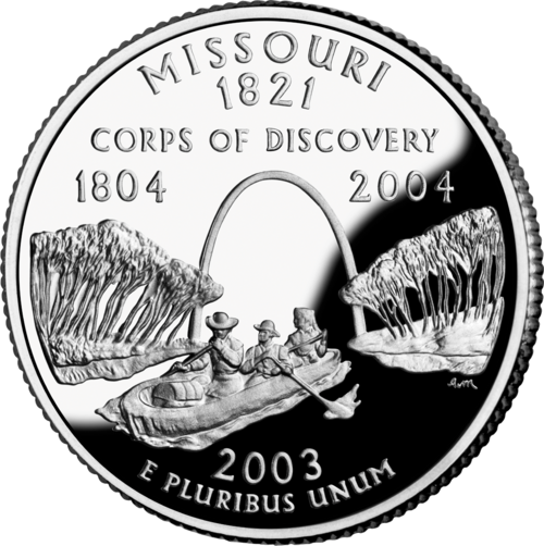
ミズーリ州( / m ɪ ˈ z ʊər i / Miz-OOR-ee)はアメリカ合衆国中西部にある二重の内陸 州。[6]陸地面積では第21位で、北はアイオワ州東はイリノイ州、ケンタッキー州、テネシー州南はアーカンソー州オクラホマ州、カンザス州、ネブラスカ州南部オザーク高原があり州名の由来となったミズーリ川は東の境界となるミシシッピ川18番目に人口の多い州である。最大の都市部はセントルイス、カンザスシティ、スプリングフィールド、コロンビア。州都はジェファーソンシティである。
現在のミズーリ州には、少なくとも12,000年前から人類が居住している。9世紀に出現したミシシッピ文化は、都市や塚を築いたが、14世紀に衰退した。17世紀にヨーロッパ人が到着すると、先住民のオセージ族とミズーリア族がこの地域に住んでいた。フランス人はこの地域をルイジアナ州に組み込み、1735年にセントジュヌビエーブ、1764年にセントルイスを設立した。短期間スペインに支配された後、1803年のルイジアナ買収により米国はミズーリ州を獲得した。南部高地のアメリカ人は新しいミズーリ準州に殺到し、ミズーリ州は米国の西方拡大において中心的な役割を果たした。[7]ミズーリ州は、1820年のミズーリ妥協により奴隷州として認められた。国境州として、ミズーリ州はアメリカ南北戦争で複雑な役割を担い、敵対する政府、襲撃、ゲリラ戦にさらされた。戦後、セントルイス大都市圏とカンザスシティ大都市圏はともに工業化とビジネスの中心地となった。
現在、ミズーリ州は114の郡とセントルイス市に分かれている。ミズーリ州は「西部の母」、「洞窟の州」、「ショー・ミー・ステート」と呼ばれてきた。[8]ミズーリ州の文化はアメリカ中西部と南部の要素が融合している。ラグタイム、カンザスシティ・ジャズ、セントルイス・ブルースといった音楽ジャンルの発祥地である。よく知られているカンザスシティ・スタイルのバーベキューと、あまり知られていないセントルイス・スタイルのバーベキューは、州内外で食べられている。
ミズーリ州はビール醸造の中心地であり、米国で最もアルコールに関する法律が緩い州の1つである[9]世界最大のビール製造会社であるアンハイザー・ブッシュの本拠地であり、ミズーリ・ラインランド・オザーク地方で同名のワインを生産している。州の主要都市以外では、オザーク湖、テーブルロック湖、ブランソンが人気の観光地である。州に拠点を置く大企業には、サーナー、エクスプレス・スクリプツ、モンサント、エマソン・エレクトリック、エドワード・ジョーンズ、H&Rブロック、ウェルズ・ファーゴ・アドバイザーズ、センティーン・コーポレーション、オライリー・オートパーツなどがある。ミズーリ州の有名な大学には、ミズーリ大学、セントルイス大学、セントルイス・ワシントン大学などがある。[10]
語源と発音
州名はミズーリ川にちなんで名付けられ、川の名前はスー語族の先住民ミズーリアにちなんで付けられた。フランス人入植者はイリノイ語の名称をウィミスーリタに取り入れた。ウィミスーリタという名前は「丸木舟を持つ者」を意味する。[11]
ミズーリという名前は、現代の住民の間でもいくつかの異なる発音があり、[12]最も一般的な2つは/ m ɪ ˈ z ɜːr i /です。 mih-ZUR-eeand/ m ɪ ˈ z ɜːr ə / mih-ZUR-ə。[13][14]ミズーリ州やアメリカの他の地域では、中間子音を/ z /または/ s /、第2音節の母音を/ ɜːr /または/ ʊər /、[15]第3音節を/ i /または/ ə /。[14]の話者からは、これらの音声実現のあらゆる組み合わせが見られる。イギリス英語の慣用発音では、/m ɪ ˈ z ʊər i /が好まれ、/ m ɪ ˈ s ʊər i /代替として考えられる。[16][17]
ミズーリ大学の英語教授ドナルド・M・ランスは、どの発音も正しいとは言い切れず、ネイティブかよそ者か、田舎か都会か、南部か北部か、教育を受けたかそうでないかなど、明確に定義することもできないと述べた。[18]政治家は、より多くの聴衆にアピールするために、1回の演説でも複数の発音を使うことがよくある。[12]非公式な文脈では、州名の綴りを変えた「ミズーリ-ee」や「ミズーリ-uh」などが、発音を音声的に区別するために時々使われる。
ニックネーム
公式の州名はない。[19]しかし、ミズーリ州の非公式なニックネームは「Show Me State」で、州のナンバープレートに表示されている。このフレーズにはいくつかの由来がある。1つは、1899年のウィラード・ヴァンダイバー下院議員の演説に由来すると一般に言われている。彼は「私はトウモロコシと綿花、オナガザルと民主党を育てる州から来た。泡沫の雄弁さでは私は納得も満足もしない。私はミズーリ州出身だ。あなたは私に見せてくれ」と宣言した。これは「私はミズーリ州出身だ」という言い回しと合致しており、「私はその問題に懐疑的で、簡単には納得しない」という意味である。[20]しかし、研究者によると、「Show Me」というフレーズは1890年代以前にすでに使用されていた。[21]別の説では、これはストライキ中の労働者の代わりとしてコロラド州リードビルに連れて行かれたミズーリ州の炭鉱労働者を指しているとされている。新しい鉱夫たちは採掘方法に不慣れだったため、頻繁な指導が必要だった。[19]
ミズーリ州の他のニックネームには、「鉛の州」、「地金の州」、「オザークの州」、「西部の母」、「鉄の山の州」、「西部のペンシルベニア」などがあります。[22]また、「洞窟の州」としても知られています。 [23] : 53 州内には7,300以上の洞窟が記録されているためです(テネシー州に次いで2番目)。ペリー郡は、最も多くの洞窟と最も長い洞窟を持つ郡です。[24] [25]
公式の国家標語は「Salus Populi Suprema Lex Esto」であり、ラテン語で「人民の福祉を最高の法とせよ」という意味である。[26]
歴史
| 外部ビデオ | |
|---|---|
 | |
 ミズーリ州、ミズーリ州フルトンのウェストミンスター カレッジ体育館 ミズーリ州、ミズーリ州フルトンのウェストミンスター カレッジ体育館 |
初期の歴史
川の渓谷に沿った考古学的発掘調査により、紀元前9000年頃から継続的に居住されていたことが明らかになっています。 [27]紀元1000年より前に、ミシシッピ文化の人々は、現在のセントルイスとミシシッピ川を渡った現在のイリノイ州コリンズビル近くのカホキアに地域の政治の中心地を築きました。彼らの大都市には何千もの個別の住居がありました。それでも、彼らは、宗教的、政治的、社会的理由から、プラットフォーム、尾根の上、円錐形に建てられた、現存する巨大な土塁で知られています。カホキアは、五大湖からメキシコ湾にまで及ぶ地域貿易ネットワークの中心地でした。文明は紀元1400年までに衰退し、ほとんどの子孫はヨーロッパ人が到着するよりずっと前にこの地域を去りました。セントルイスは、その後都市開発で失われた先史時代の塚が数多く現存していることから、ヨーロッパ系アメリカ人によって一時期マウンドシティとして知られていました。ミシシッピ文化は、ミシシッピ川中流域とオハイオ川の渓谷全体に塚を残し、南東部と上流域まで広がりました。
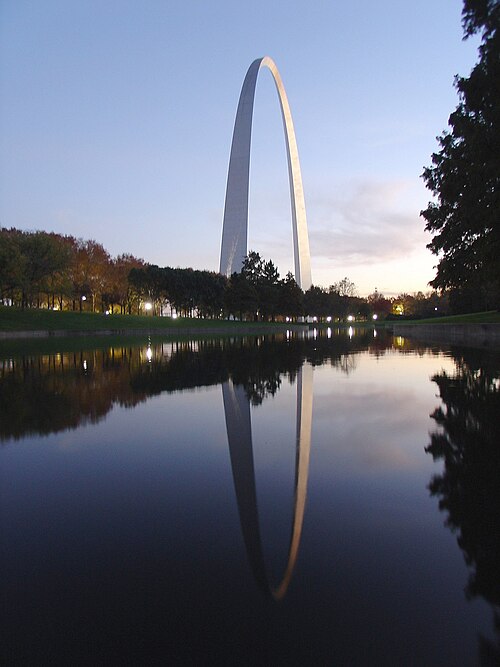
ミズーリ州となった土地は、多数の異なる領土の一部であり、境界は変化し、しばしば不確定で、1600 年代から州になるまでの間、ネイティブ アメリカンやヨーロッパ人によって多くの異なる名前が付けられていました。1700 年代前半の大半、ミズーリ州となるミシシッピ川の西岸は、ほとんど人が住んでおらず、ミシシッピ川の東岸と北岸のイリノイ族と、ミズーリ川下流域のオセージ族およびミズーリ族インディアンとの間で平和を保つ無人地帯のような場所でした。1700 年代初頭、フランスの貿易商と宣教師がミシシッピ川流域全体を探検し、この地域を「ルイジアナ」と名付けました。同じ頃、別のフランス系カナダ人のグループがミシシッピ川の東岸に 5 つの村を建設し、自分たちの居住地を「イリノイの国」、le pays des Illinois と名付けました。フランス系カナダ人の入植者がミシシッピ川を渡ってセントジェネビーブなどの入植地を築き始めたとき、彼らは自分たちの入植地をイリノイ地方にあると認識し続けました。同時に、ミシシッピ川の両岸のフランス人入植地は、フランスのルイジアナ州の一部でした。中部ミシシッピ渓谷の入植地をニューオーリンズ周辺の下流ミシシッピ渓谷のフランス人入植地と区別するために、フランスの役人や住民は中部ミシシッピ渓谷をラ・オート・ルイジアナ(「高地ルイジアナ」または「上流ルイジアナ」)と呼んでいました。
最初のヨーロッパ人開拓者はほとんどがフランス系カナダ人で、ミズーリ州で最初の開拓地をセントルイスの南約45マイル (72 km) にある現在のセントジュヌヴィエーヴに作った。彼らは1750年頃にイリノイ地方から移住してきた。彼らはミシシッピ川東岸の植民地村落の出身で、その地域では土壌が枯渇しつつあり、増加する人口に対して川底の土地が不十分だった。ミズーリ州の初期の開拓地には奴隷にされたアフリカ人やアメリカ先住民が多く含まれ、奴隷労働は商業農業と毛皮貿易の両方で中心的役割を果たした。サントジュヌヴィエーヴは繁栄する農業の中心地となり、余剰の小麦、トウモロコシ、タバコを生産して、毎年何トンもの穀物を下流のルイジアナ州に輸送して取引することができた。イリノイ地方の穀物生産は、ルイジアナ州南部、特にニューオーリンズ市の存続に不可欠だった。
セントルイスは、1764年2月14日にフランスの毛皮商人ジルベール・アントワーヌ・ド・サン・マクサン、ピエール・ラクレード、オーギュスト・シュートーによって設立されました。[28] 1764年から1803年まで、ミシシッピ川の西からミズーリ川流域の最北端までの地域、いわゆるルイジアナのヨーロッパ人の支配は、フォンテーヌブロー条約[29] (スペインをフランスに加わらせてイギリスとの戦争を行わせるため)により、スペイン人によってヌエバ・エスパーニャ副王領の一部として引き継がれました。スペイン人がセントルイスに到着したのは1767年9月でした。
セントルイスは、ミズーリ川とミシシッピ川沿いに広がるネイティブアメリカンの部族との地域毛皮貿易の中心地となり、何十年にもわたって地域経済を支配しました。大手企業の取引先は、セントルイスから川を経由してニューオーリンズまで毛皮を出荷し、ヨーロッパに輸出しました。彼らは、ネイティブアメリカンの顧客との販売と取引のために、さまざまな商品をトレーダーに提供しました。毛皮貿易と関連事業により、セントルイスは初期の金融中心地となり、一部の人々に立派な家を建てたり、贅沢品を輸入したりする富をもたらしました。イリノイ川の合流点に近い場所にあったため、農業地域の農産物も取り扱っていました。ミシシッピ川沿いの河川交通と貿易は、州の経済に不可欠でした。この地域初の大都市となったセントルイスは、蒸気船の発明と河川貿易の増加により大きく拡大しました。
19世紀

1762年以来スペインの植民地であったルイジアナは、1800年にサンイルデフォンソ条約に基づいてナポレオン・ボナパルトによってスペインからフランスの領有権が獲得されたが、この条約は秘密にされていた。ルイジアナは、アメリカ合衆国への割譲のわずか3週間前の1803年11月30日にフランスに権力が移譲されるまで、名目上はスペインの支配下にあった。
1803年の米国によるルイジアナ買収の一部であるミズーリ州は、 19世紀に西部へ向かう探検隊や開拓者にとって重要な出発点となったため、 「西への玄関口」というニックネームが付けられました。セントルイスのすぐ西にあるセントチャールズは、 1804年にミズーリ川を遡り、西部から太平洋に至る地域を探検したルイス・クラーク探検隊の出発点であり、帰還地でした。数十年にわたって、セントルイスは西へ向かう開拓者隊にとって主要な補給地点でした。
ミズーリ州西部の初期の開拓者の多くは南部北部から移住し、奴隷にされたアフリカ系アメリカ人を農業労働者として連れてきて、自分たちの文化と奴隷制度を継続することを望んだ。彼らは主にミズーリ川沿いの 17 郡に定住し、プランテーション農業が可能な平地の地域に住み、「リトル ディキシー」として知られるようになった。
この州は1811年から1812年にかけてニューマドリッド地震に見舞われたが、人口がまばらだったため死傷者は少なかった。
1821年に州として加盟

1821年、ミズーリ妥協により旧ミズーリ準州は奴隷州として認められ、セントチャールズに暫定州都が置かれた。1826年、州都はミズーリ川沿いの ジェファーソンシティに恒久的に移された。
もともと、州の西側の境界は直線で、カンザス川がミズーリ川に合流する地点であるカウスマス[30]を通る子午線として定義されていました。この指定以降、川は移動しています。この線はオーセージ境界として知られています。 [31] 1836年に、先住民族から土地を購入した後、州の北西隅にプラット購入地が追加され、ミズーリ川がカンザス川の北の境界になりました。この追加により、当時すでに連邦で最大の州であった州の陸地面積が増加しました(約66,500平方マイル(172,000 km 2)が、当時ウェストバージニア州を含んでいたバージニア州の65,000平方マイルに増加しました)。[32]
1830 年代初頭、北部諸州およびカナダからのモルモン教徒の移住者が、インディペンデンス付近およびそのすぐ北の地域に定住し始めました。宗教と奴隷制をめぐる対立が、「旧入植者」(主に南部) とモルモン教徒 (主に北部) の間で起こりました。1838年にモルモン戦争が勃発しました。1839 年までに、リルバーン ボッグス知事の「絶滅命令」の助けを借りて、旧入植者はモルモン教徒をミズーリ州から強制的に追放し、彼らの土地を没収しました。
奴隷制度をめぐる対立は、州と領土の間の国境の緊張を悪化させた。1838年から1839年にかけて、いわゆるハニーランドをめぐるアイオワ州との国境紛争により、両州は国境沿いに 民兵を召集した。
1830年代から1860年代にかけて移民が増加し、ミズーリ州の人口は10年ごとにほぼ倍増しました。新参者のほとんどはアメリカ生まれでしたが、1840年代後半から1850年代にかけて多くのアイルランド人とドイツ人の移民が到着しました。大多数がカトリック教徒であったため、彼らは、ほとんどがプロテスタントであった州内に独自の宗教施設を設立しました。多くが都市に定住し、地域、そして州全体のカトリック教会と学校のネットワークを作りました。19世紀のドイツ人移民は、ミズーリ川沿いにワイン産業を、セントルイスにビール産業を生み出しました。
多くのドイツ人移民が奴隷制に強く反対していた一方で、[33] [34]都市部に住む多くのアイルランド人移民は奴隷制に賛成しており、アフリカ系アメリカ人の奴隷を解放すると未熟練労働者が過剰になり、賃金が下がることを恐れていた。[34]
ミズーリ州の農民のほとんどは、南北戦争以前は自給自足の農業を営んでいた。奴隷を所有していた農民の大半は、それぞれ 5 人未満の奴隷しか所有していなかった。一部の歴史家は、20 人以上の奴隷を所有する農園主と定義しており、ミズーリ川沿いの州中央部にある「リトル ディキシー」として知られる郡に集中していた。奴隷制度をめぐる緊張は、主に州と国家の将来に関係していた。1860 年、奴隷にされたアフリカ系アメリカ人は、州の人口 1,182,012 人のうち 10% 未満を占めていた。[35]ミシシッピ川沿いの農地や低地の村の洪水を制御するために、州は1860 年までに川沿いに140 マイル (230 km) の堤防の建設を完了していた。 [36]
アメリカ南北戦争

1861年に南部諸州の脱退が始まった後、ミズーリ州議会は脱退に関する特別会議の選出を求めた。この会議は脱退に反対票を投じたが、連邦への支持にも条件を付けた。サムター要塞の戦いの後、南部支持派のクレイボーン・F・ジャクソン知事は、訓練のためにセントルイスの野営地に集結していた州民兵数百名の動員を命じた。また、秘密裏に、セントルイス兵器廠の攻略を支援するため南軍の武器と砲兵の派遣も要請した。この行動に警戒し、南軍の援助があることを知ったナサニエル・ライアン将軍が先制攻撃を仕掛け、野営地を包囲して州軍に降伏を強いた。ライアンは、主に英語を話さないドイツ人移民からなる兵士たちに、捕虜を通りを行進させるよう指示したが、これが脱退支持派の市民による暴動を引き起こした。どのようにして始まったのかは議論の余地があるが、この暴動は暴力行為に発展し、北軍兵士がセントルイスの民間人によって殺害された。この事件全体はキャンプ・ジャクソン事件と呼ばれている。
これらの出来事は州内の分裂を激化させた。ジャクソン知事は、脱退会議の議長であるスターリング・プライスを、新しいミズーリ州防衛隊の指揮官に任命した。北軍のライアン将軍が州を急速に進軍する中、ジャクソンとプライスは1861年6月14日に州都ジェファーソンシティから逃げざるを得なかった。ミズーリ州ネオショで、ジャクソンは州議会を招集し、脱退を求めた。しかし、選出された立法府は北軍支持派と南軍支持派に分裂していた。そのため、ネオショで召集された議会には北軍支持派はほとんど出席せず、脱退条例はすぐに採択された。南軍は1861年10月30日にミズーリ州の脱退を承認した。
選出された知事が州都を離れ、議員らも散り散りになっていたため、州議会はジャクソン軍とともに南に逃げた 20 名を除くほとんどの議員が出席して再招集された。議会はすべての役職を空席と宣言し、ハミルトン ギャンブルをミズーリ州の新知事に任命した。リンカーン大統領の政権は、ギャンブルの政府をミズーリ州の合法的な政府として直ちに承認した。連邦政府の決定により、州内での任務のために北軍支持の民兵部隊を編成し、北軍のために志願兵連隊を編成することが可能になった。
戦闘は北軍と、プライス将軍のミズーリ州兵とベン・マカロック将軍の指揮するアーカンソー州とテキサス州の南軍の連合軍との間で起こった。ウィルソンズ・クリークの戦いとミズーリ州レキシントンの包囲戦で勝利を収め、他の場所では損失を被った南軍は、大幅に増強された北軍に直面してアーカンソー州、その後テキサス州マーシャルに撤退した。
南軍正規軍がミズーリ州に大規模な襲撃を何度か行ったが、その後 3 年間の同州での戦闘は主にゲリラ戦であった。ウィリアム・クァントリル大尉、フランク・ジェームズとジェシー・ジェームズ、ヤンガー兄弟、ウィリアム・T・アンダーソンなどの「市民兵士」または反乱軍は、素早い小規模部隊戦術を利用した。ミズーリ・パルチザン・レンジャーズが先駆けとなったこのような反乱は、南北戦争中に北軍が占領した南部連合の一部でも発生した。歴史家は、ジェームズ兄弟の無法者時代の物語をアメリカの「ロビン・フッド」神話として描いている。[37] 1880年代のオザーク山脈のボールド・ノバーズによる自警活動は、公式の戦争終結後も長く続いた反乱者の精神の非公式な継続であり、ブランソンの自己イメージのお気に入りのテーマとなっている。[38]
復興期と19世紀後半
20世紀


進歩主義時代( 1890 年代から 1920 年代) には、ミズーリ州出身の多くの著名な指導者が腐敗を終わらせ、政治、政府、社会を近代化しようと努めた。ジョセフ・「ホーリー・ジョー」・フォークは、中流階級と田舎の福音主義プロテスタントに強く訴えた重要な指導者であった。フォークは、進歩主義改革者であり民主党員として1904 年の選挙で知事に選出された。フォークは、民衆による法律の管理と厳格な施行を通じて、ミズーリ州を公道道徳のリーダーとする概念である「ミズーリ・アイデア」を推進した。彼は、独占禁止法の訴追、州職員の無料鉄道パスの廃止、賄賂法の延長、選挙法の改善、ロビイストの正式登録の義務化、競馬場賭博の違法化、日曜休業法の施行を成功させた。フォークは、住民発議と住民投票の規定、選挙、教育、雇用と児童労働、鉄道、食品、ビジネス、公共事業の規制を含む進歩主義の法律の制定に貢献した。フォーク政権時代には、多くの農業委員会やミズーリ州図書館委員会など、効率性を重視した審査委員会や委員会がいくつか設立された。[39]

南北戦争から第二次世界大戦の終結までの間、中西部が急速に工業化するにつれ、ミズーリ州は農村経済から工業・サービス・農業の複合経済へと移行した。鉄道が西部に拡張されたことで、カンザスシティは国内の主要な交通ハブへと変貌した。テキサスの畜産業の成長、鉄道インフラの拡大、冷蔵貨車の発明により、カンザスシティは主要な食肉加工の中心地にもなり、テキサスからの大規模な牛の群れがドッジシティやカンザス州の他の町に運ばれた。そこで牛はカンザスシティ行きの列車に積み込まれ、そこで屠殺されて東部の市場に配送された。20世紀前半はカンザスシティが最盛期を迎え、建設ブームが起こり、ダウンタウンにはスタイリッシュなアールデコ 調の高層ビルが立ち並ぶようになった。

1930 年、スプリングフィールド周辺で ジフテリアが流行し、約 100 人が死亡しました。血清が急いで現場に届けられ、医療関係者が流行を食い止めました。
1950年代半ばから1960年代にかけて、セントルイスとカンザスシティは、他の中西部の工業都市と同様に、産業空洞化と鉄道や製造業の雇用喪失に見舞われた。 セントチャールズは、 1956年に最初の州間高速道路プロジェクトの場所であると主張している。[40]このような高速道路建設により、中流階級の住民は都市を離れ、より安価な土地が利用できる郊外の元農地であることが多い新しい住宅地に移ることが容易になった。これらの大都市は、異なる経済を発展させ、人口動態の変化に適応するために、数十年にわたる再調整を経てきた。郊外地域では、大手小売モールなどの知識産業とサービスの両方で、独立した雇用市場が形成されてきた。
21世紀
2014年、ミズーリ州は、ファーガソンの警察官によるマイケル・ブラウン射殺事件に続く抗議活動と暴動で全国的な注目を集め、[41] [42] [43]ジェイ・ニクソン知事がミズーリ州兵を召集するに至った。[44] [45]大陪審は警察官の起訴を却下し、米国司法省は慎重な調査の結果、警察官が自分の身の安全を正当に恐れていたと結論付けた。[46]しかし、司法省は別の調査で、ファーガソン警察とファーガソン市が人種差別的な動機による過度の罰金や処罰を通じて市の予算を均衡させるために違憲的な慣行に頼っていたこと、[47]ファーガソン警察は「過度で危険な武力を行使し、不釣り合いに黒人を標的にしていた」こと、 [48]市裁判所は「公共の安全よりも収入を重視し、市民の憲法上の適正手続きと法の下での平等な保護の保証を日常的に侵害していた」ことも明らかにした。[49]
ミズーリ大学では、キャンパス内で起きた人種差別事件に対する大学の対応が不十分であると抗議する学生による一連の抗議活動が2015年9月に始まった。 [50] [51]
2017年6月7日、全米黒人地位向上協会はミズーリ州へのアフリカ系アメリカ人旅行者に警告を発した。これは全米黒人地位向上協会が州全体を対象に警告を発した初の例である。[52] [53]ミズーリ州司法長官事務所による2018年の報告書によると、過去18年間、「アフリカ系アメリカ人、ヒスパニック、その他の有色人種は、職務質問、捜索、逮捕の影響を不釣り合いに受けている」という。[54]同じ報告書では、最も大きな差異は2017年に「黒人の運転手が交通違反で呼び止められる可能性が85%高かった」としている。[55]
2018年に農務省は経済調査局(ERS)と国立食料農業研究所(NIFA)をカンザスシティに移転する計画を発表した。彼らはその後、ミズーリ州カンザスシティのダウンタウンの特定の場所に決定した。[56] KCストリートカープロジェクトの追加とスプリントセンターアリーナの建設により、KCのダウンタウンエリアは新しいオフィス、ホテル、住宅団地への投資を誘致した。カンザスシティとセントルイスの両市は、新しいパワー&ライト(KC)地区とボールパークビレッジ(STL)地区の追加、および各ダウンタウンエリアの既存の歴史的建造物の改修により、ダウンタウンエリアの再生を遂げている。[57] 2019年にセントルイスでのMLS拡張チームの発表により、セントルイスのダウンタウン西部エリアの開発がさらに促進されている。[58]カンザスシティは人口増加のブームを経験しており、ダウンタウン・カンザスシティを中心にスリーライト・アパートメントなどの新しい開発が行われており、[59] [60]ノースランドでは郊外開発が進んでいる。[61]
地理

ミズーリ州は 8 つの州と接しており、その数は隣のテネシー州に匹敵する。ミズーリ州の北はアイオワ州、東はミシシッピ川を挟んでイリノイ州、ケンタッキー州、テネシー州、南はアーカンソー州、西はオクラホマ州、カンザス州、ネブラスカ州(ミズーリ川を挟んでネブラスカ州) と接している。北と南の境界線は直線であるが、ミズーリ・ブーティール川はセント・フランシス川とミシシッピ川の間に南に延びている。2 大河川はミシシッピ川 (州の東の境界線を定義) とミズーリ川 (州を西から東に流れる) で、基本的に 2 大都市であるカンザスシティとセントルイスを結んでいる。
今日では中西部の一部と見なされることが多いが、[62]ミズーリ州は歴史的には多くの人から境界州と見なされていた。これは主に南部からの移民の定住と南北戦争前の奴隷州としての地位、そしてセントルイスの影響によるものである。「リトル・ディキシー」を構成する郡は州中央のミズーリ川沿いの郡で、奴隷が最も集中していた南部からの移民が定住した。
2005年、ミズーリ州は、総面積101,000エーカー(410 km 2)の国立公園やその他のレクリエーションエリアを16,695,000人の観光客が訪れ、年間収入は741万ドル、運営費の26.6%を占めました。[63]
地形
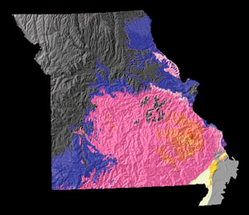
ミズーリ川の北、場合によってはすぐ南には、アイオワ州、ネブラスカ州、カンザス州に広がる北部平原がある。ここには、かつてカナダ楯状地からミズーリ川まで広がった氷河作用によってできた起伏のある丘陵が残っている。ミズーリ州には、ミシシッピ川、ミズーリ川、メラメック川沿いに大きな断崖がたくさんある。ミズーリ州南部は、先カンブリア時代の火成岩であるセントフランソワ山脈を取り囲む分断された台地であるオザーク山脈まで伸びている。この地域には、陥没穴や洞窟の形成を伴う石灰岩の含有量が多いカルスト地形もある。[64]
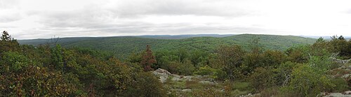
州の南東部はミズーリ・ブーティール地域として知られ、ミシシッピ沖積平野またはミシシッピ湾の一部である。この地域は州内で最も低く、最も平坦で、最も暖かく、最も雨の多い地域である。また、経済の大部分が農業であるため、最も貧しい地域の一つでもある。[65]また、綿花と米の栽培が主流で、最も肥沃な地域でもある。ブーティールは、1811年と1812年の4回のニューマドリッド地震の震源地であった。
気候

ミズーリ州は一般に湿潤大陸性気候で、冬は涼しく、時には寒いこともあり、夏は暑く、湿気が多く、雨が多い。州の南部、特にブーティールでは、気候は湿潤亜熱帯性となる。アメリカ合衆国の内陸部に位置するミズーリ州は、しばしば極端な気温に見舞われる。気温を緩和する高い山や海が近くにないため、ミズーリ州の気候は、寒い北極からの空気と、高温多湿のメキシコ湾からの空気の影響を交互に受ける。ミズーリ州の最高気温記録は、 1954年7月14日にワルソーとユニオンで記録された118 °F (48 °C) であり、最低気温記録は、1905年2月13日にワルソーで記録された−40 °F (−40 °C) である。
ミズーリ州は竜巻街道に位置し、激しい雷雨や竜巻といった異常気象にも見舞われます。2011年5月22日、EF-5の巨大な竜巻により、ジョプリン市のおよそ3分の1が破壊され、158人が死亡しました。この竜巻により、推定10億~30億ドルの損害が発生し、159人が死亡、1,000人以上が負傷しました。この竜巻は、1957年以来初めてミズーリ州を襲ったEF5の竜巻であり、1947年以降で米国で最も死者数の多い竜巻で、米国史上7番目、世界で27番目に死者数の多い竜巻となっています。セントルイスとその郊外も特に激しい竜巻に見舞われた歴史があり、最も最近のものでは、ランバート・セントルイス地区に被害を与えたEF4の竜巻です。 2011 年 4 月 22 日のセントルイス国際空港。1896年 5 月 27 日、アメリカ史上最悪の竜巻がセントルイスを襲い、少なくとも 255 人が死亡、1,000 万ドル (2009 年の価値で 39 億ドル、現在の価値で 55 億 4,000 万ドルに相当) の被害が発生しました。
.jpg/500px-Lake_of_the_Ozarks_-_Missouri_(40533516433).jpg)
野生動物

ミズーリ州には、いくつかの固有種を含む多様な動植物が生息しています。[67]ミシシッピ川、ミズーリ川、テーブルロック湖、オザーク湖のおかげで、大量の淡水が存在し、多くの小さな支流の川、小川、湖があります。ミズーリ川の北では、州は主にグレートプレーンズの起伏のある丘陵地帯ですが、ミズーリ川の南では、州は主にオークとヒッコリーの中央アメリカの広葉樹林に覆われています。
森林
第二次世界大戦後、放牧、伐採、採鉱など、公有林のレクリエーションや商業利用が増加した 。漁師、ハイカー、キャンパーなどが「荒野の特徴」を持つ森林地帯の保護を求めてロビー活動を始めた。1930年代から1940年代にかけて、アルド・レオポルド、アーサー・カーハート、ボブ・マーシャルは森林局の「荒野」政策を策定した。彼らの努力は1964年の荒野保護法で実を結び、荒野地域を「地球とその生命共同体が人間によって踏みにじられておらず、人間自身が訪問者であり留まらない場所」と指定した。これにはマーク・トウェイン国有林のような二次林も含まれていた。[68]
人口統計
.png/500px-Missouri_population_map_(2000).png)
アメリカ合衆国国勢調査局は、ミズーリ州の人口は2019年7月1日時点で6,137,428人であり、2010年の国勢調査以来2.48%増加したと推定している。[70]
2010年の国勢調査によると、ミズーリ州の人口は5,988,927人で、2010年から137,525人(2.3%)増加しています。2010年から2018年まで、これには前回の国勢調査からの自然増137,564人(出生数480,763人から死亡数343,199人を引いた数)と、州への純移住による88,088人の増加が含まれます。米国外からの移民により50,450人の純増加があり、国内の移住により37,638人の純増加がありました。ミズーリ州民の半数以上(3,294,936人、55.0%)は、州の2大都市圏であるセントルイスとカンザスシティに住んでいます。 2009年のミズーリ州の人口密度は1平方マイルあたり86.9人で、他のどの州よりも全国平均(2009年の86.8人)に近い。2018年のミズーリ州への移民の出身国上位は、メキシコ、中国、インド、ベトナム、ボスニア・ヘルツェゴビナであった。[71]
HUDの2022年ホームレス評価報告書によると、ミズーリ州には推定5,992人のホームレスがいる。[72] [73]

2010年の米国国勢調査では、米国の人口の中心はテキサス郡にあり、2000年の国勢調査では平均的な人口の中心はフェルプス郡にあることが判明しました。ミズーリ州の人口の中心は、オーセージ郡のウェストファリア市にあります。[78]
2004 年の人口には 194,000 人の外国生まれの人々 (州人口の 3.4%) が含まれていました。
ミズーリ州における祖先の上位 5 グループは、ドイツ系(27.4%)、アイルランド系(14.8%)、イギリス系(10.2%)、アメリカ系(8.5%)、フランス系(3.7%) です。

ドイツ系アメリカ人は、ミズーリ州全域に存在する祖先グループです。アフリカ系アメリカ人は、セントルイス(2010年の国勢調査時点で、州内のアフリカ系アメリカ人の56.6%がセントルイスまたはセントルイス郡に住んでいました)、カンザスシティ、ブーン郡、ブーティール南東部、かつてプランテーション農業が盛んだったミズーリ川流域の一部で、人口のかなりの部分を占めています。フランス系ミズーリクレオール人は、セントルイス南部のミシシッピ川流域に集中しています(ミズーリ州フランス語を参照)。カンザスシティには、メキシコやコロンビアなどのラテンアメリカ、スーダン、ソマリア、ナイジェリアなどのアフリカ、中国やフィリピンなどの東南アジア、旧ユーゴスラビアなどのヨーロッパ(ボスニア系アメリカ人を参照)からの大規模な移民コミュニティがあり、その数は増加しています。ミズーリ州にはチェロキーインディアンの人口が多く存在し、2020年には30,518人がネイティブアメリカンのみであると認識され、152,917人が他の人種と併存していると認識されていました。[79]
2004 年、州の人口の 6.6 パーセントが 5 歳未満 、25.5 パーセントが 18 歳未満、13.5 パーセントが 65 歳以上と報告されました。女性は人口の約 51.4 パーセントでした。ミズーリ州住民の 81.3 パーセントは高校卒業者 (全国平均以上) であり、21.6 パーセントは学士号以上を取得しています。ミズーリ州民の 3.4 パーセントは外国生まれで、5.1 パーセントは家庭で英語以外の言語を話しています。
2010 年、ミズーリ州には 2,349,955 世帯があり、世帯当たりの人口は 2.45 人でした。住宅所有率は 70.0 パーセントで、持ち家住宅の平均価格は 137,700 ドルでした。2010 年の世帯収入の中央値は 46,262 ドル、1 人当たり 24,724 ドルでした。2010 年、ミズーリ州民の 14.0 パーセント (1,018,118 人) が貧困ライン以下の生活をしていました。
通勤時間の平均は23.8分でした。

伝説
出生データ
2011年、ミズーリ州の 1歳未満の人口の28.1%がマイノリティであった。[80]
注: 表の出生数は一致しません。ヒスパニック系は民族と人種の両方でカウントされるため、全体の数が多くなります。
- 2016 年以降、白人ヒスパニック系の出生に関するデータは収集されておらず、1 つのヒスパニック系グループに含められています。ヒスパニック系の出生者はどの人種でもかまいません。
言語
ミズーリ州の住民の大多数は英語を話します。人口の約5.1%が自宅で英語以外の言語を話していると報告しています。スペイン語はセントルイスとカンザスシティの都市圏の小さなラテン系コミュニティで話されています。[91]
ミズーリ州には、ミズーリ・フランス語として知られる絶滅の危機に瀕したフランス語方言がある。クレオール人と自称するこの方言の話者は、 17世紀後半から当時イリノイ・カントリーと呼ばれていた地域に定住したフランス人開拓者の子孫である。この方言は、カナダやルイジアナのフランス語話者とは隔離されて発達し、カナダ・フランス語やルイジアナ・フランス語とは全く異なるものとなった。かつてはこの地域で広く話されていたミズーリ・フランス語は現在ではほぼ絶滅しており、少数の高齢者だけが話せる程度である。[92] [93]
宗教
2014年に実施されたピュー研究所の調査[94]によると、ミズーリ州民の80%が何らかの宗教を信仰しています。77%がキリスト教とそのさまざまな宗派に属し、残りの3%は非キリスト教の宗教を信仰しています。残りの20%は無宗教で、2%は無神論者、3%は不可知論者と特定しています(残りの15%は「特に何か」を特定していません)。
ミズーリ州の宗教人口統計は次のとおりです。
- クリスチャン 77%
- プロテスタント 58%
- 福音派プロテスタント 36%
- 主流プロテスタント 16%
- 歴史的に黒人プロテスタント 6%
- カトリック 16%
- モルモン教徒 1%
- 正教会信者 <1%
- エホバの証人 <1%
- その他のキリスト教徒 <1%
- プロテスタント 58%
- 非キリスト教 3%
- ユダヤ人 <1%
- イスラム教徒 <1%
- 仏教徒 1%
- ヒンズー教徒 <1%
- その他の世界の宗教 <1%
- 無宗教 20%
- 無神論者 2%
- 不可知論者 3%
- 特になし 15%
- わからない <1%
2010年に信者数が最も多かった宗派は、南部バプテスト連盟が749,685人、ローマカトリック教会が724,315人、合同メソジスト教会が226,409人であった。[95]
その他の宗派には、253の会衆に約93,000人のモルモン教徒、21のシナゴーグに25,000人のユダヤ教徒、39のモスクに12,000人のイスラム教徒、34の寺院に7,000人の仏教徒、17の寺院に20,000人のヒンズー教徒、9つの会衆に2,500人のユニテリアン教徒、17の寺院に2,000人のバハイ教徒、5つのシク教寺院、ゾロアスター教寺院、ジャイナ教寺院、そして数え切れないほどのネオペイガニズム信者がいる。[96]
ミズーリ州には、セントルイス郊外のカークウッドに本部を置くルーテル教会ミズーリ教区や、ヘイゼルウッドにあるユナイテッド・ペンテコステ教会インターナショナルなど、いくつかの宗教団体が本部を置いています。
カンザスシティ近郊のインディペンデンスは、コミュニティ・オブ・クライスト(旧末日聖徒イエス・キリスト教会)、チャーチ・オブ・クライスト(テンプル・ロット) 、および末日聖徒イエス・キリスト教会残存派の本部がある。この地域とミズーリ州の他の地域は、末日聖徒イエス・キリスト教会(LDS教会)にとっても宗教的にも歴史的にも重要な場所であり、同教会はいくつかの場所とビジターセンターを維持している。
スプリングフィールドは、アッセンブリーズ・オブ・ゴッドUSAとバプテスト聖書連盟インターナショナルの本部である。ジェネラル・アソシエーション・オブ・ジェネラル・バプテストの本部はポプラブラフにある。ユニティ教会の本部はユニティビレッジにある。スプリングフィールドは特に州内のキリスト教の中心地として知られており[97] 、バイブル・ベルトの「中心」であると考える人もいる。[98]
セントルイスのヒンドゥー寺院はミズーリ州最大のヒンドゥー寺院で、14,000 人以上のヒンズー教徒が訪れます。
経済

- 2016年の総雇用数: 2,494,720人
- 2016年の雇用主事業所総数:160,912 [100]
アメリカ商務省経済分析局は、ミズーリ州の州総生産は2023年に4,220億ドルになると推定している。 [101] 2023年の 一人当たり個人所得は61,302ドルで、国内34位である。[102]主要産業には、航空宇宙、輸送機器、食品加工、化学、印刷・出版、電気機器、軽工業、金融分野のサービスなど がある。
州の農産物は、牛肉、大豆、豚肉、乳製品、干し草、トウモロコシ、鶏肉、モロコシ、綿、米、卵である。ミズーリ州は豚の生産量で全米第6位、牛の生産量で第7位である。ミズーリ州は大豆の生産量で全米上位5州にランクされており、米の生産量では全米第4位である。2001年には108,000の農場があり、テキサス州に次いで2番目に多い数であった。ミズーリ州は急速に成長しているワイン産業を積極的に推進している。ミズーリパートナーシップによると、ミズーリ州の農業産業はミズーリ州の経済に330億ドルのGDPをもたらし、880億ドルの売上と378,000人以上の雇用を生み出している。[103]

ミズーリ州には大量の石灰岩があります。採掘される他の資源としては、鉛、石炭、砕石があります。ミズーリ州は全州の中で最も多くの鉛を生産しています。鉛鉱山のほとんどは、州の中央東部にあります。ミズーリ州はまた、ポートランドセメントの主要成分である石灰の生産でも第 1 位または第 1 位に近い位置にあります。
ミズーリ州では、科学、農業技術、バイオテクノロジーの分野も成長しています。かつてはアメリカ最大のバイオテクノロジー企業の一つであったモンサントは、2018年にバイエルAGに買収されるまでセントルイスに拠点を置いていました。現在はバイエルの米国子会社であるバイエルコーポレーションの農作物科学部門の一部となっています。
観光、サービス、卸売/小売業は製造業に次いで重要であり、州内の多くの川、湖、洞窟、公園などから観光業が恩恵を受けています。州立公園のネットワークに加えて、ミズーリ州にはセントルイスのゲートウェイ アーチ国立公園とオザーク国立景観河川があります。スタントンのメラメック洞窟は、多くの人が訪れる観光洞窟です。

ミズーリ州は連邦準備銀行を2つ持つ唯一の州である。1つはカンザスシティ(ミズーリ州西部、カンザス州、ネブラスカ州、オクラホマ州、コロラド州、ニューメキシコ州北部、ワイオミング州を管轄)にあり、もう1つはセントルイス(ミズーリ州東部、イリノイ州南部、インディアナ州南部、ケンタッキー州西部、テネシー州西部、ミシシッピ州北部、アーカンソー州全域を管轄)にある。[104]
2017年4月の同州の季節調整済み失業率は3.9%だった。[105] 2017年にミズーリ州は労働者の権利を守る州となったが[106] 、2018年8月にミズーリ州の有権者は67%対33%で労働者の権利を守る法律を拒否した。 [107] [108] [109]
課税
個人所得は1.5% から 6.0% までの 10 段階の所得区分で課税されます。ミズーリ州のほとんどの品目の売上税率は 4.225% で、さらに地方税が課せられます。ミズーリ州の 2,500 を超える地方自治体は、不動産と動産に課せられる財産税に依存しています。
動力付き車両を除き、ほとんどの個人財産は免税となります。免税対象となる不動産には、政府所有の不動産、非営利墓地、宗教的礼拝専用、学校や大学、純粋な慈善目的で使用される不動産が含まれます。相続税はなく、連邦相続税徴収に関連するミズーリ州の相続税は限定されています。
2017年、税務財団はミズーリ州を法人税指数で5番目に良い州、全体的な税制環境で15番目に良い州と評価しました。[ 110]ミズーリ州の法人税率は6.25%ですが、課税所得を計算する前に連邦所得税の50%を控除できるため、実効税率は5.2%になります。[111]
エネルギー
2012年、ミズーリ州の発電設備容量は約22,000MWでした。[112] 2011年、ミズーリ州の電力の82%は石炭によって発電されました。[113] 10%は州唯一の原子力発電所である[113]ジェファーソンシティの北東にあるキャラウェイ郡のキャラウェイ発電所で発電されました。5%は天然ガスによって発電されました。[113] 1%はトルーマン湖やオザーク湖のダムなどの水力発電によって発電されました。ミズーリ州には小規模ながらも増加している風力発電と太陽光発電があり、風力発電容量は2009年の309MWから2011年には459MWに増加し、太陽光発電は同じ期間に0.2MWから1.3MWに増加しました。[114] [115] 2016年時点で、ミズーリ州の太陽光発電設備は141MWに達した。[116]
ミズーリ州の油井は2012年度に12万バレルの原油を生産した。[117]ミズーリ州には石油精製所はない。[115] [118]
交通機関
空港
ミズーリ州には、セントルイス・ランバート国際空港とカンザスシティ国際空港という2つの主要空港があります。南ミズーリ州には、複数の直行便があるスプリングフィールド・ブランソン国際空港(SGF)があります。 [119]中部ミズーリ州の住民は、コロンビア地域空港(COU)を利用してシカゴ(ORD)、ダラス(DFW)、デンバー(DEN)に飛んでいます。[120]
レール

.jpg/500px-KC_Streetcar_(26813012241).jpg)

国内で最も混雑する鉄道センターの 3 つのうち 2 つはミズーリ州にあります。カンザスシティはBNSF 鉄道、ノーフォーク サザン鉄道、カンザスシティ サザン鉄道、ユニオン パシフィック鉄道の主要な鉄道ハブであり、クラス 1 の鉄道はすべてミズーリ州にサービスを提供しています。カンザスシティは米国で 2 番目に大きな貨物鉄道センターです (ただし、取り扱いトン数では 1 位です)。カンザスシティと同様に、セントルイスは鉄道貨物の主要な目的地です。スプリングフィールドは BNSF 鉄道の運用ハブであり続けています。
アムトラックの旅客列車は、カンザスシティ、ラプラタ、ジェファーソンシティ、セントルイス、リーズサミット、インディペンデンス、ウォーレンズバーグ、ハーマン、ワシントン、カークウッド、セダリア、ポプラブラフに停車する。シカゴハブネットワークの一環としてミズーリ州で提案されている高速鉄道路線には、3,100万ドルの資金が投入されている。[121]
ミズーリ州で運行されている唯一の都市型ライトレール/地下鉄システムはメトロリンクで、セントルイス市とイリノイ州およびセントルイス郡の郊外を結んでいます。これは米国最大のシステム(線路距離で)の1つです。カンザスシティのダウンタウンにあるKCストリートカーは2016年5月に開業しました。 [122]
セントルイスのゲートウェイマルチモーダル トランスポーテーション センターは、州内で最大のアクティブな多目的交通センターです。セントルイスのダウンタウンにあり、歴史あるユニオン ステーションコンプレックスの隣にあります。メトロリンク、メトロバス地域バス システム、グレイハウンド、アムトラック、タクシー サービス のハブ センター/ステーションとして機能します。
2018年、ミズーリ州セントルイス、カンザスシティ、コロンビアを結ぶミズーリハイパーループの建設が提案され、州全体の移動時間が約30分に短縮された。[123]このプロジェクトは、企業パートナーのハイパーループワンが閉鎖されたことで、2023年12月に頓挫した。
バス

多くの都市には定期的な固定ルートシステムがあり、多くの田舎の郡には田舎の公共交通機関サービスがあります。グレイハウンドとトレイルウェイズはミズーリ州で都市間バスサービスを提供しています。メガバスはセントルイスにサービスを提供していますが、2015年にコロンビアとカンザスシティへのサービスを中止しました。[124]
河川
ミシシッピ川とミズーリ川は、ミズーリ州全域で商業航行が可能です。ミズーリ川は浚渫と防波堤によって水路化され、ミシシッピ川には岩を避けて川を深くするための一連の閘門とダムが設けられました。セントルイスはミシシッピ川の荷船輸送の主要目的地です。
道路
2004年後半に修正第3号が可決された後、ミズーリ州運輸局(MoDOT)は、2007年12月までに2,200マイル(3,500 km)の高速道路を良好な状態にすることを目標とした、よりスムーズで、より安全で、より迅速な道路建設プログラムを開始しました。2006年から2011年にかけて、交通事故による死亡者数は、2005年の1,257人から、2006年の1,096人、2007年の992人、2008年の960人、2009年の878人、2010年の821人、2011年の786人へと毎年減少しました。[125]
法律と政府


ミズーリ州憲法は、同州の 4 番目の憲法であり、1945 年に採択されました。この憲法は、立法府、司法府、行政府の 3 つの政府部門を規定しています。立法府は、下院と上院の2つの機関で構成されています。これらの機関は、ミズーリ州議会を構成しています。
下院は、直近の10年ごとの国勢調査に基づいて配分された163人の議員から構成される。上院は、人口がほぼ同数の地区から選出された34人の議員から構成される。司法部門は、7人の裁判官を擁するミズーリ州最高裁判所、カンザスシティ、セントルイス、スプリングフィールドに所在するミズーリ州控訴裁判所(3つの地区に分かれた中間控訴裁判所)、および地方裁判所として機能する45の巡回裁判所から構成される。行政府はミズーリ州知事が率いており、他に州全体で選出される5つの役職が含まれる。2023年1月9日に州監査役ニコル・ギャロウェイが退任したため、ミズーリ州では州全体で選出される役職に就く民主党員はいない。[126]
ハリー・S・トルーマン(1884年 - 1972年)は、アメリカ合衆国第33代大統領(民主党、1945年 - 1953年)で、ラマーで生まれました。彼はジャクソン郡の裁判官を務め、その後10年間、同州の代表としてアメリカ合衆国上院議員を務め、 1944年に副大統領に選出されました。1953年に大統領を退任した後は、インディペンデンスに住んでいました。
2020年の調査では、ミズーリ州は投票コスト指数で48位にランクされており、テキサス州とジョージア州のみがそれより上位にランクされています。[127]
ミズーリ州は死刑制度を維持している。認められている処刑方法にはガス室が含まれる。[128]ミズーリ州では 中絶はほぼ全面的に禁止されている。[129]
かつての政治の先駆者としての地位
ミズーリ州はアメリカ政治の指標として広くみなされており、しばしば激戦州となっていた。同州は他のどの州よりも長く大統領選で勝利した候補者を支持してきた。1904年から2004年までのすべての選挙で国民とともに投票してきたが、唯一の例外は1956年、隣のイリノイ州の民主党候補アドレー・スティーブンソンがミズーリ州で勝利したにもかかわらず選挙に敗れたときである。しかし近年、カンザスシティ、セントルイス、コロンビア以外の州では大きく右傾化しており、ミズーリ州は全体として共和党が安全な州となっている。同州の選挙人を獲得した最後の民主党員は、1996年のビル・クリントンである。同州は、2008年と2012年の両選挙で勝利した隣のイリノイ州の民主党バラク・オバマ候補の選挙戦を拒否した。ミズーリ州は2012年にミット・ロムニー候補に10%近く投票し、2016年にはドナルド・トランプ候補に18%以上、2020年には15%の 票を投じた。
On October 24, 2012, there were 4,190,936 registered voters.[130] At the state level, both Democratic Senator Claire McCaskill and Democratic Governor Jay Nixon were re-elected.
On November 3, 2020, there were 4,318,758 registered voters, with 3,026,028 voting (70.1%).[131] By this time, the state had favored more Republican candidates for federal offices. The offices held by Democratic party officials a decade before were subsequently held by Republican Senator Josh Hawley and Republican Governor Mike Parson.
Missouri's accuracy rate for the last 29 presidential elections is now 89.66%. This percentage is on par with that of Ohio, which has voted for the winner of every presidential election since 1896, except in 1944, 1960 and 2020, with no Republican ever winning the White House without the state. Nevada has been carried by the winner of every presidential election since 1912, with only two exceptions: 1976 and 2016. New Mexico has voted for the winner of every presidential election since its statehood in 1912, except in 1976, 2000 and 2016.
Laissez-faire alcohol and tobacco laws
Missouri has been known for its population's generally "stalwart, conservative, noncredulous" attitude toward regulatory regimes, which is one of the origins of the state's unofficial nickname, the "Show-Me State".[133] As a result, and combined with the fact that Missouri is one of America's leading alcohol states, regulation of alcohol and tobacco in Missouri is among the most laissez-faire in America. For 2013, the annual "Freedom in the 50 States" study prepared by the Mercatus Center at George Mason University ranked Missouri as #3 in America for alcohol freedom and #1 for tobacco freedom (#7 for freedom overall).[134] The study notes that Missouri's "alcohol regime is one of the least restrictive in the United States, with no blue laws and taxes well below average", and that "Missouri ranks best in the nation on tobacco freedom".[134]
Missouri law makes it "an improper employment practice" for an employer to refuse to hire, to fire, or otherwise to disadvantage any person because that person lawfully uses alcohol or tobacco products outside of work.[135]
With a large German immigrant population and the development of a brewing industry, Missouri always has had among the most permissive alcohol laws in the United States. It has never enacted statewide prohibition. Missouri voters rejected prohibition in three separate referendums in 1910, 1912, and 1918. Alcohol regulation did not begin in Missouri until 1934.
Today, alcohol laws are controlled by the state government, and local jurisdictions are prohibited from going beyond those state laws. Missouri has no statewide open container law or prohibition on drinking in public, no alcohol-related blue laws, no local option, no precise locations for selling liquor by the package (allowing even drug stores and filling stations to sell any kind of liquor), and no differentiation of laws based on alcohol percentage. State law protects persons from arrest or criminal penalty for public intoxication.[136]
Missouri law expressly prohibits any jurisdiction from going dry.[137] Missouri law also expressly allows parents and guardians to serve alcohol to their children.[138] The Power & Light District in Kansas City is one of the few places in the United States where a state law explicitly allows persons over 21 to possess and consume open containers of alcohol in the street (as long as the beverage is in a plastic cup).[139]
As for tobacco (as of July 2016), Missouri has the lowest cigarette excise taxes in the United States, at 17 cents per pack,[140] and the state electorate voted in 2002, 2006, 2012, and twice in 2016 to keep it that way.[141][142] In 2007, Forbes named Missouri's largest metropolitan area, St. Louis, America's "best city for smokers".[143][144]
According to the Centers for Disease Control and Prevention, in 2008 Missouri had the fourth highest percentage of adult smokers among U.S. states, at 24.5%.[145] Although federal law prohibits the sale of tobacco to persons under 21, tobacco products can be distributed to persons under 21 by family members on private property.[146]
No statewide smoking ban ever has been seriously entertained before the Missouri General Assembly, and in October 2008, a statewide survey by the Missouri Department of Health and Senior Services found that only 27.5% of Missourians support a statewide ban on smoking in all bars and restaurants.[147] Missouri state law permits restaurants seating less than 50 people, bars, bowling alleys, and billiard parlors to decide their own smoking policies, without limitation.[148]

Cannabis laws
In 2014, a Republican-led legislature and Democratic governor Jay Nixon enacted a series of laws to partially decriminalize possession of cannabis by making first-time possession of up to 10 grams no longer punishable with jail time and legalizing CBD oil. In November 2018, 66% of voters approved a constitutional amendment that established a right to medical marijuana and a system for licensing, regulating, and taxing medical marijuana.
Counties
Missouri has 114 counties and one independent city, St. Louis, which is Missouri's most densely populated—5,140 people per square mile.
The largest counties by population are St. Louis (996,726), Jackson (698,895), and St. Charles (395,504). Worth County is the smallest (2,057).
The largest counties by size are Texas (1,179 square miles) and Shannon (1,004). Worth County is the smallest (266).
Cities and towns
Jefferson City is the capital city of Missouri, while the state's five largest cities are Kansas City, St. Louis, Springfield, Columbia, and Independence.[149]
St. Louis is the principal city of the largest metropolitan area in Missouri, composed of 17 counties and the independent city of St. Louis; eight of its counties are in Illinois. As of 2022, St. Louis was the 21st-largest metropolitan area in the nation with 2.80 million people. If ranked using Combined Statistical Area, it is also the 21st-largest with 2.91 million people in 2022. Some of the major cities making up the St. Louis metro area in Missouri are O'Fallon, St. Charles, St. Peters, Florissant, Chesterfield, Wentzville, Wildwood, University City, Ballwin, and Kirkwood.
Kansas City is Missouri's largest city and the principal city of the fourteen-county Kansas City Metropolitan Statistical Area, including five counties in the state of Kansas. As of 2022, it was the 31st-largest metropolitan area in the U.S., with 2.21 million people. In the Combined Statistical Area in 2022, it ranked 29th with 2.55 million. Some of the other major cities comprising the Kansas City metro area in Missouri include Independence, Lee's Summit, Blue Springs, Liberty, Raytown, Gladstone, Grandview, and Belton.
Springfield is Missouri's third-largest city and the principal city of the Springfield-Branson Metropolitan Area, which has a population of 549,423 and includes seven counties in southwestern Missouri. Branson is a major tourist attraction in the Ozarks in southwest Missouri. Some of the other major cities comprising the Springfield-Branson metro area include Nixa, Ozark, and Republic.
Education
Missouri State Board of Education
The Missouri State Board of Education has general authority over all public education in the state of Missouri. It is made up of eight citizens appointed by the governor and confirmed by the Missouri Senate.
Primary and secondary schools
Education is compulsory from ages seven to seventeen. It is required that any parent, guardian, or another person with custody of a child between the ages of seven and seventeen, the compulsory attendance age for the district, must ensure the child is enrolled in and regularly attends public, private, parochial school, home school or a combination of schools for the full term of the school year. Compulsory attendance also ends when children complete sixteen credits in high school.
Children in Missouri between the ages of five and seven are not required to be enrolled in school. However, if they are enrolled in a public school, their parent, guardian, or custodian must ensure they regularly attend.
Missouri schools are commonly but not exclusively divided into three tiers of primary and secondary education: elementary school, middle school or junior high school and high school. The public school system includes kindergarten to 12th grade. District territories are often complex in structure. In some cases, elementary, middle, and junior high schools of a single district feed into high schools in another district. As another example, special education and related services for students in the twenty-two school districts of St. Louis County are provided by staff employed by a special school district, a local education agency that serves students county-wide. High school athletics and competitions are governed by the Missouri State High School Activities Association (MSHSAA).
Homeschooling is legal in Missouri and is an option to meet the compulsory education requirement. It is neither monitored nor regulated by the state's Department of Elementary and Secondary Education.[150]
Another gifted school is the Missouri Academy of Science, Mathematics and Computing, which is at the Northwest Missouri State University.
Colleges and universities

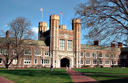
The University of Missouri System is Missouri's statewide public university system. The flagship institution and largest university in the state is the University of Missouri in Columbia. The others in the system are University of Missouri–Kansas City, University of Missouri–St. Louis, and Missouri University of Science and Technology in Rolla.
During the late nineteenth and early twentieth century, the state established a series of normal schools in each region of the state, originally named after the geographic districts: Northeast Missouri State University (now Truman State University) (1867), Central Missouri State University (now the University of Central Missouri) (1871), Southeast Missouri State University (1873), Southwest Missouri State University (now Missouri State University) (1905), Northwest Missouri State University (1905), Missouri Western State University (1915), Maryville University (1872) and Missouri Southern State University (1937). Lincoln University and Harris–Stowe State University were established in the mid-nineteenth century and are historically black colleges and universities.
Among private institutions Washington University in St. Louis and Saint Louis University are two top ranked schools in the US.[151] There are numerous junior colleges, trade schools, church universities and other private universities in the state. A.T. Still University was the first osteopathic medical school in the world. Hannibal–LaGrange University in Hannibal, Missouri, was one of the first colleges west of the Mississippi (founded 1858 in LaGrange, Missouri, and moved to Hannibal in 1928).[152]
The state funds a $3000, renewable merit-based scholarship, Bright Flight, given to the top three percent of Missouri high school graduates who attend a university in-state.
The 19th-century border wars between Missouri and Kansas have continued as a sports rivalry between the University of Missouri and University of Kansas. The rivalry was chiefly expressed through football and basketball games between the two universities, but since Missouri left the Big 12 Conference in 2012, the teams no longer regularly play one another. It was the oldest college rivalry west of the Mississippi River and the second-oldest in the nation. Each year when the universities met to play, the game was coined the "Border War". Following the game, an exchange occurred where the winner took a historic Indian War Drum, which had been passed back and forth for decades. Though Missouri and Kansas no longer have an annual game after the University of Missouri moved to the Southeastern Conference, rivalry still exists between them.
Culture
Music

Many well-known musicians were born or have lived in Missouri. These include guitarist and rock pioneer Chuck Berry, singer and actress Josephine Baker, "Queen of Rock" Tina Turner, pop singer-songwriter Sheryl Crow, Michael McDonald of the Doobie Brothers, rap producer Metro Boomin, and rappers Nelly, Chingy, and Akon, all of whom are either current or former residents of St. Louis.
Country singers from Missouri include Perryville native Chris Janson, New Franklin native Sara Evans, Cantwell native Ferlin Husky, West Plains native Porter Wagoner, Tyler Farr of Garden City, and Mora native Leroy Van Dyke, along with bluegrass musician Rhonda Vincent, a native of Greentop. Rapper Eminem was born in St. Joseph and also lived in Savannah and Kansas City. Ragtime composer Scott Joplin lived in St. Louis and Sedalia. Jazz saxophonist Charlie Parker lived in Kansas City. Rock and Roll singer Steve Walsh of the group Kansas was born in St. Louis and grew up in St. Joseph.
The Kansas City Symphony and the St. Louis Symphony Orchestra are the state's major orchestras. The latter is the nation's second-oldest symphony orchestra and achieved prominence in recent years under conductor Leonard Slatkin. Branson is well known for its music theaters, most of which bear the name of a star performer or musical group.
Literature
Missouri is the native state of Mark Twain. His novels The Adventures of Tom Sawyer and The Adventures of Huckleberry Finn are set in his boyhood hometown of Hannibal. Authors Kate Chopin, T. S. Eliot and Tennessee Williams were from St. Louis. Kansas City-born writer William Least Heat-Moon resides in Rocheport. He is best known for Blue Highways, a chronicle of his travels to small towns across America, which was on The New York Times Bestseller list for 42 weeks in 1982–1983. Novelist Daniel Woodrell, known for depicting life in the Missouri Ozarks, was born in Springfield and lives in West Plains.

Sports


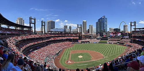
Missouri hosted the 1904 Summer Olympics at St. Louis, the first time the games were hosted in the United States.
Professional major league teams:
- MLB: St. Louis Cardinals, Kansas City Royals
- NFL: Kansas City Chiefs
- NHL: St. Louis Blues
- MLS: St. Louis City SC
Former professional major league teams:
- National Football League:
- St. Louis Cardinals (moved from Chicago in 1960; moved to Tempe, Arizona, in 1988 and are now the Arizona Cardinals)
- St. Louis All Stars (active in 1923 only)
- Kansas City Blues/Cowboys (active 1924–1926, folded)
- St. Louis Gunners (independent team, joined the NFL for the last three weeks of the 1934 season and folded thereafter)
- St. Louis Rams 1995–2015 moved from Los Angeles and then back to Los Angeles
- Major League Baseball (American League):
- St. Louis Browns (moved from Milwaukee in 1902; moved to Baltimore, Maryland after the 1953 season and are now the Baltimore Orioles)
- Kansas City Athletics (moved from Philadelphia in 1955; moved to Oakland, California after the 1967 season and are now the Oakland Athletics)
- National Basketball Association:
- St. Louis Bombers (charter BAA franchise in 1946, joined the NBA when it formed in 1949; ceased operations in 1950)
- St. Louis Hawks (moved from Milwaukee in 1955; moved to Atlanta in 1968 and are now the Atlanta Hawks)
- Kansas City Kings (moved from Cincinnati in 1972; moved to Sacramento in 1985 and are now the Sacramento Kings; prior to locating in Kansas City, they were known as the Cincinnati Royals)
- National Hockey League:
- Kansas City Scouts (1974 expansion team, moved to Denver, Colorado in 1976 and became the Colorado Rockies, and would move again to Newark, New Jersey; now called the New Jersey Devils)
- St. Louis Eagles (1934 relocation of the original Ottawa Senators, folded after the 1934–35 season)
- Major League Soccer:
- Kansas City Wiz/Kansas City Wizards (founded in 1995, but moved from Kansas City, Missouri, to Kansas City, Kansas, in 2010 and became Sporting Kansas City)
See also

References
- ^ "Elevations and Distances in the United States". United States Geological Survey. 2001. Archived from the original on October 15, 2011. Retrieved October 24, 2011.
- ^ Bureau, US Census (April 26, 2021). "2020 Census Apportionment Results". The United States Census Bureau. Archived from the original on April 26, 2021. Retrieved April 27, 2021.
{{cite web}}:|last=has generic name (help) - ^ "Median Annual Household Income". The Henry J. Kaiser Family Foundation. Archived from the original on December 20, 2016. Retrieved December 9, 2016.
- ^ "Missouri Revised Statutes Chapter 10 State Emblems Section 10.095". State of Missouri. Archived from the original on September 30, 2007. Retrieved July 10, 2007.
- ^ "Missouri Governor declares not just any Bourbon can be called Missouri bourbon". St. Louis Post-Dispatch. July 12, 2019. Archived from the original on July 24, 2019. Retrieved July 24, 2019.
- ^ "Census Regions of the United States" (PDF). U.S. Census Bureau. Archived (PDF) from the original on February 1, 2017. Retrieved January 9, 2017.
- ^ Fe, Mailing Address: National Trails Intermountain Region Pony Express National Historic Trail PO Box 728 Santa; Us, NM 87504 Phone:741-1012 Contact. "Pony Express National Historic Trail (U.S. National Park Service)". www.nps.gov. Archived from the original on February 23, 2019. Retrieved February 5, 2019.
{{cite web}}: CS1 maint: numeric names: authors list (link) - ^ "Hey Heidi: How did the Show Me State come about?". Ksdk.com. May 19, 2016. Archived from the original on January 3, 2020. Retrieved April 17, 2021.
- ^ Matthews, Christopher. "The 3 Best and 3 Worst States in America for Drinking". Time. ISSN 0040-781X. Archived from the original on September 1, 2019. Retrieved October 29, 2019.
- ^ "US News—Washington University in St. Louis". US News—Best Colleges. Archived from the original on July 4, 2019.
- ^ McCafferty, Michael. 2004. "Correction: Etymology of Missouri", American Speech, 79.1:32
- ^ a b Wheaton, Sarah (October 13, 2012). "Missouree? Missouruh? To Be Politic, Say Both". The New York Times. pp. A1. Archived from the original on October 13, 2012. Retrieved October 14, 2012.
- ^ "Missouri". Merriam-Webster Dictionary. Archived from the original on April 22, 2009. Retrieved July 21, 2013.
- ^ a b Lance, Donald M. (Fall 2003). "The Pronunciation of Missouri: Variation and Change in American English". American Speech. 78 (3): 255–284. doi:10.1215/00031283-78-3-255. ISSN 0003-1283. S2CID 143791619. Archived from the original on April 9, 2008. Retrieved October 19, 2007.
- ^ "Missouri". Oxford English Dictionary (Online ed.). Oxford University Press. (Subscription or participating institution membership required.)
- ^ Wells, John C. (2008). Longman Pronunciation Dictionary (3rd ed.). Longman. ISBN 978-1-4058-8118-0.
- ^ Roach, Peter (2011). Cambridge English Pronouncing Dictionary (18th ed.). Cambridge: Cambridge University Press. ISBN 978-0-521-15253-2.
- ^ Lance, Donald M. (September 17, 2003). "The Pronunciation of Missouri : Variation and Change in American English". American Speech. 78 (3): 255–284. doi:10.1215/00031283-78-3-255. S2CID 143791619. Archived from the original on February 25, 2018. Retrieved February 25, 2018 – via Project MUSE.
- ^ a b "Origin of "Show-Me" Slogan". State Archives Missouri History (FAQ). MO: Secretary of State. Archived from the original on March 17, 2010. Retrieved February 20, 2010.
- ^ "skepticism". Archived from the original on July 9, 2014. Retrieved April 19, 2014 – via The Free Dictionary.
- ^ "I'm from Missouri—Show Me", Barry Popik, archived from the original on October 28, 2006, retrieved August 14, 2006
- ^ Introduction to Missouri, Netstate, archived from the original on April 16, 2016, retrieved October 18, 2007
- ^ Unklesbay, Athel Glyde; Vineyard, Jerry D. (1992). Missouri Geology: Three Billion Years of Volcanoes, Seas, Sediments, and Erosion. University of Missouri Press. ISBN 978-0-8262-0836-1. Archived from the original on May 10, 2022. Retrieved November 15, 2021.
- ^ House, Scott (May 14, 2005). "Fact Sheet on 6000 Caves". The Missouri Speleological Survey. Archived from the original on May 9, 2008. Retrieved March 16, 2008.
- ^ "Missouri Department of Natural Resources". Dnr.mo.gov. Archived from the original on November 9, 2020. Retrieved April 17, 2021.
- ^ The Great Seal of Missouri, MO: Secretary of State, archived from the original on January 30, 2009, retrieved March 27, 2009
- ^ "Missouri - History". Encyclopedia Britannica. Archived from the original on March 9, 2021. Retrieved March 3, 2021.
- ^ Cazorla, Frank; Baena, Rose; Polo, David; and Reder Gadow, Marion. (2019) The governor Louis de Unzaga (1717–1793) Pioneer in the Birth of the United States of America. Foundation, Malaga, pages 49, 57–65, 70–75, 150, 207
- ^ Foley (1989), 26.
- ^ Hoffhaus. (1984). Chez Les Canses: Three Centuries at Kawsmouth, Kansas City: Lowell Press. ISBN 0-913504-91-2.
- ^ "MISSOURI V. IOWA, 48 U.S. 660 (1849)—US Supreme Court Cases from Justia & Oyez". Supreme.justia.com. Archived from the original on November 11, 2010. Retrieved July 31, 2010.
- ^ Meinig, D.W. (1993). The Shaping of America: A Geographical Perspective on 500 Years of History, Volume 2: Continental America, 1800–1867. New Haven: Yale University Press. ISBN 0-300-05658-3; pg. 437
- ^ Davis, Chad (February 21, 2019). "A Little-Known History: German Immigrants In Missouri Were Anti-Slavery Allies". news.stlpublicradio.org. Archived from the original on October 29, 2019. Retrieved October 29, 2019.
- ^ a b "Part I: Peopling St. Louis". stlouis-mo.gov. Archived from the original on October 29, 2019. Retrieved October 29, 2019.
- ^ Historical Census Browser, 1860 Federal Census, University of Virginia Library Archived December 6, 2009, at the Wayback Machine. Retrieved March 21, 2008.
- ^ "Louisiana: The Levee System of the State" Archived July 21, 2018, at the Wayback Machine, New York Times, October 8, 1874; Retrieved November 15, 2007
- ^ Steckmesser Kent L (1966). "Robin Hood and the American Outlaw: A Note on History and Folklore". Journal of American Folklore. 79 (312): 348–355. doi:10.2307/538043. JSTOR 538043.
- ^ Mary Hartman and Elmo Ingenthron. Bald Knobbers: Vigilantes on the Ozarks Frontier (1988)
- ^ Steven L. Piott, Holy Joe: Joseph Folk and the Missouri Idea (1997)
- ^ "First interstate project". Fhwa.dot.gov. Archived from the original on June 7, 2011. Retrieved May 6, 2014.
- ^ McLaughlin, Eliott C. (August 15, 2014). "What we know about Michael Brown's shooting". CNN. Archived from the original on August 25, 2014.
- ^ Carr, David (August 17, 2014). "View of #Ferguson Thrust Michael Brown Shooting to National Attention". The New York Times. Archived from the original on August 10, 2017.
- ^ Bouie, Jamelle (August 19, 2014). "Why the Fires in Ferguson Won't End Soon". Slate. Archived from the original on August 31, 2017..
- ^ Davey, Monica; Eligon, John; Blinder, Alan (August 19, 2014). "National Guard Troops Fail to Quell Unrest in Ferguson". The New York Times. Archived from the original on August 19, 2014. Retrieved August 19, 2014.
- ^ Hartmann, Margaret (August 18, 2014). "National Guard Deployed After Chaotic, Violent Night in Ferguson". Intelligencer. NY Magazine. Archived from the original on August 19, 2014. Retrieved August 18, 2014.
- ^ Department of Justice Report Regarding the Criminal Investigation Into the Shooting Death of Michael Brown by Ferguson, Missouri Police Officer Darren Wilson (PDF) (Report). U.S. Department of Justice. March 4, 2015. Archived (PDF) from the original on July 31, 2017.
- ^ Apuzzo, Matt (March 3, 2015). "Ferguson Police Routinely Violate Rights of Blacks, Justice Dept. Finds". The New York Times. Archived from the original on March 3, 2015. Retrieved March 4, 2015.
- ^ "Ferguson Officials Suspended After DOJ Report Have Resigned, City Confirms". NBC News. March 7, 2015. Archived from the original on August 10, 2017.
- ^ "Report on Ferguson Exposes Broader Effort to Reform Municipal Courts". NBC News. March 3, 2015. Archived from the original on August 10, 2017..
- ^ Naskidashvili, Nana (October 1, 2015). "Students march through MU Student Center in protest of racial injustice". Columbia Missourian. Archived from the original on July 8, 2017. Retrieved November 11, 2015.
- ^ Plaster, Madison (October 1, 2015). "Second 'Racism Lives Here' event calls for administration to act on social injustices". The Maneater. Archived from the original on November 11, 2015. Retrieved November 11, 2015.
- ^ "Urgent–Missouri Travel Advisory" (PDF). National Association for the Advancement of Colored People. June 7, 2017. Archived (PDF) from the original on February 25, 2021. Retrieved April 17, 2021.
- ^ Coleman, Nancy (August 3, 2017). "NAACP issues its first statewide travel advisory, for Missouri". CNN. Archived from the original on October 28, 2017.
- ^ Gold, Alison (June 1, 2018). "Black Drivers Stopped in Missouri at a Rate 85 Percent Higher Than Whites". Riverfront Times. Archived from the original on July 5, 2018. Retrieved July 5, 2018.
- ^ Lartey, Jamiles (July 5, 2018). "'Predatory police': the high price of driving while black in Missouri". The Guardian. Archived from the original on July 5, 2018. Retrieved July 5, 2018.
- ^ "Secretary Perdue Announces Lease for ERS and NIFA in Kansas City, MO" (Press release). US Department of Agriculture. October 31, 2019. Archived from the original on December 22, 2019. Retrieved December 22, 2019.
- ^ "Nearly $8 billion in development underway in St. Louis City". KMOV.com. Archived from the original on December 22, 2019. Retrieved December 22, 2019.
- ^ Siemers, Erik (November 7, 2019). "MLS: A timeline for a team name & how the stadium project expanded". St. Louis Business Journal. Archived from the original on September 19, 2020. Retrieved December 22, 2019.
- ^ https://flatlandkc.org/people-places/migration-patterns-kansas-city/
- ^ "Archived copy". Archived from the original on September 2, 2024. Retrieved September 2, 2024.
{{cite web}}: CS1 maint: archived copy as title (link) - ^ "Archived copy". Archived from the original on September 27, 2023. Retrieved September 2, 2024.
{{cite web}}: CS1 maint: archived copy as title (link) - ^ "Midwest Region Economy at a Glance". Bls.gov. Archived from the original on September 17, 2010. Retrieved July 31, 2010.
- ^ Almanac of the 50 States (Missouri). Information Publications (Woodside, California). 2008. p. 203.
- ^ "Missouri's Karst Wonderland—Missouri State Parks and Historic Sites, DNR". Mostateparks.com. June 6, 2008. Archived from the original on February 28, 2010. Retrieved February 20, 2010.
- ^ "Income Inequality in Missouri". Ded.mo.gov. December 21, 2001. Archived from the original on January 7, 2010. Retrieved July 31, 2010.
- ^ "Missouri Weather And Climate". Archived from the original on May 5, 2011. Retrieved July 17, 2007.
- ^ "Missouri's High Country". Missouri Department of Conservation. Archived from the original on June 22, 2020. Retrieved June 19, 2020.
- ^ Farmer, Charles J. (1999). A Personal Guide to Missouri Wilderness. University of Missouri Press. pp. 9–13.
- ^ "Historical Population Change Data (1910–2020)". Census.gov. United States Census Bureau. Archived from the original on April 29, 2021. Retrieved May 1, 2021.
- ^ "QuickFacts Missouri; UNITED STATES". 2019 Population Estimates. United States Census Bureau, Population Division. February 6, 2019. Archived from the original on January 3, 2020. Retrieved February 6, 2019.
- ^ "Immigrants in Missouri" (PDF). Archived (PDF) from the original on March 24, 2023. Retrieved January 4, 2024.
- ^ "2007-2022 PIT Counts by State". Archived from the original on March 14, 2023. Retrieved March 11, 2023.
- ^ "The 2022 Annual Homelessness Assessment Report (AHAR) to Congress" (PDF). Archived (PDF) from the original on March 11, 2023. Retrieved March 11, 2023.
- ^ Population Division, Laura K. Yax. "Historical Census Statistics on Population Totals By Race, 1790 to 1990, and By Hispanic Origin, 1970 to 1990, For The United States, Regions, Divisions, and States". Archived from the original on July 25, 2008.
- ^ "Population of Missouri: Census 2010 and 2000 Interactive Map, Demographics, Statistics, Quick Facts". Retrieved April 17, 2021.[permanent dead link]
- ^ "2010 Census Data". Archived from the original on May 16, 2014. Retrieved December 11, 2017.
- ^ "Profile of General Population and Housing Characteristics: 2020 Demographic Profile Data (DP-1): Missouri". United States Census Bureau. Archived from the original on April 2, 2024. Retrieved April 2, 2024.
- ^ "Population and Population Centers by State". United States Census Bureau. 2000. Archived from the original on December 12, 2001. Retrieved December 5, 2008.
- ^ "Race and Ethnicity in the United States: 2010 Census and 2020 Census".
- ^ Exner, Rich (June 3, 2012). "Americans under age 1 now mostly minorities, but not in Ohio: Statistical Snapshot". The Plain Dealer. Archived from the original on July 14, 2016. Retrieved August 17, 2012.
- ^ "data" (PDF). Centers for Disease Control and Prevention. Archived (PDF) from the original on September 25, 2018. Retrieved September 25, 2018.
- ^ "data" (PDF). Centers for Disease Control and Prevention. Archived (PDF) from the original on September 26, 2018. Retrieved September 25, 2018.
- ^ "data" (PDF). Centers for Disease Control and Prevention. Archived (PDF) from the original on September 26, 2018. Retrieved September 25, 2018.
- ^ "data" (PDF). Centers for Disease Control and Prevention. Archived (PDF) from the original on June 3, 2018. Retrieved May 4, 2018.
- ^ "Births: Final Data for 2017" (PDF). Centers for Disease Control and Prevention. Archived (PDF) from the original on February 1, 2019. Retrieved February 21, 2019.
- ^ "Data" (PDF). Centers for Disease Control and Prevention. Archived (PDF) from the original on November 28, 2019. Retrieved December 21, 2019.
- ^ "Data" (PDF). Centers for Disease Control and Prevention. Archived (PDF) from the original on June 23, 2021. Retrieved March 30, 2021.
- ^ "Data" (PDF). Centers for Disease Control and Prevention. Archived (PDF) from the original on February 10, 2022. Retrieved February 20, 2022.
- ^ "Data" (PDF). Centers for Disease Control and Prevention. Archived (PDF) from the original on February 1, 2023. Retrieved February 3, 2022.
- ^ "Data" (PDF). www.cdc.gov. Archived (PDF) from the original on April 4, 2024. Retrieved April 5, 2024.
- ^ "Latinos in Missouri" (PDF). Archived (PDF) from the original on May 25, 2017.
- ^ Ammon, Ulrich (1989). Status and Function of Languages and Language Varieties. Walter de Gruyter. pp. 306–8. ISBN 978-0-89925-356-5. Archived from the original on December 20, 2012. Retrieved September 3, 2010.; International Sociological Association.
- ^ Carrière, J-M (1939). "Creole Dialect of Missouri". American Speech. 14 (2): 109–19. doi:10.2307/451217. JSTOR 451217.
- ^ a b "Religious Landscape Study". May 11, 2015. Archived from the original on September 5, 2015. Retrieved August 30, 2015.
- ^ "The Association of Religion Data Archives | State Membership Report". www.thearda.com. Archived from the original on December 2, 2013. Retrieved November 22, 2013.
- ^ Kellie Moore (February 25, 2013). "Fox apologizes for comments on Wiccans at University of Missouri". Religious News Service. Archived from the original on December 24, 2013. Retrieved December 23, 2013.
- ^ Pokin, Steve. "Which do we have more of? Churches or Chinese restaurants?". Springfield News-Leader. Archived from the original on April 15, 2021. Retrieved March 22, 2021.
- ^ "Springfield Area Congregations Study: Profile and Community Engagement" (PDF). Archived (PDF) from the original on April 15, 2021. Retrieved March 22, 2021.
- ^ "Missouri State Quarter". United States Mint. Archived from the original on November 18, 2021. Retrieved September 21, 2021.
- ^ "Missouri". United States Census Bureau. Archived from the original on November 1, 2019. Retrieved November 1, 2019.
- ^ "GDP by State". GDP by State | U.S. Bureau of Economic Analysis (BEA). Bureau of Economic Analysis. Archived from the original on August 17, 2018. Retrieved May 22, 2024.
- ^ Account, Economic (March 29, 2024). "Personal Income by State". U.S. Bureau of Economic Analysis (BEA). Archived from the original on May 20, 2024. Retrieved May 22, 2024.
- ^ "Missouri Partnership | Economic Development | Global Agtech Leader". www.missouripartnership.com. Archived from the original on May 25, 2017. Retrieved May 17, 2017.
- ^ "FRB: Federal Reserve Districts and Banks". Federalreserve.gov. December 13, 2005. Archived from the original on August 26, 2013. Retrieved February 20, 2010.
- ^ "DED Releases April 2017 Jobs Report". Missouri Department of Economic Development. May 16, 2017. Archived from the original on May 25, 2017. Retrieved May 17, 2017.
- ^ "Governor Greitens Signs Right To Work into Missouri Law—Missouri Partnership". www.missouripartnership.com. February 6, 2017. Archived from the original on May 25, 2017. Retrieved May 17, 2017.
- ^ "Right-to-work overturned as Prop A fails". August 8, 2018. Archived from the original on August 9, 2018. Retrieved August 10, 2018.
- ^ Watkins, Eli. "Unions notch win in deep-red Missouri with rejection of right-to-work law". CNN. Archived from the original on August 10, 2018. Retrieved August 10, 2018.
- ^ "Missouri voters reject right-to-work, McCulloch loses, Stenger wins". St. Louis Business Journal. 2018. Archived from the original on February 15, 2019. Retrieved August 10, 2018.
- ^ a b "2017 State Business Tax Climate Index—Tax Foundation". Tax Foundation. September 28, 2016. Archived from the original on May 16, 2017. Retrieved May 17, 2017.
- ^ "Missouri Partnership | Economic Development | Location | Low Business Costs". missouripartnership.com. Archived from the original on May 25, 2017. Retrieved May 17, 2017.
- ^ "Missouri Electricity Profile 2012". U.S. Energy Information Administration. May 1, 2014. Archived from the original on April 29, 2014. Retrieved May 17, 2014.
- ^ a b c d National Association for State Energy Officials and the Kentucky Department for Energy Development and Independence. "Missouri Energy Profile" (PDF). Archived from the original (PDF) on June 3, 2014. Retrieved July 14, 2013.
- ^ U.S. Installed Wind Capacity Archived March 14, 2014, at the Wayback Machine
- ^ a b Sherwood, Larry (July 2010). "U.S. Solar Market Trends 2009" (PDF). Interstate Renewable Energy Council (IREC). Archived from the original (PDF) on September 25, 2010. Retrieved July 28, 2010.
- ^ "Missouri Partnership | Economic Development | Empowered Energy Solutions". www.missouripartnership.com. Archived from the original on May 23, 2017. Retrieved May 17, 2017.
- ^ Missouri Department of Natural Resources. "Geologicaly Survey Program—Oil and Gas in Missouri". Archived from the original on July 16, 2013. Retrieved July 14, 2013.
- ^ United States Energy Information Administration. "Petroleum and Other Liquids—Number and Capacity of Petroleum Refineries". Archived from the original on May 29, 2014. Retrieved July 14, 2013.
- ^ "Non-stop Destinations | Springfield-Branson National Airport (SGF)". flyspringfield.com. Archived from the original on January 12, 2016. Retrieved January 18, 2016.
- ^ "Columbia Regional Airport". www.flycou.com. Archived from the original on January 12, 2016. Retrieved January 18, 2016.
- ^ "Fact Sheet: High Speed Intercity Passenger Rail Program: Chicago–St. Louis–Kansas City". Archived from the original on January 28, 2017. Retrieved January 28, 2010.
- ^ "KC Streetcar—About KC Streetcar". Archived from the original on October 29, 2013. Retrieved October 27, 2013.
- ^ della Cava, Marco (January 30, 2018). "Is Missouri ready for 700 mph hyperloop commutes?". USA Today. Archived from the original on March 28, 2019. Retrieved March 28, 2019.
- ^ "Megabus canceling service in Kansas City, Columbia". kansascity. Archived from the original on February 1, 2016. Retrieved January 18, 2016.
- ^ "Number of Persons Killed or Injured in Missouri Crashes by Year". Missouri State Highway Patrol. Archived from the original on January 17, 2013. Retrieved September 30, 2012.
- ^ "Scott Fitzpatrick sworn in as Missouri Auditor, vows to monitor school spending" Archived January 10, 2023, at the Wayback Machine, KCUR, January 9, 2023
- ^ J. Pomante II, Michael; Li, Quan (December 15, 2020). "Cost of Voting in the American States: 2020". Election Law Journal: Rules, Politics, and Policy. 19 (4): 503–509. doi:10.1089/elj.2020.0666. S2CID 225139517.
- ^ "Methods of Execution". Archived from the original on July 1, 2018. Retrieved March 20, 2023.
- ^ "Missouri". Center for Reproductive Rights. Retrieved September 18, 2024.
- ^ "Registered Voters in Missouri 2012". Missouri Secretary of State. October 24, 2012. Archived from the original on October 25, 2012. Retrieved October 28, 2012.
- ^ "Voter Turnout Report: 2020 General Election" (PDF). Missouri Secretary of State. December 8, 2020. Retrieved June 14, 2021.[permanent dead link]
- ^ Leip, David. "Presidential General Election Results Comparison—Missouri". US Election Atlas. Archived from the original on December 1, 2008. Retrieved December 16, 2020.
- ^ "Missouri Secretary of State—State Archives—Origin of "Show Me" slogan". Sos.mo.gov. Archived from the original on July 24, 2010. Retrieved July 31, 2010.
- ^ a b Mercatus Center (March 28, 2013). "Freedom in the 50 States-Missouri". Freedom in the 50 States. George Mason University. Archived from the original on April 7, 2013. Retrieved March 29, 2013.
- ^ "Mo. Rev. Stat. § 290.145". Moga.mo.gov. August 28, 2009. Archived from the original on August 8, 2010. Retrieved July 31, 2010.
- ^ "Mo. Rev. Stat. § 67.305". Moga.mo.gov. August 28, 2009. Archived from the original on July 1, 2010. Retrieved July 31, 2010.
- ^ "Mo. Rev. Stat. § 311.170". Moga.mo.gov. August 28, 2009. Archived from the original on August 30, 2010. Retrieved July 31, 2010.
- ^ "Mo. Rev. Stat. § 311.310". Moga.mo.gov. August 28, 2009. Archived from the original on May 27, 2010. Retrieved July 31, 2010.
- ^ "Mo. Rev. Stat. § 311.086". Moga.mo.gov. August 28, 2009. Archived from the original on August 29, 2010. Retrieved July 31, 2010.
- ^ "State Cigarette Excise Tax Rates" (PDF). Archived from the original (PDF) on October 4, 2016. Retrieved November 9, 2016.
- ^ "A burning issue", St. Louis Post-Dispatch, November 12, 2006
- ^ O'Neil, Tim (November 6, 2012). "Missouri keeps tobacco tax as the lowest in the nation". stltoday.com. Archived from the original on July 13, 2018. Retrieved February 5, 2019.
- ^ "Best Cities for Smokers". Forbes. November 1, 2007. Archived from the original on May 31, 2010. Retrieved July 31, 2010.
- ^ "Missouri voters reject tobacco tax hikes". KY3-TV. Archived from the original on November 9, 2016. Retrieved November 9, 2016.
- ^ "Centers for Disease Control and Prevention, "Behavioral Risk Factor Surveillance System—Adults who are current smokers", September 19, 2008". Apps.nccd.cdc.gov. May 15, 2009. Archived from the original on March 10, 2010. Retrieved July 31, 2010.
- ^ "Mo. Rev. Stat. § 407.931.3". Moga.mo.gov. Archived from the original on August 15, 2010. Retrieved July 31, 2010.
- ^ "Missouri Department of Health and Senior Services, County Level Survey 2007: Secondhand Smoke for Missouri Adults, October 1, 2008". Dhss.mo.gov. Archived from the original on December 16, 2008. Retrieved July 31, 2010.
- ^ "Mo. Rev. Stat. § 191.769". Moga.mo.gov. August 28, 2009. Archived from the original on December 10, 2011. Retrieved July 31, 2010.
- ^ a b "City and Town Population Totals: 2020–2022". U.S. Census Bureau. Archived from the original on September 28, 2022. Retrieved January 4, 2024.
- ^ Missouri Department Of Elementary And Secondary Education (September 2, 2009). "Home Schooling". Dese.mo.gov. Archived from the original on May 14, 2011. Retrieved February 20, 2010.
- ^ "America's Best Colleges 2008: National Universities: Top Schools." USNews.com: . January 18, 2008. Archived July 30, 2008, at the Wayback Machine
- ^ Don Colborn, PhD. "HLGU—About HLG". Hlg.edu. Archived from the original on November 22, 2011. Retrieved December 10, 2011.
External links
Missouri at Wikipedia's sister projects
 Definitions from Wiktionary
 Media from Commons
 News from Wikinews
 Quotations from Wikiquote
 Texts from Wikisource
 Textbooks from Wikibooks
 Resources from Wikiversity
 Travel information from Wikivoyage
- Missouri Government
- Missouri Digital Heritage, Missouri Government, archived from the original on February 15, 2021, retrieved December 4, 2009
- Missouri State Guide, from the Library of Congress Archived December 1, 2019, at the Wayback Machine
- Missouri State Tourism Office, archived from the original on February 17, 2021, retrieved July 31, 2010
- Energy & Environmental Data for Missouri, US: DoE, archived from the original on December 29, 2010, retrieved December 6, 2018
- Missouri State Facts, USDA
- "American Library Association Government Documents Roundtable", List of searchable databases produced by Missouri state agencies, archived from the original on October 31, 2020, retrieved April 2, 2018
- Missouri History, Geology, Culture, UM system, archived from the original on March 26, 2016, retrieved March 14, 2011
- Historic Sanborn Fire Insurance Maps of Missouri, UM system, archived from the original on April 10, 2011
- 1930 Platbooks of Missouri Counties, UM system, archived from the original on October 21, 2016, retrieved March 14, 2011
- Scientific American, "Ancient Man in Missouri Archived January 12, 2023, at the Wayback Machine", September 11, 1880, p. 169
38°N 92°W / 38°N 92°W / 38; -92 (State of Missouri)