
Loading article…


ニューヨーク都市圏は、広くはトライステートエリアと呼ばれ、しばしばグレーターニューヨークとも呼ばれ、都市面積で世界最大の 都市圏であり、[11] [12] [13] 、4,669.0平方マイル(12,093 km 2 )をカバーしています。[14]ニューヨーク都市圏は、世界で最も人口の多い都市圏の1つであり、米国最大の都市圏であり、 2020年の米国国勢調査時点で2000万人を超える居住者がいる唯一の米国都市圏です。
広大な大都市圏には、国内で最も人口の多い都市であるニューヨーク市、ロングアイランド、ニューヨーク州のハドソン渓谷中流と下流、14の郡、ニュージャージー州の最大都市のうち11 、コネチカット州の最大都市7のうち6つが含まれる。トライステートエリアという用語は通常、ニューヨーク、ニュージャージー、コネチカットを指すのに使われるが、ニューヨーク市で働く人のうち、ペンシルベニア州、特にペンシルベニア州東部のリーハイバレー、バックス郡、ポコノス地域から通勤する人が増えており、大都市圏は4つの州にまたがっている。ニューヨーク大都市圏は、より大きな北東部メガロポリスの地理的および人口統計的中心である。
ニューヨーク都市圏は、2020年時点で2,010万人の住民を抱え、全米人口の6%強を占める、米国で最も人口の多い都市統計地域である。 [8]統合統計地域には、2020年時点で2,360万人の住民がいる。 [15] [16]世界最大級の都市集積地の一つである。[17] [18] [19]ニューヨーク都市圏は、米国への合法的な移民にとって最高の玄関口であり続けている。[20] [21] [22] [23]世界のどの都市圏よりも外国生まれの人口が多い。都市統計地域は6,720平方マイル(17,405 km 2)で、統合統計地域は13,318平方マイル(34,493 km 2)であり、民族的および地理的に多様な地域を包含している。ニューヨーク都市圏の人口はニューヨーク州の人口より多く、2016年には都市圏の空域は1億3000万人以上の乗客を収容した。[24]
2022年現在[update]、ニューヨーク都市圏は世界最大の都市圏経済であり、都市圏総生産は2.5兆ドルを超えています。[10]ニューヨーク大都市圏は、金融、ヘルスケア、製薬、生命科学における科学的成果、[25] [26] 国際貿易、出版、不動産、教育、ファッション、エンターテインメント、観光、法律、製造業など、複数の産業の中心地であり、ニューヨーク都市圏が独立した主権国家であれば、世界で8番目に大きな経済圏を構成することになります。世界で最も著名な金融、 [27] [28] [29] 外交、メディアの中心地です[30] [31]。[32] [33]
フォーブス誌によると、2014年には、ニューヨーク都市圏には米国の住宅価格の中央値で上位10位の郵便番号のうち8つがあり、マンハッタンだけで6つありました。[34]ニューヨーク都市圏は、その変化に富んだ景観と自然の美しさで知られ、ブルームバーグによると、米国で最も裕福な場所トップ10のうち5つが含まれています。これらは、ニューヨーク州スカーズデール、ニュージャージー州ショートヒルズ、コネチカット州オールドグリニッジ、ニューヨーク州ブロンクスビル、コネチカット州ダリエンです。[35]ニューヨーク都市圏の高等教育ネットワークは、数百の大学から構成されており、アイビーリーグの4 大学、コロンビア大学、プリンストン大学、イェール大学、コーネル大学(コーネル工科大学とウェイルコーネル医学部)のキャンパス、最大規模の公立大学システムの旗艦キャンパスであるニューヨーク州立大学 ストーニーブルック校とラトガース大学などがあります。世界的に評価の高いニューヨーク大学、ロックフェラー大学、コールド・スプリング・ハーバー研究所など。
定義
大都市統計地域
ニューヨーク都市圏を構成する郡と郡グループを 2010 年の国勢調査の数字とともに以下に示し ます。


米国行政管理予算局は、都市化地域の2つの定義、すなわち大都市統計地域 (MSA) と複合統計地域 (CSA) を利用している。MSAの定義はニューヨーク・ニューアーク・ジャージーシティ、NY・NJ・PA大都市統計地域と題され、2017年の国勢調査の推定人口2,030万人が含まれる。これは米国人のおよそ16人に1人に相当し、米国で2位のロサンゼルス大都市圏より700万人近く多い。MSAはさらに4つの大都市圏に細分化されている。23郡からなるMSAには、ニューヨーク州の10郡(ニューヨークの5つの行政区、ロングアイランドの残り2郡、およびローワー ハドソンバレーの3郡と同範囲)、ニュージャージー州北部および中央部の12郡、および ペンシルベニア州北東部の1郡が含まれる。米国最大の都市化地域は、大都市圏の中心であるニューヨーク・ニューアーク、ニューヨーク・ニュージャージー・コネチカット州都市化地域にあり、2010 年の国勢調査によると、2010 年の土地面積は 3,450 平方マイルでした。大都市圏のニューヨーク州部分は、ニューヨーク市の 5 つの行政区、ハドソン渓谷下流、ロングアイランドを含み、州の人口の 65% 以上を占めています。
ニューヨーク・ニューアーク・ジャージーシティ、NY・NJ・PA大都市統計地域 (19,043,386)
- ニューヨーク・ジャージーシティ・ホワイトプレインズ、NY・NJメトロポリタン地区(11,732,233)
- ニューヨーク州キングス郡 (ニューヨーク市のブルックリン区)
- ニューヨーク州クイーンズ郡 (ニューヨーク市のクイーンズ区)
- ニューヨーク州ニューヨーク郡 (ニューヨーク市のマンハッタン区)
- ニューヨーク州ブロンクス郡 (ニューヨーク市のブロンクス区)
- ニューヨーク州リッチモンド郡 (ニューヨーク市のスタテンアイランド自治区)
- ニューヨーク州ウェストチェスター郡
- ニュージャージー州バーゲン郡
- ニュージャージー州ハドソン郡
- ニュージャージー州パセーイク郡
- ニューヨーク州ロックランド郡
- ニューヨーク州パトナム郡
- ニューヨーク州ナッソー郡・サフォーク郡都市圏(2,832,882)
- ニューブランズウィック・レイクウッド、ニュージャージー州メトロポリタン地区 (2,383,854)
- ニューアーク、ニュージャージー州–ペンシルベニア州メトロポリタン地区 (2,174,944)
統合統計地域
複合統計地域(CSA)は、経済的に相互に結びつきの強い、隣接する中核統計地域をグループ化したものです。 [36]ニューヨーク・ニューアーク、NY・NJ・CT・PA複合統計地域の推定人口は、2014年の時点で2,370万人でした。[16]約15人に1人のアメリカ人がこの地域に住んでいます。この地域には、ニューヨーク、ニュージャージー、コネチカット、ペンシルバニアの8つの郡が含まれます。ペンシルバニア州を除くこの地域は、しばしばトライステートエリアと呼ばれ、あまり一般的ではありませんがトライステート地域と呼ばれます。ニューヨーク市のテレビ指定市場エリア(DMA)には、ペンシルバニア州パイク郡が含まれ、[37]これもCSAに含まれています。
ニューヨーク・ニューアーク・ジャージーシティ、NY・NJ・PA 大都市統計地域 (MSA) に加えて、次のコアベース統計地域もニューヨーク・ニューアーク、NY・NJ・CT・PA CSA に含まれています。
- ブリッジポート・スタンフォード・ノーウォーク・ダンベリー、コネチカット州MSA (916,829)
- ニューヘイブン・ミルフォード、コネチカット州MSA (862,477)
- トレントン–プリンストン、ニュージャージー州MSA (396,811)
- トリントン、コネチカット州小都市統計地域 (189,927)
- キングストン、ニューヨークMSA (182,693)
- キルヤス ジョエル - ポキプシー - ニューバーグ、ニューヨーク州MSA (670,301)
地理

この地域は、以下のサブリージョンに分けられることが多い。[39] [40]
- ニューヨーク市(大都市圏の主要都市で、5つの行政区から構成され、そのうちの1つがマンハッタンであり、大都市圏全体の地理的、文化的、経済的中心地である)
- ロングアイランドの中央部と東部(ナッソー郡とサフォーク郡 - ニューヨーク市を除くこの地域の他の地域とは水路で隔てられている。ニューヨークの5つの行政区のうち2つと重なるクイーンズ郡とキングス郡(ブルックリン)は含まれない)
- ノースジャージー(ニュージャージー州北部)
- セントラルジャージー(ニュージャージー州中部)
- ハドソンバレー(ウエストチェスター郡、パトナム郡、ロックランド郡のハドソンバレー南部郊外、およびダッチェス郡、サリバン郡、オレンジ郡、アルスター郡のハドソン中部郊外)
- コネチカット州西部(フェアフィールド郡、ニューヘイブン郡、リッチフィールド郡のみがこの地域の一部であり、州境で区切られています)
- ポコノス南部と東部(ペンシルベニア州モンロー郡とパイク郡)
8つのサブリージョンは、さらに細分化されることが多い。例えば、ロングアイランドは、サウスショアとノースショア(通常はナッソー郡とサフォーク郡西部を指す)とイーストエンドに分けられる。ハドソンバレーとコネチカットは、メトロノース鉄道システムを共有しているため、一緒にグループ化されて北部郊外と呼ばれることがある。[41]
気候
ケッペンの気候区分では、ニューヨーク市、ロングアイランド西部(および東部の一部)、ジャージーショアは湿潤亜熱帯気候(Cfa)に属し、[42] [43]ニューヨークは北米大陸でこの気候区分に属する最北の主要都市となっている。
首都圏の残りの大部分は、湿潤亜熱帯気候 ( Cfa )から湿潤大陸性気候( Dfa )への移行帯に位置しており[42] [43]、ニュージャージー州サセックス郡など、はるか北西の内陸の郊外地域でのみ、1 月の平均気温は -3 °C (26.6 °F) 以下となり、完全に湿潤大陸性気候となっている。Dfb (温暖な夏の亜型) 気候は、内陸の標高の高い地域でのみ見られ[42] 、 Dfa地域よりも降雪量が多い[44]。ペンシルベニア州モンローの大部分とパイク郡のほとんども、完全に湿潤大陸性気候である。
この地域の夏は典型的には暑く、湿気が多い。ニューヨークの5つの行政区内および近郊の夜間の気温は、ヒートアイランド現象によって悪化することが多く、毎年夏には平均7~8日(ロングアイランド湾のすぐ近くと大西洋岸)気温が90 °F(32 °C)を超え、最高27日(ニュージャージー州の内陸郊外)を超え、100 °F(38 °C)を超えることもある。[要出典]通常、暖かいから暑い気温は5月中旬に始まり、10月上旬まで続く。夏には、日中の暑さで強まる通り雨が特徴で、その後、短時間だが激しい雨が降る。
冬は寒く、雨と雪が混じります。冬の卓越風は沖合から吹き、大西洋の緩和効果を和らげますが、大西洋とアパラチア山脈が冷たい空気を部分的に遮ってくれるため、ニューヨーク地域の冬は、ピッツバーグ、シンシナティ、インディアナポリスなど、同程度かそれより低い緯度にある内陸の北米都市圏よりも温暖です。冬でも気温が 50 °F (10 °C) を超える暖かい時期が時々あります。[45]ニューヨーク都市圏の耐寒性ゾーンは、ダッチェス郡、モンロー郡、アルスター郡の最高地点の5aから、ニューヨーク市の大部分、ベイヨンからパリセーズの東側、国道495号線までのハドソン郡、ナッソー郡の大部分、モンマス郡の北海岸、サフォーク郡のコピアグハーバー、リンデンハースト、モントークの7bまで、広範囲にわたります。[46]
首都圏のほぼ全域で年間降水量は少なくとも42インチ(1,070 mm)で、年間を通じて比較的均等に降水しており、多くの地域では50インチ(1,270 mm)以上になる。1981年から2010年までの冬の平均降雪量は、ロングアイランド沿岸で25インチ(64 cm)弱、内陸部では50インチ(127 cm)を超えるが、これは通常、年によって大きく異なる。[47]過去にはハリケーンや熱帯暴風雨がトライステート地域を襲ったことがあるが、直撃することはまれである。ロングアイランド、ニュージャージー州、コネチカット州沿岸のいくつかの地域は、過去に深刻な高潮の被害を受けたことがある。内陸部は熱帯低気圧による大雨や洪水の被害を受けたことがある。[48]
ニューヨーク都市圏では、年間平均234日以上晴れており、日照可能量の59%に達し、[49]年間2,400~2,800時間の日照時間を記録しています。[50]
サブリージョン
ニューヨーク市

大都市圏の地理的、文化的、経済的中心は、米国で最も人口の多い都市であり、世界の首都とも呼ばれるニューヨーク市である。[61]市は5つの行政区で構成されており、それぞれがニューヨーク州の郡と接している。5つの行政区(ブルックリン、クイーンズ、マンハッタン、ブロンクス、スタテンアイランド)は、1898年に1つの市に統合された。 [62]国勢調査によると、 2022年の人口は8,335,897人(2021年には8,467,513人[63] [64] )と推定され、面積はわずか305平方マイル(790 km 2)に分布しており、[65]米国で最も人口密度の高い大都市である。 [66]世界的な大都市[ 67]であるニューヨーク市は、商業、金融、医療、生命科学[ 26]、メディア、飲食、芸術、ファッション、研究、技術、教育、娯楽に大きな影響を与えており、その速いペース[68] [69]は「ニューヨーク・ミニッツ」という言葉を定義しています。[70]国連本部があるニューヨーク[71]は、国際外交の重要な中心地です。[72]ニューヨークはグローバル都市[73]であり、世界の文化、[74] [75]金融、[27] [28]娯楽、[61]メディアの中心地[30] [31]であると同時に、世界で最も経済的に強力な都市と言われています。[33] [28] [76] [29]
ロングアイランド


ロングアイランドは、アメリカ合衆国北東海岸沖に位置し、アメリカ合衆国ニューヨーク州とニューヨーク都市圏の両方に完全に含まれる地域である。ニューヨーク港から大西洋にかけ、ルーズベルト島の東北東118マイルに広がるこの島は、西側のキングス郡とクイーンズ郡(それぞれニューヨーク市のブルックリン区とクイーンズ区を形成)、東側のナッソー郡とサフォーク郡の4つの郡から構成されている。しかし、ニューヨーク都市圏のほとんどの人々(クイーンズとブルックリンに住んでいる人々も含む)は、主に郊外の性格を持つナッソー郡とサフォーク郡を総称して「ロングアイランド」(または「ザ・アイランド」)という用語を口語的に使用している。[77]島の北にはロングアイランド湾があり、その向こうにアメリカ合衆国のコネチカット州とロードアイランド州がある。
2020年の米国国勢調査では、ニューヨーク州の人口の約40%を占める8,063,232人の人口を記録しており、 [78] [79] [80] [81] [82]、ニューヨーク市の住民の大半、2020年時点で58.4%がロングアイランドに住んでおり、具体的にはニューヨーク市のブルックリン区とクイーンズ区に住む推定4,896,398人の住民である。[83]ロングアイランドは、米国の州や準州の中で最も人口の多い島であり、世界で17番目に人口の多い島である(アイルランド、ジャマイカ、北海道を上回る)。人口密度は1平方マイルあたり5,571人(2,151人/km 2 )である。ロングアイランドが地理的に独立した大都市統計地域を構成した場合、米国で4番目に人口の多い島となる。ロングアイランドはアメリカの州であれば人口で13位、人口密度で1位となる。クイーンズは世界で最も民族的に多様な都市圏である。 [84] [85]ナッソー郡のヘムステッド町は、2016年の推定人口が770,367人で、ニューヨーク市を除くニューヨーク都市圏で最も人口の多い自治体である。[86]
ロングアイランドは世界で17番目に人口の多い島でもありますが、レクリエーション、ボート、そして数多くの町立公園、郡立公園、州立公園を含む何マイルにも及ぶ公共ビーチ、ファイヤーアイランド国立海岸、裕福で高価な沿岸住宅地でよく知られています。北岸沿いのロングアイランドのゴールドコーストは、映画「グレート・ギャツビー」に登場したナッソー郡と西サフォーク郡の高級住宅街で、20世紀初頭に裕福な実業家が建てて住んでいた豪華な邸宅が数多くありましたが、そのうち史跡として残っているのはほんのわずかです。ロングアイランドの東端(その形状から「ツインフォークス」として知られています)には、農地やワイナリーのための空き地が広がっています。特にサウスフォークは、総称して「ザ・ハンプトンズ」として知られる数多くの町や村から成り、米国で最も裕福なコミュニティのいくつかを擁し、「金持ちや有名人の遊び場」として国際的に有名である。2015年、ビジネスインサイダーによると、サウサンプトン内のサガポナックを含む郵便番号11962は、不動産情報サイトプロパティシャークによって米国で最も高価な地域としてリストされ、住宅の平均販売価格は5,125,000ドルであった。[87] 夏のシーズン中、多くの有名人や富裕層が邸宅や海辺の家を訪れたり住んだりする一方、週末にビーチ、庭園、バー、レストラン、ナイトクラブを楽しむ人々もいる。
ロングアイランドにはパークウェイと高速道路のネットワークが張り巡らされており、ロングアイランド・エクスプレスウェイ、ノーザン・ステート・パークウェイ、サザン・ステート・パークウェイは島のかなりの部分にわたる東西の主要ルートとなっている。通勤鉄道は、米国最大の通勤鉄道の1つであるメトロポリタン交通局(MTA)ロングアイランド鉄道によって提供されている。航空旅行のニーズには、いくつかの空港が対応している。クイーンズ内では、島内にジョン・F・ケネディ国際空港とラガーディア空港があり、ニューヨーク地域にサービスを提供する3つの主要な航空会社ハブのうちの2つである(3番目はニューアーク・リバティー国際空港で、3つの主要空港はすべてニューヨーク・ニュージャージー港湾局によって運営されている)。ロングアイランド・マッカーサー空港(商業航空会社が利用)とファーミングデール/リパブリック空港(プライベートおよび通勤便)は、どちらもサフォーク郡にある。
ローワーハドソンバレー

丘陵地帯、絵のように美しい風景、趣のある小さな町や村で知られるローワーハドソンバレー地域は、ニューヨーク市の北にあるハドソン川を中心にニューヨーク州内に位置しています。ウエストチェスター郡とパトナム郡は川の東側に、ロックランド郡とオレンジ郡は川の西側に位置しています。ウエストチェスター郡とロックランド郡は、交通量の多いニュータッパンジー橋と、北端近くにあるベアマウンテン橋で結ばれています。MTAメトロノース鉄道のいくつかの支線が、この地域の鉄道通勤者にサービスを提供しています。ウエストチェスター郡南部には、より人口密度の高い地域があり、ヨンカーズ、マウントバーノン、ニューロシェル、ホワイトプレインズなどの都市があります。ウエストチェスターの郊外のコミュニティの多くは、裕福で物価が高いことで知られています(例:ブロンクスビル、スカーズデール、チャパクア、アーモンク、カトナ、ブライアークリフマナー)。ロックランドのハドソン川沿いの川沿いの町、ナイアックやピアモントなどは、活気ある食事とアートシーンで知られています。ロックランドの土地面積の 30% は、印象的な景色が広がる公園に指定されており、3 州から多くの観光客が訪れます。近年、ローワー ハドソン バレーの住宅価格の高さと、リモート ワークの機会の増加により、さらに北のミッド ハドソン バレーに移住する人もいます。
歴史的に、この渓谷には製紙工場を含む多くの工場があったが、かなりの数が閉鎖された。長年汚染が続いた後、ハドソン川の水質を改善するための浄化活動が現在計画されており、米国環境保護庁(EPA)の監督を受ける予定である。[88]
ミッドハドソンバレー

ニューヨーク州のミッドハドソンバレー地域は、ニューヨーク市と州都アルバニーの中間にあります。この地域には、ダッチェス郡、アルスター郡、サリバン郡、およびオレンジ郡の北部が含まれ、地域の主要都市はポキプシー、ニューバーグ、キングストン、ビーコンです。ウォークウェイ・オーバー・ザ・ハドソンは、世界で2番目に長い歩行者用橋です。ハドソン川を渡り、ポキプシーとハイランドを結んでいます。13マイルのダッチェス・レイル・トレイルは、ホープウェル・ジャンクションからポキプシーのウォークウェイ・オーバー・ザ・ハドソンの始まりまで伸びています。この地域には、ニューヨーク州で2番目に大きな学区であるワッピンガーズ中央学区があります。ニューバーグ市のニューバーグ・ウォーターフロントには、高級レストランがたくさんあります。
アメリカ国道9号線、州間高速道路84号線、タコニック州立公園道路はすべてダッチェス郡を通っています。メトロノース鉄道のニューハンバーグ駅はポキプシー町にあり、ポキプシーからニューヨーク市の グランドセントラル駅まで走っています。
ニュージャージー州北部
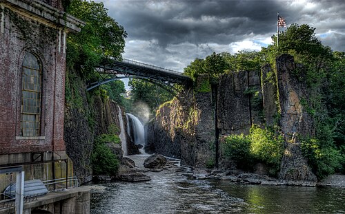
口語ではノースジャージーとも呼ばれるニュージャージー州北部は、通常、次の郡から構成されると定義されます。
ニュージャージー州観光局は、北ニュージャージー州を都市部のゲートウェイ地域と、より田舎のスカイランズ地域に分けます。ニュージャージー州北部には、ニューアーク、ジャージーシティ、パターソン、エリザベスという、同州最大の都市 4 つがあります。
この地域は、湿地、山、渓谷が広がるなど、地理的に多様性に富んでいます。高速道路や公共交通機関の鉄道網が充実しており、その多くはニュージャージートランジットが運営しています。ニュージャージー州北部には、ニューヨーク都市圏で2番目に利用者数の多い空港、ニューアーク・リバティー国際空港もあります。
ゲートウェイ地域はニューヨーク州の郊外で田舎の地域ですが、その多くは高度に都市化されています。ハドソン郡全体、エセックス郡東部、パセーイク郡南部、ユニオン郡エリザベスはすべて人口密度の高い地域です。
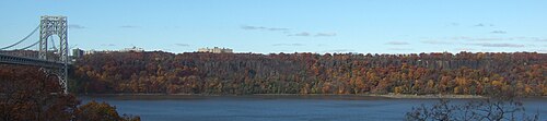
ニュージャージー州中部

.jpg/500px-Downtown_New_Brunswick_(2022).jpg)
セントラル ジャージーはニュージャージー州の中央部です。一般的に次の郡から構成されます。
- ミドルセックス郡
- マーサー郡
- モンマス郡
- オーシャン郡(トムズリバーの北側)
- ユニオン郡
- ハンタードン郡(リーディングトン郡区の南側)
- サマセット郡(ブリッジウォーター郡区の南側)
この地域の著名な自治体としては、トレントン(ニュージャージー州の州都で、ニューヨーク都市圏にある唯一の米国の州都)、プリンストン(アイビーリーグの プリンストン大学がある)、ニューブランズウィック(ニュージャージー州最大の大学であるラトガース大学のニューブランズウィックキャンパスがある)などがある。また、この地域には、レッドバンク、ロングブランチ、アズベリーパークなどの都市を含むジャージーショアの大部分も含まれている。主要な交通機関には、ニュージャージーターンパイク、ガーデンステートパークウェイ、中央ニュージャージーを二分するノースイーストコリドーがある。

コネチカット州西部
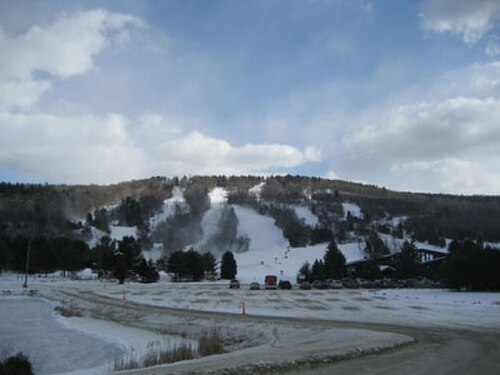
コネチカット州西部のフェアフィールド郡、ニューヘイブン郡、リッチフィールド郡は(州全体と同様に)裕福なことで知られています。大企業はこの地域全体に点在しており、ほとんどがフェアフィールド郡にあります。土地は海岸沿いに平らで、低い丘陵がやがて内陸部のマサチューセッツ州境のバークシャー山脈などの大きな丘陵に変わります。州内の大都市のほとんどはニューヘイブン郡(イェール大学がある)とフェアフィールド郡 にあります。
キャンドルウッド湖は、ニューヨーク都市圏最大のレクリエーション湖です。この湖はグレーター・ダンベリー地域に位置し、ニューヨーク市の住民の別荘が数多くあります。
ペンシルベニア州パイク郡
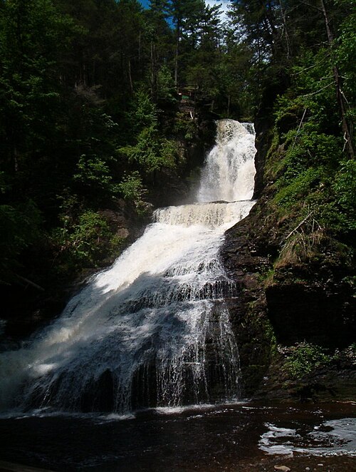
ペンシルベニア州パイク郡は、ペンシルベニア州北東部に位置している。2010年の国勢調査では、人口は57,369人であった。[91]郡庁所在地はミルフォードである。[92]ポコノ山脈地域の一部はパイク郡内にあり、ペンシルベニア州で最も急速に成長している郡の一つにランクされている。[93]
コミュニティ
主要都市と町


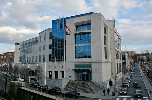


以下は、 2020年の米国国勢調査による「主要都市」とそれぞれの人口推計のリストです。主要都市には、人口10万人以上の都市、または主要な雇用、文化、教育、経済の中心地が含まれます。[98] [c]
都市部

都市部
ニューヨーク MSA の郡
ニューヨーク CSA には含まれるが MSA には含まれない郡
歴史

ウィスコンシン氷河期の間、この地域は 1,000 フィートを超える深さの巨大な氷床の端に位置していました。氷床は大量の土壌を削り取り、今日のニューヨーク都市圏の大部分の地質学的基盤となっている岩盤を残しました。後に、氷床は現在のロング アイランドとスタテン アイランドを分割する一因となりました。

ヨーロッパ人がこの地域に接触した当時、この地域には主にレナペ族[ 100]などのネイティブアメリカンが住んでいました。ネイティブアメリカンは、漁業や貿易ルートなど、多くの目的でこの地域の豊富な水路を使用していました。1524年にフランスに向けて航海したジョヴァンニ・ダ・ヴェラッツァーノは、地元の海域に入り住民に遭遇した最初のヨーロッパ人でしたが、上陸することはできませんでした。 1609年にオランダ人のために航海したヘンリー・ハドソンは、この地域を訪れ、ロウアー・マンハッタン島に入植地を築きました。この島は、1626年にオランダ人入植者によってニューアムステルダムと改名されました。 [ 101 ] 1664年にこの地域はイギリスの支配下に入り、[101] [102]その後、イングランド王チャールズ2世が弟のヨーク公に土地を与えた後、ニューヨークと改名されました。[103] [104]
毛皮貿易がさらに北に拡大するにつれ、ニューヨークは貿易の中心地となり、アフリカ人、ユダヤ人、ポルトガル人など多様な民族が流入した。マンハッタン島には、ニューヨーク湾(実際はハドソン川の下流域の水没した谷で、氷河モレーンに囲まれている)、潮汐の影響を受けるイースト川、ハドソン川によって形成された並外れた天然の良港があり、これらはすべて南端で合流し、その後の発展はすべてここから広がった。アメリカ独立戦争の間、戦略的な水路により、ニューヨークはイギリス海軍の戦時基地として極めて重要になった。ロングアイランドの戦いやニューヨークの戦いなど、この地域を守るため多くの戦いが行われた。ニューヨークは戦争初期にイギリス軍に占領され、国内の他地域からのロイヤリスト難民の避難所となり、1783年に戦争が終わるまでイギリス軍の支配下にあった。ニューヨークは1785年から1790年までアメリカ合衆国の首都となり、 [105]その後首都はフィラデルフィアに移った。ニューヨークは1790年以来、国内最大の都市となっている。[106] 1792年、一団の商人によって締結されたバトンウッド協定により、現在のニューヨーク証券取引所がロウアー・マンハッタンに設立された。今日、大都市圏の多くの人々がこの重要な証券取引所で働いている。
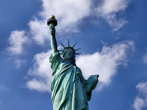
ニューヨーク港の自由の女神像は、 19世紀後半から20世紀初頭にかけて船でアメリカにやってきた何百万人もの移民を出迎えたものであり[108]、米国とその民主主義の象徴として世界的に認知されています。[109]ニューヨークへの大規模な移民は、大きな労働力需要の結果でした。市の国際的な姿勢は、さまざまな文化や民族グループに対する寛容さを生み出しました。ドイツ、アイルランド、イタリアからの移民は、最大の民族グループでした。今日でも、彼らの子孫の多くがこの地域に住み続けています。メトロポリタン美術館、メトロポリタン歌劇場、アメリカ自然史博物館などの文化的建造物が建設されました。ニューヨークの新聞は、メディア界の大物であるジェームズ・ゴードン・ベネット・シニア、ジョセフ・ピューリッツァー、ウィリアム・ランドルフ・ハーストが読者獲得を競い合い、全国で読まれました。 1884年には、輸出の70%以上がニューヨークまたはその周辺の町の港を通過しました。ニューヨークの5つの行政区(ブロンクス、ブルックリン、マンハッタン、クイーンズ、スタテンアイランド)は1898年に1つの都市に統合されました。[110] [111]

新たに統合されたニューヨーク市は、行政区間の物理的なつながりの強化とベッドタウンの成長の両方を促進しました。ニューヨーク市地下鉄は、後に市に引き継がれた3つのシステム(他の2つはブルックリン・マンハッタン交通公社と独立地下鉄システム)のうちの1つであるインターボロー・ラピッド・トランジット・カンパニーとして1904年に運行を開始しました。グランド・セントラル・ターミナルやペンシルベニア駅などの鉄道駅は、郊外の成長を促しました。全国的にアルコールが禁止された禁酒法の時代には、密造酒の需要の高まりに応えるために組織犯罪が増加しました。ブロードウェイ劇場地区は、1904 年のニューヨーク地下鉄の開通とともに発展し始め、20 世紀初頭には、ジーグフェルド・フォリーズやショーボートなどの人気ミュージカル作品や、ブロードウェイの 47 番街から 42 番街にまたがるエリアに複数の大規模で豪華に装飾された劇場がオープンしたことで、ニューヨークの演劇とエンターテイメントの中心地として世界的に有名になりました。
大恐慌により、この地域の運命は停滞し、失業と貧困が蔓延した。都市計画家ロバート・モーゼスは、自動車を中心に据えたキャリアを開始し、3 州にまたがる橋、公園道路、後には高速道路を建設した。第二次世界大戦中、ドイツの潜水艦による封鎖により、ヨーロッパとの航行が制限され、 都市経済は打撃を受けた。
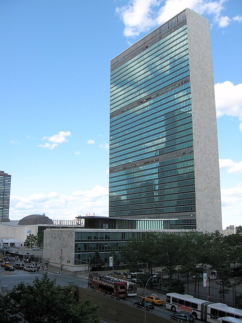
1950年に人口がピークに達した後、その後の数十年間で市の人口のかなりの部分がニューヨーク郊外へ移った。その影響は白人の流出によるものだった。産業と商業もこの時代に衰退し、企業は郊外や他の地域に移転した。この時代はニューヨーク市住宅局の下で市の低所得者層向けの住宅プロジェクトの建設が増加したが、これは市と郊外を結ぶ州間高速道路を建設するためにコミュニティが破壊された時期と一致していた。市、特にブルックリンは、象徴的なメジャーリーグの野球チーム、ブルックリン・ドジャースが1957年のシーズン後にロサンゼルスに移転したことで、経済的だけでなく心理的にも打撃を受けた。犯罪は市に深刻な影響を及ぼした。都市再開発プロジェクトは、ある程度、貧困地域の荒廃を緩和したが、その多くは後に失敗し、ゲットー化、住宅における非公式の人種隔離、都市の近隣地域をまとまりのある健康的な居住地にしていた有機的な都市構造の崩壊など、予期せぬ結果を引き起こした。1965年の北東部停電の際には社会不安はほとんど報告されなかったが、1977年のニューヨーク市停電では、市内の一部で大規模な暴動、略奪、放火が発生した。さらに、1970年代の不況により、ニューヨーク市地域の製造業などの伝統的産業が麻痺した。 この時期の数少ない明るいハイライトは、ニューヨークの金融街にある巨大なオフィスビル、オリジナルのワールドトレードセンターの完成だった。その象徴的な110階建てのツインタワーは、短期間ながら世界で最も高いビルであった。
1980年代、ニューヨークの経済は、特に金融部門で好景気に沸いていた。ウォール街は不動産市場の急成長を促し、その後はドットコムバブルを引き起こした。それにもかかわらず、犯罪は依然として問題であった。この問題は、麻薬の蔓延によって悪化した。ニューヨーク市周辺は、米国に入る麻薬の主要な流入港の1つだった。サウスブロンクスなどの地域は、20世紀後半の都市の衰退の典型例となった。しかし、1990年代に入ると、犯罪に対する厳しい政策により、犯罪は大幅に減少した。ニューヨーク市の犯罪は、 21世紀を通じて減少し続けている。
2001 年9 月 11 日の攻撃は、この地域と国家の歴史において極めて重要な出来事でした。この攻撃により、2 機の飛行機が旧ワールド トレード センターに衝突し、タワーが崩壊して 3,000 人近くが死亡しました。このため、企業はロウアー マンハッタンから撤退しましたが、その代わりに高層住宅が増加し、ニューヨークの建設ブームは今日まで続いています。
2003年には、2003年北米停電と呼ばれる別の停電が発生したが、市内では略奪は発生しなかった。

2012年10月29日と30日、ハリケーン・サンディは大都市圏に甚大な被害をもたらし、大西洋沿岸の一部を記録的な高潮、深刻な洪水、強風で荒廃させ、倒木や電線、変電所の故障により何百万人もの住民が停電し、ガソリン不足や公共交通機関の混乱を招いた。ニューヨークとニュージャージーの物理的インフラと私有財産、商業活動の中断による被害は数百億ドルと推定されている。[112]この嵐とその甚大な影響により、将来同様の出来事が発生した場合に破壊的な結果を招くリスクを最小限に抑えるために、大都市圏の海岸線の周りに防波堤やその他の海岸障壁を建設するという議論が巻き起こった。[113] [114]
ワン ワールド トレード センター (フリーダム タワーとも呼ばれる) は、倒壊したツインタワーの代わりとして 2014 年に完成しました。
2017年から2021年にかけてのニューヨーク市交通危機は、メディアが2017年の「地獄の夏」と呼んだことから始まり、ニューヨーク州知事アンドリュー・クオモが非常事態を宣言するに至った。この危機は、ニューヨーク市地下鉄システムとニューヨーク市バス路線、そしてニューヨーク市と大都市圏の他の地域を結ぶいくつかの通勤路線の終点であるペンシルベニア駅における複数の深刻な問題の相互作用が原因であった。その根本的な原因には、重要なインフラの長期にわたる放置や、継続的な運営のための十分な資金の不足などが含まれていた。非常事態は2021年6月30日に正式に終了した。
統計履歴

米国国勢調査局は、1950 年に初めて大都市圏を標準大都市圏(SMA) として指定しました。「ニューヨーク - 北東 NJ SMA」は、17 の郡を含むように定義されました。ニューヨーク州の 9 郡 (ニューヨーク市の 5 つの行政区、ナッソー、サフォーク、ウェストチェスター、ロックランド)、ニュージャージー州の 8 郡 (バーゲン、ハドソン、パセーイク、エセックス、ユニオン、モリス、サマセット、ミドルセックス) です。1960 年に、大都市圏の標準は修正され、標準大都市統計地域 (SMSA) に改名されました。新しい標準によって、以前の SMA はいくつかの部分に分割されました。ニューヨーク州の 9 つの郡は「ニューヨーク SMSA」になり、ニュージャージー州の 3 つの郡 (エセックス、ユニオン、モリス) は「ニューアーク SMSA」になり、ニュージャージー州の他の 2 つの郡 (バーゲンとパセーイク) は「パターソン - パセーイク - クリフトン SMSA」になりました。ハドソン郡は「ジャージー シティ SMSA」に指定され、ミドルセックス郡とサマセット郡は大都市圏の地位を失った。1973 年、大都市圏の新しい基準によってさらなる変更が行われた。ナッソー郡とサフォーク郡は独自の SMSA (「ナッソー - サフォーク SMSA」) として分割された。バーゲン郡 (元々はパターソン - クリフトン - パセーイク SMSA の一部) はニューヨーク SMSA に移管された。ニューヨーク SMSA はパトナム郡 (以前は非大都市圏) も受け入れた。サマセット郡はニューアーク SMSA に追加され、2 つの新しい SMSA、「ニュー ブランズウィック - パース アンボイ - セアビル SMSA」(ミドルセックス郡) と「ロング ブランチ - アズベリー パーク SMSA」(モンマス郡) が設立された。1983 年、統合大都市統計地域 (CMSA) の概念が初めて導入された。 CMSA は、より広い労働市場エリア内の個別の雇用センターである、いくつかの主要大都市統計地域 (PMSA) で構成されていました。「ニューヨーク - 北ニュージャージー - ロングアイランド CMSA」は、12 の PMSA で構成されていました。
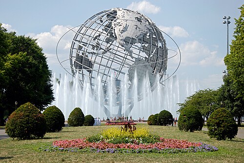
7 つの PMSA は、分割された元の 1950 年のニューヨーク SMA に基づいていました: ニューヨーク、バーゲン – パセーイク、ジャージー シティ、ミドルセックス – サマセット – ハンタードン (ハンタードンが初めて追加されました)、モンマス – オーシャン (オーシャンが初めて追加されました)、ナッソー – サフォーク、およびニューアーク (サセックスが初めて追加されました)。 追加された 1 つの PMSA は、オレンジ カウンティ PMSA (以前はニューバーグ – ミドルタウン SMSA) でした。 他の 4 つの PMSA は、コネチカットの以前の SMSA でした: ブリッジポート、スタンフォード、ノーウォーク、およびダンベリー。 1993 年には、ニューヨーク – 北ニュージャージー – ロングアイランド CMSA に、トレントン PMSA (マーサー カウンティ)、ダッチェス カウンティ PMSA、ウォーターベリー PMSA、およびニューヘブン PMSA の 4 つの PMSA が追加されました。 サセックス、ウォーレン、およびパイクのいくつかの新しい郡も CMSA に追加されました。 CMSA モデルは、もともと 2000 年の国勢調査のデータを集計するために使用されました。2003 年には、コア ベース統計エリア (CBSA)モデルを使用して新しい一連の標準が確立され、2010 年現在も使用されています。CBSA モデルにより、古い CMSA は、ニューヨーク - ノーザン ニュージャージー - ロングアイランド、ポキプシー - ニューバーグ - ミドルタウン、トレントン - プリンストン、ブリッジポート - スタンフォード - ノーウォーク (ダンベリーを含む)、ニューヘブン - ミルフォード (ウォーターベリーを含む) などの複数の大都市統計エリアに分割されました。 2013年、国勢調査局は、ペンシルベニア州のカーボン郡、リーハイ郡、ノーサンプトン郡、モンロー郡、ニュージャージー州ウォーレン郡(総称してアレンタウン・ベツレヘム・イーストン、ペンシルベニア州-ニュージャージー州MSAとイーストストラウズバーグ、ペンシルベニア州MSAを含む)を統合統計地域に追加し、[117]ポキプシー・ニューバーグ・ミドルタウンをより広いニューヨーク・北ニュージャージー・ロングアイランド・ニューヨーク・ニュージャージー・ペンシルベニア州MSAに同化しました。2018年、アレンタウン・ベツレヘム・イーストン、ペンシルベニア州-ニュージャージー州MSAは統合統計地域から削除されました。[118]
地域への提案
大都市圏は、元々の州とは別の政治的代表権を持ったことは一度もない。これは、望ましいモデルに関する意見の相違と、大都市圏が州をまたぐ憲法上の複雑さに関係している。ニューヨーク州では過去30年間、[119]ニューヨーク州とその大都市圏を別の州に分割するのではなく、州を別々の地域に分割して知事と議員を別々に置き、州の一部にとどめるという議論が浮上してきた。[120] [121]この考えは、州内の共和党員によって、州議会における民主党の支配を崩す機会とみなされてきた。[122] [123]
ニューヨーク州の再編をめぐる議論は、一般的に2つのモデルで行われてきた。2地域モデルでは、ニューヨーク市の5つの行政区すべて、ロングアイランドのナッソー郡とサフォーク郡、ウエストチェスター郡とロックランド郡で構成される「ダウンステート」ニューヨーク地域が作られ、アップステートは残りの53となる。[122] [120]そして3地域モデルでは、ニューヨークには5つの郡があり、モントークはナッソー郡、サフォーク郡、ロックランド郡、ウエストチェスター郡で構成され、ニューアムステルダムはニューヨーク州の残りの部分となる。[122] [121] [124]この議論は、共和党の州上院議員 ダフネ・ジョーダンが州を2つの州に分割することを支持した2019年2月に報告された。[122] [120]しかし、この提案が可決されるには議会の法案が必要であると考えられていた。[125]
人口統計
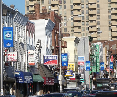

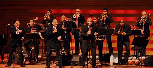

2020年国勢調査
2010年国勢調査
2010年の国勢調査によると、都市圏の人口は22,085,649人。人口密度は1平方マイルあたり1,865人。人種構成は、白人(非ラテン系)51.7%、ラテン系21.7% 、アフリカ系アメリカ人15.3% 、アジア系アメリカ人9.0% 、ネイティブアメリカンとアラスカ先住民0.16% 、太平洋諸島系アメリカ人0.03% 、その他0.5%、混血1.6% 。[133]
年齢の中央値は37.9歳。18歳未満が25.5%、18歳から24歳が9.5%、25歳から44歳が28%、45歳から64歳が26.6%、65歳以上が13.2%であった。男性は人口の48.3%、女性は人口の51.7%を占めた。[要出典]
人口の 97.7% は世帯に住んでおり、2.3% は集団宿舎に住んでおり、1% は施設に収容されています。8,103,731 世帯があり、そのうち 30.2% にあたる 2,449,343 世帯に子供がいます。46.1% にあたる 3,736,165 世帯は異性または結婚したカップルで構成されています。妻のいない男性世帯は 4.9% にあたる 400,534 世帯です。15.0% にあたる 1,212,436 世帯は夫のいない女性世帯です。34% にあたる 2,754,596 世帯は非家族世帯です。世帯密度は 1 平方マイルあたり 684 世帯です。住宅ユニットの 91.9% が占有されており、空き率は 3.8% です。平均世帯人数は 1 世帯あたり 2.65 人です。非家族世帯の平均収入は 90,335 ドル、家族世帯の平均収入は 104,715 ドルでした。人口の 13.3% または 2,888,493 人が貧困ライン以下でした。[引用が必要]
人口の26.7%にあたる5,911,993人は米国外で生まれました。このうち、ほとんど(50.6%にあたる2,992,639人)はラテンアメリカで生まれ、27.0%にあたる1,595,523人はアジアで生まれ、17.4%にあたる1,028,506人はヨーロッパで生まれ、3.8%にあたる224,109人はアフリカで生まれ、0.2%にあたる11,957人はオセアニアで生まれました。[要出典]
人口推計


2020年現在、アメリカ合衆国国勢調査局は、ニューヨーク統合統計地域の人口を23,582,649人と推定しており、これは米国で最も人口が多く、世界でも最も人口の多い都市圏の1つです。統合統計地域の人口増加は、ニューヨーク市大都市圏を構成するニューヨーク州、ニュージャージー州、コネチカット州、ペンシルベニア州の一部に分散しています。
ニューヨーク都市圏は民族的に多様である。2010年の国勢調査によると、ニューヨーク市のアジア系アメリカ人の数は100万人を超え、サンフランシスコとロサンゼルスの合計数を上回っている。[137]ニューヨークは、米国の都市の中で最も多くのアジア系人口を抱えている。[138]ニューヨーク市クイーンズ区は、州最大のアジア系アメリカ人人口と米国最大のアンデス人(コロンビア、エクアドル、ペルー、チリ、ボリビア)人口を抱える都市であり、世界で最も民族的に多様な都市部でもある。[139] [140]ニューヨーク州で最も急速に増加している民族は漢民族である。マンハッタンの元祖チャイナタウンの複数の衛星都市であるブルックリン(ブルックリン華埠頭) やクイーンズ区フラッシング(法拉盛華埠頭)周辺は、伝統的な都市の飛び地として繁栄している一方、東の郊外ナッソー郡へと急速に拡大している。[141]ロングアイランド[142]では、ニューヨーク都市圏とニューヨーク州がそれぞれ新しい中国人移民の最大の移住先となっており、大規模な中国人移民がニューヨーク市とその周辺地域に続いている。[143] [144] [145] [146] [147] [148] 2012年には、ニューヨークの6.3%が中国系で、その4分の3近くがロングアイランドのクイーンズかブルックリンに住んでいた。[149]特に、ニューヨーク地域には10万人を超える福州人が住んでいる。[150] 2万人の朝鮮系中国人(中国語:朝鲜族、朝鮮語: 조선족 )のコミュニティがクイーンズのフラッシングに集中している一方、ニューヨークには中国、インド、ネパール以外では最大のチベット人人口がクイーンズに集中している。[151]韓国人は市の人口の1.2%、日本人は0.3%を占めている。フィリピン人は東南アジア最大の人口である。 最も人口の多い南アジア系グループはインド人で、市の人口の2.4%を占めている。バングラデシュ人とパキスタン人はそれぞれ0.7%と0.5%である。[152] クイーンズは、アジア系インド人、韓国人、フィリピン人[ 153] 、マレーシア人[20]や他の東南アジア人[154 ] が定住するのに好む区である。一方、ブルックリンは、西インド諸島系[155]とアジア系インド人の 両方の移民を大量に受け入れている。
ニューヨークはアメリカの都市の中で最大のヨーロッパ系および非ヒスパニック系白人人口を抱えている。2012年のニューヨークの非ヒスパニック系白人人口は270万人で、ロサンゼルス(110万人)、シカゴ(86万5000人)、ヒューストン(55万人)の非ヒスパニック系白人人口を合わせた数を上回っている。[156]市内に住むヨーロッパ系移民は非常に多様である。2012年の国勢調査の推計によると、およそ56万人のイタリア系アメリカ人、38万5000人のアイルランド系アメリカ人、25万3000人のドイツ系アメリカ人、22万3000人のロシア系アメリカ人、20万1000人のポーランド系アメリカ人、13万7000人のイギリス系アメリカ人がいた。さらに、ギリシャ系およびフランス系アメリカ人はそれぞれ6万5000人、ハンガリー系は6万人と推定されている。ウクライナ系アメリカ人とスコットランド系アメリカ人はそれぞれ55,000人と35,000人である。スペイン系アメリカ人の数は2010年に合計30,838人であった。 [157]ノルウェー系とスウェーデン系の人はそれぞれ約20,000人であり、チェコ系、リトアニア系、ポルトガル系、スコットランド系アイルランド系、ウェールズ系の人はいずれも12,000人から14,000人であった。[158]ニューヨーク市のアラブ系アメリカ人は160,000人を超え、 [159]ブルックリンに最も集中している。中央アジア人、主にウズベク系アメリカ人は、市内の非ヒスパニック系白人人口の中で急速に増加している一群で、その数は3万人を超え、米国への中央アジア系移民の半数以上を占め、[160]ほとんどがクイーンズかブルックリンに定住している。アルバニア系アメリカ人はブロンクス区に最も集中している。[161]
ニューヨーク都市圏全体も民族的に多様である。[162]ニューヨーク都市圏には、全米最大のアフリカ系アメリカ人/黒人人口が約400万人居住している。 [163]ニューヨーク地域は、米国への合法移民にとって群を抜いて最大の都市ゲートウェイであり続け、次に人気のあるゲートウェイ地域であるロサンゼルスとマイアミの合計数を大幅に上回っている。[164] [165] [166] [167]この地域は、イスラエル国外では最大のユダヤ人およびイスラエル人コミュニティの本拠地であり、この地域のユダヤ人人口は2012年に150万人を超え、中東および東ヨーロッパ各地からのさまざまなユダヤ教宗派が含まれている。[151]また、この都市圏には、国内のインド系アメリカ人の20%と少なくとも20のリトルインディア居住地があり、韓国系アメリカ人の15%と4つのコリアタウンがある。[168] [169]西半球で最大のアジア系インド人人口を擁し、ロシア系アメリカ人、 [143 ]およびアフリカ系アメリカ人の人口も最大であり、ドミニカ系アメリカ人、プエルトリコ系アメリカ人、南米系アメリカ人の人口も最大であり[143] 、米国で2番目に多いヒスパニック人口は480万人である[157] 。ニューヨーク市だけでも少なくとも6つのチャイナタウンがあり[170]、2014年の国勢調査の推定によると、都市圏には819,527人の非人種的華僑が居住しており[ 171] 、アジア以外では最大である。[130] [131]
2013年にニューヨーク地域に合法的に移住した南米の上位の国は、エクアドル、コロンビア、ガイアナ、ペルー、ブラジルであった。カリブ海諸国ではドミニカ共和国、ジャマイカ、ハイチ、トリニダード・トバゴ、アフリカではエジプト、ガーナ、ナイジェリア、中米ではエルサルバドル、ホンジュラス、グアテマラであった。[172]プエルトリコ人のニューヨーク市への移住が再び活発化する中、2013年の時点でこの人口は首都圏で約130万人に増加した。
ニューヨーク市は世界のゲイの首都と言われており、世界最大かつ最も著名なLGBTQ人口を抱えています。[173]ニューヨーク都市圏には、推定568,903人の自認するゲイおよびバイセクシュアルのコミュニティがあり、米国最大かつ世界最大級のコミュニティです。[135] [136] ニューヨークでの同性婚は2011年6月24日に合法化され、その30日後から施行されることが認められました。[174]毎年恒例のニューヨーク・プライド・マーチ(またはゲイ・プライド・パレード)は、マンハッタンの5番街を南下してグリニッチ・ビレッジで終了し、世界最大のプライド・パレードで、毎年6月には何万人もの参加者と何百万人もの歩道観客を集めています。[175]
宗教
2014 年のピュー宗教景観調査によると、ニューヨーク都市圏の宗教構成は次のようになっています。
経済

ニューヨーク市の地域経済は世界最大で、2022年のGDPは2.5兆ドルとなり、主権国家の中で8位となる。多くのフォーチュン500企業がニューヨークに本社を置いており、 [179]多数の外国企業も同様である。市内の民間部門の雇用10分の1は外国企業によるものである。 [180] 2012年と2015年に、ニューヨークはそれぞれアトランティック誌が発表した第1回と第2回世界経済大国指数リストでトップとなり、5つの別々の団体が発表した5つの異なるリストに掲載されている都市を基準にランク付けされた。[33] [181]金融、国際貿易、新メディアと従来型メディア、不動産、教育、ファッションとエンターテイメント、観光、バイオテクノロジー、製造業がこの地域の主要産業である。その富とともに、この地域の生活費は米国で最も高い。
郡別国内総生産
ウォール街


ニューヨーク都市圏の最も重要な経済部門は、米国金融産業の本部としての役割、つまり別名ウォール街としての役割にあります。ロウアーマンハッタンの金融街にあるウォール街を拠点とするニューヨークは、最も経済的に強力な都市であると同時に世界有数の金融センターとも呼ばれています。[33] [185] [186] [187] [188]また、時価総額で世界最大の2つの証券取引所、ニューヨーク証券取引所とナスダックがここにあります。[182] [183] 2013年8月に163,400人の雇用を数えた市の証券業界は、市の金融セクターで最大のセグメントを形成し、重要な経済の原動力であり続け、2012年には市の民間部門の雇用の5%、市の税収の8.5%(38億ドル)、市の平均給与360,700ドルを含む市の総賃金の22%を占めました。[189]
マンハッタンのオフィススペースは2013年に約5億2000万平方フィート(4810万m2)で、[190]米国最大のオフィス市場となっており、[191]マンハッタンのミッドタウンは国内最大の中心ビジネス地区となっている。 [192]
ローワーマンハッタンは米国で3番目に大きな中心業務地区で、ウォール街のニューヨーク証券取引所とブロードウェイ165番地のナスダックの両方の本拠地であり、 2013年の平均1日当たりの取引量と上場企業の時価総額の両方で測定した場合、それぞれ世界最大と2番目に大きな証券取引所を表しています。[183] 2012年のウォール街の投資銀行手数料は合計で約400億米ドルで、[193] 2013年には、リスクとコンプライアンス機能を管理するニューヨークの銀行の上級役員の年間収入は324,000米ドルにも達しました。[194]
2013年7月、ニューヨーク証券取引所の運営会社であるNYSEユーロネクストは、英国銀行協会からロンドン銀行間取引金利の管理を引き継ぎました。[195]
多くのウォール街の企業は、ニュージャージー州の比較的低い商業用不動産と賃貸価格を活用しながら、マンハッタンの金融業界のエコシステムへの地理的な近さを維持するために、補助的な金融または技術業務をジャージーシティに追加または移転しています。[196]
テクノロジーとバイオテクノロジー
ニューヨークを中心とするシリコン アレー (Silicon Alley) は、インターネット、ニューメディア、金融テクノロジー(フィンテック)および暗号通貨、電気通信、デジタル メディア、ソフトウェア開発、バイオテクノロジー、ゲーム デザイン、および起業家エコシステムとベンチャーキャピタル投資によってサポートされている情報技術分野のその他の分野を含む、大都市圏のハイテク産業[197 ]を包含する領域の換喩へと進化しました。ニューヨーク市が創造性と起業家精神、社会的寛容性[198]および環境持続可能性[199] [200]の世界的結節点として台頭していること、ならびにニューヨークが複数の大西洋横断光ファイバー幹線に近接していること [201] 、市の知的首都であること、および広範囲にわたる屋外ワイヤレス接続性[202]など、北米有数のインターネット ハブおよび電気通信センターとしての地位にあることに支えられ、ニューヨークおよび大都市圏全体でハイテクスタートアップ企業と雇用が増加しています。[202]ロウアーマンハッタンのウェストストリート140番地に本社を置くベライゾンコミュニケーションズは、2014年にニューヨーク市全域にわたる30億ドルの光ファイバー通信アップグレードの最終段階にありました。 [203]
バイオテクノロジー部門も、学術的科学研究と公的および民間の財政支援の強さを背景に、ニューヨーク都市圏で成長している。2011年12月19日、当時のニューヨーク市長マイケル・ブルームバーグは、ニューヨークを世界有数のテクノロジーの中心地に変えるという目標を掲げ、マンハッタンのルーズベルト島に20億ドル規模の応用科学大学院コーネルテックを建設するため、コーネル大学とテクニオン・イスラエル工科大学を選んだと発表した。[204] [205] 2014年半ばまでに、バイオテクノロジー投資会社アクセラレーターは、イーライリリー・アンド・カンパニー、ファイザー、ジョンソン・エンド・ジョンソンなどの投資家から3,000万ドル以上を調達し、アレクサンドリア生命科学センターでバイオテクノロジーの新興企業を設立するための初期資金を調達した。このセンターは東29丁目の70万平方フィート(65,000平方メートル)以上を占め、センターの科学者と起業家、および近くの学術機関、医療機関、研究機関とのコラボレーションを促進している。ニューヨーク市経済開発公社の早期段階生命科学資金イニシアチブと、セルジーン、ゼネラル・エレクトリック・ベンチャーズ、イーライリリーなどのベンチャーキャピタルパートナーは、生命科学とバイオテクノロジーの分野で15〜20のベンチャーを立ち上げるために最低1億ドルを拠出することを約束した。[206]ウエストチェスター郡は21世紀に急成長を遂げたバイオテクノロジー部門も発展させており、2016年時点で10億ドルを超える民間投資が計画されており、[207]このことから、この郡は「バイオチェスター」というニックネームを得ています。[208]
ニューヨーク・ニュージャージー港
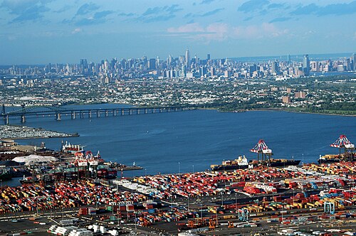
ニューヨーク・ニュージャージー港はニューヨーク大都市圏の港湾地区であり、自由の女神国定公園の半径約25マイル(40 km)以内の地域を包含している。ニューヨーク大都市圏の主要な経済エンジンであるこの港には、ニューヨーク近郊の650マイル(1,050 km)の海岸線に沿った河口の航行可能な水路システムと、ニュージャージー州北東部のゲートウェイ地域、および地域の空港とそれを支える鉄道と道路の配送ネットワークが含まれている。ニューヨーク・ニュージャージー港は、2022年10月までの10か月間で820万TEUを超える海上 貨物量を処理しており、パナマ運河の拡張によるポストパナマックスの恩恵を受け、月間貨物量でカリフォルニアの港を上回って加速している。[209] [210]
水の純度と利用可能性
水の純度と供給は、ニューヨーク都市圏の生命線である。ニューヨーク市は、保護されているキャッツキル山脈 流域から飲料水を供給されている。[211]流域の完全性と妨げられていない自然の水ろ過システムのおかげで、ニューヨークは、飲料水の大部分が浄水場での浄化を必要としないほど純粋である、米国でわずか4つの大都市のうちの1つである。[212]市の北にあるクロトン流域では、32億ドルをかけて浄水場を建設中で、これによりニューヨークの水供給が推定2億9千万ガロン/日増加し、市の現在の水供給量の20%以上となる。[213]ニューヨーク市の水道システムの不可欠な部分であるニューヨーク市水道トンネル第3号の進行中の拡張は、市の歴史上最大の資本建設プロジェクトであり、 [214]マンハッタンとブロンクスへのサービスセグメントは完了し、ブルックリンとクイーンズへのサービスセグメントは2020年に建設される予定です。[215]ニュージャージー州北部と中央部の淡水の多くは貯水池によって供給されていますが、同じ目的を果たす市営の井戸が数多く存在します。
教育

ニューヨーク都市圏には、多くの名門高等教育機関がある。アイビーリーグの大学3校、ニューヨーク市マンハッタンのコロンビア大学、ニュージャージー州プリンストンのプリンストン大学、コネチカット州ニューヘイブンのイェール大学は、いずれもUSニューズ&ワールド・レポート誌の2018年時点でのランキングで全米トップ3の国立大学にランクされており[216]、この地域にある。[217]また、ニューヨーク大学とロックフェラー大学もマンハッタンにあり、いずれも世界のトップ35の大学にランクされている。[218]マンハッタンの南西27マイル(43km)のニューブランズウィックとニュージャージー州ピスカタウェイに位置する世界的な大学であるラトガース大学は、この地域で群を抜いて最大の大学である。[219]ニューヨーク工科大学は、ロングアイランドのオールドウェストベリーとマンハッタンのコロンバスサークル近くの2つのキャンパスに分かれている。ホフストラ大学はロングアイランド最大の私立大学である。[220]フォーダム大学もティア1大学であり、[221]米国北東部で最も古いカトリック系の高等教育機関であり、[222]ニューヨーク州で3番目に古い大学である。[223]ニューヨーク市教育局は、120万人以上の生徒を抱える米国最大の学区である。[224]この地域には多くの公立高校もあり、その中には国内で最も名声のある学校の一つと言われている。[225]
達成
2010年のアメリカコミュニティ調査によると、この地域の25歳以上の14,973,063人のうち、14.8% (2,216,578) が大学院または専門職学位を持ち、21.1% (3,166,037) が学士号を持ち、6.4% (962,007) が準学士号を持ち、16.0% (2,393,990) が大学教育を受けたが学位は持っていない、26.8% (4,009,901) が高校卒業または同等の資格を持ち、14.8% (2,224,557) が高校未満の教育を受けていた。[226] 2010年、CNN Moneyは、この地域を米国で最もスマートな地域トップ10の1つにランク付けした。[227]
交通機関


ニューヨーク地域の交通網の深さと複雑さは、大都市自体の規模と複雑さに匹敵します。
2013年、ニューヨーク・ニューアーク・ジャージーシティ大都市統計地域(ニューヨークMSA)では、自家用車で通勤する労働者の割合が最も低く(56.9%)、鉄道で通勤する労働者は18.9%だった。2006年から2013年までの期間、ニューヨークMSAでは自動車通勤する労働者が2.2%減少した。[228]
レール
米国の公共交通機関利用者の約3人に1人、また全米の鉄道利用者の3分の2がニューヨーク都市圏に住んでいる。 [229] [230]
ニューヨーク市地下鉄
ニューヨーク市地下鉄は、営業中の駅数(472)と路線の長さで測ると世界最大の高速輸送システムである。2006年には年間乗客数(2006年の乗客数は15億人)で世界第3位であった[231]。しかし、2013年には地下鉄の乗車数は17億1000万回を超え[232] 、世界で7番目に混雑する高速輸送鉄道システムに落ち込んだ。 [233]ニューヨークの地下鉄は、香港、[234] [235] ロンドン、ソウル、[236] [237]東京、 トロント など、ほとんどの都市のシステムに共通する夜間の閉鎖とは対照的に、ほぼすべてのシステムが24時間営業していることでも注目に値する。[238]
パス
PATHは、ニュージャージー州北部の都市圏にあるニューアーク、ハリソン、ホーボーケン、ジャージーシティの各都市と、ニューヨーク市のマンハッタンのローワーおよびミッドタウン地区を結ぶ高速輸送システムです。PATHはニューヨーク・ニュージャージー港湾局によって運営されています。PATHの列車は24時間年中無休で運行しています。[239]このシステムの路線の総延長は13.8マイル(22.2 km)で、路線の重複は考慮されていません。[240]
通勤電車
大都市圏は、基本的にニューヨークに通勤する人々が通う地域によっても定義されます。市内には 3 つの主要な通勤鉄道システムが走っており、アムトラックによる都市間鉄道輸送も行われています。
ロングアイランド鉄道(LIRR)は、2015年現在、米国で最も利用者数の多い通勤鉄道であり、 [241]ニューヨーク州政府の機関であるメトロポリタン交通局(MTA)によって運営されており、ニューヨーク市エリアの交通に重点を置いている。マンハッタンのミッドタウンにあるペンシルベニア駅とブルックリンのダウンタウンにあるアトランティック駅に2つの主要ターミナルがあり、ロングアイランドシティ駅にマイナーターミナル、クイーンズにあるジャマイカ駅に主要な乗り換え地点がある。
ニュージャージー・トランジット(NJT)は、2015年現在、米国で2番目に利用者数の多い通勤鉄道であり、[241]ニュージャージー州の機関であるニュージャージー・トランジット・コーポレーションが、メトロノース鉄道およびアムトラックと共同で運営している。マンハッタンのペンシルベニア駅、ホーボーケン・ターミナル、ニューアーク・ペンシルベニア駅に主要ターミナルがあり、ニュージャージー州ハドソン郡のセコーカス・ジャンクションに主要な乗り換え地点がある。ニュージャージー・トランジットは、ハドソン郡を通るハドソン・バーゲン・ライトレール、ニューアーク・ライトレール、およびトレントンから南ニュージャージーのカムデンまでコンレール・シェアード・アセット・オペレーションズと共有する線路に沿って走るリバー・ラインも運営している。NJトランジットは、マンハッタンに出入りする通勤バスも運行している。
メトロノース鉄道(MNRR)は、2015年現在、米国で3番目に利用者数の多い通勤鉄道であり、[241]コネチカット州運輸局およびニュージャージー・トランジットと共同でMTAによって運営されている。主要ターミナルはグランド・セントラル駅である。ポート・ジャービス線とパスカック・バレー線の列車は、ニュージャージー州ホーボーケンのホーボーケン・ターミナルで終着する。通勤者は、セコーカス・ジャンクションでニュージャージー・トランジットの列車に乗り換えてニューヨーク・ペンシルベニア駅に行くか、ホーボーケン・ターミナルでPATH列車に乗り換えてマンハッタンに行くことができる。
アムトラックの北東回廊は、フィラデルフィア、ニューヘイブン、ボストンとワシントンDC間のその他の地点へのサービスを提供しています。
首都圏の主要駅は以下のとおりです。
次の表は、ニューヨーク都市圏でこれらの通勤鉄道が運行するすべての鉄道路線を示しています。ニュージャージートランジットは、フィラデルフィア都市圏で追加の鉄道路線を運行しています。(大西洋から反時計回りに表示):
主要高速道路
この地域には以下の高速道路が通っています:


州間高速道路

 I-78
I-78 I-80
I-80 I-84
I-84 I-87
I-87 I-91
I-91 I-95
I-95 I-195
I-195 I-278 –ニューヨーク市周辺の南環状道路として機能
 I-280
I-280 I-287 –ニューヨーク市周辺の北環状道路として機能
 I-295
I-295- I-295 –ニュージャージー州マーサー郡トレントン周辺の北部部分環状道路として機能
 I-478
I-478 I-495 − ロングアイランドエクスプレスウェイまたはLIEとしても知られる
 I-678
I-678 I-684
I-684 I-695
I-695 I-878 – 署名なし
米国路線
州道

.jpg/500px-CT15sRoad-Exit44-CT58_(39144462790).jpg)
 ルート3
ルート3 ルート4
ルート4 ルート8
ルート8 ニューヨーク9A
 ルート15
ルート15 国道17号線
 国道18号線
 ルート21
ルート21 ルート23
ルート23 ルート24
ルート24 ニューヨーク24
 ルート25
ルート25 ニューヨーク25
 ルート27
ルート27 ニューヨーク27
 ルート28
ルート28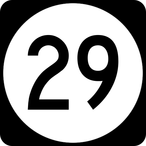 ルート29
ルート29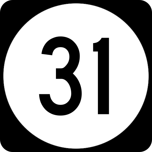 ルート31
ルート31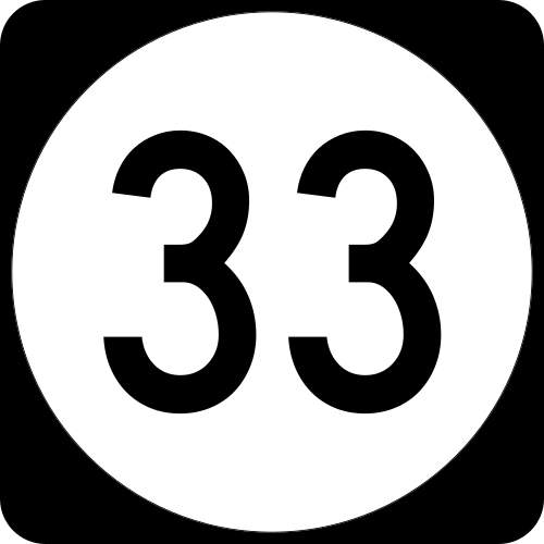 ルート33
ルート33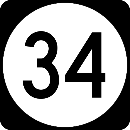 ルート34
ルート34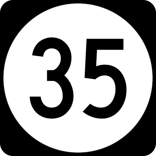 ルート35
ルート35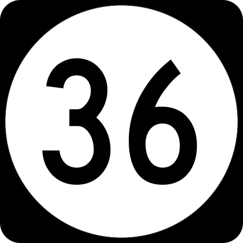 ルート36
ルート36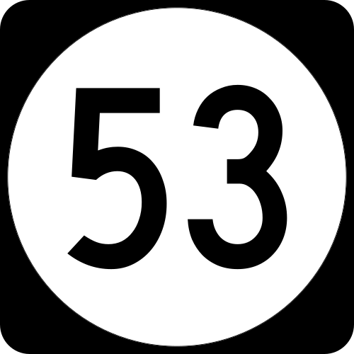 ルート53
ルート53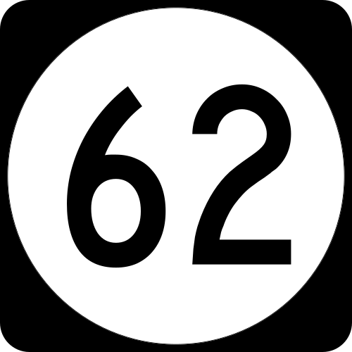 ルート62
ルート62 国道139号線
 国道208号線
 NY 440 /ルート 440
 国道495号線
 ニューヨーク895
その他の通行制限道路
_from_the_overpass_for_the_Capital_to_the_Coast_Trail_in_Wall_Township,_Monmouth_County,_New_Jersey.jpg/500px-thumbnail.jpg)
これらの道路の一部には、番号が割り当てられています。
 ベルトパークウェイ
 ブロンクスリバーパークウェイ
- コネチカット州ターンパイク(I-95の一部)
 クロスアイランドパークウェイ
 FDRドライブ
 GS パークウェイ
 グランドセントラルパークウェイ
 ハーレムリバードライブ
 ヘンリー・ハドソン・パークウェイ
 ハッチンソンリバーパークウェイ
 ジャッキー・ロビンソン・パークウェイ(旧インターボロ・パークウェイ)
 メリット パークウェイ(国道 15 号線の一部)
 NJ ターンパイク(I-95 の一部)
 ニューヨーク スルーウェイ(I-87 の一部)
 ノーザン ステート パークウェイ
 パリセーズパークウェイ
 ソーミルリバーパークウェイ
 サザン ステート パークウェイ
 スプレインブルックパークウェイ
 タコニック ステート パークウェイ
名前の付いた橋とトンネル


- アレクサンダー・ハミルトン橋は、マンハッタンのワシントンハイツ地区にあるトランスマンハッタンエクスプレスウェイと、州間高速道路95号線の一部であるクロスブロンクスエクスプレスウェイを結んでいる。
- バジロン橋(I-95 とニュージャージー ターンパイクの一部)
- チャプレン ワシントン - ハリー ラダーマン橋(I-95 と NJ ターンパイクの一部)
- ベイヨン橋(NY440号線とNJ440号線の一部)は、10億ドルのプロジェクトで道路を64フィート高くして215フィートにし、背の高いコンテナ船が下を通れるようにして、ニューヨーク市とニュージャージー州北部の港にアクセスできるようにした。 [247]
- ベア マウンテン ブリッジ(US 6 と US 202 の一部)
- ブロンクス・ホワイトストーン橋(I-678 号線の一部) – ブロンクス区とクイーンズ区を結びます。
- ブルックリン橋はニューヨークの象徴であり、1964年1月29日に米国国立公園局によって国定歴史建造物に指定されました。 [248]ブルックリンとロウアーマンハッタン(パークロウとシティホール)を結んでいます。
- ブルックリン・バッテリー トンネル(I-478 の一部) は、元ニューヨーク州知事に敬意を表して正式にヒュー L. ケアリー トンネルと改名され、ブルックリンとロウアー マンハッタン (金融地区) を結んでいます。
- デラウェア ウォーター ギャップ有料橋(デラウェア川を渡る I-80 号線の一部)
- ドリスコル橋(ガーデンステートパークウェイの一部)は、合計15車線と6車線の路肩を有し、車線数では世界で最も幅の広い自動車用橋[249]であり、世界で最も交通量の多い橋の1つです。
- エド・コッホ・クイーンズボロ橋(NY 25 号線の一部) – 元ニューヨーク市長エドワード・I・コッホに敬意を表して改名。非公式には「59 番街橋」としても知られています。クイーンズとマンハッタンの東側を結びます。
- ジョージ・ワシントン橋(I-95とUS 1-9/46の一部)は、世界で最も交通量の多い自動車橋であり[242] [243]、14車線で世界でも最も幅の広い橋の1つである。[249]
- ゴーサルズ橋(I-278 号線の一部)
- グレートサウスベイブリッジ、ロングアイランド
- ヒーローズトンネル(旧ウェストロックトンネル)(CT 15 の一部)
- ホランドトンネル(I-78とNJ 139の一部)
- リンカーントンネル(国道495号線の一部)
- マンハッタン橋はブルックリンとマンハッタンのチャイナタウンを結び、7車線の交通に加えて、ニューヨーク市地下鉄のB、D、N、Q線の4本の線路が通っています。
- ミッドハドソン橋(US 44 と NY 55 の一部)
- ニューアーク ベイ ブリッジ(I-78 の一部)
- ニューホープ – ランバートビル有料橋(デラウェア川を渡る US 202 号線の一部)
- ニューバーグ・ビーコン橋(I-84 と NY 52 の一部)
- オーティスビル トンネル(ニューヨーク州オレンジ郡のショーンガンク リッジを通るメトロノース鉄道 ポート ジャービス線)
- アウターブリッジ クロッシング(NY 440 号線と NJ 440 号線の一部)
- パールハーバー記念橋(I-95 号線とコネチカット ターンパイクの一部)
- ポキプシー橋は、ハドソン川を渡る歩道橋としても知られ、ニューヨーク州のアルスター郡とダッチェス郡を結ぶ世界最長の歩行者専用橋である[244]。
- プラスキ スカイウェイ(US 1-9 の一部)
- クイーンズ・ミッドタウン トンネル(I-495 の一部) – クイーンズとマンハッタンのミッドタウンを結びます。
- スカダーフォールズ橋(デラウェア川を渡る州間高速道路295号線の一部)
- シコルスキー記念橋(CT 15 メリット & ウィルバー クロス パークウェイの一部)
- タッパン・ジー橋(I-87、I-287、ニューヨーク州スルーウェイの一部)はニューヨーク州最長の橋であり、40億ドルかけて架け替えられた。[250]
- トーマス・アルバ・エジソン記念橋(US 9 号線の一部)
- スロッグス ネック橋(I-295 の一部) – ブロンクス区とクイーンズ区 (ロング アイランド サウンドの西端) を結びます。
- トレントン・モリスビル有料橋(US 1 の一部)
- トライボロー橋(I-278 の一部) は、正式にはロバート F. ケネディ (RFK) 橋と改名され、マンハッタン、ブロンクス、クイーンズの 3 つの区を結びます (そのため、この名前が付けられています)。
- ヴェラッツァーノ・ナローズ橋(州間高速道路278号線の一部)は、アメリカ大陸最長の吊り橋であり、世界でも最長の吊り橋の一つ(かつては世界最長)であり、スタテンアイランドとブルックリンの区を結んでいる。[245] [246]
- ウィリアム A. スティッケル記念橋(I-280 号線の一部)
- ウィリアムズバーグ橋は、ニューヨーク市地下鉄のJ、M、Z 線の 2 本の線路と 8 車線が通っており、ウィリアムズバーグ、ブルックリン、ローワー イースト サイド、またはマンハッタンを結んでいます。
通勤バス
ニュージャージートランジット、アカデミーバス、コーチUSA、スパニッシュトランスポーテーション、トレイルウェイズオブニューヨーク、およびその他のいくつかの会社が、マンハッタンのポートオーソリティバスターミナルへの通勤バスを運行しており、ニュージャージー州では他の多くのバスサービスも提供しています。バスサービスはニューヨーク州とコネチカット州の他の近隣郡でも運行されていますが、ほとんどは地下鉄ターミナルまたは他の鉄道駅で終点となります。
主要空港
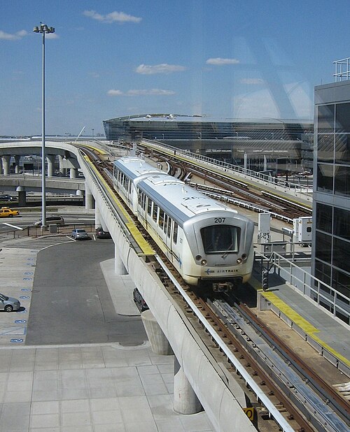

ニューヨーク都市圏で最も利用者数が多い3つの空港は、ジョン・F・ケネディ国際空港、ニューアーク・リバティー国際空港、ラガーディア空港です。2016年には1億3,050万人の旅行者がこれら3つの空港を利用し、都市圏の空域は国内で最も利用者数が多い空港となっています。[24]
以下の小規模空港も首都圏にあり、毎日商業サービスを提供しています。
通勤利用
2010年のアメリカのコミュニティ調査によると、通勤者の54.3%(5,476,169人)が車または他の自家用車を単独で使用し、7.0%(708,788人)が相乗りを使用し、27.0%(2,721,372人)が公共交通機関を使用し、5.5%(558,434人)が徒歩で通勤し、2.0%(200,448人)が自転車などの他の交通手段を使用して通勤していました。[251]
文化と現代生活

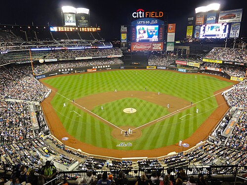


ニューヨークはアイスランド[261]とラトビア[262]の外交領事館やニューヨークのバルーク大学[263]によって世界の文化の中心地と評されている。また、オーストラリア国立図書館で展示されているように、 「ニューヨーク、世界の文化の中心地、1940-1965」と題された一連のエッセイを収録した本も出版されている。[264]トム・ウルフはニューヨークの文化について「文化は天気の一部のように空気中に漂っているようだ」と述べている。[265]
マンハッタンは依然として大都市圏の文化生活の中心地ですが、この地域全体には著名な文化施設が溢れており、芸術的なパフォーマンスや民族的なイベントが年間を通じて国際的な注目を集めています。
スポーツチーム
ニューヨーク都市圏には、ナショナル・フットボール・リーグ[ 266] 、メジャーリーグ・ベースボール[267] 、ナショナル・バスケットボール・アソシエーション[ 268 ] 、 [ナショナル・ホッケー・リーグ] 、[269]、メジャーリーグ・サッカー[270]の本部がある。[271]世界でこれまでに建設された最も高価なスタジアムのトップ10のうち4つ(メットライフ・スタジアム、新しいヤンキー・スタジアム、マディソン・スクエア・ガーデン、シティ・フィールド)は、ニューヨーク都市圏にある。[253]ニューヨーク都市圏には、これら5つのリーグのプロスポーツチームの総数が最も多い。
ニューヨーク都市圏のプロスポーツチームの一覧:
- 全米バスケットボール協会(NBA)
- ブルックリン・ネッツ(ブルックリン、ニューヨーク市)
- ニューヨーク・ニックス(マンハッタン、ニューヨーク市)
- 全米女子サッカーリーグ(NWSL)
- 女子プロバスケットボール協会(WNBA)
- ニューヨーク・リバティ(ブルックリン、ニューヨーク市)
- メジャーリーグベースボール(MLB)
- ニューヨーク・メッツ(ニューヨーク市クイーンズ)
- ニューヨーク・ヤンキース(ニューヨーク市ブロンクス)
- メジャーリーグサッカー(MLS)
- ニューヨーク・シティFC(ニューヨーク市ブロンクス)
- ニューヨーク・レッドブルズ(ニュージャージー州ハリソン)
- マイナーリーグ野球(MiLB)
- イースタンリーグ( AA )
- サウスアトランティックリーグ( A )
- ジャージー ショア ブルークローズ(フィリーズ) (ニュージャージー州 レイクウッド タウンシップ)
- ブルックリン サイクロンズ(メッツ) (ブルックリン、ニューヨーク市)
- ハドソンバレー・レネゲード(レイズ)(ニューヨーク州フィッシュキル)
- アトランティックリーグ・オブ・プロ野球(ALPB)
- カナダ・アメリカプロ野球協会(CanAmリーグ)
- ナショナルフットボールリーグ(NFL)
- ニューヨーク・ジャイアンツ(ニュージャージー州イーストラザフォード)
- ニューヨーク・ジェッツ(ニュージャージー州イーストラザフォード)
- ナショナルホッケーリーグ(NHL)
- ニュージャージー・デビルズ(ニュージャージー州ニューアーク)
- ニューヨークアイランダーズ(ニューヨーク州エルモント)
- ニューヨーク・レンジャース(マンハッタン、ニューヨーク市)
- アメリカンホッケーリーグ(AHL)
- ブリッジポート サウンド タイガース(アイランダーズ) (コネチカット州ブリッジポート)
- プロ女子ホッケーリーグ(PWHL)
- ニューヨーク・サイレンズ(ニュージャージー州ニューアーク)
- メジャーリーグラクロス(屋外)(MLL)
- 北米ラグビーリーグ(NARL)
- 大学スポーツ( NCAA ディビジョン I )
- 陸軍ブラックナイツ(ニューヨーク州ウェストポイント)
- コロンビア大学ライオンズ(マンハッタン、ニューヨーク市)
- フェアフィールド大学スタッグス(コネチカット州フェアフィールド)
- フェアリー・ディキンソン大学ナイツ(ニュージャージー州ティーネック)
- フォーダム大学ラムズ(ニューヨーク市ブロンクス)
- ホフストラ大学プライド(ニューヨーク州ヘムステッド)
- アイオナ大学ゲールズ(ニューヨーク州ニューロシェル)
- ロングアイランド大学ブラックバーズ(ブルックリン、ニューヨーク市)
- マンハッタン カレッジ ジャスパースとレディ ジャスパース(ニューヨーク市ブロンクス)
- マリスト大学レッドフォックス(ニューヨーク州ポキプシー)
- モンマス大学ホークス(ニュージャージー州ウェストロングブランチ)
- ニュージャージー工科大学ハイランダーズ(ニュージャージー州ニューアーク)
- プリンストン大学タイガース(ニュージャージー州プリンストン)
- クイニピアック大学ボブキャッツ(コネチカット州ハムデン)
- ライダー大学ブロンズ(ニュージャージー州ローレンスビル)
- ラトガース大学スカーレットナイツ(ニュージャージー州ピスカタウェイ/ニューブランズウィック)
- セイクリッドハート大学パイオニアーズ(コネチカット州フェアフィールド)
- セントピーターズ大学ピーコックス(ニュージャージー州ジャージーシティ)
- セント・ジョーンズ大学レッド・ストーム(ニューヨーク市クイーンズ)
- シートンホール大学パイレーツ(ニュージャージー州サウスオレンジ)
- ストーニーブルック大学シーウルブズ(ニューヨーク州ストーニーブルック)
- ワグナー大学シーホークス(ニューヨーク市スタテンアイランド)
- イェール大学ブルドッグス(コネチカット州ニューヘイブン)
メディア
The New York metropolitan area is home to the headquarters of several well-known media companies, subsidiaries, and publications, including Thomson Reuters, The New York Times Company, the Associated Press, Warner Bros. Discovery, NBCUniversal, the Hearst Corporation, Paramount Global, News Corp, the Fox Corporation, The Wall Street Journal, Fox News, ABC, CBS, and NBC. Local television channels broadcasting to the New York market include WCBS-TV 2 (CBS), WNBC 4 (NBC), WNYW 5 (FOX), WABC-TV 7 (ABC), WWOR-TV 9 (MyNetworkTV), WPIX 11 (CW), WNET 13 (PBS), WNYE-TV 25 (NYC Media) and WPXN-TV 31 (Ion). NY1 is a 24/7 local news provider available only to cable television subscribers. Radio stations serving the area include: WNYC, WKCR, WFMU, WABC, and WFAN. Many television and radio stations use the top of the Empire State Building to broadcast their terrestrial television signals, while some media entities broadcast from studios in Times Square.
The New York metropolitan area is extensive enough so that its own channels must compete with channels from neighboring television markets (including Philadelphia, Scranton/Wilkes-Barre, and Hartford) within its outlying counties. Cable companies offer such competition in the Pennsylvania portion, Connecticut, and a few counties in central New Jersey.
Theme parks
In New Jersey

In New York State
Coney Island, in Brooklyn, is considered one of America's first amusement parks.
Playland, in Rye, Westchester County, has been open since 1928.
Legoland New York, in Goshen, Orange County, opened in 2021.
Plans were unveiled by New York Mayor Michael Bloomberg on September 27, 2012, for the New York Wheel, a giant Ferris wheel, to be built at the northern shore of Staten Island, overlooking the Statue of Liberty, New York Harbor, and the Lower Manhattan skyline.[273]
Area codes
The area is served by at least 26 area codes:
- 212: Serves Manhattan and is overlaid with 646, 917, and 332.
- 718: Serves all other boroughs of New York City and is overlaid with 347, 917, and 929.
- 917: Serves all of New York City.
- 516 & 363: Serve Nassau County.
- 631 & 934: Serve Suffolk County.
- 914: Serves Westchester County.
- 845: Serves the Hudson Valley counties of southern New York State.
- 570 & 272: Serves Pike County in Pennsylvania.
- 203 & 475: Serves southwestern Connecticut.
- 860 & 959: Serves the rest of Connecticut not served by 203 or 475.
- 201: Serves most of Bergen County, as well as parts of Essex, Hudson, and Passaic in Northern New Jersey, and is overlaid with 551.
- 973: Serves portions of Bergen, Essex, Hudson, Morris, Passaic, Sussex, and portions of Union County in Northern New Jersey, and is overlaid with 862.
- 908: Serves communities in Union County, Somerset County, northern parts of Middlesex County, Hunterdon County, Warren County, and Morris County as well as some cell phones in Monmouth County in Central New Jersey.
- 732: Serves Middlesex County, Somerset County, portions of Union County, Monmouth and northern Ocean counties in Central New Jersey; overlaid with 848.
- 609 & 640: Serves Mercer County and parts of Middlesex, Monmouth, and Ocean Counties in Central New Jersey.
See also
- Biotech and pharmaceutical companies in the New York metropolitan area
- Tech companies in the New York metropolitan area
- Mass transit in New York City
- Regional Plan Association
- Transportation in New York City
- Putnam County, New York
Notes
- ^ Mean monthly maxima and minima (i.e. the expected highest and lowest temperature readings at any point during the year or given month) calculated based on data at said location from 1991 to 2020
- ^ Official weather observations for Central Park were conducted at the Arsenal at Fifth Avenue and 64th Street from 1869 to 1919, and at Belvedere Castle since 1919.[51]
- ^ Many of the places on this list are towns in New York, but oftentimes only specific villages or hamlets within the towns are significant.
References
- ^ Jones, Huw. "New York widens lead over London in top finance centres index". Reuters. London. Archived from the original on June 11, 2022. Retrieved August 28, 2022.
- ^ "A Nation challenged: in New York; New York Carries On, but Test of Its Grit Has Just Begun" Archived March 24, 2020, at the Wayback Machine, The New York Times, October 11, 2001. Accessed November 20, 2016. "A roaring void has been created in the financial center of the world."
- ^ Sorrentino, Christopher (September 16, 2007). "When He Was Seventeen". The New York Times. Archived from the original on April 17, 2009. Retrieved December 22, 2007.
In 1980, there were still the remains of the various downtown revolutions that had reinvigorated New York's music and art scenes and kept Manhattan in the position it had occupied since the 1940s as the cultural center of the world.
- ^ Michael P. Ventura (April 6, 2010). "Manhattan May Be the Media Capital of the World, But Not For iPad Users". DNAinfo. Archived from the original on August 4, 2017. Retrieved June 11, 2017.
- ^ Dawn Ennis (May 24, 2017). "ABC will broadcast New York's pride parade live for the first time". LGBTQ Nation. Archived from the original on July 28, 2017. Retrieved April 23, 2022.
- ^ "Census profile: New York-Newark-Jersey City, NY-NJ-PA Metro Area". Census Reporter. Archived from the original on October 15, 2022. Retrieved October 14, 2022.
- ^ a b "Urban and Rural: List of 2020 Census Urban Areas". United States Census Bureau. Retrieved July 22, 2023.
- ^ a b "Metropolitan and Micropolitan Statistical Areas Population Totals: 2020-2023". United States Census Bureau, Population Division. March 14, 2024. Retrieved March 15, 2024.
- ^ "Total Gross Domestic Product for New York-Newark-Jersey City, NY-NJ-PA (MSA)", Federal Reserve Economic Data, Federal Reserve Bank of St. Louis
- ^ a b c "Gross Domestic Product by County and Metropolitan Area", Federal Reserve Economic Data, Federal Reserve Bank of St. Louis
- ^ "Largest City in the World by Area 2023". World Population Review. Archived from the original on January 19, 2023. Retrieved January 19, 2023.
- ^ "Largest Cities In The World By Land Area". WorldAtlas. January 7, 2019. Archived from the original on January 18, 2023. Retrieved January 18, 2023.
New York is often estimated to be the largest city in the world by land area.
- ^ "World Urban Areas" (PDF). Demographia. April 2018. Archived (PDF) from the original on October 13, 2016. Retrieved April 27, 2018.
- ^ Niall McCarthy (February 5, 2021). "The World's Largest Cities By Area". Hamburg: Statista. Archived from the original on February 9, 2021. Retrieved March 1, 2021.
- ^ "USA: Combined Metropolitan Areas". CityPopulation.de. August 2021. Archived from the original on April 2, 2023. Retrieved November 19, 2021.
- ^ a b "Annual Estimates of the Resident Population: April 1, 2010 to July 1, 2015 – Combined Statistical Area; and for Puerto Rico – 2015 Population Estimates". U.S. Census Bureau. Archived from the original on February 13, 2020. Retrieved March 28, 2016.
- ^ "World's Largest Urban Areas [Ranked by Urban Area Population]". Rhett Butler. 2003–2006. Archived from the original on October 9, 2009. Retrieved November 25, 2011.
- ^ "Largest Cities of the World – (by metro population)". Woolwine-Moen Group d/b/a Graphic Maps. Archived from the original on June 18, 2016. Retrieved November 25, 2011.
- ^ "Largest urban areas in the world: 2008 All Urban Areas 2,000,000 & Over" (PDF). Wendell Cox Consultancy. Archived (PDF) from the original on September 1, 2012. Retrieved November 25, 2011.
- ^ a b "Yearbook of Immigration Statistics: 2013 Lawful Permanent Residents Supplemental Table 2". U.S. Department of Homeland Security. Archived from the original on October 13, 2016. Retrieved July 31, 2014.
- ^ "Yearbook of Immigration Statistics: 2012 Supplemental Table 2". U.S. Department of Homeland Security. Archived from the original on April 3, 2013. Retrieved July 31, 2014.
- ^ "Yearbook of Immigration Statistics: 2011 Supplemental Table 2". U.S. Department of Homeland Security. Archived from the original on August 8, 2012. Retrieved July 31, 2014.
- ^ "Yearbook of Immigration Statistics: 2010 Supplemental Table 2". U.S. Department of Homeland Security. Archived from the original on July 12, 2012. Retrieved July 31, 2014.
- ^ a b "The Port Authority of NY and NJ 2016 Air Traffic Report" (PDF). The Port Authority of New York and New Jersey. April 14, 2017. Archived (PDF) from the original on May 25, 2017. Retrieved June 26, 2017.
- ^ "Top 50 science cities in life sciences". www.natureindex.com. Archived from the original on October 24, 2021. Retrieved March 26, 2022.
- ^ a b "Governor Hochul, Mayor Adams Announce Plan for SPARC Kips Bay, First-of-Its-Kind Job and Education Hub for Health and Life Sciences Innovation" (Press release). Albany: NY State Office of Information Technology Services. October 13, 2022. Archived from the original on November 1, 2022. Retrieved October 13, 2022.
- ^ a b Huw Jones (January 27, 2020). "New York surges ahead of Brexit-shadowed London in finance: survey". Reuters. Archived from the original on January 27, 2020. Retrieved January 27, 2020.
New York remains the world's top financial center, pushing London further into second place as Brexit uncertainty undermines the UK capital and Asian centers catch up, a survey from consultants Duff & Phelps said on Monday.
- ^ a b c "Top 8 Cities by GDP: China vs. The U.S." Business Insider, Inc. July 31, 2011. Archived from the original on October 16, 2015. Retrieved October 28, 2015.
For instance, Shanghai, the largest Chinese city with the highest economic production, and a fast-growing global financial hub, is far from matching or surpassing New York, the largest city in the U.S. and the economic and financial super center of the world.
"PAL sets introductory fares to New York". Philippine Airlines. Archived from the original on March 27, 2015. Retrieved March 25, 2015. - ^ a b Richard Florida (May 8, 2012). "What Is the World's Most Economically Powerful City?". The Atlantic Monthly Group. Archived from the original on March 18, 2015. Retrieved March 25, 2015.
- ^ a b Felix Richter (March 11, 2015). "New York Is The World's Media Capital". Statista. Archived from the original on July 14, 2017. Retrieved May 29, 2017.
- ^ a b Dawn Ennis (May 24, 2017). "ABC will broadcast New York's pride parade live for the first time". LGBTQ Nation. Archived from the original on July 28, 2017. Retrieved May 29, 2017.
- ^ "Top 8 Cities by GDP: China vs. The U.S." Business Insider, Inc. July 31, 2011. Archived from the original on October 16, 2015. Retrieved February 4, 2017.
For instance, Shanghai, the largest Chinese city with the highest economic production, and a fast-growing global financial hub, is far from matching or surpassing New York, the largest city in the U.S. and the economic and financial super center of the world.
"PAL sets introductory fares to New York". Philippine Airlines. Archived from the original on March 27, 2015. Retrieved February 4, 2017. - ^ a b c d Richard Florida (March 3, 2015). "Sorry, London: New York Is the World's Most Economically Powerful City". Bloomberg.com. The Atlantic Monthly Group. Archived from the original on March 14, 2015. Retrieved March 25, 2015.
Our new ranking puts the Big Apple firmly on top.
- ^ Erin Carlyle (October 8, 2014). "New York Dominates 2014 List of America's Most Expensive ZIP Codes". Forbes. Archived from the original on October 12, 2014. Retrieved October 12, 2014.
- ^ "These Are the 100 Richest Places in America". Bloomberg News. Archived from the original on June 13, 2018. Retrieved June 11, 2018.
- ^ "OMB's Decisions Regarding Recommendations From the Metropolitan and Micropolitan Statistical Area Standards Review Committee Concerning Changes to the Standards for Defining Metropolitan and Micropolitan Statistical Areas". Federal Register. Archived from the original on October 29, 2013. Retrieved October 8, 2013.
- ^ "New York City Designated Market Area map PDF" (PDF). Archived (PDF) from the original on October 22, 2011. Retrieved September 10, 2011.
- ^ "Elevations and Distances in the United States". U.S. Geological Survey. April 29, 2005. Archived from the original on November 2, 2006. Retrieved August 31, 2012.
- ^ Geography Explained (see Change in Labor Market Areas) "Geography Explained - New York State Department of Labor". Archived from the original on October 10, 2011. Retrieved September 16, 2011.
- ^ "Census Map" (PDF). Archived from the original (PDF) on October 30, 2011.
- ^ "Metro-North Railroad". Metropolitan Transportation Authority of the State of New York. Archived from the original on July 14, 2013. Retrieved September 27, 2011.
- ^ a b c Peel, M. C.; Finlayson, B. L.; McMahon, T. A. "World Map of Köppen-Geiger climate classification". The University of Melbourne. Archived from the original on April 30, 2011. Retrieved September 3, 2012.
- ^ a b "New York Polonia Polish Portal in New York". NewYorkPolonia.com. Archived from the original on January 4, 2013. Retrieved September 3, 2012.
- ^ "united states annual snowfall map". HowStuffWorks, Inc. Archived from the original on July 5, 2012. Retrieved September 3, 2012.
- ^ "The Climate of New York". New York State Climate Office. Archived from the original on April 12, 2008. Retrieved September 3, 2012.
- ^ [1] Archived July 4, 2019, at the Wayback Machine
- ^ "Weatherbase New York, New York". Canty and Associates LLC. Archived from the original on September 16, 2012. Retrieved September 3, 2012.
- ^ Sam Dolnick (August 28, 2011). "Damage From Irene Largely Spares New York – Recovery Is Slower in New York Suburbs". The New York Times. Archived from the original on September 13, 2012. Retrieved September 3, 2012.
- ^ "WXPART4: Average Annual Percentage of Possible Sunshine at Phoenix as Compared to Other Major U.S. Cities". Public.asu.edu. Archived from the original on January 13, 2013. Retrieved April 26, 2013.
- ^ "united states annual sunshine map". HowStuffWorks, Inc. Archived from the original on April 29, 2011. Retrieved April 26, 2013.
- ^ Belvedere Castle at NYC Parks
- ^ "NowData – NOAA Online Weather Data". National Oceanic and Atmospheric Administration. Retrieved May 4, 2021.
- ^ "Summary of Monthly Normals 1991–2020". National Oceanic and Atmospheric Administration. Archived from the original on May 4, 2021. Retrieved May 4, 2021.
- ^ "New York Central Park, NY Climate Normals 1961−1990". National Oceanic and Atmospheric Administration. Retrieved July 18, 2020.
- ^ a b "New York, New York, USA - Monthly weather forecast and Climate data". Weather Atlas. Retrieved July 4, 2019.
- ^ "NowData - NOAA Online Weather Data". National Oceanic and Atmospheric Administration. Archived from the original on January 18, 2022. Retrieved August 11, 2021.
- ^ "Station: West Point, NY". U.S. Climate Normals 2020: U.S. Monthly Climate Normals (1991-2020). National Oceanic and Atmospheric Administration. Archived from the original on August 11, 2021. Retrieved August 11, 2021.
- ^ "Average Weather for Morristown, New Jersey – Temperature and Precipitation". Weather.com. Archived from the original on October 23, 2012. Retrieved March 28, 2008.
- ^ Average weather for Toms River, New Jersey Archived July 14, 2023, at the Wayback Machine, Weather.com. Accessed November 3, 2019.
- ^ "Weatherbase: Weather for Stroudsburg, Pennsynlvania". Weatherbase. 2011. Archived from the original on August 10, 2014. Retrieved November 14, 2013. Retrieved on November 22, 2011.
- ^ a b Edward Robb Ellis (December 21, 2004). The Epic of New York City: A Narrative History. Basic Books. p. 594. ISBN 9780786714360. Archived from the original on April 4, 2023. Retrieved December 12, 2022.
- ^ "A 5-Borough Centennial Preface for Katharine Bement Davis Mini-History". The New York City Department of Correction. 1997. Archived from the original on October 23, 2011. Retrieved October 26, 2011.
- ^ "Annual Estimates of the Resident Population for Incorporated Places of 50,000 or More, Ranked by July 1, 2014 Population: April 1, 2010 to July 1, 2014 – United States – Places of 50,000+ Population – 2014 Population Estimates". United States Census Bureau. Archived from the original on February 13, 2020. Retrieved May 24, 2015.
- ^ "Annual Estimates of the Resident Population: April 1, 2010 to July 1, 2014 – 2014 Population Estimates". United States Census Bureau. Archived from the original on April 4, 2015. Retrieved May 24, 2015.
- ^ "New York City Land Use". The City of New York. Archived from the original on March 28, 2014. Retrieved March 27, 2014.
- ^ US-25S&-_lang=en County and City Data Book:2007 (U.S. Census Bureau), Table B-1, Area and Population Archived February 12, 2020, at archive.today, Retrieved July 12, 2008.
- ^ "Global Power City Index 2009" (PDF). The Mori Memorial Foundation. Archived (PDF) from the original on June 29, 2014. Retrieved June 1, 2012.
- ^ Poliak, Shira. "Adjusting To New York City". Sun Sentinel. Archived from the original on December 3, 2015. Retrieved November 1, 2015.
Additionally, the fast-paced lifestyle of New York demands adjusting.
- ^ Stephen Miller (October 3, 2016). Walking New York: Reflections of American Writers from Walt Whitman to Teju Cole pp.46, 50, 131. Fordham University Press. ISBN 9780823274253. Archived from the original on July 17, 2017. Retrieved May 10, 2017.
- ^ "Dictionary – Full Definition of NEW YORK MINUTE". Merriam-Webster. Archived from the original on September 23, 2015. Retrieved November 1, 2015.
- ^ Plan your visit Archived March 14, 2017, at the Wayback Machine, United Nations. Accessed February 9, 2017. "The Headquarters of the United Nations is located in New York, along the East River. When you pass through the gates of the United Nations visitors’ entrance, you enter an international territory. This 18-acre site does not belong to just one country, but to all countries that have joined the Organization; currently, the United Nations has 193 Member States."
- ^ "NYC Mayor's Office for International Affairs". The City of New York. Archived from the original on June 16, 2015. Retrieved June 24, 2015.
- ^ "Global power city index 2009" (PDF). The Mori Memorial Foundation. Archived (PDF) from the original on June 29, 2014. Retrieved August 2, 2014.
- ^ "Introduction to Chapter 14: New York City (NYC) Culture". The Weissman Center for International Business Baruch College/CUNY 2011. Archived from the original on May 5, 2013. Retrieved August 2, 2014.
- ^ New York, Culture Capital of the World, 1940–1965 / edited by Leonard Wallock; essays by Dore Ashton ... [et al.]. NATIONAL LIBRARY OF AUSTRALIA. 1988. ISBN 9780847809905. Archived from the original on January 13, 2013. Retrieved August 2, 2014.
- ^ "PAL sets introductory fares to New York". Philippine Airlines. Archived from the original on March 27, 2015. Retrieved March 25, 2015.
- ^ About Long Island Archived May 16, 2015, at the Wayback Machine, LongIsland.com
- ^ "Annual Estimates of the Resident Population: April 1, 2010 to July 1, 2015 – 2015 Population Estimates". United States Census Bureau. Archived from the original on February 13, 2020. Retrieved March 28, 2016.
- ^ "Kings County, New York QuickFacts". U.S. Census Bureau. Archived from the original on February 17, 2016. Retrieved March 28, 2016.
- ^ "Queens County, New York QuickFacts". U.S. Census Bureau. Archived from the original on August 8, 2014. Retrieved March 28, 2016.
- ^ "Nassau County, New York QuickFacts". U.S. Census Bureau. Archived from the original on June 7, 2011. Retrieved March 28, 2016.
- ^ "Suffolk County, New York QuickFacts". U.S. Census Bureau. Archived from the original on July 29, 2011. Retrieved March 28, 2016.
- ^ "ACS DEMOGRAPHIC AND HOUSING ESTIMATES – 2011-2015 American Community Survey 5-Year Estimates". Archived February 14, 2020, at archive.today. Accessed July 21, 2017.
- ^ Christine Kim; Demand Media. "Queens, New York, Sightseeing". USA TODAY. Archived from the original on June 16, 2016. Retrieved June 23, 2014.
- ^ Andrew Weber (April 30, 2013). "Queens". NewYork.com. Archived from the original on May 13, 2015. Retrieved June 23, 2014.
- ^ "QuickFacts Hempstead town, Nassau County, New York". Archived from the original on October 1, 2023. Retrieved July 5, 2017.
- ^ [2] Archived August 8, 2015, at the Wayback Machine Accessed August 8, 2015.
- ^ "Frequently Asked Questions". Hudson River PCBs. New York, NY: U.S. Environmental Protection Agency. Archived from the original on November 21, 2011. Retrieved September 29, 2011.
- ^ "National Historic Landmarks Program – Lake Mohonk Mountain House". National Park Service. Archived from the original on November 10, 2013. Retrieved September 3, 2012.
- ^ Mark J. Magyar (November 8, 2011). "Paterson Great Falls National Park: More Than Scenery". njSPOTLIGHT. Archived from the original on January 17, 2013. Retrieved September 2, 2012.
- ^ "Pike County, Pennsylvania QuickFacts". U.S. Census Bureau. Archived from the original on June 6, 2011. Retrieved September 11, 2012.
- ^ "Pike County, PA Court Administration". Pike County Commissioners. Archived from the original on February 6, 2013. Retrieved September 11, 2012.
- ^ David Pierce (June 25, 2010). "Population pops in Pike, Monroe counties". The Pocono Record. Archived from the original on March 11, 2012. Retrieved September 11, 2012.
- ^ "National Historic Landmarks Program – New Haven Green Historic District". National Park Service. Archived from the original on July 1, 2019. Retrieved September 3, 2012.
- ^ "City of Paterson – Silk City". Archived from the original on November 9, 2013. Retrieved April 2, 2013.
- ^ "A Brief History of Peruvian Immigration to the United States". yumimmigrantcity.com. Archived from the original on July 31, 2013. Retrieved April 20, 2013.
- ^ Joe Malinconico & Charlie Kratovil (May 9, 2012). "Paterson's Bengali Community Takes Pride in Akhtaruzzaman's Upset Victory". The Alternative Press. Archived from the original on May 14, 2013. Retrieved April 20, 2013.
- ^ "U.S. Census Bureau Quickfacts". United States Census Bureau. April 1, 2020. Archived from the original on February 6, 2021. Retrieved November 25, 2023.
- ^ "List of 2020 Census Urban Areas". United States Census Bureau. Archived from the original on January 14, 2023. Retrieved January 7, 2023.
- ^ "About the Lenapes". [Lenape Lifeways]. Archived from the original on May 14, 2012. Retrieved September 8, 2012.
- ^ a b "United States History – History of New York City, New York". Archived from the original on September 8, 2012. Retrieved September 9, 2012.
- ^ Shorto, Russell (2005). The Island at the Center of The World, 1st Edition. New York: Vintage Books. p. 30. ISBN 1-4000-7867-9.
- ^ "New Jersey Colony Reading Comprehension". MrNussbaum.com. Archived from the original on October 24, 2012. Retrieved September 9, 2012.
- ^ "KINGSTON Discover 300 Years of New York History DUTCH COLONIES". National Park Service, U.S. Department of the Interior. Archived from the original on November 23, 2008. Retrieved September 9, 2012.
- ^ "The Nine Capitals of the United States". United States Senate. Archived from the original on March 20, 2016. Retrieved September 9, 2012.
- ^ "Rank by Population of the 100 Largest Urban Places, Listed Alphabetically by State: 1790–1990". U.S. Census Bureau. June 15, 1998. Archived from the original on October 12, 2012. Retrieved September 9, 2012.
- ^ "Statue of Liberty". World Heritage. UNESCO. Archived from the original on August 28, 2012. Retrieved August 31, 2012.
- ^ "Statue of Liberty". A&E Television Networks. Archived from the original on September 23, 2012. Retrieved September 9, 2012.
- ^ "Statue of Liberty". World Heritage. UNESCO World Heritage Centre. Archived from the original on October 24, 2011. Retrieved October 23, 2011.
- ^ "A 5-Borough Centennial Preface for Katharine Bement Davis Mini-History". The New York City Department of Correction. 1997. Archived from the original on October 23, 2011. Retrieved September 2, 2012.
- ^ "New York: A City of Neighborhoods". New York City Department of City Planning. Archived from the original on September 15, 2012. Retrieved September 2, 2012.
- ^ Martin Z. Braun & Freeman Klopott (November 26, 2012). "Bloomberg Seeks $9.8 Billion Aid for NYC Sandy Storm Losses". Bloomberg. Archived from the original on November 28, 2012. Retrieved November 27, 2012.
- ^ Jeff Stone & Maria Gallucci (October 29, 2014). "Hurricane Sandy Anniversary 2014: Fortifying New York – How Well Armored Are We For The Next Superstorm?". International Business Times. Archived from the original on July 24, 2015. Retrieved July 23, 2015.
- ^ Robert S. Eshelman (November 15, 2012). "ADAPTATION: Political support for a sea wall in New York Harbor begins to form". E&E Publishing, LLC. Archived from the original on February 5, 2013. Retrieved July 23, 2015.
- ^ "Queens – The NYC Experience". The City of New York. February 16, 2011. Archived from the original on May 4, 2012. Retrieved September 7, 2012.
- ^ Schenkler, Michael. "We Are A Nation Of Immigrants". Queens Tribune. Archived from the original on May 11, 2008. Retrieved September 7, 2012.
- ^ "Combined Statistical Areas 2013" (PDF). Archived from the original (PDF) on July 21, 2014. Retrieved October 28, 2013.
- ^ OMB BULLETIN NO. 18-04: Revised Delineations of Metropolitan Statistical Areas, Micropolitan Statistical Areas, and Combined Statistical Areas, and Guidance on Uses of the Delineations of These Areas Archived March 4, 2020, at the Wayback Machine. Office of Management and Budget. September 14, 2018.
- ^ Campbell, Jon. "Upstate, Downstate: Why New York secession efforts haven't been successful". Rochester Democrat and Chronicle. Archived from the original on November 1, 2020. Retrieved March 1, 2020.
- ^ a b c "Split New York into 2 states? Upstate NY lawmaker wants study for idea". Syracuse. Advance Media New York. February 25, 2019. Archived from the original on October 8, 2019. Retrieved August 29, 2019.
- ^ a b Kearney, Brent (March 11, 2019). "Should New York be split into three separate regions?". WKTV. Heartland Media. Archived from the original on August 29, 2019. Retrieved August 29, 2019.
- ^ a b c d Mikelionis, Lucas (March 8, 2019). "Break liberals' grip on New York by splitting state into 3 regions, Republican proposes". Fox News. Archived from the original on August 29, 2019. Retrieved August 29, 2019.
- ^ Linge, Mary Kay (April 6, 2019). "New York bill proposes splitting Empire State into three districts". New York Post. Archived from the original on August 29, 2019. Retrieved August 29, 2019.
- ^ Linge, Mary Kay (April 6, 2019). "New York bill proposes splitting Empire State into three districts". New York Post. Archived from the original on August 29, 2019. Retrieved March 1, 2020.
- ^ "New New York? Lawmaker Proposes Turning NYC, Long Island Into Its Own State". CBS local. February 23, 2019. Archived from the original on August 24, 2019. Retrieved March 1, 2020.
- ^ Kiniry, Laura. "Moon Handbooks New Jersey", Avalon Travel Publishing, 2006. pg. 34 ISBN 1-56691-949-5. Retrieved April 10, 2015.
- ^ Laryssa Wirstiuk (April 21, 2014). "Neighborhood Spotlight: Journal Square". Jersey City Independent. Archived from the original on June 30, 2018. Retrieved May 24, 2015.
- ^ "Palisades Park borough, New Jersey QuickLinks". United States Census Bureau. Archived from the original on May 13, 2014. Retrieved August 8, 2014.
- ^ Kirk Semple (May 18, 2012). "In New Jersey, Memorial for 'Comfort Women' Deepens Old Animosity". The New York Times. Archived from the original on May 29, 2019. Retrieved May 24, 2015.
- ^ a b Vivian Yee (February 22, 2015). "Indictment of New York Officer Divides Chinese-Americans". The New York Times. Archived from the original on February 24, 2015. Retrieved February 23, 2015.
- ^ a b "Chinese New Year 2012 in Flushing". QueensBuzz.com. January 25, 2012. Archived from the original on May 26, 2013. Retrieved July 18, 2014.
- ^ Forstall, Richard L., ed. (March 27, 1995). "Population of Counties by Decennial Census: 1900 to 1990". United States Census Bureau. Archived from the original on July 18, 2015. Retrieved August 9, 2015.
- ^ U.S. Census Bureau. "U.S. Census website". United States Census Bureau. Archived from the original on December 27, 1996. Retrieved August 10, 2015.
- ^ [3] Archived August 9, 2017, at the Wayback Machine, Schulz, Dana (November 29, 2017). "The History of the Rockefeller Center Christmas Tree, a NYC Holiday Tradition". 6sqft.
- ^ a b Gary J. Gates. "Same-sex Couples and the Gay, Lesbian, Bisexual Population: New Estimates from the American Community Survey" (PDF). The Williams Institute on Sexual Orientation. Archived from the original (PDF) on June 9, 2013. Retrieved December 7, 2013.
- ^ a b Brian Silverman & Kelsy Chauvin (2013). Frommer's New York City 2013. Wiley. ISBN 9781118331446. Archived from the original on September 6, 2015. Retrieved March 24, 2015.
- ^ Kirk Semple (June 23, 2011). "Asian New Yorkers Seek Power to Match Numbers". The New York Times. Archived from the original on June 27, 2011. Retrieved July 5, 2011.
Asians, a group more commonly associated with the West Coast, are surging in New York, where they have long been eclipsed in the city's kaleidoscopic racial and ethnic mix. For the first time, according to census figures released in the spring, their numbers have topped one million—nearly 1 in 8 New Yorkers—which is more than the Asian population in the cities of San Francisco and Los Angeles combined.
- ^ "Asian American Statistics". Améredia Incorporated. Archived from the original on July 14, 2011. Retrieved July 5, 2011.
- ^ Christine Kim; Demand Media. "Queens, New York, Sightseeing". USA TODAY. Archived from the original on June 16, 2016. Retrieved July 18, 2014.
- ^ Andrew Weber (April 30, 2013). "Queens". NewYork.com. Archived from the original on May 13, 2015. Retrieved July 18, 2014.
- ^ "State & County QuickFacts Nassau County, New York QuickLinks". United States Census Bureau. Archived from the original on October 7, 2014. Retrieved July 18, 2014.
- ^ Heng Shao (April 10, 2014). "Join The Great Gatsby: Chinese Real Estate Buyers Fan Out To Long Island's North Shore". Forbes. Archived from the original on August 8, 2014. Retrieved August 2, 2014.
- ^ a b c "Yearbook of Immigration Statistics: 2011 Supplemental Table 2". U.S. Department of Homeland Security. Archived from the original on August 8, 2012. Retrieved July 18, 2014.
- ^ "Yearbook of Immigration Statistics: 2013 Lawful Permanent Residents Supplemental Table 2". U.S. Department of Homeland Security. Archived from the original on October 13, 2016. Retrieved July 18, 2014.
- ^ "Yearbook of Immigration Statistics: 2013 Lawful Permanent Residents Supplemental Table 1". U.S. Department of Homeland Security. Archived from the original on October 13, 2016. Retrieved July 18, 2014.
- ^ "Yearbook of Immigration Statistics: 2012 Supplemental Table 2". U.S. Department of Homeland Security. Archived from the original on April 3, 2013. Retrieved July 18, 2014.
- ^ "Yearbook of Immigration Statistics: 2010 Supplemental Table 2". U.S. Department of Homeland Security. Archived from the original on July 12, 2012. Retrieved February 24, 2013.
- ^ John Marzulli (May 9, 2011). "Malaysian man smuggled illegal Chinese immigrants into Brooklyn using Queen Mary 2: authorities". The New York Daily News. New York. Archived from the original on May 5, 2015. Retrieved February 24, 2013.
- ^ "U.S. Census website". United States Census Bureau. Archived from the original on December 27, 1996. Retrieved July 19, 2014.
- ^ Cosmologies of Credit: Transnational Mobility and the Politics of Destination in China, 2010, Julie Y. Chu
- ^ a b "Most Significant Unreached People Group Communities in Metro NY". GLOBAL GATES. July 17, 2012. Archived from the original on October 27, 2014. Retrieved October 27, 2014.
- ^ "Table SF1-P9 NYC: Total Asian Population by Selected Subgroups" (PDF). NYC.gov. Archived from the original (PDF) on May 5, 2012. Retrieved August 27, 2011.
- ^ "Queens County, New York QuickFacts". U.S. Census Bureau. Archived from the original on August 8, 2014. Retrieved August 13, 2014.
- ^ John Roleke. "A Growing Chinatown in Elmhurst". About.com. Archived from the original on July 11, 2014. Retrieved August 13, 2014.
- ^ Boothe, Emilia (August 31, 2017). "West Indian Immigration and Carnival: Coming to Brooklyn". Brooklynology. Posted by Jen Hoyer. Brooklyn Public Library. Archived from the original on December 3, 2022. Retrieved October 6, 2023.
- ^ "American FactFinder – Results". U.S. Department of Commerce. Archived from the original on February 12, 2020. Retrieved October 8, 2014.
- ^ a b "Hispanic or Latino by Type: 2010". United States Census Bureau. Retrieved October 8, 2014.[permanent dead link]
- ^ "American FactFinder – Results". United States Census Bureau. Archived from the original on March 16, 2015. Retrieved October 8, 2014.
- ^ "A Community of Many Worlds: Arab Americans in New York City". Allied Media Corp. Archived from the original on November 8, 2014. Retrieved October 9, 2014.
- ^ "Yearbook of Immigration Statistics: 2013 Lawful Permanent Residents Supplemental Table 2". U.S. Department of Homeland Security. Archived from the original on October 13, 2016. Retrieved July 19, 2014.
- ^ Nadège Ragaru & Amilda Dymi. "The Albanian-American Community in the United States : A Diaspora Coming to Visibility" (PDF). Archived (PDF) from the original on August 22, 2014. Retrieved July 29, 2014.
- ^ Ian Gordon; Tony Travers; and Christine Whitehead (July 2007). "The Impact of Recent Immigration on the London Economy" (PDF). The City of London Corporation. Archived (PDF) from the original on November 3, 2013. Retrieved September 8, 2013.
- ^ Moslimani, Mohamad; Tamir, Christine; Budiman, Abby; Noe-Bustamante, Luis; Mora, Lauren (January 18, 2024). "Facts About the U.S. Black Population". Pew Research Center. Retrieved August 14, 2024.
- ^ "Yearbook of Immigration Statistics: 2012 Supplemental Table 2". U.S. Department of Homeland Security. Archived from the original on April 3, 2013. Retrieved April 2, 2013.
- ^ "Yearbook of Immigration Statistics: 2011 Supplemental Table 2". U.S. Department of Homeland Security. Archived from the original on August 8, 2012. Retrieved April 26, 2012.
- ^ "Yearbook of Immigration Statistics: 2010 Supplemental Table 2". U.S. Department of Homeland Security. Archived from the original on July 12, 2012. Retrieved April 26, 2012.
- ^ "Yearbook of Immigration Statistics: 2009 Supplemental Table 2". U.S. Department of Homeland Security. Archived from the original on August 8, 2012. Retrieved April 26, 2012.
- ^ "Profile of General Population and Housing Characteristics: 2010 Demographic Profile Data Geography: New York-Newark-Bridgeport, NY-NJ-CT-PA CSA". Archived from the original on February 12, 2020. Retrieved September 2, 2012.
- ^ "Profile of General Population and Housing Characteristics: 2010 Demographic Profile Data Geography: United States". U.S. Census Bureau. Archived from the original on December 27, 1996. Retrieved September 2, 2012.
- ^ Kirk Semple (June 23, 2011). "Asian New Yorkers Seek Power to Match Numbers". The New York Times. Archived from the original on December 19, 2014. Retrieved September 2, 2012.
- ^ "SELECTED POPULATION PROFILE IN THE UNITED STATES – 2014 American Community Survey 1-Year Estimates New York-Newark-Bridgeport, NY-NJ-CT-PA CSA – Chinese alone". U.S. Census Bureau. Archived from the original on February 14, 2020. Retrieved August 29, 2016.
- ^ "Persons Obtaining Lawful Permanent Resident Status by Leading Core Based Statistical Areas (CBSAs) of Residence and Region and Country of Birth: Fiscal Year 2013". United States Department of Homeland Security. Archived from the original on May 1, 2015. Retrieved March 6, 2015.
- ^ Peter Minkoff (April 5, 2018). "New York - The World's Gay Capital". Your LGBTQ+ Voice. Archived from the original on January 4, 2023. Retrieved January 4, 2023.
- ^ Nicholas Confessore & Michael Barbaro (June 24, 2011). "New York Allows Same-Sex Marriage, Becoming Largest State to Pass Law". The New York Times Company. Archived from the original on February 9, 2014. Retrieved September 2, 2012.
- ^ "Revelers Take To The Streets For 48th Annual NYC Pride March". CBS New York. June 25, 2017. Archived from the original on June 28, 2017. Retrieved July 3, 2017.
A sea of rainbows took over the Big Apple for the biggest pride parade in the world Sunday.
- ^ Simone Weichselbaum (June 26, 2012). "Nearly one in four Brooklyn residents are Jews, new study finds". New York Daily News. Archived from the original on July 4, 2018. Retrieved May 30, 2013.
- ^ "Largest Indoor Buddha in the Western Hemisphere". RoadsideAmerica.com. Archived from the original on November 15, 2015. Retrieved October 27, 2015.
- ^ Pew Research Center, "Religious Landscape Study: New York City metro area" Archived October 24, 2016, at the Wayback Machine
- ^ Fortune 500 web site (cities) Archived August 24, 2011, at the Wayback Machine, retrieved July 21, 2011; Fortune, Vol. 163, no. 7 (May 23, 2011), page F-45
- ^ Wylde, Kathryn (January 23, 2006). "Keeping the Economy Growing". Gotham Gazette. Archived from the original on October 6, 2008. Retrieved March 24, 2015.
- ^ Richard Florida (May 8, 2012). "What Is the World's Most Economically Powerful City?". The Atlantic Monthly Group. Archived from the original on March 18, 2015. Retrieved November 22, 2012.
- ^ a b "NYSE Listings Directory". Archived from the original on June 21, 2013. Retrieved October 27, 2014.
- ^ a b c "2013 WFE Market Highlights" (PDF). World Federation of Exchanges. Archived from the original (PDF) on March 27, 2014. Retrieved October 27, 2014.
- ^ Karim Lahlou. "Startups move to co-shared offices amid high real estate prices". The Midtown Gazette. Archived from the original on August 21, 2014. Retrieved October 27, 2014.
- ^ "Top 8 Cities by GDP: China vs. The U.S." Business Insider, Inc. July 31, 2011. Archived from the original on February 5, 2013. Retrieved June 22, 2014.
- ^ John Glover (November 23, 2014). "New York Boosts Lead on London as Leading Finance Center". Bloomberg L.P. Archived from the original on January 12, 2015. Retrieved March 25, 2015.
- ^ "UBS may move US investment bank to NYC". e-Eighteen.com Ltd. June 10, 2011. Archived from the original on January 26, 2012. Retrieved March 25, 2015.
- ^ "The Global Financial Centres Index 17" (PDF). Long Finance. March 23, 2015. Archived from the original (PDF) on April 14, 2015. Retrieved March 25, 2015.
- ^ Thomas P. DiNapoli (New York State Comptroller) and Kenneth B. Bleiwas (New York State Deputy Comptroller) (October 2013). "The Securities Industry in New York City" (PDF). Archived (PDF) from the original on August 22, 2014. Retrieved July 30, 2014.
- ^ "What is an office condominium?". Rudder Property Group. Archived from the original on September 29, 2010. Retrieved May 28, 2013.
- ^ "Understanding The Manhattan Office Space Market". Officespaceseeker.com. Archived from the original on July 13, 2014. Retrieved May 18, 2013.
- ^ "Marketbeat United States CBD Office Report 2Q11" (PDF). Cushman & Wakefield, Inc. Archived from the original (PDF) on May 8, 2013. Retrieved May 18, 2013.
- ^ Ambereen Choudhury, Elisa Martinuzzi & Ben Moshinsky (November 26, 2012). "London Bankers Bracing for Leaner Bonuses Than New York". Bloomberg L.P. Archived from the original on August 4, 2014. Retrieved July 20, 2014.
- ^ Sanat Vallikappen (November 10, 2013). "Pay Raises for Bank Risk Officers in Asia Trump New York". Bloomberg L.P. Archived from the original on August 4, 2014. Retrieved July 20, 2014.
- ^ David Enrich; Jacob Bunge & Cassell Bryan-Low (July 9, 2013). "NYSE Euronext to Take Over Libor". The Wall Street Journal. Archived from the original on October 19, 2013. Retrieved July 10, 2013.
- ^ Ronda Kaysen (August 15, 2013). "New Yorkers Discover Jersey City". The New York Times. Archived from the original on August 11, 2014. Retrieved August 1, 2014.
- ^ Megan Rose Dickey & Jillian D'Onfro (October 24, 2013). "SA 100 2013: The Coolest People In New York Tech". Business Insider. Archived from the original on July 22, 2014. Retrieved July 30, 2014.
- ^ Matt Flegenheimer (March 23, 2016). "Ted Cruz Deplores 'Liberal, Left-Wing Values' While Lobbying for New York Votes". The New York Times. Archived from the original on April 13, 2016. Retrieved April 22, 2016.
- ^ "The Latest: China Hopes US Joins Climate Deal Quickly". The New York Times. Associated Press. April 22, 2016. Archived from the original on May 3, 2016. Retrieved April 22, 2016.
- ^ Lisa Foderaro (September 21, 2014). "Taking a Call for Climate Change to the Streets". The New York Times. Archived from the original on May 26, 2015. Retrieved April 22, 2016.
- ^ "Telecommunications and Economic Development in New York City: A Plan for Action" (PDF). New York City Economic Development Corporation. March 2005. Archived from the original (PDF) on March 4, 2006. Retrieved July 29, 2014.
- ^ Ivan Pereira (December 10, 2013). "City opens nation's largest continuous Wi-Fi zone in Harlem". amNewYork/Newsday. Archived from the original on August 12, 2014. Retrieved July 29, 2014.
- ^ Jon Brodkin (June 9, 2014). "Verizon will miss deadline to wire all of New York City with FiOS". Condé Nast. Archived from the original on August 10, 2014. Retrieved July 30, 2014.
- ^ RICHARD PÉREZ-PEÑA (December 19, 2011). "Cornell Alumnus Is Behind $350 Million Gift to Build Science School in City". The New York Times. Archived from the original on December 19, 2014. Retrieved August 1, 2014.
- ^ Ju, Anne (December 19, 2011). "'Game-changing' Tech Campus Goes to Cornell, Technion". Cornell University. Archived from the original on September 1, 2015. Retrieved August 1, 2014.
- ^ Morris, Keiko (July 28, 2014). "Wanted: Biotech Startups in New York City: The Alexandria Center for Life Science Looks to Expand". The Wall Street Journal. Archived from the original on August 1, 2014. Retrieved August 1, 2014.
- ^ John Jordan (January 2016). "$1.2 Billion Project Could Make Westchester a Biotech Destination". Hudson Gateway Association of Realtors. Archived from the original on April 24, 2016. Retrieved April 9, 2016.
- ^ Steve Ditlea (May 7, 2015). "Westchester's Unexpected Powerhouse Position In the Biotech Industry – Four years after our initial look at Westchester's biotech industry, the sector has gone from fledgling to behemoth". Today Media. Archived from the original on April 16, 2016. Retrieved April 7, 2016.
All around, there are signs of a Biochester bloom:
- ^ "Port of New York and New Jersey Monthly Cargo Volumes". Port Authority of New York and New Jersey. Archived from the original on December 16, 2022. Retrieved December 10, 2022.
- ^ Vanessa Yurkevich (December 9, 2022). "The busiest port in America is no longer on the West Coast". CNN. Archived from the original on December 11, 2022. Retrieved December 11, 2022.
- ^ "Current Reservoir Levels". New York City Department of Environmental Protection. Archived from the original on July 7, 2016. Retrieved July 4, 2016.
- ^ Lustgarten, Abrahm (August 6, 2008). "City's Drinking Water Feared Endangered; $10B Cost Seen". The New York Sun. Archived from the original on August 20, 2016. Retrieved July 4, 2016.
- ^ Dunlap, David W. (July 23, 2014). "Quiet Milestone in Project to Bring Croton Water Back to New York City". The New York Times. Archived from the original on July 17, 2016. Retrieved July 4, 2016.
- ^ Flegenheimer, Matt (October 16, 2013). "After Decades, a Water Tunnel Can Now Serve All of Manhattan". The New York Times. Archived from the original on July 17, 2016. Retrieved July 4, 2016.
- ^ Jim Dwyer (April 6, 2016). "De Blasio Adding Money for Water Tunnel in Brooklyn and Queens". The New York Times. Archived from the original on July 17, 2016. Retrieved July 4, 2016.
- ^ "National University Rankings". U.S. News & World Report. Archived from the original on May 21, 2011. Retrieved March 27, 2018.
- ^ "List of Ivy League Schools". University Review. Archived from the original on October 4, 2013. Retrieved September 10, 2013.
- ^ "Academic Ranking of World Universities 2013". ShanghaiRanking Consultancy. Archived from the original on September 27, 2017. Retrieved September 10, 2013.
- ^ Largest Colleges Archived September 6, 2015, at the Wayback Machine, niche.com
- ^ "Hofstra at a Glance - Hofstra University, New York". www.hofstra.edu. Archived from the original on January 30, 2017. Retrieved February 17, 2017.
- ^ "Fordham University". U.S. News & World Report. Archived from the original on September 28, 2013. Retrieved October 2, 2013.
- ^ Kurian, George Thomas; Lamport, Mark A. (eds.) (2015). Encyclopedia of Christian Education. 3. Rowman & Littlefield. ISBN 978-0-8108-8492-2. OCLC 881399583.|p=510
- ^ Shelley, Thomas J. (2016). Fordham, A History of the Jesuit University of New York: 1841–2003. New York: Fordham University Press. ISBN 978-0-8232-7151-1. OCLC 6933280401
- ^ "Selected statistics on enrollment, teachers, dropouts, and graduates in public school districts enrolling more than 15,000 students, by state: 1990, 2000, and 2006" (PDF). Digest of Education Statistics 2008. U.S. Department of Education. Institute of Education Sciences, National Center for Education Statistics. March 18, 2009. pp. 129–139. Archived (PDF) from the original on May 7, 2009. Retrieved April 26, 2009.
- ^ "U.S. News & World Report Best High Schools National Rankings". U.S. News & World Report. Archived from the original on May 5, 2016. Retrieved September 10, 2012.
- ^ "SELECTED SOCIAL CHARACTERISTICS IN THE UNITED STATES 2010 American Community Survey 1-Year Estimates". U.S. Census Bureau. Archived from the original on February 12, 2020. Retrieved November 16, 2011.
- ^ Christie, Les (October 1, 2010). "America's brainiest places to live". CNN Money. Archived from the original on November 16, 2011. Retrieved November 16, 2011.
- ^ McKenzie, Brian (August 2015). "Who Drives to Work? Commuting by Automobile in the United States: 2013" (PDF). American Survey Reports. Archived (PDF) from the original on December 21, 2017. Retrieved December 26, 2017.
- ^ "The MTA Network: Public Transportation for the New York Region". Metropolitan Transportation Authority. Archived from the original on June 3, 2019. Retrieved September 7, 2012.
- ^ Pisarski, Alan (October 16, 2006). "Commuting in America III: Commuting Facts" (PDF). Transportation Research Board. Archived (PDF) from the original on January 13, 2013. Retrieved September 7, 2012.
- ^ "The MTA Network: Public Transportation for the New York Region". Metropolitan Transportation Authority. Archived from the original on June 3, 2019. Retrieved September 4, 2012.
- ^ "MTA: Subway Ridership At Highest Level Since 1950". NY1. April 10, 2012. Archived from the original on April 14, 2012. Retrieved April 11, 2012.
- ^ "(New York City) Subways (Facts and Figures under title of Annual Subway Ridership)". MTA.info. April 2, 2013. Archived from the original on June 22, 2013. Retrieved April 2, 2013.
- ^ "Service Hours". MTR. Archived from the original on September 29, 2012. Retrieved September 6, 2012.
- ^ "Tsuen Wan Line". TravelChinaGuide.com. Archived from the original on October 20, 2012. Retrieved September 6, 2012.
- ^ "Train Time Table – Search station". Seoul Metropolitan Rapid Transit Corporation. Archived from the original on February 16, 2012. Retrieved September 6, 2012.
- ^ "Subway map". Seoul Metropolitan Rapid Transit Corporation. Archived from the original on April 14, 2012. Retrieved September 6, 2012.
- ^ McGinn, Stuart (October 31, 2022). "Toronto Transit Users Want The Subway To Start Earlier & Here's What The TTC Has To Say". Narcity. Narcity Media. Archived from the original on October 13, 2023. Retrieved October 6, 2023.
- ^ "PATH Timetable, Map and Guide" (PDF). Port Authority of New York and New Jersey. September 2017. Archived (PDF) from the original on May 8, 2018. Retrieved April 30, 2018.
- ^ "World Trade Center Progress" (PDF). panynj.gov. The Port Authority of New York and New Jersey. February 2010. p. 2. Archived (PDF) from the original on September 24, 2015. Retrieved August 31, 2014.
- ^ a b c "Public Transportation Ridership Report Fourth Quarter 2015" (PDF). American Public Transportation Association (APTA). March 2, 2016. Archived (PDF) from the original on October 6, 2016. Retrieved August 29, 2016.
- ^ a b "Port Authority of New York and New Jersey – George Washington Bridge". The Port Authority of New York and New Jersey. Archived from the original on September 20, 2013. Retrieved September 13, 2013.
- ^ a b Bod Woodruff; Lana Zak & Stephanie Wash (November 20, 2012). "GW Bridge Painters: Dangerous Job on Top of the World's Busiest Bridge". ABC News. Archived from the original on September 28, 2013. Retrieved September 13, 2013.
- ^ a b "Guinness World Records 2014 – Officially Amazing". Archived from the original on December 11, 2013. Retrieved December 7, 2013.
- ^ a b "Longest Suspension Bridges in the World". Pearson Education, publishing as Infoplease. Archived from the original on August 10, 2012. Retrieved September 7, 2012.
- ^ a b "Verrazano–Narrows Bridge". Eastern Roads. Archived from the original on September 3, 2012. Retrieved September 7, 2012.
- ^ "Port Authority: Bayonne Bridge Project 6 Months Ahead Of Schedule". CBS New York. July 18, 2012. Archived from the original on May 24, 2013. Retrieved September 7, 2012.
- ^ "Brooklyn Bridge – National Historic Landmarks Program". U.S. National Park Service. Archived from the original on November 28, 2002. Retrieved September 7, 2012.
- ^ a b "Garden State Parkway opens world's widest bridge – 15 lanes". TOLLROADSnews, Peter Samuel. April 11, 2006. Archived from the original on March 23, 2012. Retrieved September 7, 2012.
- ^ Khurram Saeed & Theresa Juva-Brown (December 17, 2012). "It's official: State picks builder for new Tappan Zee Bridge". lohud.com. Archived from the original on October 10, 2014. Retrieved December 19, 2012.
- ^ "SELECTED ECONOMIC CHARACTERISTICS 2010 American Community Survey 1-Year Estimates". US Census Bureau. 2010. Archived from the original on February 13, 2016. Retrieved April 5, 2020.
- ^ "The Metropolitan Museum of Art General Information". Metropolitan Museum of Art. Archived from the original on April 18, 2012. Retrieved September 10, 2012.
- ^ a b Esteban (October 27, 2011). "11 Most Expensive Stadiums In The World". Total Pro Sports. Archived from the original on August 27, 2012. Retrieved May 18, 2013.
- ^ Belson, Ken (April 8, 2010). "New Stadium, a Football Palace, Opens Saturday With Lacrosse". The New York Times. Archived from the original on April 13, 2010. Retrieved May 18, 2013.
- ^ "Big Apple History Arts and Entertainment The Crossroads of the World". Thirteen/WNET New York 2005 Educational Broadcasting Corporation. Archived from the original on January 5, 2008. Retrieved September 3, 2012.
- ^ "Crossroads of the world – Times Square the official website of Times Square". Times Square District Management Association, Inc. Archived from the original on February 21, 2011. Retrieved September 3, 2012.
- ^ "Times Square New York, NY Times Square". 2011 NYCTourist.com. Archived from the original on April 21, 2012. Retrieved September 3, 2012.
- ^ Aditya Rangroo (October 14, 2010). "Times Square Crossroads of the World New York City Info". (C) 1980 – 2010 TimesSquare.com A Dataware Corporation Company. Archived from the original on July 22, 2013. Retrieved September 3, 2012.
- ^ Allan Tannenbaum (February 2004). "New York in the 70s: A Remembrance". The Digital Journalist. Archived from the original on March 20, 2012. Retrieved September 3, 2012.
- ^ Joshua Pramis (October 2011). "World's Most-Visited Tourist Attractions No. 1: Times Square, New York City". American Express Publishing Corporation. Archived from the original on February 1, 2015. Retrieved September 3, 2012.
- ^ "Consulate General of Iceland New York Culture". Consulate General of Iceland New York. Archived from the original on February 5, 2013. Retrieved September 10, 2012.
- ^ "Consulate of Latvia in New York". Consulate of Latvia. Archived from the original on February 8, 2013. Retrieved September 10, 2012.
- ^ "Introduction to Chapter 14: New York City (NYC) Culture". The Weissman Center for International Business, Baruch College/CUNY 2011. Archived from the original on May 5, 2013. Retrieved September 10, 2012.
- ^ New York, Culture Capital of the World, 1940–1965 / edited by Leonard Wallock; essays by Dore Ashton ... [et al.]. NATIONAL LIBRARY OF AUSTRALIA. 1988. ISBN 9780847809905. Archived from the original on January 13, 2013. Retrieved September 10, 2012.
- ^ "Speeches: Tom Christopher Exhibit Opening" (Press release). Consulate General of the United States: Frankfurt, Germany. May 9, 2007. Archived from the original on July 23, 2007. Retrieved September 10, 2012.
- ^ "National Football League Company Information". Hoover's, Inc. Archived from the original on October 3, 2013. Retrieved May 18, 2013.
- ^ "Major League Baseball Company Information". Hoover's, Inc. Archived from the original on March 21, 2013. Retrieved May 18, 2013.
- ^ "National Basketball Association, Inc. Company Information". Hoover's, Inc. Archived from the original on May 18, 2013. Retrieved May 18, 2013.
- ^ "National Hockey League Company Information". Hoover's, Inc. Archived from the original on May 21, 2013. Retrieved May 18, 2013.
- ^ "Major League Soccer, L.L.C. Company Information". Hoovers, Inc. Archived from the original on September 28, 2013. Retrieved May 18, 2013.
- ^ "Six Flags Great Adventure To Become The World's Largest Theme Park In 2013". njtoday.net. August 30, 2012. Archived from the original on January 17, 2013. Retrieved September 2, 2012.
- ^ KarlFabricius (September 20, 2010). "10 Highest Roller Coasters on Earth". EntertainmentDesigner.com. Archived from the original on September 15, 2012. Retrieved September 2, 2012.
- ^ James Barron (September 27, 2012). "World's Tallest Ferris Wheel Planned for Staten Island". The New York Times. Archived from the original on September 29, 2012. Retrieved September 29, 2012.
External links
New York metropolitan area at Wikipedia's sister projects
 Definitions from Wiktionary
 Media from Commons
 News from Wikinews
 Quotations from Wikiquote
 Texts from Wikisource
 Textbooks from Wikibooks
 Resources from Wikiversity
 Travel information from Wikivoyage
- Government Census, Table 1.