
Loading article…
北海道
北海道 | |
|---|---|
| 日本語の書き起こし | |
| • 日本語 | 北海道 |
| • ローマ字 | 北海道 |
 2001年5月、Terraによる北海道の衛星画像 | |
 フラグ  シンボル | |
| アンセム:光あがって、昔の昔、北海囃子 | |
 | |
| 座標:北緯43度 東経142度 / 北緯43度 東経142度 / 43; 142 | |
| 国 | 日本 |
| 地域 | 北海道 |
| 島 | 北海道 |
| 資本 | 札幌 |
| 最大の都市 | 札幌 |
| 区分 | 地区:74、市町村:179 |
| 政府 | |
| • 知事 | 鈴木直道 |
| エリア | |
| • 合計 | 83,423.84 km 2 (32,210.12 平方マイル) |
| • ランク | 1位 |
| 人口 (2023年7月31日) | |
| • 合計 | 5,111,691 |
| • ランク | 8日 |
| • 密度 | 61/km 2 (160/平方マイル) |
| 国内総生産 [1] | |
| • 合計 | 20兆4,650億 円1,877億ドル(2019年) |
| ISO 3166 コード | JP-01 |
| Webサイト | 北海道 |
| 日本のシンボル | |
| 鳥 | タンチョウ(Grus japonensis) |
| 花 | ハマナス(ハマナス、ハマナス) |
| マスコット | キュンちゃん |
| 木 | エゾマツ(エゾマツ、エゾマツ) |
北海道(日本語:北海道、ヘボン語:北海道、発音: [hokkaꜜidoː]) 、通称「北海一周」) 日本で2番目に大きな島で、日本最大かつ最北端の県、独自の地域。[2]津軽海峡が北海道本州、2つの島は海底鉄道の青函トンネル。
北海道最大の都市は道庁所在地の札幌市であり、道内で唯一の政令指定都市でもある。サハリンは北海道の北約43キロメートル(27マイル)に位置し、東と北東にはロシアが統治する千島列島があるが、南端の4つは日本が領有権を主張している。島は群島の北端に位置しているため気候は寒く、冬にはかなりの降雪がある。厳しい気候にもかかわらず、多くの作物の穀倉地帯となっている。
北海道はかつて蝦夷地、エゾ、イエソ、エッソと呼ばれていました。[3] 16世紀以降、日本人入植者が島の南端を支配していましたが、北海道には主にアイヌ人が住んでいました。[4] 1869年の明治維新後、北海道は日本に併合され、植民地化され、北海道と改名されました。[5] [6] [7] [8] [9] [10]日本人入植者はアイヌの土地を没収し、同化を強制しました。[4] [8] 21世紀では、アイヌはほぼ完全に日本社会に同化しており、その結果、アイヌ系の日本人の大多数は彼らの遺産や文化について何も知りません。[11] [12] [13]
名前

開拓使を設置するにあたり、明治政府は蝦夷地の名称を変更することを決定した。松浦武四郎は政府に海北道、北加伊道など六つの案を提出した。政府は最終的に北海道という名称を使用することを決定したが、東海道などとの類似性から、海北道と北加伊道の間の妥協案として北海道と表記することにした。松浦によると、この名称はアイヌ語がこの地域をカイと呼んでいたことから考案されたという。また、「カイ」という部分は、中国や日本でアイヌや関連民族を指す標準的な綴り方として千年以上使われてきた音読み「蝦夷」に非常によく似ている。松浦の「kai」は、実際にはアイヌ語のニヴフ語外称であるQoy(IPA: [kʰuɣɪ])の蝦夷Ka-iの漢語読みの影響を受けて改変されたものである可能性がある。[14]
1947年、北海道は完全な都道府県となった。歴史的な接尾辞「道」は英語で「prefecture」と翻訳され、大阪と京都の「府」、その他の「都道府県」の「県」と曖昧に同じである。「道」は、北海道を一意に識別するために、例えば道道(dōdō、「北海道の道路」)[15]や道議会(Dōgikai、「北海道議会」)[16]のように使用される。これは、東京を表す都( -to)が使用されるのと同じである。北海道政府は「北海道政府」ではなく「北海道政府」を自称している。
先住民族の権利運動の高まりとともに、北海道にはアイヌ語の名称をつけるべきだという考えが浮上した。しかし、名称変更の決定がなされた場合、どのアイヌ語の語句が選ばれようとも、その本来の指示対象は広大な地理的実体とは決定的に異なる。日本の活動家の間では、アイヌモシㇼ ( aynumosir ) という語句が好んで選ばれてきた。[17]その主な意味は「人間の土地」であり、「神の土地」( kamuymosir ) とは対照的である。sisammosir (隣人の土地、本州や北海道南端の日本人居住地を指すことが多い) と対比すると、それはアイヌの人々の土地を意味し、文脈によっては北海道を指すこともある。[18]現代の民族言語学的観点からは、アイヌの人々はサハリンの大部分と千島列島全体にその領域を広げてきた。もう一つのフレーズ、ヤウンモシㇼは、有名になった。これは文字通り「陸上の土地」を意味し、「沖合の土地」(レプンモシ)とは対照的であり、文脈に応じて千島列島、本州、または外国を指すことがある。話者が北海道の住民である場合、ヤウンモシは北海道を指すことがある。[19]さらに別のフレーズ、アコルモシ(アコㇿモシㇼ)は「私たちの(包括的な)土地」を意味する。北海道アイヌの間で発せられる場合、北海道または日本全体を指すことがある。[18]
歴史
初期の歴史
縄文時代、15,000年以上前に始まった北海道では、地元の文化とそれに伴う狩猟採集生活が栄えました。本州とは対照的に、この時代、北海道では争いがありませんでした。縄文人の自然霊への信仰は、アイヌの精神性の起源であると考えられています。約2,000年前、この島は弥生人の植民地となり、島の人口の多くは狩猟採集から農業へと移行しました。[20]
720年に完成した日本書紀は、記録に残る歴史上初めて北海道について言及した書物であると言われています。その書物によると、阿倍比羅夫[21]は658年から660年にかけて大規模な水軍と陸軍を率いて北の地域に赴き、ミシハセ族やエミシ族と接触しました。比羅夫が訪れた場所の一つは渡島と呼ばれ、現在の北海道であると考えられています。しかし、渡島の位置や渡島のエミシ族が現在のアイヌ民族の祖先であるという一般的な考えなど、この出来事の詳細については多くの説があります。[要出典]
奈良時代から平安時代(710-1185年)、北海道の人々は日本の中央政府の前哨地である出羽国と貿易を行っていた。封建時代から、北海道の人々は蝦夷と呼ばれるようになった。その後、北海道は蝦夷地(蝦夷地、文字通り「蝦夷の国」)[22]または蝦夷ヶ島(蝦夷ヶ島、文字通り「蝦夷の島」)として知られるようになった。蝦夷人は主に狩猟と漁業に依存し、日本人との貿易を通じて米と鉄を入手した。[要出典]
封建時代の日本

室町時代( 1336-1573)、日本人は渡島半島の南に集落を築き、篠立のような一連の要塞化された住居を建てた。より多くの人々が戦いを避けるために集落に移り住むと、日本人とアイヌの間に紛争が起こった。紛争は最終的に戦争に発展した。武田信広(1431-1494)はアイヌのリーダーであるコシャマインを殺害し[21]、 1457年に反対派を打ち負かした。信広の子孫は松前藩の支配者となり、安土桃山時代と江戸時代(1568-1868)にはアイヌとの独占貿易権が認められた。松前家の経済は、広範な貿易ネットワークを持っていたアイヌとの貿易に依存していた[要出典]。[23] 松前氏は江戸時代末期まで蝦夷地南部の権力を握っていた。[要出典]

松前氏のアイヌ支配は、日本の封建国家の拡大という文脈で理解されなければならない[要出典] 。中世北本州の軍事指導者(例:藤原北条氏、秋田氏)は、朝廷とその代理機関である鎌倉幕府および足利幕府との政治的、文化的つながりはわずかしか保っていなかった。封建的有力者は、中世の制度的秩序の中で自らの役割を定義し、将軍の称号を名乗ることもあれば、非日本人としてのアイデンティティを与えるような称号を名乗ることもあった。実際、封建的有力者の多くは、日本社会に同化した蝦夷の軍事指導者の子孫であった。 [24]松前氏は他の日本人と同様に大和民族の血を引いていたが、北本州の蝦夷はアイヌと関係のある独特の集団であった。蝦夷は8世紀にまで遡る日本国家に征服され、統合され、その結果、少数民族となり、独自の文化と民族性を失い始めた。松前藩がアイヌを支配した頃には、蝦夷のほとんどは民族的に混血しており、身体的にはアイヌよりも日本人に近いものであった。このことから、「変化」理論は、縄文人が弥生人の移住者の流入によって本州北部の東北地方に徐々に変化したと仮定しており、「置換」理論は縄文人が弥生人に置き換えられたと仮定している。[25]

アイヌ民族は封建制に反対して数多くの反乱を起こした。最後の大規模な反乱は、 1669年から1672年にかけてのシャクシャインの反乱である。1789年には、メナシ・クナシリの反乱として知られる小規模な運動が鎮圧された。この反乱の後、「日本人」と「アイヌ人」という用語は明確に区別された集団を指すようになり、松前人は紛れもなく日本人となった。
フロリダ大学のジョン・A・ハリソンによれば、1868年以前、日本は北海道、樺太、千島列島に対する領有権を主張していたが、日本はこれらの地域を徹底的に探検、統治、開発したことはなく、この主張はロシアの北東太平洋地域への進出と、カムチャッカ半島(1699年以降)、サハリン(1850年代)、オホーツク海沿岸(1640年代以降)へのロシア人の入植によって無効になった。[26]
1868年の明治維新以前、徳川幕府はロシアの侵略に備えて北方防衛を準備する必要性を認識し、1855年から1858年にかけて蝦夷地の大半を支配下に置いた。[27]多くの日本人入植者はアイヌを「非人間的で犬の劣った子孫」とみなしていた。[8] [28] 徳川はロシアからの脅威を認識していたため、アイヌに対して不規則にさまざまな同化政策を課した。[8]例えば、 1793年のラクシュマン遠征や1804年のゴロヴニン事件など、ロシアからの脅威と認識されたことに応じて同化政策が実施された。 [8]それぞれのロシアの脅威が収まったように見えた後、同化政策は1855年まで中止された。[8]しかし、1855年にロシア帝国と徳川家康の国境を定めた下田条約が調印されると、徳川家康は再びロシアを北海道に対する日本の主権に対する脅威と見なし、アイヌに対する同化政策を再開した。[8]
明治時代
北海道の植民地化
明治時代以前、この島は蝦夷地と呼ばれていた。これは「蛮族の土地」あるいは「政府に従わなかった人々の土地」と訳される。[29] 1868年の戊辰戦争の直後、榎本武揚率いる徳川家康の一団が一時的に島を占領したが(この政体は一般的には蝦夷共和国として知られているが、これは誤りである)、1869年5月に反乱は鎮圧された。植民地政策により、蝦夷地は日本の領土に併合された。[ 30] [8] [10] [9]その後、蝦夷地は箱館県庁の管理下に置かれる。明治政府は開拓使を設立する際に新しい名称を導入した。 1869年以降、日本北部は「北の航路」を意味する「北海道」と呼ばれるようになり[3]、渡島、後志、胆振、石狩、天塩、北見、日高、十勝、釧路、根室、千島などの地方区分が設けられた。[ 31 ]
蝦夷地(のちの北海道)の植民地化の取り組みは1869年に遡る。当時、日本の支持者は蝦夷地の植民地化は、特に西洋諸国、特にロシアとの交渉において、世界の舞台で日本の地位と影響力を高めるための戦略的動きになると主張した。[32]明治政府が北海道の植民地化に多額の投資をしたのにはいくつかの理由がある。[33]第一に、彼らはロシアの潜在的な進出に対する緩衝材として、この地域に対する支配を主張することを目指していた。[33]第二に、彼らは石炭、木材、魚、肥沃な土地など、北海道の豊富な天然資源に惹かれていた。 [33]最後に、西洋諸国は植民地拡大を威信の象徴と見なしていたため、日本は北海道の植民地化を、西洋諸国に対して近代的で尊敬される国家であることを示す機会と見なしていた。[33]


開拓使の主目的は、ロシアが極東の支配をウラジオストクを超えて拡大する前に北海道を確保することであった。日本人は原住民の抵抗のために島の内陸低地に定住することができなかった。[34]抵抗は最終的に壊滅し、低地は開拓使の管理下に入った。[34]日本人の最も重要な目標は、農業人口を増やし、移住と定住に適した環境を作ることであった。[34]しかし、日本人は近代的な農業技術の専門知識を持っておらず、原始的な採鉱と伐採方法しか持っていなかった。[34] 黒田清隆がプロジェクトの責任者となり、米国に支援を求めた。[34]
彼の最初のステップは、アメリカに渡り、ユリシーズ・グラント大統領の農務長官であったホレス・カプロンを雇用することだった。1871年から1873年まで、カプロンは西洋の農業と鉱業の普及に尽力したが、結果はまちまちだった。努力の妨げに苛立ち、カプロンは1875年に帰国した。1876年、ウィリアム・S・クラークが札幌に農学校を設立するために到着した。滞在はわずか1年だったが、クラークは北海道に永続的な印象を残し、農業とキリスト教の教えで日本人を鼓舞した。[35]彼の別れの言葉「少年よ、大志を抱け!」は、今日でも北海道の公共の建物に刻まれている。その10年間で、北海道の人口は58,000人から240,000人に増加した。[36]
黒田はカプロンを年間1万ドルで雇い、任務に関連するすべての費用を支払った。黒田と彼の政府は、おそらくカプロンの以前の植民地経験、特に米墨戦争後にテキサスから新しい領土へのネイティブアメリカンの強制移住に関与したことに興味をそそられたのだろう。[37]カプロンはアメリカの方法と道具を採用し、西洋の作物の種子を輸入し、ヨーロッパの家畜の品種(彼のお気に入りのノースデボン牛を含む)を持ち込むことで、資本集約型の農業技術を導入した。[38]彼は北海道に実験農場を設立し、鉱床と農業の可能性を評価する調査を実施し、水へのアクセス、製粉所、道路の改善を主張した。[39]
日本人による北海道の開拓は、日本政府とアメリカの専門家や技術の協力によって組織され、支援された。[37] 1870年代から1880年代にかけて、日本の指導者たちは、旧武士領主、武士の家臣、農民や小作農を含む一般市民を組織的に移住させ、彼らに「無料の」土地と財政援助を提供することで、北海道の開拓に力を注いだ。 [37]この変革は、さまざまな植民地化技術を導入したアメリカ人顧問の専門知識によって促進され、北海道は日本の資本主義的野望に適した土地へと変貌した。[37]
日本の指導者たちは、米国への外交訪問中に、アメリカの入植者による植民地主義からインスピレーションを得た。[33]日本の植民地当局は、西洋の帝国主義諸国、特に米国から入植者による植民地主義の手法を学んだ。これには、北海道の大部分を無主地と宣言し、アイヌの人々の土地を没収する口実を提供することも含まれていた。[33] [40]日本は、明治時代が始まってから1年後の1869年に、日本人の北海道への入植を奨励することを目的として、北海道開拓局を設立した。[41]本土の日本人入植者が北海道に移住し始め、日本の北海道の植民地化につながった。 [40] 資本主義と産業の目的に動機付けられた明治政府は、北海道全体の肥沃な土地と鉱物資源の豊富な地域を、歴史的にアイヌが居住していたことを考慮せずに強制的に収用した。[40 ]明治政府は、土地の接収を実施し、日本人入植者に有利な土地所有法を制定し、事実上、アイヌの人々から慣習的な土地権と伝統的な生計手段を剥奪した。[40] 1899年の北海道旧土人保護法は、アイヌ民族を伝統的な土地から追い出し、島中央部の険しい山岳地帯に移住させることで、アイヌ民族をさらに疎外し、貧困化させた。[42] [43]この法律は、アイヌ民族の主な生計手段である漁業と狩猟を禁止した。[44]アイヌ民族は主に安価な肉体労働の供給源として評価され、差別的な同化政策は彼らの劣等感をさらに固定化し、アイヌコミュニティ内の貧困と疾病を悪化させた。[45]これらの政策はアイヌ民族の離散傾向を悪化させ、多くの人々が政府や民間企業に就職し、家族を養うのがやっとのわずかな賃金しか得られなかった。[40]
明治政府はアイヌ民族を同化させるだけでなく、アイヌの言語と文化を完全に根絶することを目的とした同化運動に乗り出した。[40]アイヌ民族は日本名と日本語を名乗ることを余儀なくされ、徐々に文化と伝統が侵食されていった。[42]アイヌ民族は自分たちの言語を話すことを禁じられ、学校では日本語だけを教えられた。[46]偏見が蔓延したため、多くのアイヌ民族は自分たちのルーツを隠した。[42]明治政府が島を完全に政治的に支配し、先住民を従属させ、積極的に経済的搾取を行い、野心的な永住政策を展開した結果、北海道は日本で唯一成功した入植地となった。[40]
明治日本が北海道を植民地化した後、植民地化のプロセスを加速するために、明治日本は囚人労働に依存しました。[8]日本人は3つの監獄を建設し、北海道を監獄島とし、政治犯を投獄して囚人労働に使用しました。[8]最初の監獄の開所式では、北海道の地理を「日本化」する試みとして、アイヌ語の名前「シベツプト」が日本語の名前「ツキガタ」に置き換えられました。[8] 2番目の監獄は北炭幌内炭鉱の近くに開設され、アイヌの人々はそこで強制労働を強いられました。[8]安価な囚人労働は、北海道の石炭や硫黄の採掘、道路建設で重要な役割を果たしました。 [8]最終的に、北海道ではさまざまな種類の年季奉公、朝鮮人労働、児童労働、女性労働が囚人労働に取って代わりました。[8]労働条件は厳しく危険でした。[8]日本の資本主義への移行は、北海道の炭鉱部門の成長に大きく依存していました。[8]第一次世界大戦中、北海道の石炭の重要性は高まり、炭鉱では大量の労働者が必要となった。[8]
第二次世界大戦
1945年7月中旬、北海道の様々な港、都市、軍事施設がアメリカ海軍の第38任務部隊の攻撃を受けた。7月14日から15日にかけて、任務部隊の航空母艦から出撃した航空機は、北海道の南海岸沿いの港と本州北部の多数の船舶を沈没させ、損傷させた。さらに、7月15日には、戦艦3隻と軽巡洋艦2隻からなる部隊が室蘭市を砲撃した。[47]日本の降伏が正式に発表される前に、ソ連は北海道侵攻の準備を進めていたが、ハリー・トルーマン米大統領は、1943年のカイロ宣言に従って、ダグラス・マッカーサー将軍が日本本土のすべての島の降伏を受け入れることを明確にした。[48]
現在
1947年に改正地方自治法が施行され、北海道は他の都道府県と同等になった。日本政府は、北海道における行政権を維持するために、1949年に総理府の機関として北海道開発庁を設立した。同庁は2001年に国土交通省に吸収された。同省の北海道局と北海道開発局は、北海道の公共建設事業に今でも強い影響力を持っている 。
地理
ネイティブ名: 北海道 | |
|---|---|
 | |
| 地理 | |
| 位置 | 東アジア |
| 座標 | 北緯43度 東経142度 / 北緯43度 東経142度 / 43; 142 |
| 諸島 | 日本列島 |
| エリア | 77,981.87 km 2 (30,108.97 平方マイル) |
| 最高標高 | 2,290メートル(7510フィート) |
| 最高点 | 旭山 |
| 管理 | |
日本 | |
| 都道府県 | 北海道 |
| 最大の集落 | 札幌市(人口1,890,561人) |
| 人口統計 | |
| 人口 | 5,377,435 (2016年9月30日) |
| 人口密度 | 64.5/km 2 (167.1/平方マイル) |
| 民族グループ | アイヌ 語 日本語 |
北海道は日本の北部、ロシア(サハリン州)に近い。島の西側は日本海、北側はオホーツク海、東側は太平洋に面している。島の中央部は山がちで、火山性高原となっている。北海道には、面積3,800 km 2 の石狩平野、面積3,600 km 2の十勝平野、面積2,510 km 2釧路平野(日本最大の湿原)、面積200 km 2 のサロベツ平野など、複数の平野がある。北海道は面積が83,423.84 km2(32,210.12平方マイル)で、日本で2番目に大きい島です。
津軽海峡は北海道と本州(青森県)を隔てています。[3] ラ・ペルーズ海峡は北海道とロシアのサハリン島を隔てています。根室海峡は北海道とロシアの千島列島の国後島を隔てています。
北海道の行政管轄には、利尻島、奥尻島、礼文島など、いくつかの小さな島々が含まれています。(日本の計算では、北海道には千島列島のいくつかも含まれています。)北海道は、日本で最大かつ最北に位置する都道府県です。面積では世界で21位です。
-

-
 国際宇宙ステーションから見た北海道
 -

-

人口


北海道は、2023年時点で5,111,691人の人口を抱え、日本の主要5島の中で3番目に人口が多い[update]。[2] [51]北海道の人口密度は日本で最も低く、1平方キロメートルあたりわずか61人(160人/平方マイル)である。北海道は、世界の島々の中で人口第21位である。主要都市には、中部地方の札幌と旭川、南部の本州に面した函館港がある。札幌は北海道最大の都市であり、日本で5番目に大きな都市である。2023年7月31日現在の人口は1,959,750人で、人口密度は1,748人/平方キロメートル( 4,530人/平方マイル)である。 [update]
動植物
北海道には、ロシアを除くアジアのどの地域よりも多くのヒグマが生息しています。北海道のヒグマは3つの異なる系統に分かれています。世界には8つの系統しかありません。[52]本州のヒグマはずっと前に絶滅しました。
北海道北部に自生する針葉樹はトドマツ(Abies sachalinensis)である。[53]また、島には アジサイ( Hydrangea hirta )という花の咲く植物も見られる。
地質活動
日本の多くの地域と同様に、北海道は地震活動が活発です。多数の地震が発生するほか、以下の火山は現在も活動中であると考えられています(1850 年以降に少なくとも 1 回の噴火)。
1993年にはマグニチュード7.7の地震が発生し、奥尻島を壊滅的な被害にさらし、住民202人が死亡した。 2003年9月26日にはマグニチュード8.3の地震が島の近くで発生した。2018年9月6日には苫小牧市付近を震源とするマグニチュード6.6の地震が発生し、島全体で停電が発生した。[55]
2021年5月16日、北海道沖でマグニチュード6.1の地震が発生した。[56]
公園
* 2005年7月14日にユネスコの世界遺産に登録されました。


- 道立自然公園は12ヶ所あり、その面積は146,802ヘクタールで、都道府県別で最大の面積を誇っています。[57]
支庁

.svg/500px-Hokkaido_in_Japan_(claimed).svg.png)
2010年4月現在[update]、北海道には9つの総合振興局と5つの振興局がある。北海道は、日本で支庁を置く8つの都道府県のうちの1つである。しかし、北海道は、主要都市を除く都道府県の全域をカバーする支庁を持っている唯一の県である(離島や遠隔地のためだけの支庁を持っているわけではない)。これは主に北海道の広大さによるもので、北海道の多くの地域は、札幌市から効率的に管理するには遠すぎる。北海道の支庁は、日本の他の地域で都道府県庁が果たしている多くの任務を遂行している。
自治体
北海道は179の市町村に分かれています。

政令指定都市 市 町 村
都市
北海道には35の市町村があります。
町と村
北海道の町村は以下の通りです。
Climate


As Japan's coldest region, Hokkaidō has relatively cool summers and icy/snowy winters. Most of the island falls in the humid continental climate zone with Köppen climate classification Dfb (hemiboreal) in most areas but Dfa (hot summer humid continental) in some inland lowlands. The average August temperature ranges from 17 to 22 °C (62.6 to 71.6 °F), while the average January temperature ranges from −12 to −4 °C (10.4 to 24.8 °F), in both cases depending on elevation and distance from the ocean, though temperatures on the western side of the island tend to be a little warmer than on the eastern. The highest temperature ever recorded is 39.5 °C (103.1 °F) on 26 May 2019.[59]
The northern portion of Hokkaidō falls into the taiga biome[60] with significant snowfall. Snowfall varies widely from as much as 11 metres (400 in) on the mountains adjacent to the Sea of Japan down to around 1.8 metres (71 in) on the Pacific coast. The island tends to have isolated snowstorms that develop long-lasting snowbanks. Total precipitation varies from 1,600 millimetres (63 in) on the mountains of the Sea of Japan coast to around 800 millimetres (31 in) (the lowest in Japan) on the Sea of Okhotsk coast and interior lowlands and up to around 1,100 millimetres (43 in) on the Pacific side. The generally high quality of powder snow and numerous mountains in Hokkaidō make it a popular region for snow sports. The snowfall usually commences in earnest in November and ski resorts (such as those at Niseko, Furano, Teine and Rusutsu) usually operate between December and April. Hokkaidō celebrates its winter weather at the Sapporo Snow Festival.
During the winter, passage through the Sea of Okhotsk is often complicated by large floes of drift ice. Combined with high winds that occur during winter, this frequently brings air travel and maritime activity to a halt beyond the northern coast of Hokkaidō. Ports on the open Pacific Ocean and Sea of Japan are generally ice-free year round, though most rivers freeze during the winter.
Unlike the other major islands of Japan, Hokkaidō is normally not affected by the June–July rainy season and the relative lack of humidity and typically warm, rather than hot, summer weather makes its climate an attraction for tourists from other parts of Japan.
Temperature comparison
Major cities and towns
_(2374185648).jpg/500px-Sapporo_at_Night_(HOKKAIDO-JAPAN)_(2374185648).jpg)
Hokkaidō's largest city is the capital, Sapporo, which is a designated city. The island has two core cities: Hakodate in the south and Asahikawa in the central region. Other important population centers include Tomakomai, Iwamizawa, Kushiro, Obihiro, Kitami, Abashiri, Wakkanai, and Nemuro.
Gallery


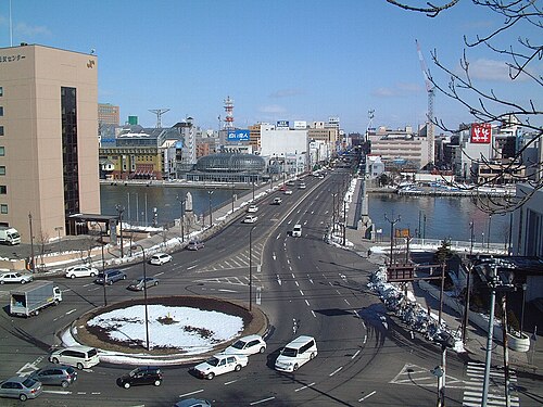
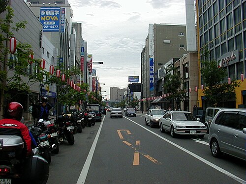


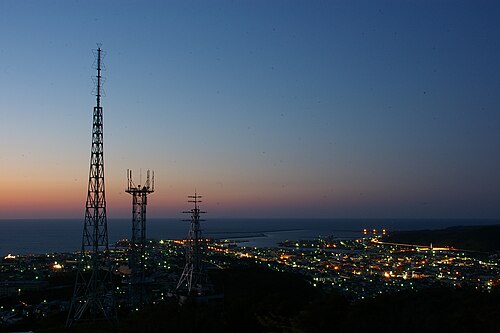
Sightseeing attractions
- 2014–2016: inverted house by Oslo School of Architecture and Design (Raphael Zuber, Neven Fuchs, Laura Cristea) and Kengo Kuma & Associates[61][62]
Economy

Although there is some light industry (most notably paper milling and beer brewing) most of the population is employed by the service sector. In 2001, the service sector and other tertiary industries generated more than three-quarters of the gross domestic product.[63]
Agriculture and other primary industries play a large role in Hokkaidō's economy. Hokkaidō has nearly one fourth of Japan's total arable land. It ranks first in the nation in the production of a host of agricultural products, including wheat, soybeans, potatoes, sugar beets, onions, pumpkins, corn, raw milk, and beef. Hokkaidō also accounts for 22% of Japan's forests with a sizable timber industry. The prefecture is first in the nation in production of marine products and aquaculture.[63] The average farm size in Hokkaidō is 26 hectares per farmer in 2013, which is almost 11 times bigger than the national average of 2.4 hectares.[64]

Tourism is an important industry, especially during the cool summertime when visitors are attracted to Hokkaidō's open spaces from hotter and more humid parts of Japan and other Asian countries. During the winter, skiing and other winter sports bring other tourists, and increasingly international ones, to the island.[65]
Coal mining played an important role in the industrial development of Hokkaidō, with the Ishikari coalfield. Cities such as Muroran were primarily developed to supply the rest of the archipelago with coal.[20]
In 2023, Rapidus Corporation announced Hokkaido's largest business investment with a 5 trillion yen plan to build a semiconductor manufacturing factory in Chitose. The site is expected to eventually host over 1,000 employees.[66]
Transportation

Hokkaido's only land link to the rest of Japan is the Seikan Tunnel. Most travellers travel to the island by air: the main airport is New Chitose Airport at Chitose, just south of Sapporo. Tokyo–Chitose is in the top 10 of the world's busiest air routes, handling more than 40 widebody round trips on several airlines each day. One of the airlines, Air Do was named after Hokkaidō.
Hokkaidō can be reached by ferry from Sendai, Niigata and some other cities, with the ferries from Tokyo dealing only in cargo. The Hokkaido Shinkansen takes passengers from Tokyo to near Hakodate in slightly over four hours.[67] There is a fairly well-developed railway network, but many cities can only be accessed by road. The coal railways were constructed around Sapporo and Horonai during the late 19th century, as advised by American engineer Joseph Crawford.[20]
Hokkaidō is home to one of Japan's Melody Roads, which is made from grooves cut into the ground, which when driven over causes a tactile vibration and audible rumbling transmitted through the wheels into the car body.[68][69]
Education
The Hokkaido Prefectural Board of Education oversees public schools (except colleges and universities) in Hokkaidō. Public elementary and junior high schools (except Hokkaido Noboribetsu Akebi Secondary School and schools attached to Hokkaidō University of Education) are operated by municipalities, and public high schools are operated by either the prefectural board or municipalities.
Senior high schools
As of 2016[update],[70] there are 291 high schools in Hokkaido: 4 national schools, 55 private schools,[71] 233 public schools,[72] and 2 integrated junior-senior schools.
Colleges and universities
Hokkaidō has 34 universities (7 national, 6 local public, and 21 private universities), 15 junior colleges, and 6 colleges of technology (3 national, 1 local public, and 2 private colleges).
Culture

- Historical Village of Hokkaido
- Hokkaido Archaeological Operations Center
- Hokkaidō Heritage
- Hokkaido Museum
- Hokkaido Museum of Modern Art
- Hokkaido Museum of Northern Peoples
- Pacific Music Festival
- Sapporo ramen, Jingisukan
Sports
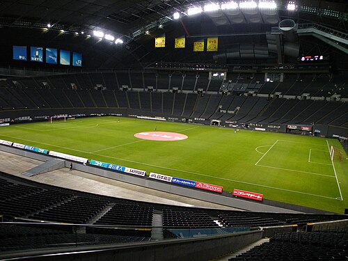
The 1972 Winter Olympics were held in Sapporo.
The sports teams listed below are based in Hokkaidō.
- Consadole Sapporo (association football)
- Hokkaido American Football Association
- Hokkaido Nippon-Ham Fighters
- Japan Basketball League
- Levanga Hokkaido (basketball)
- Loco Solare (curling)
- Nippon Paper Cranes (ice hockey)
- Oji Eagles (ice hockey)
Winter festivals
- Asahikawa Ice Festival
- Big Air – snowboarding freestyle competition
- Sapporo Snow Festival
- Shōwa-Shinzan International Yukigassen - competitive snowballing
- Sōunkyō Ice Festival
International relations
Hokkaidō has relationships with several provinces, states, and other entities worldwide.[73]
 Alberta, Canada, since 1980[74][75]
 Heilongjiang, China, since 1980[74]
 Massachusetts, United States, since 1988[74][76]
 Sakhalin Oblast, Russia, since 1998[74]
 Busan, South Korea, since 2005
- Gyeongsangnam-do, South Korea, since 2006
- Seoul, South Korea, since 2010[77]
 Chiang Mai, Thailand, since 2013[78]
 Thimphu, Bhutan
- Hawaii, United States of America[79]
.svg/500px-Flag_of_Canada_(Pantone).svg.png)

As of January 2014[update], 74 individual municipalities in Hokkaidō have sister city agreements with 114 cities in 21 countries worldwide.[80]
Politics
Governor
The current governor of Hokkaido is Naomichi Suzuki.[81] He won the governorship in the gubernatorial election in 2019 as an independent. In 1999, Hori was supported by all major non-Communist parties and Itō ran without party support. Before 1983, the governorship had been held by Liberal Democrats Naohiro Dōgakinai and Kingo Machimura for 24 years. In the 1971 election when Machimura retired, the Socialist candidate Shōhei Tsukada lost to Dōgakinai by only 13,000 votes;[82] Tsukada was also supported by the Communist Party – the leftist cooperation in opposition to the US-Japanese security treaty had brought joint Socialist-Communist candidates to victory in many other prefectural and local elections in the 1960s and 1970s. In 1959, Machimura had defeated Yokomichi's father Setsuo in the race to succeed Hokkaidō's first elected governor, Socialist Toshibumi Tanaka who retired after three terms. Tanaka had only won the governorship in 1947 in a run-off election against Democrat Eiji Arima because no candidate had received the necessary vote share to win in the first round as required by law at the time.
Assembly
The Hokkaido Legislative Assembly has 100 members from 47 electoral districts. As of April 30, 2015[update], the LDP caucus holds a majority with 51 seats, the DPJ-led group has 26 members. Other groups are the Hokkaidō Yūshikai of New Party Daichi and independents with twelve seats, Kōmeitō with eight, and the Japanese Communist Party with four members.[83] General elections for the Hokkaido assembly are currently held together with gubernatorial elections in the unified local elections (last round: April 2015).
For the lower house of the National Diet, Hokkaidō is divided into twelve single-member electoral districts. In the 2017 election, candidates from the governing coalition of Liberal Democrats and Kōmeitō won seven districts and the main opposition Constitutional Democrats five. For the proportional election segment, Hokkaidō and Tokyo are the only two prefectures that form a regional "block" district of their own. The Hokkaido proportional representation block elects eight Representatives. In 2017, the Liberal Democratic Party received 28.8% of the proportional vote and won three seats, the Constitutional Democratic Party won three (26.4% of the vote), one seat each went to Kibō no Tō (12.3%) and Kōmeitō (11.0%). The Japanese Communist Party, who won a seat in 2014, lost their seat in 2017 while receiving 8.5% of the votes.
In the upper house of the National Diet, a major reapportionment in the 1990s halved the number of Councillors from Hokkaidō per election from four to two. After the elections of 2010 and 2013, the Hokkaido electoral district – like most two-member districts for the upper house – is represented by two Liberal Democrats and two Democrats. In the 2016 upper house election, the district magnitude will be raised to three, Hokkaidō will then temporarily be represented by five members and six after the 2019 election.
See also
- Former Hokkaidō Government Office
- Golden Kamuy, a manga and anime series set mainly in Hokkaido.
- Hokkaido dialects
- List of cities in Hokkaido by population
- People from Hokkaido
- Sankebetsu brown bear incident
- Sinnoh, a fictional region in the Pokémon franchise which is based on Hokkaido.
Notes
Citations
- ^ "2020年度国民経済計算(2015年基準・2008SNA) : 経済社会総合研究所 - 内閣府". 内閣府ホームページ (in Japanese). Retrieved 2023-05-18.
- ^ a b "離島とは(島の基礎知識) (what is a remote island?)". MLIT (Ministry of Land, Infrastructure, Transport and Tourism) (in Japanese). Ministry of Land, Infrastructure, Transport and Tourism. 22 August 2015. Archived from the original (website) on 2007-11-13. Retrieved 9 August 2019.
MILT classification 6,852 islands (main islands: 5 islands, remote islands: 6,847 islands)
- ^ a b c Nussbaum, Louis-Frédéric. (2005). "Hokkaidō" in Japan Encyclopedia, p. 343, p. 343, at Google Books
- ^ a b Seaton, Philip (2017). "Japanese Empire in Hokkaido". Oxford Research Encyclopedia of Asian History. doi:10.1093/acrefore/9780190277727.013.76. ISBN 978-0-19-027772-7.
- ^ Mason, Michele (2012). Dominant Narratives of Colonial Hokkaido and Imperial Japan: Envisioning the Periphery and the Modern Nation-State. Palgrave Macmillan. pp. 7–9. ISBN 978-1-349-45025-1.
- ^ "University of Hawai'i Press - Manifold".
- ^ Hennessey, John (2018). "Engineering Japanese Settler Colonialism in Hokkaido: A Postcolonial Reevaluation of William Wheeler's Work for the Kaitakushi" (PDF). Asia in Focus. 6 (6): 3.
- ^ a b c d e f g h i j k l m n o p q Jolliffe, Pia M. (15 October 2020). "Forced Labour in Imperial Japan's First Colony: Hokkaidō". The Asia–Pacific Journal. 18 (20).
- ^ a b "How the Sharing of Ainu Culture Became One Man's Lifework|Features|HOKKAIDO LOVE! -Hokkaido Official Tourism Site". 15 July 2023.
- ^ a b https://www.hm.pref.hokkaido.lg.jp/wp-content/themes/hokkaidomuseum/images/forign_pdf/ENG-2-4.pdf [bare URL PDF]
- ^ Cobb, Ellie (20 May 2020). "Japan's forgotten indigenous people". BBC Travel. Retrieved 29 December 2023.
- ^ Honna, Nobuyuki; Tajima, Hiroko Tina; Minamoto, Kunihiko (2000). "Japan". In Kam, Ho Wah; Wong, Ruth Y. L. (eds.). Language Policies and Language Education: The Impact in East Asian Countries in the Next Decade. Singapore: Times Academic Press. ISBN 978-9-81210-149-5.
- ^ Hohmann, S. (2008). "The Ainu's modern struggle". World Watch. 21 (6): 20–24.
- ^ "Chapter 3: Nivkh as an Aspiration Language," p. 53 RUG.nl Archived 2011-09-28 at the Wayback Machine
- ^ "道道". kotobank.com. Archived from the original on 2021-08-03. Retrieved 2022-01-12.
- ^ "道議会". kotobank.com. Retrieved 2024-09-01.
- ^ Kojima Kyōko 児島恭子 (2009). Emishi Eo kara Ainu e エミシ・エゾからアイヌへ (in Japanese). Yoshikawa Kobunkan.
- ^ a b Kayano Shigeru 萱野茂 (1996). Kayano Shigeru no Ainu-go jiten 萱野茂のアイヌ語辞典. (in Japanese).
- ^ Tamura Suzuko 田村すず子 (1996). Ainu-go Saru-hōgen jiten アイヌ語沙流方言辞典 (in Japanese).
- ^ a b c "A Journey into the culture and history of Hokkaidō" (PDF). hkd.mlit.go.jp. Archived (PDF) from the original on 2020-09-17. Retrieved 2019-05-29.
- ^ a b Japan Handbook, p. 760
- ^ McClain, James L. (2002). Japan, A Modern History (First ed.). New York, N.Y.: W.W. Norton & Company. p. 285. ISBN 978-0-393-04156-9.
- ^
Lie, John (2009) [2001]. Multiethnic Japan (revised ed.). Cambridge, Massachusetts: Harvard University Press. pp. 89–90. ISBN 9780674040175. Retrieved 15 March 2024.
By the fifteenth century Ainu people were principally hunter-fisher-gatherers and engaged in far-flung trade with others, ranging from Aleutian islanders to the east, Russians and Chinese to the west, and Shamo (as the Ainu call Wajin, or Japanese people) to the south [....].
- ^ Howell, David. "Ainu Ethnicity and the Boundaries of the Early Modern Japanese State", Past and Present 142 (February 1994), p. 142
- ^ Ossenberg, Nancy (see reference) has the best evidence of this relationship with the Jōmon. Also, a newer study, Ossenberg, et al., "Ethnogenesis and craniofacial change in Japan from the perspective of nonmetric traits" (Anthropological Science v.114:99–115) is an updated analysis published in 2006 which confirms this finding.
- ^ Harrison, John A. (1951). "The Capron Mission and the Colonization of Hokkaido, 1868-1875". Agricultural History. 25 (3): 135–136. JSTOR 3740831.
- ^ Nakamura, Akemi, "Japan's last frontier took time to tame, cultivate image Archived 2013-11-04 at the Wayback Machine", The Japan Times, 8 July 2008, p. 3.
- ^
Compare:
The American Asian Review. 13 (1–2). New York: Institute of Asian Studies, St. John's University: 77. 1995 https://books.google.com/books?id=uu0YAQAAMAAJ. Retrieved 15 March 2024.
Using the expressive sound 'ah', and the Japanese copula da ('it is'), wajin encountering an Ainu person would shout out the insulting pun, 'ah, inu da,' 'It's an Ainu' or 'Oh, it's a dog!'
{{cite journal}}: Missing or empty|title=(help) - ^ Siripala, Thisanka (2020). "Far-Right Politics and Indigenous Ainu Activism in Japan" (PDF). Georgetown Journal of Asian Affairs. 6: 36–37.
- ^ Siripala, Thisanka (2020). "Far-Right Politics and Indigenous Ainu Activism in Japan" (PDF). Georgetown Journal of Asian Affairs. 6: 36–37.
- ^ Satow, Ernest. (1882). "The Geography of Japan" in Transactions of the Asiatic Society of Japan, Vols. 1–2, p. 88., p. 33, at Google Books
- ^ Mason, Michele (2012). Dominant Narratives of Colonial Hokkaido and Imperial Japan: Envisioning the Periphery and the Modern Nation-State (PDF). Palgrave Macmillan. pp. 14–15. ISBN 978-1-349-45025-1.
- ^ a b c d e f Hennessey, John (2018). "Engineering Japanese Settler Colonialism in Hokkaido: A Postcolonial Reevaluation of William Wheeler's Work for the Kaitakushi" (PDF). Asia in Focus. 6 (6): 3.
- ^ a b c d e Harrison, John A. (1951). "The Capron Mission and the Colonization of Hokkaido, 1868-1875". Agricultural History. 25 (3): 135–142. JSTOR 3740831.
- ^ McDougall, Walter A. (1993). Let the Sea Make a Noise, pp. 355–356.
- ^ McDougall, p. 357.
- ^ a b c d "University of Hawai'i Press - Manifold".
- ^ "University of Hawai'i Press - Manifold".
- ^ "University of Hawai'i Press - Manifold".
- ^ a b c d e f g Mason, Michele (2012). Dominant Narratives of Colonial Hokkaido and Imperial Japan: Envisioning the Periphery and the Modern Nation-State. Palgrave Macmillan. pp. 7–9. ISBN 978-1-349-45025-1.
- ^ Onishi, Norimitsu (3 July 2008). "Recognition for a People Who Faded as Japan Grew". The New York Times. Retrieved 2024-04-11.
- ^ a b c "Japan's forgotten indigenous people". www.bbc.com. Retrieved 2024-04-11.
- ^ Siripala, Thisanka (2020). "Far-Right Politics and Indigenous Ainu Activism in Japan" (PDF). Georgetown Journal of Asian Affairs. 6: 37.
- ^ Siripala, Thisanka (2020). "Far-Right Politics and Indigenous Ainu Activism in Japan" (PDF). Georgetown Journal of Asian Affairs. 6: 36–38.
- ^ Siripala, Thisanka (2020). "Far-Right Politics and Indigenous Ainu Activism in Japan" (PDF). Georgetown Journal of Asian Affairs. 6: 38.
- ^ Onishi, Norimitsu (3 July 2008). "Recognition for a People Who Faded as Japan Grew". The New York Times. Retrieved 2024-04-11.
- ^ "Chapter VII: 1945". The Official Chronology of the US Navy in World War II. Hyperwar. Archived from the original on 2 October 2020. Retrieved 20 September 2011.
- ^ "Translation of Message from Harry S. Truman to Joseph Stalin". Retrieved 2024-04-11.
- ^ "Statistics Bureau of Japan". Archived from the original on 2020-11-08. Retrieved 2019-07-21.
- ^ Hokkaidō Population during Tokugawa Shogun
- ^ "総務省|住基ネット". soumu.go.jp. Archived from the original on 2021-02-24. Retrieved 2019-09-15.
- ^ Hirata, Daisuke; et al. (2013). "Molecular Phylogeography of the Brown Bear (Ursus arctos) in Northeastern Asia Based on Analyses of Complete Mitochondrial DNA Sequences". Mol Biol Evol. 30 (7): 1644–1652. doi:10.1093/molbev/mst077. PMID 23619144.
- ^ Zhang, D.; Katsuki, T.; Rushforth, K. (2013). "Abies sachalinensis". IUCN Red List of Threatened Species. 2013: e.T42298A2970610. doi:10.2305/IUCN.UK.2013-1.RLTS.T42298A2970610.en. Retrieved 7 September 2021.
- ^ Japanese Wiki page ja:北海道
- ^ "M 6.6 - 27km E of Tomakomai, Japan". United States Geological Survey. Archived from the original on 6 September 2018. Retrieved 6 September 2018.
- ^ "Earthquake ALERT! 6.1-magnitude quake strikes this country". Zee Business. 2021-05-16. Archived from the original on 2021-05-16. Retrieved 2021-05-16.
- ^ "General overview of area figures for Natural Parks by prefecture" (PDF). Ministry of the Environment Japan. 31 March 2008. Archived (PDF) from the original on 2012-04-21. Retrieved 2009-06-02.
- ^ a b c d e f Disputed with Russia (see Kuril Islands dispute).
- ^ Sim, Walter (26 May 2019). "Hokkaidō sizzling in temperatures up to 39.5 deg C as unseasonal heat wave grips Japan". The Straits Times. Archived from the original on 27 May 2019. Retrieved 27 May 2019.
- ^ C.Michael Hogan. 2011. Taiga. eds. M.McGinley & C.Cleveland. Encyclopedia of Earth. National Council for Science and the Environment. Washington DC Archived 2013-11-04 at the Wayback Machine
- ^ "Inverted House / The Oslo School of Architecture and Design + Kengo Kuma & Associates". 9 August 2016.
- ^ "Inside outing: Inverted House, Japan, by Oslo School of Architecture and Design + Kengo Kuma". 27 June 2017.
- ^ a b "Hokkaido's Business Environment". Trade and Economic Exchange Group, Commerce and Economic Exchange Division, Department of Economic Affairs, Hokkaido Government. Archived from the original on 2010-07-21. Retrieved 2008-12-05.
- ^ "Trend toward stronger agriculture seen in Hokkaidō". The Nikkei. 5 January 2015. Archived from the original on 7 April 2019. Retrieved 7 April 2019.
- ^ Takahara, Kanako (July 8, 2008). "Boom time for Hokkaido ski resort area". The Japan Times. The Japan Times Ltd. Archived from the original on 2013-04-13. Retrieved 2008-09-27.
- ^ Izawa, Kenji; Shinden, Satoshi; Wakai, Takumi (2023-03-01). "New Hokkaido chip plant will 'stun the world,' Rapidus says". The Asahi Shimbun.
- ^ Bender, Andrew (28 March 2016). "Japan Opens a Futuristic Bullet Train Line from Tokyo to Hokkaido". Forbes. Archived from the original on 8 September 2017. Retrieved 4 September 2017.
- ^ Johnson, Bobbie (13 November 2007). "Japan's melody roads play music as you drive". The Guardian. Farringdon Road, London, England: GMG. p. 19 (International section). Archived from the original on 2013-09-01. Retrieved 2008-10-20.
- ^ "Your car as a musical instrument – Melody Roads". Noise Addicts. 29 September 2008. Archived from the original on 13 September 2018. Retrieved 20 October 2008.
- ^ "H28道内の学校数 | 教育庁総務政策局教育政策課". Archived from the original on 2016-10-02. Retrieved 2022-10-28.
- ^ "学校検索 | 私学ナビHokkaido 北海道の私立学校協会".
- ^ "公立高等学校 - 北海道スクールネットポータルサイト".
- ^ "Exchange Affiliates" Archived 2015-05-24 at the Wayback Machine. Retrieved on 5 December 2008.
- ^ a b c d "Hokkaido – Alberta Relations" (PDF). Archived from the original (PDF) on 2010-12-04. Retrieved 2010-05-30.
- ^ "Alberta Sport, Recreation, Parks & Wildlife Foundation". Archived from the original on 2011-10-28. Retrieved 2010-05-30.
- ^ "Massachusetts Hokkaido Association". Archived from the original on 2015-06-30. Retrieved 2010-05-30.
- ^ "ソウル特別市との交流". Archived from the original on 2018-08-09. Retrieved 2013-11-03.
- ^ "MOU of the Establishment of Friendship between Province of Chiang Mai and Prefecture of Hokkaido" (PDF). Archived (PDF) from the original on 2018-12-29. Retrieved 2018-12-29.
- ^ "Hawaii's Sister-States". State of Hawai'i. Archived from the original on October 16, 2020.
- ^ 市町村の姉妹友好提携 (Sister city partnerships) Archived 2017-12-28 at the Wayback Machine. Retrieved on 3 November 2013. (in Japanese)
- ^ "In Hokkaido, Japan's youngest governor seen as 'safe driver,' but critics want him to go off script". Hokkaido Shimbun. The Japan Times. 30 August 2019. Retrieved 3 June 2024.
When 38-year-old Naomichi Suzuki was elected governor of Hokkaido in April, he simultaneously achieved another feat: becoming the youngest serving prefectural leader in the nation.
- ^ Hokkaido prefectural government: Gubernatorial election results since 1947[permanent dead link] (in Japanese)
- ^ Hokkaido Prefectural Assembly: Members by electoral district and parliamentary group Archived 2014-08-09 at the Wayback Machine (in Japanese)
Explanatory notes
^[note 1] Source: English edition of Sightseeing in Hokkaido, Winter Festival and Events
General references
- Batchelor, John; Japanese Central Association (1893). An itinerary of Hokkaido, Japan, Volume 1. Tokyo: Hakodate Chamber of Commerce.
- Bisignani, J. D. (1993). Japan Handbook. Chico, California: Moon Publications. ISBN 9780960332229; ISBN 9780908054145; OCLC 8954556
- McDougall, Walter A. (1993). Let the Sea Make a Noise: A History of the North Pacific from Magellan to MacArthur. New York: Basic Books. ISBN 9780465051526; OCLC 28017793
- Nussbaum, Louis-Frédéric and Käthe Roth. (2005). Japan encyclopedia. Cambridge: Harvard University Press. ISBN 978-0-674-01753-5; OCLC 58053128
External links
Look up Hokkaido in Wiktionary, the free dictionary.
- Hokkaido Official Website (in Japanese)
- Hokkaido Official Website (in English)
- Amazing Details on Hokkaido (In English)
- Hokkaido Ski Resort Archived 2020-08-14 at the Wayback Machine



