
Loading article…
メリーランド | |
|---|---|
| ニックネーム: 「オールドライン州」、「フリーステート」、「リトルアメリカ」、[1]「ミニチュアアメリカ」[2] | |
モットー:
| |
.svg/500px-Maryland_in_United_States_(zoom).svg.png) メリーランド州が強調表示されたアメリカ合衆国の地図 | |
| 国 | アメリカ合衆国 |
| 州になる前 | メリーランド州 |
| 連合に加入 | 1788年4月28日(第7回) |
| 資本 | アナポリス |
| 最大の都市 | ボルチモア |
| 最大の郡または同等の郡 | モンゴメリー |
| 最大の大都市圏と都市圏 |
|
| 政府 | |
| • 知事 | ウェス・ムーア( D ) |
| • 副知事 | アルナ・ミラー(D) |
| 立法府 | 総会 |
| • 上院 | 上院 |
| • 下院 | 代議院 |
| 司法 | メリーランド州最高裁判所 |
| 米国上院議員 |
|
| 米国下院代表団 |
|
| エリア | |
| • 合計 | 12,407平方マイル(32,133 km 2) |
| • 土地 | 9,776平方マイル(25,314 km 2) |
| • 水 | 2,633平方マイル(6,819 km 2) 21% |
| • ランク | 42位 |
| 寸法 | |
| • 長さ | 250マイル(400 km) |
| • 幅 | 100マイル(200 km) |
| 標高 | 350フィート(110メートル) |
| 最高標高 (ホイ・クレスト[5] [a]) | 3,360 フィート (1,024 メートル) |
| 最低標高 (大西洋[5]) | 0 フィート (0 メートル) |
| 人口 (2020年[6]) | |
| • 合計 | 6,177,224 |
| • ランク | 18日 |
| • 密度 | 632/平方マイル (244/km 2 ) |
| • ランク | 5位 |
| • 世帯収入の中央値 | 87,063ドル |
| • 所得順位 | 1位 |
| 異名 | メリーランド州出身 |
| 言語 | |
| • 公用語 | なし(英語、事実上) |
| タイムゾーン | UTC−05:00 (東部時間) |
| • 夏 ( DST ) | UTC−04:00 ( EDT ) |
| USPSの略称 | 医学博士 |
| ISO 3166 コード | 米国メリーランド州 |
| 伝統的な略語 | メリーランド州 |
| 緯度 | 北緯37度53分から北緯39度43分 |
| 経度 | 西経75度03分から西経79度29分 |
| Webサイト | メリーランド州政府 |
| 州のシンボル一覧 | |
|---|---|
 | |
.svg/500px-Seal_of_Maryland_(reverse).svg.png) | |
 | |
| 歌 | なし。以前は、「メリーランド、マイ・メリーランド」、ジェームズ・ライダー・ランドール著(1861年)、(1939年に採択、2021年に廃止) |
| 生きた記章 | |
| 鳥 | ボルチモアオリオールズ |
| 猫の種類 | 三毛猫 |
| 甲殻類 | ブルークラブ |
| 犬種 | チェサピーク ベイ レトリーバー |
| 魚 | ロックフィッシュ |
| 花 | ブラックアイドスーザン |
| 馬の品種 | サラブレッド |
| 昆虫 | ボルチモア チェッカースポット バタフライ |
| 爬虫類 | ダイヤモンドバックガメ |
| 木 | ホワイトオーク |
| 無生物の記章 | |
| 飲料 | 牛乳 |
| ダンス | スクエアダンス |
| 恐竜 | アストロドン・ジョンストーニ |
| 食べ物 | スミスアイランドケーキ |
| 化石 | エコーラ ガードネラエ |
| 宝石 | パタクセント川の石 |
| 船 | カツオ |
| スポーツ | |
| 州道標識 | |
 | |
| 州25セント硬貨 | |
 2000年にリリース | |
| アメリカ合衆国の州のシンボルのリスト | |
メリーランド州(米国: / ˈ m ɛr ɪ l ə nd / メリーランド州(メリーランド州、英: Merr-il-ənd)[b]はアメリカ合衆国の中部大西洋にある州。[8][9]南はバージニア州西はウェストバージニア州北はペンシルベニア州デラウェア州と大西洋、南西には首都ワシントンDCある。総面積は12,407平方マイル(32,130 km2)で、陸地面積では9番目に小さい州。[10]人口は6,177,224人で、人口は18番目に多く、人口密度は5番目に高い。メリーランド州の州都はアナポリス、最も人口の多い都市はボルチモア。[11]
メリーランドの海岸線は、16世紀にヨーロッパ人によって初めて探検されました。それ以前は、いくつかのネイティブアメリカンの部族、主にアルゴンキン族が住んでいました。[12]元々の13植民地の1つとして、メリーランドはカトリックに改宗した初代ボルチモア男爵ジョージ・カルバートによって設立されました[13] [14]彼は、イングランドで迫害されたカトリック教徒に宗教的な避難所を提供しようとしました。[15] 1632年、イングランドのチャールズ1世はボルチモア卿に植民地特許を与え、妻ヘンリエッタ・マリアにちなんで植民地と名付けました。[16] 1649年、メリーランド州議会は、寛容の原則を定めた宗教に関する法律を可決しました。[17]メリーランドの初期には宗教的争いがよくあり、カトリック教徒は、他のどのイングランド植民地よりも多かったとはいえ、少数派のままでした。メリーランド州の初期の入植地と人口の中心地は、チェサピーク湾に注ぐ水路の周囲に集中していた。同州の経済はプランテーションが中心で、主にタバコの栽培が中心であった。メリーランド州の入植者からの安価な労働力の需要により、多数の年季奉公人や奴隷のアフリカ人が輸入された。1760年、ペンシルベニアとの長期にわたる国境紛争の解決に伴い、メリーランド州の現在の境界が形成された。同州の住民の多くは、アメリカ独立戦争で政治的、軍事的に重要な役割を果たした。同州は奴隷州であったが、南北戦争中は連邦に留まり、ワシントンDCやバージニアに近いことから戦略的に重要な位置にあった。南北戦争が終わった後、メリーランド州は港湾、鉄道網、ヨーロッパからの大量移民によって 産業革命に参加した。
1940年代以降、メリーランド州の人口は急速に増加し、約600万人に達し、米国で最も人口密度の高い州の一つとなっている。2015年現在[update]、メリーランド州は全米で最も高い世帯収入の中央値を有しているが、これは主にワシントンDCに近いことと、製造業、小売サービス、行政、不動産、高等教育、情報技術、防衛契約、医療、バイオテクノロジーなど多角化された経済によるものである。[18]メリーランド州は、米国で最も多文化な州の一つである。非白人が人口の過半数を占める6州の一つであり、アフリカ系アメリカ人の割合が5番目に高く、アフリカ、アジア、中央アメリカ、カリブ海諸国で生まれた住民が多い。米国の歴史においてこの州が中心的な役割を果たしていることは、人口1人当たりの歴史的建造物の数が最多であることに反映されている。
州の西部にはアパラチア山脈が広がり、中央部は主にピードモント山脈で構成され、州の東側はチェサピーク湾の大部分を占めています。メリーランド州の23郡のうち16郡とボルチモア市は、チェサピーク湾の河口とその多くの支流の潮汐水域に接しており[19] [11]、それらを合わせると海岸線の長さは4,000マイルを超えます。米国で最も小さな州の1つであるにもかかわらず、多様な気候と地形的特徴があり、「ミニチュアアメリカ」というあだ名が付けられています。[20]同様に、メリーランド州の地理、文化、歴史は、米国の中部大西洋岸、北東部、南部の要素を組み合わせています。
歴史
17世紀
メリーランド州の最初の植民地
現在のメリーランド州には、もともとピスカタウェイ族(パタクセント族を含む)、ナンティコーク族(トクウォ族、オジニー族、その他の部族を含む)、ポウハタン族、レナペ族、サスケハノック族、ショーニー族、テュテロ族、サポニ族、ポコモケ族、マサウォメック族などの部族が住んでいた。[21] [自費出版情報源? ] 初代ボルチモア男爵ジョージ・カルバート(1579年 - 1632年)は、北はマサチューセッツ、すぐ南はバージニアの間の領土に対する勅許状をチャールズ1世に求めた。[22]ボルチモアが1632年4月に死去した後、 1632年6月20日に 息子のセシリウス・カルバート、第2代ボルチモア男爵(1605年 - 1675年)に勅許が与えられた。公式には、新しい「メリーランド植民地」はチャールズ1世の妻ヘンリエッタ・マリア・オブ・フランスに敬意を表して名付けられた。 [23]ボルチモア卿は当初、成長または増加の地を意味する「クレセンティア」という名前を提案したが、「国王はテラ・マリアエ(メリーランド)を提案し、それが法案に盛り込まれた。」[15]
メリーランド州の元々の州都はポトマック川の北岸にあるセントメアリーズ市であり、その周囲の郡は州内で最初に設立され[24]、最初は国王にちなんでオーガスタ・カロライナと呼ばれ、後にセントメアリーズ郡と改名されました[25] 。
ボルティモア卿の最初の開拓者は、1634年3月に、メリーランド州知事として弟のレナード・カルバート卿(1606年 - 1647年)とともに新植民地に到着した。彼らは、現在のセントメアリーズ郡にあるセントメアリーズ市に最初の永住地を作った。彼らは、貿易の確立に熱心だったこの地域の最高首長からその場所を購入した。セントメアリーズはメリーランドの最初の州都となり、1695年まで60年間その地位を維持した。すぐにさらに多くの開拓者が続いた。彼らのタバコ栽培は成功し、新植民地はすぐに利益を生むようになった。しかし、マラリア、黄熱病、腸チフスの発生率を考えると、メリーランドの平均寿命はニューイングランドよりも約10年短かった。[26]
カトリック教徒への迫害
メリーランドは、イングランドのローマカトリック教徒の少数派に避難場所を提供するために設立されました。[27] メリーランドはイングランド本土の植民地の中で最もカトリック教徒が多かったものの、カトリック教徒は依然として少数派であり、全人口の10%未満を占めていました。[28]
1642年、多くのピューリタンがバージニアからメリーランドへ移り、チェサピーク湾上流の西岸に、現在アナポリスと呼ばれるプロビデンス市を建設した。[29]チェサピーク湾のケント島をめぐるバージニア貿易商との争いが武力衝突に発展した。1644年、ピューリタンのウィリアム・クレイボーンがケント島を占領し、その仲間で議会支持派のピューリタン、リチャード・イングルがセント・メアリーズ教会を乗っ取った。[30]両者とも、大衆の支持を得るための手段として宗教を利用した。クレイボーンとピューリタン仲間が勢力を誇った1644年から1646年の2年間は「略奪の時代」として知られている。彼らはイエズス会の司祭を捕らえて投獄し、その後イギリスに送還した。
1646年、レナード・カルバートは軍隊を率いて戻り、セント・メアリーズ・シティを奪還し、秩序を回復した。代議院は1649年に「宗教に関する法律」を可決し、三位一体論者のキリスト教徒全員に宗教の自由を認めた。[26]
1650年、ピューリタンは領主政府に対して反乱を起こした。「プロテスタントはカトリックを議会から一掃し 、宗教紛争が再び起こった。」[26]ピューリタンはローマカトリックと英国国教会の両方を禁止する新政府を設立した。ピューリタン革命政府は「略奪の時代」として知られる統治期間中、メリーランドのカトリック教徒を迫害した。暴徒はメリーランド南部の元々のカトリック教会をすべて焼き払った。ピューリタンの支配は1658年まで続き、カルバート家とボルティモア卿が領主支配を取り戻し、寛容法を再制定した。
1688年のイギリス名誉革命後、メリーランド州はカトリックを非合法化した。1704年、メリーランド州議会はカトリック教徒による学校の運営を禁止し、宗教団体の拡大や自立を妨げるために法人による財産所有を制限し、カトリック教徒の子供たちの改宗を奨励した。[28]カトリックの秘跡の執行も公式に制限された。この状況はアメリカ独立戦争(1775-1783)後まで続いた。裕福なカトリック教徒の農園主は、比較的秘密裏に宗教を実践するために自分の土地に礼拝堂を建てた。
18世紀に入ると、個々の司祭や信徒指導者は、イエズス会が所有するメリーランド州の農場を私有財産であると主張し、宗教団体の財産所有に関する法的制限を回避するためにそれを遺贈した。[28]
国境紛争(1681-1760)

国王勅許状により、メリーランドにはポトマック川の北から北緯40 度線までの土地が与えられた。チャールズ 2 世がペンシルベニアに勅許状を与えた際に問題が生じた。勅許状では、ペンシルベニアの南の境界がメリーランドの北の境界である北緯 40 度線と同一と定義された。しかし勅許状では、チャールズ 2 世とウィリアム ペンは、北緯 40 度線がフィラデルフィアの北に位置する場合、ニューキャッスル (デラウェア州)の近くを通ると想定していたことが示されていた。ペンは、この場所を既に植民地の首都として選んでいた。1681 年に問題が発覚した後、交渉が続いた。
1682年にチャールズ2世が提案した妥協案は、ペンが現在のデラウェア州の追加特許を受け取ったことで台無しになった。[32]ペンは、メリーランドの特許状ではボルティモア卿は未開拓の土地しか所有できず、デラウェア州へのオランダ人の入植は彼の特許状より前からあったと主張して勝訴した。この紛争は1世紀近く未解決のまま、ウィリアム・ペンとボルティモア卿の子孫であるメリーランド州を支配していたカルバート家とペンシルベニアを支配していたペン家によって引き継がれた。[32]
ペンシルベニアとの国境紛争は1730年代にクレサップ戦争を引き起こした。1730年に敵対行為が勃発し、1730年代前半に激化、1736年にはメリーランド、1737年にはペンシルベニアが軍隊を派遣した。紛争の武力紛争は1738年5月にジョージ2世の介入で終結し、停戦交渉が強制された。暫定協定は1732年に成立していた。[32]
交渉は1760年に最終合意が締結されるまで続いた。この合意ではメリーランド州とペンシルベニア州の境界線を現在メイソン・ディクソン線として知られる緯線と定義した。メリーランド州とデラウェア州の境界線は半島横断線とニューキャッスルの周囲の12マイルサークルに基づいていた。[32]
18世紀
イギリス人入植者のほとんどは年季奉公人としてメリーランドに到着し、渡航費を払うために数年間労働者として働かなければならなかった。[33]初期には、年季奉公人とアフリカ人奴隷または労働者との境界線は流動的で、白人と黒人の労働者は一緒に暮らし、働き、組合を形成するのが一般的だった。白人の母親から生まれた混血の子供は、子供が母親の社会的地位を継承するという奴隷法の原則であるpartus sequitur venttremによって自由人とみなされた。この原則は1662年にバージニアに続いて植民地全体で採用された。
自由黒人家族の多くは、土地が安いデラウェア州に移住した。[34]イギリスの経済状況の改善に伴い、植民地への年季奉公労働者の流入が減少するにつれ、メリーランド州の農園主は数千人の奴隷を輸入し、人種的カーストの境界線は厳格化した。
メリーランドは、アメリカ独立戦争でイギリス統治に対して反乱を起こした13植民地のうちの1つでした。アメリカ独立戦争 (1775-1783) の終わり近くの1781年2月2日、メリーランドは連合規約および永久連合の批准を承認した最後かつ13番目の州となりました。連合規約および永久連合は1776年に最初に提案され、 1778年の第2回大陸会議で採択され、統一された主権国家としてアメリカ合衆国が誕生しました。メリーランドは、1788年に新しい連邦憲法を批准した後、連邦に加盟した7番目の州にもなりました。1800年にフィラデルフィアから首都が移転する前の1790年12月、メリーランドは初代大統領ジョージ・ワシントンが選んだ土地を連邦政府に寄付しました。土地はバージニア州のポトマック川北岸のモンゴメリー郡とプリンスジョージ郡、およびポトマック川南岸のフェアファックス郡とアレクサンドリアから提供されたが、バージニア州から寄贈された土地は、1846年のコロンビア特別区の返還により、後に同州に返還された。
19世紀

経済の変化、革命の理想、牧師の説教の影響を受けて、メリーランド州の多くの農園主は独立戦争後の20年間で奴隷を解放した。アッパーサウス全体で自由黒人人口は戦争前の1%未満から1810年までに14%に増加した。[35]奴隷制度廃止論者のハリエット・タブマンとフレデリック・ダグラスは、それぞれこの時期にドーチェスター郡とタルボット郡で奴隷として生まれた。[36] [37]
米英戦争中、イギリス軍はマクヘンリー砦に守られたボルチモアを占領しようとした。砲撃中にフランシス・スコット・キーによって「星条旗」という歌が作られ、後に国歌として採用された。
国道は後にアメリカ国道40号線と改名され、1817年に連邦高速道路として認可され、ボルチモアからセントルイスまで走っていました。米国で最初に認可された鉄道であるボルチモア・アンド・オハイオ鉄道(B&O)は、1830年にボルチモアとエリコットシティの間で最初の定期運行区間を開通させました[38] 。そして1852年には東海岸からオハイオ川に到達する最初の鉄道となりました[39] 。
内戦

南北戦争の間も、メリーランド州は連邦に留まったが、これは主に人口動態と連邦政府の介入によるものである。南北戦争勃発直前に行われた1860年の国勢調査では、メリーランド州のアフリカ系アメリカ人の49%が自由人であったことが示されている。[35]
トーマス・ホリデイ・ヒックス知事は州議会を停止し、新たな連邦支持派の知事と議会の選出を確実にするために、エイブラハム・リンカーン大統領はボルチモア市長のジョージ・ウィリアム・ブラウンを含む奴隷制支持派の政治家数人を逮捕し、人身保護令状請求権を含むいくつかの公民権を停止し、ボルチモアを見下ろすフェデラル・ヒルに大砲を配置するよう命じた。
1861年4月、ボルチモアを行軍していた連邦軍と州軍が攻撃を受け、南北戦争で最初の流血事件となる1861年ボルチモア暴動が起きた。 [41]南北戦争中に軍に入隊したメリーランド州民11万5千人のうち、約8万5千人、つまり77%が北軍に入隊し、残りは南軍に入隊した。[要出典]州内で最大かつ最も重要な戦闘は、1862年9月17日のシャープスバーグ近郊でのアンティータムの戦いである。戦術的には引き分けだったが、この戦闘は戦略的には北軍の勝利であり、戦争の 転換点となったと考えられている。
南北戦争後
1864年に制定された新しい州憲法では奴隷制度が廃止され、メリーランド州は初めて「自由州」として認められた。[42]解放奴隷に投票権を与える憲法修正条項が可決された後、1867年に州は非白人男性に参政権を拡大した。
民主党は急速に共和党から州内の権力を取り戻した。民主党は1864年憲法を1867年憲法に置き換えた。1877年の復興期の終わりに続いて、民主党は最初は身体的脅迫と不正投票によって、後には憲法修正と法律によって、黒人の選挙権を剥奪する手段を考案した。しかし、黒人と移民は州内での民主党の選挙権剥奪の試みに抵抗した。メリーランド州の黒人は1896年から1904年にかけて州政府に選出された異人種間の共和党連合の一部であり、有権者の20%を占めた。[43]
他の州と比べると、黒人は南北戦争の前後でより安定した地位にあった。黒人人口のほぼ半数が戦前は自由であり、一部は財産を築いていた。人口の半数が都市に住んでいた。黒人の識字率は高く、民主党が黒人を排除する手段を講じる中、参政権運動が黒人に浸透し、抵抗する方法を教えるのに役立った。[43]白人は公共施設で人種差別を課し、ジム・クロウ法を施行したが、これは1960年代半ばに連邦公民権法が可決されるまで実質的に続いた。
ボルチモアは産業革命の時期に大きく成長したが、これは主に港湾と鉄道網の発達により、ヨーロッパからの移民労働者を引き付けたためである。南北戦争後、ボルチモア周辺には多くの製造業が設立された。ジョンズ・ホプキンス、エノック・プラット、ジョージ・ピーボディ、ヘンリー・ウォルターズなどのボルチモアの実業家は、それぞれ大学、図書館システム、音楽・舞踊学校、美術館など、彼らの名前を冠した著名な市内施設を設立した。
カンバーランドは19世紀にはメリーランド州で2番目に大きな都市だった。近くに天然資源があり、鉄道もあったため、カンバーランドは主要な製造業の中心地として成長した。[44]
20世紀

19世紀後半から20世紀初頭にかけての進歩主義時代は、政治改革をもたらした。1892年から1908年にかけて成立した一連の法律で、改革者たちは標準的な州発行の投票用紙(政党が配布し記入したものではなく)の実現に努め、党員が投票者を「支援」するのを防ぐために閉鎖式投票所を確保し、党幹部が候補者を選べないように予備選挙を開始し、党のシンボルなしで候補者をリストアップして読み書きのできない人々の参加を妨げた。これらの措置は、教育を受けていない白人と黒人にとって不利に働いた。黒人はこうした取り組みに抵抗し、参政権団体が有権者教育を行った。黒人は移民と同盟を組んでさまざまな民主党の運動に抵抗し、自分たちの選挙権を剥奪しようとする3つの試みを阻止した。[43] 1905年、1907年、1911年の選挙権剥奪法案は、主に黒人の反対により却下された。黒人は有権者の20%を占め、移民は15%を占めており、議会は移民に不利益を与えない黒人に対する要件を考案するのに苦労した。[43]
進歩主義時代は、メリーランド州の労働力の労働条件にも改革をもたらしました。1902 年、州は鉱山の労働条件を規制し、 12 歳未満の児童労働者を違法とし、義務教育を義務化し、国内初の労働者災害補償法を制定しました。労働者災害補償法は裁判所で覆されましたが、改訂され、最終的に 1910 年に制定されました。
1904 年のボルチモア大火は30時間以上燃え続け、1,526 棟の建物が破壊され、70 ブロックに及んだ。1,231 人以上の消防士が鎮火に努めた。
1917年に国が第一次世界大戦に参戦すると、キャンプ・ミード、アバディーン性能試験場、エッジウッド兵器廠などの新しい軍事基地が設立され、フォート・マクヘンリーなどの既存の施設も大幅に拡張されました。
1923年にジョージア州議会議員ウィリアム・D・アップショーがメリーランド州が禁酒法を可決しなかったことを公然と批判した後、ボルチモア・サン紙の編集者ハミルトン・オーウェンズはその文脈でメリーランド州に「自由州」というニックネームを作り出し、HL・メンケンが一連の新聞社説でこれを広めた。[42] [45]
メリーランド州の都市部と農村部は、大恐慌中に異なる経験をした。1932年、「ボーナス軍」がワシントンDCに向かう途中で州内を行進した。メリーランド州は1937年に学校と福祉のための収入を生み出すために最初の所得税を制定した。 [46]
かつてはチェサピーク湾とその支流全域で重要であった旅客・貨物蒸気船のサービスは1962年に終了した。[47]
ボルチモアは第二次世界大戦中、主要な軍需生産の中心地でした。最大の工場は、リバティ船を建造したベスレヘム・スチールのフェアフィールド・ヤードと、航空機製造の グレン・マーティンでした。
メリーランド州は第二次世界大戦後に人口増加を経験した。1960年代初め、ワシントンDCとボルチモア周辺で郊外開発が進むにつれ、州はそれまで州の大部分を占めていた伝統的な南部文化とタイドウォーター文化とは対照的に、より中部大西洋岸文化を取り入れ始めた。農地は住宅地に取って代わられ、コロンビア、セントチャールズ、モンゴメリービレッジなど、慎重に計画されたコミュニティもあった。同時に州間高速道路システムが州全体に建設され、特にI-95、I-695、キャピタルベルトウェイが有名で、交通パターンが変わった。1952年、メリーランド州の東半分と西半分が、近くのフェリーサービスに代わるチェサピーク湾橋で初めて結ばれた。[48]
メリーランド州の各地域は第二次世界大戦後に経済的な変化を経験した。ボルチモアでは重工業が衰退した。メリーランド州最西端の 4 つの郡では、工業、鉄道、炭鉱の仕事が減少した。東海岸の南部では、家族経営の農場が大手企業に買収され、大規模な養鶏場や野菜栽培が普及した。メリーランド州南部では、郊外開発と 1990 年代の州タバコ買収プログラムにより、タバコ栽培がほぼ消滅した。
労働者階級の産業の消滅による人口減少を食い止めるため、ボルチモアは1960年代にチャールズ・センターとボルチモア世界貿易センターの建設による都市再開発プロジェクトを開始した。その結果、無傷の住宅街が解体され、社会的不安定さが生じたが、港周辺の古い住宅街の一部は改装され、新しい住民に人気が高まった。
地理
メリーランド州の面積は12,406.68平方マイル(32,133.2 km 2)で、総面積はベルギー[11,787平方マイル(30,530 km 2)]とほぼ同じです。[49]メリーランド州は42番目に大きく、9番目に小さい州であり、次に小さい州であるハワイ州[10,930.98平方マイル(28,311.1 km 2 )]に最も近い面積です。次に大きい州はメリーランド州の隣のウェストバージニア州で、メリーランド州のほぼ2倍の面積[24,229.76平方マイル(62,754.8 km 2)]です。
説明


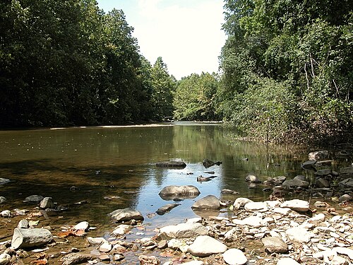


メリーランド州は州境内に多様な地形を有しており、 「ミニチュアアメリカ」というニックネームの由来となっている。[50]東部の海草が点在する砂丘から、チェサピーク湾近くの野生生物と大きなハゲヒノキが生息する低湿地、ピードモント地域のなだらかな丘陵地帯のオークの森、そして西部の メリーランド山脈の松林まで、その範囲は多岐にわたる。
メリーランド州は、北はペンシルベニア州、北と東はデラウェア州、東は大西洋、南と西はポトマック川を挟んでウェストバージニア州とバージニア州に接している。バージニア州との州境の中央部はワシントン D.C. によって遮られている。ワシントン D.C.は、もともとモンゴメリー郡とプリンスジョージズ郡の一部であった土地にあり、メリーランド州ジョージタウンを含むが、1790 年に米国連邦政府に割譲されてワシントン D.C. が形成された。チェサピーク湾は州をほぼ二分しており、湾の東側の郡は総称してイースタン ショアとして知られている。
州の水路のほとんどはチェサピーク湾流域の一部であるが、例外としてギャレット郡の西端のごく一部(ミシシッピ川流域の一部であるユーギオゲニー川が排水)、ウースター郡の東半分 (メリーランド州の大西洋沿岸湾に排水)、および州の北東隅のごく一部 (デラウェア川流域に排水) がある。メリーランド州の地理と経済生活においてチェサピークは非常に重要な位置を占めているため、州の公式ニックネームをマサチューセッツ州が何十年も使用してきたニックネーム「ベイ ステート」に変更しようという運動が定期的に起こってきた。
メリーランド州の最高地点は、バックボーン山のホイ・クレストで、標高は3,360フィート(1,020メートル)である。この山はギャレット郡の南西端、ウェストバージニア州との州境近く、ポトマック川北支流の源流近くにある。メリーランド州西部のハンコックという小さな町の近く、州の約3分の2を横切る地点で、州境と州境は2マイル(3.2キロメートル)未満しか離れていない。[51]北はメイソン・ディクソン線、南は北向きに弧を描くポトマック川である。
メリーランド州の一部は、様々な公式および非公式の地理的地域に含まれています。たとえば、デルマーバ半島は、メリーランド州の東海岸の郡、デラウェア州全体、およびバージニア州の東海岸を構成する2つの郡で構成されていますが、メリーランド州の最西端の郡はアパラチア地方の一部と見なされています。ボルチモア・ワシントン回廊の大部分は、海岸平野のピードモント山脈のすぐ南にありますが、[52] 2つの地域の境界にまたがっています。
地質学
メリーランド州は地震帯から遠いため、地震は少なく規模も小さい。[53] [54] 2011年に発生したバージニア州のM5.8の地震は、メリーランド州全域で中程度に感じられた。メリーランド州の建物は地震に対する設計が不十分で、簡単に被害を受ける可能性がある。[55]さらに、ニュージャージー州中部のテュークスベリーで発生したM4.8の地震は、メリーランド州全域でわずかに感じられた。[56]
メリーランド州には自然湖はないが、これは主にこの地域に氷河の歴史がなかったためである。[57]現在州内にある湖はすべて人工的に作られたもので、そのほとんどがダムによって作られたものである。[58]地質学者は バックルズ・ボグはかつての自然湖の名残であると考えている。[59]
メリーランド州には天然ガスを含むシェール層があり、理論的には水圧破砕法が可能である。[60]
フローラ

東海岸の州によくあることですが、メリーランド州の植物は豊富で健全です。年間の降水量が十分あるため、海草やさまざまな葦といった小型のものから、高さが 70 フィート (21 メートル) 以上にもなる州の木である巨大なワイオーク(ホワイトオークの巨大な例)まで、さまざまな種類の植物が生育しています。
中部大西洋沿岸林は、南東大西洋沿岸平野に典型的であり、チェサピーク湾周辺とデラウェア半島に生育している。西に移動するにつれて、北東部沿岸林と南東部混合林が混在し、州中央部を覆う。メリーランド州西部のアパラチア山脈には、アパラチア・ブルーリッジ森林がある。これらは、ウェストバージニア州境近くでアパラチア混合中生林に取って代わられる。 [62]
州内では多くの外来種が栽培されており、観賞用や新奇な種として栽培されている。これらの中には、州の温暖な地域に生息するサルスベリ、イタリアヒノキ、南部マグノリア、ライブオークなどがあり、 [63]、州の温暖な中央部と東部には耐寒性のあるヤシの木もある。 [64]州の米国農務省の植物耐寒性ゾーンは、州の最西部ではゾーン5 と6 、中央部ではゾーン7、南部沿岸部、湾岸地域、ボルチモア都市圏の一部ではゾーン8に及ぶ。[65]クズ、ニセアカシア、モクレン、日本セイタカアワダチソウなどの侵入植物種は、固有種の植物の成長を阻害している。[66]メリーランド州の州花であるブラックアイドスーザンは、州内の野生の花のグループの中に豊富に生育している。
動物相

州内には、特に州西部の森林地帯や山岳地帯にオジロジカが多数生息しており、個体数過多が問題となることがある。哺乳類は西部の山岳地帯から中央部にかけて生息しており、アメリカクロクマ[67] 、[68] 、ボブキャット[68]、キツネ、コヨーテ[69]、アライグマ、カワウソ[67]などがいる。
アサティーグ島には珍しい野生馬が生息している。[70]これらはスペインのガレオン船の難破から逃げ出した馬の子孫であると考えられている。[70]毎年7月の最終週には、馬が捕獲され、浅い湾を泳いで渡り、バージニア州シンコティーグで売られる。これは、小さな島が馬で溢れかえらないようにするための保全技術である。[70]ポニーとその販売は、児童書『ミスティ・オブ・シンコティーグ』によって有名になった。
純血種のチェサピーク・ベイ・レトリーバー犬は、チェサピーク地域での水上スポーツ、狩猟、捜索救助のために特別に飼育されました。[71] 1878年、チェサピーク・ベイ・レトリーバーはアメリカン・ケネル・クラブに認定された最初のレトリーバー犬種でした。[71]その後、メリーランド大学ボルチモア郡校のマスコットとして 採用されました。
メリーランド州の爬虫類と両生類には、メリーランド大学カレッジパーク校のマスコットに採用されているダイヤガメや、絶滅危惧種のイースタンボックスタートルが含まれます。[72]この州は、公式の州鳥であり、MLBチームボルチモアオリオールズのマスコットでもあるボルチモア・オリオールの領土の一部です。[73]オリオールのほかにも、メリーランド州からは435種の鳥が報告されています。[74]
州の昆虫はボルチモア・チェッカースポット蝶であるが、生息域の南端ほどメリーランド州では一般的ではない。[75]
環境
メリーランド州は20世紀末に近隣の州と協力してチェサピーク湾の環境改善に取り組んできた。湾の水生生物と水産業は開発や湾に流入する肥料や家畜の廃棄物によって脅かされてきた。[76] [77]
2007年、Forbes.comはメリーランド州を、太平洋沿岸の3州とバーモント州に次いで、国内で5番目に「環境に優しい」州と評価した。メリーランド州は、全米で総エネルギー消費量40位で、2005年には6州を除く全米の1人当たりの有毒廃棄物量よりも少なかった。[ 78] 2007年4月、メリーランド州は、温室効果ガス排出量を削減するために北東部全州、ワシントンDC、カナダの3州が結成した地域温室効果ガスイニシアチブ(RGGI)に参加した。 [79] 2017年3月、メリーランド州は、ガス埋蔵量が証明されている州で初めて、水圧破砕法を禁止する法律を可決した。バーモント州にはそのような法律があるがシェールガスにはなく、ニューヨーク州にもそのような禁止法があるが、行政命令によるものである。[60]
2023年、AESコーポレーションは、 23年前に建設されたウォーリアーラン石炭火力発電所を2024年6月に廃止する意向を発表しました。この発電所は、閉鎖の計画がまだなかった州内の最後の石炭火力発電所でした。[80]
気候

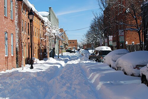
メリーランド州は、標高の地域差、水辺への近さ、斜面からの風による寒さからの保護などにより、多様な気候に恵まれている。オーシャンシティ、ソールズベリー、アナポリス、ワシントンDCの南部と東部の郊外、ボルチモアを含むメリーランド州の東半分は、大西洋沿岸平野にあり、地形は平坦で、土壌は砂質または泥質である。この地域は湿潤亜熱帯気候(ケッペンの気候区分 Cfa)で、夏は高温多湿、冬は涼しいから寒い。米国農務省耐寒性ゾーン8aに該当する。[65]
ピエモンテ地方にはグレーター・ボルチモアの北部と西部、ウェストミンスター、ゲイザースバーグ、フレデリック、ヘイガーズタウンが含まれており、季節ごとの平均降雪量は一般的に20インチ(51cm)を超え、米国農務省耐寒性ゾーン7bと7aに属し、[65]気温が10°F(−12°C)を下回ることは珍しくありません。カンバーランド・バレーの西側では、気候は湿潤大陸性気候(ケッペンのDfa )に移行し始めます。
メリーランド州西部では、カンバーランド、フロストバーグ、オークランドなどの都市を含むアレガニー郡とギャレット郡の標高の高い地域では、標高の影響もあり、湿潤大陸性気候帯の特徴がより顕著である。これらの地域はUSDA耐寒性ゾーン6b以下に該当する。[65]
州の降水量は東海岸の特徴である。年間降水量は35~45インチ(890~1,140 mm)で、標高の高い場所ではさらに多くなる。メリーランド州のほぼ全域で、1か月あたり3.5~4.5インチ(89~114 mm)の降雨がある。年間平均降雪量は、沿岸部では9インチ(23 cm)から州西部の山岳地帯では100インチ(250 cm)を超える。[81]
メリーランド州は大西洋岸に近いため、熱帯低気圧の影響を受けやすいが、デラウェア半島とノースカロライナ州の外縁部が大きな緩衝地帯となっているため、大型ハリケーン(カテゴリー 3以上)の直撃はまれである。メリーランド州に上陸してエネルギーのほとんどを放出した熱帯低気圧の残骸が直撃することが多い。メリーランド州では、年間平均30~40日ほど雷雨が発生し、年間平均6回ほど竜巻が発生する。[82]
都市と首都圏

メリーランド州の人口の大半は、州の中央部、ボルチモア都市圏とワシントン都市圏に住んでおり、どちらもボルチモア・ワシントン都市圏の一部である。メリーランド州の人口の大半は、ワシントン D.C.周辺の都市や郊外、およびメリーランド州で最も人口の多い都市であるボルチモア市内とその周辺に集中している。歴史的に、これらの都市やメリーランド州の他の多くの都市は、川、小川、小川が急流や滝によって中断される線であるフォールラインに沿って発展した。メリーランド州の州都アナポリスはこのパターンの例外であり、セバーン川の岸沿いにあり、チェサピーク湾に注ぐ場所に近い。
イースタンショアは、メリーランド州西部の郡と同様、人口が少なく田舎が多い。メリーランド州最西端の2つの郡、アレガニー郡とギャレット郡は山がちで人口もまばらで、州の他の地域よりもウェストバージニア州やアパラチア地方に似ている。しかし、東海岸と西海岸には、オーシャンシティ、プリンセスアン、ソールズベリー、西メリーランド州のカンバーランド、フロストバーグ、ハンコックなど、地域的に重要な都市が点在している。メリーランド州南部はまだいくぶん田舎だが、1960年代以降、ワシントンDCからの郊外化が著しく進んでおり、重要な人口密集地には、レキシントンパーク、プリンスフレデリック、カリフォルニア、ウォルドルフなどがある。[93] [94]
人口統計

2020年のアメリカ合衆国国勢調査では、メリーランド州の人口は6,185,278人で、 2010年のアメリカ合衆国国勢調査から7.1%増加したことがアメリカ合衆国国勢調査局によって判明した。[95]アメリカ合衆国国勢調査局は、2019年7月1日のメリーランド州の人口は6,045,680人で、2010年のアメリカ合衆国国勢調査から4.71%増加し、前年から2,962人増加したと推定している。これには、前回の国勢調査からの自然増加269,166人(出生数464,251人から死亡数275,093人を引いた数)と、州への純移住116,713人による増加が含まれる。アメリカ国外からの移民は129,730人の純増となり、国内での移住は13,017人の純減となった。 [96] 2018年、メリーランド州への移民の出身国上位は、エルサルバドル(11%)、インド(6%)、中国(5%)、ナイジェリア(5%)、フィリピン(4%)であった。[97]メリーランド州の人口の中心は、アナランデル郡とハワード郡の郡境にある、法人化されていないコミュニティであるジェサップにある。[98]
メリーランド州は国境州としての歴史により、アメリカ合衆国の北部と南部両方の特徴を示すようになった。一般的に、ウェストバージニア州のパンハンドルとペンシルベニア州の間にある田舎の西部メリーランド州はアパラチア文化を持ち、メリーランド州の南部と東海岸地域は南部文化を体現している。[99]一方、ボルチモアとワシントンDC から放射状に広がる人口密度の高い中央メリーランド州は、北東部文化との共通点が多い。[100]米国国勢調査局はメリーランド州を南大西洋岸諸州の一つに指定しているが、他の連邦機関、メディア、一部の住民からは中部大西洋岸諸州やアメリカ合衆国北東部と関連付けられることが多い。 [101] [102] [103] [104] [105]
HUDの2022年ホームレス評価報告書によると、メリーランド州には推定5,349人のホームレスがいる。[106] [107]
出生データ
2011年現在、メリーランド州の 1歳未満の人口の58.0%が少数民族出身である。[108]
注: 表の出生数は一致しません。ヒスパニック系は民族と人種の両方でカウントされるため、全体の数が多くなります。
2016 年以降、白人ヒスパニック系の出生に関するデータは収集されておらず、1 つのヒスパニック系グループに含められています。ヒスパニック系の出生者は、どの人種でもかまいません。
言語と祖先
ヒスパニック系を人種カテゴリーから除いたメリーランド州の人種構成(2019年)[121]
NH = 非ヒスパニック系
ホワイトNH(49.82%)
ブラック NH (29.75%)
アジア系NH(6.35%)
ネイティブアメリカン NH (0.25%)
太平洋諸島系ニューハンプシャー州 (0.04%)
2つ以上のレースNH(2.85%)
その他NH(0.31%)
ヒスパニック系(全人種)(10.64%)
2016年現在、メリーランド州で英語以外で最も話されている言語は、スペイン語(9%)、中国語(1.2%)、西アフリカの言語(主にヨルバ語とイボ語、1%)、フランス語(1%)、韓国語(0.7%)、アフロアジア語(主にアムハラ語、0.6%)、タガログ語(0.6%)です。メリーランド州で話者数が多い他の言語は、ベトナム語(0.4%)、アラビア語(0.4%)、ロシア語(0.4%)、ヒンディー語(0.3%)、ウルドゥー語(0.3%)、ペルシャ語(0.3%)、ネパール語(0.3%)、ハイチクレオール語(0.2%)、テルグ語(0.2%)です。[122] [123]

.svg/500px-Maryland_Counties_by_race_(2020_census).svg.png)
1970年、米国国勢調査局はメリーランド州の人口のうち17.8%がアフリカ系アメリカ人、80.4%が非ヒスパニック系白人であると報告した。[128]
2019年、非ヒスパニック系白人アメリカ人はメリーランド州の人口の49.8%を占め(白人ヒスパニックを含む白人アメリカ人は57.3%)、メリーランド州は少数民族が多数派の州となっている。[129]メリーランド州の人口の50.2%は非白人、つまりヒスパニックまたはラテン系であり、これは東海岸のどの州よりも高い割合であり、少数民族が多数派であるハワイ、ニューメキシコ、テキサス、カリフォルニア、ネバダ、ワシントンDCに次いで高い割合である。 [130] 2031年までには、少数民族がメリーランド州の投票資格のある住民の過半数になると予測されている。[131]メリーランド州の多文化主義と多様性は、歴史的にアフリカ系アメリカ人の人口が多いこと、およびDCとボルチモア地域の重要性によってもたらされた、特に中米、アフリカ、カリブ海、アジアからの移民によって説明できる。
アフリカ系アメリカ人は州の人口のかなりの部分を占めており、2020年の時点で31.1%である。 [127]そのほとんどは、西アフリカから奴隷としてこの地域に移送された人々の子孫である。アフリカ系アメリカ人は、ボルチモア市、プリンスジョージズ郡、チャールズ郡、ボルチモア郡の西部、および南イースタンショアに集中している。チャールズ郡とプリンスジョージズ郡は、アフリカ系アメリカ人が国内で最も金銭的に成功している2つの郡であり、平均世帯収入は国の他の地域よりもはるかに高い。かつての奴隷州であったメリーランド州は、その歴史のほとんどにおいてアフリカ系アメリカ人の人口が多かった。アフリカ系アメリカ人の人口は、ワシントンDCとボルチモア地域への大移動とともに時間とともに増加し、より近年では新たな大移動と、ワシントンDCからのモンゴメリー、プリンスジョージズ、チャールズ郡への移動により、ジェントリフィケーションと住宅費の高騰により多くのアフリカ系アメリカ人が去ったことで増加した。特にプリンスジョージ郡は、何十年もの間、ワシントンDCから移住するアフリカ系アメリカ人を引き付けており、しばしば「ワシントンDCの第9区」と呼ばれています。
メリーランド州は、アフリカ生まれの住民の割合が他の州と比べて圧倒的に高い。アフリカ系の住民には、ナイジェリア、特にイボ族とヨルバ族、エチオピア、特にオロモ族とティグレ族がかなりいるアムハラ族、カメルーン、ガーナ、シエラレオネ、ケニアからの20世紀以降の移民が含まれる。[132]メリーランド州には、他のアフリカやカリブ諸国からの住民もいる。メリーランド州のアフリカ移民人口は一般に高学歴で、ボルチモアとDCの中心部郊外に最も集中している。ナイジェリア人はメリーランド州で4番目に大きな移民グループで、主にボルチモア地域とその近郊、およびプリンスジョージズ郡に集中している。アフリカの角、特にエチオピアからの多くの移民がメリーランド州に定住しており、ワシントンDCの郊外、特にモンゴメリー郡とプリンスジョージズ郡に大きなコミュニティがある。ワシントン首都圏には、エチオピア以外では世界最大のエチオピア人人口が居住している。 [133]ワシントンDC大都市圏のエチオピア人コミュニティは、歴史的にはワシントンDCのアダムズ・モーガン地区とショー地区に拠点を置いていたが、コミュニティが成長するにつれて、多くのエチオピア人がシルバースプリングに定住した。[134]メリーランド州とDC地域のその他の地域のエチオピア系アメリカ人は、主にアムハラ語を話す人々であるが、オロモ語とティグリニャ語を話す人々も相当数存在する。ワシントン首都圏には、大規模なエリトリア人コミュニティもある。
メリーランド州住民の祖先として最も多く報告されているのは、ドイツ系(15%)、アイルランド系(11%)、イギリス系(8%)、アメリカ人(7%)、イタリア系(6%)、ポーランド人(3%)である。[135]
アイルランド系アメリカ人の人口は、メリーランド州のボルチモア地域[136]、ワシントンDCの北部および東部郊外一帯に見られる。彼らは、ワシントンDCのかつてはアイルランド系住民が多数を占めていた地区[137] [138]の郊外[137] に移住した人々の子孫である。また、メリーランド州西部では、アイルランド系移民労働者がB&O鉄道の建設を手伝った。[136]小規模だがかなり古いアイルランド系人口がメリーランド州南部に見られ、そのルーツの一部は初期のメリーランド植民地にまで遡る。[139]しかし、この人口は今でも文化的に非常に活発であり、毎年フェスティバルが開催されている。[140]
東海岸とメリーランド州南部の人口の大部分はイギリス系アメリカ人の子孫です。東海岸には主にメソジストのプロテスタントが入植し、南部の郡には当初イギリス系カトリック教徒が入植しました。メリーランド州西部と北部にはドイツ系アメリカ人の人口が多く住んでいます。
19世紀後半から20世紀初頭にかけてのより新しいヨーロッパからの移民は、工業関連の職に惹かれて最初にボルチモアに定住した。これらのグループは主にユダヤ系、イタリア系、ギリシャ系、ポーランド系、チェコ系、リトアニア系、ロシア系、ウクライナ系の出身であった。ギリシャ系コミュニティにはギリシャ系ユダヤ人も多数含まれている。[141]これらの南欧および東欧からの移民は主にボルチモア南東部に集中し、この都市のユニークな文化に大きな影響を与えた。ジェントリフィケーションにより多くがボルチモア郡の周辺地域に移ったものの、この都市はこれらの移民の文化と影響を保持しており、これらのコミュニティを祝う文化イベントはボルチモアでよく行われている。メリーランド州には20世紀初頭からユダヤ系アメリカ人が多く存在し、ボルチモア地域には多数のユダヤ人移民が、続いてワシントンDC地域にもユダヤ人が移住した。メリーランド州は、国内でユダヤ人居住者の割合が5番目に高い州であり(ワシントンDCを含む)、239,000人のユダヤ人が人口の4%を占めています。また、ワシントン・ボルチモア統合統計地域は、国内のどの大都市圏を合わせたよりもユダヤ人の数が多く7番目に多く、ユダヤ人人口は300,000人と推定されています。[要出典]
東ヨーロッパで生まれたヨーロッパ移民の割合は、1990年から2010年の間に大幅に増加しました。ソ連、ユーゴスラビア、チェコスロバキアの崩壊に伴い、東ヨーロッパから多くの移民が米国にやって来ました。そのうち12パーセントが現在メリーランド州に住んでいます。[142] [143]
20世紀後半のヒスパニック系移民は、アスペンヒル、ハイアッツビル/ラングレーパーク、グレンモント/ウィートン、ブレイデンスバーグ、リバーデイルパーク、ゲイサーズバーグ、およびイーストボルチモアのハイランドタウンとグリークタウンに定住しました。メリーランド州は、中米出身の住民の割合が全米で最も高い州です。 [要出典] エルサルバドル人はメリーランド州で最大のヒスパニックグループであり、メリーランド州はエルサルバドル系住民の割合が全米で最も高い州です。[要出典] DCエリアは、アメリカの都市圏の中でもエルサルバドル人の割合が最も高く、特にプリンスジョージ郡とモンゴメリー郡に集中しています。また、エルサルバドル人の総数はロサンゼルスエリアに次いで2番目に多いです。州内に人口が多い他のヒスパニック系グループには、メキシコ人、グアテマラ人、ホンジュラス人、ドミニカ人、ペルー人、プエルトリコ人がおり、ブラジル人、コロンビア人、エクアドル人、ボリビア人の人口も増加している。メリーランド州のヒスパニック系人口は特にモンゴメリー郡とプリンスジョージズ郡に集中しており、ボルチモア地域とフレデリック郡にも大きな人口がいる。メリーランド州は国内で最も多様なヒスパニック系人口を抱える州の一つであり、カリブ海諸国や中米諸国からの人口がかなり多い。[144]
メリーランド州にはカリブ系アメリカ人が多数存在し、特にジャマイカ系アメリカ人は人口の0.6%を占め、メリーランド州の政治と文化に大きな存在感と影響力を持っている。メリーランド州の現知事ウェス・ムーアは、ジャマイカ移民の母親の息子である。メリーランド州に人口が多い他のカリブ系アメリカ人の国籍には、ドミニカ人、ハイチ人、トリニダード・トバゴ人、ガイアナ人などがいる。カリブ系アメリカ人は、プリンスジョージズ郡、ボルチモア市、ボルチモア郡に最も集中している。
アジア系アメリカ人はワシントンDC周辺の郊外郡とボルチモア郊外、特にハワード郡に集中しており、ロックビル、ゲイサーズバーグ、ジャーマンタウンには中国系アメリカ人、韓国系アメリカ人、台湾系アメリカ人のコミュニティがある。特に中国人はアジア系アメリカ人の中で2番目に大きなグループを形成し、モンゴメリー郡では最大のグループである。[要出典]メリーランド州には韓国系アメリカ人の人口も多く、特にハワード郡にはエリコットシティにコリアタウンがある。[145] [146]東南アジア系で最大のグループであるフィリピン系アメリカ人は、モンゴメリー郡、プリンスジョージズ郡、チャールズ郡に大きなコミュニティを形成している。他の大きな東南アジア系グループには、モンゴメリー郡に集中しているベトナム人、フレデリック郡、ハワード郡、ボルチモア郡に集中しているビルマ人などがいる。[出典が必要]メリーランド州には、 1970 年代以降、州内で大きな存在感を示している非常に大規模で多様な南アジア系アメリカ人の人口がいます。インド系アメリカ人はメリーランド州で最大のアジア系グループで、人口の 1.7 % を占め、州内全域、特にモンゴメリー郡とハワード郡に住んでいますが、ボルチモア郡、フレデリック郡、プリンスジョージ郡にも多数が住んでいます。 [出典が必要]インド系アメリカ人の人口は文化的、言語的に多様で、最も多く話されているインド系の言語は、ヒンディー語、グジャラート語、テルグ語、タミル語です。[出典が必要]また、ワシントン D.C. とボルチモア地域、特にボルチモア郡とハワード郡にはパキスタン系アメリカ人の人口が多く、ワシントンD.C. 地域にはバングラデシュ系アメリカ人のコミュニティーが大きくあります。[要出典]メリーランド州は、米国で最も多くのネパール系アメリカ人の人口を抱える州の一つであり、ネパール系ブータン系アメリカ人も含まれる。その多くはブータンからの追放や2015年のネパール地震後に亡命を求めた最近の移民や難民である。 ; メリーランド州には推定2万人から2万5千人のネパール人がおり、ボルチモア地域に集中しており、ワシントンDC地域にもかなりの人口がいる。[要出典]州議会に選出された最初のネパール系アメリカ人は、メリーランド州で選出され、ボルチモア郡の一部を代表したハリー・バンダリである。 [147] [148]州公認の部族が3つあり、2020年には31,845人がネイティブアメリカンのみであると自認し、96,805人が1つ以上の他の人種と組み合わせて自認した。[149]
メリーランド州は、教育を受けたアジア人やアフリカ人を地域の専門職に引きつけており、国内で5番目に人種的マイノリティの割合が高い州です。[150]
2006年には645,744人が外国生まれと数えられ、その多くはラテンアメリカとアジア出身者であった。約4%は不法移民である。[151]
ウィリアムズ研究所による2010年の米国国勢調査の分析によると、メリーランド州には12,538組の同性カップルが住んでおり、1,000世帯あたり5.8組の同性カップルが住んでいることになる。[152]
宗教

メリーランド州は、歴史的にアメリカのカトリックの伝統にとって重要な場所である。なぜなら、ジョージ・カルバートがイギリスの植民地メリーランドをイギリスのカトリック教徒の避難所として意図していたからである。ボルチモアはアメリカで最初のカトリック司教の座(1789年)であり、エミッツバーグはアメリカ生まれで初めて列聖された市民、聖エリザベス・アン・シートンの生家であり埋葬地である。最初のカトリック大学であるジョージタウン大学は、当時メリーランド州の一部であった場所に1789年に設立され、1790年代にコロンビア特別区が創設されたときにその一部となった。ボルチモアの聖母マリア被昇天国立聖堂は、アメリカで最初に建てられたローマカトリックの大聖堂であり、ボルチモア大司教は、正式な首位権はないものの、アメリカの準首位大主教([要出典])であり、しばしば枢機卿である。 19 世紀と 20 世紀に東ヨーロッパと南ヨーロッパから移住した人々の中には、多くのカトリック教徒がいました。
メリーランド州は米国カトリック教会と歴史的に深い関わりがあるにもかかわらず、同州のカトリック教徒の割合は全国平均の 20% を下回っています。人口統計的には、プロテスタントと無宗教を自認する人々の数はカトリック教徒よりも多いです。
ピュー研究所の2014年の調査によると、メリーランド州の人口の69%がキリスト教徒であると自認している。成人人口の約52%がプロテスタントである。[d]プロテスタントに次いでカトリックが2番目に多い宗教であり、人口の15%を占めている。[153] [154] アーミッシュ/メノナイトのコミュニティは、セントメアリーズ郡、ギャレット郡、セシル郡にある。[155 ] ユダヤ教はメリーランド州で最大の非キリスト教宗教であり、信者は241,000人で、総人口の4%を占めている。[156] ユダヤ人はモンゴメリー郡全体と、ボルチモアの北西にあるパイクスビルとオーウィングズミルズに多数存在する。推定81,500人のユダヤ系アメリカ人がモンゴメリー郡に住んでおり、総人口の約10%を占めている。[157]セブンスデー・アドベンチスト教会の世界本部とアフマディーヤ・ムスリムの全国本部はワシントンDC郊外のシルバースプリングにある。
公共宗教研究所によると、2020年のメリーランド州の人口の61%がキリスト教を信仰している。[158]プロテスタントとローマカトリックは引き続きキリスト教界を支配しており、ユダヤ教徒は全宗教人口の3%のままであった。PRRIの調査では、無宗教者は人口の28%に増加したことが判明した。
LGBT人口
メリーランド州は、全米の中でもLGBT人口の割合が最も高い州の1つです。メリーランド州民の5.7%がレズビアン、ゲイ、バイセクシュアル、トランスジェンダー、クィアを自認しており、これは全米で最も高い数字です。(ワシントンDCはLGBT人口が8.6%で、さらに高い順位です。) メリーランド州は、LGBTコミュニティの権利に関して全米で最も優れた州の1つであり、2001年以降、性的指向については差別に対する保護が制定され、2014年にはジェンダーについても差別に対する保護が制定され、2013年には同性婚が合法化され、2018年には転向療法の禁止が制定され、2021年にはゲイパニックディフェンスが廃止され、2023年にはトランスジェンダーの権利を保護する大統領令が発令されています。2020年、モンゴメリー郡はLGBTIQ+の権利章典を実施する条例を全会一致で可決しました。
The first person known to describe himself as a drag queen was William Dorsey Swann, born enslaved in Hancock, Maryland. Swann was the first American on record who pursued legal and political action to defend the LGBTQ community's right to assemble.[159]
In February 2010, Attorney General Doug Gansler issued an opinion stating that Maryland law should honor same-sex marriages from out of state. At the time, the state Supreme Court wrote a decision upholding marriage discrimination.[152]
On March 1, 2012, Maryland Governor Martin O'Malley signed the freedom to marry bill into law after it passed in the state legislature. Opponents of same-sex marriage began collecting signatures to overturn the law, which faced a referendum, as Question 6, in the November 2012 election.[152] A January 2011 Gonzales Research & Marketing Strategies poll showed 51% support for marriage in the state.[160]
In May 2012, Maryland's Court of Appeals ruled that the state will recognize marriages of same-sex couples who married out-of-state, no matter the outcome of the November election.[152] Voters upheld the bill, passing Question 6 with 52% to 48% on November 6, 2012. Same-sex couples began marrying in Maryland on January 1, 2013.[152]
Economy

The Bureau of Economic Analysis estimates that Maryland's gross state product in 2016 was $382.4 billion.[161] However, Maryland has been using Genuine Progress Indicator, an indicator of well-being, to guide the state's development, rather than relying only on growth indicators like GDP.[162][163] According to the U.S. Census Bureau, Maryland households are currently the wealthiest in the country, with a 2013 median household income of $72,483,[164] which puts it ahead of New Jersey and Connecticut, which are second and third respectively. Two of Maryland's counties, Howard and Montgomery, are the second and eleventh wealthiest counties in the nation respectively. Maryland has the most millionaires per capita in 2013, with a ratio of 7.7 percent.[165] Also, the state's poverty rate of 7.8 percent is the lowest in the country.[166][167][168] Per capita personal income in 2006 was $43,500, fifth in the nation. As of March 2022, the state's unemployment rate was 4.6 percent.[169]
Maryland's economy benefits from the state's proximity to the federal government in Washington, D.C., with an emphasis on technical and administrative tasks for the defense/aerospace industry and bio-research laboratories, as well as staffing of satellite government headquarters in the suburban or exurban Baltimore/Washington area. Ft. Meade serves as the headquarters of the Defense Information Systems Agency, United States Cyber Command, and the National Security Agency/Central Security Service. In addition, a number of educational and medical research institutions are located in the state. In fact, the various components of The Johns Hopkins University and its medical research facilities are now the largest single employer in the Baltimore area.[citation needed] Altogether, white collar technical and administrative workers comprise 25 percent of Maryland's labor force,[citation needed] attributable in part to nearby Maryland being a part of the Washington Metro Area where the federal government office employment is relatively high.
Manufacturing, while large in dollar value, is highly diversified with no sub-sector contributing over 20 percent of the total. Typical forms of manufacturing include electronics, computer equipment, and chemicals. The once-mighty primary metals sub-sector, which once included what was then the largest steel factory in the world at Sparrows Point, still exists, but is pressed with foreign competition, bankruptcies, and mergers.[citation needed] During World War II, the Glenn Martin Company (now part of Lockheed Martin) airplane factory employed some 40,000 people.
Mining other than construction materials is virtually limited to coal, which is located in the mountainous western part of the state. The brownstone quarries in the east, which gave Baltimore and Washington much of their characteristic architecture in the mid-19th century, were once a predominant natural resource. Historically, there used to be small gold-mining operations in Maryland, some near Washington, but these no longer exist.
In 2022, the top private employers by number of employees were BYK Gardner, Clean Harbors, Holy Cross Hospital, Johns Hopkins Bayview Medical Center, Johns Hopkins University Applied Physics Laboratory, Johns Hopkins University School of Medicine, Maryland Neuroimaging Center, Northrop Grumman, University of Maryland, and University of Maryland Medical Center.[170]
Port of Baltimore
One major service activity is transportation, centered on the Port of Baltimore and its related rail and trucking access. The port ranked 17th in the U.S. by tonnage in 2008.[171] Although the port handles a wide variety of products, the most typical imports are raw materials and bulk commodities, such as iron ore, petroleum, sugar, and fertilizers, often distributed to the relatively close manufacturing centers of the inland Midwest via good overland transportation. The port also receives several brands of imported motor vehicles and is the number one auto port in the U.S.[172]
Baltimore City is among the top 15 largest ports in the nation,[173] and was one of six major U.S. ports that were part of the February 2006 controversy over the Dubai Ports World deal.[174] The state as a whole is heavily industrialized, with a booming economy and influential technology centers. Its computer industries are some of the most sophisticated in the United States, and the federal government has invested heavily in the area. Maryland is home to several large military bases and scores of high-level government jobs.
The Chesapeake and Delaware Canal is a 14 miles (23 km) canal on the Eastern Shore that connects the waters of the Delaware River with those of the Chesapeake Bay, and in particular with the Port of Baltimore, carrying 40 percent of the port's ship traffic.[175]
Fishing
Maryland has a large food-production sector. A large component of this is commercial fishing, centered in the Chesapeake Bay, but also including activity off the short Atlantic seacoast. The largest catches by species are the blue crab, oysters, striped bass, and menhaden. The Bay also has overwintering waterfowl in its wildlife refuges. The waterfowl support a tourism sector of sportsmen.
Agriculture
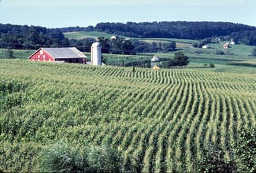
Maryland has large areas of fertile agricultural land in its coastal and Piedmont zones, though this land use is being encroached upon by urbanization. Agriculture is oriented to dairy farming (especially in foothill and piedmont areas) for nearby large city milksheads, plus specialty perishable horticulture crops, such as cucumbers, watermelons, sweet corn, tomatoes, melons, squash, and peas (Source:USDA Crop Profiles). The southern counties of the western shoreline of Chesapeake Bay are warm enough to support a tobacco cash crop zone, which has existed since early Colonial times, but declined greatly after a state government buy-out in the 1990s. There is also a large automated chicken-farming sector in the state's southeastern part; Salisbury is home to Perdue Farms. Maryland's food-processing plants are the most significant type of manufacturing by value in the state. Farming suffers from weeds as anywhere else, including an unusual multiply resistant ragweed (Ambrosia artemisiifolia) found by Rousonelos et al., 2012 with both ALS- and PPO-resistances[176] and which by 2016 had developed a third, EPSP resistance.[177] This ragweed population is a drag on soybean cultivation and, as of May 7, 2022[update], is the worst multiresistant weed problem in the state.[177]
Biotechnology
Maryland is a major center for life sciences research and development. With more than 400 biotechnology companies located there, Maryland is the fourth largest nexus in this field in the United States.[178]
Institutions and government agencies with an interest in research and development located in Maryland include the Johns Hopkins University, the Johns Hopkins Applied Physics Laboratory, more than one campus of the University System of Maryland, Goddard Space Flight Center, the United States Census Bureau, the National Institutes of Health (NIH), the National Institute of Standards and Technology (NIST), the National Institute of Mental Health (NIMH), the Walter Reed National Military Medical Center, the federal Food and Drug Administration (FDA), the Howard Hughes Medical Institute, the Celera Genomics company, the J. Craig Venter Institute (JCVI), and AstraZeneca (formerly MedImmune).
Maryland is home to defense contractor Emergent BioSolutions, which manufactures and provides an anthrax vaccine to U.S. government military personnel.[179]
Tourism

Tourism is popular in Maryland. Many tourists visit Baltimore, the beaches of the Eastern Shore, and the nature of western Maryland. Attractions in Baltimore include the Harborplace, the Baltimore Aquarium, Fort McHenry, as well as the Camden Yards baseball stadium. Ocean City on the Atlantic Coast has been a popular beach destination in summer, particularly since the Chesapeake Bay Bridge was built in 1952 connecting the Eastern Shore to the more populated Maryland cities.[48] The state capital of Annapolis offers sites such as the state capitol building, the historic district, and the waterfront. Maryland also has several sites of interest to military history, given Maryland's role in the American Civil War and in the War of 1812. Other attractions include the historic and picturesque towns along the Chesapeake Bay, such as Saint Mary's, Maryland's first colonial settlement and original capital.[180]
Healthcare
As of 2017, the top two health insurers including all types of insurance were CareFirst BlueCross BlueShield with 47% market share followed by UnitedHealth Group at 15%.[181]
Maryland has experimented with healthcare payment reforms, notably beginning in the 1970s with an all-payer rate setting program regulated by the Health Services Cost Review Commission.[182] In 2014, it switched to a global budget revenue system, whereby hospitals receive a capitated payment to care for their population.[182]
Transportation
The Maryland Department of Transportation oversees most transportation in the state through its various administration-level agencies.[183] The independent Maryland Transportation Authority maintains and operates the state's eight toll facilities.
Roads

Maryland's Interstate highways include 110 miles (180 km) of Interstate 95 (I-95), which enters the northeast portion of the state, travels through Baltimore, and becomes part of the eastern section of the Capital Beltway to the Woodrow Wilson Bridge. I-68 travels 81 miles (130 km), connecting the western portions of the state to I-70 at the small town of Hancock. I-70 enters from Pennsylvania north of Hancock and continues east for 93 miles (150 km) to Baltimore, connecting Hagerstown and Frederick along the way.
I-83 has 34 miles (55 km) in Maryland and connects Baltimore to southern central Pennsylvania (Harrisburg and York, Pennsylvania). Maryland also has an 11-mile (18 km) portion of I-81 that travels through the state near Hagerstown. I-97, fully contained within Anne Arundel County and the shortest (17.6 miles (28.3 km)) one- or two-digit interstate highway in the contiguous US, connects the Baltimore area to the Annapolis area.
There are also several auxiliary Interstate highways in Maryland. Among them are two beltways encircling the major cities of the region: I-695, the McKeldin (Baltimore) Beltway, which encircles Baltimore; and a portion of I-495, the Capital Beltway, which encircles Washington, D.C. I-270, which connects the Frederick area with Northern Virginia and Washington, D.C. through major suburbs to the northwest of Washington, is a major commuter route and is as wide as fourteen lanes at points. I-895, also known as the Harbor Tunnel Thruway, provides an alternate route to I-95 across Baltimore Harbor.
Both I-270 and the Capital Beltway were extremely congested; however, the Intercounty Connector (ICC; MD 200) has alleviated some congestion over time. Construction of the ICC was a major part of the campaign platform of former Governor Robert Ehrlich, who was in office from 2003 until 2007, and of Governor Martin O'Malley, who succeeded him. I-595, which is an unsigned highway concurrent with US 50/US 301, is the longest unsigned interstate in the country and connects Prince George's County and Washington, D.C. with Annapolis and the Eastern Shore via the Chesapeake Bay Bridge.
Maryland also has a state highway system that contains routes numbered from 2 through 999, however most of the higher-numbered routes are either unsigned or are relatively short. Major state highways include Routes 2 (Governor Ritchie Highway/Solomons Island Road/Southern Maryland Blvd.), 4 (Pennsylvania Avenue/Southern Maryland Blvd./Patuxent Beach Road/St. Andrew's Church Road), 5 (Branch Avenue/Leonardtown Road/Point Lookout Road), 32, 45 (York Road), 97 (Georgia Avenue), 100 (Paul T. Pitcher Memorial Highway), 210 (Indian Head Highway), 235 (Three Notch Road), 295 (Baltimore-Washington Parkway), 355 (Wisconsin Avenue/Rockville Pike/Frederick Road), 404 (Queen Anne Highway/ Shore Highway), and 650 (New Hampshire Avenue).
Airports
Maryland's largest airport is Baltimore-Washington International Thurgood Marshall Airport, more commonly referred to as BWI. The airport is named for the Baltimore-born Thurgood Marshall, the first African-American Supreme Court justice. The only other airports with commercial service are at Hagerstown and Salisbury.
The Maryland suburbs of Washington, D.C. are also served by the other two airports in the region, Ronald Reagan Washington National Airport and Dulles International Airport, both in Northern Virginia. The College Park Airport is the nation's oldest, founded in 1909, and is still used. Wilbur Wright trained military aviators at this location.[184][185]
Rail

Amtrak trains, including the high-speed Acela Express serve Penn Station in Baltimore, BWI Airport, New Carrollton, and Aberdeen along the Washington, D.C. to Boston Northeast Corridor. Train service is provided to Rockville and Cumberland by Amtrak's Washington, D.C., to Chicago Capitol Limited.
The WMATA's Metrorail rapid transit and Metrobus local bus systems (the 2nd and 6th busiest in the nation of their respective modes) provide service in Montgomery and Prince George's counties and connect them to Washington D.C.. The Maryland Transit Administration (often abbreviated as "MTA Maryland"), a state agency part of the Maryland Department of Transportation also provides transit services within the state. Headquartered in Baltimore, MTA's transit services are largely focused on central Maryland, as well as some portions of the Eastern Shore and Southern MD. Baltimore's Light RailLink and Metro SubwayLink systems serve its densely populated inner-city and the surrounding suburbs. The MTA also serves the city and its suburbs with its local bus service (the 9th largest system in the nation). The MTA's Commuter Bus system provides express coach service on longer routes connecting Washington, D.C. and Baltimore to parts of Central and Southern MD as well as the Eastern Shore. The commuter rail service, known as MARC, operates three lines which all terminate at Washington Union Station and provide service to Baltimore's Penn and Camden stations, Perryville, Frederick, and Martinsburg, West Virginia. In addition, many suburban counties operate local bus systems which connect to and complement the larger MTA and WMATA/Metro services.
The MTA will also administer the Purple Line, an under-construction light rail line that will connect the Maryland branches of the Red, Green/Yellow, and Orange lines of the Washington Metro, as well as offer transfers to all three lines of the MARC commuter rail system.[186][187]
Freight rail transport is handled principally by two Class I railroads, as well as several smaller regional and local carriers. CSX Transportation has more extensive trackage throughout the state, with 560 miles (900 km),[188] followed by Norfolk Southern Railway. Major rail yards are located in Baltimore and Cumberland,[188] with an intermodal terminal (rail, truck and marine) in Baltimore.[189]
Law and government
.jpg/500px-Maryland_state_coat_of_arms_(illustrated,_1876).jpg)
The government of Maryland is conducted according to the state constitution. The government of Maryland, like the other 49 state governments, has exclusive authority over matters that lie entirely within the state's borders, except as limited by the Constitution of the United States.
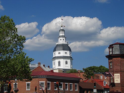
Power in Maryland is divided among three branches of government: executive, legislative, and judicial. The Maryland General Assembly is composed of the Maryland House of Delegates and the Maryland Senate. Maryland's governor is unique in the United States as the office is vested with significant authority in budgeting. Unlike many other states, significant autonomy is granted to many of Maryland's counties.
Most of the business of government is conducted in Annapolis, the state capital; however some cabinet departments and state officials have their offices in Baltimore. Elections for governor and most statewide offices, as well as most county elections, are held in midterm-election years (even-numbered years not divisible by four).
The judicial branch of state government consists of one united District Court of Maryland that sits in every county and Baltimore City, as well as 24 Circuit Courts sitting in each County and Baltimore City, the latter being courts of general jurisdiction for all civil disputes over $30,000, all equitable jurisdiction and major criminal proceedings. The intermediate appellate court is known as the Appellate Court of Maryland and the state supreme court is the Supreme Court of Maryland. The appearance of the justices of the Supreme Court of Maryland is unique; Maryland is the only state whose justices wear red robes.[190]
Taxation
Maryland imposes five income tax brackets, ranging from 2 to 6.25 percent of personal income.[191] The city of Baltimore and Maryland's 23 counties levy local "piggyback" income taxes at rates between 1.25 and 3.2 percent of Maryland taxable income. Local officials set the rates and the revenue is returned to the local governments quarterly. The top income tax bracket of 9.45 percent is the fifth highest combined state and local income tax rates in the country, behind New York City's 11.35 percent, California's 10.3 percent, Rhode Island's 9.9 percent, and Vermont's 9.5 percent.[192]
Maryland's state sales tax is six percent.[193] All real property in Maryland is subject to the property tax.[194] Generally, properties that are owned and used by religious, charitable, or educational organizations or property owned by the federal, state or local governments are exempt.[194] Property tax rates vary widely.[194] No restrictions or limitations on property taxes are imposed by the state, meaning cities and counties can set tax rates at the level they deem necessary to fund governmental services.[194]
Elections
Prior to the American Civil War, Maryland's elections were largely controlled by the Democrats, which account for 54.9% of all registered voters as of May 2017.[195]
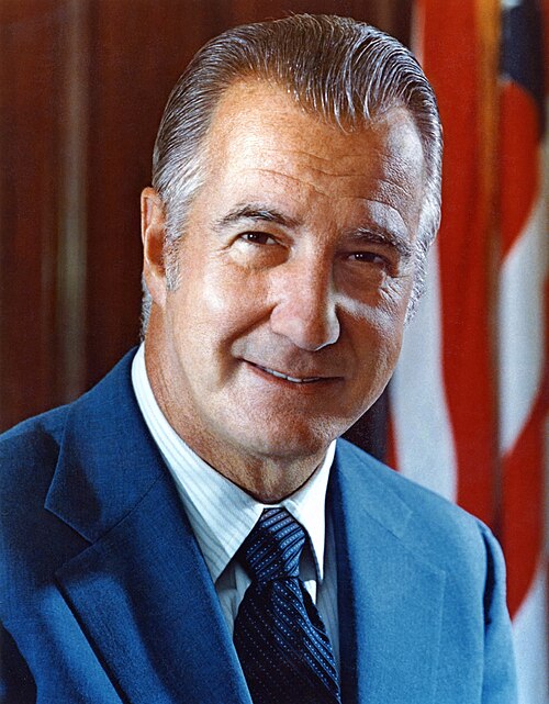
State elections are dominated by Baltimore and four populous suburban counties bordering Washington, D.C., and Baltimore: Montgomery, Prince George's, Anne Arundel, and Baltimore counties. As of July 2017,[196] 66 percent of the state's population resides in these six jurisdictions, most of which contain large, traditionally Democratic voting blocs: African Americans in Baltimore City and Prince George's; federal employees in Prince George's, Anne Arundel, and Montgomery; and post-graduates in Montgomery. The remainder of the state, particularly Western Maryland and the Eastern Shore, is more supportive of Republicans.[citation needed] One of Maryland's best known political figures is a Republican – former governor Spiro Agnew, who pled no contest to tax evasion and resigned in 1973.[197]
In 1980, Maryland was one of six states to vote for Jimmy Carter. In 1992, Bill Clinton fared better in Maryland than any other state, except his home state of Arkansas. In 1996, Maryland was Clinton's sixth best; in 2000, Maryland ranked fourth for Gore; and in 2004, John Kerry showed his fifth-best performance in Maryland. In 2008, Barack Obama won the state's 10 electoral votes with 61.9 percent of the vote, to John McCain's 36.5 percent.
In 2002, former Governor Robert Ehrlich was the first Republican to be elected to that office in four decades, and after one term, he lost his seat to Baltimore Mayor and Democrat Martin O'Malley. Ehrlich ran again for governor in 2010, losing again to O'Malley.
The 2006 election brought no change in the pattern of Democratic dominance. After Democratic Senator Paul Sarbanes announced that he was retiring, Democratic Congressman Benjamin Cardin defeated Republican Lieutenant Governor Michael S. Steele, with 55 percent of the vote, against Steele's 44 percent.
While Republicans typically win more counties in statewide elections by piling up large margins in the west and east, they are usually overcome by the densely populated and solidly Democratic Baltimore–Washington axis. In 2008, for instance, McCain won 17 counties to Obama's six (plus Baltimore City). While McCain won most of the western and eastern counties by margins of 2-to-1 or more, he was almost completely shut out in the larger counties surrounding Baltimore and Washington; every large county except Anne Arundel went for Obama, who won by 25 points statewide.[199]
From 2007 to 2011, U.S. Congressman Steny Hoyer (MD-5), a Democrat, was elected as Majority Leader for the 110th Congress and 111th Congress of the House of Representatives, serving in that post again from 2019 to 2023. In addition, Hoyer served as House Minority Whip from 2003 to 2006 and 2012 to 2018. His district covers parts of Anne Arundel and Prince George's counties, in addition to all of Charles, Calvert, and St. Mary's counties in southern Maryland.[200]
In 2010, Republicans won control of most counties. The Democratic Party remained in control of eight county governments, including that of Baltimore.[201]
In 2022, Wes Moore became the first Democrat elected Governor of Maryland since 2010, replacing Republican Larry Hogan, who did not run for re-election due to term limits. Moore is the first African-American elected Governor of Maryland, and the fifth African-American governor in American history.[202]
Media
A well-known newspaper in Maryland is The Baltimore Sun.[203] Many residents of the Washington metropolitan area receive The Washington Post.[citation needed]
The most populous areas are served by either Baltimore or Washington, D.C. broadcast stations. The Eastern Shore is served primarily by broadcast media based around the Delmarva Peninsula; the northeastern section receives both Baltimore and Philadelphia stations. Garrett County, which is mountainous, is served by stations from Pittsburgh, and requires cable or satellite for reception. Maryland is served by statewide PBS member station Maryland Public Television (MPT).[citation needed]
Education
Primary and secondary education

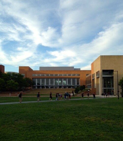
Education Week ranked Maryland #1 in its nationwide 2009–2013 Quality Counts reports.[204] The College Board's 9th Annual AP Report to the Nation also ranked Maryland first.[citation needed] Primary and secondary education in Maryland is overseen by the Maryland State Department of Education, which is headquartered in Baltimore.[205] The highest educational official in the state is the State Superintendent of Schools, who is appointed by the State Board of Education to a four-year term of office. The Maryland General Assembly has given the Superintendent and State Board autonomy to make educationally related decisions, limiting its influence on the day-to-day functions of public education. Each county and county-equivalent in Maryland has a local Board of Education charged with running the public schools in that particular jurisdiction.
The budget for education was $5.5 billion in 2009, representing about 40 percent of the state's general fund.[206] Data from the 2017 census shows that, among large school districts, four Maryland districts are in the top six for per-pupil annual spending, exceeded only by the Boston and New York City districts.[207]
Maryland has a broad range of private primary and secondary schools. Many of these are affiliated with various religious sects, including parochial schools of the Catholic Church, Quaker schools, Seventh-day Adventist schools, and Jewish schools. In 2003, Maryland law was changed to allow for the creation of publicly funded charter schools, although the charter schools must be approved by their local Board of Education and are not exempt from state laws on education, including collective bargaining laws.
In 2008, the state led the entire country in the percentage of students passing Advanced Placement examinations. 23.4 percent of students earned passing grades on the AP tests given in May 2008. This marks the first year that Maryland earned this honor.[208] Three Maryland high schools (in Montgomery County) were ranked among the top 100 in the country by US News in 2009, based in large part on AP test scores.[209]
Colleges and universities
Maryland has several historic and renowned private colleges and universities, the most prominent of which is Johns Hopkins University, founded in 1876 with a grant from Baltimore entrepreneur Johns Hopkins.
The first public university in the state is the University of Maryland, Baltimore, which was founded in 1807 and contains the University of Maryland's only public academic health, human services, and one of two law centers (the other being the University of Baltimore School of Law). Seven professional and graduate schools train the majority of the state's physicians, nurses, dentists, lawyers, social workers, and pharmacists.[210] The flagship university and largest undergraduate institution in Maryland is the University of Maryland, College Park which was founded as the Maryland Agricultural College in 1856 and became a public land grant college in 1864. Towson University, founded in 1866, is the state's second largest university.
In 1974, Maryland, along with seven other states, mainly in the South, submitted plans to desegregate its state universities; Maryland's plans were approved by the U.S. Department of Health, Education and Welfare.[211]
Baltimore is home to the University of Maryland, Baltimore County and the Maryland Institute College of Art. The majority of public universities in the state (Bowie State University, Coppin State University, Frostburg State University, Salisbury University and the University of Maryland-Eastern Shore) are affiliated with the University System of Maryland. Two state-funded institutions, Morgan State University and St. Mary's College of Maryland, as well as two federally funded institutions, the Uniformed Services University of the Health Sciences and the United States Naval Academy, are not affiliated with the University System of Maryland. The University of Maryland Global Campus is the largest public university in Maryland[212] and one of the largest distance-learning institutions in the world.[213]
St. John's College in Annapolis and Washington College in Chestertown, both private institutions, are the oldest colleges in the state and among the oldest in the country. Other private institutions include Mount St. Mary's University, McDaniel College (formerly known as Western Maryland College), Hood College, Stevenson University (formerly known as Villa Julie College), Loyola University Maryland, and Goucher College, among others.
Public libraries
Maryland's 24 public library systems deliver public education for everyone in the state of Maryland through a curriculum that comprises three pillars: Self-Directed Education (books and materials in all formats, e-resources), Research Assistance & Instruction (individualized research assistance, classes for students of all ages), and Instructive & Enlightening Experiences (e.g., Summer Reading Clubs, author events).
Maryland's library systems include, in part:
- Anne Arundel County Public Library
- Baltimore County Public Library
- Cecil County Public Library
- Enoch Pratt Free Library
- Frederick County Public Library
- Harford County Public Library
- Howard County Public Library
- Montgomery County Public Libraries
- Prince George's County Memorial Library System
- St. Mary's County Public Library[214]
Many of the library systems have established formalized partnerships with other educational institutions in their counties and regions.[215]
Sports


With two major metropolitan areas, Maryland has a number of major and minor professional sports franchises. Two National Football League teams play in Maryland, the Baltimore Ravens in Baltimore and the Washington Commanders in Landover. The Baltimore Colts represented the NFL in Baltimore from 1953 to 1983 before moving to Indianapolis.
The Baltimore Orioles are the state's Major League Baseball franchise. The National Hockey League's Washington Capitals and the National Basketball Association's Washington Wizards formerly played in Maryland, until the construction of an arena in Washington, D.C. in 1997 (now known as Capital One Arena). University of Maryland's team is the Maryland Terrapins.
Maryland enjoys considerable historical repute for the talented sports players of its past, including Cal Ripken Jr. and Babe Ruth. In 2012, The Baltimore Sun published a list of Maryland's top ten athletes in the state's history. The list includes Babe Ruth, Cal Ripken Jr, Johnny Unitas, Brooks Robinson, Frank Robinson, Ray Lewis, Michael Phelps, Jimmie Foxx, Jim Parker, and Wes Unseld.[216]
Other professional sports franchises in the state include three affiliated minor league baseball teams, one independent league baseball team, the Baltimore Blast indoor soccer team, two indoor football teams and three low-level outdoor soccer teams. Maryland is also home to one of the three races in horse racing's annual Triple Crown, the Preakness Stakes, which is run every spring at Pimlico Race Course in Baltimore. The Baltimore Stallions were a Canadian Football Team in the CFL that played the 1994–95 season.
Congressional Country Club has hosted three golf tournaments for the U.S. Open and a PGA Championship.
The official state sport of Maryland, since 1962, is jousting; the official team sport since 2004 is lacrosse.[217] The National Lacrosse Hall of Fame is located in Sparks, Maryland at the USA Lacrosse headquarters. In 2008, intending to promote physical fitness for all ages, walking became the official state exercise. Maryland is the first state with an official state exercise.[218]
Friendship partners
Maryland has relationships with many provinces, states, and other entities worldwide.
 Bong and Maryland Counties, in Liberia[219]
 Jalisco, Mexico (1996)[220]
 Cross River and Ondo States, Nigeria[221][222]
 Kwazulu-Natal, South Africa[223]
 Medan Marelan, Indonesia[224]
See also

- Index of Maryland-related articles
- Outline of Maryland
- List of people from Maryland
- USS Maryland, 4 ships
Notes
- ^ Elevation adjusted to North American Vertical Datum of 1988.
- ^ In US English, the first syllable is pronounced /ˈmɛr-/ even by the minority of speakers who contrast the vowels in merry /ˈmɛri/ and Mary /ˈmɛəri/. The pronunciation /ˈmɛərɪlənd/ MAIR-il-ənd is the predominant one in British Received Pronunciation.[7]
- ^ As of 2022–2023, there were only 8,646 Nepali immigrants in Maryland; however, numerous sources cite the number of Nepali or Nepali-Bhutanese immigrants and refugees in Maryland as between 20,000 and 25,000, considering that the community has often been undercounted.
- ^ Including Evangelical Protestants (18%), Mainline Protestants (18%), and Historically[further explanation needed] Black Protestants (16%).[153]
References
- ^ "Maryland's quality of life ranks high compared to other states". The Daily Record. July 1, 2021. Archived from the original on October 22, 2023. Retrieved September 30, 2023.
- ^ "Maryland Facts". Maryland Office of Tourism. Archived from the original on June 13, 2010. Retrieved June 2, 2009.
- ^ "Senate Bill 88" (PDF). Archived from the original (PDF) on September 29, 2017.
- ^ "Great Seal of Maryland (reverse)". Maryland State Archives. Archived from the original on January 4, 2013. Retrieved March 4, 2014.
- ^ a b "Elevations and Distances in the United States". United States Geological Survey. 2001. Archived from the original on October 15, 2011. Retrieved October 21, 2011.
- ^ "QuickFacts: Maryland". United States Census Bureau. Retrieved April 3, 2022.
- ^ Wells, John C. (2008). Longman Pronunciation Dictionary (3rd ed.). Longman. ISBN 978-1-4058-8118-0.
- ^ "Mid-Atlantic Home : Mid–Atlantic Information Office". U.S. Bureau of Labor Statistics. Archived from the original on April 8, 2019. Retrieved July 27, 2017.
- ^ "United States Regions". National Geographic Society. January 3, 2012. Archived from the original on November 28, 2021. Retrieved November 19, 2021.
- ^ "Maryland - 2023 - III.B. Overview of the State". mchb.tvisdata.hrsa.gov. Archived from the original on January 3, 2024. Retrieved January 3, 2024.
- ^ a b "Baltimore". Encyclopædia Britannica. June 18, 2023. Archived from the original on July 19, 2019. Retrieved April 25, 2019.
- ^ "People, Tribes and Bands". Maryland Manual On-line: A Guide to Maryland and its Government. Maryland State Archives. Archived from the original on July 17, 2019. Retrieved August 25, 2019.
- ^ "George Calvert and Cecilius Calvert, Barons Baltimore" William Hand Browne, Nabu Press (August 1, 2010), ISBN 117662539X ISBN 978-1176625396
- ^ Krugler, John D. (2004). English and Catholic : the Lords Baltimore in the seventeenth century. Baltimore: Johns Hopkins University Press. ISBN 978-0801879630. OCLC 53967315.
- ^ a b Andrews, Matthew Page (1929). History of Maryland: Province and State. Garden City, New York: Doubleday, Doran & Company, Inc. pp. 3–5.
- ^ "The Charter of Maryland : 1632". avalon.law.yale.edu. December 18, 1998. Archived from the original on March 25, 2015. Retrieved May 2, 2018.
- ^ "Avalon Project—Maryland Toleration Act; September 21, 1649". avalon.law.yale.edu. Archived from the original on November 25, 2009. Retrieved May 3, 2018.
- ^ "State Median Household Income Patterns: 1990–2010". U.S. Census Bureau. Archived from the original on October 26, 2011. Retrieved August 6, 2012.
- ^ Tom Horton; William Chesapeake Bay Foundation (2013). Turning the Tide: Saving the Chesapeake Bay. Island Press. p. 221. ISBN 9781610911160.
- ^ "Maryland Facts". Visit Maryland. Archived from the original on April 25, 2019. Retrieved April 25, 2019.
- ^ "Maryland Indian Tribes and Languages". www.native-languages.org. Retrieved September 3, 2024.
- ^ Stewart, George R. (1967) [1945]. Names on the Land: A Historical Account of Place-Naming in the United States (Sentry (3rd) ed.). Houghton Mifflin. pp. 42–43.
- ^ Marsh 2011, p. 5.
- ^ Masser, Kristin P. "Maryland In Focus—St. Mary's County". Maryland State Archives. Archived from the original on October 10, 2017. Retrieved September 6, 2017.
- ^ History of Maryland, p. 32
- ^ a b c "Maryland—The Catholic Experiment". www.ushistory.org. Archived from the original on March 22, 2016.
- ^ Greenwell, Megan (August 21, 2008). "Religious Freedom Byway Would Recognize Maryland's Historic Role". The Washington Post. Archived from the original on February 17, 2021. Retrieved May 3, 2014.
- ^ a b c Wilder, Craig Steven (2016). "War and Priests: Catholic Colleges and Slavery in the Age of Revolution". In Beckert, Seth; Rockman, Seth (eds.). Slavery's Capitalism: A New History of American Economic Development. Philadelphia, PA: University of Pennsylvania. p. 233. ISBN 978-0-8122-4841-8.
- ^ Taylor, Owen M., History of Annapolis (1872) p. 5
- ^ Brenner, Robert. Merchants and Revolution London:Verso. 2003, ISBN 1-85984-333-6
- ^ Tom (March 4, 2014). "Lord Baltimore's Map of Maryland in 1732". Ghosts of Baltimore. Archived from the original on February 25, 2019. Retrieved February 24, 2019.
- ^ a b c d Hubbard, Bill Jr. (2009). American Boundaries: the Nation, the States, the Rectangular Survey. University of Chicago Press. pp. 21–23. ISBN 978-0-226-35591-7.
- ^ "Indentured Servants and the Pursuits of Happiness" Archived January 4, 2010, at the Wayback Machine. Crandall Shifflett, Virginia Tech.
- ^ Paul Heinegg. Free African Americans in Virginia, North Carolina, South Carolina, Maryland and Delaware Archived August 7, 2010, at the Wayback Machine. Retrieved February 15, 2008.
- ^ a b Peter Kolchin, American Slavery: 1619–1877, New York: Hill and Wang, 1993, pp. 81–82
- ^ "Harriet Tubman". HISTORY. Archived from the original on January 19, 2019. Retrieved January 18, 2019.
- ^ Douglass, Frederick (2003). Narrative of the Life of Frederick Douglass, an American Slave. New York, NY: Barnes & Noble Classics. p. 17. ISBN 978-1-59308-041-9.
- ^ Dilts, James D. (1993). The Great Road: The Building of the Baltimore and Ohio, the Nation's First Railroad, 1828–1853. Palo Alto, CA: Stanford University Press. p. 80. ISBN 978-0-8047-2235-3.
- ^ Stover, John F. (1987). History of the Baltimore and Ohio Railroad. West Lafayette, IN: Purdue University Press. p. 18. ISBN 978-0-911198-81-2.
- ^ Walter Coffey (April 29, 2016). "Maryland Remains in the Union". The Civil War Months. Walter Coffey. Archived from the original on August 17, 2016. Retrieved July 7, 2016.
- ^ Vogler, Mark E. (April 18, 2009). "Civil War Guard on duty in Baltimore to save President Street Station". eagletribune.com. Eagle Tribune. Archived from the original on April 19, 2009. Retrieved April 28, 2015.
- ^ a b "Maryland at a Glance: Nicknames". Maryland State Archives. September 29, 2015. Archived from the original on January 22, 2018. Retrieved February 8, 2018.
- ^ a b c d Tuck, Stephen (Spring 2013). "Democratization and the Disfranchisement of African Americans in the US South during the Late 19th Century" (PDF). Reading for "Challenges of Democratization". Archived from the original (PDF) on February 23, 2014. Retrieved February 11, 2014 – via Brandon Kendhammer, Ohio University.
- ^ "Bird's Eye View of Cumberland, Maryland 1906". World Digital Library. 1906. Archived from the original on October 3, 2013. Retrieved July 22, 2013.
- ^ Dayhoff, Kevin (October 7, 2012). "Eagle Archive: Here's a toast to Maryland's origins as 'The Free State'". The Baltimore Sun. Archived from the original on February 9, 2018. Retrieved February 8, 2018.
- ^ Cairns, Huntington (December 1937). "History and Constitutionality of the Maryland Income Tax Law". Maryland Law Review. Legal History, Theory and Process Commons. UM Carey Law. pp. 1, 6. Archived from the original on March 4, 2016. Retrieved August 19, 2015.
... 1937 Special Session of the Maryland Legislature imposed an income tax ... expenditure of public funds for the benefit of able-bodied persons whose inability to support themselves arises from the prevalence of widespread unemployment.
- ^ "The Steamboats of Chesapeake Bay". Archived from the original on August 4, 2020. Retrieved March 9, 2020.
- ^ a b "William Preston Lane Jr. Memorial Bay Bridge—History". baybridge.com. Archived from the original on July 1, 2008. Retrieved February 5, 2008.
- ^ "Belgium". CIA World Factbook. Central Intelligence Agency. May 15, 2008. Archived from the original on January 9, 2021. Retrieved May 15, 2008.
Area—comparative: about the size of Maryland
- ^ Kelly, John (June 26, 2021). "Maryland calls itself America in miniature". The Washington Post. Retrieved September 26, 2023.
- ^ "Hancock—C&O Canal Trust". Chesapeake and Ohio Canal Trust. Archived from the original on November 25, 2020. Retrieved October 22, 2020.
- ^ Delgado, Patricia (December 2011). "Chesapeake Bay National Estuarine Research Reserve in Maryland Site Profile" (PDF). Maryland Department of Natural Resources. p. 54. Archived (PDF) from the original on May 25, 2017. Retrieved May 21, 2017.
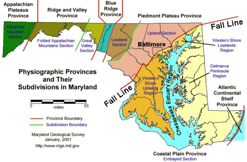
Map showing ... Maryland physiographic provinces
- ^ "M2.0—Maryland". Archived from the original on January 17, 2013. Retrieved November 25, 2012.
- ^ "M3.4—Maryland Potomac–Shenandoah Region". Archived from the original on November 2, 2012. Retrieved November 25, 2012.
- ^ Reger, James P. "Earthquakes and Maryland". Maryland Geological Survey. Archived from the original on October 26, 2013. Retrieved December 25, 2018.
- ^ "Earthquake hits New Jersey, causing tremors in Maryland but no major damage". Baltimore Sun. April 5, 2024. Archived from the original on April 25, 2024. Retrieved April 25, 2024.
- ^ "Maryland's Lakes and Reservoirs: FAQ". Maryland Geological Survey. January 24, 2007. Archived from the original on May 29, 2010. Retrieved February 3, 2008.
- ^ Maryland.gov, "Maryland at a glance" Archived January 10, 2019, at the Wayback Machine. Accessed December 3, 2018.
- ^ Rosenwald, Michael S. (July 30, 2012). "Fact: Maryland has no natural lakes". The Washington Post. Archived from the original on December 5, 2018. Retrieved June 10, 2015.
- ^ a b Pamela Wood (March 27, 2017). "Maryland General Assembly approves fracking ban". The Baltimore Sun. Archived from the original on April 1, 2017. Retrieved April 1, 2017.
- ^ "Maryland at a Glance: State Symbols, Maryland State Flower—Black-Eyed Susan". Maryland Manual Online. Maryland State Archives. Archived from the original on August 21, 2014. Retrieved May 20, 2014.
- ^ Olson, D. M.; Dinerstein, E.; et al. (2001). "Terrestrial Ecoregions of the World: A New Map of Life on Earth". BioScience. 51 (11): 933–938. doi:10.1641/0006-3568(2001)051[0933:TEOTWA]2.0.CO;2. ISSN 0006-3568.
- ^ "Zone Hardiness Map through Prairie Frontier". Prairiefrontier.com. Archived from the original on February 7, 2011. Retrieved October 24, 2010.
- ^ John Leeds Bozman (1837). The history of Maryland: from its first settlement, in 1633, to the restoration, in 1660; with a copious introduction, and notes and illustrations. J. Lucas & E.K. Deaver. p. 24.
- ^ a b c d "Hardiness Zones". Arbor Day Foundation. Archived from the original on June 29, 2018. Retrieved March 5, 2013.
- ^ "Invasive Species of concern in Maryland". Mdinvasivesp.org. Archived from the original on January 3, 2010. Retrieved October 24, 2010.
- ^ a b "Maryland Animals". Archived from the original on August 30, 2007. Retrieved August 30, 2007.
- ^
Therres, Glenn (Fall 2007). "Lions in our mountains? The mystery of cougars in Maryland" (PDF). Wildlife and Heritage. Maryland Department of Natural Resources. Archived from the original (PDF) on April 19, 2011. Retrieved July 6, 2009.
Historically bobcats were distributed statewide but during the post colonization period densities began to plummet. By the mid-1900s, populations had probably reached all-time lows, with remnant populations existing only in western Maryland. This prompted the Department of Natural Resources (DNR) to classify them as a state-listed "Species of Special Concern." During the past quarter century, occupied range and densities have increased markedly. Results from the annual Bowhunter Survey and the Hunter Mail survey have identified bobcat sightings in 14 of Maryland's 23 counties. Currently, bobcats have dual legal classification in Maryland. In addition to the Species of Special Concern designation, they are also defined as a Game Animal / Furbearer with a closed harvest season.
- ^
"Coyotes in Maryland". Maryland Department of Natural Resources. Archived from the original on August 15, 2011. Retrieved September 16, 2011.
Coyotes were historically a western species with core populations found west of the Mississippi River. Alterations and/or elimination of competing predators during the post-European colonization period facilitated rapid range expansion into eastern North America during the 20th Century. Established populations now occur in every state and province in North America. Coyotes are a relatively new addition to local ecosystems, and were first documented in Maryland during 1972. Initial substantiated sightings occurred in Cecil, Frederick and Washington counties. Since that time population densities and occupied range have expanded incrementally and coyotes now occur statewide.
- ^ a b c "Assateague Island National Seashore wild Ponies". Assateagueisland.com. Archived from the original on March 4, 2010. Retrieved October 24, 2010.
- ^ a b "Chesapeake Bay Retriever History". K9web.com. Archived from the original on October 24, 2010. Retrieved October 24, 2010.
- ^ "Eastern Box Turtle". Maryland Biodiversity Project. Archived from the original on July 9, 2018. Retrieved July 8, 2018.
- ^ "Maryland Government Website—Maryland State Bird". Msa.md.gov. June 7, 2010. Archived from the original on May 27, 2010. Retrieved October 24, 2010.
- ^ "Official list of the birds of Maryland" (PDF). Maryland/District of Columbia Records Committee. Archived from the original (PDF) on July 9, 2018. Retrieved May 4, 2009.
- ^ Euphydryas phaeton (Drury, 1773) Archived September 6, 2010, at the Wayback Machine, Butterflies and Moths of North America
- ^ Goodman, Peter S. (August 1, 1999). "An Unsavory Byproduct: Runoff and Pollution". Washington Post. p. A1. Archived from the original on September 8, 2017. Retrieved August 30, 2017.
- ^ Horton, Tom (January 1, 1999). "Hog farms' waste poses a threat". Baltimore Sun. Archived from the original on October 12, 2013. Retrieved October 5, 2013.
- ^ Wingfield, Brian; Marcus, Miriam (October 16, 2007). "America's Greenest States". Forbes.com. Archived from the original on November 5, 2010. Retrieved October 24, 2010.
- ^ "Program Design Archive". RGGI, Inc. Archived from the original on March 2, 2018. Retrieved April 20, 2018.
- ^ Caplan, Morgan (November 15, 2023). "Maryland On Track To Be Coal-Free by 2025 with Announced Retirement of Warrior Run Plant". Sierra_Club (Press release). Retrieved September 27, 2024.
- ^ "Snowfall Map". Archived from the original on May 22, 2010. Retrieved October 24, 2010.
- ^ "NOAA National Climatic Data Center. Retrieved on October 24, 2006". Archived from the original on October 16, 2011. Retrieved October 25, 2006.
- ^ "NowData—NOAA Online Weather Data". National Oceanic and Atmospheric Administration. Archived from the original on July 24, 2015. Retrieved December 17, 2012.
- ^ "Monthly Averages for Oakland, MD". weather.com. Archived from the original on September 27, 2013. Retrieved September 28, 2013.
- ^ "Station Name: MD Cumberland 2". National Oceanic and Atmospheric Administration. Archived from the original on May 25, 2017. Retrieved March 5, 2013.
- ^ "Monthly Averages for Hagerstown, MD". weather.com. Archived from the original on September 27, 2013. Retrieved September 28, 2013.
- ^ "Station Name: MD Frederick Police Brks". National Oceanic and Atmospheric Administration. Archived from the original on May 25, 2017. Retrieved March 5, 2013.
- ^ "Station Name: MD MD Sci Ctr Baltimore". National Oceanic and Atmospheric Administration. Archived from the original on May 25, 2017. Retrieved February 27, 2013.
- ^ "Monthly Averages for Elkton, MD (21921)". The Weather Channel. Archived from the original on November 6, 2018. Retrieved May 21, 2017.
- ^ "Station Name: MD Ocean City Muni Ap". National Oceanic and Atmospheric Administration. Archived from the original on May 25, 2017. Retrieved March 5, 2013.
- ^ "Monthly Averages for Waldorf, MD". The Weather Channel. Archived from the original on November 6, 2018. Retrieved May 21, 2017.
- ^ "Monthly Averages for Point Lookout State Park [Scotland, MD]". The Weather Channel. Archived from the original on November 10, 2018. Retrieved May 21, 2017.
- ^ "Calvert County, Maryland's Success in Controlling Sprawl". Environmental Protection Agency. Archived from the original on September 13, 2016. Retrieved September 3, 2016.
- ^ Shields, Todd (February 16, 1997). "On Edge". The Washington Post. Archived from the original on September 17, 2016. Retrieved September 3, 2016.
- ^ a b "Historical Population Change Data (1910–2020)". Census.gov. United States Census Bureau. Archived from the original on April 29, 2021. Retrieved May 1, 2021.
- ^ "QuickFacts Maryland; United States". 2018 Population Estimates. United States Census Bureau, Population Division. February 7, 2019. Archived from the original on February 9, 2019. Retrieved February 7, 2019.
- ^ "Immigrants in Maryland" (PDF). American Immigration Council. 2020. Archived (PDF) from the original on August 11, 2023. Retrieved August 12, 2023.
- ^ "Population and Population Centers by State—2000". United States Census Bureau. Archived from the original on December 12, 2001. Retrieved December 5, 2008.
- ^ "The South As It's [sic] Own Nation". League of the South. 2004. Archived from the original on June 5, 2008. Retrieved May 23, 2008.
On the other hand, areas beyond these thirteen States maintain their Southern culture to varying degrees. Much of Missouri remains basically Southern, as do parts of southern Maryland and Maryland's eastern shore.
- ^ Beck, John; Randall, Aaron & Frandsen, Wendy (June 27, 2007). "Southern Culture: An Introduction" (PDF). Durham, North Carolina: Carolina Academic Press. pp. 14–15. Archived (PDF) from the original on July 8, 2011. Retrieved May 23, 2008.
Kentucky, Missouri, West Virginia, and Maryland – slaveholding states and regions before the Civil War that did not secede from the Union – are also often included as part of the South. As border states, these states always were crossroads of values and customs, and today parts of Maryland seem to have become part of the 'Northeast'.
- ^ "Regions of the United States". American Memory. The Library of Congress. Archived from the original on May 28, 2010. Retrieved August 11, 2009.
- ^ "Region 3: The Mid-Atlantic States". U.S. Environmental Protection Agency. Archived from the original on July 27, 2010. Retrieved August 11, 2009.
- ^ "Your Local FBI Office". Federal Bureau of Investigation. Archived from the original on August 15, 2009. Retrieved August 11, 2009.
- ^ "Routes Serving the Northeast". National Railroad Passenger Corporation. Archived from the original on August 15, 2009. Retrieved August 11, 2009.
- ^ "Best Regional Colleges". The Princeton Review. Archived from the original on February 6, 2010. Retrieved August 11, 2009.
- ^ "2007-2022 PIT Counts by State". Archived from the original on March 14, 2023. Retrieved March 11, 2023.
- ^ "The 2022 Annual Homelessness Assessment Report (AHAR) to Congress" (PDF). Archived (PDF) from the original on March 11, 2023. Retrieved March 11, 2023.
- ^ Exner, Rich (June 3, 2012). "Americans under age 1 now mostly minorities, but not in Ohio: Statistical Snapshot". The Plain Dealer. Archived from the original on July 14, 2016. Retrieved February 19, 2020.
- ^ "Births: Final Data for 2013" (PDF). National Vital Statistics Reports. 64 (1). National Center for Health Statistics: 35–36. January 15, 2015. Archived (PDF) from the original on September 11, 2017. Retrieved February 19, 2020.
- ^ "Births: Final Data for 2014" (PDF). National Vital Statistics Reports. 64 (12). National Center for Health Statistics: 35–36. December 23, 2015. Archived (PDF) from the original on February 14, 2017. Retrieved February 19, 2020.
- ^ "Births: Final Data for 2015" (PDF). National Vital Statistics Reports. 66 (1). National Center for Health Statistics: 38, 40. January 5, 2017. Archived (PDF) from the original on August 31, 2017. Retrieved February 19, 2020.
- ^ "Births: Final Data for 2016" (PDF). National Vital Statistics Reports. 67 (1). National Center for Health Statistics: 25. January 31, 2018. Archived (PDF) from the original on June 3, 2018. Retrieved February 19, 2020.
- ^ "Births: Final Data for 2017" (PDF). National Vital Statistics Reports. 67 (8). National Center for Health Statistics: 20. November 7, 2018. Archived (PDF) from the original on February 1, 2019. Retrieved February 19, 2020.
- ^ "Births: Final Data for 2018" (PDF). National Vital Statistics Reports. 68 (13). National Center for Health Statistics: 20. November 27, 2019. Archived (PDF) from the original on November 28, 2019. Retrieved February 19, 2020.
- ^ Martin, Joyce A.; Hamilton, Brady E.; Osterman, Michelle J.K.; Driscoll, Anne K. (March 23, 2021). "Births: Final Data for 2019" (PDF). National Vital Statistics Reports. 70 (2). Centers for Disease Control and Prevention: 1–51. PMID 33814033. Archived (PDF) from the original on June 23, 2021. Retrieved March 30, 2021.
- ^ "Data" (PDF). Centers for Disease Control and Prevention. Archived (PDF) from the original on February 10, 2022. Retrieved February 20, 2022.
- ^ "Data" (PDF). Centers for Disease Control and Prevention. Archived (PDF) from the original on February 1, 2023. Retrieved February 3, 2022.
- ^ "Data" (PDF). www.cdc.gov. Archived (PDF) from the original on April 4, 2024. Retrieved April 5, 2024.
- ^ "Immigrants in Maryland". American Immigration Council. May 1, 2015. Archived from the original on January 30, 2023. Retrieved January 30, 2023.
- ^ "Biggest sources of immigrants to Maryland". Stacker. Archived from the original on January 30, 2023. Retrieved January 30, 2023.
- ^ "B03002 Hispanic or Latino Origin by Race—Maryland—2019 American Community Survey 1-Year Estimates". U.S. Census Bureau. July 1, 2019. Archived from the original on March 4, 2021. Retrieved November 6, 2020.
- ^ "The Demographic Statistical Atlas of the United States - Statistical Atlas". statisticalatlas.com. Archived from the original on January 30, 2023. Retrieved January 30, 2023.
- ^ acutrans19 (September 28, 2022). "Top 10 Languages of Maryland". Acutrans | Certified Translation Services. Archived from the original on January 30, 2023. Retrieved January 30, 2023.
{{cite web}}: CS1 maint: numeric names: authors list (link) - ^ a b Yax, Laura K. "Historical Census Statistics on Population Totals By Race, 1790 to 1990, and By Hispanic Origin, 1970 to 1990, For The United States, Regions, Divisions, and States". Archived from the original on July 25, 2008.
- ^ [1]
- ^ "Maryland QuickFacts from the US Census Bureau". Archived from the original on February 7, 2015. Retrieved January 14, 2015.
- ^ a b "QuickFacts: Maryland". U.S. Census Bureau. Archived from the original on July 26, 2020. Retrieved July 16, 2021.
- ^ "Maryland—Race and Hispanic Origin: 1790 to 1990". U.S. Census Bureau. Archived from the original on July 25, 2008. Retrieved April 18, 2012.
- ^ "B03002 Hispanic or Latino Origin by Race – Maryland – 2019 American Community Survey 1-Year Estimates". U.S. Census Bureau. July 1, 2019. Archived from the original on March 4, 2021. Retrieved November 23, 2020.
- ^ "Maryland Quick Facts". United States Census Bureau. Archived from the original on February 3, 2019. Retrieved July 25, 2017.
- ^ "States of Change: The Demographic Evolution of the American Electorate, 1974–2060" (PDF). Center for American Progress. Archived (PDF) from the original on April 23, 2016. Retrieved July 25, 2016.
- ^ "Languages in Maryland" (PDF). U.S. English Foundation, Inc. Archived from the original (PDF) on January 17, 2013. Retrieved May 22, 2012.
Prince George's County has the highest percentage of Kru/Ibo/Yoruba speakers of any county in the nation.
- ^ *Westley, Brian. Washington: "Nation's Largest Ethiopian Community Carves Niche". ( Archived March 4, 2016, at the Wayback Machine). USA Today. Associated Press. October 17, 2005.
- "Washington: Nation's Largest Ethiopian Community Carves Niche" Archived February 20, 2021, at the Wayback Machine. The Southeast Missourian. Associated Press. October 23, 2005. p. 7C. Retrieved August 25, 2018.
- ^ "DC's 'Little Ethiopia' has moved to Silver Spring and Alexandria". Greater Greater Washington. Archived from the original on August 21, 2018. Retrieved August 25, 2018.
- ^ Data Access and Dissemination Systems (DADS). "American FactFinder—Results". Archived from the original on February 12, 2020. Retrieved January 14, 2015.
- ^ a b "Irish Immigrants in Baltimore: Introduction, Teaching American History in Maryland". Maryland State Archives. Archived from the original on May 22, 2017. Retrieved May 21, 2017.
- ^ a b Dastagir, Alia E. (May 23, 2011). "Swampoodle: The neighborhood behind the play". ABC Channel 7: TBD online magazine. p. 2. Archived from the original on June 6, 2013. Retrieved June 11, 2014.
- ^ "Washington, DC Genealogy Research, Resources, and Records: Irish Neighborhoods in Old Washington". genweb.org. Archived from the original on May 25, 2017. Retrieved May 21, 2017.
- ^ "Mulberry Tree: College News: Explore Maryland's History in Ireland". St. Mary's College of Maryland online magazine. Spring 2014. Archived from the original on July 14, 2014. Retrieved June 11, 2014.
- ^ "About the Celtic Society of Southern Maryland". CSSM.org. Celtic Society of Southern Maryland. Archived from the original on May 25, 2017. Retrieved May 21, 2017.
- ^ "KhK-GenGreece". www.yvelia.com. Archived from the original on March 4, 2016. Retrieved February 11, 2023.
- ^ "European Immigrants in the United States". migrationpolicy.org. Archived from the original on February 11, 2015. Retrieved January 14, 2015.
- ^ "Cities with the Highest Percentage of Russians in Maryland". Archived from the original on October 29, 2014. Retrieved January 14, 2015.
- ^ Department of Legislative Services (June 2008). "Overview of Hispanic Community in Maryland" (PDF). pp. 6–7. Archived from the original (PDF) on January 17, 2013. Retrieved July 5, 2012.
- ^ Yau, Jennifer (2007). "The Foreign Born from Korea in the United States". Migration Policy Institute. Archived from the original on January 10, 2012. Retrieved December 23, 2007.
- ^ "U.S. Census Bureau: Maryland". U.S. Census Bureau. Retrieved June 16, 2021.
- ^ "2020 Regular Session - Bond Bill Fact Sheet for Baltimore Association of Nepalese in America" (PDF). Archived (PDF) from the original on February 5, 2023. Retrieved February 5, 2023.
- ^ "Maryland's Nepali community mourns Brindra Giri, a recent immigrant killed in Rite Aid warehouse shooting". Baltimore Sun. September 23, 2018. Archived from the original on February 5, 2023. Retrieved February 5, 2023.
- ^ "Race and Ethnicity in the United States: 2010 Census and 2020 Census".
- ^ "Minority population surging in Texas". NBC News. Associated Press. August 18, 2005. Archived from the original on December 31, 2013. Retrieved December 7, 2009.
- ^ Turner Brinton, "Immigration Bill Could Impact Maryland". Archived December 21, 2013, at the Wayback Machine. Capital News Service, April 5, 2006. Retrieved July 22, 2007.
- ^ a b c d e "Maryland". Freedom to Marry. Archived from the original on October 3, 2013. Retrieved September 28, 2013.
- ^ a b c "Religious composition of adults in Maryland". Religious Landscape Study. The Pew Forum on Religion & Public Life. 2017. Archived from the original on October 10, 2017. Retrieved October 5, 2017.
- ^ "State Membership Report". www.thearda.com. The Association of Religion Data Archives. Archived from the original on December 2, 2013. Retrieved November 15, 2013.
- ^ "Maryland Amish". Amish America. March 2011. Archived from the original on December 31, 2017. Retrieved October 6, 2017.
- ^ "Table 77. Christian Church Adherents and Jewish Population States: 2008". United States Census Bureau. Archived from the original (Excel) on March 27, 2010. Retrieved October 24, 2010.
- ^ "2017 Greater Washington Jewish Community Demographic Study" (PDF). Jewish Federation of Greater Washington. Archived (PDF) from the original on February 28, 2019. Retrieved February 28, 2019.
- ^ "PRRI – American Values Atlas". ava.prri.org. Archived from the original on April 4, 2017. Retrieved September 17, 2022.
- ^ Joseph, Channing Gerard (January 31, 2020). "The First Drag Queen Was a Former Slave". The Nation. ISSN 0027-8378. Archived from the original on February 2, 2021. Retrieved February 4, 2020.
- ^ "Maryland Polling Memo". Public Policy Polling. May 24, 2012. Archived from the original on August 3, 2017. Retrieved August 16, 2013.
- ^ "Regional Data". Archived from the original on August 31, 2017. Retrieved March 14, 2018.
- ^ Dolan, Karen (January 30, 2012). "A better way of measuring progress in Maryland". Baltimore Sun. Archived from the original on January 20, 2013. Retrieved November 11, 2012.
- ^ Measuring Prosperity: Maryland's Genuine Progress Indicator | Solutions Archived October 5, 2012, at the Wayback Machine. Thesolutionsjournal.com. Retrieved on July 12, 2013.
- ^ "American FactFinder MedImmune Results". Archived from the original on February 12, 2020. Retrieved July 16, 2015.
- ^ Frank, Robert (January 15, 2014). "Top states for millionaires per capita". CNBC. Archived from the original on January 22, 2014. Retrieved January 21, 2014.
- ^ U.S. Poverty Rate Drops; Ranks of Uninsured Grow Archived July 7, 2017, at the Wayback Machine washingtonpost.com.
- ^ Maryland is ranked as richest state Archived December 15, 2014, at the Wayback Machine baltimoresun.com.
- ^ US Poverty Rate Declines Significantly Archived December 15, 2014, at the Wayback Machine wibw.com.
- ^ "Monthly Labor Review—February 2018" (PDF). Maryland Department of Labor, License, and Governing. April 5, 2018. Archived (PDF) from the original on May 15, 2022. Retrieved April 20, 2018.
- ^ "2022 Annual Comprehensive Financial Report." Comptroller of Maryland. April 2023. p. 164. Archived April 20, 2023, at the Wayback Machine.
- ^ U.S. Army Corps of Engineers. Waterborne Commerce Statistics Center. New Orleans, LA. "Tonnage for Selected U.S. Ports in 2008." Archived July 31, 2010, at the Wayback Machine Revised February 17, 2010.
- ^ "Port of Baltimore". Automotive Logistics Buyers' Guide. Ultima Media. Archived from the original on May 25, 2017. Retrieved May 22, 2017.
The Port of Baltimore handles more autos than any other US port.
- ^ "Tonnage of Top 50 U.S. Water Ports, Ranked by Total Tons". Bureau of Transportation Statistics. U.S. Department of Transportation. Archived from the original on October 16, 2020. Retrieved November 2, 2020.
- ^ Davis, Julie Hirschfeld; Shaw, Gwyneth K. (March 11, 2006). "Bush fears terror setback". The Baltimore Sun. Archived from the original on October 1, 2020. Retrieved November 2, 2020.
- ^ "Chesapeake and Delaware Canal". Philadelphia, PA: U.S. Army Corps of Engineers. Archived from the original on September 28, 2013. Retrieved September 28, 2013.
- ^ Rousonelos, Stephanie L.; Lee, Ryan M.; Moreira, Murilo S.; VanGessel, Mark J.; Tranel, Patrick J. (2012). "Characterization of a Common Ragweed (Ambrosia artemisiifolia) Population Resistant to ALS- and PPO-Inhibiting Herbicides". Weed Science. 60 (3). Weed Science Society of America (WSSA) (CUP): 335–344. doi:10.1614/ws-d-11-00152.1. ISSN 0043-1745. S2CID 86234767.
- ^ a b Heap, Ian (May 7, 2022). "Multiple resistant Ambrosia artemisiifolia from United States, Maryland". The International Survey of Herbicide Resistant Weeds. Archived from the original on May 17, 2022. Retrieved May 7, 2022.
- ^ "Maryland's Bioscience Environment: 2009". The Maryland Biotechnology Center. Archived from the original on August 20, 2011. Retrieved August 19, 2011.
- ^ "Emergent BioSolutions Receives Orphan Drug Designation for BioThrax for Post-Exposure Prophylaxis of Anthrax Disease". Marketwatch.com. Dow Jones & Company. April 21, 2014. Archived from the original on September 18, 2016. Retrieved August 29, 2016.
- ^ Lam, Kenneth K. (August 30, 2013). "Unearthing early American life in St. Mary's City: St. Mary's City is an archaeological jewel on Maryland's Western Shore". Baltimore Sun. Archived from the original on February 17, 2018. Retrieved February 18, 2020.
- ^ "Competition in health insurance research". American Medical Association. Archived from the original on June 18, 2019. Retrieved June 15, 2019.
- ^ a b Galarraga, Jessica; Pines, Jesse M. (2017). "The Challenging Transformation Of Health Care Under Maryland's Global Budgets". Health Affairs Forefront. doi:10.1377/forefront.20171214.96251. Archived from the original on May 27, 2022. Retrieved March 29, 2022.
- ^ "MDOT Departments". Archived from the original on May 25, 2009. Retrieved June 5, 2016. Maryland Department of Transportation. Retrieved on March 23, 2009.
- ^ "College Park Aviation Museum Home". Collegeparkaviationmuseum.com. September 12, 2013. Archived from the original on July 27, 2009. Retrieved September 28, 2013.
- ^ "Frederick E. Humphreys: First Military Pilot". New York State Division of Military and Naval Affairs: Military History. December 9, 2008. Archived from the original on July 19, 2011. Retrieved November 23, 2010.
- ^ "Purple Line". MDOT MTA Purple Line. Archived from the original on January 14, 2021. Retrieved January 12, 2021.
- ^ Shaver, Katherine (December 16, 2020). "Maryland board approves $250 million legal deal to complete Purple Line construction". The Washington Post. ISSN 0190-8286. Archived from the original on January 14, 2021. Retrieved January 12, 2021.
- ^ a b CSX Transportation. Jacksonville, FL (2010). "CSX and Maryland." Archived October 21, 2011, at the Wayback Machine
- ^ Maryland Port Administration. Baltimore, MD. "Seagirt Marine Terminal." Archived January 6, 2012, at the Wayback Machine Retrieved October 31, 2011.
- ^ Lamy, Rudolf B. (2006). "A Study of Scarlet: Red Robes and the Maryland Court of Appeals." Archived April 25, 2012, at the Wayback Machine Monograph. (Annapolis, MD: Maryland State Law Library.)
- ^ "Maryland State taxes". BankRate.com. Archived from the original on August 13, 2009. Retrieved April 9, 2008.
- ^ "Maryland Income Tax Information—Local Tax Rates". Individuals.marylandtaxes.com. Archived from the original on September 20, 2008. Retrieved September 22, 2008.
- ^ "Sales and Use Tax". Archived from the original on July 7, 2019. Retrieved July 7, 2019.
- ^ a b c d "A Homeowner's Guide to Property Taxes and Assessments". Archived from the original on July 7, 2019. Retrieved July 7, 2019.
- ^ Maryland State Board of Elections. "Voter Registration Statistics". Archived from the original on February 25, 2016. Retrieved February 24, 2016.
- ^ "American FactFinder—Results". Archived from the original on February 13, 2020. Retrieved June 12, 2018.
- ^ Feerick, John D. (2014) [1976]. The Twenty-Fifth Amendment: Its Complete History and Application (Third ed.). New York: Fordham University Press. pp. 132–133. ISBN 978-0-8232-5200-8.
- ^ "Voter Registration Statistics". Maryland State Board of Elections. Archived from the original on February 2, 2023. Retrieved June 21, 2024.
- ^ Local and National Election Results—Election Center 2008—Elections & Politics Archived November 7, 2008, at the Wayback Machine. CNN.com. Retrieved on July 12, 2013.
- ^ "Congressman Steny Hoyer". Steny Hoyer. Archived from the original on September 7, 2016. Retrieved February 19, 2020.
- ^ "Official Gubernatorial General Election results for Maryland". The State Board of Elections. State of Maryland. Archived from the original on October 18, 2016. Retrieved September 29, 2016.
- ^ Daniels, Cheyanne M. (January 18, 2023). "Fast-rising Dem star Wes Moore to be inaugurated Wednesday". The Hill. Archived from the original on January 18, 2023. Retrieved January 18, 2023.
- ^ "Bluesheets: (Baltimore) The Sun". Thomson Reuters. September 1, 2005. Archived from the original on July 10, 2011. Retrieved May 28, 2008.
- ^ "Quality Counts – Maryland – State Highlights 2013" (PDF). Education Week: 4. 2013. Archived (PDF) from the original on December 25, 2022. Retrieved September 15, 2023.
- ^ "About MSDE" Archived January 6, 2009, at the Wayback Machine. Maryland State Department of Education. Retrieved on March 22, 2009.
- ^ "Slicing education?". gazette.net. The Gazette. October 30, 2009. p. A-9. Archived from the original on September 4, 2015. Retrieved November 12, 2009.
As it stands, the $5.5 billion Maryland spends on education makes up about 40 percent of the general fund budget.
- ^ "Top 10 Largest School Districts by Enrollment and Per Pupil Current Spending". United States Census Bureau. January 31, 2022. Archived from the original on January 27, 2022. Retrieved January 31, 2022.
- ^ de Vise, Daniel (February 5, 2009). "Md. Leads U.S. in Passing Rates on AP Exams". Washington Post. pp. B1. Archived from the original on November 13, 2012. Retrieved February 18, 2009.
- ^ "Best High Schools: Gold Medal List". usnews.com. U.S. News & World Report. Archived from the original on May 6, 2009. Retrieved November 7, 2009.
- ^ "UMB Fast Facts". University of Maryland, Baltimore. Archived from the original on May 25, 2017. Retrieved May 21, 2017.
- ^ "JBHE Chronology of Major Landmarks in the Progress of African Americans in Higher Education" Archived April 1, 2019, at the Wayback Machine, JBHE.
- ^ Miyares, Javier (April 8, 2020). "Education Viewpoint: This pandemic puts online education in the spotlight". Baltimore Business Journal. Archived from the original on February 20, 2021. Retrieved May 16, 2020.
- ^ D'Amato, Pete (May 1, 2020). "Coronavirus accelerates higher education's trend toward distance learning". The Hechinger Report. Archived from the original on May 16, 2020. Retrieved May 16, 2020.
- ^ "Home". Archived from the original on November 15, 2016. Retrieved November 14, 2016.
- ^ "Institute of Museum and Library Services—Maryland State Profile". IMLS. Archived from the original on February 27, 2019. Retrieved February 26, 2019.
- ^ "Top 10 Maryland athletes in The Sun's 175-year history". Baltimore Sun. May 16, 2012. Archived from the original on January 20, 2013. Retrieved March 16, 2013.
- ^ "State Symbols". Maryland State Archives. Archived from the original on May 27, 2010. Retrieved December 6, 2007.
- ^ "State Symbols: Marylanders take a walk, and eat cake too". Journalism.umd.edu. September 30, 2008. Archived from the original on September 28, 2013. Retrieved September 28, 2013.
- ^ "Bong County & Maryland County, Liberia". Maryland Sister States. Archived from the original on September 4, 2021. Retrieved September 4, 2021.
- ^ "State of Jalisco, Mexico". Maryland Sister States. Archived from the original on September 3, 2021. Retrieved September 4, 2021.
- ^ "Cross River State, Nigeria". Maryland Sister States. Archived from the original on September 18, 2021. Retrieved September 4, 2021.
- ^ "Ondo State, Nigeria". Maryland Sister States. Archived from the original on September 18, 2021. Retrieved September 4, 2021.
- ^ "Kwazulu-Natal, South Africa". Maryland Sister States. Archived from the original on September 4, 2021. Retrieved September 4, 2021.
- ^ "It turns out that this is the origin of Marelan, one of the sub-districts in Medan City". Net24jam.id. Archived from the original on October 22, 2023. Retrieved October 10, 2022.
Bibliography
- Brugger, Robert J. (1988). Maryland, A Middle Temperament: 1634–1980. Baltimore: Johns Hopkins University Press. ISBN 978-0-8018-5465-1.
- Chappelle, Susan Ellery Green; et al. (1986). Maryland: A History of its People. Baltimore: Johns Hopkins University Press. ISBN 978-0-8018-3005-1.
- Davis, William Wilkins. Religion and Politics in Maryland on the Eve of the Civil War: The Letters of W. Wilkins Davis. Foreword by Charles W. Mitchell. 1988; rev. ed., Eugene, Ore.: Wipf & Stock, 2009.
- Denton, Lawrence M. (1995). A Southern Star for Maryland. Baltimore: Publishing Concepts. ISBN 978-0-9635159-3-3.
- Marsh, Carole (2011). My First Pocket Guide About Maryland. Gallopade International. p. 5. ISBN 9780635086280.
External links
Maryland at Wikipedia's sister projects
 Definitions from Wiktionary
 Media from Commons
 News from Wikinews
 Quotations from Wikiquote
 Texts from Wikisource
 Textbooks from Wikibooks
 Resources from Wikiversity
 Travel information from Wikivoyage
- Official website
- Maryland Office of Tourism Archived January 5, 2009, at the Wayback Machine
- Energy Data & Statistics for Maryland
- USGS real-time, geographic, and other scientific resources of Maryland
- U.S. Census Bureau
- Catholic Encyclopedia article Archived June 12, 2010, at the Wayback Machine
- Maryland State Facts from USDA Archived August 24, 2016, at the Wayback Machine
 Geographic data related to Maryland at OpenStreetMap
- Maryland State Archives: Special Collections, Map Collections Archived November 10, 2018, at the Wayback Machine
- Maryland Historical Society: County Maps Archived July 19, 2020, at the Wayback Machine
- The Huntingfield Map Collection Archived June 30, 2020, at the Wayback Machine
- Maryland: State Resource Guide, from the Library of Congress Archived April 19, 2023, at the Wayback Machine
39°N 77°W / 39°N 77°W / 39; -77 (State of Maryland)