
Loading article…
アラスカ
| |
|---|---|
| アラスカ州 | |
| ニックネーム: 最後のフロンティア | |
| モットー: 北から未来へ | |
| 国歌: アラスカの旗 | |
_(+grid)_(W3).svg/500px-Alaska_in_United_States_(US50)_(+grid)_(W3).svg.png) アラスカが強調表示された米国の地図 | |
| 国 | アメリカ合衆国 |
| 州になる前 | アラスカ州 |
| 連合に加入 | 1959年1月3日(49回目) |
| 資本 | ジュノー |
| 最大の都市 | アンカレッジ |
| 最大の大都市圏と都市圏 | アンカレッジ |
| 政府 | |
| • 知事 | マイク・ダンリービー( R ) |
| • 副知事 | ナンシー・ダールストロム(右) |
| 立法府 | アラスカ州議会 |
| • 上院 | 州上院 |
| • 下院 | 衆議院 |
| 司法 | アラスカ州最高裁判所 |
| 米国上院議員 |
|
| 米国下院代表団 | メアリー・ペルトラ( D ) (リスト) |
| エリア | |
| • 合計 | 665,384 [1] 平方マイル (1,723,337 km 2 ) |
| • 土地 | 586,412平方マイル[2] 平方マイル (1,518,800 km 2 ) |
| • 水 | 91,316平方マイル(236,507 km 2) 13.77% |
| • ランク | 1位 |
| 寸法 | |
| • 長さ | 1,420 マイル (2,285 km) |
| • 幅 | 2,261 マイル (3,639 km) |
| 標高 | 1,900 フィート (580 メートル) |
| 最高標高 (デナリ[3]) | 20,310 フィート (6,190.5 メートル) |
| 最低標高 | 0 フィート (0 メートル) |
| 人口 (2020年[5]) | |
| • 合計 | 733,391 |
| • ランク | 48番目 |
| • 密度 | 1.10/平方マイル (0.42/km 2 ) |
| • ランク | 50代 |
| • 世帯収入の中央値 | 77,800ドル[4] |
| • 所得順位 | 12日 |
| 異名 | アラスカ |
| 言語 | |
| • 公用語 | アフトナ、アルティーク、デナイナ、デグ・シナグ、英語、エヤク、グウィチン、ハイダ、ハン、ホリカチュク、イヌピアク 、 コユコン、ローワー・タナナ、セント・ローレンス島 ユピク、タナクロス、トリンギット、チムシアン、ウナンガクス、アッパー・クスコックウィム、アッパータナナ、ユピク |
| • 話し言葉 |
|
| タイムゾーン | |
| 169°30'の東 | UTC−09:00 (アラスカ) |
| • 夏 ( DST ) | UTC−08:00 (ADT) |
| 169°30'の西 | UTC−10:00 (ハワイ・アリューシャン) |
| • 夏 ( DST ) | UTC−09:00(HADT) |
| USPSの略称 | AK |
| ISO 3166 コード | 米国アラスカ州 |
| 緯度 | 北緯51°20'から北緯71°50' |
| 経度 | 西経130度から東経172度 |
| Webサイト | アラスカ州政府 |
| 州のシンボル一覧 | |
|---|---|
 | |
 | |
| 生きた記章 | |
| 鳥 | ライチョウ |
| 犬種 | アラスカン・マラミュート |
| 魚 | キングサーモン |
| 花 | ワスレナグサ |
| 昆虫 | 4点スキマートンボ |
| 哺乳類 | |
| 木 | シトカスプルース |
| 無生物の記章 | |
| 化石 | マンモス |
| 宝石 | ジェイド |
| ミネラル | 金 |
| スポーツ | 犬ぞり |
| 州道標識 | |
 | |
| 州25セント硬貨 | |
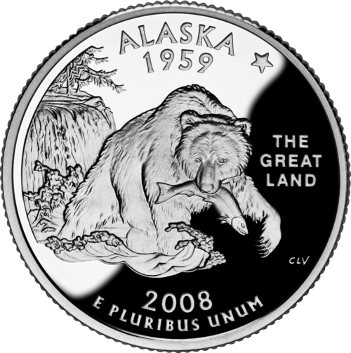 2008年にリリース | |

アラスカの国境を示すインタラクティブ マップ (クリックして拡大)
アラスカ( / ə ˈ l æ s k ə / Alaska,ALSA)は、アメリカ合衆国の州一つ 北アメリカ大陸の北西端にアメリカ合衆国西部に位置する。アメリカ合衆国の他の州で隣接していないのはハワイ州。アラスカは、アメリカ合衆国の最北、最西、最東(アリューシャン列島は180度子午線東半球に入る)にある州でもある。東はカナダ領のユーコンとブリティッシュコロンビア州。西の海上国境はベーリング海峡のチュクチ自治管区と。北極海チュクチとボーフォート海、太平洋半飛び地であり、世界最大の飛び地である。
アラスカ州は面積で米国最大の州であり、テキサス州、カリフォルニア州、モンタナ州の面積を合わせたよりも広い。また、世界で6番目に大きな地方行政区画である。アラスカは米国で3番目に人口が少なく、最も人口がまばらな州であるが、 2020年時点で人口736,081人で、北緯60度線以北に位置する大陸で最も人口の多い地域であり、カナダ北部とグリーンランドの人口を合わせた4倍以上である。[6] 州都ジュノーを含む、面積で米国最大の4つの都市がこの州にある。州内で最も人口の多い都市はアンカレッジで、アラスカ州の住民の約半数がその都市圏に住んでいる。
アラスカには数千年も前から先住民が暮らしており、この地域はベーリング海峡を経由した北米への最初の入植地の入り口となったと広く信じられている。ロシア帝国は18世紀からこの地域を積極的に植民地化し、最終的に現在の州の大部分を占めるロシア領アメリカを設立し、先住民のアラスカ・クレオール人の人口を育成・維持した。[7]この遠隔地の領有地を維持するための費用と物流上の困難さから、 1867年に720万ドル(2023年の1億5700万ドルに相当)で米国に売却された。この地域はいくつかの行政上の変更を経て、 1912年5月11日に準州として組織された。1959年1月3日、米国の49番目の州として認められた。[8]
アラスカは、州経済が最も小さい州の一つであるにもかかわらず、豊富な天然資源のおかげで一人当たりの所得が最も高い州の一つとなっており、商業漁業、天然ガスと石油の採掘がアラスカの経済を支配している。米軍基地と観光業も経済に貢献しており、州の半分以上は国有地で、国有林、国立公園、野生生物保護区がある。アラスカは最も無宗教な州の一つであり、娯楽用マリファナを最初に合法化した州の一つであり、自由主義的な政治文化で知られ、国政選挙では一般的に共和党を支持している。アラスカの先住民人口は、全米の州の中で2番目に多く、15%を超え、ハワイに次いで多い。[9]
語源
「アラスカ」(ロシア語:Аля́ска、ローマ字: Aljáska)という名前は、ロシア植民地時代にアラスカ半島を指すために使われました。これは、アリュート語の 慣用句「 alaxsxaq 」に由来しており、「本土」、より正確には「海の作用が向けられる対象」を意味します。[10] [11] [12]
歴史
植民地化以前
ヨーロッパ人が到着する以前、数千年にわたりアラスカには数多くの先住民が住んでいた。ここで行われた言語学およびDNA研究により、北アメリカへの入植はベーリング地峡を経由して行われたという証拠が得られている。[13] [14]アラスカ州タナナ渓谷のアップワードサンリバー遺跡では、生後6週間の乳児の遺骨が発見された。乳児のDNAは、彼女が更新世末期に新世界に存在した他の先住民グループとは遺伝的に異なる集団に属していたことを示した。2013年にアップワードサンリバー遺跡で遺骨を発掘したアラスカ大学フェアバンクス校の考古学者ベン・ポッターは、この新しいグループを古代ベーリング人という名前で呼んだ。[15]
トリンギット族は、現在のアラスカ南東部、ブリティッシュコロンビア州、ユーコン準州の一部に、母系血縁社会を形成し、財産の相続と血統を継承した。また、南東部には、現在では独自の芸術で知られるハイダ族も住んでいた。チムシアン族は、1887年にブリティッシュコロンビア州からアラスカ州に移住し、グロバー・クリーブランド大統領、後に米国議会によってアネット島への定住許可が下り、アラスカ州メトラカトラの町を建設した。これら3つの民族、および太平洋岸北西海岸の他の先住民族は、 18世紀後半から19世紀半ばにかけて天然痘の流行を経験し、最も壊滅的な流行は1830年代と1860年代に発生し、多くの死者と社会の混乱を招いた。[16]
植民地化

研究者の中には、アラスカに最初のロシア人居住地が築かれたのは17世紀だと考える者もいる。[17]この仮説によれば、1648年にセミョン・デジニョフの探検隊のコチェ数人がアラスカに上陸し、この居住地を築いたという。この仮説は、 1764年から1765年にアラスカを訪れ、クヴェレン川沿いの「ヒゲを生やした男たち」が「偶像に祈りを捧げる」村について報告したチュクチの地理学者ニコライ・ダウルキンの証言に基づいている。現代の研究者の中には、クヴェレンをコユク川と関連づける者もいる。[18]
アラスカに到達した最初のヨーロッパ船は、シベリア・コサックのAFシェスタコフとロシア人探検家ドミトリー・パヴルツキー(1729-1735)の遠征中、1732年8月21日に測量士MSグヴォズデフと航海士補I.フョードロフの指揮下で到着したセント・ガブリエル号であると一般に考えられている。[19]ヨーロッパ人とアラスカのもう一つの接触は1741年、ヴィトゥス・ベーリングがロシア海軍の遠征隊を率いてセント・ペーター号に乗船した時である。彼の乗組員が世界最高級の毛皮とされたラッコの毛皮を持ち帰った後、毛皮商人の小さな団体がシベリアの海岸からアリューシャン列島に向けて航海を始めた。ヨーロッパ人による最初の恒久的な入植地は1784年に設立された。
1774年から1800年にかけて、スペインは太平洋北西部に対する領有権を主張するためアラスカに数回の遠征隊を派遣した。1789年、ヌートカ湾にスペインの入植地と砦が建設された。これらの遠征隊は、バルディーズ、ブカレリ湾、コルドバなどの地名をもたらした。その後、露米会社が19世紀初頭から中期にかけて、拡張された植民地化計画を実行した。現在のアラスカ南東部にあるアレクサンダー諸島のバラノフ島にあったシトカは、1804年から1867年までニューアークエンジェルと改名され、ロシア領アメリカの首都となった。植民地が米国に移管された後も、ここは首都であり続けた。ロシア人はアラスカを完全には植民地化せず、植民地は決して利益を生むことはなかった。ロシア人の入植の証拠は、アラスカ南東部全体に名前や教会の中に残っている。
1867年、アンドリュー・ジョンソン大統領の下でアメリカ合衆国国務長官を務めたウィリアム・H・スワードは、ロシアと720万ドルでアラスカ購入(軽蔑的にスワードの愚行と呼ばれた)の交渉を行った。 [20]ロシアの当時の統治者、ロシア帝国皇帝、ポーランド王、フィンランド大公でもあったアレクサンドル2世もこの売却を計画し、[21]購入は1867年3月30日に行われた。6ヵ月後、委員がシトカに到着し、正式な引き渡しが手配された。正式な国旗掲揚は1867年10月18日にシトカ砦で行われた。式典では、250人の制服を着た米兵が「キャッスル・ヒル」にある知事官邸まで行進し、そこでロシア軍がロシア国旗を降ろし、米国国旗を掲揚した。
アラスカは当初、軍によって緩やかに統治され、 1884年からは地区として管理され、知事は米国大統領によって任命された。連邦地方裁判所はシトカに本部があった。アラスカが米国旗の下にあった最初の10年間の大半、シトカはアメリカ人入植者が住む唯一のコミュニティだった。彼らは「暫定市政府」を組織したが、これはアラスカ初の市政府であったが、法的な意味ではなかった。[22]アラスカのコミュニティが合法的に市として法人化することを許可する法律は1900年まで制定されず、都市の自治は1959年に州として発効するまで非常に制限されていたか、利用できなかった。
米国の領土編入
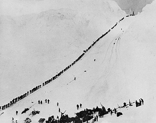
1890年代に始まり、場所によっては1910年代初頭まで続いたアラスカと近隣のユーコン準州でのゴールドラッシュにより、何千人もの鉱夫と開拓者がアラスカにやって来た。1879年から1920年にかけて、アラスカは累計で4億6千万ドル(インフレ調整後66億9192万7500ドル)以上の鉱物を生産した。[23] アラスカは1912年に正式に組織化された準州となった。1906年までシトカにあったアラスカの首都は、北のジュノーに移された。同年にアラスカ州知事公邸の建設が始まった。ノルウェーとスウェーデンからのヨーロッパ移民もアラスカ南東部に定住し、漁業と林業に参入した。

第二次世界大戦中、アリューシャン列島作戦はアッツ島、アガッツ島、キスカ島に集中していたが、いずれも日本帝国が占領していた。[a]日本軍の占領中、アッツ島とキスカ島でそれぞれアメリカ人民間人1名と米海軍隊員2名が死亡し、約50名のアリュート人の民間人と8名の船員が日本に抑留された。アリュート人の約半数が抑留期間中に死亡した。[24] ウナラスカ/ダッチハーバーとアダック島は、米陸軍、米陸軍航空隊、米海軍の重要な基地となった。米国のレンドリース計画では、アメリカの軍用機をカナダを経由してフェアバンクス、さらにノームまで飛ばし、ソ連のパイロットがこれらの航空機を接収して、ドイツのソ連侵攻と戦うために輸送した。軍事基地の建設は、アラスカのいくつかの都市の人口増加に貢献した。
州の地位

アラスカの州昇格は、ジェームズ・ウィッカーシャムが下院議員に就任した当初から重要な課題でした。数十年後、1946 年の領土住民投票の後、州昇格運動は初めて本格的に勢いを増しました。その後すぐに、アラスカ州昇格委員会とアラスカ憲法制定会議が開かれました。州昇格支持者は、主に米国議会だけでなくアラスカ州内でも、政敵との大きな戦いを繰り広げました。1958 年 7 月 7 日に米国議会で州昇格が承認され、1959 年 1 月 3 日にアラスカが正式に州として宣言されました。
聖金曜日の地震
1964年3月27日、大規模な聖金曜日地震が発生し、主に津波と地滑りによって133人が死亡し、いくつかの村と沿岸部の大きなコミュニティの一部が破壊された。この地震は記録上4番目に強い地震で、モーメントマグニチュードは9.2( 1989年のサンフランシスコ地震の1000倍以上)であった。[25]時刻(午後5時36分)、季節(春)、震源地の場所はすべて、特にアンカレッジで数千人の命を救った可能性のある要因として挙げられている。アラスカは1585年7月11日にマグニチュード9.25と推定されるより深刻な巨大地震に見舞われ、これは北米史上最大、世界史上 2番目に強い地震として記録されている。
聖金曜日の地震は4分38秒続いた。600マイル(970 km)の断層が一度に破壊され、最大60フィート(18 m)移動し、約500年分の応力蓄積が解放された。土壌の液状化、亀裂、地滑り、その他の地盤崩壊により、いくつかのコミュニティで大きな構造的損傷が発生し、財産にも大きな損害が発生した。アンカレッジでは、特にニックアーム沿いのいくつかの地滑り地帯で、地震対策が不十分な多くの家屋、建物、インフラストラクチャ(舗装された道路、歩道、水道本管と下水道本管、電気システム、その他の人工設備)が大きな破壊または損傷を受けた。南西200マイル(320 km)では、コディアック近郊の一部地域が30フィート(9 m)恒久的に隆起した。アンカレッジの南東、ガードウッドとポーテージ付近のターナゲイン・アーム源流周辺の水位は8フィート(2.4メートル)も下がり、スワード・ハイウェイを新たな高潮線より高くするために再建と埋め立てが必要となった。
プリンスウィリアム湾では、ポートバルディーズで大規模な海底地滑りが発生し、バルディーズ市の港と埠頭の崩壊と、当時停泊していた船の乗組員の死者合わせて32人が死亡した。近くでは、高さ27フィート(8.2メートル)の津波がチェネガ村を破壊し、住民68人のうち23人が死亡した。生存者は波を逃れて高台に登った。地震後の津波は、ウィッティア、スワード、コディアックなどアラスカ州のコミュニティ、ブリティッシュコロンビア州、ワシントン州、オレゴン州、カリフォルニア州の人々と財産に深刻な被害を及ぼした。[26]津波はハワイと日本でも被害をもたらした。地震に直接関連する動きの証拠はフロリダ州とテキサス州からも報告されている。
アラスカ州は、人口密集地域での大災害を経験したことがなく、そのような災害の影響に対処するための資源は非常に限られていました。アンカレッジでは、地質学者リディア・セルクレッグの要請により、アンカレッジ市とアラスカ州住宅局が、地震による市の被害を評価するために、地質学者、土壌科学者、エンジニアを含む40人の科学者のチームを任命しました。[27]エンジニアリングおよび地質評価グループと呼ばれるこのチームは、アラスカ大学アンカレッジ校の地質学教授ルース・A・M・シュミットが率いていました。科学者チームは、すぐに再建を望んでいた地元の開発業者やダウンタウンのビジネスオーナーと対立しました。科学者たちは、再建されたインフラが安全であることを保証するために、将来の危険性を特定したいと考えていました。[28]チームは、地震からわずか1か月余り後の1964年5月8日に報告書を作成しました。[27] [29]
アラスカに大規模な活動拠点を置いているアメリカ軍も、地震終息後すぐに支援に踏み切った。アメリカ陸軍は、アメリカ本土48州との通信を速やかに復旧し、アンカレッジ市民支援のために部隊を派遣し、バルディーズに車列を派遣した。[30]軍と民間指導者の助言を受けて、リンドン・B・ジョンソン大統領は地震の翌日、アラスカ全土を大規模被災地域と宣言した。アメリカ海軍とアメリカ沿岸警備隊は、孤立した沿岸のコミュニティに船を派遣し、緊急のニーズに応えた。地震翌日は悪天候と視界不良のため航空救助と観測活動が妨げられたが、29日の日曜日には状況が改善し、救助ヘリコプターと観測機が派遣された。[30]軍の空輸は直ちにアラスカへの救援物資の輸送を開始し、最終的に257万ポンド(117万kg)の食糧とその他の物資を届けた。[31]放送ジャーナリストのジーニー・チャンスは、アンカレッジの公共安全ビル内の臨時ポストから、アンカレッジ上空のKENI放送に24時間以上連続して出演し、平穏の声として復旧と救援活動を支援しました。 [32]彼女は市の警察署長から事実上、公共安全担当官に任命されました。[32]チャンスは、マグニチュード9.2の地震後に発生した壊滅的な出来事の速報を提供し、公共安全局の声として対応活動を調整し、利用可能なリソースを地域のニーズに結び付け、避難所や調理済み食糧配給に関する情報を広め、愛する人々の間で安否を伝え、家族の再会を支援しました。[33]
長期的には、米国陸軍工兵隊が道路の再建、瓦礫の撤去、完全に破壊されたコミュニティのための新しい町の建設を主導し、費用は1億1千万ドルに上った。[31]西海岸およびアラスカ津波警報センターは、災害への直接的な対応として設立された。連邦災害救援基金は、再建費を賄うとともに、アラスカ政府の荒廃したインフラを財政的に支援し、プルドー湾で大規模な石油埋蔵量が発見されるまで、アラスカの財政を支えた数億ドルを費やした。米国国防総省の命令により、アラスカ州兵は将来のあらゆる災害に対応するためにアラスカ緊急サービス部を設立した。[30]
石油ブーム
1968 年にプルドー湾で石油が発見され、1977 年にトランスアラスカパイプラインシステムが完成すると、石油ブームが起こりました。石油からのロイヤルティ収入は、1980 年以降、州の予算の大きな部分を賄ってきました。
アラスカの土地の経済的価値は石油生産だけではなかった。20世紀後半、アラスカは観光業が重要な収入源であることに気付いた。観光業が人気になったのは、第二次世界大戦後、この地域に駐留していた軍人が故郷に戻り、その自然の素晴らしさを賞賛したためである。戦争中に建設されたアルカンハイウェイと1963年に完成したアラスカ海上ハイウェイシステムにより、アラスカは以前よりもアクセスしやすくなった。観光業はアラスカでますます重要になり、今日では毎年140万人以上が同州を訪れている。[34]
観光業が経済にとってより重要になるにつれ、環境保護も重要性を増した。1980年のアラスカ国有地保護法(ANILCA)により、国立野生生物保護区システムに5370万エーカー(217,000 km 2 )、国立野生および景観河川システムに25の河川の一部、国有林地に330万エーカー(13,000 km 2) 、国立公園地に4360万エーカー(176,000 km 2)が追加されました。この法律により、現在アラスカにはアメリカの国立公園の3分の2が含まれています。今日、アラスカの土地の半分以上は連邦政府が所有しています。[35]
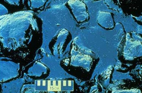
1989年、エクソン・バルディーズ号がプリンス・ウィリアム湾の岩礁に衝突し、 1,100万ガロン(42メガリットル)以上の原油が1,100マイル(1,800キロメートル)の海岸線にわたって流出した。今日、開発哲学と保全哲学の争いは、北極圏国立野生生物保護区での石油掘削とペブル鉱山計画をめぐる激しい論争に表れている。
地理
北アメリカの北西端に位置するアラスカは、アメリカ合衆国の最北端かつ最西端の州であるが、アリューシャン列島が東半球にまで伸びているため、アメリカ合衆国で最も東の経度に位置している。[36]アラスカは、北アメリカ大陸で唯一、アメリカ合衆国の州として隣接していない州である。アラスカとワシントン州は、カナダのブリティッシュコロンビア州を含む約500マイル (800 km) のカナダ領土で隔てられている。厳密にはアメリカ合衆国本土の一部であるが、口語的な用語としては通常含まれず、アラスカは「下48州」と呼ばれることが多いアメリカ合衆国本土の一部ではない。州都ジュノーは、北アメリカ大陸の本土に位置するが、北米の他の高速道路網とは道路でつながっていない。アラスカ最大の湖はイリアムナ湖である。
アラスカ州は東にカナダのユーコン準州とブリティッシュコロンビア州(カナダ領土とのみ接する唯一の州)と接しており、南と南西はアラスカ湾と太平洋、西はベーリング海、ベーリング海峡、チュクチ海、北は北極海に面している。アラスカの領海はベーリング海峡でロシアの領海と接しており、ロシアのビッグダイオミード島とアラスカのリトルダイオミード島はわずか3マイル(4.8km)しか離れていない。アラスカの海岸線は米国の他のすべての州を合わせたよりも長い。[37]

アラスカは総面積が663,268平方マイル(1,717,856 km 2)で、米国で群を抜いて最大の州です。アラスカは米国で2番目に大きい州(テキサス州)の2倍以上の大きさで、次に大きい3つの州(テキサス、カリフォルニア、モンタナ)を合わせたよりも大きいです。アラスカは世界で7番目に大きい地方行政区画です。独立国であれば、世界で18番目に大きい国となり、イランとほぼ同じ大きさになります。
アラスカには無数の島があり、潮汐の影響を受ける海岸線はおよそ 34,000 マイル (55,000 km) あります。アリューシャン列島はアラスカ半島の南端から西に伸びています。アリューシャン列島と沿岸地域には多くの活火山があります。たとえば、ユニマック島にはシシャルディン山があります。シシャルディン山は北太平洋から 10,000 フィート (3,000 m) の高さまでそびえ立ち、時折くすぶる火山です。この火山列は本土のアンカレッジの西にあるスパー山まで伸びています。地質学者はアラスカを、活発に大陸形成が起こっている太平洋岸北西部の複数の州とカナダの州からなる広大な地域であるランゲリアの一部であると特定しています。
世界最大級の潮汐の一つは、アンカレッジのすぐ南にあるターナゲイン・アームで発生し、潮位差は35フィート(10.7メートル)以上になることがあります。[38]
アラスカには、少なくとも1ヘクタール以上の自然湖が409,000以上あります。 [39]湿地帯と湿地の永久凍土は188,320平方マイル(487,700 km 2)を覆っています(主に北部、西部、南西部の平原にあります)。氷河の氷はアラスカの約28,957平方マイル(75,000 km 2)を覆っています。[40]ベーリング氷河は北米最大の氷河で、単独で2,008平方マイル(5,200 km 2)を覆っています。[41]
地域
アラスカのさまざまな地域を区切る公式に定義された境界はありませんが、州は一般的に次の 5 つまたは 6 つの地域に分けられます。
南中央
アラスカで最も人口の多い地域は、アンカレッジ、マタヌスカ・スシトナ渓谷、キーナイ半島です。アラスカ山脈の南とランゲル山脈の西にある田舎でほとんど人が住んでいない地域も、プリンスウィリアム湾地域やコルドバとバルディーズのコミュニティと同様に、南中央部の定義に含まれます。[42]
南東
パンハンドルまたはインサイド・パッセージとも呼ばれるこの地域は、アラスカ州に最も近い。そのため、アラスカ購入後の数年間に、最初の非先住民の入植地のほとんどがここで発生した。この地域の大部分は、アレキサンダー諸島と、米国最大の国有林であるトンガス国有林である。州都ジュノー、旧州都シトカ、かつてアラスカ最大の都市であったケチカンがある。 [43]アラスカ・マリン・ハイウェイは、地域と国全体に重要な陸上輸送リンクを提供しており、隣接する北米の道路網に直接接続しているのは、ヘインズ、ハイダー、スカグウェイの3つのコミュニティのみである。[44]
インテリア

内陸部はアラスカ州最大の地域で、その多くは無人の荒野です。フェアバンクスはこの地域で唯一の大都市です。デナリ国立公園と自然保護区はここにあります。デナリ(旧称マッキンリー山) は北米最高峰で、ここにあります。
ノーススロープ
ノーススロープは主にツンドラで、小さな村が点在している。この地域は原油の埋蔵量が豊富であることで知られ、アラスカ国立石油備蓄とプルドーベイ油田の両方がある。[45]かつてバローと呼ばれていたウトキアグヴィク市は、米国最北端の都市で、ここに位置している。コッツェビューを中心とし、コブック川渓谷も含む北西北極圏地域は、この地域の一部とみなされることが多い。ノーススロープと北西北極圏のそれぞれのイヌピアットは、自分たちが一つの民族であるとはほとんど考えていない。[46]
南西
アラスカ南西部は、ベーリング海から内陸に約 500 マイル (800 km) 広がる、人口の少ない地域です。住民のほとんどは海岸沿いに住んでいます。コディアック島も南西部にあります。世界最大の河川デルタの 1 つである、広大なユーコン・クスコクウィム デルタもここにあります。アラスカ半島の一部は南西部の一部と見なされており、アリューシャン列島もしばしば (常にではありませんが) 南西部に含められます。
アリューシャン列島
.png/500px-Aleutian_Islands_with_180th_meridian_and_International_Date_Line_(cropped).png)
アリューシャン列島は、経済的にグループ化されると主にアラスカ南西部の一部となるが、大陸から地理的に離れているため、この地域の他の地域とは別のグループとして認識されることもある。300を超える小さな火山島がこの島列を構成し、太平洋に向かって1,200マイル(1,900 km)以上伸びている。これらの島のいくつかは東半球に位置するが、州全体、ひいては北米大陸全体を同じ法定日内に収めるために、国際日付変更線が180°より西に引かれている。アッツ島とキスカ島の2つの島は、第二次世界大戦中に日本軍に占領された。
土地所有権
アメリカ合衆国土地管理局の1998年10月の報告書によると、アラスカの約65%は、多数の国有林、国立公園、国立野生生物保護区を含む公有地として米国連邦政府によって所有および管理されています。[47]これらのうち、土地管理局は8,700万エーカー(3,500万ヘクタール)を管理しており、これは州の23.8%に相当します。北極国立野生生物保護区は、米国魚類野生生物局によって管理されています。これは、1,600万エーカー(650万ヘクタール)を占める世界最大の野生生物保護区です。
残りの土地のうち、アラスカ州は 1 億 100 万エーカー (4,100 万ヘクタール) を所有しており、これはアラスカ州法に基づいて認められたものです。その土地の一部は、新しく設立された自治区に関する法定条項に基づき、上記の組織化された自治区に時折譲渡されます。より小さな部分は、農村部の区画割りやその他開拓関連の機会のために確保されています。これらは、多くの場合、遠隔地で道路のない場所にあるため、あまり人気がありません。アラスカ大学は、土地付与大学として、独自に管理しているかなりの土地を所有しています。
残りの 4,400 万エーカー (1,800 万ヘクタール) は、 1971 年のアラスカ先住民権利和解法(ANCSA)に基づいて設立された 12 の地域および多数の地元先住民企業によって所有されています。地域先住民企業 Doyon, Limited は、広告やその他のコミュニケーションで、アラスカ最大の民間土地所有者として自社を宣伝することがよくあります。1991 年以降、企業の土地保有を公開市場で売却することを許可した ANCSA の条項は、発効する前に廃止されました。実質的に、企業は所有権 (多くの場合、地下所有権を含むが、これはアラスカの個人には認められていない特権) を保有していますが、土地を売却することはできません。個々の先住民の割り当ては公開市場で販売されます。
残りの土地はさまざまな民間企業が所有しており、その総面積は州の約 1 パーセントに相当します。アラスカは、先住民企業の所有地を除いた場合、民間の土地所有率が最も低い州です。
アラスカ遺産資源調査
アラスカ文化遺産調査(AHRS)は、アメリカ合衆国アラスカ州内にあるすべての歴史的および先史時代の遺跡の限定的な目録であり、歴史考古学局によって管理されています。調査の文化資源目録には、50年以上前のものであるという一般的な規定のもと、物体、構造物、建物、遺跡、地区、移動路が含まれています。2012年1月31日現在、35,000以上の遺跡が報告されています。[48][update]
都市、町、自治区
.jpg/500px-Aerial_view_of_Fairbanks_Alaska_skyline_(Quintin_Soloviev).jpg)


アラスカ州は、他のアメリカの州の多くと違って郡に分かれておらず、行政区に分かれている。[49]アラスカ憲法制定会議の代表者たちは、伝統的な郡制度の落とし穴を避けたいと考え、独自のモデルを採用した。[50]州内で人口密度の高い地域の多くは、アラスカの16の行政区の一部であり、他の州の郡と似た機能を果たしている。他の州の郡に相当するものとは異なり、行政区は州全体の陸地面積をカバーしていない。どの行政区にも属さない地域は、未編入行政区と呼ばれる。
未編入自治区には独自の政府はありませんが、米国国勢調査局は州と協力して、統計分析と発表のみを目的として、未編入自治区を 11 の国勢調査地域に分割しました。記録地区は、アラスカ州の公的記録を管理するための仕組みです。州は 34 の記録地区に分かれており、州の記録官によって集中管理されています。すべての記録地区は、公的記録への文書の受理に関して、同じ受理基準、料金表などを使用します。
米国の多くの州が州/郡/郡区の3層地方分権制度を採用しているのに対し、アラスカの大部分は州/自治区の2層のみを採用している。人口密度が低いため、土地の大半は未編入自治区に位置している。その名の通り、中間の自治区政府は存在せず、州政府によって直接管理されている。2000年には、アラスカの57.71%の面積がこのステータスにあり、人口の13.05%が未編入自治区に住んでいる。[51]
アンカレッジは 1975 年に市政府とグレーター アンカレッジ地域自治区を合併してアンカレッジ自治体を形成し、市本体とイーグル リバー、チュギアック、ピーターズ クリーク、ガードウッド、バード、インディアンの各コミュニティを包含しています。フェアバンクスには別の自治区 (フェアバンクス ノース スター自治区) と自治体 (フェアバンクス市) があります。
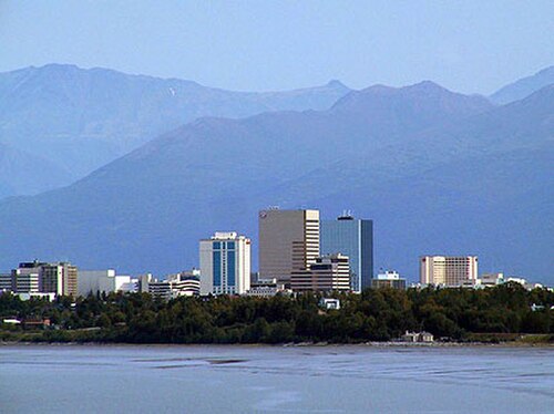
州内で最も人口の多い都市はアンカレッジで、2020年には291,247人が住んでいました。 [52]アラスカ州で一人当たりの収入が最も豊かな場所はデナリ(42,245ドル)です。ヤクタットシティ、シトカ、ジュノー、アンカレッジは、面積で米国最大の4都市です。
都市および国勢調査指定地域(人口順)
2020年の米国国勢調査によると、アラスカ州には合計355の法人化された都市と国勢調査指定地域(CDP)がある。[53]都市の数には、基本的に統合された市郡に相当する4つの統合自治体が含まれている。これらのコミュニティの大部分は、「ブッシュ」として知られるアラスカの田園地帯に位置しており、その連続した北米の道路網とは接続されていない。このセクションの下部にある表には、アラスカ州の人口順に、最大の都市と国勢調査指定地域のトップ100が記載されている。
2020年の米国国勢調査によると、アラスカ州の人口は733,391人であり、そのうち16,655人、つまり人口の2.27%は法人化された都市や国勢調査指定地域に住んでいなかった。[52]その数字の約4分の3は、ケチカン、コディアック、パーマー、ワシラの市域外にある都市部や郊外の地域に住んでいる人々である。米国国勢調査局はこれらの地域にCDPを設定していないが、1980年の国勢調査ではケチカン地域の地域に7つのCDPが設定されていた(クローバーパス、ヘリングコーブ、ケチカンイースト、マウンテンポイント、アラスカ州道7号線、ペノック島、サックスマンイースト)が、それ以降は使用されていない。残りの人口は、アラスカ州全体に、組織化された自治区内と未組織自治区の両方で、主に遠隔地に散在していた。
気候

アラスカは米国で最も寒い州である。[55] アラスカ南部および南東部は中緯度海洋性気候(ケッペンの気候区分:Cfb)で、北部は亜北極海洋性気候(ケッペンのCfc)で、夏は涼しく、冬は比較的穏やかである。年間ベースで見ると、南東部はアラスカで最も雨が多く暖かい地域で、冬は気温が穏やかで、年間を通じて降水量が多い。ジュノーでは年間平均50インチ(130 cm)以上、ケチカンでは150インチ(380 cm)以上である。[56]ここは、冬季の日中の平均最高気温が氷点以上となるアラスカで唯一の地域でもある。

アンカレッジとアラスカ州南中央部の気候は、海岸に近いことからアラスカの基準からすると穏やかです。この地域はアラスカ州南東部よりも雨は少ないですが、雪が多く、晴天の日が多い傾向にあります。アンカレッジでは、年間平均降水量が 16 インチ (41 cm)、積雪量は約 75 インチ (190 cm) ですが、南中央部にはそれよりはるかに多くの雪が降る地域もあります。夏が短く涼しいため、 亜北極気候 (ケッペン: Dfc ) に属します。
アラスカ西部の気候は、ベーリング海とアラスカ湾によって大きく左右される。南西部は亜北極海洋性気候、それより北は大陸性亜北極気候である。気温は、この地域が北にあることを考えるとやや穏やかである。この地域の降水量は非常に多様である。スワード半島の北側からコバック川渓谷まで広がる地域(つまり、コッツェビュー湾周辺の地域)は、技術的には砂漠であり、年間降水量が10インチ(25 cm)未満の場所もある。その一方で、ディリンガムとベセルの間のいくつかの場所では、平均降水量が約100インチ(250 cm)である。[57]
アラスカ内陸部の気候は亜北極性で、大陸性亜北極性気候の典型的な例であるが、いくつかの谷では気候が湿潤大陸性気候(ケッペンのDfb ) に近い。アラスカの最高気温と最低気温の一部は、フェアバンクス付近の地域で発生する。夏は暖かく (ただし通常は短い)、気温が華氏 90 度 (摂氏 30 度前半から半ば) に達することもあるが、長く非常に寒い冬には、気温が華氏 -60 度 (摂氏 -51 度) を下回ることもある。内陸部の降水量はまばらで、年間 10 インチ (25 cm) 未満になることも多いが、冬に降った降水量は冬の間中続く傾向がある。
アラスカで記録された最高気温と最低気温は、どちらも内陸部です。最高気温は、1915年6月27日にフォートユーコン(北極圏からわずか8マイル(13km)内側)で記録された100 °F(38 °C)で、[58] [59]アラスカはハワイと並んで米国で最も気温の低い州となりました。[60] [61]アラスカの公式最低気温は、1971年1月23日にプロスペクトクリークで記録された−80 °F(−62 °C)で、 [58] [59]北米大陸(カナダのユーコン準州スナッグ)で記録された最低気温より1度高い
アラスカの北端、ブルックス山脈の北側の気候は北極圏気候(ケッペンの気候区分ではET )で、冬は長く非常に寒く、夏は短くて涼しい。7月でも、ウトキアグヴィクの平均最低気温は34°F(1°C)である。[63]アラスカのこの地域の降水量は少なく、多くの場所で年間平均10インチ(25cm)未満で、ほとんどが雪となり、ほぼ一年中地面に残る。
動物相
人口統計
アメリカ合衆国国勢調査局は、 2020年の国勢調査で、アラスカ州の人口は2020年4月1日時点で733,391人で、2010年の国勢調査から3.3%増加したことを明らかにした。[6] 2010年の国勢調査によると、アメリカ合衆国アラスカ州の人口は710,231人で、2000年の国勢調査の626,932人から13.3%増加した。
2020年、アラスカ州の人口は48番目に多く、バーモント州とワイオミング州に次ぐ規模であった。[67]アラスカ州は人口密度が最も低く、世界で最も人口がまばらな地域の一つで、1平方マイルあたり1.2人(0.46人/km 2)である。次のワイオミング州は1平方マイルあたり5.8人(2.2人/km 2)である。[68]アラスカ州は面積で圧倒的に米国の州であり、10番目に裕福(一人当たりの所得)である。[69] 2018年現在、人口規模が大きいため、電話の市外局番が[update]まだ1つしかない米国の14州のうちの1つである。[70]
HUDの2022年ホームレス評価報告書によると、アラスカ州には推定2,320人のホームレスがいる。[71] [72]
人種と民族


2019年のアメリカ人コミュニティ調査では、人口の60.2%が非ヒスパニック系白人、3.7%が黒人またはアフリカ系アメリカ人、15.6%がアメリカインディアンまたはアラスカ先住民、6.5%がアジア人、1.4%がハワイ先住民とその他の太平洋諸島民、7.5%が2つ以上の人種、7.3%がヒスパニックまたはラテンアメリカ人(人種を問わず)と推定されています。調査推定では、2015年から2019年までの総人口の7.8%が外国生まれでした。[77] 2015年には、61.3%が非ヒスパニック系白人、3.4%が黒人またはアフリカ系アメリカ人、13.3%がアメリカインディアンまたはアラスカ先住民、6.2%がアジア人、0.9%がハワイ先住民とその他の太平洋諸島民、0.3%がその他の人種、7.7%が混血でした。 2015年にはヒスパニック系とラテンアメリカ人は州人口の7%を占めた。 [78] 2015年から2019年まで、ヒスパニック系とラテンアメリカ人の最大のグループはメキシコ系アメリカ人、プエルトリコ人、キューバ系アメリカ人だった。州に住むアジア系最大のグループはフィリピン人、韓国系アメリカ人、日本人と中国人のアメリカ人だった。[79]
2010年の州民構成は、白人が66.7%(非ヒスパニック系白人が64.1%)、アメリカインディアンとアラスカ先住民が14.8%、アジア人が5.4%、黒人またはアフリカ系アメリカ人が3.3%、ハワイ先住民とその他の太平洋諸島民が1.0%、その他の人種が1.6%、2つ以上の人種が混在が7.3%であった。2010年のヒスパニック系またはラテンアメリカ人は、あらゆる人種で人口の5.5%を占めた。[80] 2011年の時点で[update]、アラスカの1歳未満の人口の50.7%は少数民族(つまり、両親が非ヒスパニック系白人ではない)に属していた。[81] 1960年の米国国勢調査局の報告によると、アラスカの人口は白人が77.2%、黒人が3%、アメリカインディアンとアラスカ先住民が18.8%であった。[82]
2018年、アラスカへの移民の出身国上位はフィリピン、メキシコ、カナダ、タイ、韓国でした。[83]
言語
2011年のアメリカコミュニティ調査によると、5歳以上の83.4%の人が家庭で英語のみを話していました。約3.5%が自宅でスペイン語を話し、2.2%が他のインド・ヨーロッパ語族の言語を話し、約4.3%がアジアの言語(タガログ語を含む)を話し、[84]約5.3%が自宅で他の言語を話していました。[85] 2019年のアメリカコミュニティ調査では、83.7%が英語のみを話し、16.3%が英語以外の言語を話していたことがわかりました。英語に次いで最も話されているヨーロッパの言語はスペイン語で、州人口の約4.0%が話しています。アジアと太平洋諸島の言語を合わせると、アラスカ州の5.6%が話していました。[86] 2010年以来、アラスカ州民の合計5.2%が州の20の先住民言語の1つを話しており、[87]地元では「ネイティブ言語」と呼ばれています。
アラスカ大学フェアバンクス校のアラスカ先住民言語センターは、アラスカには少なくとも20の先住民言語が存在し、方言の異なる言語もいくつかあると主張している。[88]アラスカの先住民言語のほとんどは、エスキモー・アレウト語族またはナ・デネ語族に属しているが、一部の言語は孤立言語(例:ハイダ語)またはまだ分類されていない(例:チムシア語)と考えられている。[88] 2014年時点で、アラスカの先住民言語のほぼすべてが、絶滅危惧言語、移行言語、消滅危機言語、ほぼ絶滅言語、休眠言語に分類されている。[89][update]
2014年10月、アラスカ州知事は、同州の20の先住民言語を公用語とすることを宣言する法案に署名した。[90] [91]この法案は、それらの言語を象徴的に公用語として認めたものの、政府内での公式使用には採用されていない。法案に含まれていた20の言語は以下の通り。
宗教

複数の調査でアラスカは最も無宗教な州の一つにランクされています。[93] [94]
南アンカレッジのチェンジポイント教会(左)と東アンカレッジのアンカレッジ・バプテスト教会(右)は、出席者数と会員数でアラスカ最大の教会です。
宗教データアーカイブ協会(ARDA)が2010年に収集した統計によると、アラスカ州住民の約34%が宗教団体のメンバーである。宗教人口のうち、およそ4%がモルモン教徒、0.5%がユダヤ教徒、0.5%がイスラム教徒、1%が仏教徒、0.2%がバハイ教徒、0.5%がヒンズー教徒であった。[95] 2010年の時点でアラスカ州で最大の宗教宗派は[update]、信者50,866人のカトリック教会、38,070人の無宗派福音派、32,170人の末日聖徒イエス・キリスト教会、19,891人の南部バプテスト連盟であった。 [96] [97]教会の会員数で言えば、アラスカ州はワシントン州やオレゴン州とともに、米国で最も宗教色の薄い州であるとされている。[98] [99]
ピュー研究所は2014年に、成人人口の62%がキリスト教を信仰していると判定した。キリスト教宗派のうち、カトリックが最大のキリスト教グループであった。プロテスタント宗派を合わせると、プロテスタントが最大のキリスト教の伝統であり、福音主義がプロテスタントグループ内で最大の運動であった。無宗教人口は37%で最大の非キリスト教宗教所属を占めた。無神論者は人口の5%を占め、最大の非キリスト教宗教は仏教であった。2020年、公共宗教研究所(PRRI)は、成人の57%がキリスト教徒であると判定した。[100] PRRIによると、2022年までにキリスト教は人口の77%に増加する。
2020年の宗教データアーカイブ協会によると、キリスト教人口は、73,930人の信者を擁する無宗派/超宗派のプロテスタントが最大のキリスト教集団であった。ローマカトリック教徒は40,280人で2番目に多かった。キリスト教人口全体では、無宗派のキリスト教徒の信者率は1,000人あたり100.81人、カトリック教徒は1,000人あたり54.92人であった。[101] 2014年のピュー研究所の調査によると、宗教は人口の41%にとって非常に重要であると考えられていたが、29%はやや重要であると考えていた。[102] 2014年にピュー研究所は、およそ55%が絶対的な確信を持って神を信じており、24%がかなり確信を持って信じていると判断した。 2020年のARDAの別の調査を反映して、2014年のピュー研究所の調査では、週1回宗教的な礼拝に出席している人が30%、月に1~2回が34%、めったに/まったく出席していない人が36%であることが示されました。[102] 2018年に、ゴスペル・コアリションはピュー研究所のデータを使用した記事を発表し、全国の非教会信者が宗教的な礼拝に頻繁に出席していない理由は、他の方法で信仰を実践していること、気に入った礼拝所が見つからないこと、説教が嫌いで歓迎されていないと感じること、ロジスティクスの問題であると判断しました。[103]
1795年、コディアックに最初のロシア正教会が設立された。アラスカ先住民との結婚は、ロシア移民が社会に溶け込むのに役立った。その結果、ますます多くのロシア正教会がアラスカ内に徐々に設立された。[104]アラスカはまた、どの州よりもクエーカー教徒の人口(割合で)が多い。 [105] 2009年、アラスカには6,000人のユダヤ人がいた(彼らにとってハラハーの遵守は特別な問題を引き起こす可能性がある)。[106]アラスカのヒンズー教徒は、シク教徒やジャイナ教徒を含む他のアジアの宗教コミュニティのメンバーと会場や祝賀行事を共有することがよくある。[107] [108] [109] 2010年、アラスカのヒンズー教徒はアラスカのスリガネーシャ寺院を設立し、アラスカで最初のヒンズー教寺院および世界最北のヒンズー教寺院となった。アラスカには推定2,000~3,000人のヒンズー教徒がいる。ヒンズー教徒の大多数はアンカレッジかフェアバンクスに住んでいます。
アラスカ州のイスラム教徒の数は2,000人から5,000人と推定されている。[110] [111] [112] 2020年、ARDAは州内に400人のイスラム教徒がいると推定した。[101]アンカレッジのイスラム教コミュニティセンターは、1990年代後半にアンカレッジにモスクを建設する取り組みを開始した。彼らは2010年にアンカレッジ南部で建物の建設に着手し、2014年後半には完成に近づいていた。完成したモスクは州で最初のモスクであり、世界でも最北端のモスクの一つであった。[113]バハイ教のセンターもあり、[114] 2020年には690人の信者がいた。 [101]さらに、 2020年にはヒンズー教とヨガの信者が合わせて469人で、少数の仏教徒もいた。
経済

2022年10月現在、アラスカ州の雇用者数は合計316,900人。雇用主事業所数は21,077社。[115]
2018年の州総生産は550億ドルで、全米48位。2018年の一人当たり個人所得は7万3000ドルで、全米7位。フェニックス・マーケティング・インターナショナルによる2013年の調査によると、アラスカは一人当たりの億万長者の数が全米で5番目に多く、その割合は6.75パーセントだった。[116]石油・ガス産業がアラスカ経済を支配しており、州の歳入の80パーセント以上が石油採掘によるものである。アラスカの主な輸出品(石油・天然ガスを除く)は魚介類で、主にサケ、タラ、ポロック、カニである。
農業はアラスカ経済のごく一部を占めています。農業生産は主に州内での消費を目的としており、苗木、乳製品、野菜、家畜などが含まれます。製造業は限られており、ほとんどの食料品や一般品は他国から輸入されています。
雇用は主に政府機関や、天然資源の採掘、船舶輸送などの産業で行われています。フェアバンクス ノース スター、アンカレッジ、コディアック島の各自治区、そしてコディアックでは、軍事基地が経済の重要な構成要素となっています。連邦政府の補助金も経済の重要な部分であり、州は税金を低く抑えることができます。工業生産は原油、天然ガス、石炭、金、貴金属、亜鉛、その他の鉱業、海産物加工、木材、木製品です。サービスと観光部門も成長しています。観光客は地元の宿泊施設を支援することで経済に貢献しています。
エネルギー

.png/500px-Alaska_crude_oil_production_in_1970_through_2020_(51140868890).png)
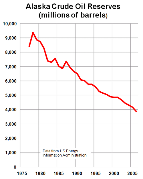
アラスカには膨大なエネルギー資源があるが、石油埋蔵量はほぼ枯渇している。主要な石油とガスの埋蔵量はアラスカ・ノーススロープ盆地(ANS)とクック入江盆地で発見されたが、米国エネルギー情報局によると、2014年2月までにアラスカはテキサス、ノースダコタ、カリフォルニアに次いで原油生産量で国内第4位に落ちた。[117] [118]アラスカのノーススロープにあるプルドー湾は今でも米国で2番目に産出量の多い油田で、通常は1日あたり約40万バレル(64,000 m 3 /日)を生産しているが、2014年初頭までにノースダコタのバッケン層は1日あたり90万バレル(140,000 m 3 /日)以上を生産していた。[119]プルドーベイ油田は北米で発見された最大の在来型油田であったが、カナダの巨大なアサバスカ油田よりもはるかに小規模であった。アサバスカ油田は2014年までに1日あたり約150万バレル(24万m3 /日)の非在来型石油を生産しており、その生産速度で数百年分の生産可能埋蔵量を誇っていた。[120]
トランスアラスカパイプラインは、 1日あたり最大210万バレル(33万m 3)の原油を輸送および汲み上げることができ、これは米国の他のどの原油パイプラインよりも多い。さらに、アラスカの瀝青炭、亜瀝青炭、および褐炭盆地には、相当量の石炭鉱床がある。米国地質調査所は、アラスカ北斜面の天然ガスハイドレートから、未発見で技術的に回収可能なガスが85.4兆立方フィート(2,420 km 3 )あると推定している。 [121]また、アラスカには多数の河川があり、国内で最も高い水力発電の可能性がある。アラスカの海岸線の広い範囲では、風力および地熱エネルギーの可能性がある。[122]
アラスカの経済は、暖房、輸送、電力、照明用のディーゼル燃料の価格が高騰し、それに大きく依存している。風力と水力発電は豊富で未開発であるが、州全体のエネルギーシステムの提案は、燃料価格が低い(1ガロンあたり50セント以下)、距離が長い、人口が少ないなどの理由で、(2001年の報告書の時点では)経済的ではないと判断された。[123]アラスカの都市部では、ガソリン1ガロンの価格は、通常、全国平均より30~60セント高い。農村部では、価格が一般にかなり高いが、輸送費、季節的な使用量のピーク、近くの石油開発インフラ、その他多くの要因によって大きく異なる。[124] [125]
恒久基金
アラスカ永久基金は憲法で認められた石油収入の充当であり、主に当時建設されたばかりのトランスアラスカパイプラインシステムを見越して、州の石油収入の余剰を管理するために1976年に有権者によって設立されました。この基金はもともと、 1969年のプルドーベイリース売却の前夜にキース・ミラー知事によって提案されました。これは、議会が売却の収益の全額(9億ドル)を一度に使い果たしてしまうことを恐れたためです。後にジェイ・ハモンド知事とキーナイ 州議会議員ヒュー・マローンによって支持されました。それ以来、通常は一般基金に預けられる収入を転用することで、魅力的な政治的展望となってきました。
アラスカ州憲法は、州の資金を特定の目的に充てることを禁じるように書かれている。永久基金は、創設当時の不信の政治風潮が主な理由で、この例外となった。当初の元本734,000ドルから、この基金は石油使用料と資本投資プログラムの結果、500億ドルにまで成長した。[126]元本のほとんど、あるいはすべてがアラスカ州外で慎重に投資されている。このため、アラスカの政治家は、基金がアラスカ州内で投資を行うよう頻繁に求めているが、そのような姿勢は一度も勢いを増していない。
Starting in 1982, dividends from the fund's annual growth have been paid out each year to eligible Alaskans, ranging from an initial $1,000 in 1982 (equal to three years' payout, as the distribution of payments was held up in a lawsuit over the distribution scheme) to $3,269 in 2008 (which included a one-time $1,200 "Resource Rebate"). Every year, the state legislature takes out 8% from the earnings, puts 3% back into the principal for inflation proofing, and the remaining 5% is distributed to all qualifying Alaskans. To qualify for the Permanent Fund Dividend, one must have lived in the state for a minimum of 12 months, maintain constant residency subject to allowable absences,[127] and not be subject to court judgments or criminal convictions which fall under various disqualifying classifications or may subject the payment amount to civil garnishment.
The Permanent Fund is often considered to be one of the leading examples of a basic income policy in the world.[128]
Cost of living
The cost of goods in Alaska has long been higher than in the contiguous 48 states. Federal government employees, particularly United States Postal Service (USPS) workers and active-duty military members, receive a Cost of Living Allowance usually set at 25% of base pay because, while the cost of living has gone down, it is still one of the highest in the country.[129]
Rural Alaska suffers from extremely high prices for food and consumer goods compared to the rest of the country, due to the relatively limited transportation infrastructure.[129]
Agriculture and fishing
Due to the northern climate and short growing season, relatively little farming occurs in Alaska. Most farms are in either the Matanuska Valley, about 40 miles (64 km) northeast of Anchorage, or on the Kenai Peninsula, about 60 miles (97 km) southwest of Anchorage. The short 100-day growing season limits the crops that can be grown, but the long sunny summer days make for productive growing seasons. The primary crops are potatoes, carrots, lettuce, and cabbage.
The Tanana Valley is another notable agricultural locus, especially the Delta Junction area, about 100 miles (160 km) southeast of Fairbanks, with a sizable concentration of farms growing agronomic crops; these farms mostly lie north and east of Fort Greely. This area was largely set aside and developed under a state program spearheaded by Hammond during his second term as governor. Delta-area crops consist predominantly of barley and hay. West of Fairbanks lies another concentration of small farms catering to restaurants, the hotel and tourist industry, and community-supported agriculture.
Alaskan agriculture has experienced a surge in growth of market gardeners, small farms and farmers' markets in recent years, with the highest percentage increase (46%) in the nation in growth in farmers' markets in 2011, compared to 17% nationwide.[130] The peony industry has also taken off, as the growing season allows farmers to harvest during a gap in supply elsewhere in the world, thereby filling a niche in the flower market.[131]
Oversized vegetables on display at the Alaska State Fair (left) and the Tanana Valley State Fair (right)
Alaska, with no counties, lacks county fairs. Instead, a small assortment of state and local fairs (with the Alaska State Fair in Palmer the largest), are held mostly in the late summer. The fairs are mostly located in communities with historic or current agricultural activity, and feature local farmers exhibiting produce in addition to more high-profile commercial activities such as carnival rides, concerts and food. "Alaska Grown" is used as an agricultural slogan.
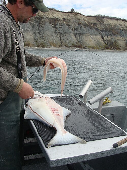
Alaska has an abundance of seafood, with the primary fisheries in the Bering Sea and the North Pacific. Seafood is one of the few food items that is often cheaper within the state than outside it. Many Alaskans take advantage of salmon seasons to harvest portions of their household diet while fishing for subsistence, as well as sport. This includes fish taken by hook, net or wheel.[132]
Hunting for subsistence, primarily caribou, moose, and Dall sheep is still common in the state, particularly in remote Bush communities. An example of a traditional native food is Akutaq, the Eskimo ice cream, which can consist of reindeer fat, seal oil, dried fish meat and local berries.
Alaska's reindeer herding is concentrated on Seward Peninsula, where wild caribou can be prevented from mingling and migrating with the domesticated reindeer.[133]
Most food in Alaska is transported into the state from "Outside" (the other 49 U.S. states), and shipping costs make food in the cities relatively expensive. In rural areas, subsistence hunting and gathering is an essential activity because imported food is prohibitively expensive. Although most small towns and villages in Alaska lie along the coastline, the cost of importing food to remote villages can be high because of the terrain and difficult road conditions, which change dramatically due to varying climate and precipitation changes. Transport costs can reach 50¢ per pound ($1.10/kg) or higher in some remote areas during times of inclement weather or rough terrain conditions, if these locations can be reached at all. The cost of delivering a gallon (3.8 L) of milk is about $3.50 in many villages where per capita income can be $20,000 or less. Fuel cost per gallon is routinely twenty to thirty cents higher than the contiguous United States average, with only Hawaii having higher prices.[134][135]
Culture


Some of Alaska's popular annual events are the Iditarod Trail Sled Dog Race from Anchorage to Nome, World Ice Art Championships in Fairbanks, the Blueberry Festival and Alaska Hummingbird Festival in Ketchikan, the Sitka Whale Fest, and the Stikine River Garnet Fest in Wrangell. The Stikine River attracts the largest springtime concentration of American bald eagles in the world.
The Alaska Native Heritage Center celebrates the rich heritage of Alaska's 11 cultural groups. Their purpose is to encourage cross-cultural exchanges among all people and enhance self-esteem among Native people. The Alaska Native Arts Foundation promotes and markets Native art from all regions and cultures in the State, using the internet.[136]
Music
Influences on music in Alaska include the traditional music of Alaska Natives as well as folk music brought by later immigrants from Russia and Europe. Prominent musicians from Alaska include singer Jewel, traditional Aleut flautist Mary Youngblood, folk singer-songwriter Libby Roderick, Christian music singer-songwriter Lincoln Brewster, metal/post hardcore band 36 Crazyfists and the groups Pamyua and Portugal. The Man.
There are many established music festivals in Alaska, including the Alaska Folk Festival, the Fairbanks Summer Arts Festival, the Anchorage Folk Festival, the Athabascan Old-Time Fiddling Festival, the Sitka Jazz Festival, the Sitka Summer Music Festival, and the Anchorage Chamber Music Festival. The most prominent orchestra in Alaska is the Anchorage Symphony Orchestra, though the Fairbanks Symphony Orchestra and Juneau Symphony are also notable. The Anchorage Opera is currently the state's only professional opera company, though there are several volunteer and semi-professional organizations in the state as well.
The official state song of Alaska is "Alaska's Flag", which was adopted in 1955; it celebrates the flag of Alaska.
Film and television
The 1983 Disney movie Never Cry Wolf was at least partially shot in Alaska. The 1991 film White Fang, based on Jack London's 1906 novel and starring Ethan Hawke, was filmed in and around Haines. Steven Seagal's 1994 On Deadly Ground, starring Michael Caine, was filmed in part at the Worthington Glacier near Valdez.[137]
Many reality television shows are filmed in Alaska. In 2011, the Anchorage Daily News found ten set in the state.[138]
Sports
The following is a list of sporting venues, events, and teams based in Alaska.
Anchorage
Venues
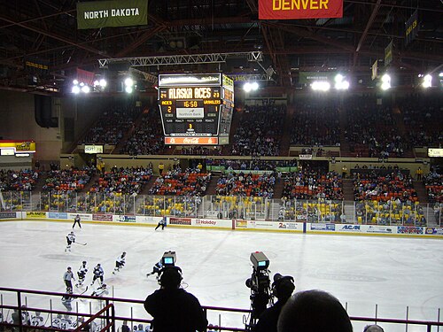
- Alyeska Resort
- Chugach State Park, a 495,000-acre (2,000 km2) high alpine park.[139]
- Anchorage has many groomed cross-country skiing trails within the urban core. There are 105 miles (169 km) of maintained ski trails in the city,[140] some of which reach downtown.[141]
- Mulcahy Stadium
- Sullivan Arena
- Alaska Airlines Center
Teams
- Anchorage Wolverines
- Anchorage Bucs
- Anchorage Glacier Pilots
- Alaska-Anchorage Seawolves men's ice hockey
- Rage City Rollergirls
- Arctic Rush (soccer)
- Cook Inlet SC (soccer)
- Pioneer United FC (men's soccer)
Events
- Great Alaska Shootout, an annual NCAADivision I basketball tournament[142]
- Sadler's Ultra Challenge wheelchair race between Fairbanks and Anchorage[143]
- The Tour of Anchorage is an annual 50-kilometer (31 mi) ski race within the city.[144]
- World Eskimo Indian Olympics
Fairbanks
Venues
Teams
- Alaska Goldpanners of Fairbanks
- Alaska Nanooks men's ice hockey
- Fairbanks Ice Dogs
- Fairbanks Rollergirls
- Fairbanks SC (soccer)
Events
- Sadler's Ultra Challenge wheelchair race between Fairbanks and Anchorage[145]
- Sonot Kkaazoot
- World Eskimo Indian Olympics
Elsewhere
Teams
- MatSu United FC (men's soccer)
- Denali Destroyer Dolls
- Kenai River Brown Bears
- Mat-Su Miners
- Peninsula Oilers
Events
- Alaska Mountain Wilderness Classic
- Arctic Winter Games
- Mount Marathon Race
- World Extreme Skiing Championship
Dog mushing
Public health and safety
The Alaska State Troopers are Alaska's statewide police force. They have a long and storied history, but were not an official organization until 1941. Before the force was officially organized, law enforcement in Alaska was handled by various federal agencies. Larger towns usually have their own local police and some villages rely on "Public Safety Officers" who have police training but do not carry firearms. In much of the state, the troopers serve as the only police force available. In addition to enforcing traffic and criminal law, wildlife Troopers enforce hunting and fishing regulations. Due to the varied terrain and wide scope of the Troopers' duties, they employ a wide variety of land, air, and water patrol vehicles.
Many rural communities in Alaska are considered "dry", having outlawed the importation of alcoholic beverages.[146] Suicide rates for rural residents are higher than urban.[147]
Domestic abuse and other violent crimes are also at high levels in the state; this is in part linked to alcohol abuse.[148] Alaska has the highest rate of sexual assault in the nation, especially in rural areas. The average age of sexually assaulted victims is 16 years old. In four out of five cases, the suspects were relatives, friends or acquaintances.[149]
Health insurance
As of 2022[update], CVS Health and Premera account for 47% and 46% of private health insurance, respectively.[150] Premera and Moda Health offer insurance on the federally-run Affordable Care Exchange.[151]
Hospitals
Providence Alaska Medical Center in Anchorage is the largest hospital in the state as of 2021;[152] Anchorage also hosts Alaska Regional Hospital and Alaska Native Medical Center.
Alaska's other major cities such as Fairbanks and Juneau also have local hospitals.[153] In Southeast Alaska, Southeast Alaska Regional Health Consortium, runs healthcare facilities across 27 communities as of 2022, including hospitals in Sitka and Wrangell;[154] although it originally served Native Americans only, it has expanded access and combined with other local facilities over time.[155][156]
Education
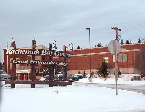
The Alaska Department of Education and Early Development administers many school districts in Alaska. In addition, the state operates a boarding school, Mt. Edgecumbe High School in Sitka, and provides partial funding for other boarding schools, including Nenana Student Living Center in Nenana and The Galena Interior Learning Academy in Galena.[157]
There are more than a dozen colleges and universities in Alaska. Accredited universities in Alaska include the University of Alaska Anchorage, University of Alaska Fairbanks, University of Alaska Southeast, and Alaska Pacific University.[158] Alaska is the only state that has no collegiate athletic programs that are members of NCAA Division I, although both Alaska-Fairbanks and Alaska-Anchorage maintain single sport membership in Division I for men's ice hockey.
The Alaska Department of Labor and Workforce Development operates AVTEC, Alaska's Institute of Technology.[159] Campuses in Seward and Anchorage offer one-week to 11-month training programs in areas as diverse as Information Technology, Welding, Nursing, and Mechanics.
Alaska has had a problem with a "brain drain". Many of its young people, including most of the highest academic achievers, leave the state after high school graduation and do not return. As of 2013[update], Alaska did not have a law school or medical school.[160] The University of Alaska has attempted to combat this by offering partial four-year scholarships to the top 10% of Alaska high school graduates, via the Alaska Scholars Program.[161]
Beginning in 1998, schools in rural Alaska must have at least 10 students to retain funding from the state, and campuses not meeting the number close. This was due to the loss in oil revenues that previously propped up smaller rural schools.[162] In 2015, there was a proposal to raise that minimum to 25,[163] but legislators in the state largely did not agree.[164]
.jpg/500px-Don_Young,_official_115th_Congress_photo_portrait_(headshot).jpg)
Transportation
Road
Alaska has few road connections compared to the rest of the U.S. The state's road system, covering a relatively small area of the state, linking the central population centers and the Alaska Highway, the principal route out of the state through Canada. The state capital, Juneau, is not accessible by road, with access only being through ferry or flight;[165] this has spurred debate over decades about moving the capital to a city on the road system, or building a road connection from Haines. The western part of Alaska has no road system connecting the communities with the rest of Alaska.
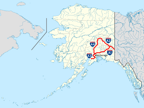
The Interstate Highways in Alaska consists of a total of 1,082 miles (1,741 km). One unique feature of the Alaska Highway system is the Anton Anderson Memorial Tunnel, an active Alaska Railroad tunnel recently upgraded to provide a paved roadway link with the isolated community of Whittier on Prince William Sound to the Seward Highway about 50 miles (80 km) southeast of Anchorage at Portage. At 2.5 miles (4.0 km), the tunnel was the longest road tunnel in North America until 2007.[166] The tunnel is the longest combination road and rail tunnel in North America.
Southwest Alaska is largely coastal, sparsely populated, and unconnected to the road system. Access to most communities in Southwest Alaska is primarily by air taxi, although larger towns like Kodiak, Bethel, King Salmon, Dillingham, and Dutch Harbor are accessible by scheduled air service. Additionally, some coastal communities can be reached via the Alaska Marine Highway ferry.[167]
-
 The Sterling Highway, near its intersection with the Seward Highway
 -
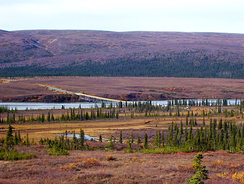 The Susitna River bridge on the Denali Highway is 1,036 feet (316 m) long.
 -
-
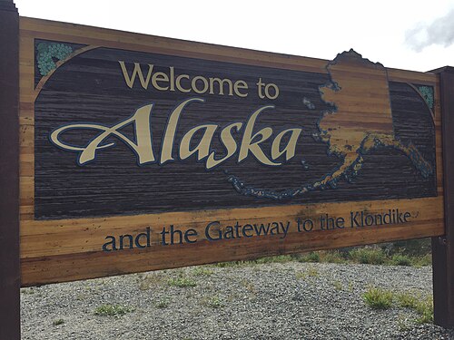 Alaska welcome sign on the Klondike Highway
Rail
Built around 1915, the Alaska Railroad (ARR) played a key role in the development of Alaska through the 20th century. It links shipping lanes on the North Pacific with Interior Alaska with tracks that run from Seward by way of South Central Alaska, passing through Anchorage, Eklutna, Wasilla, Talkeetna, Denali, and Fairbanks, with spurs to Whittier, Palmer and North Pole. The cities, towns, villages, and region served by ARR tracks are known statewide as "The Railbelt". In recent years, the ever-improving paved highway system began to eclipse the railroad's importance in Alaska's economy.
The railroad played a vital role in Alaska's development, moving freight into Alaska while transporting natural resources southward, such as coal from the Usibelli coal mine near Healy to Seward and gravel from the Matanuska Valley to Anchorage. It is well known for its summertime tour passenger service.
The Alaska Railroad was one of the last railroads in North America to use cabooses in regular service and still uses them on some gravel trains. It continues to offer one of the last flag stop routes in the country. A stretch of about 60 miles (100 km) of track along an area north of Talkeetna remains inaccessible by road; the railroad provides the only transportation to rural homes and cabins in the area. Until construction of the Parks Highway in the 1970s, the railroad provided the only land access to most of the region along its entire route.
In northern Southeast Alaska, the White Pass and Yukon Route also partly runs through the state from Skagway northwards into Canada (British Columbia and Yukon Territory), crossing the border at White Pass Summit. This line is now mainly used by tourists, often arriving by cruise liner at Skagway. It was featured in the 1983 BBC television series Great Little Railways.
These two railroads are connected neither to each other nor any other railroad. The nearest link to the North American railway network is the northwest terminus of the Canadian National Railway at Prince Rupert, British Columbia, several hundred miles to the southeast. In 2000, the U.S. Congress authorized $6 million to study the feasibility of a rail link between Alaska, Canada, and the lower 48.[168][169][170] As of 2021, the Alaska-Alberta Railway Development Corporation had been placed into receivership.
Some private companies provides car float service between Whittier and Seattle.
-
 An Alaska Railroad locomotive over a bridge in Girdwood approaching Anchorage (2007)
 -


Sea
Many cities, towns and villages in the state do not have road or highway access; the only modes of access involve travel by air, river, or the sea.

Alaska's well-developed state-owned ferry system (known as the Alaska Marine Highway) serves the cities of southeast, the Gulf Coast and the Alaska Peninsula. The ferries transport vehicles as well as passengers. The system also operates a ferry service from Bellingham, Washington and Prince Rupert, British Columbia, in Canada through the Inside Passage to Skagway. The Inter-Island Ferry Authority also serves as an important marine link for many communities in the Prince of Wales Island region of Southeast and works in concert with the Alaska Marine Highway.
In recent years, cruise lines have created a summertime tourism market, mainly connecting the Pacific Northwest to Southeast Alaska and, to a lesser degree, towns along Alaska's gulf coast. The population of Ketchikan for example fluctuates dramatically on many days—up to four large cruise ships can dock there at the same time.
Air
Cities not served by road, sea, or river can be reached only by air, foot, dogsled, or snowmachine, accounting for Alaska's extremely well developed bush air services—an Alaskan novelty. Anchorage, and to a lesser extent Fairbanks, is served by many major airlines. Because of limited highway access, air travel remains the most efficient form of transportation in and out of the state. Anchorage recently completed extensive remodeling and construction at Ted Stevens Anchorage International Airport to help accommodate the upsurge in tourism (in 2012–2013, Alaska received almost two million visitors).[171]
Making regular flights to most villages and towns within the state commercially viable is difficult, so they are heavily subsidized by the federal government through the Essential Air Service program. Alaska Airlines is the only major airline offering in-state travel with jet service (sometimes in combination cargo and passenger Boeing 737-400s) from Anchorage and Fairbanks to regional hubs like Bethel, Nome, Kotzebue, Dillingham, Kodiak, and other larger communities as well as to major Southeast and Alaska Peninsula communities.
.jpg/500px-ERA_Aviation_prop_plane_landing_at_ANC_(6194226738).jpg)
The bulk of remaining commercial flight offerings come from small regional commuter airlines such as Ravn Alaska, PenAir, and Frontier Flying Service. The smallest towns and villages must rely on scheduled or chartered bush flying services using general aviation aircraft such as the Cessna Caravan, the most popular aircraft in use in the state. Much of this service can be attributed to the Alaska bypass mail program which subsidizes bulk mail delivery to Alaskan rural communities. The program requires 70% of that subsidy to go to carriers who offer passenger service to the communities.
Many communities have small air taxi services. These operations originated from the demand for customized transport to remote areas. Perhaps the most quintessentially Alaskan plane is the bush seaplane. The world's busiest seaplane base is Lake Hood, located next to Ted Stevens Anchorage International Airport, where flights bound for remote villages without an airstrip carry passengers, cargo, and many items from stores and warehouse clubs.
In 2006, Alaska had the highest number of pilots per capita of any U.S. state.[172] In Alaska there are 8,795 active pilot certificates as of 2020.[173]
Snow
Another Alaskan transportation method is the dogsled. In modern times (that is, any time after the mid-late 1920s), dog mushing is more of a sport than a true means of transportation. Various races are held around the state, but the best known is the Iditarod Trail Sled Dog Race, a 1,150-mile (1,850 km) trail from Anchorage to Nome (although the distance varies from year to year, the official distance is set at 1,049 miles or 1,688 km). The race commemorates the famous 1925 serum run to Nome in which mushers and dogs like Togo and Balto took much-needed medicine to the diphtheria-stricken community of Nome when all other means of transportation had failed. Mushers from all over the world come to Anchorage each March to compete for cash, prizes, and prestige. The "Serum Run" is another sled dog race that more accurately follows the route of the famous 1925 relay, leaving from the community of Nenana (southwest of Fairbanks) to Nome.[174]
In areas not served by road or rail, primary transportation in summer is by all-terrain vehicle and in winter by snowmobile or "snow machine", as it is commonly referred to in Alaska.[175]
Communication
Alaska's internet and other data transport systems are provided largely through the two major telecommunications companies: GCI and Alaska Communications. GCI owns and operates what it calls the Alaska United Fiber Optic system[176] and, as of late 2011, Alaska Communications advertised that it has "two fiber optic paths to the lower 48 and two more across Alaska.[177] In January 2011, it was reported that a $1 billion project to connect Asia and rural Alaska was being planned, aided in part by $350 million in stimulus from the federal government.[178]
Law and government
State government

Like all other U.S. states, Alaska is governed as a republic, with three branches of government: an executive branch consisting of the governor of Alaska and their appointees which head executive departments; a legislative branch consisting of the Alaska House of Representatives and Alaska Senate; and a judicial branch consisting of the Alaska Supreme Court and lower courts.
The state of Alaska employs approximately 16,000 people statewide.[179]
The Alaska State Legislature consists of a 40-member House of Representatives and a 20-member Senate. Senators serve four-year terms and House members two. The governor of Alaska serves four-year terms. The lieutenant governor runs separately from the governor in the primaries, but during the general election, the nominee for governor and nominee for lieutenant governor run together on the same ticket.
Alaska's court system has four levels: the Alaska Supreme Court, the Alaska Court of Appeals, the superior courts and the district courts.[180] The superior and district courts are trial courts. Superior courts are courts of general jurisdiction, while district courts hear only certain types of cases, including misdemeanor criminal cases and civil cases valued up to $100,000.[180]
The Supreme Court and the Court of Appeals are appellate courts. The Court of Appeals is required to hear appeals from certain lower-court decisions, including those regarding criminal prosecutions, juvenile delinquency, and habeas corpus.[180] The Supreme Court hears civil appeals and may in its discretion hear criminal appeals.[180]
State politics
Although in its early years of statehood Alaska was a Democratic state, since the early 1970s it has been characterized as Republican-leaning.[182] Local political communities have often worked on issues related to land use development, fishing, tourism, and individual rights. Alaska Natives, while organized in and around their communities, have been active within the Native corporations. These have been given ownership over large tracts of land, which require stewardship.
Alaska was formerly the only state in which possession of one ounce or less of marijuana in one's home was completely legal under state law, though the federal law remains in force.[183]
The state has an independence movement favoring a vote on secession from the United States, with the Alaskan Independence Party.[184]
Six Republicans and four Democrats have served as governor of Alaska. In addition, Republican governor Wally Hickel was elected to the office for a second term in 1990 after leaving the Republican party and briefly joining the Alaskan Independence Party ticket just long enough to be reelected. He officially rejoined the Republican party in 1994.
Alaska's voter initiative making marijuana legal took effect on February 24, 2015, placing Alaska alongside Colorado and Washington, as well as Washington D.C., as the first three U.S. states where recreational marijuana is legal. The new law means people over 21 can consume small amounts of cannabis.[185] The first legal marijuana store opened in Valdez in October 2016.[186]
Voter registration
Taxes
To finance state government operations, Alaska depends primarily on petroleum revenues and federal subsidies. This allows it to have the lowest individual tax burden in the United States.[188] It is one of five states with no sales tax, one of seven states with no individual income tax, and—along with New Hampshire—one of two that has neither.[189] The Department of Revenue Tax Division[190] reports regularly on the state's revenue sources. The department also issues an annual summary of its operations, including new state laws that directly affect the tax division. In 2014, the Tax Foundation ranked Alaska as having the fourth most "business friendly" tax policy, behind only Wyoming, South Dakota, and Nevada.[191]
While Alaska has no state sales tax, 89 municipalities collect a local sales tax, from 1.0 to 7.5%, typically 3–5%. Other local taxes levied include raw fish taxes, hotel, motel, and bed-and-breakfast 'bed' taxes, severance taxes, liquor and tobacco taxes, gaming (pull tabs) taxes, tire taxes and fuel transfer taxes. A part of the revenue collected from certain state taxes and license fees (such as petroleum, aviation motor fuel, telephone cooperative) is shared with municipalities in Alaska.
The fall in oil prices after the fracking boom in the early 2010s has decimated Alaska's state treasury, which has historically received about 85 percent of its revenue from taxes and fees imposed on oil and gas companies.[192] The state government has had to drastically reduce its budget, and has brought its budget shortfall from over $2 billion in 2016 to under $500 million by 2018. In 2020, Alaska's state government budget was $4.8 billion, while projected government revenues were only $4.5 billion.[193]
Federal politics

Alaska regularly supports Republicans in presidential elections and has done so since statehood. Republicans have won the state's electoral college votes in all but one election that it has participated in (1964). No state has voted for a Democratic presidential candidate fewer times. Alaska was carried by Democratic nominee Lyndon B. Johnson during his landslide election in 1964, while the 1960 and 1968 elections were close. Since 1972, Republicans have carried the state by large margins. In 2008, Republican John McCain defeated Democrat Barack Obama in Alaska, 59.49% to 37.83%. McCain's running mate was Sarah Palin, the state's governor and the first Alaskan on a major party ticket. Obama lost Alaska again in 2012, but he captured 40% of the state's vote in that election, making him the first Democrat to do so since 1968. In 2020, Joe Biden received 42.77% of the vote for president, marking the high point for a Democratic presidential candidate since Johnson's 1964 victory.
The Alaska Bush, central Juneau, midtown and downtown Anchorage, and the areas surrounding the University of Alaska Fairbanks campus and Ester have been strongholds of the Democratic Party. The Matanuska-Susitna Borough, the majority of Fairbanks (including North Pole and the military base), and South Anchorage typically have the strongest Republican showing.
Elections
Alaska has a history of primary defeats for incumbent U.S. Senators, including Ernest Gruening, Mike Gravel, and Lisa Murkowski. However, Murkowski won re-election with a write-in campaign. Despite this, Alaska has also seen long-serving members of Congress, such as Ted Stevens, who served as a U.S. Senator for 40 years, and Don Young, who held Alaska's sole U.S. House seat for 49 years (from 1973 to 2022).
In the 2020 election cycle, Alaskan voters approved Ballot Measure 2.[194] The measure passed by a margin of 1.1%, or about 4,000 votes.[195] The measure requires campaigns to disclose the original source and any intermediaries for campaign contributions over $2,000. The measure also establishes non-partisan blanket primaries for statewide elections (like in Washington state and California) and ranked-choice voting (like in Maine).[195] Measure 2 makes Alaska the third state with jungle primaries for all statewide races, the second state with ranked choice voting, and the only state with both.
The 2022 special election to fill Alaska's only U.S. House seat, left vacant by the death of Don Young, was won by Mary Peltola. She became the first Democrat to win the House seat since 1972 and the first Alaskan Native elected to the United States Congress in history.
- Alaska's current statewide elected officials
-

-
 Lisa Murkowski, senior United States senator
 -
 Dan Sullivan, junior United States senator
 -
 Mary Peltola, United States congresswoman
.jpg/500px-Mike_Dunleavy_official_photo_(cropped).jpg)
.jpeg/500px-Mary_Peltola_Congressional_Member_Portrait_(2).jpeg)
See also
- Index of Alaska-related articles
- Outline of Alaska
- List of boroughs and census areas in Alaska
- USS Alaska, 4 ships
Notes
- ^ These three Aleutian outer islands are about 460 miles (740 km) away from mainland USSR, 920 miles (1,480 km) from mainland Alaska, 950 miles (1,530 km) from Japan.
- ^ Wally Hickel would rejoin the Republican party after winning the election as a member of the Alaskan Independence Party.
- ^ Byron Mallott, the Democratic gubernatorial nominee, suspended his campaign and became the running mate of Bill Walker, an independent who left the Republican Party. They won the election with 48.1% or 134,658 votes.
References
- ^ "State Area Measurements and Internal Point Coordinates". Census.gov. Archived from the original on April 7, 2020. Retrieved September 1, 2023.
- ^ "Geography of Alaska, Alaska Kids' Corner, State of Alaska". Archived from the original on December 3, 2023. Retrieved January 17, 2024.
- ^ "Elevations and Distances in the United States". United States Geological Survey. 2001. Archived from the original on October 15, 2011. Retrieved October 21, 2011.
- ^ "US Census Bureau QuickFacts". Retrieved April 30, 2022.
- ^ "2020 Population and Housing State Data". census.gov. United States Census Bureau. Archived from the original on November 18, 2023. Retrieved November 18, 2023.
- ^ a b "2020 Census Apportionment Results". census.gov. United States Census Bureau. Archived from the original on April 26, 2021. Retrieved April 30, 2021.
- ^ Black, Lydia (2004). Russians in Alaska, 1732-1867. University of Alaska Press. pp. 217, 218.
- ^ Video: 49th Star. Alaska Statehood, New Flag, Official, 1959/01/05 (1959). Universal Newsreel. 1959. Archived from the original on May 15, 2012. Retrieved February 20, 2012.
- ^ "U.S. Census Bureau QuickFacts: Alaska". census.gov. Archived from the original on December 29, 2018. Retrieved February 17, 2020.
- ^ Bergsland, Knut, ed. (1994). Aleut Dictionary: Unangam Tunudgusii. Alaska Native Language Center. ISBN 978-1-55500-047-9., at pp. 49 (Alaxsxi-x = mainland Alaska), 50 (alagu-x = sea), 508 (-gi = suffix, object of its action).
- ^ Bright, William (2007). Native American Placenames in the United States. University of Oklahoma Press. ISBN 978-0806135984.
- ^ Ransom, J. Ellis. 1940. "Derivation of the Word 'Alaska'", American Anthropologist n.s., 42: pp. 550–551
- ^ UCL (July 12, 2012). "Native American populations descend from three key migrations". UCL News. Archived from the original on December 9, 2023. Retrieved December 22, 2023.
- ^ Handwerk, Brian (June 5, 2019). "Ancient DNA Reveals Complex Story of Human Migration Between Siberia and North America". Smithsonian Magazine. Archived from the original on December 22, 2023. Retrieved December 22, 2023.
- ^ "Lost Native American Ancestor Revealed in Ancient Child's DNA". National Geographic. January 3, 2018. Archived from the original on January 3, 2018. Retrieved January 3, 2018.
- ^ Brian C. Hosmer, American Indians in the Marketplace: Persistence and Innovation among the Menominees and Metlakatlans, 1870–1920 (Lawrence, Kansas: University Press of Kansas, 1999), pp. 129–131, 200.
- ^ Свердлов Л. М. Русское поселение на Аляске в XVII в.? "Природа". М., 1992. No. 4. С.67–69.
- ^ Postnikov, Alexey V. (2000). "Outline of the History of Russian Cartography". Regions: a Prism to View the Slavic Eurasian World. Archived from the original on January 17, 2013. Retrieved June 6, 2012.
- ^ Аронов В. Н. Патриарх Камчатского мореходства. // "Вопросы истории рыбной промышленности Камчатки": Историко-краеведческий сб.—Вып. 3.—2000. Вахрин С. Покорители великого океана. Петроп.-Камч.: Камштат, 1993.
- ^ Doyle, Don H. (2024). The Age of Reconstruction: How Lincoln's New Birth of Freedom Remade the World. Princeton & Oxford: Princeton University Press, pp. 99-120.
- ^ The man who $old Alaska Archived December 1, 2020, at the Wayback Machine – Anchorage Daily News
- ^ Wheeler, Keith (1977). "Learning to cope with 'Seward's Icebox'". The Alaskans. Alexandria: Time–Life Books. pp. 57–64. ISBN 978-0-8094-1506-9.
- ^ Brooks, Alfred H.; et al. (1920). "Mineral Resources of Alaska, 1920" (PDF). USGS: 7.
- ^ Cloe, John Haile (2017). Attu: the forgotten battle. United States National Park Service. ISBN 978-0-9965837-3-2. Archived from the original on March 31, 2023. Retrieved November 5, 2019.
- ^ Taylor, Alan. "1964: Alaska's Good Friday Earthquake – The Atlantic". The Atlantic. Archived from the original on February 13, 2021. Retrieved February 4, 2021.
- ^ "1964 Alaskan Tsunami". University of Southern California Tsunami Research Group. Archived from the original on May 8, 2015. Retrieved July 18, 2015.
- ^ a b Friedel, Megan K. (2010). Guide to the Anchorage Engineering Geology Evaluation Group papers, 1964. UAA/APU Consortium Library Archives and Special Collections. HMC-0051. https://archives.consortiumlibrary.org/collections/specialcollections/hmc-0051/ Archived March 28, 2019, at the Wayback Machine
- ^ "Ruth Anne Marie Schmidt Ph.D." Alaska Women's Hall of Fame. 2015. Retrieved November 23, 2015.
- ^ Saucier, Heather (April 2014). "PROWESS Honors Historic Earthquake Survivor". American Association of Petroleum Geologists. Retrieved July 31, 2018.
- ^ a b c Cloe, John Haile "Helping Hand" Military response to Good Friday earthquake Archived 2016-10-27 at the Wayback Machine Alaska Historical Society, 3/4/2014
- ^ a b Galvin, John Great Alaskan Earthquake and Tsunami: Alaska, March 1964 Archived 2016-10-27 at the Wayback Machine Popular Mechanics, 6/29/2007
- ^ a b "When a Quake Shook Alaska, a Radio Reporter Led the Public Through the Devastating Crisis". Smithsonian Magazine. Archived from the original on March 21, 2020. Retrieved December 2, 2020.
- ^ Barbaro, Michael (May 22, 2020). "Genie Chance and the Great Alaska Earthquake". The New York Times. Archived from the original on January 2, 2021. Retrieved January 23, 2023.
- ^ Phillips, James G. (1969). "Alaskan Oil Boom". CQ Researcher by CQ Press. CQ Researcher Online. CQ Press: 835–854. doi:10.4135/cqresrre1969111200. S2CID 264579055. Archived from the original on July 31, 2018. Retrieved September 27, 2022.
- ^ Wells, Bruce (July 12, 2022). "First Alaska Oil Wells". American Oil & Gas Historical Society. Archived from the original on March 7, 2016. Retrieved September 27, 2022.
- ^ "Facts About Alaska, Alaska Kids' Corner, State of Alaska". alaska.gov. n.d. Archived from the original on January 9, 2019. Retrieved April 13, 2018.
- ^ Benson, Carl (September 2, 1998). "Alaska's Size in Perspective". Geophysical Institute, University of Alaska Fairbanks. Archived from the original on November 25, 2007. Retrieved November 19, 2007.
- ^ Porco, Peter (June 23, 2003). "Long said to be second to Fundy, city tides aren't even close". Anchorage Daily News: A1.
- ^ "Geography of Alaska lake districts: Identification, description, and analysis of lake-rich regions of a diverse and dynamic state | U.S. Geological Survey". www.usgs.gov. Retrieved August 8, 2024.
- ^ "Glacier and Landscape Change in Response to Changing Climate". www2.usgs.gov. Archived from the original on February 3, 2018. Retrieved February 2, 2018.
- ^ "Beringglacier.org". beringglacier.org. Archived from the original on January 2, 2018. Retrieved February 2, 2018.
- ^ "Travel Information on South Central Alaska". 2006. Archived from the original on April 19, 2011. Retrieved April 22, 2011.
- ^ "1927: When Ketchikan was the Largest City in Alaska". Sitnews US. April 30, 2007. Archived from the original on May 10, 2012. Retrieved July 24, 2012.
- ^ "The Alaska Marine Highway System" (PDF). Alaska Department of Transportation and Public Facilities. Archived from the original (PDF) on March 30, 2013. Retrieved April 21, 2012.
- ^ "Alaska.com". Alaska.com. Archived from the original on June 3, 2010. Retrieved June 2, 2010.
- ^ Hersher, Rebecca (December 1, 2016). "Barrow, Alaska, Changes Its Name Back To Its Original 'Utqiaġvik'". National Public Radio. Archived from the original on February 20, 2021. Retrieved December 14, 2020.
- ^ "Alaska Land Ownership". Archived from the original on June 28, 2002. Retrieved May 4, 2014.
- ^ Alaska Heritage Resources Survey Archived May 13, 2014, at the Wayback Machine, Department of Natural Resources—Alaska.gov (retrieved May 9, 2014)
- ^ "Alaska Boroughs—"Official" sites". Official Borough Websites. CountyState.Info. Archived from the original on October 27, 2007. Retrieved September 13, 2007.
- ^ "Local Government". Alaska Humanities Forum. Archived from the original on November 5, 2021. Retrieved November 4, 2021.
- ^ Dixon, Mim (September 18, 2019). What Happened To Fairbanks?: The Effects of the Trans-alaska Oil Pipeline on the Community Of Fairbanks, Alaska. Routledge. ISBN 978-1-000-01076-3. Archived from the original on March 31, 2023. Retrieved November 8, 2020.
- ^ a b c "2020 Census Data – Cities and Census Designated Places" (Web). State of Alaska, Department of Labor and Workforce Development. Archived from the original on August 13, 2021. Retrieved October 31, 2021.
- ^ "Places (2020): Alaska" (TXT). United States Census Bureau. Archived from the original on March 18, 2021. Retrieved October 31, 2021.
- ^ "Western States Data Public Land Acreage". Wildlandfire.com. November 13, 2007. Archived from the original on July 27, 2011. Retrieved June 2, 2010.
- ^ Julia Haines. "These Are the 10 Coldest States in the U.S." usnews. Archived from the original on February 12, 2024. Retrieved February 12, 2024.
- ^ "Monthly Climate Summary, Ketchikan, Alaska". Western Regional Climate Center. Archived from the original on May 16, 2013. Retrieved February 7, 2013.
- ^ "Mean Annual Precipitation, Alaska-Yukon". Spatial Climate Analysis Service. Oregon State University. February 2000. Archived from the original on October 25, 2012. Retrieved June 5, 2012.
- ^ a b "NOAA Weather Radio All Hazards Information—Alaska Weather Interesting Facts and Records" (PDF). National Oceanic and Atmospheric Administration. Archived from the original (PDF) on September 29, 2006. Retrieved January 3, 2007.
- ^ a b "State Extremes". Western Regional Climate Center, Desert Research Institute. Archived from the original on January 5, 2007. Retrieved January 3, 2007.
- ^ "SD Weather History and Trivia for May: May 1". National Oceanic and Atmospheric Administration. Archived from the original on February 8, 2007. Retrieved January 3, 2007.
- ^ "FAQ Alaska—Frequently Asked Questions About Alaska: Weather". Statewide Library Electronic Doorway, University of Alaska Fairbanks. January 17, 2005. Archived from the original on January 2, 2007. Retrieved January 3, 2007.
- ^ Rozell, Ned (January 23, 2003). "The Coldest Place in North America". Geophysical Institute of the University of Alaska Fairbanks. Archived from the original on February 2, 2007. Retrieved January 3, 2007.
- ^ History for Barrow, Alaska. Monthly Summary for July 2006 Archived July 3, 2017, at the Wayback Machine. Weather Underground. Retrieved October 23, 2006.
- ^ "Alaska climate averages". Weatherbase. Archived from the original on November 1, 2015. Retrieved November 1, 2015.
- ^ "Annual Estimates of the Resident Population for Counties: April 1, 2020 to July 1, 2023". United States Census Bureau. Archived from the original on April 7, 2020. Retrieved March 28, 2024.
- ^ "Historical Population Change Data (1910-2020)". Census.gov. Archived from the original on April 29, 2021.
- ^ "2020 Census Apportionment Results, Table 2 Resident Population for the 50 States, the District of Columbia, and Puerto Rico: 2020 Census". United States Census Bureau. April 26, 2021. Archived from the original on April 26, 2021. Retrieved April 26, 2021.
- ^ "Resident Population Data: Population Density". U.S. Census Bureau. 2010. Archived from the original on October 28, 2011. Retrieved June 6, 2012.
- ^ "State Per Capita Income 2011" (PDF). Bureau of Economic Analysis, U.S. Department of Commerce. March 28, 2012. Archived from the original (PDF) on September 15, 2012. Retrieved June 6, 2012.
- ^ "State Area Codes". 50states.com. Archived from the original on February 13, 2018. Retrieved February 13, 2018.
- ^ "2007-2022 PIT Counts by State". Archived from the original on March 14, 2023. Retrieved March 11, 2023.
- ^ "The 2022 Annual Homelessness Assessment Report (AHAR) to Congress" (PDF). Archived (PDF) from the original on March 11, 2023. Retrieved March 11, 2023.
- ^ a b Yax, Laura K. "Historical Census Statistics on Population Totals By Race, 1790 to 1990, and By Hispanic Origin, 1970 to 1990, For The United States, Regions, Divisions, and States". Archived from the original on July 25, 2008.
- ^ "Population of Alaska—Census 2010 and 2000 Interactive Map, Demographics, Statistics, Quick Facts—CensusViewer". censusviewer.com. Archived from the original on March 5, 2016. Retrieved January 6, 2014.
- ^ "2010 Census Data". census.gov. Archived from the original on May 22, 2017. Retrieved December 11, 2017.
- ^ "Racial and Ethnic Diversity in the United States: 2010 Census and 2020 Census". U.S. Census Bureau. August 12, 2021. Archived from the original on August 12, 2021. Retrieved August 12, 2021.
- ^ "2019 QuickFacts". U.S. Census Bureau.
- ^ "2015 Demographic and Housing Estimates". data.census.gov. Archived from the original on May 21, 2021. Retrieved May 21, 2021.
- ^ "2019 Demographic and Housing Estimates". data.census.gov. Archived from the original on March 28, 2022. Retrieved May 21, 2021.
- ^ "U.S. Census website". United States Census Bureau. October 5, 2010. Archived from the original on July 9, 2021. Retrieved May 29, 2011.
- ^ Exner, Rich (June 3, 2012). "Americans under age 1 now mostly minorities, but not in Ohio: Statistical Snapshot". The Plain Dealer. Archived from the original on July 14, 2016. Retrieved August 17, 2012.
- ^ "Alaska—Race and Hispanic Origin: 1880 to 1990". U.S. Census Bureau. Archived from the original on December 24, 2014. Retrieved April 18, 2012.
- ^ "Immigrants in Alaska" (PDF). Archived (PDF) from the original on February 13, 2024. Retrieved September 24, 2023.
- ^ "50 Quick Facts about Alaska" ISBN 978-1-783-33276-2
- ^ "Language use in the United States, 2011" (PDF). Archived (PDF) from the original on May 13, 2014. Retrieved May 18, 2014.
- ^ "2019 Language Statistics". data.census.gov. Archived from the original on May 22, 2021. Retrieved May 22, 2021.
- ^ Graves, K, PhD, MSW, Rosich, R, PhD, McBride, M, PhD, RN, Charles, G, Phd and LaBelle, J, MA: Health and health care if Alaska Native Older Adults. "Ethno Med - Alaska Native - Description - Geriatrics - Stanford Medicine". Archived from the original on January 28, 2014. Retrieved October 7, 2016.. In Periyakoil VS, eds. eCampus Geriatrics, Stanford Ca, 2010.
- ^ a b "Languages, Alaska Native Language Center". Archived from the original on July 27, 2014. Retrieved August 4, 2014.
- ^ Languages, Alaska Native Language Center, Ethnologue (classifications), http://www.uaf.edu/anlc/languages/stats/ Archived July 6, 2014, at the Wayback Machine
- ^ "Alaska's indigenous languages attain official status" Archived February 12, 2017, at the Wayback Machine, Reuters.com, October 24, 2014. Retrieved October 30, 2014.
- ^ "Bill History/Action for 28th Legislature HB 216". The Alaska State Legislature. Archived from the original on February 4, 2017. Retrieved January 12, 2016.
- ^ "2020 American Values Atlas: Religious Tradition". Public Religion Research Institute. February 24, 2023. Archived from the original on April 4, 2017. Retrieved March 30, 2023.
- ^ Green, Emma (September 6, 2017). "The 20 States Where Non-Religious People Make Up the Greatest Share of the Population". The Atlantic. Archived from the original on October 2, 2023. Retrieved September 16, 2023.
- ^ "Survey Finds Alaskans Less Religious Than Other Americans". Pew Research Center's Religion & Public Life Project. September 4, 2008. Archived from the original on October 2, 2023. Retrieved September 16, 2023.
- ^ "Religion in America: U.S. Religious Data, Demographics and Statistics—Pew Research Center". Pew Research Center's Religion & Public Life Project. May 11, 2015. Archived from the original on May 6, 2015. Retrieved November 18, 2013.
- ^ "The Association of Religion Data Archives—State Membership Report". thearda.com. Archived from the original on December 12, 2013. Retrieved November 15, 2013.
- ^ "The Association of Religion Data Archives—Maps & Reports". thearda.com. Archived from the original on December 12, 2013. Retrieved November 15, 2013.
- ^ "Adherents.com". Adherents.com. Archived from the original on May 5, 2010. Retrieved June 2, 2010.
{{cite web}}: CS1 maint: unfit URL (link) - ^ "Believe it or not, Alaska's one of nation's least religious states". Anchorage Daily News. July 13, 2008. Archived from the original on January 16, 2009. Retrieved July 23, 2008.
- ^ "PRRI – American Values Atlas". ava.prri.org. Archived from the original on April 4, 2017. Retrieved September 17, 2022.
- ^ a b c "2020 Congregational Membership". Association of Religion Data Archives. Archived from the original on April 19, 2023. Retrieved April 15, 2023.
- ^ a b "Adults in Alaska". Pew Research Center's Religion & Public Life Project. May 11, 2015. Archived from the original on January 14, 2016. Retrieved January 1, 2016.
- ^ Carter, Joe (October 13, 2018). "Why Christians Don't Go to Church (and Why They Must)". The Gospel Coalition. Archived from the original on April 19, 2023. Retrieved April 15, 2023.
- ^ "An early Russian Orthodox Church". Vilda.alaska.edu. Archived from the original on February 25, 2008. Retrieved June 2, 2010.
- ^ "Association of Religion Data Archive". Thearda.com. Archived from the original on January 13, 2012. Retrieved June 2, 2010.
- ^ Table 76. Religious Bodies—Selected Data. U.S. Census Bureau, Statistical Abstract of the United States: 2011.
- ^ Kalyan, Mala. "Shri Ganesha Mandir of Alaska". Cultural Association of India Anchorage. Archived from the original on February 1, 2009. Retrieved September 26, 2009.
- ^ "Hindu Temples on West Coast USA". Hindu Temples in USA—Hindu Mandirs in USA. Archived from the original on June 16, 2010. Retrieved June 2, 2010.
- ^ "Holi / Baisakhi Celebration". Cultural Association of India Anchorage. Archived from the original on February 1, 2009. Retrieved September 26, 2009.
- ^ O'Malley, Julia (February 20, 2007). "First Muslim cemetery opens in Alaska". Anchorage Daily News. Archived from the original on January 16, 2009. Retrieved August 30, 2008.
- ^ "Engaging Muslim: Religion, Culture, Politics". engagingmuslims.alaskapacific.edu. Archived from the original on February 15, 2009. Retrieved August 30, 2008.
- ^ Howk, Robert (July 7, 2005). "Alaskan Muslims Avoid Conflict". Humanity News. Archived from the original on January 13, 2009. Retrieved June 2, 2010.
- ^ "Mosque milestone for Alaska Muslims—Americas". Al Jazeera. December 25, 2010. Archived from the original on February 4, 2011. Retrieved May 29, 2011.
- ^ "Alaska Bahá'í Community". Archived from the original on January 17, 2019. Retrieved January 16, 2019.
- ^ "U.S. Census Bureau QuickFacts: Alaska". Archived from the original on October 15, 2019. Retrieved November 11, 2019.
- ^ Frank, Robert (January 15, 2014). "Top states for millionaires per capita". CNBC. Archived from the original on January 22, 2014. Retrieved January 22, 2014.
- ^ "EIA State Energy Profiles: Alaska". U.S. Energy Information Administration. March 27, 2014. Archived from the original on May 22, 2014. Retrieved May 21, 2014.
- ^ "Rankings: Crude Oil Production, February 2013". United States Energy Information Administration. Archived from the original on October 19, 2013. Retrieved May 19, 2014.
- ^ "ND Monthly Bakken Oil Production Statistics" (PDF). North Dakota Department of Mineral Resources. Archived (PDF) from the original on July 14, 2014. Retrieved May 21, 2014.
- ^ "Crude Oil Forecast, Markets and Transportation". Canadian Association of Petroleum Producers. June 2013. Archived from the original on May 22, 2014. Retrieved May 21, 2014.
- ^ "Gas Hydrates on Alaska's North Slope". Usgs.gov. Archived from the original on June 1, 2010. Retrieved June 2, 2010.
- ^ "EIA State Energy Profiles: Alaska". Tonto.eia.doe.gov. August 27, 2009. Archived from the original on November 3, 2010. Retrieved November 7, 2010.
- ^ "Screening Report for Alaska Rural Energy Plan" (PDF). April 2001. Archived from the original (PDF) on February 16, 2008. Retrieved April 11, 2006.
- ^ "Alaska Profile". www.eia.gov. Archived from the original on December 22, 2023. Retrieved December 22, 2023.
- ^ "Alaska Fuel Price Report: Current Community Conditions (January 2015)" (PDF). January 2015. Archived (PDF) from the original on January 19, 2024. Retrieved December 22, 2023.
- ^ "Alaska Permanent Fund Corporation". apfc.org. Archived from the original on May 20, 2007. Retrieved May 29, 2007.
- ^ "State of Alaska Permanent Fund Division". Pfd.state.ak.us. Archived from the original on April 20, 2010. Retrieved June 2, 2010.
- ^ "Alaska's Citizens' Dividend Set To Be Near Highest Ever". BIEN. August 31, 2015. Archived from the original on November 3, 2015. Retrieved November 3, 2015.
- ^ a b "Economic Forecast Released". Economic Forecast Released. Archived from the original on May 6, 2010. Retrieved February 4, 2021.
- ^ "More than 1,000 New Farmers Markets Recorded Across Country as USDA Directory Reveals 17 Percent Growth—USDA Newsroom". Usda.gov. August 5, 2011. Archived from the original on January 17, 2013. Retrieved June 14, 2012.
- ^ "Welcome to The Alaska Peony Growers Association". Alaskapeonies.org. Archived from the original on June 30, 2012. Retrieved June 14, 2012.
- ^ "Alaska Department of Fish and Game". Adfg.alaska.gov. Archived from the original on June 24, 2011. Retrieved May 29, 2011.
- ^ "Reindeer Herding". Reindeer.salrm.uaf.edu. Archived from the original on November 19, 2010. Retrieved November 7, 2010.
- ^ "Daily Fuel Gauge Report". Automobile Association of America. Archived from the original on June 20, 2013. Retrieved May 18, 2013.
- ^ "Retail Fuel Pricing and News". Oil Price Information Service. Archived from the original on June 2, 2013. Retrieved May 18, 2013.
- ^ "Alaska Native Arts Foundation". alaskanativearts.org. Archived from the original on July 17, 2014. Retrieved November 28, 2019.
- ^ "On Deadly Ground". Filminamerica.com. Archived from the original on December 27, 2010. Retrieved November 7, 2010.
- ^ Hopkins, Kyle (February 14, 2011). "Rating the Alaska reality shows: The best and the worst". Anchorage Daily News. Archived from the original on March 2, 2013. Retrieved March 2, 2013.
- ^ Guide to the State Parks of the United States-2nd Edition. Washington, D.C.: The National Geographic Society. 2004. pp. 340–342. ISBN 0-7922-6628-5.
- ^ "Trails". Parks and Recreation. Municipality of Anchorage. Archived from the original on March 18, 2024. Retrieved February 26, 2014.
- ^ "Tony Knowles Coastal Trail". Alaska Trails. State of Alaska. Retrieved February 26, 2014.
- ^ "Great Alaska Shootout". Anchorage: 100 years of big wild life. Anchorage Convention and Visitors Bureau. Archived from the original on July 3, 2015. Retrieved February 25, 2014.
- ^ Pedeferri, Tony (October 18, 2012). "Alaska Race will Return in 2013". US Handcycling – News. Archived from the original on March 31, 2022. Retrieved February 25, 2014.
- ^ "Tour of Anchorage". Anchorage: 100 years of big wild life. Anchorage Convention and Visitors Bureau. Archived from the original on April 28, 2015. Retrieved February 25, 2014.
- ^ Pedeferri, Tony (October 18, 2012). "Alaska Race will Return in 2013". US Handcycling – News. Archived from the original on March 31, 2022. Retrieved February 25, 2014.
- ^ "Alaska State Troopers Alaska Bureau of Alcohol and Drug Enforcement Control Board" (PDF). Dps.state.ak.us. Archived from the original (PDF) on December 30, 2013. Retrieved May 30, 2014.
- ^ "State of Alaska". Hss.state.ak.us. Archived from the original on September 25, 2009. Retrieved June 2, 2010.
- ^ "Survey reveals higher rate of violence against Alaska women". Archived from the original on May 31, 2014. Retrieved May 30, 2014.
- ^ D'oro, Rachel (January 30, 2008). "Rural Alaska steeped in sexual violence". USA Today. Archived from the original on November 5, 2010. Retrieved December 31, 2010.
- ^ "Competition in health care research". American Medical Association. Archived from the original on October 13, 2022. Retrieved January 15, 2023.
- ^ "Health insurance in Alaska: find affordable coverage". healthinsurance.org. October 1, 2021. Archived from the original on April 22, 2021. Retrieved January 15, 2023.
- ^ Ruskin, Liz (September 20, 2021). "How Alaska's largest hospital reached its tipping point". Alaska Public Media. Archived from the original on June 9, 2023. Retrieved June 9, 2023.
- ^ "Individual Hospital Statistics for Alaska". American Hospital Directory. Archived from the original on June 9, 2023. Retrieved June 9, 2023.
- ^ "SouthEast Alaska Regional Health Consortium" (PDF). Petersburg Medical Center. March 24, 2022. Archived (PDF) from the original on June 9, 2023. Retrieved July 21, 2023.
- ^ Stremple, Claire (November 3, 2021). "ICYMI: Southeast Alaska's tribal health provider has expanded its service in Juneau". KTOO. Archived from the original on June 9, 2023. Retrieved June 9, 2023.
- ^ Woolsey, Robert (June 2, 2017). "SEARHC takes on questions of ethnicity, access, and workplace values". KCAW. Archived from the original on June 9, 2023. Retrieved June 9, 2023.
- ^ "Asset Building in Residence Life". Alaska ICE. April 4, 2009. Archived from the original on October 9, 2007.
- ^ These are the only three universities in the state ranked by U.S. News & World Report. "USNews.com: America's Best Colleges 2007". Archived from the original on January 1, 2007. Retrieved January 3, 2007.
- ^ "AVTECHome Page". Avtec.labor.state.ak.us. Archived from the original on October 9, 2011. Retrieved September 7, 2012.
- ^ "House Bill 43 'University Institutes of Law And Medicine'". States News Service. February 5, 2013. Archived from the original on December 30, 2013. Retrieved December 21, 2013.
- ^ "UA Scholars Program—Frequently Asked Questions". Archived from the original on March 9, 2008. Retrieved December 28, 2009.
- ^ "Alaska's Rural Schools Fight Off Extinction". The New York Times. November 25, 2009. Archived from the original on November 26, 2009. Retrieved July 15, 2021.
- ^ Colton, Hannah (October 26, 2015). "Proposed increase to minimum enrollment threatens funding for dozens of small schools". Alaska Public Radio. KLDG. Archived from the original on October 28, 2015. Retrieved July 15, 2021.
- ^ Colton, Hannah (November 11, 2015). "Bill to cut funding to small schools finds little support among Alaska lawmakers". KDLG. Archived from the original on November 16, 2015. Retrieved July 15, 2021.
- ^ Yardley, William (June 6, 2008). "In Juneau, Firm Resistance to a Road Out of Isolation". The New York Times. Archived from the original on March 28, 2023. Retrieved May 7, 2023.
- ^ completion of the 3.5-mile (5.6 km) Interstate 93 tunnel as part of the "Big Dig" project in Boston, Massachusetts.
- ^ "Alaska's Southwest Region | Travel Alaska". www.travelalaska.com. Retrieved July 8, 2024.
- ^ Yaffe, Barbara (January 2, 2011). "Alaska Oil / BC Tar sands via rail". Archived from the original on December 19, 2010. Retrieved January 2, 2011.
- ^ Dowd, Allan (June 27, 2007). "Economic study touts Alaska-Canada rail link". Reuters. Archived from the original on July 13, 2019. Retrieved January 2, 2011.
- ^ "Alaska Canada Rail Link". AlaskaCanadaRail.org. January 2, 2005. Archived from the original on April 25, 2011. Retrieved January 2, 2011.
- ^ State of Alaska Office of Economic Development. Economic Impact of Alaska's Visitor Industry Archived May 22, 2014, at the Wayback Machine . January 2014. Retrieved May 21, 2014.
- ^ Out of the estimated 663,661 residents, 8,550 were pilots, or about one in 78, Federal Aviation Administration. 2005 U.S. Civil Airman Statistics Archived December 29, 2009, at the Wayback Machine
- ^ "U.S. Civil Airmen Statistics". www.faa.gov. Archived from the original on May 10, 2009. Retrieved November 1, 2020.
- ^ "Norman Vaughan Serum Run". United Nations. April 15, 2010. Archived from the original on March 3, 2009. Retrieved June 2, 2010.
- ^ Friedman, Sam (April 10, 2015). "Snowmachine or snowmobile? Whatever you call it, there's a lot riding on it". Fairbanks Daily Newsminer. Archived from the original on February 1, 2018. Retrieved October 19, 2017.
- ^ "Alaska United Fiber Optic System homepage". Alaskaunited.com. Archived from the original on February 6, 2012. Retrieved July 24, 2012.
- ^ Alaska Communications Coverage Map Archived January 7, 2012, at the Wayback Machine. Alaska Communications.
- ^ Arctic fiber-optic cable could benefit far-flung Alaskans Archived January 11, 2012, at the Wayback Machine . Anchorage Daily News.
- ^ "State of Alaska Workforce Profile Fiscal Year 2013" (PDF). Dop.state.ak.us. Archived from the original (PDF) on March 30, 2014. Retrieved May 25, 2014.
- ^ a b c d "About the Alaska Court System". State.ak.us. Archived from the original on September 13, 2009. Retrieved June 2, 2010.
- ^ Leip, David. "General Election Results—Alaska". United States Election Atlas. Archived from the original on June 4, 2011. Retrieved November 18, 2016.
- ^ "National Journal Alaska State Profile". Election.nationaljournal.com. Archived from the original on November 15, 2006. Retrieved June 2, 2010.
- ^ Volz, Matt (July 11, 2006). "Judge rules against Alaska marijuana law". The Seattle Times. Archived from the original on June 17, 2008. Retrieved May 22, 2008.
- ^ "Questions And Answers—About Alaskan Independence". Alaskan Independence Party. 2006. Archived from the original on January 4, 2012. Retrieved January 15, 2012.
- ^ Chappel, Bill (February 24, 2015). "Marijuana Is Now Legal in Alaska, The 3rd U.S. State With Legal Pot". Archived from the original on February 24, 2015. Retrieved February 25, 2015.
- ^ Andrews, Laurel,Marijuana milestone: Alaska's first pot shop opens to the public in Valdez Archived November 16, 2016, at the Wayback Machine Alaska Dispatch News, October 29, 2016
- ^ "Alaska Division of Elections". www.elections.alaska.gov. Archived from the original on June 30, 2018. Retrieved June 4, 2021.
- ^ CNN Money (2005). "How tax friendly is your state?" Retrieved from CNN website Archived September 13, 2017, at the Wayback Machine.
- ^ "12 states that have either no income or sales taxes". Newsday. Archived from the original on February 15, 2019. Retrieved February 14, 2019.|
- ^ "Alaska Department of Revenue". Tax.state.ak.us. Archived from the original on June 10, 2010. Retrieved June 10, 2010.|
- ^ "How Friendly Is Your State's Tax System? The Tax Foundation's 2014 State Business Tax Climate Index". The Tax Foundation. October 9, 2013. Archived from the original on July 12, 2010. Retrieved May 25, 2014.
- ^ Cohn, Scott (July 10, 2018). "Alaska, Shackled with a 'Grave' Budget Crisis, is America's Worst State for Business". CNBC. Archived from the original on July 10, 2018. Retrieved August 14, 2020.
- ^ Garber, Jonathan (May 8, 2020). "Plunging oil prices, coronavirus fuel budget crisis in petroleum-rich Alaska". Fox Business. Archived from the original on May 10, 2020. Retrieved August 14, 2020.
- ^ Kitchenman, Andrew (November 17, 2020). "Alaska will have a new election system: Voters pass Ballot Measure 2". KTOO. Archived from the original on November 18, 2020. Retrieved December 23, 2020.
- ^ a b "Alaska Ballot Measure 2, Top-Four Ranked-Choice Voting and Campaign Finance Laws Initiative (2020)". Ballotpedia. Archived from the original on November 13, 2020. Retrieved December 23, 2020.
External links
Alaska at Wikipedia's sister projects
 Definitions from Wiktionary
 Media from Commons
 News from Wikinews
 Quotations from Wikiquote
 Texts from Wikisource
 Textbooks from Wikibooks
 Resources from Wikiversity
 Travel information from Wikivoyage
- Alaska's Digital Archives
- Alaska Inter-Tribal Council
- The short film Alaska (1967) is available for free viewing and download at the Internet Archive.
 Geographic data related to Alaska at OpenStreetMap
- Who Owns/Manages Alaska? (map)
- Carl J. Sacarlasen Diary Extracts at Dartmouth College Library
- M.E. Diemer Alaska Photographs at Dartmouth College Library
- Alfred Hulse Brooks Photographs and Papers. Yale Collection of Western Americana, Beinecke Rare Book and Manuscript Library.
U.S. federal government
- Alaska State Guide from the Library of Congress
- Energy & Environmental Data for Alaska
- USGS real-time, geographic, and other scientific resources of Alaska Archived December 23, 2011, at the Wayback Machine
- US Census Bureau
- Alaska State Facts
- Alaska Statehood Subject Guide from the Eisenhower Presidential Library Archived November 13, 2018, at the Wayback Machine
- Alaska Statehood documents, Dwight D. Eisenhower Presidential Library Archived July 21, 2017, at the Wayback Machine
Alaska state government
- State of Alaska website
- Alaska State Databases
- Alaska Department of Natural Resources, Recorder's Office
64°N 152°W / 64°N 152°W / 64; -152 (State of Alaska)