
Loading article…
北ミシガン(北ロウアーミシガンとも呼ばれ、ミシガン州内では口語的に「アップノース」とも呼ばれる)は、アメリカ合衆国ミシガン州の地域である。この地域は、州北部に位置するさらに北のアッパー半島やロイヤル島とは区別され、西はミシガン湖、東はヒューロン湖に面している。アッパー半島へはマキノー橋でアクセスできる。この地域の南の境界は厳密には定義されていないが、ほとんどの定義では、 2020年の国勢調査で人口が506,658人であったロウアー半島の最北端の21郡が含まれる。この地域の最大の都市は、トラバースシティ、キャデラック、アルピーナ、ルディントン、マニスティ、ペトスキーである。
アッパー半島と同様に、ミシガン州北部も人気の観光地であり、州の他の地域よりも田園地帯の様相が強い。この地域には、中小規模の都市がいくつかあり、広大な州立および国立森林、湖や河川、そして五大湖の海岸線の大部分が広がっている。観光業を主要産業とする他の地域と同様に、この地域も季節によって人口が大きく変動する。
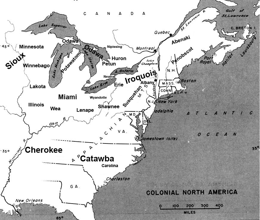
フランス人とイギリス人がこの地域に植民地を築く何千年も前から、ミシガン州北部にはネイティブアメリカンの文化とそれに続く部族が住んでいました。ミシガン州北部は、学者たちが先史時代の住民が住んでいたと考えるローレル複合文化の南端でした。彼らは、五大湖地域に存在した先史時代の部族にちなんで名付けられたホープウェルインディアン交易システムの一部でした。[ 2 ]
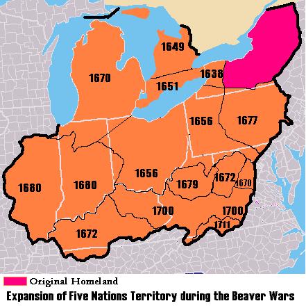
メノミニー族の伝承によれば、この部族の本来の故郷は、現在のスーセントマリーとミチリマキナックの近く、さらに北にあった。ヨーロッパ人との接触以前のある時期(おそらく1600年頃)、東からオジブワ族、オダワ族、ポタワトミ族がやって来たため、彼らはメノミニー川まで南西に追いやられた。 [ 3 ]アンドリュー・ブラックバードが書いたオダワ族の歴史書には、エメット郡には「草原の部族」を意味するムシュコデシュと呼ばれるインディアンの一族が密集して住んでいたと記されている。ムシュコデシュ族は農耕社会であり、「古くなった荒れ果てた畑を放棄して森林を草原に変え、草の生い茂る平原を形成して土地を形作った」と言われている。オタワ族の伝承によれば、ムシュコデシュ族がオタワ族の戦士団を侮辱した後、オタワ族は4万から5万人のムシュコデシュ族を虐殺し、残りを土地から追い出したという。マッシュコデシュ族が誕生する以前、マキノー海峡周辺地域はミチネマキナゴ族の居住地でした。[ 4 ]元々はミシイケン族として知られ、夏の居住地はマキノー島で、周辺地域はミシイケン・イマキナコムと呼ばれていました。これらの地域には、リトル・トラバース湾の南側の丘陵地帯にある越冬地も含まれていました。ミシイケン族は小柄な先住民族で、1640年代のビーバー戦争中にイロコイ族によってほぼ絶滅させられました。この民族の残党はオジブワ族に受け入れられ、現在もマキノー・バンド・オブ・チペワ・アンド・オタワ・インディアンの中に存在しています。[ 5 ]
歴史時代、オジブワ族、オダワ族、ポタワトミ族として知られるアニシナベ語/アルゴンキン語族の人々は、 「三つの火の評議会」と呼ばれる緩やかな連合体を形成していた。彼らはマキノー海峡周辺、ミシガン州のアッパー半島とロウアー半島、そしてヒューロン湖沿いのカナダ北部の島々と海岸線に居住していた。
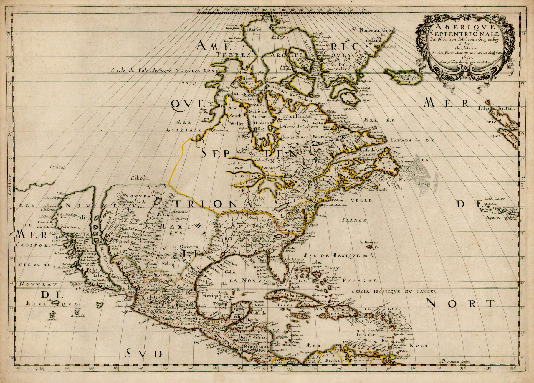
1608年、サミュエル・ド・シャンプランはケベックをヌーベルフランスの一部として設立した。彼はエティエンヌ・ブリュレなどのクーリュール・デ・ボワを森に送り込み、インディアンとの関係を築かせた。1615年か1616年頃、シャンプランはフレンチ川を経由してジョージア湾へ行き、南端のペネタングイシーン付近でオタワ族とヒューロン族のインディアンと出会った。[ 7 ] [ 8 ] [ 9 ] [ 10 ]フランス人はインディアン部族との北米毛皮貿易を確立した。その後数十年間、フランスの探検家や宣教師は、五大湖上流を含むヌーベルフランスの「上流地域」の探検を続けた。1634年、ジャン・ニコレットはウィスコンシンに向かう途中でマキノー海峡を通過した。[ 11 ]フランスがセントローレンス川沿いの内陸部を植民地化する一方で、オランダとイギリスは北アメリカ東海岸の植民地化を開始し、毛皮貿易を確立し、五大湖の東と南東沿いのイロコイ族に武器を与えた。貿易と毛皮をめぐる競争は、残忍なビーバー戦争を引き起こした。イロコイ族は五大湖の領土に西へ進出し、以前そこに定住していた部族を追いやった。1649年にイロコイ族が南オンタリオからヒューロン族を攻撃し、分散させた結果、ヒューロン族はミチリマキナックのオジブワ族のもとに避難し、最終的に彼らの世話をするためにイエズス会の宣教団が設立された。[ 12 ]
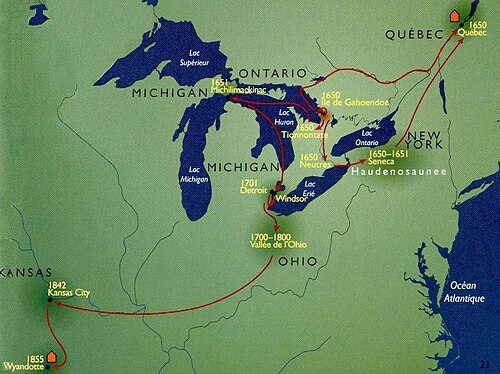
イエズス会士マルケット神父は1671年にセントイグナスに宣教所を設立した。ビーバー戦争が激化する中、マルケット神父はインディアンに福音を伝えた。1673年5月17日から、マルケット神父が1675年5月18日にラディントン近郊で亡くなるまで、マルケット神父とルイ・ジョリエはミシガン湖とミシシッピ川北部を探検し、地図を作成した。1679年、ルネ=ロベール・カヴェリエ・ド・ラ・サールとルイ・ヘネピン神父は北西航路を探すためル・グリフォン号で出発した。これはミシガン北部を航行した最初の帆船として知られている。彼らはエリー湖、ヒューロン湖、ミシガン湖を、それまでカヌーに乗った男たちだけが探検した未踏の水域を通って航海した。マルケット神父の死後、宣教所はフィリップ・ピアソン神父、そしてヌーヴェル神父に引き継がれた。[ 14 ]
アンリ・ヌーヴェル神父は「オタワ伝道所の長」でした[ 15 ]。ヌーヴェルはこの職を1672年から1680年まで(1678年から1679年の2年間の中断期間を含む)、そして1688年から1695年まで務めました[ 16 ] 。ヌーヴェルの下で、1674年頃に新しい礼拝堂が建てられました。1683年までに伝道所は非常に成功し繁栄したため、ニコラ・ポティエ神父、アンジャルラン神父、ピエール・バイヨケ神父の3人の司祭がそこに派遣されました[ 14 ] 。 1679年にサン・イグナスにフランス軍の駐屯地が設立されたことで、兵士たちは宣教師たちよりも教育水準が低く、人当たりも悪かったため、フランス人と地元住民との関係が悪化しました。
1683年、ジョゼフ=アントワーヌ・ド・ラ・バール総督は、ダニエル・グレイソロン、スール・デュ・リュット、オリヴィエ・モレル・ド・ラ・デュランタイエに、五大湖のミシガン湖とヒューロン湖を結ぶマキノー海峡の北岸に戦略的な拠点を築くよう命じた。彼らはセント・イグナスのイエズス会宣教所を要塞化し、ラ・デュランタイエは北西部のフランス軍要塞の総司令官として着任した。その要塞とは、フォート・サン・ルイ・デ・イリノイ(イリノイ州ユーティカ)、フォート・カミニスティゴヤ(オンタリオ州サンダーベイ)、フォート・ラ・トゥーレット(オンタリオ州ニピゴン湖)である。彼はまた、現在のウィスコンシン州グリーンベイ周辺地域の管理も担当していた。 1684年の春、ラ・デュランタイは、ビーバー戦争の一環としてセネカ族(イロコイ連邦の一部)に包囲されていたセント・イグナスからフォート・セント・ルイス・デ・イリノイへの救援遠征隊を率いた。彼らは、儲かる毛皮貿易を支配するために、より多くの狩猟地を獲得しようとしていた。その年の夏と1687年に再び、ラ・デュランタイは、海峡からクーリュール・ド・ボワとインディアンを率いて、ニューヨーク州西部北部の領土にあるセネカ族の本拠地を攻撃した。これらの年、ニューヨークからのイギリス人商人は五大湖に進出し、ミチリマキナックでも交易を行った。これと1689年のイギリスとフランスの間の戦争勃発により、1690年に新司令官ルイ・ド・ラ・ポルト・ド・ルーヴィニーがフォート・ド・ブアードの建設を指揮した。
1690年代、アントワーヌ・ド・ラ・モット・カディラック司令官は、フォート・ド・ブアードを拠点として五大湖の探検と地図作成を行った。カディラックは1697年にセント・イグナスを離れ、イエズス会士たちは1705年までに住居と教会を明け渡した。[ 17 ]
ビーバー戦争は、1701年にモントリオールでフランス人とコンディアロンク(マキノー地域のヒューロン族の酋長)を含む39人のインディアン酋長によってモントリオール大和平が調印されたことで終結した。アントワーヌ・ローメ・ド・ラ・モット・スール・ド・カディラックが1701年にデトロイトを建設するためにこの地域を離れ、セント・イグナスの住民の多くを連れて行ったとき、この伝道所の重要性は劇的に低下した。[ 14 ]


セント・イグナス伝道所は1705年まで開いていたが、その年にエティエンヌ・ド・カルヘイル神父によって放棄され焼失した。[ 18 ] 1712年に再開され、1741年に南岸に移転するまで海峡の北岸で運営されていた。[ 19 ] 伝道所の移転に伴い、マルケットの礼拝堂の正確な位置は不明となった。[ 18 ]
1712年、フランス人とメスクワキ族の間でフォックス戦争が始まった頃、カナダ総督フィリップ・ド・リゴー・ド・ヴォードルイユは、コンスタン・ル・マルシャン・ド・リニェリーを派遣し、1696年に王室の命令で放棄されたミチリマキナックの旧拠点を再占領させた。
1715年頃(第一次フォックス戦争中)、フランス軍はミシガン州下半島の北端に新たな拠点を建設し、ミシガン北部の軍事拠点を再建した。この拠点は毛皮などの交易や、先住民との宣教活動の新たな中心地となった。
リグネリーは約3年間イリノイ州でメスクワキ族と戦った後、1722年にミチリマキナックの指揮官に復帰した。彼は代理総督シャルル・ル・モワン・ド・ロングイユ、そして(1726年からは)ヌーベルフランス総督シャルル・ド・ラ・ボワシュ、ボーアルノワ侯爵の命令を実行した。
1720年から1722年にかけて、ピエール・フランソワ・ザビエル・ド・シャルルボワは太平洋横断ルートを探し求め、ミシリマキナックやミシガン州北部の他の地点に立ち寄った。1728年、毛皮商人のオーギュスタン・ラングラードはミシリマキナックで毛皮取引の許可を得た。彼と、オタワ族との混血である息子のシャルル・ミシェル・ド・ラングラード(1729年にこの砦で生まれた)は、後にミシガン州北部の毛皮貿易、そして1712年から1733年のフォックス戦争と1754年から1763年のフレンチ・インディアン戦争における五大湖周辺の部族とのフランスとの関係に大きな影響を与えることになる。
1745年までに、オダワ族はミシガン湖沿岸からグランドトラバース湾地域にかけて集落を築き、人口は約1,550人から3,000人であった。季節によって人口は変動し、季節に応じて内陸の異なるキャンプ地(時にはイリノイ州まで)へ移動するのがその伝統であった。[ 20 ]オジブワ族の一部もオダワ族とグランドトラバース湾地域を共有していた。[ 20 ]
1751年、マニスティにオダワ族へのイエズス会宣教団が設立された。[ 21 ]
1760年代、フランス・インディアン戦争(およびヨーロッパでの七年戦争)でフランスを破った後、イギリスはマキノー海峡とミシシッピ川東のフランス領を支配下に置いた。彼らは先住民の抵抗に遭い、先住民はポンティアック戦争(1763~1766年)と呼ばれる蜂起を起こした。1763年6月2日、オジブワ族とサック族の戦士がミチリマキノー砦の白人住民の大多数を殺害した。生き残った一人であるアレクサンダー・ヘンリー長老は捕虜となりビーバー島に連行されたが、オダワ・ワワタム族に救出された。イギリスは1780年にその場所に、より堅固なマキノー砦を建設した。 [ 22 ] [ 23 ]
アメリカ独立戦争における反乱軍の勝利は、この地域の勢力図に再び変化をもたらした。イギリスは1783年のパリ条約でマキノー島のマキノー砦を新たに独立したアメリカ合衆国に正式に割譲したが、イギリス軍は1796年まで五大湖の拠点を撤退することを拒否した。その時、イギリス軍はデトロイト、マキノー、ナイアガラの砦をアメリカ側に譲渡した。イギリス軍とアメリカ軍は1812年の米英戦争中もこの地域で再び争った。境界線が確定したのは1828年、近くのドラモンド島にあったイギリス軍の拠点、ドラモンド砦が撤退した時であった。
海峡全域は、1783年のパリ条約により米国が英国から正式に獲得し、1787年の北西部条例により入植が許可された。しかし、英国軍の大部分は、1794年にジェイ条約によって北西部領土に対する米国の主権が確立され、北ミシガンが「ノックス郡」の一部となるまで、五大湖地域から撤退しなかった。[ 24 ] 1795年から1815年の間に、メティス(フランス人(後にスコットランド人)の毛皮猟師や商人と結婚した先住民女性の子孫)の入植地と交易拠点が、ミシガン州、ウィスコンシン州、そして程度は低いもののイリノイ州とインディアナ州に設立された。1829年になっても、メティスはウィスコンシン州の経済において支配的であり、北ミシガンでも影響力を持っていた[ 25 ] 。これは、彼らが先住民と白人の毛皮商人の間の仲介者として働くことができたためである。 1805 年に設立されたミシガン準州への米国の入植は、土地所有権をめぐってネイティブアメリカンとの誤解が度々発生した。一方、1804 年、マキノー島はアメリカの毛皮貿易の中心地であった。[ 26 ]ガードン・サルトンストール・ハバードは、ジョン・ジェイコブ・アスターの多くの罠猟師やボヤジュールの一人であり[ 27 ] 、マキノー船で五大湖の水域を航行し、ヨーロッパで販売するための毛皮を集めていた。[ 28 ] 米国議会が先住民との貿易を規制するための貿易および通商法を可決すると、インディアン貿易局はマキノーに米国の交易拠点「ファクトリー」を設立し、それは 1812 年の戦争まで存在した。[ 29 ] [ 30 ] 1812 年の戦争の最初の戦闘の 1 つは、マキノー砦の包囲戦であり、イギリス軍とネイティブアメリカンによって行われた。イギリスとアメリカ合衆国の戦争勃発後まもなく、彼らはこの島を占領した。イギリスの容易な勝利に勇気づけられた先住民たちは、その後、イギリスを支持するために集結した。先住民の協力は、戦争の残りの期間におけるイギリスの数々の勝利において重要な要因となった。1812年と1813年の残りの期間、イギリスは領土の首都デトロイトも支配していたため、マキノー島の支配は揺るぎないものとなった。アメリカ軍はマキノーを攻撃する前に、この島を奪還しなければならなかった。1813年9月のエリー湖の戦いの後、イギリス軍はデトロイトを放棄し、アメリカ軍がミシガン北部の水域を奪還する機会を得た。1814年7月、マキノー砦の司令官ロバート・マクドゥオールがプレーリー・デュ・シエン包囲戦の戦争遂行に苦戦していた頃、アメリカ軍はマキノー島の戦いの最中にマキノーを攻撃した。アメリカ軍は砦の占領に失敗し、イギリス軍は1815年の和平までマキノー島を保持し、その後アメリカ軍が再占領した。[ 31 ] [ 32 ]
マキノー島はアメリカ毛皮会社の交易拠点であり続け、陸軍医師のウィリアム・ボーモントが 1820年に駐屯軍医となり[ 33 ] 、 1822年から1833年にかけて19歳のアレクシス・セント・マーティンに対して有名な消化実験を開始した場所でもあった[ 35 ] [ 36 ]。マキノー島はまた、ヘンリー・スクールクラフトが1833年から米国インディアン代理人本部を置いた場所でもあった。 1830年のインディアン強制移住法の後、スクールクラフトは1836年のワシントン条約を交渉し、グランドラピッズ北部の土地を北ミシガンの土地の明確な法的所有権と入植のために開放し、土地の売却によって先住民が「文明化された」生活に同化するための技能訓練の資金を提供するという条項が盛り込まれた。
毛皮貿易、アメリカ軍やインディアン事務所、さまざまな商人が存在していたにもかかわらず、ミチリマキナック(サギノーからグリーンベイまでのすべての集落と定義される)の定住人口は、1820年から1840年の期間で800人から1000人の間であった。[ 37 ]


1840年代までに、ヨーロッパのファッションでビーバーの帽子がシルクの帽子に取って代わられたため、アメリカ毛皮会社は急激に衰退した。 [ 38 ] [ 39 ]政府機関がデトロイトの首都に移転したため、マキノー海峡の影響力は低下した。漁業はわずかに増加したが、毛皮産業の衰退はミチリマキノーの経済的重要性に打撃を与えた。[ 40 ]
エリー運河は1825年に開通し、ニューイングランドやニューヨークからの入植者がオールバニーやバッファローを経由して水路でミシガンに到達できるようになった。この航路の開通と1837年のシカゴの市制施行により、デトロイトからマキノー海峡を経由してシカゴに至る五大湖の蒸気船交通量が増加した。 [ 41 ] [ 42 ] [ 43 ] [ 44 ] 沿岸地域は旅行されていたが、ミシガン北部の内陸部についてはほとんど何も知られていなかった。[ 45 ] 1837年にミシガンが州になったとき、最初に行ったことの1つは、ミシガンのあまり知られていない地域の地質学的、鉱物学的、動物学的、植物学的、地形学的側面を理解するための取り組みとして、ダグラス・ホートンをミシガン地質調査の責任者に任命することであった。[ 46 ]初期の入植者たちは、漁師、ネイティブアメリカンへの宣教師、漁業、灯台、航行する船のための薪の伐採など、五大湖の初期の海事産業に従事する人々を含め、ミシガン州北部沿岸にやって来た。1835年、第3アメリカ砲兵連隊のベンジャミン・プール中尉[ 47 ]は、サギノーとマキノーの間にあるかつてのインディアンの道を測量し、それが後にマキノー・トレイルとして知られるようになった。
ネイティブアメリカンへの伝道活動には、ピーター・ドハティ牧師[ 48 ]とジョン・フレミング牧師による1839年のオールド・ミッション半島での長老派教会の伝道、ウィリアム・モンタギュー・フェリーによる1825年のマキノー島での長老派教会系の伝道所/伝道教会、マグドレーヌ・ラフランボワーズとサミュエル・チャールズ・マッツケリによる1830年のマキノー島でのカトリックの聖アンヌ教会、フレデリック・バラガ・フランシス・ザビエル・ピエルツとイグナティウス・ムラクによるラルブル・クロッシュとペシャウベスタウン(リーラノー半島)でのチペワ族とオタワ族へのカトリック伝道、ピーター・グリーンスキーによる1844年にリトル・トラバース湾近くに設立されたメソジストのグリーンスキー・ヒル教会、そしてピーター・ウォーカズー酋長とジョージ・スミス牧師によってノースポート(リーラノー半島)に設立された1848年の会衆派教会の伝道活動などがある。 1848年にストラング派モルモン教徒のコミュニティがビーバー島に移住したこと [ 49 ]は、モルモン教の指導者たちが法律を施行し、ビーバー諸島でのアルコールの使用を制限しようとしたことから、さらなる紛争を引き起こした[ 50 ] 。
主要な漁業集落としては、ミシガン州リーランドの「フィッシュタウン」やビーバー島群島などが挙げられる。
ミシガン州北部の初期の灯台には、サンダーベイ島灯台(1831年)、オールドプレスクアイル灯台(1840年)、サウスマニトゥー島灯台(1840年)、デトゥールリーフ灯台(1847年)、ウォーゴシャンス灯台(1851年)、グランドトラバース灯台(1852年)、タワスポイント灯台(1853年)、ビーバーアイランドハーバー灯台(1856年)、ビーバーアイランドヘッド灯台(1858年)、ポイントベッツィー灯台(1858年)などがある。
米国救命局が五大湖に救命艇ステーションのシステムを確立したのは1870年代になってからだが、[ 51 ]ノースマニトゥー島救命ステーションのようなボランティアステーションは1854年には既に設立されていた。
1836年のワシントン条約で、ミシガンの部族はミシガン北部の土地に対する権利を放棄し、入植者に開放した。1840年代には、オダワ族の村がミシガン湖岸、特に現在のハーバースプリングスからクロスビレッジにかけて点在していた。半島先端の地域は、1875年まで米国連邦政府との条約規定により、主に先住民族のために確保されていた。初期の政府はマキノー島とセントイグナスを中心に運営されていたが、1840年から1853年の間に、州はこの単一の大きなミチリマキナック郡[ 52 ] [ 53 ] [ 54 ] [ 55 ]を分割し、ミシガン北部に約21の郡の名前と境界を定めた。この命名と測量により、特定の区画された土地を土地事務所で販売することが可能になった。[ 56 ]北ミシガンへの白人移民と自作農の増加は、1836年の条約に起因するネイティブアメリカンの土地請求の処理に困難をもたらした。チペワ族とオダワ族のインディアン部族は、1855年の条約を通じて救済を求めた。 [ 57 ]この1855年の条約合意により、1836年の条約に関連する個々のネイティブアメリカンの家族のために土地と支払いが確保されたが、この条約の後、米国はインディアンまたはその部族に対して(「土地、金銭、または保証されたその他のもの」)何も負わなくなった。[ 58 ]

土地の測量と先住民の未解決の土地請求が解消されたことで、北ミシガンへの入植はさらに増加した。1862年のホームステッド法により、1エーカーあたり1.25ドルで160エーカーの土地が利用可能になったため、多くの南北戦争退役軍人や投機家が北ミシガンにやってきた。[ 59 ] 通過する船のための木材の伐採は本格的な木材産業へと発展し、マニスティ、トラバースシティ、シャルルボワ、ルディントンなどの港湾都市の発展に貢献した。
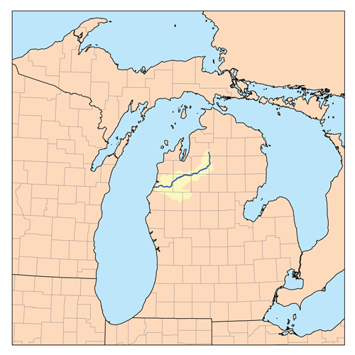
1870年代から、ミシガン州北部と南部のより大きな工業地帯を結ぶ鉄道が建設された。グランドラピッズ・アンド・インディアナ鉄道は1872年12月にトラバースシティに到達し(ウォルトンジャンクション・アンド・トラバースシティ鉄道会社経由)、1873年にはペトスキー(それまでは「ベア川」として知られていた)に到達した。 [ 61 ]フリント・アンド・ペレ・マルケット鉄道は1874年にラディントンに終着駅を完成させた。ミシガン・セントラル鉄道は1872年秋にオツェゴ郡に到達したが、 [ 62 ] 1873年の金融恐慌とそれに続く5年間の景気低迷のため、鉄道投資は数年間停滞した。チェボイガンと[ 63 ]マキノーシティには1880年代初頭まで鉄道サービスがなかった。[ 64 ]
1871年のミシガン大火によるマニスティや他の木材港での打撃にもかかわらず、北ミシガンでの木材生産は大幅に増加した。蒸気動力(水力ではなく)製材所や丸鋸などの新しい機械ツールにより、大量の木材を迅速に処理する能力が拡大した。狭軌の移動式レールにより、これまでアクセスできなかった河川から離れた場所で年間を通して木材を伐採することが可能になった。[ 65 ] 1877年の鉄道ストライキと同時期に、ミシガン州の木材市場は1877年7月に暴落した。 [ 66 ] [ 67 ] 1880年までに五大湖地域が伐採を支配するようになり、ミシガン州は他のどの州よりも多くの木材を生産するようになった。[ 68 ]
1880年代には商業漁業も盛んになった。1881年までに、ビーバー諸島周辺の豊かな漁場のおかげで、ビーバー島は米国最大の淡水魚供給地となった。[ 69 ] 1886年までに、乱獲により漁獲量は激減した。[ 70 ] 1893年、ミシガン州漁業委員会は、ネブラスカ大学の動物学者ヘンリー・ウォードにトラバース湾地域の魚の餌源を調査するよう依頼した。[ 71 ]

北ミシガンでは、リョコウバトは食料源として狩猟されていたが、1870年代までに、個体数の増加と経済的な困窮が重なり、乱獲と最終的な絶滅につながった。特に1874年と1878年に大規模な営巣とその後の数百万羽の虐殺の後、リョコウバトの大規模な群れが北ミシガンの空を覆い尽くすことはなくなった。この頃には、大規模な営巣は五大湖周辺の北部でのみ見られるようになっていた。最後の大規模な営巣は1878年にミシガン州ペトスキーで行われた(数日前にはペンシルベニア州でも営巣があった)。そこでは、ほぼ5か月間、毎日5万羽が殺された。生き残った成鳥は新しい場所で2度目の営巣を試みたが、雛を育てる機会を得る前にプロの猟師によって殺された。1880年代まで散発的な営巣が報告されたが、鳥たちは疲弊しており、迫害されると巣を放棄することが多かった。[ 72 ]
カラマズーなどの鉄道拠点を経由して中西部の大都市と鉄道で結ばれたことで、入植者が移住し、裕福なリゾート客がペトスキー近郊のベイビュー協会、シャルルボワのベルヴェデーレクラブ、その他の湖畔の別荘地に夏の別荘協会を設立するようになった。1875年から1895年まで、1,044エーカー(422ヘクタール)のマキノー国立公園は、ロッキー山脈のイエローストーン国立公園に次いで米国で2番目の国立公園となった。
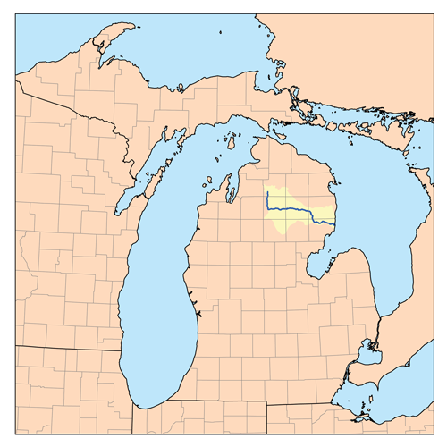

オーセーブル川沿いのスポーツフィッシングは、デトロイト、クリーブランド、シンシナティ、バッファロー、トレド、インディアナポリス、シカゴの裕福なスポーツマンにとって観光名所となった。[ 74 ] 1870年代後半にジャクソン、ランシング、サギノー鉄道がグレイリングに到達した後、北極グレイリングの生息地であるクロフォード郡での狩猟と釣り旅行の宣伝を始めた。[ 74 ]同様に、グランドラピッズ・アンド・インディアナ鉄道は、1882年に「グランドラピッズ・アンド・インディアナ鉄道で到達できる北ミシガンの健康、娯楽、狩猟、釣りリゾートガイド」を出版した。[ 75 ] 1880年、ニューヨークの弁護士アンセル・ジャッド・ノースラップは、北ミシガンでの釣り旅行の詳細な記録を出版し、マスとグレイリングの釣りのためにオーセーブル川、マニスティ川、チェボイガン川、ピジョン川、ジョーダン川を評価した。[ 76 ]ミシガン州は、1873 年に漁業委員会を設立し、河川にホワイトフィッシュ、ブラックバス、カリフォルニアサーモン、カリフォルニアトラウト、ジャーマンコイ、ブルックトラウトなどの外来種を放流した。[ 77 ] 漁業委員会は、ポカゴンのクリスタルスプリングスクリークに最初の魚の孵化場を作り、小さな魚を満載した貨車をミシガン州各地の河川に送った。[ 78 ] [ 79 ]グレイリングがオーセーブル川、マニスティ川、その他の河川から姿を消すと、州は外来種のブルックトラウト、ブラウントラウト、ニジマス(スチールヘッド)でミシガン州北部の漁業を支えた。[ 80 ] 最終的に、ミシガン州北部の大部分に生息していた北極グレイリングは 絶滅した。[ 81 ]春に川床を使って丸太を運ぶ伐採作業は、これらの魚の繁殖地を破壊した。[ 82 ]回復する前に、ブルックトラウト[ 83 ]などの外来種のスポーツフィッシュがグレイリングの生息地を占拠し、ミシガン州北部からグレイリングを姿を消させた。
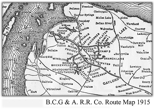
鉄道網の開通は最終的に変革をもたらした。北部で木材やその他の商品を生産し、南部の都市市場に出荷できるようになった。製鉄所、製革所、製粉所、セメント工場、農業企業など、多様な産業が発展した。1885年までに、松の集中的な伐採と輸出により、製材業のホワイトパインの生産能力が著しく低下した。[ 84 ]ミシガン州での伐採は1889年にピークを迎えた。[ 85 ]入手可能な場所では、広葉樹やツガが伐採され、特にイーストジョーダン、トラバース湾、クロフォード郡付近では、一時的にこの地域の製材業の寿命が延びた。[ 86 ]ウィリアム・ハワード・ホワイトの木材鉄道(ボインシティ、ゲイロード&アルペナ鉄道会社)、デイビッド・ワードのデトロイト&シャルルボワ鉄道、イーストジョーダン&サザン鉄道により、遠隔地の木材地帯へのアクセスが可能になった。木材伐採が衰退するにつれ、鉄道会社はミシガン州北部を「新鮮な空気」の保養地として宣伝し始め、[ 87 ]伐採会社は伐採後の切り株だらけの土地を農業用地として宣伝した。[ 88 ]
北ミシガンの湖畔地域では、漁業や林業が徐々に衰退していく中でも、リゾート時代が栄えた。歴史家ブルース・キャットンの回顧録『朝の列車を待つ』(1972年)は、ミシガン州の林業時代が終焉を迎えつつあった20世紀初頭の北ミシガンの小さな町での彼自身の体験を記録している。[ 89 ]アーネスト・ヘミングウェイもまた、彼の「ニック・アダムス」シリーズを通して、世紀末の北ミシガンでの生活を記録している。ヘミングウェイの両親はリゾート客で、冬はイリノイ州オークパークで過ごし、夏は1899年からワルーン湖畔のウィンデミア・コテージで過ごしていた。[ 90 ]


伐採業が衰退するにつれ、ミシガン州北部の多くの地域は自然保護活動によって森林地帯へと回復した。ヒューロン国有林は1909年に、マニスティ国有林は1938年にそれぞれ指定された。州立公園も設立され、その中には以下のようなものがある。
グレイリングのハンソンヒルズは、ミシガン州初のダウンヒルスキー場でした。1929年にオープンし、鉄道が乗り入れていました。[ 93 ]キャデラック近郊のキャバーフェイピークススキー&ゴルフリゾートは1938年にオープンし、鉄道が乗り入れていました。ボインマウンテンリゾートは1948年にオープンしました。ベンジー郡のクリスタルマウンテンは1956年にオープンしました。ハーバースプリングス近郊のナブズノブは1958年にオープンしました。
1960年代に旅客鉄道の利用が終焉を迎えると(自動車旅行の増加も一因)、地元の商工会議所による北ミシガンの積極的なプロモーション活動により、今日でも多くの観光客を北へ引きつける数々の祭りやアトラクションが誕生した。

北ミシガンの住民は一般的に、グレイリングとマキノー橋の間にあると考えています。この地域の南の境界は明確に定義されていません。州南部の住民の中には、フリント、ポートヒューロン、グランドラピッズ、マウントプレザントのすぐ北を南の境界と考える人もいますが、北ミシガンの住民はこの地域をミッドミシガンと呼んでいます。また、ベイシティとクレアの北の地域に限定する人もいます。これは、ロウアー半島のミトンのような形の「指」を大まかに示すUSハイウェイ10を基準点として使用しています。[ 94 ]「アップノース」がどこから始まるかという話題は、ミシガン州民の間でよく議論され、この件に関して決定的な答えはありません。[ 95 ]
北緯45度線はミシガン州北部を横断しています。この線を示す標識は、ロウアー半島のミッションポイント灯台[ 96 ] (トラバースシティのすぐ北)、サットンズベイ、ケワディンのケアンハイウェイ[ 97 ]、ミシガン州アルバ(国道131号線沿い、郡道42号線の北約2マイル、道路の両側に標識あり)、ゲイロード[ 98 ] 、アトランタ、アルピーナ[ 99 ]にあります。これらは、このような標識や記念碑が存在することが知られている米国29か所のうちの6か所です。もう1つの同様の標識は、アッパー半島のミシガン州メノミニーにあります[ 100 ]。
マキノー海峡を挟んで北、西、北東には、ミシガン州のアッパー半島(「UP」)があります。ミシガン州最北端に位置するにもかかわらず、アッパー半島は通常、北ミシガンの定義には含まれません(ただし、北ミシガン大学はアッパー半島のマルケット市にあります)。ミシガン州の住民は、アッパー半島を州の独立した地域とみなしていますが、アッパー半島の住民は「北ミシガン」はロウアー半島にはないと言うことがよくあります。彼らは、この地域は「北ロウアーミシガン」とだけ呼ばれるべきだと主張しており、これは異なる半島出身の人々の間で論争の的になることがあります。この2つの地域は、全長5マイルのマキノー橋で結ばれています。[ 101 ]橋の南側に住む人々はトロールと呼ばれ、橋の北側に住む人々はユーパーと呼ばれています。
マニスティ郡からイオスコ郡までを結ぶ線(地図上の2番目のオレンジ色の層)より北側のロウアー半島の北部全体は、ローマカトリックのゲイロード教区の一部とみなされている。[ 102 ]
この地域の地理的特徴は、なだらかな丘陵、西海岸の海岸砂丘を含む五大湖の海岸線、大きな内陸湖、多数の河川、広大な森林によって形成されています。土壌の種類と一般的な樹種の変化によって特徴づけられる緊張帯が、マスケゴンからサギノー湾まで確認されています。 [ 103 ]この線の北では、歴史的な入植前の森林はブナとサトウカエデで、さらに南では湿った土壌でのみ生育するツガ、ホワイトパイン、イエローバーチが混在していました。ミシガン州南部の森林は主に落葉樹で、オーク、レッドメープル、シャグバークヒッコリー、バスウッド、コットンウッドは、さらに北では珍しいです。ミシガン州北部の土壌は粗い傾向があり、生育期間は短く、気候は涼しいです。湖の影響による天候は、ミシガン州北部の雪の地帯にかなりの降雪をもたらします。
氷河がこの地域を形作り、独特の地域生態系を生み出した。この地域の大部分は、いわゆるグレイリング氷河融解平野であり、砂質の氷河融解尾根を含む広大な氷河融解平野、ジャックパインの荒地、一部のホワイトパイン・レッドパインの森林、および北部広葉樹林から構成されている。大きな湖は氷河の作用によって形成された。[ 104 ]
The region has the four seasons in their extremes, with sometimes hot and humid summer days (although, mild in comparison to some parts of the south) to subzero days in winter. With the expansive hardwood forest in Northern Michigan, "fall color" tourists are found throughout the area in early to mid-autumn.[105] When the spring rains come, many roads and bridges become impassable due to flooding or muddy to the point a four-wheel drive cannot pass. Snowfall varies throughout the region due to lake-effect snow from the prevailing westerly winds off of Lake Michigan: average yearly snow ranges from 141.4 inches or 3.59 metres in Gaylord to 52.4 inches or 1.33 metres in Harrisville.[106] Both the high and low temperature records for all of Michigan are held by communities in Northern Lower Michigan. The high is 112 °F or 44.4 °C set in Mio on July 13, 1936, and the low is −51 °F or −46.1 °C set in Vanderbilt on February 9, 1934.[107]


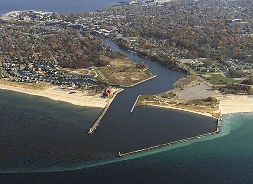
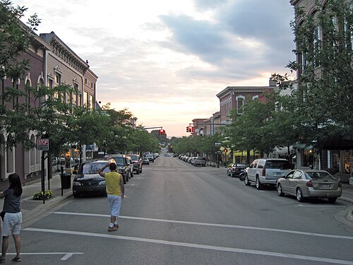
In the northernmost 21 counties in the Lower Peninsula of Michigan, the total population of the region is 506,658 people.[A] The most populated city in Northern Michigan is Traverse City, with over 15 thousand inhabitants. Grand Traverse County is the largest county in Northern Michigan by population, at just under 100,000. Grand Traverse County also contains the three most populous municipalities in Northern Michigan: Garfield Township, Traverse City (which partially extends into Leelanau County), and East Bay Township.
この地域には、ニューイングランド(メイン州、バーモント州、ニューヨーク州)、アイルランド、ドイツ、ポーランドなど、さまざまな民族が暮らしていた。オダワ族はエメット郡(リトル・トラバース・バンド・オブ・オダワ・インディアンズ)に居住している。その他にも、マウント・プレザントやリーラノー半島にネイティブ・アメリカンの居留地が存在する。
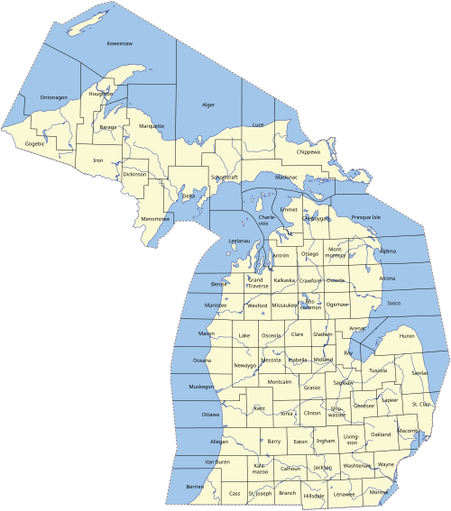
伝統的にミシガン州北部と関連付けられている郡は21あります。
これら21郡に加えて、南に位置するさらに6つの郡も時折「北ミシガン」と呼ばれることがあるが、一般的には他の地域の一部とみなされている。これらの郡は以下のとおりである。
以下は、ミシガン州北部の都市、村、および非法人地域の一覧です。

ミシガン州北部には、カエデ、カバノキ、オーク、トネリコ、ホワイトシダー、ポプラ、マツ、ブナなど、多くの種類の樹木が生育しています。シダ類、トウワタ、クイーンアンズレース、チコリは、開けた野原や道路沿いに自生しています。森林植物には、野生のネギ、モレル茸、トリリウムなどがあります。海岸にはハマニンニクが生えています。また、様々な種類のコケが地面を覆っています。
北ミシガンでよく見られる哺乳類には、オジロジカ、キツネ、アライグマ、ヤマアラシ、ウサギなどがいる。クロクマ、ヘラジカ、コヨーテ、ボブキャット、オオカミ、ピューマも生息している。クーガーは一般的ではないが、長年にわたってその存在が報告されている。 [ 109 ] [ 110 ] [ 111 ]魚類には、ホワイトフィッシュ、イエローパーチ、マス、バス、ノーザンパイク、ウォールアイ、マスキー、サンフィッシュなどがいる。
よく見られる鳥は、カモ、カモメ、野生の七面鳥、アオサギ、ショウジョウコウカンチョウ、アオカケス、コガラ、ハチドリ、ボルチモアムクドリモドキ、エゾライチョウなどです。春と秋には、カナダガンが頭上を飛んでいるのが見られることがあります。ミシガン州北部下半島に固有のあまり知られていない鳥には、エゾライチョウ、オナガライチョウ、アカエリカイツブリ、スウェインソンノスリ、カラフトフクロウなどがいます。[ 112 ] [ 113 ]
オーセーブル州立森林は、ミシガン州下半島の北中部にある州立森林です。森林の大部分は、野生生物の狩猟管理や、キルトランドセンニュウなどの絶滅危惧種や希少種の保護に利用されており、生息地を維持するために定期的に管理された野焼きが行われています。キルトランドセンニュウの生息地は、この地域のますます多くの場所に広がっています。[ 114 ]キルトランドセンニュウ祭りがあり、キルトランドコミュニティカレッジが一部後援しています。[ 115 ]
アメリカ鳥類保護協会と全米オーデュボン協会は、いくつかの場所を国際的に重要な鳥類生息地として指定している。[ 116 ]
昆虫の個体数は、米国中西部の他の地域で見られるものと類似している。テントウムシ、コオロギ、トンボ、蚊、アリ、イエバエ、バッタは一般的で、セイヨウマツノキクイムシや、数種類のチョウやガ(例えば、オオカバマダラやトマトヨトウガ)も見られる。昆虫の個体数における顕著な違いとしては、6月にコガネムシの個体数が多くなること、そして年間を通して、特に夏場の平均気温が低いため、ホタルが少ないことが挙げられる。
ミシガン州北部には、ミシガン州で最も絶滅の危機に瀕している種であり、世界でも最も絶滅の危機に瀕している種の一つであるハンガーフォードミズスズメガが生息しています。この種は世界でわずか5か所にしか生息しておらず、そのうち4か所はミシガン州北部にあります(1か所はオンタリオ州ブルース郡)。実際、この希少な甲虫の安定した個体群は、ミシガン州エメット郡のメープル川東支流の約4キロメートルにわたる区間にのみ存在します。
ミシガン州北部には、致命的な毒を持つヘビは生息していません。毒ヘビであるヒガシマサソーガガラガラヘビはミシガン州に生息していますが、特に北部ではあまり見られません。いずれにせよ、このヘビに噛まれた場合、命に別状はありませんが、成人が体調を崩す可能性があります。その場合は、速やかに医師の診察を受けるべきです。
生息するヘビには、ヒガシブタバナヘビ、ブラウンヘビ、コモンガーターヘビ、ヒガシミルクヘビ、ノーザンリボンヘビなどがいる。一般的な爬虫類と両生類は、様々な種類の池ガエル、ヒキガエル、サンショウウオ、小型のカメのみである。
アメリカ合衆国ミシガン州の州立森林は、ミシガン州天然資源局森林・鉱物・火災管理部門によって管理されています。面積は390万エーカー(1万6000平方キロメートル)で、全米最大の州立森林システムです。ミシガン州の州立森林一覧をご覧ください。北部下半島には3つの森林があります。
さらに、この地域の大部分はマニスティ国有林とヒューロン国有林に覆われています。前者のマニスティ国有林には、ノードハウス砂丘原生地域という独特な環境が存在します。ミシガン湖の東岸にあるこの比較的小さな地域は、面積3,450エーカー(14.0 km² )で、広大な湖岸砂丘生態系を有する米国でも数少ない原生地域の1つです。砂丘は3,500年から4,000年前のもので、湖面より約140フィート(43メートル)高くそびえています。ノードハウス砂丘には、ジャックパイン、ジュニパー、ツガなどの木本植物が点在しています。多くの小さな水たまりや湿地が景観に点在し、砂丘の一部は砂丘草で覆われています。広々とした砂浜は、散歩や夕日鑑賞に最適です。
ミシガン湖とヒューロン湖の沿岸沖にある8つの島々(それぞれシャルルボワ郡とアルピーナ郡に属する)は、ミシガン諸島国立野生生物保護区の一部となっている。


ボート、ゴルフ、キャンプが主なアクティビティです。セーリング、カヤック、[ 117 ]カヌー、バードウォッチング、サイクリング、[ 118 ] [ 119 ] [ 120 ]乗馬、オートバイ、オフロード走行は重要な趣味です。森林アクティビティはどこでも楽しめます。ミシガン州立公園やその他の保護区が多数あり、まさに「快適な半島」となっています。これらには、ヒューロン国有林やマニスティ国有林、スリーピングベア砂丘国立湖岸(ミシガン湖東部の砂丘が35マイルにわたって広がっている)[ 121 ] 、ノードハウス砂丘原生地域などが含まれます。

北部ロウアー地域にあるダウンヒルおよびノルディックスキー(クロスカントリー)のリゾートには、ボインマウンテン、ボインハイランズ、オツェゴクラブ&リゾート(1939年創業)、クリスタルマウンテンリゾート、スノースネークスキー&ゴルフ、ナブズノブ、キャバーフェイピークス、シュースマウンテンなどがあります。これらのリゾートの中には、夏季にゴルフリゾートとしても利用されているところもあります。ミシガン州フレデリックは、特にクロスカントリースキーの中心地として知られています。
秋のアクティビティには、収穫祭、季節限定のビールやワインのイベント、紅葉ツアーなどがあります。ミシガン州北部では、狩猟が人気の秋のレジャーです。弓矢猟、前装式銃猟、そして現代式ライフル猟のシーズンがあります。鹿猟解禁日(11月15日)は、一部の住民にとって重要な日です。鹿猟解禁日のため出席率が低くなることから、11月15日に休校となる学校もあります。
冬には、地元の人々がさまざまなスポーツを楽しみ、それが北ミシガンへの観光客も引きつけています。スノーモービル(そり滑りとも呼ばれる)は人気があり、何百マイルにも及ぶ整備されたトレイルが地域を横断しています。氷上釣りも人気です。ホートン湖のティップアップ・タウンは、氷上釣り、スノーモービル、ウィンタースポーツの大規模なフェスティバルで、凍った湖面に村が集まるという点でユニークです。ヒギンズ湖も氷上釣りに適しており、ノース・ヒギンズ湖州立公園にはスノーモービル、クロスカントリースキー、スノーシューのトレイルが多数あります。グレイリングとゲイロードとその周辺はノルディックスキーで有名です。キャデラックは、夏よりも冬の方が人気が高いと言われています。
ランバーマンズ・モニュメントは、この地域を形作り、天然資源を活用した木こりたちを称えるものです。オーセーブル川と平行に走るリバーロード国立景観道路沿いにあり、オスコダまで続く23マイル(37km )は国立景観道路に指定されています。[ 127 ]ミシガン州は、ジェームズ・マクギリヴレイによる1906年8月10日のオスコダ・プレス紙に掲載された最も古い記録された出版物(後に1910年にデトロイト・ニュース紙で改訂・出版)に基づき、オスコダをポール・バニヤンの公式な故郷と指定しました。[ 128 ]
ハートウィック・パインズ州立公園は、グレイリングと州間高速道路75号線近くのクロフォード郡にある、9,672エーカー(39.14平方キロメートル)の州立公園兼林業博物館です。ミシガン州下半島で3番目に大きく、州全体では5番目に大きな州立公園です。公園内には、伐採時代以前のミシガン州北部の景観を彷彿とさせる、ホワイトパインとレッドパインの原生林が広がっています。また、インターロッケン州立公園も特筆すべき場所です。ここはミシガン州下半島で最も古い州立公園であり、他に残る原生のイースタンホワイトパインの群生地です。
The Besser Museum for Northeast Michigan is a community museum serving Alpena County and surrounding counties in the U.S. state of Michigan. Alpena is a port city on Lake Huron. The museum defines its role broadly — to preserve, protect and present history and culture closely connected with the heritage of Northern Michigan and the Great Lakes. The museum includes a small publicly owned planetarium.[129] The institution says "Our mission is to collect, preserve, interpret, and exhibit authentic articles and artifacts of art, history, and science to inspire curiosity, foster community pride, and cultivate personal legacy."[130]
There were more than 150 past and present lighthouses around Michigan's Great Lakes coasts, including several in Northern Michigan. They serve as functioning warnings to mariners, but are also integral to the region's culture and history. See the list of Michigan lighthouses for more information on individual lighthouses.
A number of annual festivals occur in Northern Michigan, including:
北ミシガンの経済は、人口が少なく、産業も少なく、ミシガン南部と比べて農業も少ないため、制約を受けています。季節雇用や観光関連の雇用は重要です。失業率は概して高いです。(2007年6月には、失業率が最も高い10郡のうち7郡が北ミシガン地域にありました。[ 184 ] 歴史的には、毛皮貿易、木材伐採、商業漁業が最も重要な産業でした。毛皮貿易は1840年代に事実上消滅しました。伐採は今でも重要ですが、最盛期(1860~1910年)の生産量のほんの一部に過ぎません。商業漁業は小規模な活動です。
北ミシガンの大きな魅力は観光業です。不動産、特にコンドミニアムや別荘も重要な収入源です。北ミシガンの不動産および観光市場での支出は、南ミシガンやシカゴ地域からの観光客に依存しているため、北ミシガンの経済は自動車産業やその他の産業の低迷に敏感です。[ 185 ]

ミシガン州の農業は、州南部地域に比べて気候や土壌条件によって制限されている。しかし、東部にはジャガイモや乾燥豆の大規模な農場がある。西部では、グランドトラバース湾周辺の保護された微気候の中で、ワイン用ブドウ、野菜、サクランボが生産されている。グランドトラバース地域には、ミシガン州の連邦政府認定ワイン産地4ヶ所のうち2ヶ所がある。グランドトラバース湾地域は、その景観の美しさから別荘地として非常に人気が高く、米国で最も農業が危機に瀕している地域の一つに挙げられている。
Heavy industrial developments are sparse. The northeast corner has an industrial base.
Cement-making and the mining of limestone and gypsum for Portland Cement are major exports of the area. Charlevoix's Medusa Cement Plant was bought by Cemex in the 1990s. Alpena is home to the Lafarge Company's holdings in the world's largest cement plant and is home to Besser Block Co. (Jesse M. Besser invented concrete block in 1904 and founded the Besser Block Co. in Alpena after making the concrete block making machine). USG Corporation, also known as United States Gypsum Corporation, operates several quarries, including one at Alabaster, and one in Rogers City. Rogers City is the locale of the world's largest limestone quarry, which is also used in steel making all along the Great Lakes.

Northern Michigan has significant natural gas reserves along the Antrim shale formation in northern Michigan. By some estimates it is the 15th largest gas field in the nation.[187] Drilling activity peaked in the late 1980s and early 1990s,[188] In 2014, Encana, the Canadian company who had been drilling in Northern Michigan, sold their mineral rights to Marathon Oil order to focus on more profitable operations elsewhere. For oil interest, Encana amassed rights for the Collingwood-Utica Shale (Michigan) between 2008 and 2010, mostly in Cheboygan, Kalkaska, Michigan, and Missaukee counties. The Collingwood layer is two miles below the surface and would require horizontal drilling.[189][190][191]
Alpena has a hardboard manufacturing facility owned by Decorative Panels, International. Nearer to the Lake Michigan shore, Cadillac and Manistee have manufacturing and chemical industries. Morton Salt operates one of the largest salt plants in the world in Manistee. Also, the East Jordan Iron Works corporate offices, as well as the original foundry, are located in East Jordan.
A small number of people work on the Great Lakes freighters. Adjacent to the Traverse CityCherry Capital Airport is a United States Coast Guardair station (CGAS), which is responsible for both maritime and land-based search and rescue operations in the northern Great Lakes region.
Military presence in Northern Michigan is as follows:
Interlochen Center for the Arts is a notable arts center that offers a high-school-level academy and summer camp near Traverse City. There are also several institutions of higher education in Northern Michigan. Community colleges include North Central Michigan College (NCMC, pronounced "nuck-muck" by locals), Alpena Community College, Huron Shores Campus-Alpena Community College, Kirtland Community College, West Shore Community College, and Northwestern Michigan College (NMC) including the Great Lakes Maritime Academy, the only U.S. maritime academy on freshwater. Northern Michigan has arguably only one four-year university (depending on the definition of the southern boundary of the region), Ferris State University in Big Rapids. Other nearby universities are in the Upper Peninsula (Northern Michigan University and Lake Superior State University), as well as Central Michigan University and Ferris State University in the more southern reaches of the state. The University of Michigan runs the University of Michigan Biological Station out of Pellston, MI. Central Michigan University runs the CMU Biological Station on Beaver Island. Hillsdale College runs the biological station in Lake County.
Many four-year universities located downstate offer bachelor's and master's degree programs through Northwestern Michigan College's unique University Center program, located in Traverse City. The University Center, located in Traverse City, is a joint program with Northwestern Michigan College and various universities around the state that allows local students to "attend" universities that offer bachelor's and master's degrees programs not available through NMC, a two-year college, locally without leaving Northern Michigan. NMC supplies the facilities while the senior universities provide the education and endorsement. Universities offering programs here include Michigan State University, Western Michigan University, Central Michigan University, Grand Valley State University, Ferris State University, Spring Arbor University, and others.[192]
Northern Michigan is in the Designated Market Areas of "Traverse City-Cadillac" (116), "Alpena" (208), and some portions of "Flint-Saginaw-Bay City" (66).
Daily editions of the Detroit Free Press and The Detroit News are also available throughout the area with the Bay City Times and Saginaw News available in the east and The Grand Rapids Press available in the west.
// designates a simulcast.
The following stations serve parts of Northern Michigan as their viewing area, and also some areas outside of the region.
Airports serving Northern Michigan include MBS International Airport near Freeland, Pellston Regional Airport,[194]Traverse City Cherry Capital Airport, Manistee Blacker Airport, and Alpena County Regional Airport in the Lower peninsula. Depending on one's destination, Chippewa County International Airport in Sault Ste. Marie, in the eastern Upper peninsula might be a viable alternative. Grand Rapids and Bishop airport at Flint (although neither is within the area) also have scheduled service proximate to parts of the region. The Oscoda-Wurtsmith Airport is now a public airport which gives 24-hour near-all-weather service for general aviation.
Several ferries still operate in the region.
The largest bridge in Northern Michigan is the Mackinac Bridge connecting Northern Michigan to the Upper Peninsula. The second largest is the Zilwaukee Bridge.
On land, Michigan is a unique travel environment. Consequently, drivers should be forewarned: travel distances should not be underestimated. Michigan's overall length is only 456 miles (734 km) and width 386 miles (621 km) – but because of the lakes those distances cannot be traveled directly. The distance from northwest to the southeast corner is 456 miles (734 km) "as the crow flies". However, travelers must go around the Great Lakes. For example, when traveling to the Upper Peninsula, it is well to realize that it is roughly 300 miles (480 km) from Detroit to the Mackinac Bridge, but it is another 300 miles (480 km) from St. Ignace to Ironwood.
Likewise direct routes are few and far between Interstate 75 (I-75) and M-115 do angle from the southeast to the northwest), but most roads are oriented either east–west or north–south (oriented with township lines set up under the Land Ordinance of 1785).
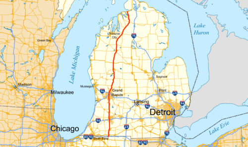

The primary means of transportation in Northern Michigan is by automobile. Northern Michigan is served by one Interstate, and a number of U.S. Highways and Michigan state trunklines.[198]
 I-75 runs northwest–southeast through the region between the Flint/Tri-Cities area and Mackinac Bridge at Mackinaw City, which leads on to the Upper Peninsula.
 US 10 enters Michigan after it crosses Lake Michigan from Manitowoc to Ludington. US 10 runs from Ludington through Baldwin and Reed City before it becomes a freeway west of US 127 near the junction with M-115. US 10 bypasses Midland and terminates at I-75 in Bay City.
 US 23 runs northward for about 200 miles (320 km) along (or parallel with) the Lake Huron shoreline as the Sunrise Side Coastal Highway from the Flint/Tri-Cities area.
 US 31 mainly parallels the Lake Michigan shore from the Ludington area north to Mackinaw City; near Traverse City, the highway cuts the base of the Leelanau Peninsula.
 US 127 ends at Grayling, connecting Northern Michigan with points south
 US 131 is a primary north–south highway that is a freeway from Manton southwards; north of the freeway terminus, the highway is mostly two lanes, connecting Kalkaska, Mancelona, and ending at US 31 in Petoskey.
 M-18 runs between Midland County, through Prudenville and Roscommon to M-72 in Crawford County.
 M-22 follows the Lake Michigan shoreline from Traverse City to Manistee and is a scenic drive along the Leelanau Peninsula and the Sleeping Bear Dunes National Lakeshore.
 M-27 runs along the old route of US 27 between Indian River and Cheboygan.
 M-32 runs between East Jordan and Alpena.
 M-33 runs between Alger (northwest of Standish) and Cheboygan.
 M-37 runs from Battle Creek via Grand Rapids to Traverse City and the Old Mission Peninsula.
 M-42 is a short route between Manton and M-66 north of Lake City.
 M-55 is a 150-mile (240 km) transpeninsular highway at the southern edge of the region from Manistee to Tawas City.
 M-65 runs northward from Au Gres (just north of Standish) to Rogers City,.
 M-66 traverses almost the entire north–south distance of the Lower Peninsula ending at Charlevoix.
 M-68 is an east–west state highway that runs from Alanson to Rogers City; it passes through Indian River, Afton, Tower, and Onaway.
 M-72 crosses the Lower Peninsula from Empire via Traverse City to Harrisville.
 M-75 is a connector between US-131 and Boyne City, and, despite its proximity to the highway, is not related to I-75.
 M-88 traverses Antrim County from Eastport to Mancelona via a handful of small towns.
 M-93 is a short highway connecting Camp Grayling, Hartwick Pines, and the city of Grayling in Crawford County.
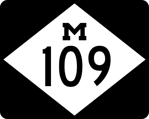 M-109 serves as a scenic loop off M-22 in the Sleeping Bear Dunes.
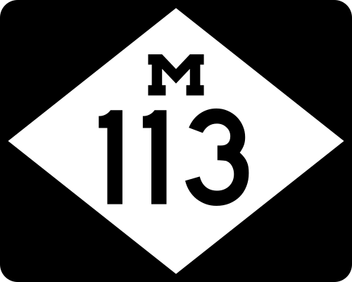 M-113 runs across southern Grand Traverse County connecting M-37, US-131, and the village of Kingsley.
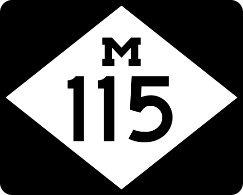 M-115 is a "diagonal highway", taking a generally northwest–southeast direction from Clare to Frankfort.
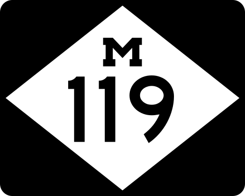 M-119 spurs off US-31 near Petoskey through Harbor Springs and along the Lake Michigan Coast as the Tunnel of Trees.
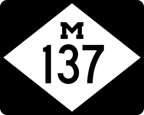 M-137 is a short highway running from US-31 to Interlochen Center for the Arts. The highway has become famous among students.
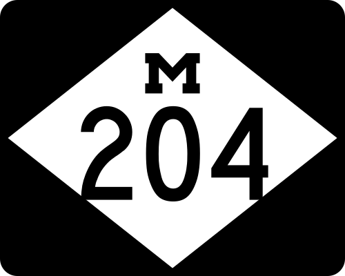 M-204 cuts across Leelanau County from Leland to Suttons Bay.
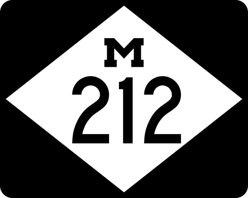 M-212 is the shortest signed highway in the state, connecting Aloha State Park to M-33 south of Cheboygan.
The Northern Lower Peninsula was home to many different railroads during the late 19th and early 20th centuries. One of these lines was the Detroit, Bay City & Alpena Railroad, later known as the Detroit and Mackinac Railway. The railroad had a main line along the Lake Huron shore and branch lines connecting to logging camps and gravel quarries. The railroad was a part owner of the SS Chief Wawatam, a rail car ferry that crossed the Straits of Mackinac. Running down the center of the Northern Lower Peninsula was the Michigan Central Railroad, which connected Mackinaw City with Bay City, Detroit, Lansing, and beyond. This line later became the New York Central and was sold to the Detroit and Mackinac Railway in 1976.[199] Several other railroads have existed in Alpena's history.[200]
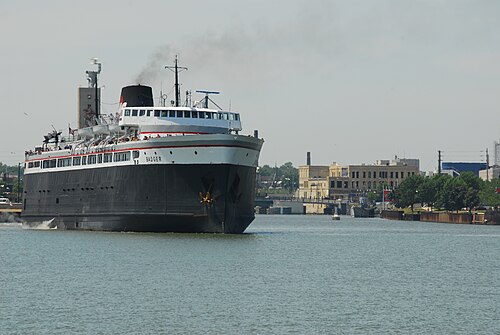
On the west side of the peninsula, the Chicago and West Michigan Railway (later the Pere Marquette Railway) and several commercial cruise lines were early in generating traffic to Northern Michigan destinations. The Pere Marquette Railway operated rail car ferries across Lake Michigan out of Ludington. The most known ferry is the SS Badger which is still in use today for automobiles and passengers.
The Grand Rapids and Indiana Railroad provided rail service between Cincinnati, Ohio, and Mackinaw City. It was later bought out by the Pennsylvania Railroad. It served resort towns such as Traverse City, Petoskey, and Cadillac. In 1975 the line was bought by the Michigan Department of Transportation and the Michigan Northern Railway was contracted to operate. By 1984 much of the railroad was abandoned and operations were handed over to the Tuscola and Saginaw Bay Railway.
The Ann Arbor was a railroad stretching from Toledo, Ohio, to Elberta, Michigan, where it operated a rail car ferry until 1982. The ferry serviced the cities of Manitowoc, Wisconsin, Menominee, Michigan, and Manistique, Michigan. The Ann Arbor became a part of Conrail and then was later divided up between the Michigan Northern Railway and the Michigan Interstate Railway Company. The remaining portions of the line were absorbed into the state owned lines operated by the Tuscola and Saginaw Bay Railway.[201]
Currently, Northern Michigan's railroad system is a skeleton of its former self. After the Chief Wawatam stopped running in 1984, rail lines serving the Straits of Mackinac were soon abandoned. In years past, four different railroads served Mackinaw City and St. Ignace, and now none are left.
The remainder of the former Detroit and Mackinac Railway is now the Lake State Railway. It operates a line from Bay City to Pinconning where it then branches northeast to Alpena and northwest to Gaylord.
Portions of the former Pere Marquette Railway, Grand Rapids and Indiana Railroad, and the Ann Arbor Railroad became the Tuscola and Saginaw Bay Railway. The main line of this railway runs from Ann Arbor north to Petoskey, with branch lines to Yuma and Traverse City. The railroad was renamed the Great Lakes Central Railroad. There have been discussions of reviving passenger service along this line.
"Driven by the Sioux from their Chequamegon Bay base in 1670, they moved next to Michillimackinac where they lived until 1704, then they again resettled near Detroit under French auspices. It was from this Detroit village that dissident members of the Turtle clans... began moving into the long vacant Ohio country... along the Sandusky River valley and plain.
{{citation}}: ISBN / Date incompatibility (help)1673 or 74 Henry Nouvel Superior of the Otawa Missions takes charge of them. Father Philip Pierson becomes pastor of the Huron
{{cite book}}: ISBN / Date incompatibility (help)The original French fort and Jesuit mission were there from about 1671, although there was no French commandant after Lamothe Cadillac left in 1697, as the post was ordered closed in 1696. The Jesuits (and several Coureurs de Bois) remained there until the Jesuits burned their residence and church in 1705.
{{cite journal}}: Cite journal requires |journal= (help) and Accompanying four photos, from 1974 (32 KB){{cite web}}: CS1 maint: deprecated archival service (link)In 1751 a Jesuit mission was established here, but the first actual white settlement took place in 1841, when a sawmill was built.
This, of course, involved annual trips to Mackinaw, the headquarters of John Jacob Astor and his colleagues, the descent of lake Michigan in open Mackinaw boats, a short stop at Chicago, and then the rivers and praries of Illinois, with few but savages for friends at the outset.
The several Government factories operating under the Superintendent of Indian Trade are listed below in the order of their establishment: ...Mackinac (Michilimackinac), 1808–12
{{cite web}}: CS1 maint: archived copy as title (link)As fashion changed in the 1820s, silk hats had a very negative impact on the beaver trade, but a positive one on beaver populations. As a result of its cheapness, silk was ubiquitous by the 1840s. Thus after a long reign, beaver felt was forced to abdicate by the dictates of changing fashion, the same ones which propelled it in the 1620s
By 1840, the beaver trade was essentially over. ... given the precipitous decline in demand brought on by the shift from beaver hats to silk hats in the 1840s...
between 1820 and 1840. It was an important era as Michigan approached statehood and the Straits area saw most of its business and influence drifting toward Detroit," ... "The mid-1800s saw the decline of the Straits of Mackinac as an economic center. With the Americans now in control of the entire region, the area's international influence and government subsidiaries dried up. New industries were slow to replace them as the area proved ill suited to farming and the fur trade died off by 1842. Changing forms of transportation also played a part, as the area had no railroads or roads. The area did have hope, as fishing began to pick up
By the 1840s, the Erie Canal brought tens of thousands of settlers to Buffalo each year in search of passage to the West. Population in cities bordering the upper Lakes reportedly quadrupled in the eight years previous to 1840 as a result of that influx
The coast was only roughly charted, the northern two-thirds of the State was an unsurveyed wilderness including all of the Northern Peninsula and practically nothing was known of its interior into which very few white men had ever penetrated
This plan provided for geological, topographical, zoological, and botanical departments, each in charge of a specialist under the direction of the State Geologist
 This article incorporates text from this source, which is in the public domain.
{{cite web}}: CS1 maint: archived copy as title (link){{cite web}}: CS1 maint: archived copy as title (link){{cite web}}: CS1 maint: archived copy as title (link)Still further progress was made in the same direction by treaty with the Ottawa and Chippewa Indians of Michigan made on the 31st day of July, 1855. By this treaty the United States withdraws from sale certain townships of the State of Michigan and assigns to each one of some twenty bands into which the Indians are divided, the particular townships in which its members may select land. The United States agree to give to each Ottawa and Chippewa Indian, being the head of a family, eighty acres of land, to each single person over twenty-one years of age forty acres, to each family of orphan children under twenty-one years of age containing two or more persons, eight acres and to each single orphan child under twenty-one years of age forty acres; and each beneficiary is to select his land in the tract reserved for the band to which he belonged. On such selection being made each was at liberty to go into possession of the land selected by him and was to receive a certificate therefore, but he could not assign his interest secured thereby. At the end of ten years he was entitled to receive a patent therefore in the usual form, but still the president might, in his discretion, order the patent to be issued at an earlier date or to be longer withheld when it was proved that the welfare of the holder of the certificate would be promoted thereby. The treaty also provides that the portion of the land so described and set apart which shall not be selected by the Indians within five years shall remain the property of the United States and may be sold like other public lands, except that the exclusive right to become purchasers within the next five years was reserved to the Indians. In consideration of these provisions of the treaty and the payment of $538,400 in manner therein specified, the Ottawa and Chippewa Indians release the United States from all liability on account of former treaty stipulations and receive them in lieu and satisfaction of all claims legal and equitable on the part of said Indians, jointly and severally, for land, money or other thing guaranteed to them or either of them by previous treaties. And by the fifth article of the treaty the tribal organization of said Ottawa and Chippewa Indians is dissolved, except so far as is necessary to carry out the provisions of said treaty; and all future matters of business are to be transacted not with the entire tribe, but with those only who are interested in the subject matter, and the payments which are to be in money by the terms of the treaty are to be paid not to the tribe as such, but to the individual Indians of these several bands per capita.
The Homestead act of 1863 drew another type of settler to northern Michigan. Any person over 21 who headed a household – ... who could successfully build a dwelling, clear, and farm at least five acres on a 160-acre parcel of land for five years – could claim the property.
The small settlement, once dubbed Bear River, was renamed Petoskey in 1873 in honor of Native American chief Ignatius Pet-o-sega.
The railroad arrived in Cheboygan in 1881... prior to this, seasonal navigation provided the only real link to places further south.
[he was] a sawmill owner until the lumber-market crash of 1877
Further trouble came in July 1877 in the form of a crash in the market for lumber, resulting in the bankruptcy of several leading Michigan lumbering concerns.
By 1881, Beaver Island had become the largest supplier of fresh-water fish in the United States because of the control Irish fishermen had over the rich fishing grounds.
By 1857, a mill and dock had been built, a general store building had been erected; dwellings for the pioneers had been built; the river had been cleaned out to permit logs to float down to the mill,
UMI number 3361957
"Formerly in Great Lakes basin, Michigan" (with map showing Northern Michigan highlighted)
"By the 1890s the grayling were all but gone due in part to over fishing, commercial lumbering and the introduction of non-native brook trout.
As early as 1885 depletion of the accessible pine began to be noticed even in the northern part of the lower peninsula.
In 1889, the year of greatest lumber production, Michigan produced approximately 5.9 Billion board feet.
By the mid to late 1890s, very much of the white pine in Michigan had been cut and the railroads lacked for traffic. The Michigan Central, the Grand Rapids and Indiana and the Detroit and Mackinac began promoting northern Michigan as a summer vacation destination in hopes of generating revenue from passengers.
[Lumber Companies] vigorously promoted the former forests as good farmland"... but experience soon proved that this was not the case
{{cite web}}: CS1 maint: archived copy as title (link)Blissfest Music Festival – Blissfest Music Festival brings together live American roots music, dance and art at the Festival Farm in rural northern Michigan.
"National Cherry Festival – If you've lived in Michigan for years and never been to the National Cherry Festival in Traverse City, you really need to attend the festivities at least once. The festival is scheduled for July 4 through 11 and attracts roughly half a million people every year.
Bell's Beer Bayview Mackinac Race – It's year 91 for the Bell's Beer Bayview Mackinac Race (and year five with Bell's sponsorship), set for July 18 in Port Huron. The longest consecutively run freshwater yacht race in the world, it is expected to attract more than 2,500 sailors, 260 boats and 75,000 sailing fans.
Teams of two paddle 120 miles down the AuSable River from Grayling to Oscoda on Lake Huron in a grueling, 19-hour marathon... The Au Sable marathon, sponsored by Weyerhaeuser, is the second leg of the Triple Crown of Canoe Racing.
The Weyerhaeuser AuSable River Canoe Marathon is the roughest nonstop canoe race in North America, ranked number seven among the world's toughest 100 races by the website 100.peak.com. The racecourse runs almost the entire length of the AuSable River, 120 miles.
Most MI fruit sites Zone 5 (−20 o F to −10 o F) to 6 (−10 o F to 0 o F)
other experts say it is only a matter of time before Michigan's Antrim Shale gas field reserves – estimated to be the 15th largest in the nation – will be tapped in greater numbers.
Drilling activity peaked in the late 1980s and early 1990s, when oil and gas companies went after natural gas in a layer of the earth called the Antrim Shale.
it's often referred to as the Utica-Collingwood. The Collingwood is two miles (or more) below the surface. Encana and others have been testing the Utica-Collingwood in Michigan
The largest emerging oil and gas field in Michigan is the Utica-Collingwood Shale, located between 10,000 and 12,000 feet below the surface of northern Michigan.
Encana recently transferred all of its Michigan Collingwood holdings, rumored to be in excess of 100,000 acres, to Marathon. Some say the reason Encana left is because they couldn't figure out the Collingwood, however, I suspect it has more to do with the $6 billion investment in the Permian basin and the focus to earn a return on that investment. The Michigan Department of Natural Resources has auctioned 120,000 acres (October 29th) in some of the prime Collingwood acreage in northern Michigan.
44°45′N84°45′W / 44.750°N 84.750°W / 44.750; -84.750