
Loading article…
| Sierra Nevada | |
|---|---|
 The Sierra's Mills Creek cirque (center) is on the west side of the Sierra Crest, south of Mono Lake (top, blue). | |
| Highest point | |
| Peak | Mount Whitney |
| Elevation | 14,505 ft (4,421 m)[1] |
| Coordinates | 36°34′42.9″N 118°17′31.2″W / 36.578583°N 118.292000°W / 36.578583; -118.292000 |
| Dimensions | |
| Length | 400 mi (640 km) north-south from Fredonyer Pass to Tehachapi Pass[2] |
| Width | 80 mi (130 km)[3] |
| Area | 24,370 sq mi (63,100 km2)[4] |
| Naming | |
| Etymology | 1777: Spanish for "snowy mountain range" |
| Nickname | the Sierra, the High Sierra, Range of Light (1894, John Muir)[5] |
| Geography | |
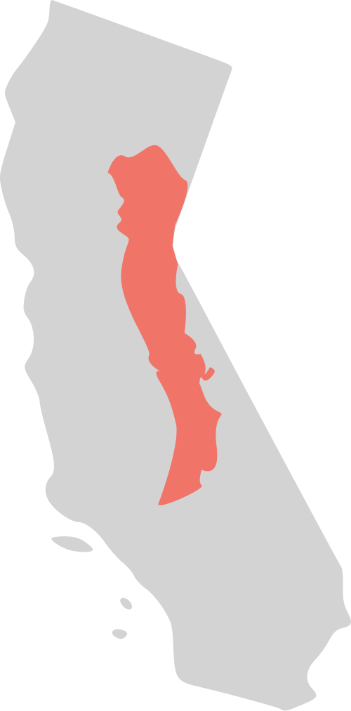 Position of Sierra Nevada inside California
| |
| Country | United States |
| States | California and Nevada |
| Range coordinates | 38°00′N 119°30′W / 38.000°N 119.500°W / 38.000; -119.500 |
| Geology | |
| Age of rock | Mesozoic |
| Type of rock | batholith and igneous |
The Sierra Nevada (/siˌɛrə nɪˈvædə, -ˈvɑːd-/ see-ERR-ə nih-VA(H)D-ə)[6][a] is a mountain range in the Western United States, between the Central Valley of California and the Great Basin. The vast majority of the range lies in the state of California, although the Carson Range spur lies primarily in Nevada. The Sierra Nevada is part of the American Cordillera, an almost continuous chain of mountain ranges that forms the western "backbone" of the Americas.
The Sierra runs 400 mi (640 km) north-south, and its width ranges from 50 mi (80 km) to 80 mi (130 km) across east–west.[3] Notable features include General Sherman, the largest tree in the world by volume; Lake Tahoe, the largest alpine lake in North America; Mount Whitney at 14,505 ft (4,421 m),[1] the highest point in the contiguous United States; and Yosemite Valley sculpted by glaciers from one-hundred-million-year-old granite, containing high waterfalls. The Sierra is home to three national parks, twenty-six wilderness areas, ten national forests, and two national monuments. These areas include Yosemite, Sequoia, and Kings Canyon National Parks, as well as Devils Postpile National Monument.
More than one hundred million years ago during the Nevadan orogeny, granite formed deep underground. The range started to uplift less than five million years ago,[8] and erosion by glaciers exposed the granite and formed the light-colored mountains and cliffs that make up the range. The uplift caused a wide range of elevations and climates in the Sierra Nevada, which are reflected by the presence of five life zones (areas with similar plant and animal communities). Uplift continues due to faulting caused by tectonic forces, creating spectacular fault block escarpments along the eastern edge of the southern Sierra.
The Sierra Nevada has played an important role in the history of California and the United States. The California gold rush occurred in the western foothills from 1848 through 1855. Due to its inaccessibility, the range was not fully explored until 1912.[9]: 81
Name and etymology
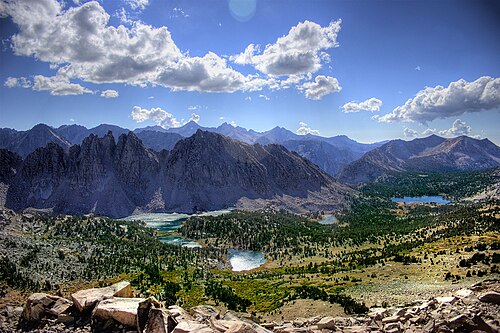
Used in 1542 by Juan Rodríguez Cabrillo to describe a Pacific Coast Range (Santa Cruz Mountains), the term "Sierra Nevada" was a general identification of less familiar ranges toward the interior.[11] In 1776, Pedro Font's map applied the name to the range currently known as the Sierra Nevada.[12]
The literal translation is "snowy mountains", from sierra "a range of mountains", 1610s, from Spanish sierra "jagged mountain range", lit. "saw", from Latin serra "a saw"; and from fem. of Spanish nevado "snowy".[13][14]
While many mountain ranges are unanimously referred to in the plural (Smokies, Rockies, Cascades, etc.), since Sierra is already pluralized in its native language, some locals who live in "the Sierra" are not hesitant to admonish those who refer to the area as "the Sierras".[15] However, there are historical and literary references that use the plural, such as the 1871 collection of Joaquin Miller poems, Songs of the Sierras.[15][16] Ansel Adams, in response to a publication of his photographs under the title Parmelian Prints of the High Sierras, commented, "The name Sierra is already a plural. To add an s is a linguistic, Californian, and mountaineering sin."[17]
Geography
The Sierra Nevada lies primarily in central and eastern California, with the Carson Range, a small but historically important spur, extending into Nevada. West-to-east, the Sierra Nevada's elevation increases gradually from 500 feet (150 m) in the Central Valley[18] to more than 14,000 feet (4,300 m) atop the highest peaks of its crest 50 to 75 miles (80 to 121 km) to the east. The east slope forms the steep Sierra Escarpment. Unlike its surroundings, the range receives a substantial amount of snowfall and precipitation due to orographic lift.
Setting
The Sierra Nevada's irregular northern boundary stretches from the Susan River[19] and Fredonyer Pass[20] to the North Fork Feather River. It represents where the granitic bedrock of the Sierra Nevada dives below the southern extent of Cenozoic igneous surface rock from the Cascade Range.[21] It is bounded on the west by California's Central Valley, on the east by the Basin and Range Province, and on the southeast by the Mojave Desert. The southern boundary is at Tehachapi Pass.[2]
Physiographically, the Sierra is a section of the Cascade–Sierra Mountains province, which in turn is part of the larger Pacific Mountain System physiographic division. The California Geological Survey states that "the northern Sierra boundary is marked where bedrock disappears under the Cenozoic volcanic cover of the Cascade Range."[22]
Watersheds
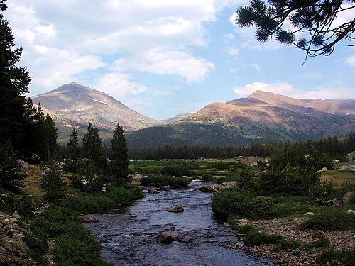
The range is drained on its western slope by the Central Valley watershed, which discharges into the Pacific Ocean at San Francisco. The northern third of the western Sierra is part of the Sacramento River watershed (including the Feather, Yuba, and American River tributaries), and the middle third is drained by the San Joaquin River (including the Mokelumne, Stanislaus, Tuolumne, and Merced River tributaries). The southern third of the range is drained by the Kings, Kaweah, Tule, and Kern rivers, which flow into the endorheic basin of Tulare Lake, which rarely overflows into the San Joaquin during wet years.
The eastern slope watershed of the Sierra is much narrower; its rivers flow out into the endorheic Great Basin of eastern California and western Nevada. From north to south, the Susan River flows into intermittent Honey Lake, the Truckee River flows from Lake Tahoe into Pyramid Lake, the Carson River runs into Carson Sink, the Walker River into Walker Lake; Rush, Lee Vining and Mill Creeks flow into Mono Lake; and the Owens River into dry Owens Lake. Although none of the eastern rivers reach the sea, many of the streams from Mono Lake southwards are diverted into the Los Angeles Aqueduct which provides water to Southern California.
Elevation
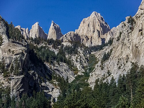
The height of the mountains in the Sierra Nevada increases gradually from north to south. Between Fredonyer Pass and Lake Tahoe, the peaks range from 5,000 feet (1,500 m) to more than 9,000 feet (2,700 m). The crest near Lake Tahoe is roughly 9,000 feet (2,700 m) high, with several peaks approaching the height of Freel Peak (10,881 ft or 3,317 m). Farther south, the highest peak in Yosemite National Park is Mount Lyell (13,120 ft or 3,999 m). The Sierra rises to almost 14,000 feet (4,300 m) with Mount Humphreys near Bishop, California. Finally, near Lone Pine, Mount Whitney is at 14,505 feet (4,421 m), the highest point in the contiguous United States.
South of Mount Whitney, the elevation of the range quickly dwindles. The crest elevation is almost 10,000 feet (3,000 m) near Lake Isabella, but south of the lake, the peaks reach only a modest 8,000 feet (2,400 m).[23]
Notable features

There are several notable geographical features in the Sierra Nevada:
- Lake Tahoe is a large, clear freshwater lake in the northern Sierra Nevada, with an elevation of 6,225 ft (1,897 m) and an area of 191 sq mi (490 km2).[24] Lake Tahoe lies between the main Sierra and the Carson Range, a spur of the Sierra.[24]
- Hetch Hetchy Valley, Yosemite Valley, Kings Canyon, and Kern Canyon are examples of many glacially-scoured canyons on the west side of the Sierra.
- Yosemite National Park is filled with notable features such as waterfalls, granite domes, high mountains, lakes, and meadows.
- Groves of giant sequoias Sequoiadendron giganteum occur along a narrow band of altitude on the western side of the Sierra Nevada. Giant sequoias are the largest trees in the world.[25]
- Two of the largest rivers in California, which form the Central Valley and drain into San Francisco Bay, derive most of their flow from the western slopes of the Sierra Nevada. The northern of the two is the Sacramento River (which also drains the adjacent Cascade Range and Klamath Range); the southern one is the San Joaquin River.
Communities
Communities in the Sierra Nevada include Paradise, South Lake Tahoe, Truckee, Grass Valley, Lee Vining, Mammoth Lakes, Sonora, Nevada City, Placerville, Pollock Pines, Portola, Auburn, Colfax and Kennedy Meadows.
Protected areas

Much of the Sierra Nevada consists of federal lands and is either protected from development or strictly managed. The mountain range is home to three National Parks – Yosemite, Kings Canyon, and Sequoia – and two national monuments – Devils Postpile and Giant Sequoia. Ten national forests[26] span much of the mountain range's remaining area. Within these national parks, monuments, and forests lie 26 wilderness areas, which together protect 15.4% of the Sierra's 63,118 km2 (24,370 sq mi) from logging and grazing.[4]
The United States Forest Service and the Bureau of Land Management currently control 52% of the land in the Sierra Nevada.[4] Logging and grazing are generally allowed on land controlled by these agencies, under federal regulations that balance recreation and development on the land.
The California Bighorn Sheep Zoological Area near Mount Williamson in the southern Sierra was established to protect the endangered Sierra Nevada bighorn sheep. Starting in 1981, hikers were unable to enter the Area from May 15 through December 15, in order to protect the sheep. As of 2010, the restriction has been lifted and access to the Area is open for the whole year.[27]
Geologic history


The earliest rocks in the Sierra Nevada are metamorphic roof pendants of Paleozoic age, the oldest being metasedimentary rocks from the Cambrian in the Mount Morrison region.[28] These dark-colored hornfels, slates, marbles, and schists are found in the western foothills (notably around Coarsegold, west of the Tehachapi Pass) and east of the Sierra Crest.[29] The earliest granite of the Sierra started to form in the Triassic period. This granite is mostly found east of the crest and north of 37.2°N.[30] In the Triassic and into the Jurassic, an island arc collided with the west coast of North America and raised a chain of volcanoes, in an event called the Nevadan orogeny.[31] Nearly all subaerial Sierran Arc volcanoes have since disappeared; their remains were redeposited during the Great Valley Sequence and the subsequent Cenozoic filling of the Great Valley, which is the source of much of the sedimentary rock in California.
In the Cretaceous, a subduction zone formed at the edge of the continent.[32] This means that an oceanic plate started to dive beneath the North American Plate. Magma, formed through the subduction of the ancient Farallon Plate, rose in plumes (plutons) deep underground, their combined mass forming what is called the Sierra Nevada batholith. These plutons formed at various times, from 115 Ma to 87 Ma.[33] The earlier plutons formed in the western half of the Sierra, while the later plutons formed in the eastern half of the Sierra.[30] At this time, the Sierra Nevada formed the western ramp of a high plateau to the east, the Nevadaplano.[34] During this period, rivers cut deep canyons into the range, generating topographic relief similar to the modern Sierra Nevada. This period of incision was halted approximately 30 million years ago by vast outpourings of pyroclastic flows from Nevada which filled the northern Sierran valleys with volcanic deposits. [35] These pyroclastic flows, which continued for about 10 million years, were followed by andesitic lahars which nearly completely buried the northern Sierran landscape such that only the tallest peaks emerged above a volcanic plain.[36] This second period of volcanism appears to have been triggered by crustal extension associated with extension of the Basin and Range Province.[37] As this andesitic volcanism began waning about five million years ago, the rivers were able to begin eroding away the 100s of meters of volcanic deposits and resume the incision that had been halted by the first period of volcanism.
Some studies have argued that this recent incision is a sign of recent tectonic uplift.[38][39] Other geologists claim that the elevations of many of the modern rivers flowing down the range are only 100-300 m lower than their ancient counterparts from 30-40 million years ago and the overall elevation and bedrock topography of the northern Sierra Nevada has changed little since at least 30-40 million years ago.[40][41][42]
About 2.5 Ma, the Earth's climate cooled, and ice ages started. Glaciers carved out characteristic U-shaped canyons throughout the Sierra. The combination of river and glacier erosion exposed the uppermost portions of the plutons emplaced millions of years before, leaving only a remnant of metamorphic rock on top of some Sierra peaks.
Extension of the Basin and Range continues today, leading to downdropping of crustal blocks just east of the Sierra Nevada during large earthquakes, such as the Lone Pine earthquake of 1872.[43]