パルスレーザー光を対象物に照射し、反射されたパルスをセンサーで測定することで対象物までの距離を測定する測量方法。レーザー光の反射時間と波長の差を利用して、対象物のデジタル三次元表現を作成することができる。現在では、この名称は「光検出測距(Light Detection and Ranging) 」の頭文字をとった略語として用いられている。
A format for reporting current and forecast weather conditions, particularly as such information relates to aviation. Standard TAFs are issued by major civil airfields at least four times a day (every six hours) and generally apply to a 24- or 30-hour period and an area within approximately 8 kilometres (5.0mi) from the center of an airport runway complex. TAFs complement and use similar encoding to METAR reports, but also take into account local geographic influences on weather.
A column of rising air in the lower altitudes of the Earth's atmosphere. It is a form of atmospheric updraft created by the uneven heating of the Earth's surface by solar radiation, and an example of atmospheric convection.
The vector difference between the geostrophic wind at two different altitudes in the atmosphere, i.e. the hypothetical vertical wind shear that would exist if the wind obeyed geostrophic balance in the horizontal direction while atmospheric pressure obeyed hydrostatic balance in the vertical direction. The name is derived from the notion of a theoretical wind that blows parallel to the thickness contours plotted on a thickness chart, where the thickness of the layers between isobaric surfaces is proportional to the mean temperature, with high values corresponding to warm air and low values to cold air.[2]
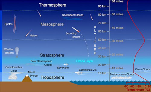
The fourth major layer of the Earth's atmosphere, above the mesosphere and below the exosphere. The lower boundary of the thermosphere is situated at approximately 80km (50mi) above the Earth's surface. Molecules in the thermosphere are exposed to highly energetic solar and cosmic radiation, and unlike in the other atmospheric layers, absorption of this energy causes temperatures in the thermosphere to increase with altitude.
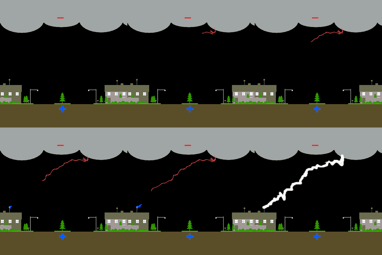
The sound produced as a result of the sudden thermal expansion of air within and surrounding the channel of a lightning discharge. This expansion creates an audible supersonic shock wave that, depending on the listener's distance from the source, can range from a sharp, loud crack (sometimes called a thunderclap or peal of thunder) to a deep, sustained rumble. Thunder is a defining feature of thunderstorms.
A storm characterized by the presence of lightning and its acoustic effect on the Earth's atmosphere, known as thunder. Thunderstorms result from the rapid upward movement of warm, moist air, often along a front. They can develop in any geographic location but are most common in the mid-latitudes. They are usually accompanied by strong winds and heavy rain; especially strong or severe thunderstorms can produce some of the most dangerous weather phenomena, including large hail, downbursts, and tornadoes.
A rapidly rotating column of air that is in contact with both a parent cloud and the surface of the Earth. Tornadoes come in many shapes and sizes, and they are often visible in the form of a condensed funnel originating from the base of a cumulonimbus cloud, usually during a thunderstorm, with a cloud of rotating dust and debris beneath it. The most extreme tornadoes can achieve wind speeds of more than 480km/h (300mph), span more than 3.2km (2.0mi) in diameter, and stay on the ground for more than 100 km (dozens of miles) before dissipating.
An area of high reflectivity detected by weather radar that is caused by large amounts of debris being lofted into the air, which is often indicative of a tornado.
The occurrence of multiple tornadoes (typically at least six to ten) spawned by the same synoptic scale weather system, usually within the same day and in the same region.
A period of continuous or nearly continuous tornado activity consisting of a series of tornado outbreaks spanning multiple days, with very few or no days lacking outbreaks.
A rotation algorithm detected by weather radar that indicates the likely presence of a strong mesocyclone such as a tornado. Such signatures can be used to track the location and development of a tornadic rotation within a larger storm.
A very large, rapidly rotatingstorm system characterized by a low-pressurecenter surrounded by a closed low-level atmospheric circulation, strong winds, and continuous spiral bands of thunderstorms that produce heavy rain. Tropical cyclones develop almost exclusively over and derive their strength from warm tropical seas. The strongest systems can last for more than a week, span more than 1,600km (1,000mi) in diameter, and cause significant damage to coastal regions with powerful winds, storm surges, and concentrated precipitation that leads to flooding. Depending on its location and strength, a tropical cyclone may be referred to by different names and categorized within a variety of classes.
The process by which a tropical cyclone develops and strengthens within the atmosphere. The mechanisms governing cyclone formation in the tropics are distinct from those that govern the development of subtropical and extratropical cyclones.
A type of atmospheric trough or low-pressure system which forms over the tropics and causes cloudiness and thunderstorms as it moves. Tropical waves represent an early, disorganized stage of tropical cyclogenesis; if conditions are favorable, they may develop into much stronger tropical cyclones. The term is used primarily in the North Atlantic and Northeastern Pacific basins.
The region of the Earth surrounding the Equator, generally delimited in latitude between the Tropic of Cancer (23°26' N) in the Northern Hemisphere and the Tropic of Capricorn (23°26' S) in the Southern Hemisphere.
The boundary in the Earth's atmosphere between the troposphere and the stratosphere, on average situated approximately 17km (11mi) above equatorial regions and 9km (5.6mi) above the polar regions.
The lowest layer of the Earth's atmosphere, within which nearly all weather phenomena occur. The troposphere contains approximately 75% of the atmosphere's total mass and 99% of its water vapor and aerosols. The average height of the troposphere above the Earth's surface varies between 6 and 18km (3.7 and 11.2mi) depending on latitude.
An elongated region of relatively low atmospheric pressure, often associated with a front. Troughs may exist at the surface or aloft or both; the lifting of moist air by convergent winds usually causes clouds and precipitation to follow immediately behind a trough. Under certain conditions, troughs may alternate with ridges in a high-amplitude pattern.
1.The indirect illumination of the lower atmosphere caused by the scattering of sunlight when the Sun itself is not directly visible because it is below the horizon.
2.The time period during which such illumination occurs, either between astronomical dawn and sunrise or between sunset and astronomical dusk.
Any vertical current of rising air in the atmosphere, often within a cloud, especially one originating from the tendency of warm air to ascend in altitude. Updrafts commonly develop when multiple smaller, more general ascending currents called thermals become concentrated and organized into a single flow, often as compensation for the development of a strong current of cold air moving in the opposite direction, known as a downdraft. Updrafts and downdrafts together are associated with the strong atmospheric convective forces that characterize multicell and supercellstorm systems, and play important roles in the formation of tropical cyclones and tornadoes.[2]
An urban or metropolitan area within which air temperatures are significantly warmer than in surrounding rural or uninhabited areas as a result of human activities, especially the artificial modification of land surfaces and the generation of waste heat by energy usage. Urban heat islands can greatly influence precipitation, air quality, and the likelihood of certain weather phenomena in the vicinity of large cities, though not all cities have a distinct urban heat island.
The temperature of a moist air parcel at which a theoretical dry air parcel would have a total pressure and density equal to those of the moist parcel.
A set of regulations under which a pilot operates an aircraft in weather conditions generally clear enough to allow the pilot to see where the aircraft is going, as opposed to instrument flight rules, under which operation of the aircraft primarily occurs through referencing the onboard instruments rather than through visual reference to the ground and environs.
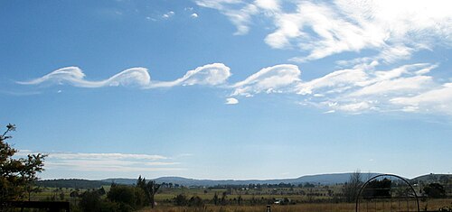
A region within a fluid in which the flow revolves around an axis line, which may be straight or curved. Vortices are a major component of turbulence and may be observed in many types of meteorological phenomena, including the winds surrounding a tropical cyclone, tornado, or dust devil.
A large, localized, persistent, and often abrupt lowering of cloud that develops beneath the surrounding base of a cumulonimbus cloud and from which tornadoes sometimes form.
warm advection
The movement, by horizontal winds, of warm air into an area. Sometimes, low-level warm advection is erroneously referred as "overruning".[14]
A type of front located at the leading edge of a warmer air mass as it overtakes a cooler air mass that is moving more slowly in the same direction. Warm fronts lie within broader troughs of low pressure than cold fronts, which sometimes follow them, and the temperature difference between the air masses they separate is often greater. Stratiform clouds, fog, and steady rain with occasional thunderstorms often precede the boundary as it moves. In surface weather analysis, warm fronts are symbolized by a red line with semicircles pointing in the direction of travel.
A class of weather advisory issued by a meteorological agency or weather forecasting service to notify the public that conditions in the coverage area are favorable for the development of a particular form of hazardous or severe weather, though the hazardous weather itself is not currently present, e.g. a tornado watch or hazardous seas watch. Watches are usually issued for a large geographic area, often for one or more administrative jurisdictions (e.g. counties in the United States). A watch is the first stage of a weather alert, indicating the need for precautionary planning, preparedness, and taking steps to ensure that any further information communicated by the issuing service will be received. It is distinct from and often precedes a warning, which indicates the imminent approach of hazardous weather.[2]
Water in its gaseous state. Water vapor is ubiquitous in the atmosphere, being continuously generated by evaporation and removed by condensation, and plays a major role in numerous meteorological processes.
The state of the atmosphere at a given time and location. Weather is driven by a diverse set of naturally occurring phenomena, especially air pressure, temperature, and moisture differences between one place and another, most of which occur in the troposphere.
A high-altitude balloon used to carry scientific instruments into the atmosphere, which then measure, record, and transmit information about meteorological variables such as atmospheric pressure, temperature, humidity, and wind speed by means of a radiosonde or other measurement device, often one which is expendable. Weather balloons are only feasible in the lower atmosphere and typically do not exceed 40 kilometres (25mi) in altitude; higher parts of the atmosphere are generally studied with sounding rockets or satellites.
The application of science and technology to predict the conditions of the atmosphere at a given time and location. Weather forecasts are made by collecting quantitative data about the current state of the atmosphere at a given place and then using meteorology to project how the atmosphere will change. Forecasting is important to a wide variety of human activities, including business, agriculture, transportation, recreation and general health and safety, because it can be used to protect life and property.
A map which displays various meteorological features across a particular area for a particular point or range of time. Weather maps often use symbols such as station models to conveniently present complicated meteorological data. They are used for both research and weather forecasting purposes.
The act of observing weather, often on the ground, for the purpose of reporting to a larger group or organization, such as the U.S. National Weather Service.
Any facility, either on land or at sea, with instruments and equipment for measuring atmospheric conditions in order to provide information for weather forecasts and to study the weather and/or climate.
The temperature that a given parcel of air would have if it were cooled adiabatically at constant pressure to saturation (i.e. 100% relative humidity) by the evaporation of water into the parcel, with the latent heat supplied by the parcel; or, equivalently, the lowest temperature that could hypothetically be reached under ambient conditions solely by evaporative cooling. At 100% relative humidity, the wet-bulb temperature is equal to the dry-bulb temperature; at lower humidity, it is lower than the dry-bulb temperature due to the loss of latent heat by evaporative cooling.[2]
An annual period of relatively high or frequent precipitation, during which most of a region's annual total rainfall (or snowfall) occurs and weather patterns are dominated by lengthy periods of low atmospheric pressure, extensive cloud cover, and high humidity. The term is primarily used in the tropics, in contrast to the dry season.
The bulk movement of air within the Earth's atmosphere. Wind occurs on a wide range of scales, from very strong thunderstorm flows lasting tens of minutes to milder local breezes lasting a few hours to global atmospheric circulations caused by the differential heating of the Equator and the poles and the Earth's rotation. Winds are often referred to by their strength and direction; the many types of wind are classified according to their spatial scale, their speed, the types of forces that cause them, the regions in which they occur, and their effects.
A meteorological index that estimates the effect of wind speed on the apparent temperature perceived by humans, particularly the decrease in human body temperature attributable to the movement of cold air. There is no universally agreed-upon formula for measuring or calculating wind chill, though it is commonly reported as a temperature. It is usually defined only for air temperatures at or below 10°C (50°F) and wind speeds above 4.8km/h (3.0mph).
The direction from which a wind originates; e.g. a northerly wind blows from the north to the south. Wind direction is usually reported using cardinal directions or in azimuth degrees measured clockwise from due north. Instruments such as windsocks, weather vanes, and anemometers are commonly used to indicate wind direction.
A brief increase in the speed of the wind, usually lasting less than 20 seconds. Gusts are more transient than squalls. They are usually only reported by weather stations when the maximum or peak wind speed exceeds the average or sustained wind speed by 10–15 knots (12–17mph).
A radiosonde specifically designed for determining wind conditions in the upper levels of the atmosphere, particularly one that transmits only pressure observations and not temperature or humidity data.[2]
A tapered conical tube made from a lightweight fabric, often brightly colored and hung loosely from a pole in an open area in order to serve as a simple visual indicator of wind speed and direction by filling with air as the wind blows. A windsock fills and points in the opposite direction from which the wind is blowing (e.g. if the wind is blowing from the west, the windsock will point east), and the angle at which it hangs from the pole can provide a basic approximation of wind speed (e.g. if the wind is very light, the windsock may hang limply at a shallow angle; if it is very strong, the windsock may point straight out from the pole and flap wildly). Windsocks are commonly employed at airports to provide useful real-time visual approximations of the wind's strength and direction to pilots.
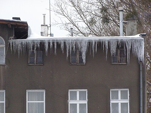
2.Any meteorological event in which varieties of precipitation which can only occur at low temperatures are formed, such as snow, sleet, or freezing rain. Such events are not necessarily restricted to the winter season but may occur in late autumn or early spring, or very rarely in the summer, as well.