Loading article…
ホノルル | |
|---|---|
| ホノルル市および郡 | |
 シール | |
| ニックネーム: 太平洋の交差点、シェルタード ベイ、HNL、ビッグ パイナップル、パラダイス | |
| モットー: ハアヘオ ノ オ ホノルル(ホノルルのプライド) [1] | |
 | |
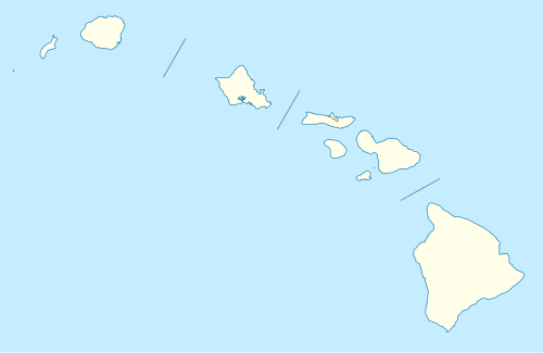  ホノルル ハワイ州内の位置(2000年米国国勢調査の定義による) | |
| 座標: 21°18′25″N 157°51′30″W / 21.30694°N 157.85833°W / 21.30694; -157.85833 | |
| 国 | アメリカ合衆国 |
| 州 | ハワイ |
| 郡 | ホノルル |
| 法人化 | 1907年4月30日[2] |
| 政府 | |
| • 市長 | リック・ブランジャーディ( I ) |
| • 評議会 | メンバー |
| エリア [3] | |
| • 市 | 68.4平方マイル(177.2 km 2) |
| • 土地 | 60.5平方マイル(156.7 km 2) |
| • 水 | 7.9平方マイル(20.5 km 2) |
| • 都会的な | 145.0平方マイル(375.5 km 2) |
| 標高 [4] | 16フィート(5メートル) |
| 人口 (2020年)[6] | |
| • 市 | 350,964 (米国: 56位) |
| • 密度 | 5,791/平方マイル (2,236.1/km 2 ) |
| • 都会的な | 853,252 (米国: 54位) |
| • 都市の密度 | 5,885/平方マイル (2,272.4/km 2 ) |
| • メトロ | 1,016,508 [5] (米国:56位) |
| 異名 | ホノルラン |
| タイムゾーン | UTC−10:00 (ハワイ時間 (HST) ) |
| 郵便番号 | 96801~96826、96828、96830、96836~96841、96843~96844、96846~96850 |
| 市外局番 | 808 |
| FIPS コード | 15-17000 |
| GNISフィーチャ ID | 366212 [4] |
| Webサイト | ホノルル |
.jpg/500px-Downtown_Honolulu_from_P%C5%ABowaina_(Punchbowl_Crater).jpg)
_(slight_cropped).jpg/500px-160701-N-SI773-264_(28109201982)_(slight_cropped).jpg)
.jpg/500px-King_Kamehameha_I_Statue_-_Honolulu_(4_by_3).jpg)
.jpg/500px-Diamond_Head_(cropped).jpg)

ホノルル(/ ˌ h ɒ n ə ˈ l uː l uː / HON -ə- LOO -loo ; [7] ハワイ語: [honoˈlulu])は、太平洋に浮かぶアメリカ合衆国ハワイ州の州都であり、最も人口の多い都市である。法人化されていない都市であり、統合されたホノルル市および郡の郡庁所在地であり、オアフ島の南東海岸沿いに位置し、[a]米国の主要都市の最西端および最南端である。ホノルルは、ハワイの世界への主要な玄関口である。また、州内およびオセアニアにおけるビジネス、金融、ホスピタリティ、軍事防衛の主要な拠点でもある。この都市は、多様な人口統計、料理、および伝統に反映されて、さまざまなアジア、西洋、太平洋の文化が混ざり合っているのが特徴である。
ホノルルはハワイ語で「保護された港」 [9]または「静かな港」 [10]を意味します。その古い名前であるコウは、おおよそヌアヌ通りからアラケア通りまで、およびホテル通りからクイーン通りまでのエリアを囲み、現在のダウンタウン地区の中心となっています。 [11]港としてのこの都市の望ましさは、ハワイ諸島およびより広い太平洋地域におけるその歴史的な成長と重要性を説明しています。ホノルルは、1845年以来、最初は独立したハワイ王国の首都、 1898年以来、米国領土およびハワイ州の首都。この都市は1941年12月7日の日本帝国による近くの真珠湾攻撃の後、世界的に認知され、米国は第二次世界大戦に。この港は世界最大の海軍司令部である米国太平洋艦隊のホストとなっている主要な米国海軍基地です。 [12]
米国国勢調査局は、一般に「ホノルル市」と呼ばれるおおよその地域を、国勢調査指定地域であるホノルル都市圏と認定している。2020年の米国国勢調査によると、ホノルルの人口は350,964人だった。2020年のホノルル都市圏統計地域には1,016,508人の住民がいた。[5] 30万人を超える住民を抱えるホノルルは、オーストラレーシア以外では最も人口の多いオセアニアの都市である。[13] [14]
ホノルルは、その好ましい熱帯気候、豊かな自然景観、広大なビーチにより、世界的に人気の高い観光地となっています。2022年現在、711,000人以上の観光客が訪れるホノルルは、ニューヨーク市、マイアミ、オーランド、ロサンゼルス、サンフランシスコ、ラスベガス、ワシントンDC、シカゴ、ボストンに次いで、米国で10番目に訪問者が多い都市です。[15]
歴史


ポリネシア人移民が最初にホノルルに定住した証拠は、口承史と遺物から得られます。これらは、現在のホノルルの場所に11世紀に定住地があったことを示しています。[16] [信頼できない情報源? ]カメハメハ1世はヌウアヌ・パリでのヌウアヌの戦いでオアフ島を征服した後、1804年にハワイ島からワイキキに王宮を移しました。 1809年に王宮は現在のホノルルのダウンタウンに移転しました。 1812年に 首都はカイルア・コナに戻りました。
1794年11月、イギリスのウィリアム・ブラウン船長が、現在のホノルル港に初めて入港した外国人となった。[17]その後も多くの外国船が入港し、ホノルル港は北米とアジアを結ぶ商船の拠点となった。 1810年にカメハメハ1世がワイキキの住居の代わりにこの地を選んだ後、19世紀初頭には数軒の家屋から都市へと成長した。 [18]
1845年、カメハメハ3世はハワイ王国の恒久的な首都をマウイ島のラハイナからホノルルに移した。[18]カメハメハ3世とその後継者たちはホノルルを近代的な首都に改造し、セントアンドリュース大聖堂、イオラニ宮殿、アリイオラニ・ハレなどの建物を建てた。同時にホノルルは島の商業の中心地となり、アメリカ人宣教師の子孫がダウンタウンに大企業を設立した。[19]
1893年のハワイ王朝の打倒、1898年の米国によるハワイ併合、 1900年の大火、1941年の日本軍による真珠湾攻撃など、19世紀後半から20世紀初頭の激動の歴史にもかかわらず、ホノルルはハワイ諸島の首都、最大の都市、主要な空港と港であり続けました。[20]

州昇格後の経済と観光のブームは、ホノルルとハワイに急速な経済成長をもたらした。2007年時点で、近代的な航空旅行により、[update]年間760万人の観光客が島を訪れており、その62.3%がホノルル国際空港から入国している。[21]今日、ホノルルは多数の高層ビルが建つ近代的な都市であり、ワイキキは何千ものホテルの部屋を擁するハワイの観光産業の中心地である。
地理
.jpg/500px-Honolulu_(satellite_photograph_-_22_12_2009).jpg)
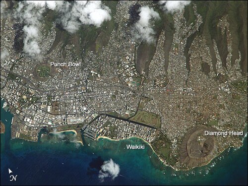
アメリカ合衆国国勢調査局によれば、ホノルル都市圏CDPの面積は68.4平方マイル(177.2 km 2)で、そのうち7.9平方マイル(20.5 km 2)、つまり11.56%が水域である。[22]
ホノルルはアメリカの主要都市の中で最も遠く離れており、世界でも最も遠く離れた都市の一つである。[23]アメリカ本土で最も近い場所は、カリフォルニア州北部のポイントアリーナ灯台で、距離は2,045海里(3,787km)である。[24](船舶がマカプウ岬を周回するには、さらに距離が必要である。)最も近い主要都市は、カリフォルニア州サンフランシスコで、距離は2,397マイル(3,858km)である。[23]メキシコ沖の島々やアラスカ州のアリューシャン列島の一部は、本土よりもホノルルに少し近い。
近隣地域、行政区、地区

- ホノルルのダウンタウンは、ハワイの金融、商業、政府の中心地です。ウォーターフロントには、長年ハワイで最も高い建物であったアロハタワーがあります。現在最も高い建物は、キングストリートとビショップストリートにある高さ 438 フィート (134 メートル)のファースト ハワイアン センターです。ハワイ パシフィック大学のダウンタウン キャンパスもここにあります。
- ホノルル芸術地区はダウンタウンとチャイナタウンの両方にあり、チャイナタウンの東端にあります。ベテル通りとスミス通り、ニミッツハイウェイ、ベレタニア通りに囲まれた12ブロックのエリアで、数多くの芸術・文化施設が集まっています。チャイナタウン歴史地区内にあり、旧ホテルストリートバイス地区も含まれています。[26]
- キャピトル地区は、ホノルルのダウンタウンの東部にあります。ここは、ハワイ州政府の現在および歴史的中心地であり、州議会議事堂、イオラニ宮殿、ホノルル・ハレ(市庁舎)、州立図書館、カメハメハ1世の像、その他多数の政府機関の建物があります。
- カカアコはダウンタウンとワイキキの間にある軽工業地区で、過去 10 年間で大規模な再開発が進められてきました。ワード ウェアハウスとワード センターという 2 つの大きなショッピング エリアがあります。ハワード ヒューズ コーポレーションは、今後 10 年間でワード センターをワード ビレッジに変える予定です。ハワイ大学マノア校のジョン A. バーンズ医学部もここにあります。えひめ丸事件の犠牲者を追悼する記念碑がカカアコ ウォーターフロント パークにあります。
- アラモアナはカカアコとワイキキの間にある地区で、世界最大のオープンエアショッピングセンターでありハワイ最大のショッピングモールであるアラモアナセンターがあります。 [27]アラモアナセンターには300を超えるテナントがあり、観光客にとても人気があります。アラモアナには、ホノルルデザインセンターとホノルルで2番目に大きい公園であるアラモアナビーチパークもあります。
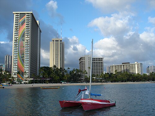
- ワイキキはホノルルの観光地区で、アラワイ運河と太平洋の間にあり、ダイヤモンドヘッドの隣に位置しています。カラカウア通りとクヒオ通り沿いには、数多くのホテル、ショップ、ナイトライフスポットが集まっています。観光客にも地元の人にも人気の場所で、毎年何百万人もの人が訪れます。オアフ島のホテルの客室のほとんどはワイキキにあります。
- マノア、モイリイリ、マキキは、ダウンタウンとワイキキのすぐ内陸にある隣接地域の住宅街です。マノア渓谷にはハワイ大学のメインキャンパスがあります。
- ヌウアヌとパウオアは、ホノルルのダウンタウンの内陸部にある上流中流階級の住宅地区です。国立太平洋記念墓地は、パウオア渓谷に面したパンチボウルクレーターにあります。
- パロロとカイムキは、マノアとマキキの東、ダイヤモンド ヘッドの内陸にある地区です。パロロ バレーはマノアと平行しており、住宅街です。カイムキは主に住宅街で、ダイヤモンド ヘッドの後ろを走るワイアラエ アベニューを中心に商業地帯が広がっています。シャミナード大学はカイムキにあります。
- ワイアラエとカハラはダイヤモンドヘッドの真東に位置するホノルルの高級住宅街で、高価な住宅が数多く建ち並んでいます。また、この地区にはワイアラエ カントリー クラブや 5 つ星のカハラ ホテル & リゾートもあります。
- イーストホノルルには、アイナハイナ、ニウバレー、ハワイカイの住宅街があります。これらは上流中流階級の地域と考えられています。ワイアラエ・イキやハワイロアリッジといった高級なゲートコミュニティもあります。
- カリヒとパラマは労働者階級の地区で、政府による住宅開発が数多く行われています。海に面したローワーカリヒは軽工業地区です。
- ソルトレイクとアリアマヌは、ホノルル国際空港からさほど遠くない、ホノルル地区の西端に沿った死火山の円錐丘に建てられた(主に)住宅地です。
- モアナルアはホノルルの西端にある 2 つの地区と谷で、トリプレル陸軍医療センターがあります。
- カメハメハハイツは北部の郊外です。[28]
- マッカリーは東部の郊外である。[29]
気候
ホノルルは、雨陰効果により、夏季は乾燥する傾向にある、暑い半乾燥気候(ケッペンの気候区分 BSh )です。[30]すべての月の平均気温が64.4°F(18.0°C)以上と熱帯気候の基準を満たしているにもかかわらず、この都市は熱帯気候に分類されるには降水量が少なすぎます。
気温は年間を通じてほとんど変わらず、平均最高気温は80~90°F(27~32°C)、平均最低気温は65~75°F(18~24°C)である。しかし、季節はわずかにある。12月から3月の「冬」の月には、最低気温が64°F(18°C)を下回る日が時々あるが、「夏」の6月から9月には、限られた日数ではあるが90°F(32°C)以上の暑い日がある。これは年間平均32日しか起こらず、[31] [b]最低気温が50°F(14~15°C)を超えるのは年に1~2回である。最高気温は1994年9月19日と2019年8月31日の95°F(35°C)で記録された。[31]最低気温は1902年2月16日と1969年1月20日の52°F(11°C)で記録された。[31]
年間平均降水量は16.41インチ(417ミリメートル)[31]で、主に10月から4月上旬にかけて降り、夏季にはほとんど降水がありません。しかし、どちらの季節も雨の日数はほぼ同じです。夏には小雨が降り、冬には大雨が降ります。ホノルルでは、年間平均278日が晴れ、89.2日が雨です。
熱帯地方にあるにもかかわらず、ハリケーンは非常にまれです。ホノルル近辺を襲った最後のハリケーンは、1992年のカテゴリー4のハリケーン・イニキです。竜巻もまれで、約15年に1回発生します。海岸沖の水竜巻もまれで、約5年に1回発生します。 [32]
ホノルルはUSDA12b植物耐寒性ゾーンに該当します。[33]
海の平均気温は3月の75.7°F(24.3°C)から9月の80.4°F(26.9°C)の範囲です。[34]
生のグラフ データを表示または編集します。

人口統計

.png/500px-Race_and_ethnicity_2010-_Honolulu_(5559875249).png)
2020年国勢調査
2020年の米国国勢調査によると、ホノルルの人口は350,964人で、米国で55番目に大きな都市となっている。 2010年の米国国勢調査では、同市の人口は337,256人だった。[40]
イーストホノルルの住宅街は、国勢調査局によって別個の国勢調査指定地域とみなされていますが、一般的にはホノルルの都市中心部の一部と見なされています。イーストホノルルの人口は2020年時点で50,922人であり、ホノルルの中心人口は40万人以上に増加しています。[45]
人種別に見ると(人種数にはヒスパニック系も含む)、アジア系が54.8% 、白人が17.9 %、黒人またはアフリカ系アメリカ人が1.5%、ネイティブアメリカンまたはアラスカ先住民が0.2%、ハワイ先住民とその他の太平洋諸島民が8.4%、その他の人種が0.8%、2つ以上の人種が16.3%であった。これとは別に、あらゆる人種のヒスパニック系およびラテン系住民は人口の5.4%を占めていた。[40] 1970年、国勢調査局はホノルルの人口を白人33.9%、アジア系および太平洋諸島民53.7%と報告した。[46]
ホノルルの人口の大部分はアジア系アメリカ人です。アジア系の民族グループは、日本人 (19.9%)、フィリピン人 (13.2%)、中国人 (10.4%)、韓国人 (4.3%)、ベトナム人 (2.0%)、インド人 (0.3%)、ラオス人 (0.3%)、タイ人 (0.2%)、カンボジア人 (0.1%)、インドネシア人 (0.1%) です。
太平洋諸島系アメリカ人はホノルルの人口の8.4%を占める。太平洋諸島系民族はハワイ先住民の血を引く人々のみ(3.2%)、サモア系アメリカ人は人口の1.5%、マーシャル人は0.5%、トンガ人は0.3%を占める。グアム系またはチャモロ系の人々は人口の0.2%を占め、その数は841人である。[40]
オアフ島全体を含むホノルル大都市圏の人口は、2010年の米国国勢調査では953,207人、2020年の米国国勢調査では1,016,508人で、米国で54番目に大きな大都市圏となっている。[47] [48]
経済

ハワイ諸島最大の都市であり空港でもあるホノルルは、島の大規模な観光産業への自然な玄関口として機能し、何百万人もの観光客を呼び込み、地元経済に年間100億ドルの貢献をしています。太平洋に位置するホノルルは、特に東西間の大規模なビジネスおよび貿易の中心地でもあります。市の経済のその他の重要な側面には、軍事防衛、研究開発、製造業などがあります。[49]
ホノルルに拠点を置く企業には以下のものがあります。
ハワイアン航空[50] 、アイランド航空[51]、アロハ・エア・カーゴは、この都市に本社を置いています。[52] [53]アロハ航空は解散するまで、この都市に本社を置いていました。[54]ミッドパシフィック航空は、かつてホノルル国際空港の敷地内に本社を置いていました。[55]
2009年、ホノルルの平均家賃は4.5%上昇し、米国の210都市圏の中で2番目に高い家賃市場となった。[56]同様に、ガソリン、電気、ほとんどの食料品を含む生活費は、市と州がほとんどの商品を輸入する必要があるため、米国本土よりもはるかに高くなっている。[23] 2014年の報告書によると、生活費は米国平均より69%高いことがわかった。[57]
ハワイにある唯一の全国銀行はすべて地元の銀行であるため、多くの観光客や新住民はさまざまな銀行に慣れる必要があります。ファースト・ハワイアン・バンクはハワイ最大かつ最古の銀行であり、[58]州で最も高いオフィスビルであるファースト・ハワイアン・センターに本社を置いています。 [59]
文化施設

自然博物館
ビショップ博物館はホノルル最大の博物館です。州内最大の自然史標本のコレクションと、世界最大のハワイおよび太平洋文化の遺物のコレクションを所蔵しています。[60]ホノルル動物園はハワイの主要な動物学施設であり、ワイキキ水族館は海洋生物学研究所として稼働しています。ワイキキ水族館はハワイ大学および世界中の他の大学と提携しています。鑑賞と植物学のために設立されたホノルルには、フォスター植物園、リリウオカラニ植物園、ウォーカーエステートなど、 いくつかの庭園があります。
舞台芸術
1900 年に設立されたホノルル交響楽団は、ロッキー山脈の西側で 2 番目に古い米国交響楽団です。その他のクラシック音楽アンサンブルには、ハワイ オペラ シアターがあります。ホノルルはハワイ音楽の中心地でもあります。主な音楽会場には、ハワイ シアター、ニール ブレイズデル センターコンサート ホール & アリーナ、ワイキキ シェルなどがあります。
ホノルルには、ダイアモンド ヘッド シアターやクム カフア シアターなど、ライブシアターを上演できる会場もいくつかあります。
視覚芸術
ホノルル美術館には、ハワイ最大のアジア・西洋美術コレクションがある。また、シャングリラ・エステートに所蔵されているイスラム美術コレクションも最大である。2011年にホノルル芸術アカデミーとホノルル現代美術館(現在はホノルル美術館スポルディングハウスと呼ばれている)が合併して以来、この美術館は州唯一の現代 美術館でもある。現代コレクションは、マキキのメインキャンパス(スポルディングハウス)とホノルルのダウンタウンにあるファースト・ハワイアン・センターのマルチレベルギャラリーに収蔵されている。美術館では、美術館の歴史的なパトロンであるドリス・デュークにちなんで名付けられた美術館のドリス・デューク劇場で、アートハウス映画と世界の映画に特化した映画とビデオのプログラムを開催している。[ 61]
ハワイ州立美術館(ダウンタウンにある)には、地元の芸術家による作品や伝統的なハワイの芸術が展示されています。この美術館は、ハワイ州文化芸術財団によって運営されています。

ホノルルでは、毎年ハワイ国際映画祭(HIFF) も開催されます。太平洋沿岸各地のプロデューサーによる最高の映画が上映されるこの映画祭は、米国最大の「東西の出会い」スタイルの映画祭です。
観光名所

スポーツ
ホノルルの熱帯気候は一年中アクティビティに適しています。2004年、メンズフィットネス誌はホノルルを米国で最もフィットネスに優れた都市に選びました。 [62]ホノルルでは3つの大きなロードレースが開催されます。
- グレート・アロハ・ランは毎年大統領の日に開催されます。
- 毎年12月の第2日曜日に開催されるホノルルマラソンには、毎年2万人を超える参加者が集まり、そのうち約半数から3分の2が日本人です。
- ホノルル トライアスロンは、米国トライアスロン協会と一部日本トライアスロン協会が統括するオリンピック距離のトライアスロン大会です。2004 年以来毎年 5 月に開催されており、スプリント コースはありません。
アイアンマン ハワイは、ホノルルで初めて開催されました。これは史上初のアイアンマン トライアスロン イベントであり、世界選手権でもあります。
ワイキキ・ラフウォーター・スイムレースは、ワイキキのビーチ沖で毎年開催されている。1970年にジム・コットンによって創設されたこのレースのコースは、ニューオータニホテルからヒルトン・レインボータワーまで2.384マイル(3.837km)に及ぶ。[63]
ホノルルの観戦スポーツファンは、一般的にハワイ大学マノア校のフットボール、バレーボール、バスケットボール、ラグビーユニオン、ラグビーリーグ、野球のプログラムを応援しています。[64]高校のスポーツイベント、特にフットボールは特に人気があります。
ホノルルにはプロスポーツチームがなく、将来有望なチームは大陸諸州へのアウェーゲームのために非常に長い移動を強いられる。ここは、ハワイ アイランダーズ(パシフィック コースト リーグ、1961 ~ 1987 年)、ザ ハワイアンズ(ワールド フットボール リーグ、1974 ~ 1975 年)、チーム ハワイ(北米サッカー リーグ、1977 年)、ハワイアン アイランダーズ( af2、2002~ 2004 年) の本拠地であった。
NCAAフットボールのハワイボウルはホノルルで開催される。また、ホノルルは1980年から2009年まで、毎年2月にNFLのプロボウルも開催していた。 2010年と2015年の試合はそれぞれマイアミガーデンズとグレンデールで開催され、2011年から2014年までプロボウルは再びホノルルで開催され、最近では2016年が開催された。[65] [66] 1993年から2008年まで、ホノルルはメジャーリーグベースボール、日本プロ野球、韓国野球機構、独立リーグのマイナーリーグ選手が参加するハワイウィンターベースボールを開催した。
In 2018, the Honolulu Little League team qualified for that year's Little League World Series tournament. The team went undefeated en route to the United States championship game, where it bested Georgia's Peachtree City American Little League team 3–0. In the world championship game, the team faced off against South Korea's South Seoul Little League team. Hawaii pitcher Ka'olu Holt threw a complete-game shutout while striking out 8, and Honolulu Little League, again by a score of 3–0, secured the victory, capturing the 2018 Little League World Series championship and Hawaii's third overall title at the Little League World Series.[67]
Venues
Venues for spectator sports in Honolulu include:
- Les Murakami Stadium at University of Hawaiʻi at Mānoa (baseball)
- Neal S. Blaisdell Center Arena (basketball)
- Stan Sheriff Center at University of Hawaiʻi at Mānoa (basketball and volleyball)
Aloha Stadium was a venue for American football and soccer located in Halawa near Pearl Harbor, just outside Honolulu.[68] The stadium was closed in 2020.[69] Plans for a new stadium at the site were announced in 2022.[70]
Government
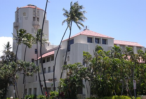
Rick Blangiardi was elected mayor of Honolulu County on August 8, 2020, and began serving as the county's 15th mayor on January 2, 2021. The municipal offices of the City and County of Honolulu, including Honolulu Hale, the seat of the city and county, are in the Capitol District, as are the Hawaii state government buildings.[71]
The Capitol District is in the Honolulu census county division (CCD), the urban area commonly regarded as the "City" of Honolulu. The Honolulu CCD is on the southeast coast of Oʻahu between Makapuu and Halawa. The division boundary follows the Koʻolau crestline, so Makapuʻu Beach is in the Ko'olaupoko District. On the west, the division boundary follows Halawa Stream, then crosses Red Hill and runs just west of Aliamanu Crater, so that Aloha Stadium, Pearl Harbor (with the USS Arizona Memorial), and Hickam Air Force Base are all in the island's Ewa CCD.[72]
The Hawaii Department of Public Safety operates the Oahu Community Correctional Center, the jail for the island of Oahu, in Honolulu CCD.[73]
The United States Postal Service operates post offices in Honolulu. The main Honolulu Post Office is by the international airport, at 3600 Aolele Street.[74] Federal Detention Center, Honolulu, operated by the Federal Bureau of Prisons, is in the CDP.[75]
Foreign missions on the island
Several countries have consular facilities in Honolulu. They include consulates of Japan,[76] South Korea,[77] Philippines,[78] Taiwan,[79] Federated States of Micronesia,[80] Australia,[81] New Zealand[82] and the Marshall Islands.[83]
Education and research
Colleges and universities
Colleges and universities in Honolulu include Honolulu Community College, Kapiolani Community College, the University of Hawaiʻi at Mānoa, Chaminade University, and Hawaii Pacific University.[53] University of Hawaiʻi at Mānoa houses the main offices of the University of Hawaiʻi System.[84]
Research institutions
.jpg/500px-Downtown,_Honolulu,_HI,_USA_-_panoramio_(8).jpg)
Honolulu is home to three renowned international affairs research institutions. The Pacific Forum, one of the world's leading Asia-Pacific policy research institutes and one of the first U.S. organizations to focus exclusively on Asia, has its main office on Bishop Street in downtown Honolulu. The East–West Center (EWC), an education and research organization established by Congress in 1960 to strengthen relations and understanding among the peoples and nations of Asia, the Pacific, and the U.S., is headquartered in Mānoa, Honolulu. The Asia-Pacific Center for Security Studies (APCSS), a U.S. Department of Defense institute, is based in Waikiki, Honolulu. APCSS addresses regional and global security issues and supports the U.S. Pacific Command by developing and sustaining relationships among security practitioners and national security establishments throughout the region.
Public primary and secondary schools

Hawaii Department of Education operates Honolulu's public schools.[85] Public high schools in the CDP area include Wallace Rider Farrington, Kaiser, Kaimuki, Kalani, Moanalua, William McKinley, and Theodore Roosevelt.[53] It also includes the Hawaii School for the Deaf and the Blind, the statewide school for blind and deaf children. There is a charter school, University Laboratory School.
Private primary and secondary schools
As of 2014[update] almost 38% of K-12 students in the Honolulu area attend private schools.[86]
Private schools include Academy of the Pacific, Damien Memorial School, Hawaii Baptist Academy, ʻIolani School, Lutheran High School of Hawaii, Kamehameha Schools, Maryknoll School, Mid-Pacific Institute, La Pietra, Punahou School, Sacred Hearts Academy, St. Andrew's Priory School, Saint Francis School, Saint Louis School, the Education Laboratory School, Saint Patrick School, Trinity Christian School, and Varsity International School. Hawaii has one of the nation's highest rate of private school attendance.[87]
Public libraries
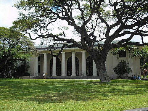
Hawaii State Public Library System operates public libraries. The Hawaii State Library in the CDP serves as the system's main library,[88] while the Library for the Blind and Physically Handicapped, also in the CDP area, serves handicapped and blind people.[89]
Branches in the CDP area include Aiea, Aina Haina, Ewa Beach, Hawaiʻi Kai, Kahuku, Kailua, Kaimuki, Kalihi-Palama, Kaneohe, Kapolei, Liliha, Mānoa, McCully-Moiliili, Mililani, Moanalua, Wahiawa, Waialua, Waianae, Waikiki-Kapahulu, Waimanalo, and Waipahu.[90]
Weekend educational programs
The Hawaiʻi Japanese School – Rainbow Gakuen (ハワイレインボー学園 Hawai Reinbō Gakuen), a supplementary weekend Japanese school, holds its classes in Kaimuki Middle School in Honolulu and has its offices in another building in Honolulu.[91] The school serves overseas Japanese nationals.[92] Honolulu has other weekend programs for the Japanese, Chinese, and Spanish languages.[93]
Media
Honolulu is served by one daily newspaper, the Honolulu Star-Advertiser, along with a magazine, Honolulu Magazine, several radio stations and television stations, among other media. Local news agency and CNN-affiliate Hawaii News Now broadcasts and is headquartered out of Honolulu.
Transportation
Air


At the western end of the CDP, Daniel K. Inouye International Airport (HNL) is the principal aviation gateway to the state of Hawaii. Kalaeloa Airport is primarily a commuter facility used by unscheduled air taxis, general aviation and transient and locally based military aircraft.
Highways
Honolulu has been ranked as having the nation's worst traffic congestion, beating former record holder Los Angeles. Drivers waste on average over 58 hours per year on congested roadways.[94] The following freeways, part of the Interstate Highway System serve Honolulu:
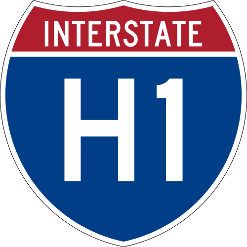 Interstate H-1, western terminous is at Kapolei where you can connect to the Farrington Highway. The H-1 passes Hickam Air Force Base and Honolulu International Airport, runs through Pearl City before heading downtown into Honolulu continues eastward through Makiki and Kaimuki, ending at Waialae/Kahala and start of the Kalanianole Highway.
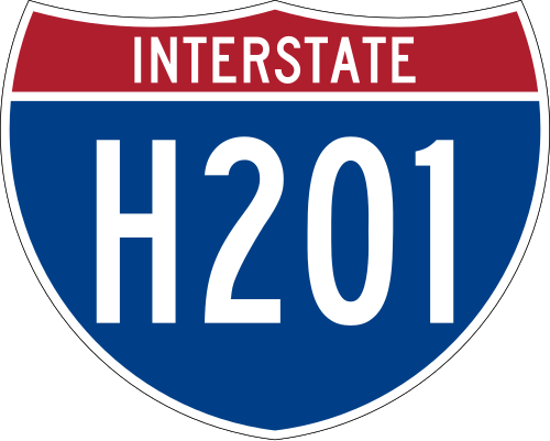 Interstate H-201—also known as the Moanalua Freeway and sometimes numbered as its former number, Hawaii State Route 78—connects two points along H-1: at Aloha Stadium and Fort Shafter. Close to H-1 and Aloha Stadium, H-201 has an exchange with the western terminus of Interstate H-3 to the windward side of Oahu (Kaneohe). This complex of connecting ramps, some directly between H-1 and H-3, is in Halawa.
 Interstate H-2 Connects at a junction near Waipahu and Pearl City with the H-1 freeway. The H-2 freeway will take you up to Schofield barracks before ending at Wahiawa where it connect to the north shore.
 Interstate H-3 Connects at a junction near Halawa Heights. This interstate highway will take you from Halawa heights through the Ko'olau Range to Kaneohe. Its final termination is at Marine Corps Base Hawaii. Exit 15 is the last exit before entering Marine Corps Base Hawaii.
Other major highways that link Honolulu CCD with other parts of the Island of Oahu are:
 Pali Highway, (State Route 61), crosses north over the Koʻolau range via the Pali Tunnels to connect to Kailua and Kaneohe on the windward side of the Island.
 Likelike Highway, (State Route 63), also crosses the Koʻolau to Kaneohe via the Wilson Tunnels.
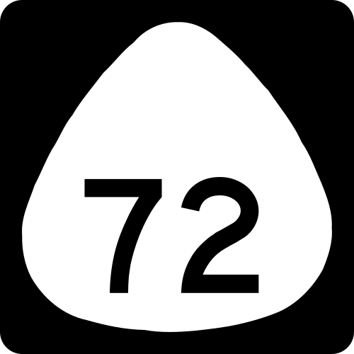 Kalanianaole Highway, State Route 72, runs eastward from Waialae/Kahala to Hawaiʻi Kai and around the east end of the island to Waimanalo Beach.
- Kamehameha Highway, State Route 80, 83, 99 and 830, runs westward from near Hickam Air Force Base to Aiea and beyond, eventually running through the center of the island and ending in Kaneohe.
- Farrington Highway, State Route 93 runs western leeward Oahu from Kaena Point through Waianae and Makaha before the start of the H-1. State Rte 930 starts east to west in the north shore connecting you from Wailua to Kaena Point
Like most major American cities, the Honolulu metropolitan area experiences heavy traffic congestion during rush hours, especially to and from the western suburbs of Kapolei, ʻEwa Beach, Aiea, Pearl City, Waipahu, and Mililani.
There is a Hawaii Electric Vehicle Demonstration Project (HEVDP).[95]
Public transport
Honolulu Authority for Rapid Transportation
In November 2010, voters approved a charter amendment to create a public transit authority to oversee the planning, construction, operation and future extensions to Honolulu's rail system, now known as Skyline. The Honolulu Authority for Rapid Transportation (HART) has a 10-member board of directors, with three members appointed by the mayor, three selected by the Honolulu City Council, and the city and state transportation directors.[96]
The opening of the first phase of the Skyline was delayed until 2023, as HART canceled the initial bids for the first nine stations, rebid the work as three packages of three stations each, and allowed more time for construction in the hope that increased competition on smaller contracts would drive down costs;[97] initial bids ranged from $294.5 million to $320.8 million, far surpassing HART's budget of $184 million.[98]
Bus
Established by former Mayor Frank F. Fasi as the replacement for the Honolulu Rapid Transit Company (HRT), Honolulu's TheBus system was honored in 1994–95 and 2000–01 by the American Public Transportation Association as "America's Best Transit System". TheBus operates 107 routes serving Honolulu and most major cities and towns on Oʻahu. TheBus comprises a fleet of 531 buses, and is run by the nonprofit corporation Oʻahu Transit Services in conjunction with the city Department of Transportation Services. As of 2006[update], Honolulu was ranked fourth for highest per-capita use of mass transit in the United States.[99]
Para-transit Options
The island also features TheHandi-Van,[100] for riders who require para-transit operations. To be eligible for this service, riders must meet the requirements of the Americans with Disabilities Act (ADA). TheHandi-Van has a fare of $2 and is available from 4am to 1am. There is a 24-hour service within 3/4 of a mile of TheBus route 2[101] and route 40.[102] TheHandi-Van comprises a fleet of 160 buses. The parantransit branch also runs Human Services Transportation Coordination (HSTCP), which mainly provides transportation for people with disabilities, older adults, and people with limited incomes, assisted by the Committee for Accessible Transportation (CAT). Both organizations work together to provide transportation for elderly and persons with disabilities.
Rail
Honolulu has no urban rail transit system, though electric street railways were operated in Honolulu by the now-defunct Honolulu Rapid Transit Company before World War II. Predecessors to the Honolulu Rapid Transit Company were the Honolulu Rapid Transit and Land Company (began 1903) and Hawaiian Tramways (began 1888).[103]
The City and County of Honolulu is constructing a 20-mile (32 km) rail transit line that will connect Honolulu with cities and suburban areas near Pearl Harbor and in the Leeward and West Oahu regions. Skyline aims to alleviate traffic congestion for West Oʻahu commuters while being integral in the westward expansion of the metropolitan area. The project has been criticized for its cost, delays, and potential environmental impacts, but the line is expected to have large ridership. The line's first segment connects East Kapolei and Aloha Stadium and opened on June 30, 2023.[104][105]
Bicycle sharing
Since June 28, 2017, Bikeshare Hawaii administers the bicycle sharing program in Oʻahu while Secure Bike Share operates the Biki system. Most Biki stations are between Chinatown/Downtown and Diamond Head, but a 2018 expansion added stations toward the University of Hawaiʻi at Mānoa Campus, Kapiolani Community College, Makiki, and Kalihi area.[106][107][108][109]
Modal characteristics
According to the 2016 American Community Survey (five-year average), 56% of Urban Honolulu residents commuted to work by driving alone, 13.8% carpooled, 11.7% used public transportation, and 8.7% walked. About 5.7% commuted by bike, taxi, motorcycle or other forms of transportation, while 4.1% worked at home.[110]
The city of Honolulu has a high percentage of households without a motor vehicle. In 2015, 16.6% of Honolulu households were car-free, which increased slightly to 17.2% in 2016; by comparison, the United States national average was 8.7% in 2016. Honolulu averaged 1.4 cars per household in 2016, compared to a national average of 1.8.[111]
Public safety
The Honolulu Police Department is the primary law enforcement agency for the city and county of Honolulu and serves the entire Oahu Island. Honolulu Police Department has a mixed fleet of marked patrol cars and unmarked along with a subsidized vehicle program in place. Marked vehicles are white with blue stripes and white lettering HONOLULU POLICE. The Honolulu Police Departments lets officers of a certain rank purchase a private vehicle for police use. Subsidized vehicles are unmarked but have a small blue roof light.[112] Subsidized vehicles can be any make, model, or color, but must follow department rules and guidelines. Honolulu Police and Hawaii County Police on the Big Island are the only departments in the state of Hawaii and the U.S. with subsidized vehicles. Honolulu Police along with other city, county law enforcement in Hawaii uses blue lights for their vehicles. They also keep their cruise blue lights on while on patrol.[113]
The Honolulu Fire Department provides firefighting services and first responder level emergency medical services on Oahu. Emergency medical services at higher levels are provided by the Honolulu Emergency Medical Services. Contrary to most other fire departments, fire trucks in Honolulu are yellow.[114]
Notable people
Sister cities
Honolulu's sister cities are:[115]
 Avarua, Cook Islands, 2024[116]
 Baguio, Philippines, 1991
 Baku, Azerbaijan, 1998
 Bruyères, France, 1960
 Cali, Colombia, 2012
- Candon, Philippines, 2015
 Caracas, Venezuela, 1990
- Cebu City, Philippines, 1990
 Chengdu, China, 2011
 Chigasaki, Japan, 2014
- Edogawa, Japan, 2022
- Fengxian (Shanghai), China, 2012
 Funchal, Portugal, 1979
- Fuzhou, China, 2021[117]
- Haikou, China, 1985
 Noreña, Spain, 1960
- Hiroshima, Japan, 1959
 Huế, Vietnam, 1995
 Incheon, South Korea, 2003
 Kaohsiung, Taiwan, 1962
 Kyzyl, Russia, 2004
- Laoag, Philippines, 1969
 Majuro, Marshall Islands, 2001
- Mandaluyong, Philippines, 2005
- Manila, Philippines, 1980
 Mombasa, Kenya, 2000
 Mumbai, India, 1970
- Nagaoka, Japan, 2012
- Naha, Japan, 1960
- Qinhuangdao, China, 2010
 Rabat, Morocco, 2007
- Saiki, Japan, 2003
 San Juan, Puerto Rico, 1985
- Seoul, South Korea, 1973
- Shibuya, Japan, 2024
- Sintra, Portugal, 1998
- Uwajima, Japan, 2004
- Vigan, Philippines, 2003
- Zhangzhou, China, 2012
- Zhongshan, China, 1997

See also
Notes
- ^ For statistical purposes, the US Census Bureau considers Honolulu to be a Census-designated place (CDP), rather than a city.[8]
- ^ There have been as many as 116 days (in 1995) that reached 90 °F (32 °C), and as recently as, 2012, no days.[31] The average is comparable to Philadelphia despite being slightly warmer during the summer.
- ^ Mean monthly maxima and minima (i.e. the expected highest and lowest temperature readings at any point during the year or given month) calculated based on data at said location from 1991 to 2020.
- ^ Official records for Honolulu have been kept at downtown from February 1877 to September 1949, and at Honolulu Int'l since October 1949. For more information, see ThreadEx
References
- ^ Honolulu And Kapolei Share City Lights 2005, Honolulu, HI, US: Honolulu County, Hawaii, November 29, 2005, archived from the original on November 5, 2013, retrieved June 30, 2012
- ^ "About the City, Official Website of the City and County of Honolulu". City and County of Honolulu. April 24, 2012. Archived from the original on October 12, 2004. Retrieved April 24, 2012.
- ^ "Geographic Ientifiers: 2010 Demographic Profile Data (G001): Urban Honolulu CDP, Hawaii". United States Census Bureau. Retrieved May 25, 2012.
- ^ a b "Honolulu". Geographic Names Information System. United States Geological Survey, United States Department of the Interior. Retrieved December 29, 2013.
- ^ a b "2020 Population and Housing State Data". United States Census Bureau, Population Division. August 12, 2021. Retrieved August 14, 2021.
- ^ "Urban Honolulu, Hawaii". U.S. Census Bureau. Retrieved December 4, 2022.
- ^ Dictionary Reference
- ^ US Census Bureau – Population Division. "Places Cartographic Boundary Files Descriptions and Metadata". Washington, D.C., US: U.S. Census Bureau. Archived from the original on July 10, 2012. Retrieved July 14, 2012.
Hawaii is the only state that has no incorporated places recognized by the U.S. Census Bureau. All places shown in the data products for Hawaii are CDPs. By agreement with the state of Hawaii, the U.S. Census Bureau does not show data separately for the city of Honolulu, which is coextensive with Honolulu County.
- ^ "About the City". Honolulu.gov. Archived from the original on February 1, 2015. Retrieved October 21, 2014.
- ^ "etymonline.com entry for Honolulu". Retrieved August 27, 2013.
- ^ "This Is Your City and County of Honolulu Government". honolulu.gov. Archived from the original on October 12, 2004. Retrieved May 22, 2012.
- ^ "Commander, U.S. Pacific Fleet". www.cpf.navy.mil. Retrieved December 14, 2020.
- ^ Ash, Russell (1998). The top 10 of everything. p. 100.
- ^ Long-Range Futures Research: An Application of Complexity Science, Robert Samet, 2009, 272
- ^ "America's 10 most visited cities", World Atlas, April 5, 2024
- ^ "Honolulu History –". Hellohonolulu.com. Archived from the original on January 4, 2013. Retrieved May 22, 2012.
- ^ Kuykendall, Ralph S. (June 1923). "A Northwest Trader at the Hawaiian Islands". The Quarterly of the Oregon Historical Society. 24 (2). Oregon Historical Society: 121. JSTOR 20610240.
- ^ a b Daws, Gavan (1967). "Honolulu in the 19th Century: Notes on the Emergence of Urban Society in Hawaii". The Journal of Pacific History. 2. Taylor & Francis: 77–78, 83. doi:10.1080/00223346708572103. JSTOR 25167896.
- ^ "About the City, Official Web Site for The City and County of Honolulu". .honolulu.gov. Archived from the original on October 12, 2004. Retrieved May 22, 2012.
- ^ "Honolulu History". Honolulu-city.com. December 7, 1941. Archived from the original on March 18, 2016. Retrieved May 22, 2012.
- ^ "2007 Annual Visitor Research Report" (PDF). Department of Business, Economic Development, and Tourism, State of Hawaii. July 1, 2008. Retrieved May 30, 2009.
- ^ "Geographic Identifiers: 2010 Demographic Profile Data (DP-1): Urban Honolulu CDP, Hawaii". United States Census Bureau. Retrieved May 25, 2012.
- ^ a b c Gill, Nicholas (August 19, 2015). "Where is the world's most remote city?". The Guardian. Retrieved December 14, 2020.
- ^ Microsoft Streets and Trips 2007 Software, Copyright 2006 by Microsoft Corp. et al.
- ^ Stearns, Harold T.; Vaksvik, Knute N. (1935). "Geology and ground-water resources of the island of Oahu, Hawaii". Maui Publishing Company, Limited. p. 536.
- ^ "Artsdistricthonolulu.com". Artsdistricthonolulu.com. Archived from the original on May 20, 2012. Retrieved May 22, 2012.
- ^ "Hawaii's Premier Shopping, Entertainment, and Dining Destination". Ala Moana Center. Retrieved May 22, 2012.
- ^ "Hawaii Life: Kamehameha Heights, Honolulu Oahu Real Estate for Sale – Just Listed Kamehameha Heights Homes, Kamehameha Heights Condos, Kamehameha Heights Land". Hawaii Life: Kamehameha Heights, Honolulu Oahu Real Estate for Sale – Just Listed Kamehameha Heights Homes, Kamehameha Heights Condos, Kamehameha Heights Land. Retrieved June 16, 2022.
- ^ "Mccully Honolulu, HI 96826, Neighborhood Profile - NeighborhoodScout". www.neighborhoodscout.com. Retrieved February 19, 2024.
- ^ "Monthly weather forecast and climate Honolulu, HI". Weather Atlas. Retrieved April 1, 2020.
- ^ a b c d e f "NowData – NOAA Online Weather Data". National Oceanic and Atmospheric Administration. Retrieved September 11, 2021.
- ^ "Weatherbase.com". Weatherbase.com. Archived from the original on June 13, 2022. Retrieved May 22, 2012.
- ^ USDA.gov"USDA Plant Hardiness Zone Map". USDA. Archived from the original on February 27, 2014. Retrieved August 31, 2016.
- ^ "Honolulu Sea Temperature October Average, United States – Sea Temperatures". World Sea Temperatures.
- ^ "Station: Honolulu INTL AP, HI". U.S. Climate Normals 2020: U.S. Monthly Climate Normals (1991–2020). National Oceanic and Atmospheric Administration. Retrieved September 11, 2021.
- ^ "WMO Climate Normals for HONOLULU, OAHU, HI 1961–1990". National Oceanic and Atmospheric Administration. Retrieved September 11, 2021.
- ^ "Historical UV Index Data - Honolulu, HI". UV Index Today. Retrieved April 20, 2023.
- ^ "Honolulu Sea Temperature January Average, United States Water Temperatures". Copyright Global Sea Temperatures – A-Connect Ltd. Retrieved November 26, 2015.
- ^ "Honolulu, Hawaii, USA – Monthly weather forecast and Climate data". Weather Atlas. Retrieved March 16, 2017.
- ^ a b c d "Profile of General Population and Housing Characteristics: 2010 Demographic Profile Data (DP-1): Urban Honolulu CDP, Hawaii". United States Census Bureau. Retrieved May 25, 2012.
- ^ "Census Of Population And Housing". U.S. Census Bureau. Retrieved May 7, 2011.
- ^ "P004 Hispanic or Latino, and Not Hispanic or Latino by Race – 2000: DEC Summary File 1 – Honolulu CDP, Hawaii". United States Census Bureau.
- ^ "P2: Hispanic or Latino, and Not Hispanic or Latino by Race – 2010: DEC Redistricting Data (PL 94-171) – Urban Honolulu CDP, Hawaii". United States Census Bureau .
- ^ "P2: Hispanic or Latino, and Not Hispanic or Latino by Race – 2020: DEC Redistricting Data (PL 94-171) – Urban Honolulu CDP, Hawaii". United States Census Bureau .
- ^ "U.S. Census Bureau QuickFacts: East Honolulu CDP, Hawaii". U.S. Census Bureau. Retrieved July 12, 2022.
- ^ "Hawaii – Race and Hispanic Origin for Selected Cities and Other Places: Earliest Census to 1990". U.S. Census Bureau. Archived from the original on August 12, 2012.
- ^ "U.S. Census Bureau QuickFacts: Honolulu County, Hawaii". U.S. Census Bureau. Retrieved July 12, 2022.
- ^ Cox, Wendell (August 19, 2021). "Metropolitan Growth: 2020 Census". Newgeography.com. Retrieved July 12, 2022.
- ^ "Honolulu Economy". City-Data.com. Advameg Inc. 2009. Retrieved January 26, 2011.
- ^ "Corporate Headquarters". Hawaiinair.com. Archived from the original on August 27, 2012. Retrieved May 20, 2009.
- ^ "General Contact Information". Honolulu, HI, US: Island Air. Archived from the original on February 2, 2013. Retrieved June 30, 2012.
- ^ "Locations Archived May 22, 2009, at the Wayback Machine." Aloha Air Cargo. Retrieved on May 21, 2009.
- ^ a b c "Honolulu CDP, HI Archived February 18, 2008, at the Wayback Machine." U.S. Census Bureau. Retrieved on May 21, 2009.
- ^ "Aloha Airlines, Inc." BusinessWeek. Retrieved on May 21, 2009.
- ^ "World Airline Directory." Flight International. May 16, 1981. 1452. "Head Office: Honolulu International Airport, Hawaii, USA."
- ^ Gomes, Andrew (March 24, 2010). "Honolulu rents still 2nd priciest in U.S." the.honoluluadvertiser.com. Honolulu, HI, US: Honolulu Advertiser. Retrieved July 14, 2012.
- ^ "The 20 Most Expensive Cities in the U.S." Kiplinger. Retrieved December 14, 2020.
- ^ Hill, Tiffany (October 8, 2008). "The Centenarians". Honolulu Magazine. Retrieved January 4, 2022.
- ^ "Honolulu | Statistics | EMPORIS". Emporis.com. Archived from the original on April 16, 2015. Retrieved January 4, 2022.
{{cite web}}: CS1 maint: unfit URL (link) - ^ "Welcome to the Bishop Museum". Bishopmuseum.org. Retrieved May 22, 2012.
- ^ "Honolulu Museum of Art – Doris Duke Theatre". Archived from the original on February 5, 2018. Retrieved February 2, 2018.
- ^ "Honolulu ranked No. 1 fittest city for second year". Pacific Business News. Pacific.bizjournals.com. January 5, 2004. Retrieved May 22, 2012.
- ^ "WAIKIKI ROUGHWATER SWIM". www.waikikiroughwaterswim.com. Retrieved February 21, 2020.
- ^ "University of Hawaiʻi at Mānoa". Uhm.hawaii.edu. May 2, 2012. Retrieved May 22, 2012.
- ^ Arnett, Paul; Reardon, Dave (December 30, 2008). "Miami tackles Pro Bowl". Honolulu Star-Bulletin. Retrieved December 30, 2008.[permanent dead link]
- ^ "Pro Bowl shifting to Super Bowl site for 2015". The Chicago Tribune. Reuters. April 9, 2014. Retrieved December 26, 2015.
- ^ "Little League World Series 2018: Live updates for Hawaii-South Korea championship game". Sporting News. August 26, 2018. Retrieved August 26, 2018.
- ^ "Halawa CDP, Hawaii Archived December 2, 2010, at the Wayback Machine." U.S. Census Bureau. Retrieved on May 21, 2009.
- ^ Bromberg, Nick (December 17, 2020). "Hawaii without a home stadium after Aloha Stadium, a former Pro Bowl site, reportedly will be condemned". Yahoo Sports. Retrieved December 19, 2020.
- ^ "Hawaii Gov. Approves Funds to Build a New Aloha Stadium | Engineering News-Record".
- ^ City and County of Honolulu (January 18, 2012), "Historic Honolulu (The Capitol District)", Official Web Site for The City and County of Honolulu, Honolulu, HI, US: City and County of Honolulu, archived from the original on November 19, 2004, retrieved July 14, 2012
- ^ United States Census Bureau (February 2, 2002), Census 2000 Block Map: Honolulu CCD 5702.01 (PDF), Washington, D.C., US: U.S. Census Bureau, retrieved July 14, 2012
- ^ "Oahu Community Correctional Center". Hawaii Department of Public Safety. Retrieved May 19, 2010.
- ^ "Post Office Location – Honolulu." United States Postal Service. Retrieved on May 21, 2009.
- ^ "FDC Honolulu Contact Information Archived May 27, 2010, at the Wayback Machine." Federal Bureau of Prisons. Retrieved on December 30, 2009.
- ^ "Visa & Travel Archived November 3, 2008, at the Wayback Machine." Consulate-General of Japan in Honolulu. Accessed August 17, 2008.
- ^ "Location Archived December 11, 2008, at the Wayback Machine." Consulate-General of South Korea in Honolulu. Retrieved on January 10, 2009.
- ^ "Other Philippine Missions in the U.S. Archived February 24, 2009, at the Wayback Machine." Consulate-General of the Philippines in Chicago. Retrieved on January 10, 2009.
- ^ "Taipei Economic and Cultural Office in Honolulu".
- ^ "Department of Foreign Affairs, Overseas Embassies, Consulates, and Missions." Department of Foreign Affairs (Federated States of Micronesia). Retrieved on January 10, 2009.
- ^ "Australian Consulate-General in Honolulu, United States of America." Department of Foreign Affairs and Trade. Retrieved on January 10, 2009.
- ^ Consulate-General of New Zealand in Honolulu
- ^ "Foreign Mission Archived June 25, 2011, at the Wayback Machine." Republic of the Marshall Islands. Retrieved on January 28, 2009.
- ^ Magin, Janis L. (July 1, 2007). "Land deals could breathe new life into Moili'ili". American City Business Journals.
- ^ "2020 census - school district reference map: Honolulu County, HI" (PDF). U.S. Census Bureau. Retrieved July 22, 2022. - Text list
- ^ Wong, Alia (March 17, 2014). "Living Hawaii: Many Families Sacrifice to Put Kids in Private Schools". Honolulu Civil Beat. Retrieved October 7, 2020.
- ^ "Despite tuition increases, private school enrollment remains steady". Hawaii Nes Now.
- ^ "Hawaii State Library". Hawaii State Public Library System. Retrieved July 14, 2012.
- ^ "Library for the Blind and Physically Handicapped". Hawaii State Public Library System. Retrieved July 14, 2012.
- ^ "Library Branches". Honolulu, HI, US: Hawaii State Public Library System. Retrieved July 29, 2012.
- ^ "Home page." Hawaii Japanese School – Rainbow Gakuen. Retrieved on April 16, 2015. "事務所住所: 2454 South Beretania St., #202 Honolulu, HI 96826" and "授業実施校: Kaimuki Middle School"
- ^ "Government of Japan to honor 3 from Hawaii today" (Archive). Honolulu Advertiser. November 3, 2007. Retrieved on April 16, 2015.
- ^ Randolph, April. "Tot talk goes global" (Archive). Honolulu Advertiser. March 19, 2008. Retrieved on April 16, 2015.
- ^ "The Worst Traffic in America? It's not Los Angeles". Yahoo! Autos. May 24, 2012. Retrieved August 8, 2012.
- ^ "Hawaii Center for Advanced Transportation Technologies". High Technology Development Corporation. Archived from the original on July 12, 2009. Retrieved November 13, 2009.
- ^ Honolulu Authority for Rapid Transportation. "HART – Honolulu Authority for Rapid Transportation". Honolulu: Honolulu Authority for Rapid Transportation. Archived from the original on April 22, 2012. Retrieved July 14, 2012.
- ^ "HART cancels bids for first 9 rail stations". KITV. September 10, 2014. Archived from the original on November 29, 2014. Retrieved November 27, 2014.
- ^ honolulutransit.org Honolulu Transit E-Blast (PDF) Archived December 25, 2014, at the Wayback Machine August 18, 2014.
- ^ "Top Transit Cities 2006". National Transit Database. February 11, 2008. Archived from the original on July 20, 2010.
- ^ "Public Transit". www.honolulu.gov. Archived from the original on November 13, 2019. Retrieved November 13, 2019.
- ^ "Route 2" (PDF).
- ^ "Route 40" (PDF).
- ^ "Hawaii's History in 1888 – Hawaii History – 1888". Hawaiihistory.org. Archived from the original on June 4, 2012. Retrieved May 22, 2012.
- ^ "With new name, city hopes for a positive rebrand of Honolulu's rail project". Hawaii News Now. June 16, 2023. Retrieved June 17, 2023.
- ^ Vantuono, William C. (June 30, 2023). "'Skyline' Opens in Honolulu". Railway Age. Retrieved December 23, 2023.
- ^ "Bikeshare Hawaii". Archived from the original on August 15, 2017. Retrieved August 14, 2017.
- ^ "10 new Biki stops to be installed from Downtown to Waikiki". KITV. August 14, 2017. Archived from the original on August 14, 2017. Retrieved August 14, 2017.
- ^ Zielke, Aydee (April 2, 2014). "Honolulu's bike share program ready to roll in summer 2015!". HHF Planners. Archived from the original on February 25, 2016. Retrieved August 14, 2017.
- ^ "Bikeshare Hawaii selects PBSC Urban Solutions as partner to supply bikes for Honolulu". American City Business Journals. Honolulu. December 8, 2015.
- ^ "Means of Transportation to Work by Age". Census Reporter. Retrieved May 4, 2018.
- ^ "Car Ownership in U.S. Cities Data and Map". Governing. December 9, 2014. Retrieved May 4, 2018.
- ^ "HPD officers say enforcing 30-year old policy endangers their lives". www.hawaiinewsnow.com. April 4, 2012. Retrieved May 2, 2021.
- ^ "New directive requires Kauai police to keep blue lights on at all times during patrols". KHON2. December 18, 2019. Archived from the original on May 2, 2021. Retrieved May 2, 2021.
- ^ "The Hawaiian Fire Departments". Fire Services Information. Retrieved July 14, 2021.
- ^ "International Relations and Sister-City Program" (official website). City and County of Honolulu. 2019. Archived from the original on October 25, 2018. Retrieved November 19, 2019.
- ^ "Honolulu signs 'historic' sister-city agreements with Rarotonga, Cook Islands". Hawaii News Now. June 7, 2024.
- ^ "Fuzhou, Honolulu forge sister-city ties". news.cn. Xinhua. October 22, 2021. Retrieved April 25, 2022.
Bibliography
External links
- City and County of Honolulu official site
- Hawaii Visitors and Convention Bureau
- Guide to Honolulu: Famous People
.svg/500px-North_America_(orthographic_projection).svg.png)