
Loading article…
Route 2 is a major provincial highway in the Canadian province of New Brunswick, carrying the main route of the Trans-Canada Highway in the province. The highway connects with Autoroute 85 at the border with Quebec, Highway 104 at the border with Nova Scotia, as well as with traffic from Interstate 95 in the U.S. state of Maine via the short Route 95 connector. A core route in the National Highway System, Route 2 is a four-lane freeway in its entirety, and directly serves the cities of Edmundston, Fredericton, and Moncton.
A 20-year project to replace the original 1960s-era two-lane Trans-Canada Highway with a four-lane freeway was completed on November 1, 2007. The final upgrade to Route 2 and Route 95 extended the continuous freeway network of North America east to New Glasgow, Nova Scotia. The continuous freeway network now extends to Lower South River, Nova Scotia, following twinning there. Once Autoroute 85 in Quebec is completed, Route 2 will also connect with the freeway networks of Central Canada without passing through the United States.
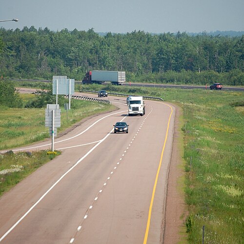
As a provincial portion of the Trans-Canada, the highway's western terminus is at the interprovincial boundary with Quebec 15 kilometres (9.3 mi) northwest of Edmundston. It follows the lower section of the Madawaska River valley and enters the Saint John River valley where it passes north of Edmundston, running several kilometres inland from the east bank of the Saint John River, crossing the Rivière Verte as it continues past Saint-Léonard.
At Grand Falls, the highway crosses to the west bank of the river and passes by Perth-Andover, Florenceville, and Hartland. At Woodstock, the Saint John River turns east and the highway continues to parallel the river on a ridge several kilometres inland along the western bank. It passes south of New Brunswick's capital, Fredericton, and Oromocto before crossing the northeastern edge of CFB Gagetown.
The Saint John River turns south near Jemseg where the highway crosses the river on the Saint John River High Level Crossing and continues east over the Jemseg River using the Jemseg River Bridge.
The highway leaves the river valleys as it continues east across the rolling hills south of Grand Lake and passes by Havelock, River Glade and Salisbury.
The highway passes north and east of the province's largest city, Moncton, and Dieppe before turning south and passing by Memramcook, Sackville, and Aulac before reaching the eastern terminus at the interprovincial boundary with Nova Scotia at the Missaguash River.

Route 2 was once part of an interprovincial "Highway 2" running from Windsor, Ontario to Halifax, Nova Scotia. It was one of the initial routes defined in 1927,[3] running from Quebec as a continuation of Quebec Route 2 via Edmundston, Grand Falls, Woodstock, Fredericton, Saint John, and Moncton, After a short crossing of the New Brunswick Panhandle alongside the Madawaska River to Edmundston, Route 2 closely followed the Saint John River all the way to Saint John, crossing three times - from the east to the west at Grand Falls, back to the east at Perth-Andover, and back to the west at Hartland (on the Hartland Covered Bridge). The road on the east side of the river between Edmundston and Grand Falls had just been opened in about 1926; previously travelers had to pass through Maine (US 1, SR 165, and Boundary Road) on the west side. A Route 2A cut the distance between Fredericton and Saint John via a poorer-quality but more direct road, intersecting Route 2 at Oromocto and Westfield. Beyond Saint John, Route 2 went northeast via Sussex to Moncton, and then turned southeast to cross the Nova Scotia border near Aulac and continue as Nova Scotia Trunk 2.[4][5][6] The original course through Aulac to the Nova Scotia border is now bypassed, with the old interprovincial bridge over the Missaguash River now demolished. The original route between Quebec and Sussex is now approximately the River Valley Scenic Drive.[7]

1950 年頃にトランスカナダ ハイウェイのルートが定められたとき、フレデリクトンとサセックスの間はセントジョン経由のルート 2 ではなく、より直接的なルート 9 を通ることになった。[ 10 ] 1950 年代後半から 1960 年代にかけて、連邦政府のトランスカナダ ハイウェイの資金でルート 2 を改良するために、主に 2 車線のバイパスやルート変更が数多く建設された。1950 年代に建設された最初のバイパスは、ソールズベリーの南西とサックビルの間のモンクトン周辺だった。モンクトンを通る古い道路はルート 2Aとなり、 1965 年にルート 6となり、現在はルート 106 となっている。[ 11 ]
次はウッドストック周辺のバイパスでした。ジャクソンビルのルート42(現在のルート560)から北東のサマービルのルート2(現在のルート103)までの道路は、1950年代後半にはルート2Bとなっていました。 [ 12 ] 1960年にハートランド屋根付き橋のすぐ上流にヒュー・ジョン・フレミング橋が完成し、ルート2Bがジャクソンビルから南にウッドストックの南のルート2(現在のルート165 )まで延伸されたことで、ルート2Bはルート2の再編成となり、ウッドストックを通る旧ルート2はルート2A(1965年にルート103に改番)となりました。[ 11 ]
フレデリクトンの最初のバイパスも1960年頃に建設され、その中にはセントジョン川に架かる1959年のプリンセス・マーガレット橋も含まれており、この橋はルート8、9、ルート10への交通のためにカールトン・ストリート橋に取って代わった。ルート2を通ってセントジョンに向かう交通は、現在ルート7の出口7となっている場所でバイパスから出た。
1965年のニューブランズウィック州のいくつかの高速道路の番号変更により、ルート2はトランスカナダハイウェイと並行するように移動され、ルート9を吸収した。セントジョンを経由する旧ルートは、ルート7 (ルート2Aに取って代わった)にもルート1の延長にもならなかったため、オロモクトとウェストフィールド間の新しいルート102として番号が変更された。[ 11 ]
ニューブランズウィック州の道路開発の大部分は、自動車交通の発達以前の集落パターンに沿って行われており、そのためほとんどのコミュニティは航行可能な水路沿いに発展するか、鉄道網によって結ばれていました。アクセス制限のある高速道路の開発は1960年代になってようやく始まり、しかも大規模なコミュニティ周辺に限られていました。初期の州道改良工事の大部分は、単に地方道路の改良に過ぎませんでした。
ルート2は当初、ニューブランズウィック州とケベック州の州境からエドムンストンまで、現在のルート144に沿って走り、セントジョン川渓谷を下ってグランドフォールズに至った。そこでセントジョン川の西岸に渡り、南下してフローレンスビルに至り、そこで東岸に渡って現在のルート130に沿ってハートランドまで進み、その後再び川を渡って西岸に戻り、現在のルート590、165、102に沿って南東方向にフレデリクトンまで進んだ。
フレデリクトンでは、市街地を囲むように4車線のアクセス制限区間が建設され、高速道路はプリンセス・マーガレット橋でセントジョン川を渡り、中心業務地区のすぐ南にある東岸へと続いていました。川の東岸に沿って、水位からわずか数メートル上の地点(春の増水期には頻繁に洪水が発生する)を通り、ルートは南下してジェムセグに至り、そこで高速道路はグランド湖の南東岸に沿って東に曲がり、ヤングス・コーブ・ロードに至り、そこで高速道路は南に曲がり、コールズ島を経てサセックスへと続いていました。
サセックスで高速道路は再び東に向きを変え、スリーリバーズ、そしてソールズベリーを通過した。ソールズベリーの東では、ルート2はモンクトンの北にある一連の低い丘陵地帯を地方道に沿って進み、ルーツ山で頂上に達した後、下り坂となり、市街地とディエップを迂回するアクセス制限区間を進み、メムラムクック川渓谷の端をかすめ、サックビル、オーラックを経て、最終的にニューブランズウィック州とノバスコシア州の州境に至った。

1960年代にトランスカナダハイウェイの資金援助を受けてこれらの地方道路が初期改良されてから(後にルート2と命名された)、1980年代半ばまで、ニューブランズウィック州の幹線道路の改良はほとんど行われなかった( 1968年のマクタカックダム建設による洪水でフレデリクトン西側のルート2が一部変更されたことを除く)。その結果、ニューブランズウィック州のトランスカナダハイウェイは著しく劣化してしまった。1980年代半ばには、ルート2は深刻な交通障害となり、州にとって大きな恥辱となっていた。
1987年、州政府はフランク・マッケナ首相の選出により交代し、マッケナ首相は州のビジネス環境の改善に注力した。州政府の主要な課題の一つは州の交通インフラを刷新することであり、マッケナ首相はブライアン・マルロニー首相率いる連邦政府と積極的な交渉を行い、新たな高速道路プロジェクトへの連邦資金を確保した。マッケナ首相は、ニューブランズウィック州のルート2(トランスカナダハイウェイ)とルート1は、大西洋岸カナダの高速道路交通の大部分を米国とカナダ中部へと導いていたため、部分的に連邦政府の責任であると考えていた。 1989年のカナダ・米国自由貿易協定の締結と、1980年代にマリタイムズ地方で多数の鉄道路線が廃止されたことを受けて、1990年代にはニューブランズウィック州の高速道路の交通量がさらに増加すると予測された。
マッケナ政権の残りの任期(1997年まで)の間、国道2号線は大幅に改良され、ニューブランズウィック州とノバスコシア州の州境からペノブスクイス(サセックスの東)までの交通量の多い区間は4車線の高速道路となった。グランドレイクの南、エドムンストンとセントレナードの間、そして州間高速道路95号線と接続するインターチェンジが設置されたウッドストックなど、その他の区間も改良された。
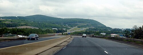
改良工事が行われたにもかかわらず、国道2号線の通行規制のない区間は依然として重大な交通上の危険箇所であった。大西洋沿岸諸州の他の州政府、様々な運送会社、企業、運輸関係者からの集中的なロビー活動により、国道2号線のさらなる改良が求められた。しかし残念ながら、当時の連邦政府の資金援助があったとしても、必要な費用は比較的高額であったため、州の財政では対応できなかった。
その結果、マッケナ政権末期には、ルート 2の大幅なルート変更案が提案された。フレデリクトンの西にあるロングスクリークから始まり、フレデリクトンと西側のオロモクトを迂回し、南東に進んでジェムセグに至るルートである。ジェムセグではセントジョン川を渡り、グランドレイクの南にある既存の4車線区間と接続する。そこから、ハイウェイは元のルート(サセックスに向かって南下していた)から再び外れ、真東に進み、スリーリバーズの東にあるリバーグレイドで既存のルート 2のルートと合流する。
全長225キロメートル(140マイル)の4車線、アクセス制限付きの新しい高速道路は、民間資金で建設され、州政府が高速道路の管理権を取得するまでの25年間は建設業者が通行料を徴収することになっていた。1990年代後半、マリタイム・ロード・デベロップメント・コーポレーション(元州自由党党首で元連邦運輸大臣のダグラス・ヤングが率いる)と呼ばれる民間コンソーシアムと、推定10億カナダドルの費用で新しいルート2のルートを建設する契約が締結された。
通行料問題は物議を醸さずにはいられず、他のいくつかの問題とともに、1999年にマッケナの後継者であるカミーユ・テリオがPC党首のバーナード・ロードに敗れる原因となった。高速道路は建設されたが、開通前に高速道路の大部分から通行料が撤廃された。民間建設によるトランスカナダハイウェイのルート変更区間には、路面に設置されたセンサーで計算される隠れた通行料がある。通行料は州政府に請求されるため、ドライバーは高速道路の使用料を直接支払う必要はない。
トランスカナダハイウェイの新しいルートは2001年の秋に開通し、この時、サセックスとリバーグレイドの間を通っていた旧ルート2の区間がルート 1の一部として再指定され、そのハイウェイの東端が約40キロメートル(25マイル)延長されました。この再指定により、州内のルート2の全長も約40キロメートル(25マイル)短縮されました。その他の再指定には、ヤングスコーブとサセックスの間の44キロメートル(27マイル)の区間がルート10の一部になったこと、ヤングスコーブとフレデリクトンの間の73キロメートル(45マイル)の区間がルート105の一部になったこと、プリンセスマーガレット橋とフレデリクトンバイパスを横断する10キロメートル(6.2マイル)の区間がルート8の一部になったことが含まれます。
ロングスクリークとリバーグレイド間のルート2の再整備と建設により、ニューブランズウィック州の高速道路は一夜にして数十年も進歩した。この道路は、 150メートル(500フィート)の中央分離帯、広範囲にわたる野生動物用フェンスと地下道、緊急路肩に沿ったランブルストリップ、舗装された緊急Uターンエリア、トラックの重量や地域の天候、路面状況を監視するためのアスファルト下のセンサー、広範囲にわたるガードレールと反射板、そしてセントジョン川高架橋と近くのジェムセグ川橋という2つの主要な橋を備えて設計された。
新ルートの完成により、フレデリクトンからノバスコシア州(さらにハリファックスやニューグラスゴーへ)まで、完全に4車線の高速道路で移動することが可能になった。
フレデリクトン~モンクトン間は、予定より5週間早い2001年10月24日午前10時に正式に開通した。
新しい国道2号線の建設の質の高さと州高速道路網の改良は、バーナード・ロード首相率いる新政権の目に留まった。2000年から2003年にかけて、フレデリクトンとエドムンストン間の国道2号線には、アクセス制限のある4車線区間がいくつか 開設されたが、そのほとんどで新たなルートの建設が必要となった。
同時期に、連邦政府との間で、新設工事の最後の、そして最も費用のかかる部分である、ウッドストックとグランドフォールズ間のアパラチア山脈を越える98キロメートル(61マイル)の区間(現在のルート165、103、130を迂回)と、フレデリクトンの西にあるロングスクリークとポキオク間の30キロメートル(19マイル)の区間(現在のルート102を迂回)を完成させるための資金確保に向けた交渉が行われた。
2003年8月、ロード首相とジャン・クレティエン首相は、国道2 号線の最後に残った非アクセス区間の改修工事を完了させるための4億カナダドル(CAD)の協定について共同で発表した。
The Pokiok-Longs Creek section had been independently contracted by the provincial government and opened in November 2006.[13] However, the provincial government sought to construct the remaining 98-kilometre (61 mi) gap as part of a complete "design-build-finance-operate-maintain-rehabilitate" plan which would see large private sector consortia bid for the right to design and construct the 98 kilometres of new highway for Route 2, as well as to operate the entire 275-kilometre (171 mi) section of Route 2 between Longs Creek, where it abuts the 230-kilometre (140 mi) hidden-toll highway section built and operated by Maritime Road Development Corporation, and the Quebec–New Brunswick border as well as all of Route 95.
The winning consortium was Brun-Way Group, a joint venture by Atcon Construction and SNC-Lavalin. Brun-Way Group has two subsidiaries, Brun-Way Construction Inc., which received the ~$540 million to complete the 98 km of new construction as well as selected upgrades to other sections of Route 2 between Longs Creek and the Quebec border, and Brun-Way Highway Operations Inc., which will receive an annual payment from the government of New Brunswick until 2033 to operate and maintain this section of the highway. This agreement will place fully 85% of the maintenance of Route 2 and 100% of Route 95 in the hands of the consortia Brun-Way and MRDC.
The construction of the last segment of four-lane Route 2 was completed by Brun-Way on November 1, 2007. This construction saw a completely new alignment built north of Woodstock, staying several kilometres inland from the Saint John River's west bank, and paralleling the Canada–United States border north to Grand Falls, where it crosses to the east bank of the river and connects with existing four-lane upgrades to Route 2 through to the Quebec boundary. In addition to upgrades to Route 2, Brun-Way is also contracted to perform similar upgrades to Route 95, a short connecting route between the Trans-Canada Highway at Woodstock and the Canada U.S. border at Houlton where it meets Interstate 95.
Upon the opening of this section to traffic on November 1, 2007, the entire length of Route 2 and Route 95 are four-lane, controlled-access, divided freeways with a posted speed limit of 110 km/h (70 mph) and a design speed of up to 120 km/h (75 mph).
2012年8月12日、州首相デイビッド・アルワードにより、国道2号線は正式に「英雄のハイウェイ」と命名された。