San Miguel, officially the Municipality of San Miguel (Tagalog: Bayan ng San Miguel, Kapampangan: Balen ning San Miguel), is a municipality in the province of Bulacan, Philippines. According to the 2024 census, it has a population of 179,792 people.[5]
Etymology
Christmas archways bearing the town's old name, San Miguel de Mayumo
There are two accounts on the origin of the town's name:
According to the 1953 journal History of Bulacan, the town was originally named Mayumo from the Kapampangan term for "sweets". The Spanish name San Miguel was added by the Augustinian missionaries who selected Michael the Archangel as the patron saint of the town.[6]
An account tells that the two leaders decided to form a town named Miguel De Mayumo after the name of Miguel Pineda (the town's first gobernadorcillo) and Mayumo, from the Kapampangan term and for the goodwill and generosity of Mariano Puno.
The municipality of San Miguel de Mayumo was established in 1763 by Carlos Agustin Maniquiz, his wife Maria Juana Puno, and Miguel Pineda, with Pineda as the first town mayor of San Miguel. Miguel Pineda was a native of Angat, Bulacan who decided to settle permanently in the barrio of San Bartolome (now named Barangay Tartaro). He found the place ideal for hunting and was later chosen as the leader of other settlers. He formed an alliance with Mariano Puno, the recognized leader of the adjacent prosperous village called Santo Rosario (now named Barangay Mandile).
The town was previously part of Pampanga, hence San Miguel's culture having Kapampangan influence; it was separated from Candaba. In 1848, the town and the neighboring barrios, which were then part of Pampanga, were added to the territory of the Province of Bulacan.[6]
The Pact of Biak-Na-Bato
Biak-na-Bato Heroes and San Miguel Martyrs Monument (foreground) and the old American-era water district tower (background)
During the Philippine Revolution in 1897, newly appointed Governor-General Fernando Primo de Rivera decided to crush Emilio Aguinaldo and his troops in Cavite, but Aguinaldo fled to Batangas and joined forces with Gen. Miguel Malvar. The Spaniards continue their pursuit but the troops outwitted them by going to the district of Morong (now Rizal) and finally to Biak-na-Bato in San Miguel, Bulacan. Aguinaldo made the mountain caves into his headquarters.[7][8]
Biak-na-Bato (21.17km2 (8.17sqmi) in the villages of Kalawakan and Talbak in Doña Remedios Trinidad town and the villages of Biak-na-Bato and Sibul) served as one of the camps of the revolutionary Katipunan forces during the Philippine Revolution. It was declared a national park by Manuel L. Quezon on November 16, 1937, through Proclamation No. 223.[9]
American occupation
Between 1903 and 1906, the adjacent town of San Ildefonso was consolidated with San Miguel due to the former's low income and inability to finance its expenditures in operating the local government.[10] It was later separated from the town to become an independent town of its own when it became capable of meeting its expenses.[11]
Japanese occupation
During World War II, Japanese Imperial ground troops entered and occupied the town municipality of San Miguel on 1942. Soldiers of the Philippine Commonwealth Army and Philippine Constabulary units retreated into the nearby mountains to become the Bulakeño guerrilla resistance against the Japanese occupation forces until the province's liberation.
Philippine independence
San Miguel was the largest town in the province of Bulacan until September 13, 1977, when Doña Remedios Trinidad, currently the largest municipality of Bulacan, was established under Presidential Decree No. 1196 during the term of President Ferdinand Marcos. Barangays Camachin, Kalawakan, and Talbac were ceded to the new municipality.[12]
Contemporary
On August 26, 2007, residents at the foot of the Biak-na-Bato mountains petitioned president Gloria Macapagal Arroyo to declare the mountains protected areas to stop marble quarrying and mining in the area.[13]
In August 2014 during a field trip to the Madlum Cave, seven students of Bulacan State University died after they were swept away following heavy rains which triggered a flash flood while crossing the Madlum river.[14]
San Miguel then was the biggest municipality in the province of Bulacan before some areas were taken and annexed to Doña Remedios Trinidad during the term of Ferdinand Marcos. The geographic nature of the town is diversified and multi-faceted, rich in nature's beauty like waterfall, rivers, caves, few mountains, hilly areas and springs. The mainland are plain agricultural lands, some part of which was substantially eroded due to commercialization and urbanization.
San Miguel is the third largest municipality by area in the province after Doña Remedios Trinidad and Norzagaray. It is 53 kilometers (33mi) from Malolos and 76 kilometers (47mi) from Manila.
Climate
The prevailing climatic conditions in the municipality is categorized into two types: Wet season and dry season.
Wet Season - (Rainy season or Monsoon season)
Dry Season - (Summer season)
Barangays
Political map of San Miguel
San Miguel is politically subdivided into 49 barangays, as shown in the matrix below.[16] Each barangay consists of puroks and some have sitios
There are 11 urban and the rest rural barangays in the town.
Demographics
In the 2020 census, the population of San Miguel, Bulacan, was 172,073 people,[23] with a density of 740 inhabitants per square kilometer or 1,900 inhabitants per square mile.
Languages
The municipality, along with two other municipalities (Remedios Trinidad and Norzagaray) and one city (San Jose del Monte) of Bulacan, is the homeland of the Alta Kabulowan, the first inhabitants of Bulacan, whose language is also called Alta Kabulowan. Their language is currently endangered and is in dire need of local government intervention. The majority of residents in the town are native speakers of the Tagalog language. Due to its proximity with Pampanga towns and it was part of Pampanga, some residents also speak the Kapampangan language.
Religion and Traditions
Currently, San Miguel is divided into four parishes and a large number of visitas, all of which are under the jurisdiction of the Diocese of Malolos. These are Diocesan Shrine and Parish of San Miguel Arcangel located in Brgy. Poblacion; San Jose Esposo de Maria Parish located in Brgy. San Jose; Nuestra Señora delos Remedios Parish located in Brgy. Sibul Springs; and Sacred Heart of Jesus Parish located in Brgy. Salacot.
The traditions are very alive and well-preserved in San Miguel, as shown by the Holy Week processions in the mother church, which include about 60 carrozas. Numerous images of our Lord, the Blessed Mother, and saints, visited this church, such as the Nuestro Padre Jesus Nazareno of Quiapo and La Purisima Concepcion de Santa Maria. Every May 8, San Miguel holds its town fiesta, and every September 29, it celebrates its Pistang Patron celebration.
Procession de los Desposorios
The tradition of Los Desposorios or the Betrothal of Mary and Joseph is very alive at San Jose Esposo de Maria Parish in Brgy. San Jose. The said parish celebrates its fiesta every 26 November, the traditional date which the Augustinians celebrates the feast of the Betrothal. It will start with Procesion de los Desposorios and after that, the antique image of Saint Joseph and Our Lady meets at the patio of the parish and the rite of the Renewal of Vows will be conducted.
San Miguel is served by an extensive network of educational institutions at the elementary, secondary, and tertiary levels. The municipality is home to numerous public and private schools, along with institutions for technical and higher education.
There are two schools district offices which govern all educational institutions within the municipality. They oversee the management and operations of all private and public, from primary to secondary schools.[34] These are San Miguel North District Office, and San Miguel South District Office.
Primary and elementary schools
Bagong Pag-Asa Elementary School
Bagong Silang Elementary School
Balaong Elementary School
Balite Elementary School
Bantog Elementary School
Bardias Elementary School
Batasan Elementary School
Biak Na Bato Elementary School
Biclat Elementary School
Buga Elementary School
Buliran Elementary School
Bulualto Elementary School
Calumpang Elementary School
D. C. Nicolas Sr. School
Don Felix De Leon Memorial School
Doña Narcisa B. Vda. De Leon Elementary School
Dr. Juan F. Pascual Memorial School
God's Love Children's Advancement Center
Ilog Bulo Primary School
Kng. Kabayo Elementary School
Labne Elementary School
Lambakin Elementary School
Magmarale Elementary School
Malibay Elementary School
Maligaya Elementary School
Malinao Elementary School
Mandile Elementary School
Masalipit Elementary School
Pacalag Elementary School
Paliwasan Elementary School
Pangarayuman Elementary School
Park Ridge School of Montesori
Partida Elementary School
Pinambaran Elementary School
Pulong Bayabas Elementary School
Pulong Duhat Primary School
Sacdalan Elementary School
Salacot Elementary School
San Jose Elementary School
San Juan Elementary School
San Miguel Elementary School
San Miguel North Central School
San Vicente Elementary School
Sapang Elementary School
School of Mount St. Mary
Sibul Elementary School
Sta. Ines Elementary School
Sta. Lucia Elementary School
Sta. Rita Elementary School
Tartaro Elementary School
Tibagan Elementary School
VOJ Eastgate Christian Academy of Bulacan
Waminal Achievers Academy
Secondary schools
Emilia Perez Ligon High School
John J. Russell Memorial High School
Partida High School
San Miguel National High School
Vedasto R. Santiago High School
Higher educational institutions
Bulacan Polytechnic College
Microlink Institute of Science and Technology
St. Paul University
Notable personalities
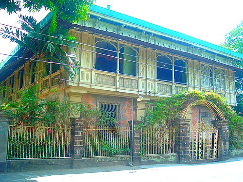
Tecson House - The house where Emilio Aguinaldo slept before he departed to Pangasinan. The house of Simon Tecson
Magtanggol C. Gunigundo - chairman, Presidential Commission on Good Government (PCGG) from 1992 to 1998; and Constitutional Convention Delegate representing the 2nd District of Bulacan, 1971 Constitutional Convention
↑"2015 Census of Population, Report No. 3 – Population, Land Area, and Population Density"(PDF). Philippine Statistics Authority. Quezon City, Philippines. August 2016. ISSN0117-1453. Archived(PDF) from the original on May 25, 2021. Retrieved July 16, 2021.
↑"2024 Census of Population (POPCEN) Population Counts Declared Official by the President". Philippine Statistics Authority. July 17, 2025. Retrieved July 18, 2025.
↑"PSA Releases the 2021 City and Municipal Level Poverty Estimates". Philippine Statistics Authority. April 2, 2024. Retrieved April 28, 2024.
↑"2024 Census of Population (POPCEN) Population Counts Declared Official by the President". Philippine Statistics Authority. July 17, 2025. Retrieved July 18, 2025.
12Cruz, Jose; Liwanag, Aurora; Celis, Arturo; Manikis, Filipina; Sambol, Jose; Mendoza, Leticia; Manio, Zenaida; Salamat, Graciana; Trinidad, Lucina; Lorenzo, Victorina (April 1953). "History of Bulacan"(JPG, PDF). National Library of the Philippines Techno Aklatan. Manila, Philippines. National Library of the Philippines. p.39. Retrieved August 5, 2019.
↑Cruz, Jose; Liwanag, Aurora; Celis, Arturo; Manikis, Filipina; Sambol, Jose; Mendoza, Leticia; Manio, Zenaida; Salamat, Graciana; Trinidad, Lucina; Lorenzo, Victorina (April 1953). "History of Bulacan"(JPG, PDF). National Library of the Philippines Techno Aklatan. Manila, Philippines. National Library of the Philippines. p.12. Retrieved August 5, 2019.
↑Cruz, Jose; Liwanag, Aurora; Celis, Arturo; Manikis, Filipina; Sambol, Jose; Mendoza, Leticia; Manio, Zenaida; Salamat, Graciana; Trinidad, Lucina; Lorenzo, Victorina (April 1953). "History of Bulacan"(JPG, PDF). National Library of the Philippines Techno Aklatan. Manila, Philippines. National Library of the Philippines. p.13. Retrieved August 5, 2019.
↑Presidential DecreeNo. 223 (November 16, 1937), Establishing As Biak-Na-Bato National Park For The Benefit And Enjoyment Of The People Of The Philippines Parcel Of Land Situated In The Municipality Of San Miguel, Province Of Bulacan, Island Of Luzon, retrieved August 5, 2019
↑ActNo. 932 (October 8, 1903), "An Act Reducing the Twenty-five Municipalities of the Province of Bulacan to Thirteen", Senate of the Philippines Legislative Digital Resources, archived from the original on October 21, 2023, retrieved July 3, 2023
↑"Bulacan, Philippines: San Ildefonso, Bulacan: History". Archived from the original on September 23, 2015. Retrieved July 3, 2023.
↑Presidential DecreeNo. 1196 (September 13, 1977), Establishing As Biak-Na-Bato National Park For The Benefit And Enjoyment Of The People Of The Philippines Parcel Of Land Situated In The Municipality Of San Miguel, Province Of Bulacan, Island Of Luzon, retrieved August 5, 2019
↑Inquirer.net, Bulaceños want Biak-na-Bato declared a protected area
↑"CA upholds dismissal of Bulacan State University officials over field trip tragedy". Rappler. March 28, 2018. Retrieved June 9, 2023.
↑"San Miguel: Average Temperatures and Rainfall". Meteoblue. Retrieved May 12, 2020.
↑Philippine Standard Geographic Code listing for San Miguel - National Statistical Coordination Board
↑Census of Population (2020). "Region III (Central Luzon)". Total Population by Province, City, Municipality and Barangay. Philippine Statistics Authority. Retrieved July 8, 2021.
12Census of Population and Housing (2010). "Region III (Central Luzon)"(PDF). Total Population by Province, City, Municipality and Barangay. National Statistics Office. Retrieved June 29, 2016.
↑"2024 Census of Population (POPCEN) Population Counts Declared Official by the President". Philippine Statistics Authority. July 17, 2025. Retrieved July 18, 2025.
↑Census of Population (2015). "Region III (Central Luzon)". Total Population by Province, City, Municipality and Barangay. Philippine Statistics Authority. Retrieved June 20, 2016.
↑Censuses of Population (1903–2007). "Region III (Central Luzon)". Table 1. Population Enumerated in Various Censuses by Province/Highly Urbanized City: 1903 to 2007. National Statistics Office.
↑"2024 Census of Population (POPCEN) Population Counts Declared Official by the President". Philippine Statistics Authority. July 17, 2025. Retrieved July 18, 2025.
↑"Poverty incidence (PI):". Philippine Statistics Authority. Retrieved December 28, 2020.
↑"Estimation of Local Poverty in the Philippines"(PDF). Philippine Statistics Authority. November 29, 2005.
↑"2003 City and Municipal Level Poverty Estimates"(PDF). Philippine Statistics Authority. March 23, 2009.
↑"City and Municipal Level Poverty Estimates; 2006 and 2009"(PDF). Philippine Statistics Authority. August 3, 2012.
↑"2012 Municipal and City Level Poverty Estimates"(PDF). Philippine Statistics Authority. May 31, 2016.
↑"Municipal and City Level Small Area Poverty Estimates; 2009, 2012 and 2015". Philippine Statistics Authority. July 10, 2019.
↑"PSA Releases the 2018 Municipal and City Level Poverty Estimates". Philippine Statistics Authority. December 15, 2021. Retrieved January 22, 2022.
↑"PSA Releases the 2021 City and Municipal Level Poverty Estimates". Philippine Statistics Authority. April 2, 2024. Retrieved April 28, 2024.
↑"Ex-San Miguel, Bulacan mayor convicted of graft for illegal collections | Inquirer News". March 13, 2015.
↑"G. R. No. 175895". Archived from the original on October 12, 2016. Retrieved January 21, 2025.
↑"Masterlist of Schools"(PDF). Department of Education. January 15, 2021. Retrieved August 8, 2025.
External links
San Miguel, Bulacan Official Website
https://psa.gov.ph/classification/psgc/barangays/0301421000"}]]}">Philippine Standard Geographic Code
Philippine Census Information
Categories:
San Miguel, Bulacan
Municipalities of Bulacan
Populated places established in 1763
1763 establishments in the Spanish East Indies
Spa towns in the Philippines
Hidden categories:
Articles with short description
Short description is different from Wikidata
Use mdy dates from November 2022
Use Philippine English from November 2022
All Wikipedia articles written in Philippine English
Pages using gadget WikiMiniAtlas
Pages using multiple image with auto scaled images
Coordinates on Wikidata
Pages using infobox settlement with potentially too many maps