
Loading article…

アイルランドの山の一覧では、北アイルランドまたはアイルランド共和国と英国の国境にある山にはアスタリスクが付けられ、残りはアイルランド共和国内にあります。山が高さでランク付けされている場合、山を分類するために使用された地形上の突出の定義(たとえば、隣接する山との間に必要な標高の変化)が示されています。[a]英国の定義では、山には600メートル(1,969フィート)の高さが必要ですが、アイルランドでは、より低い基準である500メートル(1,640フィート)が推奨されることがあります。
アイルランドの山の定義における最低のプロミネンス閾値は15メートル(49フィート)(例:ヴァンデルール・ライナム)であるが、国際登山連盟(UIAA)の基準を含むほとんどの定義では、プロミネンスが30メートル(98フィート)未満の場合は山とは見なされない(例:少なくともアルデリン山またはヒューイット山でなければならない)。多くのイギリスの定義では、プロミネンスが150メートル(492フィート)未満のピークは山頂であり、山ではない(例:マリリン山でなければならない)。アイルランドの山の広く使われている定義では、最低プロミネンスが100メートル(328フィート)(例: HuMP )であることが求められ、これが「アイルランドの最も高い山トップ100」の基礎となっている。
アイルランドの山々はアイルランドの分類に従ってランク付けされていますが、イギリスとアイルランドを対象とする分類 (例: SimmsおよびP600 ) に基づいてもランク付けされています。
定義
一般的な概念
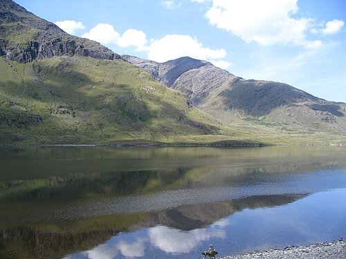
「山」の定義についてはコンセンサスはないが、英国とアイルランドでは、標高2,000フィート、最近では600メートルを超える山頂を指すことが多い。[1] [2] [3] [4]地形上の突出度要件(例えば、隣接する山々の間に必要とされる標高差) については、それほどコンセンサスが得られておらず、30~150メートル(98~492フィート)の範囲で変動することがある。 [2]突出度は、ヒマラヤ山脈のUIAA分類に関しても激しく議論されている。 [5] [6] アルプスでは、UIAAは突出度が30メートル以上を「山頂」、300メートル以上を「山」と規定している。[7]
英国とアイルランドにおけるプロミネンスの最低基準は 15 メートル (49 フィート) です。プロミネンスが使用されない唯一の定義は、地形的孤立が使用される場合です (例:マンロー山に対する「十分な分離」の使用)。英国とアイルランドのほとんどの定義では、プロミネンスが 30 メートル (98 フィート) 未満のものを分類しなくなり (例: 新しいナットル山とヴァンデルール・ライナム山はなし)、プロミネンスが 30 メートルから 150 メートル (98 メートルから 492 フィート) の山頂は、山ではなく山頂として定義されるようになりました (例: 227マンロー山頂)。
アイルランドでは、山の高さの基準を100メートル(328フィート)とすることが提案されている。[8] [9]
主な分類
- ファース.スコットランド外にある標高3,000フィート(914メートル)を超えるマンロー。 [b] [10] アイルランドには13のファース、つまり「アイルランドのマンロー」がある。
- リアル・マンロー。標高150メートル(492フィート)を超えるマンローまたはファース。[11] [12] アイルランドには5つのリアル・マンローがある。
- P600(メジャーズ)。イギリス諸島の標高600メートル(1,969フィート)以上の山。アイルランドには26のP600がある。[c] [14]
- マリリン。イギリス諸島にある、突出部が 150 メートル (492 フィート) を超える高さの山。アイルランドには 454 のマリリン山がある。
- ヒューイット山。イングランド、ウェールズ、アイルランドの山頂で、標高が 2,000 フィート (610 メートル) 以上、突出部が 30 メートル (98 フィート) 以上。アイルランドには 209 のヒューイット山がある。
- ヴァンデルール=ライナム。[d] 標高600メートル(1,969フィート)以上、突出部が15メートル(49フィート)以上のアイルランドの山。アイルランドには275の[15]ヴァンデルール=ライナムがある。[e] [9]
- アルデリン山。[f]標高500メートル(1,640フィート)以上、突出高30メートル(98フィート)以上のアイルランドの山頂。アイルランドには409のアルデリン山がある。[17] [g] [9]
- MountainViews . [h] [i]標高500メートル(1,640フィート)を超えるアイルランドの山頂、突出部の高さは100メートル(328フィート)を超える。[22]アイルランドにはこのような山が221ある。[j]
その他の分類

ディロンという用語は、パディ・ディロンの2010年版アイルランド登山ガイドブック『アイルランドの山々』で紹介されている212のアイルランド山頂を指すのに使われている。ディロンの山頂はすべて標高2,000フィート(610メートル)を超えており、そのほとんどすべては30メートル(98フィート)以上の突出部を持っている(つまり、209のアイルランド・ヒューイット山のリストと非常によく似ている)。[23]
マーディン・デューイ山という用語は、アイルランドにある標高500メートルから2,000フィート(609.6メートル)の山頂で、突出部が30メートル(98フィート)を超える山のことを指し、2000年にマイケル・デューイとマーディン・フィリップスによって発表されました。[24]マーディン・デューイ山は、ヒューイットの分類を500メートルまで拡張したデューイ山のアイルランド版です。マーディン・デューイ山は200あります。[24]
MountainViews オンライン データベース
MountainViewsは、アイルランドの登山家がアイルランドの登山を記録しカタログ化するための非営利のオンラインデータベースとして、2002年にサイモン・スチュワートによって作成されました。[25] 主なデータソースはOrdnance Survey Ireland (OSI)の地図ですが、独自の調査も行っており、OSIはそれを独自のデータベースに統合しています。また、Paul TempanのPlacenames Database of Ireland (Loganim)の作業など、他の重要なアイルランドの山のデータベースも統合しています。[21] Collins Pressは2013年にMountainView Online Dataseを「A Guide to Ireland's Mountain Summits: The Vandeleur-Lynams & the Arderins」という 本で出版しました。[9]
2012年以来、マウンテンビューズは英国とアイルランドの山と丘陵を分類する主要なライブデータベースである英国とアイルランドの丘陵データベース(DoBIH)と提携しています。 [26] [27] [28] ただし、マウンテンビューズはアイルランドの特定の山の測定値がDoBIHと若干異なる場合があります。[k]
マクギリカディーの悪臭が最も強いトップ10のリスト
マクギリカディーのリークス山脈には、アイルランド最高峰のカラントゥーヒル山(標高1,038.6メートル、3,407フィート)があり、リークス山脈はアイルランドで最も高い山々の連なりである。[29] [9]しかし、その山々の多くは「山」の分類基準を全て満たしておらず(特に近隣の山々からの標高差が100~150メートル(330~490フィート)など)、多くはアイルランドの最高峰100選に含まれていない。[8] いずれにせよ、この山脈にはアイルランドにある13のスコットランド・ファースのうち10が含まれ、その重要性と山の分類の複雑さの重要な例として、最も標高の高いリークス山脈10を以下に挙げる。
アイルランドの最高峰100選
(高さは任意、突出部は100m以上)
これは、MountainViews [i]による アイルランドの最も高い山100選[8]のリストで、Collins Press が2013年に出版した「アイルランドの山頂ガイド:ヴァンデルール・ライナム山とアルデリン山」[9]に掲載されています 。これは、ポール・テンパンによる2012年のアイルランドの山とアイルランドの山名に関する研究をまとめたものです。[40]このリストでは、100メートル(328フィート)以上の突出が求められており、これはイギリス諸島のマリリン山の一般的な基準である150メートル(高さと突出によるアイルランドのマリリン山のランキングについては、イギリス諸島のマリリン山の一覧を参照)と、シムズ・ヒューイット・アルデリン山の基準である30メートル(高さと突出によるアイルランドのシムズのランキングについては、イギリス諸島の山々の標高別一覧を参照)の妥協案です。[22] これは広く使われているリストであり、[41] [42]アイルランドのP600の26のうち25が含まれています( P600のSlieve Snaghtは上位100位には入りませんでした)。
リアル・マンロー: 高さ 3,000 フィート (914 メートル) 以上、突出部 150 メートル (492 フィート) 以上。
P600: 高さは問わず、突出部が 600 メートル (1,969 フィート) 以上。
リスト409 アイルランド アルデリン
(高さ500メートル以上、突出部30メートル以上)
標高500メートル(1,640フィート)を超えるアイルランドの山の有名な定義は、アルデリン山のリストであるが、これは突出部が30メートル(98フィート)を超える「山」の最低要件を満たしており、アイルランドのヒューイット山(標高2,000フィート(610メートル)を超える207のアルデリン山は、207〜209のアイリッシュ・ヒューイット山[k])、またはシム山(標高600メートル(1,969フィート)を超える222のアルデリン山は、222〜224のアイリッシュ・シム山[k])の同等物である。2,000フィート(610メートル)未満の199のアルデリン山は、マールディン・デューイ山(例えば、207のアイリッシュ・ヒューイット山と199のマールディン・デューイ山を合計すると、406のアイリッシュ・アルデリン山になる)である。
マウンテンビューのアルデリン山オンラインデータベース[i]は、2013年にコリンズプレスから出版された「アイルランドの山頂ガイド:ヴァンデルール・ライナム山とアルデリン山」という本で公開され、2015年に更新されました。[9] 2023年、マウンテンビューのオンラインデータベースには、アルデリンの定義を満たすアイルランドの山409個が掲載されました。MountainViews.ieのユーザーの中には、アルデリン山の全リストを完了したという記録を持つ人が数人います。あるユーザーは、ヴァンデルール・ライナム山、郡の最高地点、最高峰100選の完全なリストとともに、1年(2014年)以内にアルデリン山を完了しました。
MountainViewsは、高さ500メートル(1,640フィート)以上、突出部が15〜30メートル(49〜98フィート)の山頂の追加クラスにArderin Begsという用語を使用しています。2018年、アイルランドには124のArderin Begsがありました。[43]
リスト275 アイルランド ヴァンデルール・ライナムス
(高さ600メートル以上、突出部15メートル以上)
標高600メートル(1,969フィート)を超えるアイルランドの山の最も広い定義は、ヴァンデルール=ライナムリストである。これは、突出部が15メートル(49フィート)のみで、イングランドとウェールズのナットルのメートル法に完全相当するアイルランドの山である。[p]上記のアイルランドの最も高い山100選は、このリストのサブセットである(つまり、すべてヴァンデルール=ライナムである)。たとえば、コノートの最も高い山であるムウィールリアは、アイルランドの最も高い山100選のリストでは16位であるが、ヴァンデルール=ライナムリストでは34位である。マウンテンビューのヴァンデルール=ライナムズオンラインデータベース[i]は、2013年にコリンズプレスから出版された「アイルランドの山頂ガイド:ヴァンデルール=ライナムズとアルデリンズ」という本で公開され、2015年に更新されました。 [9] [44] 2023年現在、マウンテンビューのオンラインデータベースには、ヴァンデルール=ライナムズの定義を満たすアイルランドの山が275山掲載されています。[q]
2018年10月3日、イギリス湖水地方の登山家ジェームズ・フォレストは、8週間でアイルランドのヴァンデルール・ライナム全273峰を制覇した。[45] 2023年には、アイルランドの写真家で冒険家のエリー・ベリーが、現在275峰となっているヴァンデルール・ライナムを50日5時間で制覇し、以前の記録を6日上回った。[46]この記録は、2024年にケリーマンのショーン・クリフォードが275峰すべてを21日2時間46分で制覇したことで破られた。[47]
アイルランドの丘のリスト
カーン
MountainViewsとDatabase of British and Irish Hillsは、標高100メートル(328フィート)以上400メートル(1,312フィート)以下の337の山頂をカーンズ山として認定している。 [48] [49]
ビニオンズ
MountainViewsとDatabase of British and Irish Hillsは、少なくとも100メートル(328フィート)の高さと400メートル(1,312フィート)未満の高さを持つ484の山頂をビニオンとして認識しています。 [50] [49]
アイルランドの郡と州のトップリスト
地方トップ
アイルランドには 4 つのプロヴィンシャル・トップがあり、マンスターのカラントゥーヒル、レンスターのルグナキージャ、アルスターのスリーヴ・ドナード、コノートのムウェルリアです。
- アイルランドの最高地点別郡一覧、アイルランドの州別最高地点一覧
カウンティトップ
さらに、アイルランドには 27 のカウンティトップがあり、10 のカウンティが同じカウンティトップを共有しています。具体的には、リムリック/ティペラリーのGaltymore 、カーロー/ウェックスフォードのMount Leinster 、ロンドンデリー/ティロンのSawel 、キャバン/ファーマナのCuilcagh 、リーシュ/オファリーのArderin です。
- アイルランドの郡の最高地点別リスト、アイルランドの郡トップリスト
アイルランドとイギリスのアイルランドの山のランキング
MountainViews、Vandeleur-Lynam、および Arderin の分類はアイルランドに特有のものですが、アイルランドの山々は英国とアイルランド全土で使用されている他の同様の分類にも登場します。
シムズ
イギリスとアイルランドのシムズ山の分類(高さ600メートル以上、突出度30メートル以上)は、アイルランドのアルデリン山の分類(高さ500メートル以上、突出度30メートル以上)と非常によく似ている。2018年10月現在[update]、イギリスとアイルランドにある2,754のシムズ山(224 [k]のアイルランドのシムズ山(つまり、600メートルを超えるアイルランドのアルデリン山)を含む)は、高さと突出度によって次の表にランク付けされている。
- イギリス諸島の山々の一覧。高さと突出度によるランキング。シムズ山の山頂で、突出度が 30 メートル (98 フィート) 以上。
ヒューイッツ
アイルランドのヒューイットは、主にメートル法のシムズ分類に置き換えられましたが、次の表ではイングランドおよびウェールズのヒューイットと比較してランク付けされています。
- イングランド、ウェールズ、アイルランドのヒューイット山脈の一覧。高さ順に並べたもので、標高が 30 メートル (98 フィート) を超えるヒューイット山脈の山々の一覧です。
マリリンズ
イギリスとアイルランドで広く使われているマリリン山の分類(高さは問わず、プロミネンスは 150 メートル以上)は、アイルランドのマウンテンビュー山の分類(高さ 500 メートル以上、プロミネンスは 100 メートル以上)よりもプロミネンスの基準が厳しい。2018 年 10 月現在[update]、イギリスとアイルランドにある 2,011 のマリリン山(アイルランドのマリリン山 454 個を含む。マリリン山は高さは問わず、プロミネンスの基準を満たしていればよいため、この数は多い)。これらの山は、プロミネンスと高さで次のようにランク付けされている(このリストは、プロミネンスが 150 メートルを超える山をすべて含んでいるため、プロミネンスによるランク付けによく使用されることに注意)。
- イギリス諸島のマリリン山の一覧。マリリン山である山頂の高さと突出度が 150 メートル (492 フィート) を超える山々を、高さと突出度でランク付けしたものです。
P600s
イギリスとアイルランドの P600 分類では、600 メートルを超える突出度 (つまり、定義により、高さは 600 メートルを超える必要があります) が要求されるため、「メジャー」と呼ばれます。2018 年 10 月現在[update]、イギリスとアイルランドの 120 の P600 (アイルランドの 26 の P600 を含む) は、高さ順に次のようにランク付けされています。
- イギリス諸島の P600 山の一覧。標高とプロミネンスによるランキング。プロミネンスが 600 メートル (1,969 フィート) を超える P600 の山々。
ファース
最後に、スコットランドのファース山の分類は、スコットランド登山クラブ(SMC) がスコットランドのマンロー山の分類に適合していると特定した山々ですが、スコットランドの外側 (つまり「ファース」) にあります。2018 年 10 月現在[update]、イギリスとアイルランドの 34 のファース山 (アイルランドの 13 のファース山を含む) は、高さ順に次のようにランク付けされています。
- イギリス諸島のファース山脈の一覧。高さによるランキング、または SMC によってファース山脈とみなされる山頂。
州別範囲別リスト


- トリウール・デイフィウル– ケリー州
- バリーホウラ山脈– コーク県およびリムリック県
- ボゲラー山脈– コーク州
- カハ山脈– コーク県
- コマーラ山脈– ウォーターフォード州
- デリーナサガート山脈– コーク州
- デビルズ ビット– ティペラリー州
- ディングル半島– ケリー州
- ガルティ山脈– コーク県、リムリック県、ティペラリー県
- ジオカウン山– ケリー州
- グラナラダリー山脈 – ケリー州
- アイヴァリー半島– ケリー州
- ノックメルダウン山脈– ティペラリー州およびウォーターフォード州
- マクギリカディーズ・リークス– ケリー州
- マンガートン グループ(マンガートン山脈とも呼ばれる)– ケリー州
- マウント・ガブリエル– コーク州
- ムラガレイルク山脈– コーク県およびリムリック県
- パープルマウンテン– ケリー州
- シェヒー山脈– コーク県およびケリー県
- シルバーマイン山脈– ティペラリー州およびリムリック州
- パプス・オブ・アヌ(670メートル、2,198フィート) – ケリー州
- スリーブ・オーティ– クレア州
- スリーブ・カラン- クレア州
- スリーブ・ミッシュ山脈– ケリー州
- スリーヴ・ミスキッシュ山脈– コーク州
- スリーヴァーダ丘陵(340メートル、1,115フィート) – ティペラリー州およびキルケニー州
- スリーヴェナモン(719メートル、2,359フィート) – ティペラリー州
- スタックス山脈– ケリー州
- ブラックスターズ山脈– カーロー郡およびウェックスフォード郡
- ブランドン ヒル(515 メートル、1,690 フィート) – キルケニー州
- カーン・クロンヒュー(別名コーン・ヒル) – ロングフォード州
- クーリー山脈– ラウス州
- コッパナ– キルケニー州
- クロガン ヒル(234 メートル、768 フィート) – オファリー州
- ダルキー ヒル(140 m、459 フィート) – ダン レアリー - ラスダウン州 (旧ダブリン州)
- フォーガン ヒル– ミース州
- アレンの丘(206メートル、676フィート) – キルデア州
- ベンの丘– ウェストミース州
- タラの丘– ミース州
- ウイスネアック丘陵(182 m、597 フィート) – ウェストミース州
- ヒル・オブ・ウォード– ミース州
- キリニー ヒル(153 m、502 フィート) – ダン レアリー - ラスダウン州 (旧ダブリン州)
- ノックヨン– ウェストミース州
- マウントアルト– キルケニー州
- ムラミン– ウェストミース州
- ナウルヒルズ(122メートル、400フィート)
- スリーベアダ丘陵– キルケニー州
- シールマーティン ヒル(163 メートル、535 フィート) – フィンガル州 (旧ダブリン州)
- スリーブブルーム山脈– リーシュ県およびオファリー県
- アルデリン(527メートル、1,729フィート)
- バルカム
- バウンリーコング(509メートル、1,670フィート)
- キャロルズ ヒル
- キャッスルコナー
- ファーブリーグ
- ガランバウン
- カパードの尾根
- スティルブルック ヒル(514 メートル、1,686 フィート)
- ウルフトラップマウンテン
- スリーヴボーイ(420メートル、1,378フィート) – ウェックスフォード州
- スリーブ・ナ・カリア– ミース州
- ウィックロー山脈
- Annagh Hill
- Camaderry (699 m, 2,293 ft)
- Camenabologue
- Carrick Mountain
- Church Mountain also known as Slieve Gad (543 m, 1,781 ft)
- Cloghernagh (800 m, 2,625 ft)
- Conavalla
- Corrigasleggaun
- Croghan Mountain
- Cupidstown Hill (379 m, 1,243 ft)
- Djouce (725 m, 2,379 ft)
- Duff Hill (720 m, 2,362 ft)
- Gravale (718 m, 2,356 ft)
- Great Sugar Loaf (501 m, 1,644 ft)
- Keadeen Mountain
- Kilmashogue
- Kippure (757 m, 2,484 ft)
- Larch Hill
- Little Sugar Loaf also known as Giltspur Mountain (300 m, 984 ft)
- Lobawn
- Luggala also known as Fancy Mountain
- Lugnaquilla (924 m, 3,031 ft)
- Maulin
- Montpelier Hill (383 m, 1,257 ft)
- Mullacor
- Mullaghcleevaun (849 m, 2,785 ft)
- Seefingan
- Slievemaan (759 m, 2,490 ft)
- Sugarloaf (West Wicklow)
- Table Mountain
- Tibradden Mountain (467 m, 1,532 ft)
- Tonelagee (817 m, 2,680 ft)
- Two Rock (536 m, 1,759 ft) and Three Rock (450 m, 1,476 ft)
- Antrim Hills* – County Antrim
- Antrim Plateau* – County Londonderry
- Belfast Hills* – County Antrim
- Lisburn* – County Antrim
- Belmore Mountain* – County Fermanagh
- Bluestack Mountains also known as Croaghgorms – County Donegal
- Cuilcagh* and Benaughlin* – Counties Fermanagh and Cavan
- Derryveagh Mountains – County Donegal
- Inishowen
- Loughermore* – County Londonderry
- Mourne Mountains* – County Down
- Slieve Bearnagh
- Slieve Binnian
- Slieve Commedagh
- Slieve Donard (850 m, 2,789 ft)
- Slieve Muck
- Ben Crom
- Ouley Hill* – County Down
- Slieve Beagh* – Counties Fermanagh, Tyrone, Monaghan
- Slieve Croob* – County Down
- Slieve Gullion* – County Armagh
- Sliabh gCuircin* Camlough Mountain (423 m, 1,388 ft) – County Armagh
- Slieve Rushen* – Counties Fermanagh and Cavan
- Southwest Donegal – County Donegal
- Sperrins* – Counties Londonderry and Tyrone
- Achill Island – County Mayo
- Croaghaun (688 m, 2,257 ft)
- Slievemore (671 m, 2,201 ft)
- Ben Gorm – County Mayo
- Croagh Patrick (764 m, 2,507 ft) – County Mayo
- Clare Island – County Mayo
- Knockmore (462 m, 1,516 ft)
- Curlew Mountains – Counties Sligo and Roscommon
- Dartry Mountains – Counties Sligo and Leitrim
- Knocknarea – County Sligo
- Maumturks – County Galway
- Mweelrea (814 m, 2,671 ft) – County Mayo
- Nephin Beg Range – County Mayo
- Nephin (806 m, 2,644 ft)
- Nephin Beg (627 m, 2,057 ft)
- Slieve Carr (721 m, 2,365 ft)
- Ox Mountains – County Sligo
- Partry Mountains – Counties Mayo and Galway
- Devilsmother (645 m, 2,116 ft)
- Maumtrasna – County Mayo
- Sheeffry Range – County Mayo
- Twelve Bens – County Galway
- Errisbeg
- Diamond Hill
- Tully Mountain
See also

Wikimedia Commons has media related to Mountains of Ireland.
- List of long-distance trails in the Republic of Ireland
- List of Irish counties by highest point
- List of mountains of the British Isles by height
- List of mountains of the British Isles by prominence
- List of Furths in the British Isles
- List of Marilyns in the British Isles
- List of P600 mountains in the British Isles
- List of Hewitt mountains in England, Wales and Ireland
- List of mountain lists
- Lists of mountains and hills in the British Isles
Notes
- ^ Some definitions use feet as their principal metric (e.g. Munros), others use metres (e.g. P600s, and Vandeleur-Lynams, and Arderins), and some use a mix of both (e.g. Hewitts and Real Munros).
- ^ While there is no explicit prominence requirement, the Scottish Mountaineering Club ("SMC") reviews aspects like prominence, and isolation, when deciding on the official list of Munros. All of the SMC list of 34 Furths have a prominence over 30 m (98 ft), except for Caher West Top, which is 24 m (79 ft).
- ^ P600 an international classification of major peaks (along with the P1500, or Ultra-prominent peak), which was first applied by Alan Dawson (who called them "Majors"), and has become popular in the British Islands.[13]
- ^ The definition of an Irish Vandeleur-Lynam is similar to a "Nuttall" in England and Wales, except that the Vandeleur-Lynam is fully metric.
- ^ a b A Vandeleur-Lynam is a hill in Ireland at least 600 metres high with a drop of at least 15 metres on all sides. In 1952 Joss Lynam produced a list of 2000ft summits with 50ft drop with assistance from Rev CRP Vandeleur. Joss Lynam updated a version of this list and published it in a reprint of "Mountaineering in Ireland" by Claude Wall printed in 1976. The metricised equivalent was published in 1997. Lynam was actively involved with the list until 2002, thereafter assisting MountainViews with subsequent revisions until his death in 2011.[16]
- ^ a b The Arderin an Irish–equivalent of a "Hewitt", having the same metric prominence requirement of 30 m (98 ft), but the Arderin height requirement is lower, and metric, at 500 m (1,640 ft).
- ^ An Arderin is a hill in Ireland of 500m or over with a drop of at least 30m on all sides. This list was drawn up in 2002 by the MountainViews publisher [Simon Stewart] from an early listing of the Myrddyn Deweys with those hills from the Vandeleur-Lynams which meet the higher drop criterion. The actual list name, created in 2009, comes from the 527 m hill, Arderin, which is the County Top for both Laois and Offaly and means, from the Irish, "Height of Ireland".[18]
- ^ MountainView's classification is a popular modern standard for categorising mountains in the UK.[19]
- ^ a b c d e f g MountainViews was created in 2002 by Simon Stewart as a non–profit online database for climbers in Ireland to document and catalogue their Irish climbs.[20] Its main data feed is taken from the Ordnance Survey Ireland ("OSI"), however, it also integrates other established Irish mountain databases such as the Paul Tempan Loganim Irish Placenames Database.[21] Collins Press published its Online Datase in 2013 in the book: A Guide to Ireland's Mountain Summits: The Vandeleur-Lynams & the Arderins.[9] MountainViews is also partnered with the important Database of British and Irish Hills ("DoBIH"), which is the main live database for the categorisation of mountains and hills in the British Isles.
- ^ MountainViews defines Irish peaks that meet this criterion as being "Irish mountains".
- ^ a b c d As of October 2018[update], the Irish MountainViews Online Database lists the prominence of Knockbrinnea (W) as 29m, and Carrignabinnia as 27 m, and thus they do not qualify as Irish Arderins, which means that MountainViews does not classify these two peaks as Hewitts or Simms; the total number of Irish Arderins over 2,000 ft is thus 207. The DoBIH however uses the Harvey Tables which list the prominence for both at 30 m, and thus the DoBIH class them as Irish Hewitts and Simms, giving 209 Irish Hewitts and 224 Irish Simms on the DoBIH tables.
- ^ Caher's official OSI prominence is 99.7 m, so it is not in the list of 100 Highest Irish Mountains
- ^ In all cases this is the "Name Origin and Meaning" column from Paul Tempan's Irish Hill and Mountain Names (2010).[40]
- ^ The ratings are from the Mountainview Online Database of Irish climbs as at October 2018, as voted by members.[8]
- ^ This is not topographic isolation, but is the distance to the nearest mountain of any height, but with a minimum prominence of 15 metres (49 ft), as per the Irish MountainViews Online Database
- ^ Nuttalls are only listed for England and Wales
- ^ The 2013 Collins book listed 269 Vandeleur-Lynams, however, based on various OSI data updates, MountainView have updated their database since, and the Mountain 2023 database lists 275 Vandeleur-Lynams
- ^ This is not topographic isolation, but is the distance to the nearest mountain of any height, but with a minimum prominence of 15 metres (49 ft), as per the Irish MountainViews Online Database
References
- ^ Nuttall, John & Anne (2008). The Mountains of England & Wales – Volume 2: England (3rd ed.). Milnthorpe, Cumbria: Cicerone. ISBN 978-1-85284-037-2.
- ^ a b "A Mountain is a Mountain - isn't it?". www.go4awalk.com. Retrieved 2 January 2023.
- ^ "mountain". dictionary.com. Retrieved 2 January 2023.
- ^ Wilson, Peter (2001). Listing the Irish hills and mountains in Irish Geography, Vol 34(1), University of Ulster, Coleraine, p. 89. [1] (pdf)
- ^ "Nepal mountain peak expansion bid stalls". BBC News. 18 October 2013.
- ^ "A funny name for a mountain". Mark Horrell. 4 June 2014.
I explained how these five ridge tops couldn't possibly be classified as 8000m peaks in their own right because each of them requires less than 135 metres of re-ascent between their respective parent peaks, Kangchenjunga and Lhotse (known as topographic prominence). It seems that where logic and common sense fail the NMA feels that flattery may work instead.
- ^ "MOUNTAIN CLASSIFICATION". UIAA. March 1994.
Topographic criterium: for each summit, the level difference between it and the highest adjacent pass or notch should be at least 30 m (calculated as average of the summits at the limit of acceptability).
- ^ a b c d e "Irish Highest 100: The highest 100 Irish mountains with a prominence of +100m". Mountainviews.ie. September 2018.
- ^ a b c d e f g h i Mountainviews, (September 2013), "A Guide to Ireland's Mountain Summits: The Vandeleur-Lynams & the Arderins", Collins Books, Cork, ISBN 978-1-84889-164-7
- ^ Mountains – Key Facts. The Munros, Corbetts, Grahams, Donalds & Furths Archived 2012-08-22 at the Wayback Machine at www.smc.org.uk. Accessed on 9 Feb 2013.
- ^ "Magnificent munros: 17 Scottish mountains to bag in your lifetime". The Telegraph. 13 April 2017. Archived from the original on 12 January 2022.
Of the 282, 200 are said to have a summit prominence of over 150 metres and are therefore known as "real monros", but that's for another day.
- ^ "Real Munros". Peakbaggers. Retrieved 9 January 2018.
- ^ "The P600 peaks". HillBagging.co.uk.
- ^ Alan Dawson; Rob Woodall; Jonathan de Ferranti (2006). "THE BRITISH ISLES COMBINED LIST FOR THE UNITED KINGDOM AND REPUBLIC OF IRELAND".
Previously available lists used a cutoff of 2,000 feet (609.6 meters). The 2000 foot cutoff would result in a total of 111 mountains: 90 for Great Britain, 1 for the Isle of Man, and 20 for Ireland. By lowering the cutoff to 600 meters (in order to be consistent with upcoming lists for Europe), we now reach a total of 119 mountains, including 93 for Great Britain, 1 on Man, and 25 in Ireland.
- ^ a b "Vandeleur-Lynams: Irish mountains of 600+m with a prominence of 15m". MountainViews.ie. October 2018.
- ^ "The Vandeleur-Lynams". HillBagging.co.uk.
- ^ a b "Arderins: Irish mountains of 500+m with a prominence of 30m". MountainViews.ie. October 2018.
- ^ "The Arderins". HillBagging.co.uk.
- ^ Jim Bloomer; Roddy Urquhart (2018). "Principles of Peak Classification". ProminentPeaks.org.uk.
The UK and Ireland are a family of islands, so the issue of plateau areas does not arise. The authors have concluded that good criteria for the UK are a minimum height of 500 metres and prominence of 100 metres. This is the basis for the UK Prominent Peaks database.
- ^ "MountainViews.ie, a hillwalking resource for Ireland". Mountaineering Ireland (Irish Mountaineering Council). 2014.
- ^ a b Simon Stewart (2018). "MountainViews Sources and Credits". MountainViews.ie.
- ^ a b "Credits and Acknowledgements: Lists of the summits, islands and coastal features for Ireland". Mountainview.ie. 2018.
The "Hundred Highest" list includes summits with a prominence at a minimum of 100 m, and has been introduced to give a height based list, not too long, with a spread of locations for Ireland.
- ^ "Background to the lists". Database of British and Irish Hills. 2 August 2018.
Dillons: Hills in Ireland at least 2,000 feet high published in The Mountains of Ireland. There is no prominence criterion. 15 Dillons are not Hewitts; 14 have drop <30m, while 20213 Corcog has a 609m spot height (the old 1:10560 map shows 2012ft which converts to 610.6m on the new datum). 12 Hewitts are not Dillons.
- ^ a b "Myrddyn Deweys". HillBaggingUK. Archived from the original on 8 November 2018. Retrieved 7 November 2018.
The Myrddyn Deweys are hills in Ireland with a height between 500-609m and prominence of 30m. The list was researched by Michael Dewey and Myrddyn Phillips and was made freely available to the Mountaineering Council of Ireland in 2000. In 2011 the data was re-examined against the latest mapping. [...] There are 200 Myrddyn Deweys.
- ^ "MountainViews.ie, a hillwalking resource for Ireland". Mountaineering Ireland (Irish Mountaineering Council). 2014.
- ^ "Welcome". The Database of British and Irish Hills. Retrieved 10 October 2018.
- ^ "Birthday celebrations with two new Nuttalls". Ordnance Survey. 23 November 2016.
DoBIH was founded by Graham Jackson and Chris Crocker as a personal tool to help them log their own hill ascents. However, over the years DoBIH evolved into something much bigger with six editors and many hillwalkers supplying data.
- ^ "The Database of British and Irish Hills - past, present and future". The Relative Hills of Britain (rhb.org.uk). May 2016.
- ^ Ryan, Jim (2006). Carrauntoohil and MacGillycuddy's Reeks: A Walking Guide to Ireland's Highest Mountains. Collins Press. ISBN 978-1905172337.
- ^ "Corrán Tuathail/Carrauntoohil". MountainViews.ie. Archived from the original on 20 December 2017. Retrieved 2 January 2018.
- ^ "Binn Chaorach/Beenkeragh". MountainViews.ie. Archived from the original on 3 January 2018. Retrieved 2 January 2018.
- ^ "Cathair/Caher". MountainViews.ie. Archived from the original on 3 January 2018. Retrieved 2 January 2018.
- ^ "Cnoc na Péiste/Knocknapeasta". MountainViews.ie. Archived from the original on 3 January 2018. Retrieved 2 January 2018.
- ^ "Cathair Thiar/Caher West". MountainViews.ie. Archived from the original on 3 January 2018. Retrieved 2 January 2018.
- ^ "Maolán Buí". MountainViews.ie. Archived from the original on 3 January 2018. Retrieved 2 January 2018.
- ^ "Cnoc an Chuillinn". MountainViews.ie. Archived from the original on 3 January 2018. Retrieved 2 January 2018.
- ^ "The Bones". MountainViews.ie. Archived from the original on 3 January 2018. Retrieved 2 January 2018.
- ^ "An Gunna Mhór/The Big Gun". MountainViews.ie. Archived from the original on 3 January 2018. Retrieved 2 January 2018.
- ^ "Cruach Mhór". MountainViews.ie. Archived from the original on 3 January 2018. Retrieved 2 January 2018.
- ^ a b c Paul Tempan (February 2012). "Irish Hill and Mountain Names" (PDF). MountainViews.ie.
- ^ "10 of the Highest Mountains to Climb in Ireland". Outsider.ie. 2018.
We've compiled a list of the 10 highest mountains in Ireland for you to get your teeth into.
- ^ "The Complete Guide to Exploring Ireland's Mountains". Outsider.ie. 2018.
Top 50 highest peaks in Ireland: MountainViews.ie
- ^ Simon Stewart (2018). "Arderins + Arderin Begs: Irish mountains of 500+m with a prominence of 15+m". MountainViews.
Listing selection: All summits (531) in list Arderins + Arderin Begs
- ^ John McCale (14 February 2013). "Ireland's Mountain Summits guide for peakbaggers seeking new challenge". grough.co.uk.
A Guide to Ireland's Mountain Summits has been produced by the team behind the MountainView, a not–for–profit group that has run a popular website for more than 10 years
- ^ Geraldine Gittens (11 October 2018). "Man 35 survives storm and climbs 273 Irish mountains". Irish Independent.
And that brings us to today, when Independent.ie talks to the 35-year-old. He's just completed the Vandeleur-Lynam – the name given to the group of 273 Irish mountains over 600 metres. [...] Forrest began his adventure on Thursday, August 9, and reached his final summit – Knocknadobar in county Kerry – on Wednesday, October 3.
- ^ Matthew McConnell. "Ellie Berry Climbed Every Mountain In Ireland: Hero Of The Week". Outsider.ie.
The Tipperary woman took 50 days, 5 hours, and 45 minutes to complete the list, beating the previous record by 6 days.
- ^ "Kerry man sets new world record in scaling Ireland's 275 mountains". www.independent.ie. 31 August 2024.
- ^ "Carns". MountainViews. Retrieved 16 October 2018.
- ^ a b "Background to the lists". Database of British and Irish Hills. Retrieved 16 October 2018.
- ^ "Binnions". MountainViews. Retrieved 16 October 2018.
External links
- MountainViews: The Irish Mountain Website
- MountainViews: Irish Online Mountain Database
- The Database of British and Irish Hills , the largest database of British Isles mountains ("DoBIH")
- Hill Bagging UK & Ireland, the searchable interface for the DoBIH
- Ordnance Survey Ireland ("OSI") Online Map Viewer
- Logainm: Placenames Database of Ireland
- More Relative Hills of Britain, 2007 Mark Jackson (update to Alan Dawson's books using the DoBIH)
This article includes a geography-related list of lists.