
Loading article…
ブリュースター(Brewster / ˈ b r uː s t ər /)は、マサチューセッツ州ケープコッドにある町です。2020年の国勢調査によると、ブリュースターの人口は10,318人でした。[ 1 ]同名の国勢調査指定地域が含まれています。
1659年に開拓されたブリュースターの町は、プリマス植民地の宗教指導者であったウィリアム・ブリュースター長老にちなんで名付けられました。ブリュースターは、18世紀と19世紀の歴史的な船長の家が数多く残っていることから「船長の町」として知られており、その中には現在ブリュースター歴史協会の本拠地となっているコブ・ハウス(1799年)も含まれています。[ 2 ] [ 3 ]
ブリュースターは、かつて著名なニッカーソン家の狩猟地であった場所に作られた1,900エーカーの自然保護区、ニッカーソン州立公園があることでも知られています。 [ 4 ] [ 5 ]ニッカーソン家の影響は、現在オーシャンエッジリゾートとなっているニッカーソン邸で見ることができます。1890年に建てられたフィールドストーンホールとして知られるこの建物は、当時国内で最も高価な住宅の1つと考えられていました。[ 4 ]
この町は人気の夏の観光地で、人口は3万人まで増加します。[ 6 ]また、この町には2つの国立歴史地区、ブリュースター・オールド・キングス・ハイウェイ歴史地区とストーニー・ブルック・ファクトリー・ビレッジ歴史地区があり、どちらも国家歴史登録財に登録されています。[ 7 ]
ブリュースターは、イギリスのバドリー・ソルタートンという町と姉妹都市提携を結んでいる。

ブリュースターの先住民の居住地は、現在の町の北岸にあり、サウグアタケット族の農耕地は、現在のストーニー・ブルック川を中心としていました。[ 8 ]個々の記録では、接触前のケープコッドの先住民部族を細分化していますが、今日の歴史家や研究者は統一用語としてナウセットを使用しています。[ 9 ] 1617年のパンデミック以前には、アウターケープコッドには約1,200人の先住民が居住していましたが、1621年までにその数は500人に減少しました。[ 8 ] [ 10 ]ブリュースターの最初の恒久的な植民地居住地は、1641年の「オールド・カマーズ」または「購入者」の土地の一部であるストーニー・ブルック川周辺を中心としていました。現在のブリュースターを構成する土地は、1653年に地元のサウグアタケット族の指導者であるワノとその息子サシェマスから購入されました。[ 8 ]この時期までに、サウガタケット族は大量のトウモロコシ、豆、カボチャを所有しており、時にはイギリス人入植者に販売していた。[ 8 ]ブリュースターは、1656年にハーウィッチ町の北東の教区として正式に開拓された。[ 8 ]しかし、18世紀の初めには、現在のブリュースターにはわずか17人の男性入植者しかいなかった。

ブリュースターの最初の入植者は、サンドイッチ、プリマス、イーストハムから来た人々のほか、イングランドから直接来た人々も多かった。[ 8 ] 1700 年代を通して、現在ブリュースターとして知られる地域には、農業集落が点在していた。ストーニー ブルックの製粉所は、この地での初期の製造活動の証として残っている。[ 11 ] 1709 年に、パブと商店が存在し、会衆派教会と集会所は 1700 年に初めて組織された。[ 8 ] 1750 年までに、ブリュースター周辺には約 190 人の入植者が住んでいた。[ 8 ]ブリュースターに残っていた先住民は、町の南西の角に集まった。[ 8 ]入植者も先住民も、ケープ コッド湾の豊富なトウモロコシ畑と天然資源を利用した。ストーニーブルック地域では、ニシン、またはエールワイフが相当量発見されており、現在も発見され続けている。 [ 8 ]
Brewster was officially incorporated as its own town in 1803 when the less wealthy citizens of Harwich were upset that the town's institutions were all concentrated on Brewster's Main Street, now Route 6A, including the town hall and churches. Brewster was named in honor of Elder William Brewster, the first religious leader of the Pilgrims at Plymouth Colony.
By this period, roughly 75% of town inhabitants were involved in shipping and maritime trades.[8] Brewster captains invested an estimated $250,000 on merchant vessels, and a large saltworks was present on the shoreline of Cape Cod Bay during this period.[8] In 1865, Brewster maintained 56 farms, the highest of any town on the Lower Cape aside from Orleans. At this time, Brewster also had the third highest number of cranberry bogs on the Cape, following Harwich and Dennis.[8] Architecturally, Brewster blossomed during this period, with wealthy sea captains and commercial titans constructing Italianate, Greek Revival, and Second Empire homes. The most emblematic structure of this period is Albert Crosby's 1888 Crosby Mansion, located on Crosby Lane.[12]



According to the United States Census Bureau, the town has a total area of 25.4 square miles (65.9 km2), of which 22.9 square miles (59.3 km2) is land and 2.5 square miles (6.6 km2), or 10.07%, is water.[13]
Brewster is bordered on the north by Cape Cod Bay, on the west by Dennis, on the south by Harwich, and on the east by Orleans. The town is usually separated into two villages, West and East Brewster, both of which comprise the Brewstercensus-designated place. Brewster is 31 miles (50 km) south of Provincetown, 14 miles (23 km) east of Barnstable, 31 miles (50 km) east of the Sagamore Bridge, and 85 miles (137 km) southeast of Boston.
The town is bordered by the Brewster Flats, an extensive stretch of tidal sand flats to the north, along the shores of Cape Cod Bay. The town is home to the Roland C. Nickerson State Forest Park, the largest state forest on Cape Cod. The town has several large ponds, especially along the Harwich town line. There are several brooks throughout the town, all of which lead to Cape Cod Bay. The bay is home to several boat landings and beaches in the town.
Brewster is home to the largest pond on Cape Cod, Long Pond. The Brewster-Harwich town line goes directly through the middle of the pond. Brewster's second largest pond is Cliff Pond, located in Nickerson State Park. Both are popular destinations.
According to the Köppen climate classification system, Brewster, Massachusetts has a warm-summer, wet year round, humid continental climate (Dfb). Dfb climates are characterized by at least one month having an average mean temperature ≤ 32.0 °F (≤ 0.0 °C), at least four months with an average mean temperature ≥ 50.0 °F (≥ 10.0 °C), all months with an average mean temperature ≤ 71.6 °F (≤ 22.0 °C), and no significant precipitation difference between seasons. The average seasonal (November–April) snowfall total is approximately 30 inches (76 cm). The average snowiest month is February, which corresponds with the annual peak in nor'easter activity. The plant hardiness zone is 7a, with an average annual extreme minimum air temperature of 4.0 °F (−15.6 °C).[14]
According to the A. W. Kuchler U.S. Potential natural vegetation Types, Brewster, Massachusetts, would primarily contain a Northeastern Oak/Pine (110) vegetation type with a Southern Mixed Forest (26) vegetation form.[16]
国道6号線は、町内に出口のない2車線の高速道路として、ブリュースターの南東の角を南西から北東に横断しています。ただし、出口78、82、85、89(以前は出口9~12)から他の道路を経由してブリュースターにアクセスできます。ブリュースターにある他の5つの番号付き幹線道路はすべて一般道です。マサチューセッツ州道6A号線は、町の中心部をメインストリートとして東から西に横断しています。州道124号線と137号線はどちらも町内の州道6A号線沿いに北端があります。州道28号線と39号線の短い区間も町の南東の角を横断しています(州道28号線の区間は100ヤード(91メートル)未満で、実際にはハーウィッチから直接オーリンズに横断する標識があります)。ブリュースターには、ハーウィッチ・ロード(国道124号線)とロング・ポンド・ロード(国道137号線)の交差点に信号機(点滅する赤信号、四方停止)が1つあります。
町内には鉄道や航空便はありません。ケープコッド・レールトレイルをはじめ、いくつかの自転車道が町を通っています。最寄りの公共飛行場はチャタム(チャタム市営空港、CQX)にあり、最寄りの地方空港はバーンスタブル市営空港(HYA)、最寄りの国内線および国際線はボストンのローガン国際空港にあります。
As of the census[29] of 2000, there were 10,094 people, 4,124 households, and 2,853 families residing in the town. The population density was 439.2 inhabitants per square mile (169.6/km2). There were 7,339 housing units at an average density of 319.3 per square mile (123.3/km2). The racial makeup of the town was 97.24% White, 0.76% Black or African American, 0.23% Native American, 0.76% Asian, 0.03% Pacific Islander, 0.35% from other races, and 0.63% from two or more races. Hispanic or Latino of any race were 1.06% of the population.
There were 4,124 households, out of which 25.7% had children under the age of 18 living with them, 57.9% were married couples living together, 8.9% had a female householder with no husband present, and 30.8% were non-families. Of all households, 24.8% were made up of individuals, and 12.6% had someone living alone who was 65 years of age or older. The average household size was 2.34 and the average family size was 2.79.
In the town, the population was spread out, with 20.9% under the age of 18, 4.3% from 18 to 24, 21.5% from 25 to 44, 27.0% from 45 to 64, and 26.2% who were 65 years of age or older. The median age was 47 years. For every 100 females, there were 86.6 males. For every 100 females age 18 and over, there were 82.2 males.
The median income for a household in the town was $49,276, and the median income for a family was $57,174. Males had a median income of $41,407 versus $33,388 for females. The per capita income for the town was $24,638. About 1.6% of families and 3.7% of the population were below the poverty line, including 1.4% of those under age 18 and 3.1% of those age 65 or over.

Brewster is represented in the Massachusetts House of Representatives as a part of the First Barnstable District, along with Dennis and a portion of Yarmouth. The town is represented in the Massachusetts Senate as a part of the Cape and Islands District, which includes all of Cape Cod, Martha's Vineyard and Nantucket except the towns of Bourne, Falmouth, Sandwich and a portion of Barnstable.[30] The town is patrolled by the Second (Yarmouth) Barracks of Troop D of the Massachusetts State Police.[31]
国政レベルでは、ブリュースターはマサチューセッツ州第9選挙区に属し、現在はウィリアム・キーティング議員が代表を務めている。マサチューセッツ州選出の上院議員で、2012年に選出されたエリザベス・ウォーレン議員(クラスII)が最上級議員であり、2013年に選出されたエドワード・マーキー議員(クラスI)が最下級議員である。
ブリュースターは、行政書記と町議会によって運営される、開かれた町民集会形式の行政形態を採用しています。町には独自の警察署と消防署があります。消防署はルート6A沿い、ルート137の終点付近に位置し、警察署は約0.5マイル離れたルート124沿いにあります。町の中心部付近には郵便局が1つあり、また、ケープ図書館自動資料共有(CLAMS)ネットワークの一部である、5万冊の蔵書を誇るブリュースター婦人図書館もあります。ルート6と137の交差点、ハーウィッチとの境界線すぐそばにあるロングポンド医療センターは、町の住民だけでなく、ケープ南東部の医療ニーズにも対応しています。
ブリュースターは、イーストハム、オーリンズ、ウェルフリートの各町とともに、ノーセット地域学区に属しています。町には、幼稚園から2年生までの児童が通うストーニーブルック小学校と、3年生から5年生までの児童が通うエディ小学校があります。中学生は通常、オーリンズにあるノーセット中学校に通いますが、イーストハーウィッチにあるケープコッド・ライトハウス・チャータースクールも選択肢の一つです。高校生は、ノースイーストハムにあるノーセット地域高校に通います。
さらに、この町の高校生は、近隣のハーウィッチにあるケープコッド地域技術高校に無料で通学できる。また、私立学校が2校あり、ファミリースクールとローレルスクールという2校で、どちらも小学生を受け入れている。

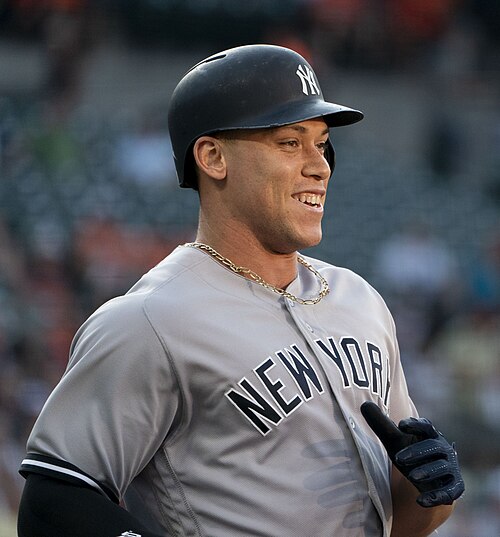
Brewster is home to the Brewster Whitecaps, an amateur collegiate summer baseball team in the Cape Cod Baseball League. The team plays at Stony Brook Field, and has featured dozens of players who went on to careers in Major League Baseball, such as Aaron Judge, Billy Wagner, and Chase Utley.
Brewster beaches, from east to west on the Cape Cod Bay are: Crosby Landing, Linnell Landing, Ellis Landing, Point of Rocks Landing, Breakwater Beach, Saint's Landing, Mant's Landing (Robbins Hill Beach), and Paines Creek Beach. In addition to the beaches on the northside, there are numerous important recreation areas in the town. The Drummer Boy Park on Route 6A has walking trails, picnic areas, playground, and an 18th-century windmill, the Old Higgins Farm Windmill, and blacksmith shop. Several hiking trails leave the Natural History museum, with the John Wing Trail going over a salt marsh boardwalk to Wing Island and the beach on Cape Cod Bay.[35] At Nickerson State Park, there are 1,900 acres (770 ha) of open woodland, nearly 8 miles (13 km) of biking trails that can be hiked as well, and hiking trails around several ponds. Punkhorn Parklands also has thousands of acres of protected woodland with many hiking trails, the one to Eagle Point being particularly popular. Smaller conservation areas are available for hiking throughout the town.[35]

In July 1888, Helen Keller and her teacher, Anne Sullivan, visited Brewster. In the photo, Helen is shown cradling a doll. The photograph was discovered almost 120 years after it was taken. The mother of the man who provided the photograph was Helen's playmate at the Elijah Cobb House.[36][37][38]
Minnie Riperton's song "Alone in Brewster Bay" refers to when Riperton and her husband, producer Dick Rudolph, vacationed on Cape Cod during the early 1970s, prior to the release of her 1975 hit single, "Lovin' You".
シカゴ第一国立銀行の頭取であったサミュエル・M・ニッカーソンは、当時最も影響力のあるビジネスリーダーの一人であった。[ 39 ] 1899年9月29日付のニューヨーク・タイムズによると、ニッカーソンの第一国立銀行の株式は210万ドルで売却された。株式を購入したシンジケートには、JPモルガン、EHハリマン、マーシャル・フィールドが含まれていた。ニッカーソンの夏の別荘、ブリュースターのフィールドストーン・ホールは現在、オーシャン・エッジというコンドミニアム・リゾートになっている。[ 40 ]
2011年に放送されたテレビ番組「Who Do You Think You Are?」のエピソードで、アシュリー・ジャッドは自身の直系の祖先をたどり、町の名前の由来となったウィリアム・ブリュースターにまで遡った。
{{cite web}}: CS1メンテナンス: アーカイブサービスは非推奨になりました (リンク)