
Loading article…
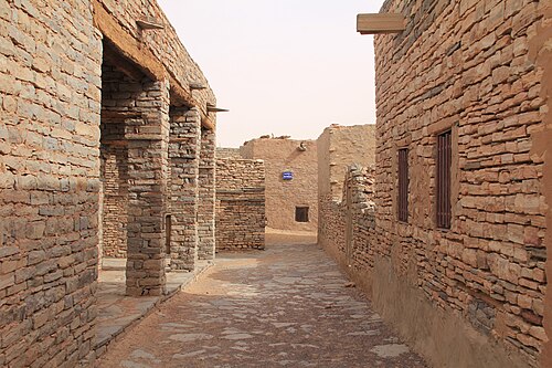
ティチット(ベルベル語: Ticit、アラビア語: تيشيت )は、モーリタニア中南部のタガント高原の麓にある村で、伝統的な建築様式とダール・ティチット遺跡群への近さで知られています。ティチットの主な農業はナツメヤシ栽培で、村には小さな博物館もあります。
ティチット空港には、村の南東1キロメートル(0.62マイル)の荒涼とした地域に指定された、舗装されていない滑走路が2本ある。
この地域には、かつてのアウカル湖の近くにあるホド窪地の北限を定める長い砂岩の崖の地形が含まれています。[ 1 ]
ダール・ティチットの新石器時代の遺跡は、紀元前2000年頃にティチット文化として知られる農牧民コミュニティによって開拓されました。[ 2 ] PJ マンソン、オーギュスタン FC ホール、S. アンブラードなどの考古学者は、コミュニティの創設時からキビが栽培されていた証拠をいくつか発見しています。集落は一般的に崖の上に位置し、石造りの建物が含まれていました。これらは西アフリカで現存する最古の考古学的集落であり、サハラ砂漠以南で最古の石造りの集落です。これらは原ソニンケ族によって建設され、おそらくガーナ帝国の前身であったと考えられています。[ 3 ] [ 4 ] [ 5 ]さまざまな動物や狩猟の場面を描いた数百の岩絵が発見されています。[ 6 ]この地域は、おそらくより乾燥した状況の始まりのために、紀元前500年頃に放棄されました。
The area around Tichit was part of Maasina, the Fula term for the Dhar Tichitt-Walata-Néma region and origin of the name Massina for the Inner Niger Delta.[7]Al-Bakri's 11th century chronicle records a war between 'Masin' and nearby Awgham. The oldest population strata in Tichit consists of an Afro-Berber group still called the Imasna.[8]
The town of Tichitt was founded in the 12th century as a caravan stop on the Trans-Saharan trade route linking Oualâta to Chinguetti and eventually Sijilmasa.[1] According to legend, seven towns have been built on top of each other at the site.[9]
The Azer dialect of Soninke was spoken in Tichit from the era of the Wagadou Empire until the early 20th century.[10] The name 'Tichit' may be derived from a term meaning 'language of the blacks' in the Tuareg languages.[11]
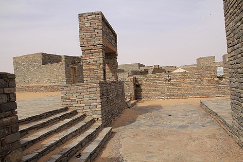
The town was self-sufficient and boasted several thousand inhabitants in the early 20th century, but desertification and sand encroachment have led to the abandonment of many structures.[9] In 1996, it was designated a UNESCO World Heritage Site. In 1999, torrential rains caused flooding that damaged 80% of the town.[9]




Tichit has a hot desert climate (BWh) according to the Köppen climate classification.