Loading article…
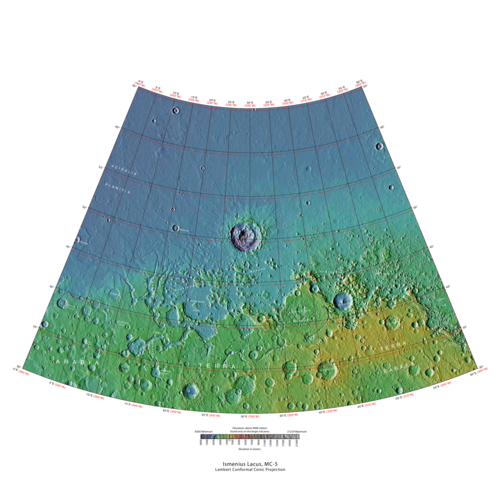 火星探査機レーザー高度計(MOLA) データによるイスメニウス湖四角形の地図。最高標高は赤、最低標高は青で示されています。 | |
| 座標 | 47°30′N 330°00′W / 47.5°N 330°W / 47.5; -330 |
|---|---|

イスメニウス湖四角形は、米国地質調査所(USGS)の天体地質学研究プログラムが使用する火星の30枚の四角形地図のうちの1枚である。四角形は火星の東半球の北西部に位置し、東経0°から60°(西経300°から360°)、北緯30°から65°をカバーする。四角形は、名目縮尺1:5,000,000(1:5M)のランベルト正角円錐図法を使用している。イスメニウス湖四角形は、MC-5(火星チャート5)とも呼ばれる。[1]イスメニウス湖四角形の南と北の境界は、それぞれおよそ3,065 km(1,905マイル)と1,500 km(930マイル)の幅である。南北の距離は約2,050 km(1,270 mi)(グリーンランドの長さよりわずかに短い)である。[2]この四角形はおよそ490万平方キロメートルの面積をカバーしており、これは火星の表面積の3%強に相当する。[3] イスメニウス湖四角形には、アキダリア平原、アラビア大陸、ヴァスティタス・ボレアリス、テラ・サベアの一部が含まれる。[4]
イスメニウス湖四角形には、科学者にとって特に興味深い2つの場所、デウテロニルス・メンサエとプロトニルス・メンサエが含まれています。これらの場所には現在および過去の氷河活動の証拠があります。また、火星特有の地形、いわゆるフレッテッド・テレインがあります。この地域で最大のクレーターはリヨット・クレーターで、おそらく液体の水によって削られた溝があります。[5] [6]
名前の由来

イスメニウス湖は、火星の北緯40度、東経30度に位置する望遠鏡で見えるアルベド地形の名前です。この用語はラテン語でイスメニア湖を意味し、カドモスが守護竜を倒したギリシャのテーベ近郊のイスメニア泉を指しています。カドモスはテーベの伝説的な創設者であり、水を汲みに泉に来ていました。この名前は1958年に国際天文学連合(IAU)によって承認されました。[7]
この地域にはニルスと呼ばれる大きな運河があったようです。1881年から1882年にかけて、この運河は他の運河に分割され、いくつかはニロシルティス、プロトニルス(第一ナイル)、デウテロニルス(第二ナイル)と呼ばれました。[8]
自然地理学と地質学
イスメニウス湖の東には、巨大な流出水路で あるマメルス渓谷があります。

下の写真の水路はかなり長い距離を走り、分岐している。水路の終点は窪地で、かつては湖だったと思われる。最初の写真はCTXで撮影した広角写真で、2枚目はHiRISEで撮影したクローズアップ写真である。[9]
-
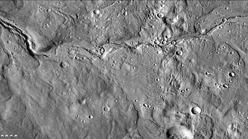 CTX から見たアラビアの運河 この運河は長い距離にわたって曲がりくねっており、分岐しています。この運河の終点は、かつては湖だったと思われる窪地です。
 -
 HiWish プログラムの HiRISE が撮影したアラビアの海峡。これは、広い視野を提供するために CTX で撮影された前の画像を拡大したものです。
 -
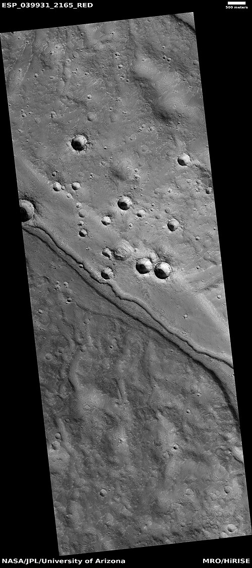 HiWish プログラムの HiRISE によって観測された、大きな水路の中にある水路。小さな水路の存在は、過去に少なくとも 2 回この地域を水が通ったことを示唆しています。
 -
 HiWish プログラムの HiRISE が撮影した、大きな水路内の水路のクローズアップ。小さな水路の存在は、この地域を過去に少なくとも 2 回は水が通ったことを示しています。黒い四角はフットボール競技場の大きさを表しています。表面の一部は、小さな丘や窪みが多く、歩くのが困難な場所もあります。
 -
 HiWish プログラムの HiRISE が捉えた、クレーターの一部を移動するチャネル システム
 -
 HiWish プログラムの HiRISE が撮影した、クレーターの縁を貫く溝
 -
 HiWish プログラムの HiRISE が捉えた、クレーターの一部を通過するチャネル システム。注: これは前の画像の拡大です。
 -
 HiWish プログラムの HiRISE が撮影した、クレーターの一部を通る水路。矢印は水路によって侵食されたクレーターを示しています。注: これは前の画像の拡大です。
 -
 HiWish プログラムで HiRISE が見たチャンネル
 -
 HiWish プログラムの HiRISE で撮影された水路の蛇行。蛇行は、水がゆっくりと流れる古い河川システムでよく発生します。
 -
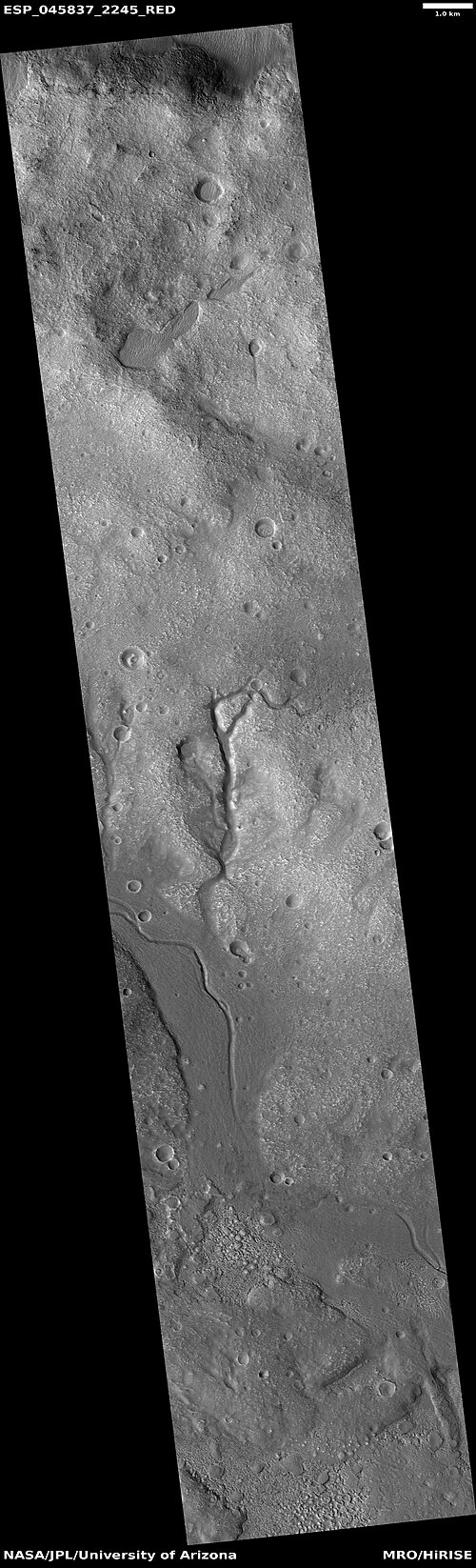 HiWish プログラムで HiRISE が見たチャンネルの広い視野
 -
 HiWish プログラムの HiRISE が撮影した、クレーターの縁を切り裂いた溝
 -
 HiWish プログラムで HiRISE が見たチャンネルの広い視野
 -
 HiWish プログラムで HiRISE が見たチャンネルの広い視野
 -
 HiWish プログラムで HiRISE が見たチャンネル
 -
 HiWish プログラムで HiRISE が見たチャンネルの広い視野
 -
 HiWish プログラムの HiRISE が撮影した、谷が垂れ下がった水路
 -
 HiWish プログラムで HiRISE が見たチャンネルの広い視野
 -
 HiWish プログラムで HiRISE が見たチャンネルの広い視野
 -
 HiWish プログラムで HiRISE が見たチャンネル
 -
 HiWish プログラムで HiRISE が見たチャンネル
 -
 HiWish プログラムで HiRISE が見たチャンネル
 -
 HiWish プログラムの HiRISE が撮影したチャネル。画像の一部にはマントルが写っていますが、他の部分では表面を覆っているマントルが写っていません。
 -
 HiWish プログラムの HiRISE で見られるように、チャネルが反転している可能性があります。
リオットクレーター
北部の平原は、一般的には平坦で滑らかで、クレーターはほとんどない。しかし、いくつかの大きなクレーターは目立つ。巨大な衝突クレーターであるリョートは、イスメニウス湖の北部で簡単に見ることができる。[10] リョートクレーターは、火星の北半球で最も深い地点である。[11]下のリョートクレーターの砂丘の画像の1つには、暗い砂丘、明るい色調の堆積物、砂嵐の跡など 、さまざまな興味深い形が見られる。小型の竜巻に似た砂嵐は、薄くて明るい塵の堆積物を取り除いて、その下の暗い表面を露出させることで跡を作り出す。明るい色調の堆積物には、水中で形成された鉱物が含まれていると広く考えられている。2010年6月に発表された研究では、過去にリョートクレーターに液体の水があった証拠が説明されている。[5] [6]
リオットクレーター付近では多くの水路が発見されている。2017年に発表された研究では、これらの水路は、高温の噴出物が厚さ20~300メートルの氷の層に着地した際に放出された水でできたと結論付けられている。計算によると、噴出物の温度は少なくとも華氏250度だったと思われる。谷は噴出物の外縁付近の噴出物の下から始まっているようだ。この考えを裏付ける証拠の1つは、近くに二次クレーターがほとんどないことである。二次クレーターがほとんど形成されなかったのは、ほとんどが氷の上に着地し、その下の地面に影響を与えなかったためである。この地域の氷は、気候が異なっていたときに蓄積された。軸の傾きや黄道傾斜は頻繁に変化する。傾きが大きい時期には、極地の氷が中緯度に再分配される。火星にはかつて川、湖、海に水があったが、これらの地形はノアキアン期とヘスペリアン期、つまり40億~30億年前のものとされているため、これらの水路の存在は珍しい。[12] [13] [14]
-
 HiRISE から見たリオット クレーターの峡谷
 -
 HiWish プログラムの HiRISE が撮影した、リオット クレーターのチャネルの広域画像
 -
 HiWish プログラムの HiRISE が撮影した、リオット クレーターのチャネルのクローズ アップ画像
 -
 HiRISE が捉えたLyot クレーターの砂丘。画像をクリックすると、明るい色調の堆積物と砂嵐の跡が見られます。
 -
 HiWish プログラムで HiRISE が見たチャンネル
その他のクレーター
衝突クレーターは一般に縁があり、その周囲に噴出物がある。一方、火山クレーターには通常縁も噴出物堆積物もない。クレーターが大きくなると(直径10km以上)、中央に山が現れる。[15]山は衝突後にクレーター底が跳ね返ったことでできる。[16] クレーターの壁には層が見られることもある。クレーターを形成する衝突は強力な爆発のようなもので、地中深くの岩石が地表に投げ出される。そのため、クレーターは地表の奥深くに何があるのかを知るのに役立つ。
-
![HiWish計画のHiRISEによって観測された、拡大した可能性のある二次クレーター。これらのクレーターは、縁の周りの地面から氷が剥がれたため、さらに広くなった可能性がある。[17][18]](https://img-server.japedia.wiki/wikipedia/commons/thumb/d/df/ESP_056953_2160expandedcraters.jpg/500px-ESP_056953_2160expandedcraters.jpg) HiWish計画のHiRISEによって観測された、拡大した可能性のある二次クレーター。これらのクレーターは、縁の周りの地面から氷が剥がれたため、さらに広くなった可能性があります。[17] [18]
HiWish計画のHiRISEによって観測された、拡大した可能性のある二次クレーター。これらのクレーターは、縁の周りの地面から氷が剥がれたため、さらに広くなった可能性があります。[17] [18] -
 HiWish プログラムの HiRISE が撮影した新しいクレーター。縁と噴出物がはっきりと見えることから、これは新しいクレーターであることがわかります。まだ侵食されていません。
 -
 明確な噴出物がある新鮮なクレーター
 -
 HiWish プログラムの HiRISE によって観測された、氷の多い地面に形成された可能性のある衝突クレーター
 -
 HiWish プログラムの HiRISE によって撮影された、氷の多い地面に形成された可能性のある衝突クレーター。噴出物が周囲よりも低い位置にあるように見えることに注目してください。高温の噴出物によって氷の一部が消失し、噴出物の高さが下がった可能性があります。
 -
 HiWish プログラムの HiRISE が撮影した台座クレーター。クレーターからの噴出物がその下の地面を浸食から守っています。
 -
 HiWish プログラムの HiRISE が撮影した台座クレーター。クレーターの底にあるメサはクレーターの後に形成されました。
 -
 HiWish プログラムの HiRISE が撮影したベンチのあるクレーター
-
 HiRISE が捉えた、 セルリクレーターの谷とデルタの可能性
 -

-
-
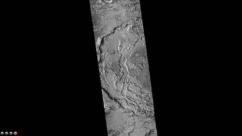
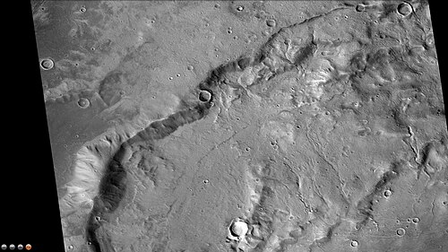 CTX カメラ (火星探査機搭載) が捉えたフォーカス クレーターの小さな溝。これはフォーカス クレーターの以前の CTX 画像の拡大版であることに留意してください。
 -
-
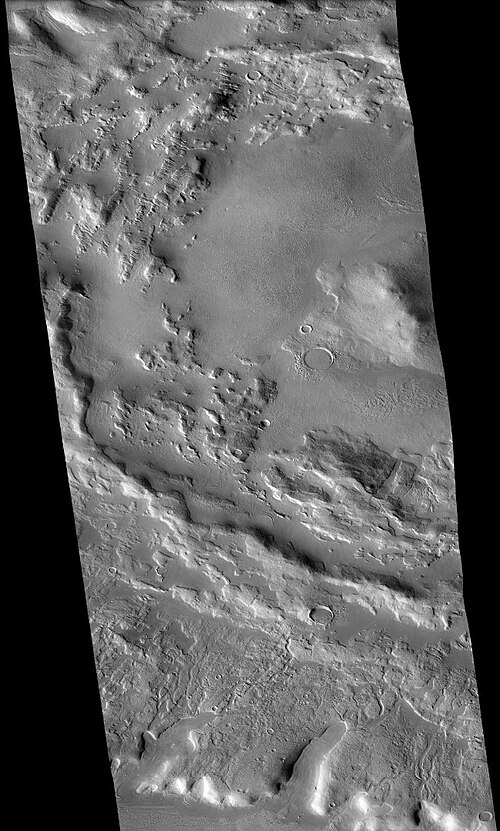
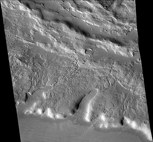 CTX カメラ (火星探査機搭載) が捉えた、シントン クレーターのすぐ南にある溝。これらは、氷の多い地面に衝突が起こったときに形成されました。注: これは、シントンの西側の以前の画像の拡大です。
 -
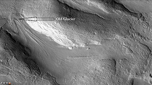 CTX カメラ (火星探査機搭載) が捉えた、シントン クレーターのすぐ北にある古い氷河。これは、この地域にある多くの氷河の 1 つです。注: これは、シントンの西側の以前の画像の拡大です。
 -
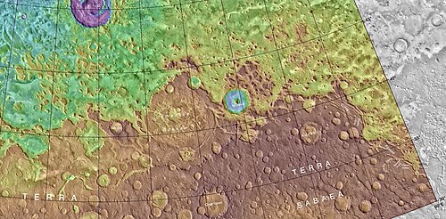 ルドークレーターとその他の近くのクレーターを示す MOLA マップ。色は標高を示します。
 -
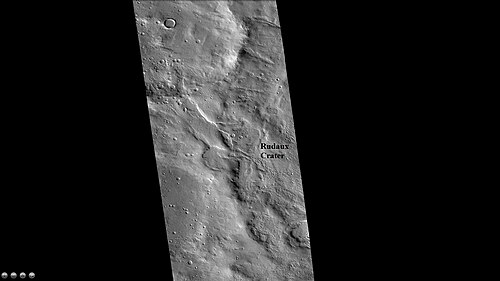 CTX カメラ (火星探査機搭載) から見たルドークレーターの西縁
 -
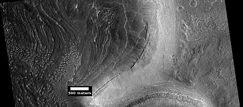 HiWish プログラムの HiRISE が撮影したクレーター内の地層の集合
 -
 HiWish プログラムの HiRISE が捉えた、奇妙な堆積物のあるクレーターの広域画像
 -
 奇妙な層状の堆積物があるクレーターのクローズアップ写真
 -
 二重クレーター。四角はフットボール競技場の大きさを示します。物体は地表に衝突する直前に 2 つに分裂しました。
 -
 メサのあるクレーター。最初にクレーターが形成されました。その後、その地域に物質が堆積しました。その物質は、このクレーターを除いて、全体的に浸食されました。
フレット地形
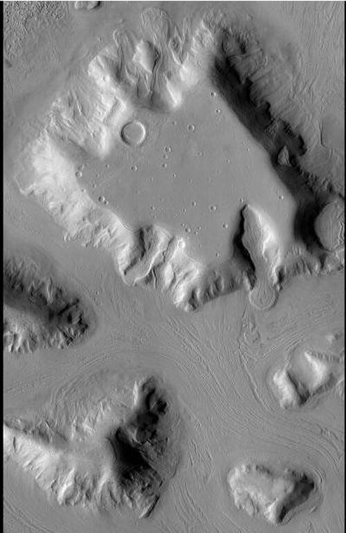
イスメニウス湖の四角形には、デウテロニラス・メンサエとプロトニラス・メンサエに一部見られるフレッテッド・テレインなどの興味深い地形がいくつかある。フレッテッド・テレインには、急峻な崖とともに滑らかで平坦な低地が含まれる。断崖や崖の高さは通常1~2kmである。この地域の水路は広く平坦な床と急峻な壁を持つ。ビュートやメサが多数存在する。フレッテッド・テレインでは、土地は狭くまっすぐな谷から孤立したメサへと移行しているように見える。[19]メサのほとんどは、サーカム・メサ・エプロン、デブリ・エプロン、岩石氷河、ローブ状デブリ・エプロンなど、さまざまな名前で呼ばれる地形に囲まれている。[20]最初は地球の岩石氷河に似ているように見えた。しかし科学者たちは確信が持てなかった。マーズ・グローバル・サーベイヤー(MGS)の火星探査機カメラ(MOC)が氷河のように氷河地形のさまざまな写真を撮影した後でも、専門家は氷河地形の物質が移動または流動しているかどうかを確実に判断できなかった。最終的に、火星探査機によるレーダー研究によって、氷河地形には純粋な水氷が含まれており、その上に薄い岩石層が氷を絶縁していることが証明された。[21] [22]
-

-
 崖が見える左の写真の拡大図。MOCパブリックターゲティングプログラムの下、マーズ・グローバル・サーベイヤー(MGS)の高解像度カメラで撮影された写真。
 -
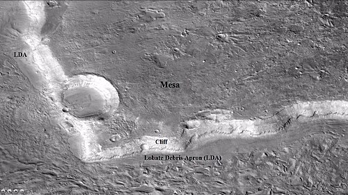 CTX を含むメサの広角ビュー。崖面とローブ状デブリ エプロン (LDA) の位置を示しています。場所はイスメニウス湖の四角形です。
 -
 メサの以前の CTX 画像の拡大。この画像には、LDA の崖面と詳細が示されています。HiWish プログラムの HiRISE で撮影された画像です。場所は、イスメニウス湖の四角形です。
 -
 凹凸のある地形の崖。色の帯の幅は約 1 km です。
 -
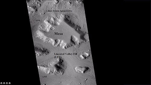 メサとビュート、その周囲に葉状の破片のエプロン、線状の谷底が見える CTX の広域ビュー。場所はイスメニウス湖の四角形です。
 -
 HiWish プログラムの HiRISE で観測された線状谷埋め(LVF)のクローズアップ。注: これは以前の CTX 画像の拡大です。
 -
 線状谷埋め(LVF)のクローズアップ画像。画像の幅は約 1 km です。
 -
 HiWish プログラムの HiRISE で表示されるフレット地形の例。フレット地形には、広く平らな床の谷が多数あります。
 -
 HiWish プログラムの HiRISE から見た、フレッティング地形の平らな谷
 -
 HiWish プログラムの HiRISE で見られる、フラットフロアのチャネルイン フレット テレイン
_02.jpg/500px-ESP_084582_2195_lineated_valley_fill_(LVF)_02.jpg)
氷河
火星の広範囲で観測可能な表面の多くは氷河によって形成されています。高緯度の地域の多く、特にイスメニウス湖四分円には、今でも大量の水氷が含まれていると考えられています。[16] [21] [23] 2010年3月、科学者たちはデウテロニラス・メンサエ と呼ばれる地域のレーダー調査の結果を発表しました。この調査では、数メートルの岩石の破片の下に氷が広く存在していることが発見されました。 [24]この氷は、極がもっと傾いていた以前の気候の間に降雪として堆積したと考えられます。 [25] 氷河がよく見られる凹凸のある地形では、表面が折り畳まれ、くぼみがあり、線状の縞模様で覆われていることも多いため、ハイキングをするのは難しいでしょう。 [26] 縞模様は移動の方向を示しています。このざらざらした質感の多くは、埋もれた氷の昇華によるものです。氷は直接ガスになり(このプロセスは昇華と呼ばれます)、後には空きスペースが残ります。[27] 氷河は純粋な氷ではなく、土や岩を含んでいます。時には、氷河が堆積した物質を尾根に流し込むことがあります。このような尾根はモレーンと呼ばれます。火星にはねじれた尾根の集まりがある場所がありますが、これは尾根ができた後の動きがさらに進んだためかもしれません。氷河から氷の塊が落ちて地表に埋もれることもあります。それが溶けると、多かれ少なかれ丸い穴が残ります。[28] 地球では、このような地形をケトルまたはケトルホールと呼びます。ニューヨーク州北部のメンドン・ポンズ公園には、このようなケトルがいくつか保存されています。以下のHiRISEの写真は、モルー・クレーターにあるケトルの可能性がある場所を示しています。
-
 左の写真の矢印は、氷河によって削られたと思われる谷を指しています。右の画像は、火星探査機マーズ・グローバル・サーベイヤーが撮影した画像で、谷が大きく拡大されたものです。
 -
 HiWish プログラムの HiRISE で撮影された、谷から移動する氷河
 -
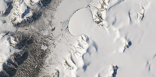 ランドサット 8 号が捉えた、地球の北極にあるローマー湖のエレファント フット氷河。この写真には、火星にある氷河だと考えられている多くの地形と同じ形をした複数の氷河が写っています。
 -
 HiWish プログラムの HiRISE が撮影した、谷から流れ出る氷河。場所はモルークレーターの縁です。
 -
 HiWishプログラムにおけるHiRISEから見たフロー
 -
 HiWishプログラムにおけるHiRISEから見たフロー
 -
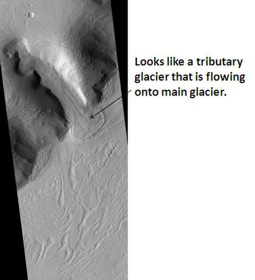 HiRISEが見た支流の氷河
 -
 HiWish プログラムの HiRISE が捉えた、メサの谷から移動する氷河
 -
 HiWish プログラムの HiRISE が捉えた、相互作用する 2 つの氷河。左側の氷河はより新しいもので、もう一方の氷河の上を流れています。
 -
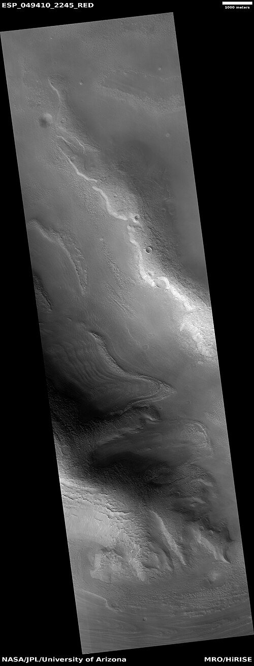 HiWish プログラムの HiRISE で撮影された、障害物と相互作用する氷河
 -
 HiWish プログラムの HiRISE が撮影した、谷から流れ出る氷河
 -
 HiWish プログラムの HiRISE で見られる線状の谷埋め
 -
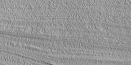 HiWish プログラムの HiRISE で撮影された線状の谷埋めのクローズ アップ画像
 -
 HiWish プログラムの HiRISE で撮影された、線状の谷埋めのクローズアップ カラー画像
 -
 HiWish プログラムの HiRISE で見た谷の線状の谷埋め
 -
 HiWish プログラムの HiRISE で撮影された、谷の線状の谷埋め。線状の谷の流れは、瓦礫で覆われた氷です。
 -
 HiWish プログラムの HiRISE で撮影された、線状の谷埋めのクローズアップ カラー画像
 -
 HiWish プログラムの HiRISE で撮影された、谷の線状の谷埋め。線状の谷の流れは、瓦礫で覆われた氷です。
 -
 HiWish プログラムの HiRISE が撮影した、谷の線状谷充填 (LVF) のクローズ アップ画像。線状谷充填は、堆積物で覆われた氷です。画像の幅は約 1 km です。
 -
 HiWish プログラムの HiRISE で撮影された、谷の線状谷充填 (LVF) のクローズ アップ画像。線状谷充填は、堆積物で覆われた氷です。
 -
 HiWish プログラムの HiRISE で撮影された、谷の線状谷充填 (LVF) のクローズ アップ画像。線状谷充填は、堆積物で覆われた氷です。
 -
 HiWish プログラムの HiRISE で撮影された、谷の線状の谷埋め。線状の谷の流れは、瓦礫で覆われた氷です。
 -
 HiWish プログラムの HiRISE が撮影した、谷の線状谷充填 (LVF) のクローズ アップ画像。線状谷充填は、堆積物で覆われた氷です。画像の幅は約 1 km です。
 -
 葉状の破片のエプロンが始まる場所。動きを示す縞模様に注意してください。
 -
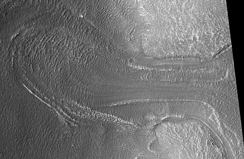 HiWish プログラムの HiRISE が捉えた、おそらく氷河。レーダー調査により、ほぼ完全に純粋な氷で構成されていることが判明しました。右側の高地 (台地) から移動しているように見えます。
 -
 CTX が撮影したイスメニウス湖四角形内のメサ。メサには複数の氷河が侵食しています。HiRISE の次の 2 つの画像では、氷河の 1 つがより詳細に写っています。
 -
 HiWish プログラムの HiRISE が撮影した氷河。長方形の領域は次の写真で拡大されています。上部に雪が積もっているゾーン。氷河は谷を下り、平野に広がっています。流れの証拠は、表面の多数の線から得られます。場所は、イスメニウス湖四角形のプロトニルス メンサエです。
 -
 前の画像の長方形の領域を拡大したもの。地球上では、この尾根はアルプスの氷河の末端モレーンと呼ばれる。HiWish プログラムで HiRISE によって撮影された写真。
 -
 HiWish プログラムの HiRISE が撮影した、氷が消えた後の氷河の残骸
 -
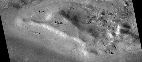 CTX が撮影したメサ周辺のローブ状デブリ エプロン (LDA)。メサと LDA にはラベルが付けられており、それらの関係がわかります。レーダー研究により、LDA には氷が含まれていることが判明しており、将来の火星移住者にとって重要なものになる可能性があります。場所はイスメニウス湖の四角形です。
 -
 HiWish プログラムの HiRISE が撮影した、ロベートデブリエプロン (LDA) のクローズアップ
 -
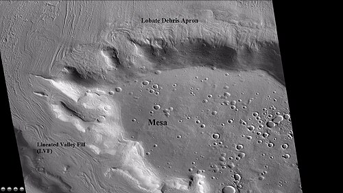 メサの広域 CTX ビューには、ローブ状のデブリ エプロン (LDA) と線状の谷の充填が示されています。どちらもデブリで覆われた氷河であると考えられています。場所は、イスメニウス湖の四角形です。
 -
 メサの以前の CTX 画像から、葉状の破片エプロンのクローズアップ。画像は、オープンセル ブレイン テレインと、より一般的なクローズドセルブレイン テレインを示しています。オープンセル ブレイン テレインには、氷のコアが含まれていると考えられています。画像は、HiWish プログラムの HiRISE から取得されました。
 -
 HiWish プログラムの HiRISE が撮影した、メサ周辺のローブ状の破片のエプロン
 -
 HiWish プログラムの HiRISE が撮影した、メサ周辺の葉状デブリのエプロンのクローズアップ画像。ブレイン テレインが見える。
 -
 HiWish プログラムの HiRISE が捉えた、2 つの異なる谷で移動する氷河
 -
 HiWish プログラムの HiRISE で見た谷を流れる流れの広域画像
 -
 Close view of part of glacier, as seen by HiRISE under HiWish program. Box shows size of football field.
 -
 Flow and mantle, as seen by HiRISE under HiWish program
 -
 Close, color view of flow, as seen by HiRISE under HiWish program
-
 Wide view of tongue-shaped glacier and lineated valley fill, as seen by HiRISE under HiWish program
 -
 Tongue-shaped glacier, as seen by HiRISE under HiWish program. Note: this is an enlargement of the previous image.
 -
 Close view of tongue-shaped glacier, as seen by HiRISE under HiWish program. Surface is broken up into cubes.
Much of the Martian surface is covered with a thick ice-rich, mantle layer that has fallen from the sky a number of times in the past.[29][30][31]
-
 Close view of mantle, as seen by HiRISE under HiWish program. Arrows show craters along edge which highlight the thickness of mantle.
 -
 Close view that displays the thickness of the mantle, as seen by HiRISE under HiWish program
 -
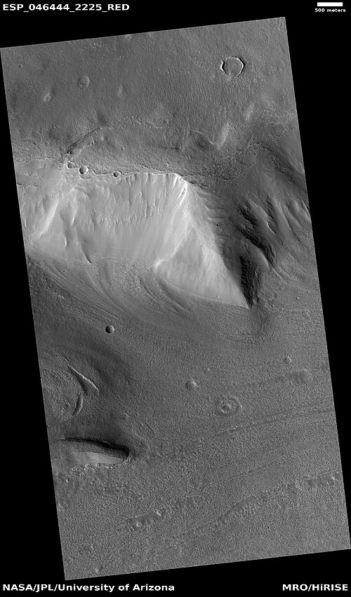 Mantle and flow, as seen by HiRISE under HiWish program. A part of the image showing the mantle is enlarged in the next image.
 -
 Mantle, as seen by HiRISE under HiWish program
 -
 Close view of mantle, as seen by HiRISE under HiWish program
 -
 Color view of mantle, as seen by HiRISE under HiWish program. Some parts of the image are covered with mantle; other parts are not.
 -
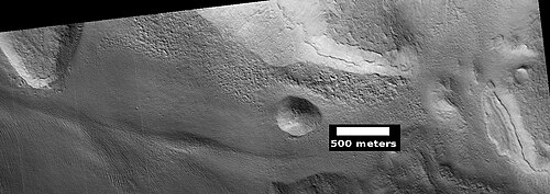 Mantle layers, as seen by HiRISE under HiWish program
 -
 Mantle layers, as seen by HiRISE under HiWish program. Mantle layers seem to be forming a group of dipping layers.
Climate change caused ice-rich features
Many features on Mars, especially ones found in the Ismenius Lacus quadrangle, are believed to contain large amounts of ice. The most popular model for the origin of the ice is climate change from large changes in the tilt of the planet's rotational axis. At times the tilt has even been greater than 80 degrees[32][33] Large changes in the tilt explains many ice-rich features on Mars.
Studies have shown that when the tilt of Mars reaches 45 degrees from its current 25 degrees, ice is no longer stable at the poles.[34] Furthermore, at this high tilt, stores of solid carbon dioxide (dry ice) sublimate, thereby increasing the atmospheric pressure. This increased pressure allows more dust to be held in the atmosphere. Moisture in the atmosphere will fall as snow or as ice frozen onto dust grains. Calculations suggest this material will concentrate in the mid-latitudes.[35][36] General circulation models of the Martian atmosphere predict accumulations of ice-rich dust in the same areas where ice-rich features are found.[33] When the tilt begins to return to lower values, the ice sublimates (turns directly to a gas) and leaves behind a lag of dust.[37][38] The lag deposit caps the underlying material so with each cycle of high tilt levels, some ice-rich mantle remains behind.[39] Note that the smooth surface mantle layer probably represents only relative recent material.
Upper Plains Unit
-
 Wide view showing contact between upper plains unit lower part of picture and a lower unit, as seen by CTX
 -
 Contact, as seen by HiRISE under HiWish program Upper plains unit on the left is breaking up. A lower unit exists on the right side of picture.
 -
 Close view of contact, as seen by HiRISE under HiWish program Picture shows details of how upper plains material is breaking. The formation of many fractures seems to precede the break up.
-
 Wide view of upper plains unit eroding into hollows, as seen by HiRISE under HiWish program. Parts of this image are enlarged in following images.
 -
 Close view of upper plain unit eroding into hollows, as seen by HiRISE under HiWish program. Breakup begins with cracks on the surface that expand as more and more ice disappears from the ground.
 -
 Close view of hollows, as seen by HiRISE under HiWish program
Remnants of a 50–100 meter thick mantling, called the Upper Plains Unit, has been discovered in the mid-latitudes of Mars. First investigated in the Deuteronilus Mensae region, but it occurs in other places as well. The remnants consist of sets of dipping layers in craters and along mesas.[40][41] Sets of dipping layers may be of various sizes and shapes—some look like Aztec pyramids from Central America.
-
 Close view of dipping layers along a mesa wall, as seen by HiRISE under HiWish program
 -
 Dipping layers, as seen by HiRISE under HiWish program
 -
 Dipping layers in a crater, as seen by HiRISE under HiWish program
 -
 Layered features in crater, as seen by HiRISE under HiWish program
 -
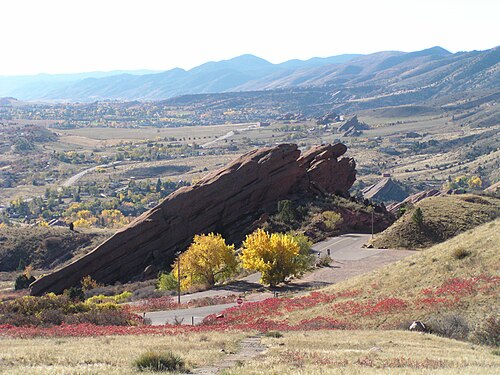 Layered feature in Red Rocks Park, Colorado. This has a different origin than ones on Mars, but it has a similar shape. Features in Red Rocks region were caused by uplift of mountains.
 -
 Dipping layers, as seen by HiRISE under HiWish program
 -
 Layered structures, as seen by HiRISE under HiWish program
 -
 Layered structures, as seen by HiRISE under HiWish program
 -
 Layered features, as seen by HiRISE under HiWish program
 -
 Layered features in channels and depressions, as seen by HiRISE under HiWish program. Arrows point to some of the layered features.
 -
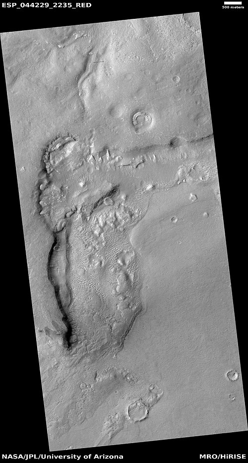 Wide view of dipping layers, upper plains unit, and brain terrain, as seen by HiRISE under HiWish program. Parts of this picture are enlarged in other images.
 -
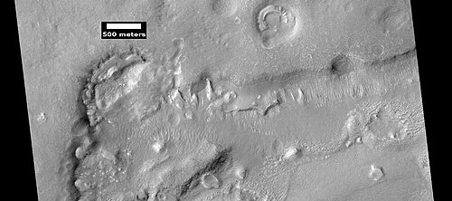 Dipping layers, as seen by HiRISE under HiWish program. This is an enlargement of a previous image.
 -
 Dipping layers, as seen by HiRISE under HiWish program
 -
 Close view of dipping layers, as seen by HiRISE under HiWish program
 -
 Close view of dipping layers, as seen by HiRISE under HiWish program. Brain terrain is also visible in the image.
 -
 Close view of dipping layers, as seen by HiRISE under HiWish program
 -
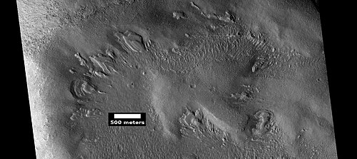 Wide view of dipping layers, as seen by HiRISE under HiWish program
 -
 Close view of dipping layers, as seen by HiRISE under HiWish program
 -
 Close view of dipping layers, as seen by HiRISE under HiWish program
This unit also degrades into brain terrain. Brain terrain is a region of maze-like ridges 3–5 meters high. Some ridges may consist of an ice core, so they may be sources of water for future colonists.
-
 Brain terrain, as seen by HiRISE under HiWish program
 -
 Layered features, as seen by HiRISE under HiWish program. On the right side of picture a small region of ribbed upper plains material is changing into brain terrain.
 -
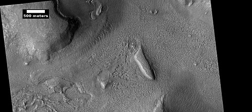 Layered features and brain terrain, as seen by HiRISE under HiWish program. The upper plains unit often changes into brain terrain.
 -
 Brain terrain being formed from a thicker layer, as seen by HiRISE under HiWish program. Arrows show the thicker unit breaking up into small cells.
 -
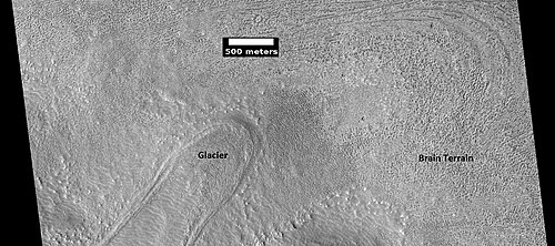 Possible glacier surrounded by brain terrain, as seen by HiRISE under HiWish program
 -
 Brain terrain is forming from the breakdown of upper plains unit, as seen by HiRISE under HiWish program. Arrow points to a place where fractures are forming that will turn into brain terrain.
 -
 Brain terrain is forming from the breakdown of upper plains unit, as seen by HiRISE under HiWish program. Arrow points to a place where fractures are forming that will turn into brain terrain.
 -
 Wide view of brain terrain being formed, as seen by HiRISE under HiWish program
 -
 Brain terrain being formed, as seen by HiRISE under HiWish program. Note: this is an enlargement of a previous image using HiView.
 -
 Brain terrain being formed, as seen by HiRISE under HiWish program. Note: this is an enlargement of a previous image using HiView. Arrows indicate spots where brain terrain is beginning to form.
 -
 Brain terrain being formed, as seen by HiRISE under HiWish program. Note: this is an enlargement of a previous image using HiView. Arrows indicate spots where brain terrain is beginning to form.
 -
 Brain terrain being formed, as seen by HiRISE under HiWish program. Note: this is an enlargement of a previous image using HiView.
 -
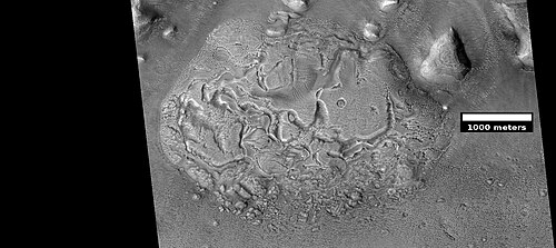 Wide view of brain terrain being formed, as seen by HiRISE under HiWish program
 -
 Brain terrain being formed, as seen by HiRISE under HiWish program. Note: this is an enlargement of the previous image using HiView.
 -
 Brain terrain being formed, as seen by HiRISE under HiWish program. Note: this is an enlargement of a previous image using HiView.
 -
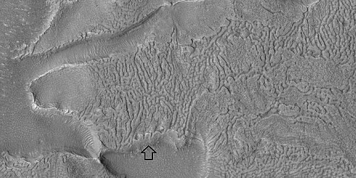 Brain terrain with a view from the side, as seen by HiRISE under HiWish program. Arrow shows where a side view of the brain terrain is visible.
 -
 Open and closed brain terrain, as seen by HiRISE under HiWish program
 -
 Open and closed brain terrain with labels, as seen by HiRISE under HiWish program
 -
 Open and closed brain terrain with labels, as seen by HiRISE under HiWish program
 -
 Brain terrain being formed, as seen by HiRISE under HiWish program
 -
 Brain terrain being formed, as seen by HiRISE under HiWish program. Arrows point to locations where the brain terrain is starting to form.
Some regions of the upper plains unit display large fractures and troughs with raised rims; such regions are called ribbed upper plains. Fractures are believed to have started with small cracks from stresses. Stress is suggested to initiate the fracture process since ribbed upper plains are common when debris aprons come together or near the edge of debris aprons—such sites would generate compressional stresses. Cracks exposed more surfaces, and consequently more ice in the material sublimates into the planet's thin atmosphere. Eventually, small cracks become large canyons or troughs.
-
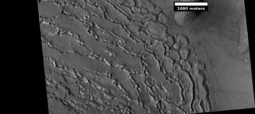 Well developed ribbed upper plains material. These start with small cracks that expand as ice sublimates from the surfaces of the crack. Picture was taken with HiRISE under HiWish program
 -
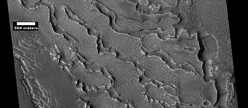 Small and large cracks, as seen by HiRISE under HiWish program The small cracks to the left will enlarge to become much larger dues to sublimation of ground ice. A crack exposes more surface area, hence greatly increases sublimation in the thin Martian air.
 -
 Close-up of canyons from previous image, as seen by HiRISE under HiWish program
 -
 View of stress cracks and larger cracks that have been enlarged by sublimation (ice changing directly into gas). This may be the start of ribbed terrain.
 -
 Evolution of ribbed terrain from stress cracks—cracks to the left eventually will enlarge and become ribbed terrain toward the right side of picture, as seen by HiRISE under HiWish program
 -
 Dipping layers, as seen by HiRISE under HiWish program. Also, Ribbed Upper plains material is visible in the upper right of the picture. It is forming from the upper plains unit, and in turn is being eroded into brain terrain.
 -
 Ribbed terrain being formed from upper plains unit, as seen by HiRISE under HiWish program. Formation begins with cracks that enhance sublimation. Box shows the size of football field.
 -
 Surface breaking down, as ice is removed, as seen by HiRISE under HiWish program. Box shows size of football field.
 -
 Wide view of terrain caused by ice leaving the ground, as seen by HiRISE under HiWish program
 -
 Close view of terrain caused by ice leaving the ground, as seen by HiRISE under HiWish program
 -
 Close view of terrain caused by ice leaving the ground, as seen by HiRISE under HiWish program
 -
 Close view of terrain caused by ice leaving the ground, as seen by HiRISE under HiWish program. Box shows size of football field.
 -
 Close view of upper plains unit showing hollows--where ice left the ground. Picture is about 1 Km across. This is part of an image named HiRISE picture of the day for October 21, 2024.
 -
 Close view of upper plains unit showing hollows--where ice left the ground. Picture is about 1 Km across. This is part of an image named HiRISE picture of the day for October 21, 2024.
 -
 Close view of upper plains unit showing hollows--where ice left the ground. Picture is about 1 Km across. This is part of an image named HiRISE picture of the day for October 21, 2024.
 -
 Hollows caused by ice leaving the ground
 -
 Hollows caused by ice leaving the ground Picture is about 1 km across.
 -
 Hollows caused by ice leaving the groundPicture is about 1 km across.
 -
 Hollows caused by ice leaving the groundPicture is about 1 km across.
Small cracks often contain small pits and chains of pits; these are thought to be from sublimation of ice in the ground.[42][43] Large areas of the Martian surface are loaded with ice that is protected by a meters thick layer of dust and other material. However, if cracks appear, a fresh surface will expose ice to the thin atmosphere.[44][45] In a short time, the ice will disappear into the cold, thin atmosphere in a process called sublimation. Dry ice behaves in a similar fashion on the Earth. On Mars sublimation has been observed when the Phoenix lander uncovered chunks of ice that disappeared in a few days.[46][47] In addition, HiRISE has seen fresh craters with ice at the bottom. After a time, HiRISE saw the ice deposit disappear.[48]
-
![Die-sized clumps of bright material in the enlarged "Dodo-Goldilocks" trench vanished over the course of four days, implying that they were composed of ice which sublimated following exposure.[47][49]](https://img-server.japedia.wiki/wikipedia/commons/thumb/1/1d/Ice_sublimating_in_the_Dodo-Goldilocks_trench.gif/500px-Ice_sublimating_in_the_Dodo-Goldilocks_trench.gif) Die-sized clumps of bright material in the enlarged "Dodo-Goldilocks" trench vanished over the course of four days, implying that they were composed of ice which sublimated following exposure.[47][49]
Die-sized clumps of bright material in the enlarged "Dodo-Goldilocks" trench vanished over the course of four days, implying that they were composed of ice which sublimated following exposure.[47][49] -
 Color versions of the photos showing ice sublimation, with the lower left corner of the trench enlarged in the insets in the upper right of the images
The upper plains unit is thought to have fallen from the sky. It drapes various surfaces, as if it fell evenly. As is the case for other mantle deposits, the upper plains unit has layers, is fine-grained, and is ice-rich. It is widespread; it does not seem to have a point source. The surface appearance of some regions of Mars is due to how this unit has degraded. It is a major cause of the surface appearance of lobate debris aprons.[43] The layering of the upper plains mantling unit and other mantling units are believed to be caused by major changes in the planet's climate. Models predict that the obliquity or tilt of the rotational axis has varied from its present 25 degrees to maybe over 80 degrees over geological time. Periods of high tilt will cause the ice in the polar caps to be redistributed and change the amount of dust in the atmosphere.[50][51][52]
Dipping layers
In many locations around Mars are features that have been called "dipping layers" These features are groups of layers in protected place like inside of craters or against slopes. Although they once covered a wide area, today they exist only in certain spots because erosion has removed most of the material. Several ideas have been advanced for how they were formed.[53] The material that formed them may have dropped from the sky as ice-rich dust.[54] [55] [56] Another idea for their origin was presented at 55th LPSC (2024) by an international team of researchers. They suggest that the layers are from past ice sheets.[57]
-
 Wide view of dipping layers, as seen by HiRISE under the HiWish program. The dark strip is where a computer problem is preventing the gathering of data.
 -
 Group of dipping layers. Each layer represents a change in the Martian climate.
 -
 Remaining parts of a group of dipping layers. Erosion has removed most of the material.
 -
 Close view of dipping layers that show the thin nature of the layers
 -
 Several sets of dipping layers
 -
 Close view of dipping layers Each layer was deposited when the climate changed. These layers only appear in protected areas.
Deltas
Researchers have found a number of examples of deltas that formed in Martian lakes. Deltas are major signs that Mars once had a lot of water because deltas usually require deep water over a long period of time to form. In addition, the water level needs to be stable to keep sediment from washing away. Deltas have been found over a wide geographical range. Below, is a pictures of a one in the Ismenius Lacus quadrangle.[58]
-
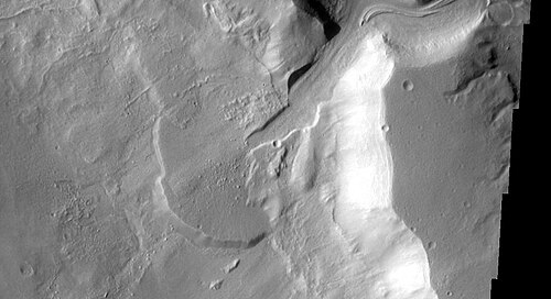 Delta in Ismenius Lacus quadrangle, as seen by THEMIS
Pits and cracks
Some places in the Ismenius Lacus quadrangle display large numbers of cracks and pits. It is widely believed that these are the result of ground ice sublimating (changing directly from a solid to a gas). After the ice leaves, the ground collapses in the shape of pits and cracks. The pits may come first. When enough pits form, they unite to form cracks.[59]
-
 CTX Image in Protonilus Mensae, showing location of next image
 -
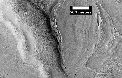 Pits in Protonilus Mensae, as seen by HiRISE, under the HiWish program.
 -
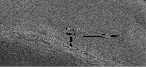 Close-up of pits, as seen by HiRISE under the HiWish program. Resolution is about 30 cm, so one could see a kitchen table if it were in the picture.
 -
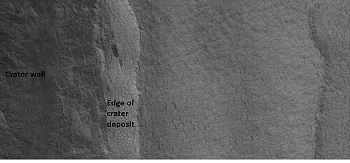 Close-up of patterned ground in a crater deposit, as seen by HiRISE under the HiWish program. Resolution is about 30 cm, so one could see a kitchen table if it were in the picture.
 -
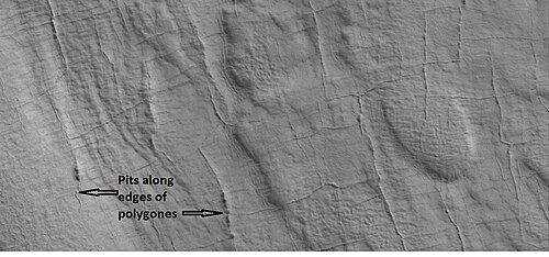 Close-up of pits forming along the edges of polygons in patterned ground, as seen by HiRISE under the HiWish program. Resolution is about 30 cm, so one could see a kitchen table if it were in the picture.
 -
 Wide view of lines of pits, as seen by HiRISE, under the HiWish program
 -
 Close view of lines of pits, as seen by HiRISE, under the HiWish program Box shows size of football field. Pits may be up to around 50 meters across.
 -
 Close view of lines of pits, as seen by HiRISE, under the HiWish program
 -
 Curved ridges as seen by HiRISE, under the HiWish program
 -
 Close view of pits and polygons, as seen by HiRISE, under the HiWish program. Pits seem to occur in low spots between polygons.
 -
 Wide view of mesas and pits, as seen by HiRISE, under the HiWish program
 -
 Close view of pits and brain terrain, as seen by HiRISE, under the HiWish program
 -
 Close view of pits, as seen by HiRISE, under the HiWish program
Mesas formed by ground collapse
-
 Group of mesas, as seen by HiRISE under HiWish program. Oval box contains mesas that may have moved apart.
 -
 Enlarged view of a group of mesas, as seen by HiRISE under HiWish program. One surface is forming square shapes.
 -
 Mesas breaking up forming straight edges, as seen by HiRISE under HiWish program
Volcanoes under ice
There is evidence that volcanoes sometimes erupt under ice, as they do on Earth at times. What seems to happen it that much ice melts, the water escapes, and then the surface cracks and collapses.[60] These exhibit concentric fractures and large pieces of ground that seemed to have been pulled apart. Sites like this may have recently had held liquid water, hence they may be fruitful places to search for evidence of life.[61][62]
-
![Large group of concentric cracks, as seen by HiRISE, under HiWish program Location is Ismenius Lacus quadrangle. Cracks were formed by a volcano under ice.[61]](https://img-server.japedia.wiki/wikipedia/commons/thumb/9/93/25755concentriccracks.jpg/500px-25755concentriccracks.jpg) Large group of concentric cracks, as seen by HiRISE, under HiWish program Location is Ismenius Lacus quadrangle. Cracks were formed by a volcano under ice.[61]
Large group of concentric cracks, as seen by HiRISE, under HiWish program Location is Ismenius Lacus quadrangle. Cracks were formed by a volcano under ice.[61] -
 Tilted layers formed when ground collapsed, as seen by HiRISE under HiWish program
 -
 Tilted layers formed from ground collapse, as seen by HiRISE under HiWish program
 -
 Mesas breaking up into blocks, as seen by HiRISE under HiWish program
 -
 Collapse features from volcano erupting under ice
 -
 Close view of collapse features from volcano erupting under ice
 -
 Close view of collapse features from volcano erupting under ice
 -
 Close view of collapse features from volcano erupting under ice
-
 Wide view of cracked surface and collapse depressions, as seen by HiRISE under HiWish program
 -
 Depression forming from a possible subsurface loss of material, as seen by HiRISE under HiWish program
Exhumed craters
Some features on Mars seem to be in the process of being uncovered. So, the thought is that they formed, were covered over, and now are being exhumed as material is being eroded. These features are quite noticeable with craters. When a crater forms, it will destroy what is under it and leave a rim and ejecta. In the example below, only part of the crater is visible. if the crater came after the layered feature, it would have removed part of the feature.
-
 Wide view of exhumed craters, as seen by HiRISE under HiWish program
 -
 Close view of exhumed crater, as seen by HiRISE under HiWish program. This crater is and was under a set of dipping layers.
Fractures forming blocks
In places large fractures break up surfaces. Sometimes straight edges are formed and large cubes are created by the fractures.
-
 Wide view of mesas that are forming fractures, as seen by HiRISE under HiWish program
 -
 Enlarged view of a part of previous image, as seen by HiRISE under HiWish program. The rectangle represents the size of a football field.
 -
 Close-up of blocks being formed, as seen by HiRISE under HiWish program
 -
 Close-up of blocks being formed, as seen by HiRISE under HiWish program. The rectangle represents the size of a football field, so blocks are the size of buildings.
 -
 Close-up of blocks being formed, as seen by HiRISE under HiWish program. Many long fractures are visible on the surface.
 -
 Surface breaking up, as seen by HiRISE under HiWish program. Near the top the surface is eroding into brain terrain.
 -
 Wide view showing light-toned feature that is breaking into blocks, as seen by HiRISE under HiWish program
 -
 Close view showing blocks being formed, as seen by HiRISE under HiWish program. Note: this is an enlargement of the previous image. Box represents the size of a football field.
 -
 Color view of rocks breaking apart, as seen by HiRISE under HiWish program
Polygonal patterned ground
Polygonal, patterned ground is quite common in some regions of Mars.[63][64][65][66][67][68][69] It is commonly believed to be caused by the sublimation of ice from the ground. Sublimation is the direct change of solid ice to a gas. This is similar to what happens to dry ice on the Earth. Places on Mars that display polygonal ground may indicate where future colonists can find water ice. Patterned ground forms in a mantle layer, called latitude dependent mantle, that fell from the sky when the climate was different.[29][30][70][71]
-
 High-center polygons, as seen by HiRISE under HiWish program. Image is of the top of a debris apron in Deuteronilus Mensae.
 -
 Close-up of field of high center polygons with scale, as seen by HiRISE under HiWish program. Note: the black box is the size of a football field.
 -
 Close-up of high center polygons seen by HiRISE under HiWish program. Note: the black box is the size of a football field.
 -
 High center polygons, as seen by HiRISE under HiWish program
 -
 Low center polygons, as seen by HiRISE under HiWish program
 -
 Close view of high center polygons, as seen by HiRISE under HiWish program. Centers of polygons are labeled.
 -
 Cracked surface and low center polygons, as seen by HiRISE under HiWish program
 -
 Large polygons, as seen by HiRISE under HiWish program
Dunes
Sand dunes have been found in many places on Mars. The presence of dunes shows that the planet has an atmosphere with wind, for dunes require wind to pile up the sand. Most dunes on Mars are black because of the weathering of the volcanic rock basalt.[72][73] Black sand can be found on Earth on Hawaii and on some tropical South Pacific islands.[74] Sand is common on Mars due to the old age of the surface that has allowed rocks to erode into sand. Dunes on Mars have been observed to move many meters.[75][76] Some dunes move along. In this process, sand moves up the windward side and then falls down the leeward side of the dune, thus caused the dune to go toward the leeward side (or slip face).[77] When images are enlarged, some dunes on Mars display ripples on their surfaces.[78] These are caused by sand grains rolling and bouncing up the windward surface of a dune. The bouncing grains tend to land on the windward side of each ripple. The grains do not bounce very high so it does not take much to stop them.
-
 Wide view of dunes in Moreux Crater, as seen by HiRISE under HiWish program
 -
 Close view of one large dune from the same location, as seen by HiRISE under HiWish program
 -
 Close view of white spot among the dark dunes showing ripples and streaks
-
 Wide view of a field of dunes, as seen by HiRISE under HiWish program
 -
 Close, color view of dunes, as seen by HiRISE under HiWish program
 -
 Close, color view of dunes, as seen by HiRISE under HiWish program
Ocean
Many researchers have suggested that Mars once had a great ocean in the north.[79][80][81][82][83][84][85] Much evidence for this ocean has been gathered over several decades. New evidence was published in May 2016. A large team of scientists described how some of the surface in Ismenius Lacus quadrangle was altered by two tsunamis. The tsunamis were caused by asteroids striking the ocean. Both were thought to have been strong enough to create 30 km diameter craters. The first tsunami picked up and carried boulders the size of cars or small houses. The backwash from the wave formed channels by rearranging the boulders. The second came in when the ocean was 300 m lower. The second carried a great deal of ice which was dropped in valleys. Calculations show that the average height of the waves would have been 50 m, but the heights would vary from 10 m to 120 m. Numerical simulations show that in this particular part of the ocean two impact craters of the size of 30 km in diameter would form every 30 million years. The implication here is that a great northern ocean may have existed for millions of years. One argument against an ocean has been the lack of shoreline features. These features may have been washed away by these tsunami events. The parts of Mars studied in this research are Chryse Planitia and northwestern Arabia Terra. These tsunamis affected some surfaces in the Ismenius Lacus quadrangle and in the Mare Acidalium quadrangle.[86][87][88][89]
-
 Channels made by the backwash from tsunamis, as seen by HiRISE. Tsunamis were probably caused by asteroids striking the ocean.
 -
 Channels that may have been made by the backwash of tsunamis in an ocean. Image is from HiRISE under the HiWish program.
 -
 Possible backwash channels that may have been created by a tsunami, as seen by HiRISE under HiWish program
 -
 Boulders that were picked up, carried, and dropped by tsunamis, as seen by HiRISE. Tsunamis were probably caused by asteroids striking ocean. Boulders are between the size of cars and houses.
 -
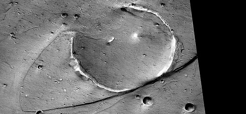 Streamlined promontory eroded by tsunami, as seen by HiRISE. Tsunamis were probably caused by asteroids striking ocean.
 -
 Concentric bands that may have been produced by the waves of a tsunami. Image is from HiRISE under the HiWish program.
Gullies
Gullies were thought for a time to have been caused by recent flows of liquid water. However, further study suggests they are formed today by chunks of dry ice moving down steep slopes.[90]
-
 Gullies in crater, as seen by HiRISE under HiWish program
 -
 Wide view of a gully on a steep slope, as seen by HiRISE under HiWish program
 -
 Closer view of previous image of a gully, as seen by HiRISE under HiWish program
 -
 Close view of channel in gully showing streamlined forms, as seen by HiRISE under HiWish program
 -
 Gullies, as seen by HiRISE under HiWish program
Layered features
Many places on Mars show rocks arranged in layers. Scientists are excited to find layers of rocks on Mars, as water is often involved in their formation, A detailed discussion of layering with many Martian examples can be found in Sedimentary Geology of Mars.[91] Rock can form layers in a variety of ways. Volcanoes, wind, or water can produce layers. Layers often are indication that the climate has changed.[92] Layers may be formed by groundwater rising up depositing minerals and cementing sediments. The hardened layers are consequently more protected from erosion. This process may occur instead of layers forming under lakes.
-
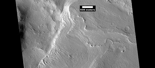 Layers, as seen by HiRISE under HiWish program
 -
 Layered mesas, as seen by HiRISE under HiWish program
 -
 Layers, as seen by HiRISE under HiWish program
 -
as seen by HiRISE under HiWish program">
 Close view of layers, >as seen by HiRISE under HiWish program
Ring mold craters
Ring Mold Craters are a kind of crater on the planet Mars, that look like the ring molds used in baking. They are believed to be caused by an impact into ice. The ice is covered by a layer of debris. They are found in parts of Mars that have buried ice. Laboratory experiments confirm that impacts into ice result in a "ring mold shape." They are also bigger than other craters in which an asteroid impacted solid rock. Impacts into ice warm the ice and cause it to flow into the ring mold shape.
However, another idea for their formation has emerged.[93] The other idea for their formation revolves around the impacting body going through layers of different densities. Later erosion could have helped shape them. It was thought that ring-mold craters could only exist in areas with large amounts of ground ice. However, with more extensive analysis of larger areas, it was found the ring mold craters are sometimes formed where there is not as much ice underground.[94] [95]
-
 Ring mold craters on floor of a crater, as seen by HiRISE under HiWish program
 -
 Ring mold craters of various sizes on floor of a crater, as seen by HiRISE under HiWish program
 -
 Ring-mold craters form when an impact goes through to an ice layer. The rebound forms the ring-mold shape, and then dust and debris settle on the top to insulate the ice.
-
 Wide view of ring-mold craters, as seen by HiRISE under HiWish program
 -
 Close view of ring-mold crater, as seen by HiRISE under HiWish program
 -
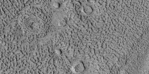 Group of ring-mold craters, as seen by HiRISE under HiWish program
-
 Ring-mold craters, as seen by HiRISE under HiWish program
 -
 Close view of ring-mold craters and brain terrain, as seen by HiRISE under HiWish program
-
 Close view of ring-mold craters and brain terrain, as seen by HiRISE under HiWish program. Rectangle shows size of football field for scale.
 -
 Ring mold crater, as seen by HiRISE under HiWish program
Mounds
-
 Wide view of field of mounds near pedestal crater, as seen by HiRISE under HiWish program
 -
 Close, color view of mounds, as seen by HiRISE under HiWish program
 -
 Row of mounds, as seen by HiRISE under HiWish program. Arrows point to some of the mounds.
 -
 Lines of mounds, as seen by HiRISE under HiWish program
Channels
-
 Channels, as seen by HiRISE, under the HiWish program
 -
 Channels, as seen by HiRISE under HiWish program
 -
 Channels that empty into a low area that could have been a lake, as seen by HiRISE under HiWish program
 -
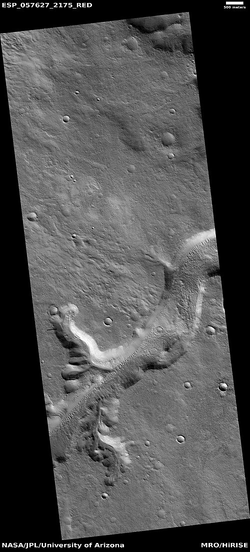 Channels, as seen by HiRISE under HiWish program. The ends of the channels have shapes that suggest they were formed by the process of sapping.
 -
 Channels, as seen by HiRISE under HiWish program. These channels are in the ejecta of a crater; hence, they may have formed from warm ejecta melting ground ice.
 -
 Channels, as seen by HiRISE under HiWish program. These channels are near the ejecta of a crater; hence, they may have formed from warm ejecta melting ground ice.
 -
 Channel near ejecta, as seen by HiRISE under HiWish program
 -
 Channels, as seen by HiRISE under HiWish program
 -
 Close view of channel, as seen by HiRISE under HiWish program
 -
 Channels, as seen by HiRISE under HiWish program
 -
 Dendritic channel system, as seen by HiRISE
 -
 Channels with one leading to a lake
 -
 Old stream bed attached to low area that was probably a lake

Landslide
-
 Landslide, as seen by HiRISE under HiWish program
 -
 Close view of landslide, as seen by HiRISE under HiWish program
 -
 Landslides, as seen by HiRISE under HiWish program
 -
 Type of landslide called a slump along crater wall, as seen by HiRISE under HiWish program Black strip is due to data not collected there.
Other images
-
 Wide view of terrain with hollows. The hollows were created when ice left the ground. The black strip is due to a malfunction.
 -
 Close view of hollows
 -
 Close view of hollows. Narrow ridges were made when hollows kept expanding.
 -
 Close, color view of hollows. The HiView program was used in the RGB color scheme.
 -
 Crater floor with pits, hollows, brain terrain, and ring mold craters. These are formed when ice leaves the ground.
 -
 Wide view of hollows that formed as ice left the ground
 -
 Close view of hollows formed when ice left the ground by sublimation
 -
 Close view of hollows formed when ice left the ground by sublimation. The ridges were formed when hollows that were next to each other grew in size.
 -
 Close view of hollows formed when ice left the ground
 -
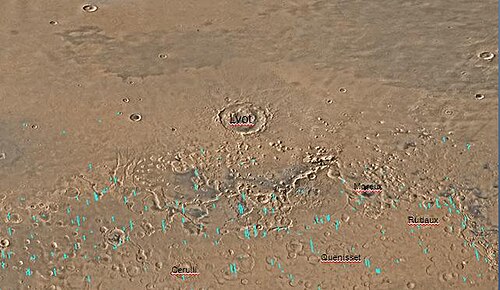 Map of Ismenius Lacus quadrangle which is located just north of Arabia, a large bright area of Mars. It contains large amounts of ice in glaciers that surround hills.
 -
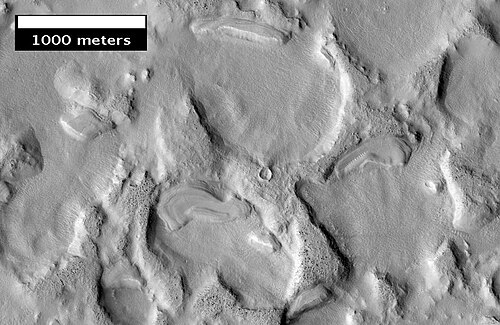 Another view of eroded terrain in Deuteronilus Mensae, as seen by HiRISE, under the HiWish program
 -
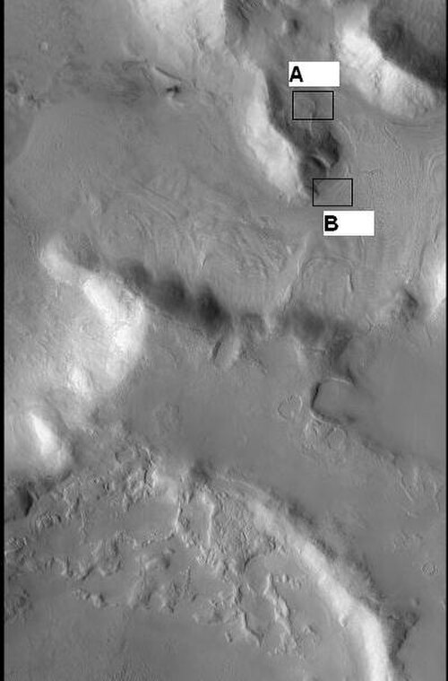 CTX context image showing location of next HiRISE image (letter B box)
 -
 Complex surface around mound in Deuteronilus Mensae, as seen by HiRISE, under the HiWish program. Location of this image is in the black box labeled B in the previous image.
 -
 End of a glacier, as seen by HiRISE under HiWish program. Surface to the right of the end moraine exhibits patterned ground which is common where ground water has frozen.
 -
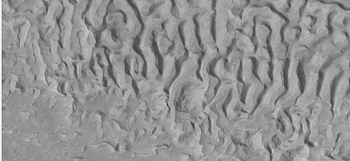 Surface forms in Ismenius Lacus, as seen by HiRISE under HiWish program
 -
 Hollows in surface, formed as ice is removed from ground, as seen by HiRISE under HiWish program
 -
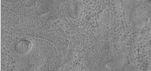 Field of pits, as seen by HiRISE under HiWish program
 -
 Possible dike, as seen by HiRISE under HiWish program
 -
 Pits and troughs, as seen by HiRISE under HiWish program. Pits may have formed from water/ice leaving the ground.
 -
 Boulders, as seen by HiRISE under HiWish program
 -
 Possible mud volcanoes, as seen by HiRISE under HiWish program
 -
 Close view of cones, as seen by HiRISE under HiWish program
 -
 Wide view of possible pingos, as seen by HiRISE under HiWish program. Pingos contain a core of pure ice; they would be useful for a source of water by future colonists.
 -
 Close view of possible pingos, as seen by HiRISE under HiWish program
 -
 Ridges, as seen by HiRISE under HiWish program
 -
 Ridges, as seen by HiRISE under HiWish program
 -
 Ridge, as seen by HiRISE under HiWish program. This ridge may be an esker.
 -
 Wide view of honeycomb shapes and possible dikes that make an "X" shape, as seen by HiRISE under HiWish program
 -
 Close view of honeycomb shapes and brain terrain, as seen by HiRISE under HiWish program
Other Mars quadrangles
Interactive Mars map
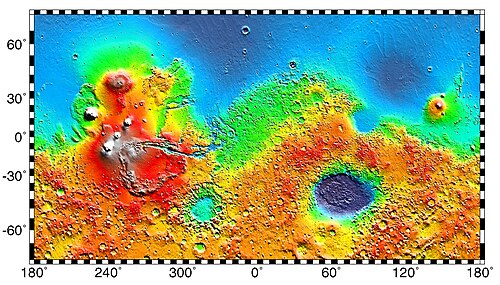
 Interactive image map of the global topography of Mars. Hover your mouse over the image to see the names of over 60 prominent geographic features, and click to link to them. Coloring of the base map indicates relative elevations, based on data from the Mars Orbiter Laser Altimeter on NASA's Mars Global Surveyor. Whites and browns indicate the highest elevations (+12 to +8 km); followed by pinks and reds (+8 to +3 km); yellow is 0 km; greens and blues are lower elevations (down to −8 km). Axes are latitude and longitude; Polar regions are noted.
 (See also: Mars Rovers map and Mars Memorial map) (view • discuss)
See also
References
- ^ Davies, M.E.; Batson, R.M.; Wu, S.S.C. "Geodesy and Cartography" in Kieffer, H.H.; Jakosky, B.M.; Snyder, C.W.; Matthews, M.S., Eds. Mars. University of Arizona Press: Tucson, 1992.
- ^ Distances calculated using NASA World Wind measuring tool. http://worldwind.arc.nasa.gov/ Archived 2018-01-06 at the Wayback Machine.
- ^ Approximated by integrating latitudinal strips with area of R^2 (L1-L2)(cos(A)dA) from 30° to 65° latitude; where R = 3889 km, A is latitude, and angles expressed in radians. See: https://stackoverflow.com/questions/1340223/calculating-area-enclosed-by-arbitrary-polygon-on-earths-surface.
- ^ "Planetary Names: Search Results".
- ^ a b Carter, J.; Poulet, F.; Bibring, J.-P.; Murchie, S. (2010). "Detection of Hydrated Silicates in Crustal Outcrops in the Northern Plains of Mars". Science. 328 (5986): 1682–1686. Bibcode:2010Sci...328.1682C. doi:10.1126/science.1189013. PMID 20576889. S2CID 7337256.
- ^ a b http://www.jpl.nasa.gov/news.cfm?release=2010-209[permanent dead link]
- ^ USGS Gazetteer of Planetary Nomenclature. Mars. http://planetarynames.wr.usgs.gov/.
- ^ Blunck, J. 1982. Mars and its Satellites. Exposition Press. Smithtown, N.Y.
- ^ "HiRISE | A Fresh, Shallow Valley in Northern Arabia Terra (ESP_039997_2170)".
- ^ U.S. department of the Interior U.S. Geological Survey, Topographic Map of the Eastern Region of Mars M 15M 0/270 2AT, 1991
- ^ "Mars: What We Know About the Red Planet". Space.com. October 2021.
- ^ Weiss, David K. (2017). "Extensive Amazonian-aged fluvial channels on Mars: Evaluating the role of Lyot crater in their formation". Geophysical Research Letters. 44 (11): 5336–5344. Bibcode:2017GeoRL..44.5336W. doi:10.1002/2017GL073821. S2CID 27711077.
- ^ Weiss, D.; et al. (2017). "Extensive Amazonian-aged fluvial channels on Mars: Evaluating the role of Lyot crater in their formation". Geophysical Research Letters. 44 (11): 5336–5344. Bibcode:2017GeoRL..44.5336W. doi:10.1002/2017GL073821. S2CID 27711077.
- ^ "Hot Rocks Led to Relatively Recent Water-Carved Valleys on Mars - SpaceRef". 14 June 2017.[permanent dead link]
- ^ "Stones, Wind, and Ice: A Guide to Martian Impact Craters".
- ^ a b Hugh H. Kieffer (1992). Mars. University of Arizona Press. ISBN 978-0-8165-1257-7. Retrieved 7 March 2011.
- ^ http://www.uahirise.org/epo/nuggets/expanded-secondary.pdf [bare URL PDF]
- ^ Viola, D., et al. 2014. "Expanded Craters in Arcadia Planitia: Evidence for >20 MYR Old Subsurface Ice". Eighth International Conference on Mars (2014). 1022pdf.
- ^ Sharp, R. 1973. "Mars Fretted and chaotic terrains". J. Geophys. Res.: 78. 4073–4083
- ^ http://www.lpi.usra.edu/meetings/lpsc2000/pdf/1053.pdf [bare URL PDF]
- ^ a b Plaut, J. et al. 2008. "Radar Evidence for Ice in Lobate Debris Aprons in the Mid-Northern Latitudes of Mars". Lunar and Planetary Science XXXIX. 2290.pdf
- ^ Plaut, J.; Safaeinili, A.; Holt, J.; Phillips, R.; Head, J.; Seu, R.; Putzig, N.; Frigeri, A. (2009). "Radar evidence for ice in lobate debris aprons in the midnorthern latitudes of Mars". Geophys. Res. Lett. 36 (2): n/a. Bibcode:2009GeoRL..36.2203P. doi:10.1029/2008GL036379. S2CID 17530607.
- ^ "European Space Agency". www.esa.int.
- ^ http://news.discovery.com/space/mars-ice-sheet-climate.html [dead link]
- ^ Madeleine, J. et al. 2007. "Exploring the northern mid-latitude glaciation with a general circulation model". In: Seventh International Conference on Mars. Abstract 3096.
- ^ "HiRISE | Glacier? (ESP_018857_2225)". www.uahirise.org.
- ^ "HiRISE | Fretted Terrain Valley Traverse (PSP_009719_2230)".
- ^ "HiRISE | Jumbled Flow Patterns (PSP_006278_2225)". hirise.lpl.arizona.edu.
- ^ a b Hecht, M (2002). "Metastability of water on Mars". Icarus. 156 (2): 373–386. Bibcode:2002Icar..156..373H. doi:10.1006/icar.2001.6794.
- ^ a b Mustard, J.; et al. (2001). "Evidence for recent climate change on Mars from the identification of youthful near-surface ground ice". Nature. 412 (6845): 411–414. Bibcode:2001Natur.412..411M. doi:10.1038/35086515. PMID 11473309. S2CID 4409161.
- ^ Pollack, J.; Colburn, D.; Flaser, F.; Kahn, R.; Carson, C.; Pidek, D. (1979). "Properties and effects of dust suspended in the martian atmosphere". J. Geophys. Res. 84: 2929–2945. Bibcode:1979JGR....84.2929P. doi:10.1029/jb084ib06p02929.
- ^ Touma, J.; Wisdom, J. (1993). "The Chaotic Obliquity of Mars". Science. 259 (5099): 1294–1297. Bibcode:1993Sci...259.1294T. doi:10.1126/science.259.5099.1294. PMID 17732249. S2CID 42933021.
- ^ a b Laskar, J.; Correia, A.; Gastineau, M.; Joutel, F.; Levrard, B.; Robutel, P. (2004). "Long term evolution and chaotic diffusion of the insolation quantities of Mars" (PDF). Icarus. 170 (2): 343–364. Bibcode:2004Icar..170..343L. doi:10.1016/j.icarus.2004.04.005. S2CID 33657806.
- ^ Levy, J.; Head, J.; Marchant, D.; Kowalewski, D. (2008). "Identification of sublimation-type thermal contraction crack polygons at the proposed NASA Phoenix landing site: Implications for substrate properties and climate-driven morphological evolution". Geophys. Res. Lett. 35 (4): L04202. Bibcode:2008GeoRL..35.4202L. doi:10.1029/2007GL032813.
- ^ Levy, J.; Head, J.; Marchant, D. (2009a). "Thermal contraction crack polygons on Mars: Classification, distribution, and climate implications from HiRISE observations". J. Geophys. Res. 114 (E1): E01007. Bibcode:2009JGRE..114.1007L. doi:10.1029/2008JE003273.
- ^ Hauber, E., D. Reiss, M. Ulrich, F. Preusker, F. Trauthan, M. Zanetti, H. Hiesinger, R. Jaumann, L. Johansson, A. Johnsson, S. Van Gaselt, M. Olvmo. 2011. Landscape evolution in Martian mid-latitude regions: insights from analogous periglacial landforms in Svalbard. In: Balme, M., A. Bargery, C. Gallagher, S. Guta (eds). Martian Geomorphology. Geological Society, London. Special Publications: 356. 111–131
- ^ Mellon, M.; Jakosky, B. (1995). "The distribution and behavior of Martian ground ice during past and present epochs". J. Geophys. Res. 100 (E6): 11781–11799. Bibcode:1995JGR...10011781M. doi:10.1029/95je01027. S2CID 129106439.
- ^ Schorghofer, N (2007). "Dynamics of ice ages on Mars". Nature. 449 (7159): 192–194. Bibcode:2007Natur.449..192S. doi:10.1038/nature06082. PMID 17851518. S2CID 4415456.
- ^ Madeleine, J., F. Forget, J. Head, B. Levrard, F. Montmessin. 2007. "Exploring the northern mid-latitude glaciation with a general circulation model". In: Seventh International Conference on Mars. Abstract 3096.
- ^ "HiRISE | Layered Mantling Deposits in the Northern Mid-Latitudes (ESP_048897_2125)". www.uahirise.org.
- ^ Carr, M (2001). "Mars Global Surveyor observations of martian fretted terrain". J. Geophys. Res. 106 (E10): 23571–23593. Bibcode:2001JGR...10623571C. doi:10.1029/2000je001316. S2CID 129715420.
- ^ Morgenstern, A., et al. 2007
- ^ a b Baker, D., J. Head. 2015. Extensive Middle Amazonian mantling of debris aprons and plains in Deuteronilus Mensae, Mars: Implication for the record of mid-latitude glaciation. Icarus: 260, 269–288.
- ^ Mangold, N (2003). "Geomorphic analysis of lobate debris aprons on Mars at Mars Orbiter Camera scale: Evidence for ice sublimation initiated by fractures". J. Geophys. Res. 108 (E4): 8021. Bibcode:2003JGRE..108.8021M. doi:10.1029/2002je001885.
- ^ Levy, J. et al. 2009. Concentric
- ^ "Bright Chunks at Phoenix Lander's Mars Site Must Have Been Ice" Archived 2016-03-04 at the Wayback Machine – Official NASA press release (19.06.2008)
- ^ a b "NASA - Bright Chunks at Phoenix Lander's Mars Site Must Have Been Ice". Archived from the original on 2016-03-04. Retrieved 2015-09-01.
- ^ Byrne, S.; et al. (2009). "Distribution of Mid-Latitude Ground Ice on Mars from New Impact Craters". Science. 325 (5948): 1674–1676. Bibcode:2009Sci...325.1674B. doi:10.1126/science.1175307. PMID 19779195. S2CID 10657508.
- ^ Smith, P.; et al. (2009). "H2O at the Phoenix Landing Site". Science. 325 (5936): 58–61. Bibcode:2009Sci...325...58S. doi:10.1126/science.1172339. PMID 19574383. S2CID 206519214.
- ^ Head, J. et al. 2003.
- ^ Madeleine, et al. 2014.
- ^ Schon; et al. (2009). "A recent ice age on Mars: Evidence for climate oscillations from regional layering in mid-latitude mantling deposits". Geophys. Res. Lett. 36 (15): L15202. Bibcode:2009GeoRL..3615202S. doi:10.1029/2009GL038554.
- ^ R.J. Soare et al. 2013. Sub-kilometre (intra-crater) mounds in Utopia Planitia, Mars: character, occurrence and possible formation hypotheses, Icarus, 225, 982–991.
- ^ Morgenstern, A,, et al. 2007. Deposition and degradation of a volatile-rich layer in Utopia Planitia and implications for climate history on Mars. Journal of Geophysical Research Planets. Volume 112. IssueE6
- ^ Carr, M. 2001. "Mars Global Surveyor observations of martian fretted terrain". J. Geophys. Res. 106, 23571-23593.
- ^ Baker, D., J. Head. 2015. "Extensive Middle Amazonian mantling of debris aprons and plains in Deuteronilus Mensae, Mars: Implication for the record of mid-latitude glaciation". Icarus: 260, 269-288
- ^ Blanc, E., et al. 2024. ORIGIN OF WIDESPREAD LAYERED DEPOSITS ASSOCIATED WITH MARTIAN DEBRIS COVERED GLACIERS. 55th LPSC (2024). 1466.pdf
- ^ Irwin III, R. et al. 2005. "An intense terminal epoch of widespread fluvial activity on early Mars: 2. Increased runoff and paleolake development." Journal of Geophysical Research: 10. E12S15
- ^ "HiRISE | Fretted Terrain Valley Traverse (PSP_009719_2230)". Hirise.lpl.arizona.edu. Retrieved December 19, 2010.
- ^ Smellie, J., B. Edwards. 2016. Glaciovolcanism on Earth and Mars. Cambridge University Press.
- ^ a b Levy, J.; et al. (2017). "Candidate volcanic and impact-induced ice depressions on Mars". Icarus. 285: 185–194. Bibcode:2017Icar..285..185L. doi:10.1016/j.icarus.2016.10.021.
- ^ University of Texas at Austin. "A funnel on Mars could be a place to look for life". ScienceDaily. 10 November 2016. .
- ^ "Refubium - Search" (PDF).
- ^ Kostama, V.-P.; Kreslavsky, Head (2006). "Recent high-latitude icy mantle in the northern plains of Mars: Characteristics and ages of emplacement". Geophys. Res. Lett. 33 (11): L11201. Bibcode:2006GeoRL..3311201K. CiteSeerX 10.1.1.553.1127. doi:10.1029/2006GL025946. S2CID 17229252.
- ^ Malin, M.; Edgett, K. (2001). "Mars Global Surveyor Mars Orbiter Camera: Interplanetary cruise through primary mission". J. Geophys. Res. 106 (E10): 23429–23540. Bibcode:2001JGR...10623429M. doi:10.1029/2000je001455. S2CID 129376333.
- ^ Milliken, R.; et al. (2003). "Viscous flow features on the surface of Mars: Observations from high-resolution Mars Orbiter Camera (MOC) images". J. Geophys. Res. 108 (E6): E6. Bibcode:2003JGRE..108.5057M. doi:10.1029/2002JE002005. S2CID 12628857.
- ^ Mangold, N (2005). "High latitude patterned grounds on Mars: Classification, distribution and climatic control". Icarus. 174 (2): 336–359. Bibcode:2005Icar..174..336M. doi:10.1016/j.icarus.2004.07.030.
- ^ Kreslavsky, M.; Head, J. (2000). "Kilometer-scale roughness on Mars: Results from MOLA data analysis". J. Geophys. Res. 105 (E11): 26695–26712. Bibcode:2000JGR...10526695K. doi:10.1029/2000je001259.
- ^ Seibert, N.; Kargel, J. (2001). "Small-scale martian polygonal terrain: Implications or liquid surface water". Geophys. Res. Lett. 28 (5): 899–902. Bibcode:2001GeoRL..28..899S. doi:10.1029/2000gl012093.
- ^ Kreslavsky, M.A., Head, J.W., 2002. "High-latitude Recent Surface Mantle on Mars: New Results from MOLA and MOC". European Geophysical Society XXVII, Nice.
- ^ Head, J.W.; Mustard, J.F.; Kreslavsky, M.A.; Milliken, R.E.; Marchant, D.R. (2003). "Recent ice ages on Mars". Nature. 426 (6968): 797–802. Bibcode:2003Natur.426..797H. doi:10.1038/nature02114. PMID 14685228. S2CID 2355534.
- ^ "HiRISE | Dunes and Inverted Craters in Arabia Terra (ESP_016459_1830)". hirise.lpl.arizona.edu.
- ^ Michael H. Carr (2006). The surface of Mars. Cambridge University Press. ISBN 978-0-521-87201-0. Retrieved 21 March 2011.
- ^ "Sand Dunes - Phenomena of the Wind - DesertUSA". www.desertusa.com.
- ^ Archived at Ghostarchive and the Wayback Machine: Curiosity Rover Report (Dec. 15, 2015): First Visit to Martian Dunes – via YouTube.
- ^ "The Flowing Sands of Mars". 9 May 2012.
- ^ Namowitz, S., Stone, D. 1975. Earth science the world we live in. American Book Company. New York.
- ^ "NASA Rover's Sand-Dune Studies Yield Surprise". Jet Propulsion Laboratory.
- ^ Parker, T. J.; Gorsline, D. S.; Saunders, R. S.; Pieri, D. C.; Schneeberger, D. M. (1993). "Coastal geomorphology of the Martian northern plains". J. Geophys. Res. 98 (E6): 11061–11078. Bibcode:1993JGR....9811061P. doi:10.1029/93je00618.
- ^ Fairén, A. G.; et al. (2003). "Episodic flood inundations of the northern plains of Mars" (PDF). Icarus. 165 (1): 53–67. Bibcode:2003Icar..165...53F. doi:10.1016/s0019-1035(03)00144-1. Archived from the original (PDF) on 2020-12-10. Retrieved 2018-11-04.
- ^ Head, J. W.; et al. (1999). "Possible ancient oceans on Mars: Evidence from Mars Orbiter Laser Altimeter data". Science. 286 (5447): 2134–2137. Bibcode:1999Sci...286.2134H. doi:10.1126/science.286.5447.2134. PMID 10591640.
- ^ Parker, T. J., Saunders, R. S. & Schneeberger, D. M. Transitional morphology in west Deuteronilus Mensae, Mars: Implications for modification of the lowland/upland boundary" Icarus 1989; 82, 111–145
- ^ Carr, M. H.; Head, J. W. (2003). "Oceans on Mars: An assessment of the observational evidence and possible fate". J. Geophys. Res. 108 (E5): 5042. Bibcode:2003JGRE..108.5042C. doi:10.1029/2002JE001963.
- ^ Kreslavsky, M. A.; Head, J. W. (2002). "Fate of outflow channel effluent in the northern lowlands of Mars: The Vastitas Borealis Formation as a sublimation residue from frozen ponded bodies of water". J. Geophys. Res. 107 (E12): 5121. Bibcode:2002JGRE..107.5121K. doi:10.1029/2001JE001831.
- ^ Clifford, S. M. & Parker, T. J. The evolution of the martian hydrosphere: Implications for the fate of a primordial ocean and the current state of the northern plains" Icarus 2001; 154, 40–79
- ^ "Ancient Tsunami Evidence on Mars Reveals Life Potential" (Press release). May 20, 2016.
- ^ Rodriguez, J.; et al. (2016). "Tsunami waves extensively resurfaced the shorelines of an early Martian ocean". Scientific Reports. 6: 25106. Bibcode:2016NatSR...625106R. doi:10.1038/srep25106. PMC 4872529. PMID 27196957.
- ^ Rodriguez, J. Alexis P.; Fairén, Alberto G.; Tanaka, Kenneth L.; Zarroca, Mario; Linares, Rogelio; Platz, Thomas; Komatsu, Goro; Miyamoto, Hideaki; Kargel, Jeffrey S.; Yan, Jianguo; Gulick, Virginia; Higuchi, Kana; Baker, Victor R.; Glines, Natalie (2016). "Tsunami waves extensively resurfaced the shorelines of an early Martian ocean". Scientific Reports. 6: 25106. Bibcode:2016NatSR...625106R. doi:10.1038/srep25106. PMC 4872529. PMID 27196957.
- ^ Cornell University. "Ancient tsunami evidence on Mars reveals life potential." ScienceDaily, 19 May 2016. https://www.sciencedaily.com/releases/2016/05/160519101756.htm.
- ^ Harrington, J.D.; Webster, Guy (July 10, 2014). "RELEASE 14-191 – NASA Spacecraft Observes Further Evidence of Dry Ice Gullies on Mars". NASA. Retrieved July 10, 2014.
- ^ Grotzinger, J. and R. Milliken (eds.). 2012. Sedimentary Geology of Mars. SEPM.
- ^ "HiRISE | High Resolution Imaging Science Experiment". Hirise.lpl.arizona.edu?psp_008437_1750. Retrieved 2012-08-04.
- ^ Baker, D., L. Carter. 2018. Formation of Impact Crater Landforms within Glacial Deposits on Mars. 49th Lunar and Planetary Science Conference 2018 (LPI Contrib. No. 2083). 1589.pdf
- ^ Baker, David M.H.; Carter, Lynn M. (2019). "Probing supraglacial debris on Mars 2: Crater morphology". Icarus. 319: 264–280. Bibcode:2019Icar..319..264B. doi:10.1016/j.icarus.2018.09.009. S2CID 126156734.
- ^ Baker, D. and L. Carter. 2019. Probing supraglacial debris on Mars 2: Crater morphology. Icarus. Volume 319. Pages 264-280
- ^ Morton, Oliver (2002). Mapping Mars: Science, Imagination, and the Birth of a World. New York: Picador USA. p. 98. ISBN 0-312-24551-3.
- ^ "Online Atlas of Mars". Ralphaeschliman.com. Retrieved December 16, 2012.
- ^ "PIA03467: The MGS MOC Wide Angle Map of Mars". Photojournal. NASA / Jet Propulsion Laboratory. February 16, 2002. Retrieved December 16, 2012.
External links

Wikimedia Commons has media related to Ismenius Lacus quadrangle.
- Martian Ice – Jim Secosky – 16th Annual International Mars Society Convention
- T. Gordon Wasilewski - Water on Mars - 20th Annual International Mars Society Convention Describes how to get water from ice in the ground
- Jeffrey Plaut - Subsurface Ice - 21st Annual International Mars Society Convention-2018