Loading article…
HiWishはNASAが作成したプログラムで、誰でも火星探査機HiRISEのカメラで写真を撮る場所を提案できる。[1] [2] [3] 2010年1月に開始された。プログラム開始から数か月で、3000人がHiRISEの利用を申し込んだ。[4] [5] 最初の画像は2010年4月に公開された。[6] 一般からの提案は12,000件を超え、火星の30の四角形のそれぞれにターゲットの提案が出された。公開された画像の中から選ばれたものは、第16回国際火星協会年次大会での3つの講演に使用された。以下は、2016年3月時点でHiWishプログラムから公開された4,224枚を超える画像の一部である。[7]
氷河の特徴
いくつかの地形は、地球上の山の谷から氷河が移動しているのとそっくりです。一部はくり抜かれたような外観で、ほとんどすべての氷が消えた後の氷河のように見えます。残っているのはモレーン、つまり氷河が運んだ土や瓦礫です。氷がほとんどなくなったため、中央がくり抜かれています。[8] これらのアルプスの氷河と思われるものは、氷河状形態 (GLF) または氷河状流 (GLF) と呼ばれています。[9] 氷河状形態は、構造が現在移動しているかどうかわからないため、後になってから付けられた用語であり、おそらくより正確な用語です。[10]

-
 谷を流れて平野に広がっている可能性のある氷河。四角形は次の画像で拡大される部分を示しています。
 -
 前の画像の長方形の領域を拡大したもの。この領域は、地球上の高山氷河ではモレーンと呼ばれるものです。
 -
 HiWish 計画の HiRISE で観測された、同心円状のクレーターを埋めるよく発達した空洞
 -
 HiWish プログラムの HiRISE が撮影した、クレーター底の氷河。氷河の割れ目はクレバスの可能性があります。クレーター壁には溝システムもあります。
 -
 HiWish プログラムの HiRISE が撮影した、谷から流れ出る氷河。場所はモルー火口の縁。場所はイスメニウス湖の四角形。
-
 HiWish プログラムの HiRISE で観測された舌状の流れの広域画像
 -
 HiWish プログラムの HiRISE で撮影された舌状の流れのクローズアップ画像
ピンゴの可能性
ここで見られる放射状および同心円状の亀裂は、ガラス窓から投げ込まれた岩石など、脆い層に力が浸透したときによく見られる。これらの特定の亀裂は、おそらく脆い火星の表面の下から何かが出現してできたものと思われる。氷がレンズ状に表面下に蓄積し、ひび割れた丘ができたのかもしれない。氷は岩石よりも密度が低いため、表面で押し上げられ、これらのクモの巣のようなパターンが生成された。同様のプロセスにより、地球の北極ツンドラでも同様のサイズの丘が形成される。このような地形は、イヌイット語で「ピンゴ」と呼ばれる。[11] ピンゴには純粋な水の氷が含まれているため、将来の火星の入植者にとって水源となる可能性がある。地球のピンゴに似た地形の多くは、ユートピア平原(北緯 35~50 度、東経 80~115 度)で発見されている。[12]
-
 HiWish プログラムで HiRISE が見た、スケールのあるピンゴの可能性
 -
 HiWish プログラムで HiRISE が撮影した、スケール付きのピンゴの可能性のある部分のクローズ アップ画像
古代の川と小川
火星の川の谷にはかつて水が流れていたという証拠が数多くあります。軌道から撮影された写真には、曲がりくねった谷、枝分かれした谷、さらには蛇行した谷と三日月形の湖が写っています。[13] 下の写真にもその一部が写っています。
-
 HiWish プログラムの HiRISE が撮影したニュートンクレーターの底の溝
 -
 HiWish プログラムで HiRISE が見た分岐チャネル
 -
 HiWish プログラムで HiRISE が見たチャンネル
 -
 HiWish プログラムで HiRISE が見た分岐チャネル
 -
 HiWish プログラムの HiRISE から見たオックスボウ湖
 -
 HiWish プログラムによる HiRISE から見た渓谷
 -
 HiWish プログラムで HiRISE が見たアラビアのチャンネル
 -
 HiWish プログラムの HiRISE が捉えた、クレーターの一部を移動するチャネル システム
 -
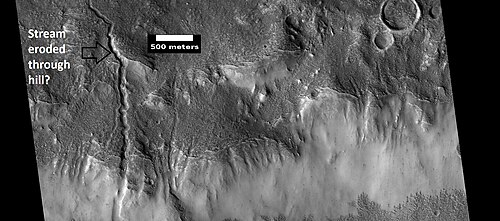 HiWish プログラムの HiRISE が撮影した水路。小川は丘陵地帯を侵食してできたようです。
 -
 HiWish プログラムの HiRISE が見た、古い三角堤とカットオフを示すチャネル。場所はMemnonia 四角形です。
 -
 HiWish プログラムの HiRISE が見た谷底の水路。場所はエリダニア四角形です。
 -
 HiWish プログラムの HiRISE が撮影した、イスメニウス湖四角形の水路のクローズ アップ画像
 -
 HiWish プログラムの HiRISE が撮影した、イスメニウス湖の四角形の谷間と水路
 -
 HiWish プログラムの HiRISE が撮影したアラム カオスの吊り谷
 -
 HiWish プログラムの HiRISE が撮影した、イスメニウス湖四角形のチャネルの広域画像
流線型の形状
流線型の形状は、火星に過去に水が流れていたことを示すさらなる証拠を表しています。水は地形を流線型に形作りました。
-
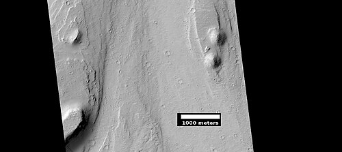 HiWish プログラムの HiRISE で見られるような合理化された機能。場所はMemnonia 四角形です。
 -
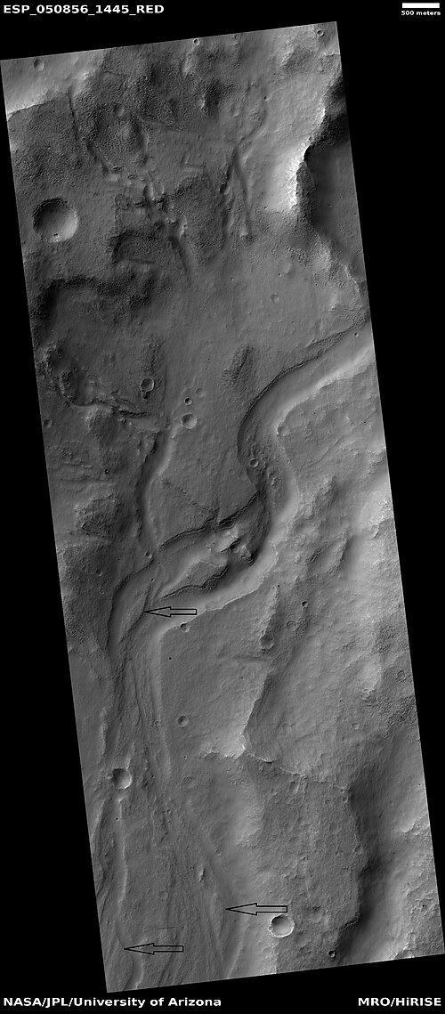 HiWish プログラムの HiRISE から見たチャネル。流線型の形状は矢印で示されています。場所はPhaethontis 四角形です。
-
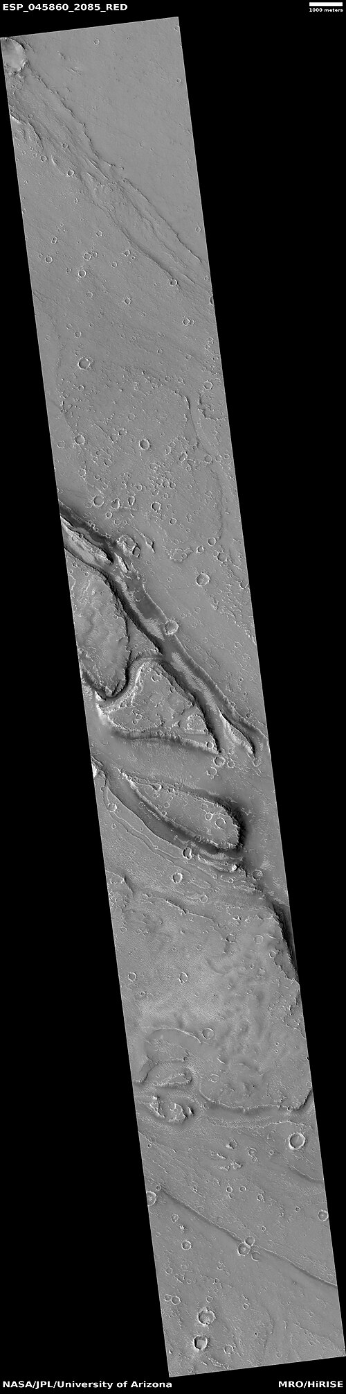 HiWish プログラムの HiRISE から見た、アメンテス四角形の流線型の広角ビュー
 -
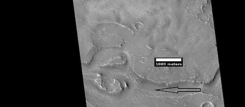 HiWish プログラムの HiRISE で見た流線型の形状のクローズアップ画像。矢印は過去の流水の方向を示しています。
 -
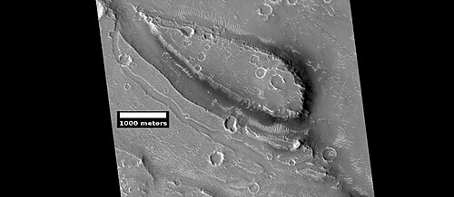 HiWish プログラムの HiRISE で見た流線型の形状のクローズアップ画像
 -
 HiWish プログラムの HiRISE で見た流線型の形状のクローズアップ画像
 -
 HiWish プログラムの HiRISE で見た流線型の形状のクローズアップ画像
 -
 HiWish プログラムの HiRISE で見た流線型の形状のクローズアップ画像
 -
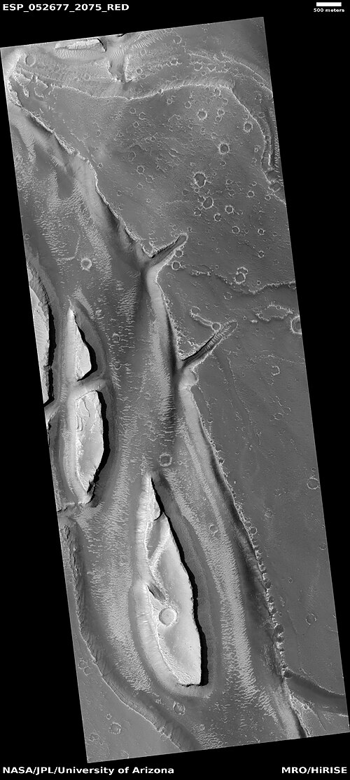 HiWish プログラムの HiRISE で見られる流線型の形状。場所はエリシウム四角形です。
新しいクレーター
-
 HiWish プログラムによる新しいクレーターの発見を示す HiRISE 画像
 -
 HiWish プログラムの HiRISE が捉えた新しいクレーター。白い矢印で示された新しいクレーターは直径約 10 ヤードで、おそらく大きなスイカほどの大きさの物体との衝突によって形成されたものと思われます。このクレーターは、同じ地域の以前の画像には写っていませんでした。
砂丘
火星には砂丘が数多くある。砂丘は秋の初めに形成され晩春まで残る季節的な二酸化炭素の霜で覆われている。火星の砂丘の多くは地球の砂丘とよく似ているが、火星探査機マーズ・リコネッサンス・オービターの高解像度画像科学実験で得られた画像では、北極地域の火星の砂丘は季節的な二酸化炭素の昇華によって引き起こされる粒子の流れによって変化していることが明らかになっている。 このプロセスは地球では見られない。多くの砂丘は黒っぽいが、これは暗い火山岩の玄武岩から生じているからである。火星で見られるような地球外の砂海は、ラテン語で波を意味する「ウンダイ」と呼ばれている。
-
 HiWish プログラムの HiRISE が撮影した 2 つのクレーターの砂丘
 -
 HiWish プログラムの HiRISE が撮影したクレーター間の砂丘。これらの一部はバルハンです。
 -
 HiWish プログラムの HiRISE が撮影したクレーター底の砂丘。そのほとんどはバルハンです。ボックスは次の画像の位置を示しています。位置はエリダニア四角形です。
 -
 HiWish プログラムの HiRISE が撮影したクレーター底の砂丘。そのほとんどはバルハンです。注: これは前の画像の中央を拡大したものです。
 -
 HiWish プログラムの HiRISE が撮影した砂丘。場所はエリダニア四角形です。
 -
 HiWish プログラムの HiRISE が捉えた、多角形の谷間の砂丘と氷の解凍
 -
 HiWish プログラムの HiRISE が捉えた、多角形の谷間の砂丘と氷の解凍のカラー画像
 -
 HiWish プログラムの HiRISE で見た、霜が解けつつある表面。砂丘から霜がところどころ消えつつあります。多角形の周りの谷の境界にはまだ霜が残っているため、白くなっています。注: 北側 (上部に近い側) は、太陽が反対側から来ているため、霜が解けていません。
 -
 HiWish プログラムの HiRISE が撮影した、モルークレーターの砂丘の広い眺め
 -
 HiWish プログラムで HiRISE が見た、マーレ ティレヌムの四角形の砂丘
 -
 HiWish プログラムの HiRISE が撮影した、ティレヌム海中公園の砂丘のクローズアップ画像
 -
 HiWish プログラムの HiRISE が撮影した、 Mare Tyrrhenum 四角形の砂丘のクローズアップ カラー画像。砂丘の表面に波紋が見られます。
 -
 HiWish プログラムの HiRISE が撮影した、ドーム型砂丘のクローズアップ カラー画像
着陸地点
提案されたターゲットのいくつかは、2020年のローバーミッションの候補地となった。ターゲットはファーソフ(クレーター)とホールデンクレーターだった。これらの場所は、生命の兆候を探し、後に地球に持ち帰るためのサンプルを収集するミッションの候補地として検討された26か所のうちの2か所として選ばれた。[14] [15] [16]
-
 HiWish プログラムの HiRISE が捉えた、ファーソフ クレーターの層。注: この画像フィールドは、CTX カメラ (火星探査機搭載) が捉えた、ファーソフ クレーターの層の以前の画像にあります。
 -
 HiRISE が捉えた、ファーソフ クレーターの層のクローズアップ。注: これはファーソフ クレーターの以前の画像の拡大です。
 -
 サッカー場の大きさを示すボックスが付いたフィルソフクレーターの層。HiWish プログラムのもと HiRISE が撮影した写真。
 -
 HiWish プログラムの HiRISE が撮影した、ファーソフ クレーターの地層と断層。矢印は 1 つの大きな断層を示していますが、画像には他にも小さな断層があります。
 -
![HiWish計画のHiRISEが撮影したホールデンクレーターのデルタの一部。ホールデンクレーターは2020年に予定されている火星探査車の着陸地点の候補地である。[17]](https://img-server.japedia.wiki/wikipedia/commons/thumb/e/e9/ESP_026126_1530delta.jpg/500px-ESP_026126_1530delta.jpg) HiWish計画のHiRISEが撮影したホールデンクレーターのデルタの一部。ホールデンクレーターは2020年に予定されている火星探査車の着陸地点の候補地である。[17]
HiWish計画のHiRISEが撮影したホールデンクレーターのデルタの一部。ホールデンクレーターは2020年に予定されている火星探査車の着陸地点の候補地である。[17] -
 HiWish プログラムで HiRISE によって表示され、HiView で拡大された、レイヤーを示す以前の画像のクローズ アップ ビュー
景観の特徴
-
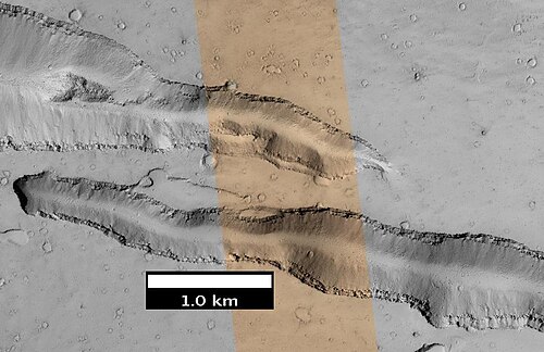 HiWish プログラムの HiRISE が捉えたアルボル トゥルスの東側の谷
 -
 HiWish プログラムの HiRISE が撮影した、エリシウム平原の谷 (フォッサ) の一部。青色は季節的な霜が発生する可能性があることを示しています。
 -
 HiWish プログラムの HiRISE が捉えたクレーター内の地滑り。画像はIapygia 四角形から。
 -
 HiWish プログラムの HiRISE から見たビュートとメサの広角ビュー。場所はエリジウム四角形です。
 -
 HiWish プログラムの HiRISE が撮影したビュートとメサ。注: これは前の画像の拡大です。
 -
 HiWish プログラムの HiRISE が撮影したメサ。注: これは前の画像の拡大です。
暗い斜面の縞
-
 HiWish プログラムの HiRISE で確認された層と暗い斜面の縞模様
 -
 HiWish プログラムの HiRISE で撮影された、メサの暗い斜面の縞。場所はアマゾニス四角形です。
 -
 HiWish プログラムの HiRISE が撮影した、台座クレーターのキャップ ロックの下のいくつかの層と暗い斜面の筋のクローズ アップ。
 -
 HiWish プログラムの HiRISE によって観測された、台座クレーター付近の暗い斜面の筋と層。矢印は、筋の小さな開始点を示しています。
 -

-
 HiWish プログラムの HiRISE で観測された谷間の層と暗い斜面の筋。場所はアマゾニス四角形です。
反復傾斜線
斜面線は、暖かい季節に伸びる斜面上の小さな黒い線です。これは液体の水の証拠である可能性があります。[18] [19] [20] しかし、水が必要かどうか、または大量の水が必要かどうかについては議論が続いています。[21] [22] [23] [24]
-
 HiWish プログラムの HiRISE で撮影された Valles Marineris の一部の広角画像。ボックスは、次の画像で拡大表示される繰り返し傾斜線の位置を示しています。
 -
![HiWishプログラムによるHiRISEで観測された、反復斜面線のクローズアップカラー画像。矢印はいくつかの反復斜面線を指しています[25]](https://img-server.japedia.wiki/wikipedia/commons/thumb/9/94/49955_1665rslcolorarrows.jpg/500px-49955_1665rslcolorarrows.jpg) HiWishプログラムによるHiRISEで観測された、反復斜面線のクローズアップカラー画像。矢印はいくつかの反復斜面線を指しています[25]
HiWishプログラムによるHiRISEで観測された、反復斜面線のクローズアップカラー画像。矢印はいくつかの反復斜面線を指しています[25]
レイヤー
火星の多くの場所では、岩石が層状に並んでいるのが見られます。岩石はさまざまな方法で層を形成します。火山、風、水などが層を形成します。[26] 層は地下水の作用によって硬化することがあります。
-
 HiWish プログラムの HiRISE によって撮影された、メムノニア四角形内のマンガラ ヴァレスにあるビュート群の基部で露出した地層。矢印は穴の中にある岩を指しています。穴は風、岩の熱によって地面の氷が溶けること、またはその他のプロセスによって形成された可能性があります。
 -
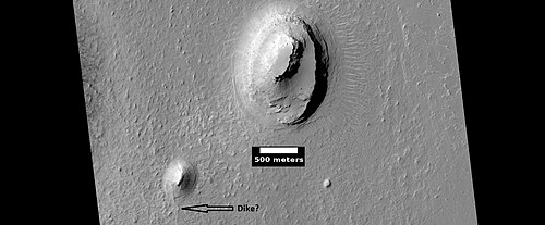 HiWish プログラムの HiRISE が撮影したビュート。ビュートには層状の岩があり、その上には硬くて耐久性のあるキャップ ロックがあり、その下にある岩を浸食から保護しています。
 -
 HiWish プログラムの HiRISE が撮影した、クロメリン クレーターのビュート。場所は、オキシア パルス四角形です。
 -
 HiWish プログラムの HiRISE が観測した Crommelin Crater の層。場所はOxia Palus 四角形です。
-
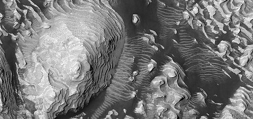 HiWish プログラムの HiRISE が撮影したダニエルソン クレーターの底にある層状の丘
 -
 HiWish プログラムの HiRISE が撮影したダニエルソンクレーターの底の層と黒い塵のクローズアップ カラー画像
 -
 HiWish プログラムの HiRISE が捉えた、ダニエルソン クレーターの底の層と黒い塵のクローズ アップ カラー画像。画像には岩が見えます。
 -
 HiWish プログラムの HiRISE が捉えたダニエルソン クレーターの底の層と黒い塵のクローズ アップ カラー画像。断層は矢印で示されています。
 -
 HiWish プログラムの HiRISE が撮影したダニエルソン クレーターの底の層のクローズ アップ画像。画像にはいくつかの断層が写っています。
-
 HiRISE の HiWish プログラムで撮影された、クレーターの底にある明るい色調のビュート。矢印は、明るい色調の物質の露頭を示しています。明るい色調の物質は、おそらく硫酸塩を多く含み、スピリット ローバーが調査した物質に似ており、かつては底全体を覆っていたと考えられます。以下の他の画像は、ビュートの拡大図です。場所は、マルガリティファー サイナス四角形です。
 -
 HiWish プログラムの HiRISE から見たホワイト ビュートの拡大図。ボックスはフットボール競技場の大きさを示しています。
 -
 HiWish プログラムの HiRISE が撮影した、ホワイト ビュートの頂上付近の眺め。四角はフットボール競技場の大きさを示しています。
 -
 HiWish プログラムの HiRISE から見た白い丘の頂上。ボックスはフットボール競技場の大きさを示しています。
-

-
 HiWish プログラムの HiRISE が捉えた、層状の地形の広域図。場所は、エオリス四角形のゲイルクレーターの北東です。
 -
 HiWish プログラムの HiRISE で撮影された、層のある丘のクローズアップ画像。注: これは前の画像の拡大です。
 -
 HiWish プログラムの HiRISE で撮影された、層のある丘のクローズアップ画像。注: これは前の画像の拡大です。
 -
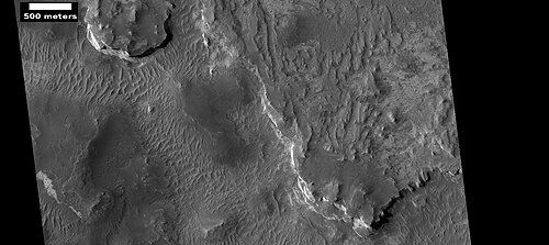 HiWish プログラムの HiRISE が見たアラビアの地層。
 -
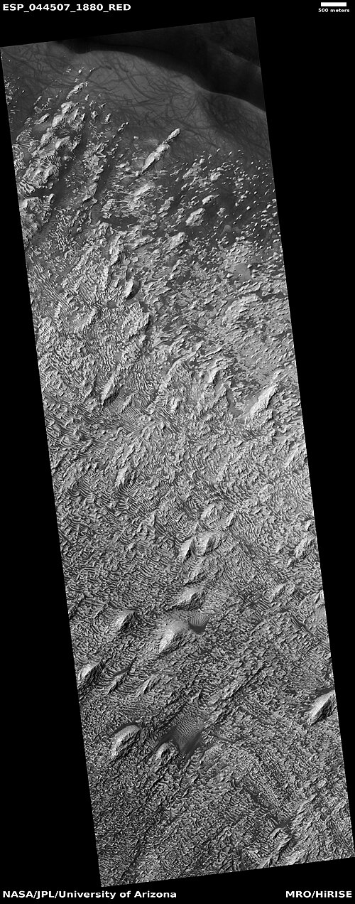 HiWish プログラムの HiRISE が撮影したダニエルソン クレーターの一部の広角画像
 -
 HiWish プログラムの HiRISE が観測したダニエルソン クレーターの以前の画像の拡大。ボックスはフットボール競技場の大きさを表します。
 -
 HiWishプログラムによるHiRISEで撮影されたダニエルソンクレーターの地層のクローズアップ。岩や暗い砂が見える。
 -
 HiWish プログラムの HiRISE が捉えた、イウス峡谷南側の谷底の層のクローズアップ
 -
 HiWish プログラムの HiRISE が撮影したロットクレーターの地層のクローズアップ
 -
 HiWish プログラムの HiRISE が見たレイヤー。場所はTempe Terraです。
 -
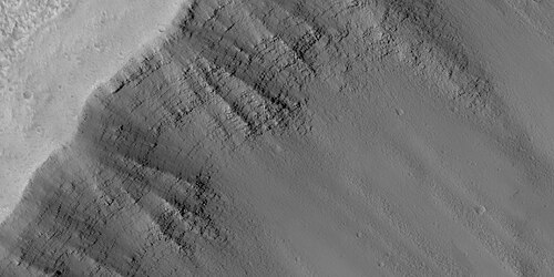 HiWish プログラムの HiRISE で見た層。場所はTempe Terraです。注: これは前の画像の拡大です。
-
 HiWish プログラムの HiRISE で見た層のクローズアップ画像。少なくとも 1 つの層は明るい色調で、水和鉱物を示している可能性があります。
 -
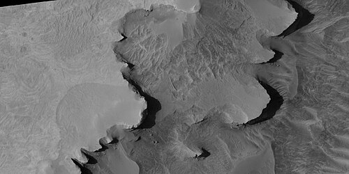 HiWish プログラムの HiRISE で見た層のクローズアップ画像
クレーター内で発見されたこの地層群はすべてアラビア四角形から来ています。
-
 HiWish プログラムの HiRISE が捉えたクレーターの層の広域画像。この画像の一部は、後続の画像で拡大されています。
 -
 HiWish プログラムの HiRISE で見たレイヤーのクローズアップ図。ボックスはフットボール競技場のサイズを示しています。
 -
 HiWish プログラムの HiRISE で見たレイヤーのクローズアップ図。ボックスはフットボール競技場のサイズを示しています。
 -
 HiWish プログラムの HiRISE で見たレイヤーのクローズアップ図。ボックスはフットボール競技場のサイズを示しています。
 -
 HiWish プログラムの HiRISE で見た層のクローズアップ画像
 -
 HiWish プログラムの HiRISE で見た層のクローズアップ画像
 -
 HiWish プログラムの HiRISE で見た層のクローズアップ画像
 -
 HiWish プログラムの HiRISE で見た層のクローズアップ画像
 -
 HiWish プログラムの HiRISE で見た層のクローズアップ画像
この次の層状地形群は、コプラテス四角形のロウロス渓谷から来ています。
-
 HiWish プログラムの HiRISE が捉えたロウロス ヴァレスの地層の広域図
 -
 HiWish プログラムの HiRISE で見たロウロス渓谷の地層のクローズアップ画像。これは前の画像の拡大画像であることに注意してください。
 -
 HiWish プログラムの HiRISE で見たロウロス渓谷の地層のクローズアップ画像。これは前の画像の拡大画像であることに注意してください。
 -
 HiWish プログラムの HiRISE で見たロウロス渓谷の地層のクローズアップ画像。これは前の画像の拡大画像であることに注意してください。
 -
 HiWish プログラムの HiRISE で見たロウロス渓谷の地層のクローズアップ画像。これは前の画像の拡大画像であることに注意してください。
氷冠の層
-
 HiWish プログラムの HiRISE で観測された、角度不整合のある北極氷床の層
 -
 HiWish プログラムの HiRISE が捉えた北極氷床の層のクローズアップ画像。矢印は角度の不整合を示しています。
 -
 HiWish プログラムの HiRISE が撮影した北極の氷冠の層のクローズアップ カラー画像
 -
 HiWish プログラムのHiRISEで撮影された北極の氷床の露出層
 -
 Close view of layers exposed in northern ice cap, as seen by HiRISE under HiWish program
Gullies
Martian gullies are small, incised networks of narrow channels and their associated downslope sediment deposits, found on the planet of Mars. They are named for their resemblance to terrestrial gullies. First discovered on images from Mars Global Surveyor, they occur on steep slopes, especially on the walls of craters. Usually, each gully has a dendritic alcove at its head, a fan-shaped apron at its base, and a single thread of incised channel linking the two, giving the whole gully an hourglass shape.[27] They are believed to be relatively young because they have few, if any craters. On the basis of their form, aspects, positions, and location amongst and apparent interaction with features thought to be rich in water ice, many researchers believed that the processes carving the gullies involve liquid water. However, this remains a topic of active research.

-
 Close-up of gully aprons showing they are free of craters; hence very young. Location is Phaethontis quadrangle. Picture was taken by HiRISE under HiWish program.
 -
 Gullies on wall of crater, as seen by HiRISE under HiWish program. Location is the Mare Acidalium quadrangle.
 -
 Close-up of gully channels, as seen by HiRISE under HiWish program. This image shows many streamlined forms and some benches along a channel. These features suggest formation by running water. Benches are usually formed when the water level goes down a bit and stays at that level for a time. Picture was taken with HiRISE under HiWish program. Location is the Mare Acidalium quadrangle. Note this is an enlargement of a previous image.
 -
 Gullies in crater in Phaethontis quadrangle, as seen by HiRISE under HiWish program
 -
 Gullies along mesa wall in North Tempe Terra, as seen by HiRISE under HiWish program
 -
 Close view of gully apron, as seen by HiRISE under HiWish program. Note this is an enlargement of the previous image.
 -
 Close view of gully alcove, as seen by HiRISE under HiWish program. Note this is an enlargement of a previous image.
-
 Gullies in crater, as seen by HiRISE under HiWish program
 -
 Close view of gullies from previous image The channels are quite curved. Because channels of gullies often form curves, it was thought that they were made by flowing water. Today, it is thought that they could be produced with chunks of dry ice. The image is from HiRISE under HiWish program.
 -
 Gullies, as seen by HiRISE. The gullies range from very samll to large, as such they may represent different stages in the formation of gullies. The colored strip is about 1 km wide.
 -
 Small gully This gully may be in its initial state of formation.
 -
 Gully, as seen by HiRISE
 -
 Wide view of gullies
 -
 Close view of gully alcoves Picture is about 1 km across.
 -
 Close view of gully alcoves Picture is about 1 km across.
 -
 Close view of gully channels Picture is about 1 km across.
Latitude dependent mantle
Much of the Martian surface is covered with a thick ice-rich, mantle layer that has fallen from the sky a number of times in the past.[28][29][30] In some places a number of layers are visible in the mantle.[31]
-
 Surface showing appearance with and without mantle covering, as seen by HiRISE, under the HiWish program. Location is Terra Sirenum in Phaethontis quadrangle.
 -
 Mantle layers, as seen by HiRISE under HiWish program. Location is Eridania quadrangle
 -
 Close up view of mantle, as seen by HiRISE under the HiWish program. Mantle may be composed of ice and dust that fell from the sky during past climatic conditions. Location is Cebrenia quadrangle.
 -
 Close view of mantle, as seen by HiRISE under HiWish program. Arrows show craters along edge which highlight the thickness of mantle. Location is Ismenius Lacus quadrangle.
 -
 Close view that displays the thickness of the mantle, as seen by HiRISE under HiWish program. Location is Ismenius Lacus quadrangle.
-
 Wide view of surface with spots displaying mantle, as seen by HiRISE under HiWish program. Location is the Arcadia quadrangle.
 -
 Close view of mantle, as seen by HiRISE under HiWish program
 -
 Close view of mantle, as seen by HiRISE under HiWish program
It fell as snow and ice-coated dust. There is good evidence that this mantle is ice-rich. The shapes of the polygons common on many surfaces suggest ice-rich soil. High levels of hydrogen (probably from water) have been found with Mars Odyssey.[32][33][34][35][36] Thermal measurements from orbit suggest ice.[37][38] The Phoenix (spacecraft) discovered water ice with made direct observations since it landed in a field of polygons.[39][40] In fact, its landing rockets exposed pure ice. Theory had predicted that ice would be found under a few cm of soil. This mantle layer is called "latitude dependent mantle" because its occurrence is related to the latitude. It is this mantle that cracks and then forms polygonal ground. This cracking of ice-rich ground is predicted based on physical processes.[41][42][43][44][45][46][47]
Polygonal patterned ground
Polygonal, patterned ground is quite common in some regions of Mars.[48][49][50][51][46][52][53] It is commonly believed to be caused by the sublimation of ice from the ground. Sublimation is the direct change of solid ice to a gas. This is similar to what happens to dry ice on the Earth. Places on Mars that display polygonal ground may indicate where future colonists can find water ice. Patterned ground forms in a mantle layer, called latitude dependent mantle, that fell from the sky when the climate was different.[28][29][54][55]
-
 Wide view of crater containing polygons with frost in the low parts, as seen by HiRISE under the HiWish program
 -
 Closer view of polygons with frost in the low parts, as seen by HiRISE under the HiWish program
 -
 Still closer view of polygons, as seen by HiRISE under the HiWish program
 -
 Close view of polygons with frost in the low parts, as seen by HiRISE under the HiWish program. Circular shapes are also visible.
-
 High center polygons, shown with arrows, as seen by HiRISE under HiWish program. Location is Casius quadrangle. Image enlarged with HiView.
 -
 Scalloped terrain labeled with both low center polygons and high center polygons, as seen by HiRISE under HiWish program. Location is Casius quadrangle. Image enlarged with HiView.
 -
 High and low center polygons, as seen by HiRISE under HiWish program. Location is Casius quadrangle. Image enlarged with HiView.
 -
 Close-up of high center polygons seen by HiRISE under HiWish program. Troughs between polygons are easily visible in this view. Location is Ismenius Lacus quadrangle.
 -
 Low center polygons, as seen by HiRISE under HiWish program. Location is Casius quadrangle. Image enlarged with HiView. Location is Casius quadrangle.
 -
 Close view of snout of glacier, as seen by HiRISE under the HiWish program. High center polygons are visible. Box shows size of football field.
 -
 Close view of high center polygons near glacier, as seen by HiRISE under the HiWish program. Box shows size of football field.
 -
 Close view of high center polygons near glacier, as seen by HiRISE under the HiWish program
-
 Wide view of a group of channels, as seen by HiRISE under HiWish project Some parts of the surface show patterned ground when enlarged.
 -
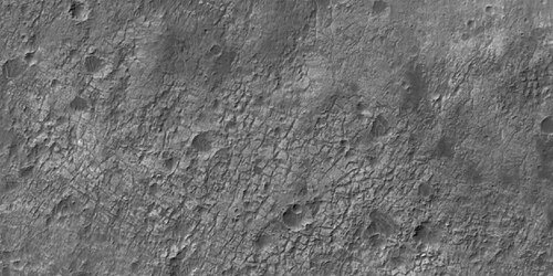 Patterned ground, as seen by HiRISE under HiWish program. This is a close up from previous image.
 -
 Ridges, as seen by HiRISE under HiWish program. This is a close up from a previous image.
 -
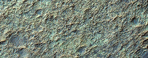 Color view of surface in a previous image, as seen by HiRISE under HiWish program
 -
 Color image of patterned ground, enlarged from a previous image, as seen by HiRISE under HiWish program
Complex polygonal patterned ground
-
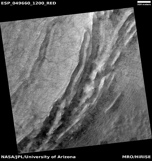 Wide view of polygons, as seen by HiRISE under HiWish program. Parts of this image are enlarged in following images. The location is the Noachis quadrangle.
 -
 Polygons, as seen by HiRISE under HiWish program
 -
 Close view of polygons, as seen by HiRISE under HiWish program. Arrow point to boulders that sit inside of small craters.
 -
 Close view of polygons, as seen by HiRISE under HiWish program
 -
 Close view of polygons, as seen by HiRISE under HiWish program
Exposed ice sheets
HiRISE images taken under the HiWish program found triangular shaped depressions in Milankovic Crater that researchers found contain vast amounts of ice that are found under only 1–2 meters of soil. These depressions contain water ice in the straight wall that faces the pole, according to the study published in the journal Science. Eight sites were found with Milankovic Crater being the only one in the northern hemisphere. Research was conducted with instruments on board the Mars Reconnaissance Orbiter (MRO).[56][57][58][59][60]
The following images are ones referred to in this study of subsurface ice sheets.[61]
-
 Wide view of part of Milankovic Crater, as seen by HiRISE under HiWish program. Many depressions here contain ice in their walls.
 -
 Close view from a previous image, as seen by HiRISE under HiWish program. The triangular shape of some depressions are noted. The area in the box is enlarged in following images.
 -
 Close view of depression, as seen by HiRISE under HiWish program. Arrows indicate where there is a very thin, 1–2 meter covering on what is believed to be ice.
These triangular depressions are similar to those in scalloped terrain. However scalloped terrain, displays a gentle equator-facing slope and is rounded. Scarps discussed here have a steep pole-facing side and have been found between 55 and 59 degrees north and south latitude[61] Scalloped topography is common in the mid-latitudes of Mars, between 45° and 60° north and south.
Scalloped topography
Scalloped topography is common in the mid-latitudes of Mars, between 45° and 60° north and south. It is particularly prominent in the region of Utopia Planitia[62][63] in the northern hemisphere and in the region of Peneus and Amphitrites Patera[64][65] in the southern hemisphere. Such topography consists of shallow, rimless depressions with scalloped edges, commonly referred to as "scalloped depressions" or simply "scallops". Scalloped depressions can be isolated or clustered and sometimes seem to coalesce. A typical scalloped depression displays a gentle equator-facing slope and a steeper pole-facing scarp. This topographic asymmetry is probably due to differences in insolation. Scalloped depressions are believed to form from the removal of subsurface material, possibly interstitial ice, by sublimation. This process may still be happening at present.[66]
On November 22, 2016, NASA reported finding a large amount of underground ice in the Utopia Planitia region of Mars.[67] The volume of water detected has been estimated to be equivalent to the volume of water in Lake Superior.[68][69] The volume of water ice in the region were based on measurements from the ground-penetrating radar instrument on Mars Reconnaissance Orbiter, called SHARAD. From the data obtained from SHARAD, "dielectric permittivity", or the dielectric constant was determined. The dielectric constant value was consistent with a large concentration of water ice.[70][71][72]
-
 Scalloped ground, as seen by HiRISE under HiWish program
 -
 Close-up of scalloped ground, as seen by HiRISE under HiWish program. Surface is divided into polygons; these forms are common where ground freezes and thaws. Note: this is an enlargement of a previous image.
 -
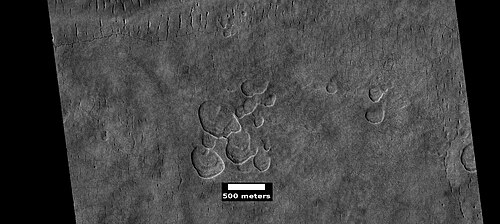 Scalloped ground, as seen by HiRISE under HiWish program
 -
 Close-up of scalloped ground, as seen by HiRISE under HiWish program. Surface is divided into polygons; these forms are common where ground freezes and thaws. Note: this is an enlargement of a previous image.
 -
 Low center polygons, shown with arrows, as seen by HiRISE under HiWish program. Image was enlarged with HiView.
 -
 Scalloped terrain, as seen by HiRISE under HiWish program. The location is the Casius quadrangle.
 -
 Scalloped terrain, as seen by HiRISE under HiWish program. The location is the Casius quadrangle.
Images of variety of craters
-
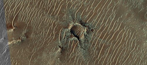 Crater with colorful ejecta, as seen by HiRISE under the HiWish program The ejecta represents samples of material from underground. Craters allow us to study underlying material.
 -
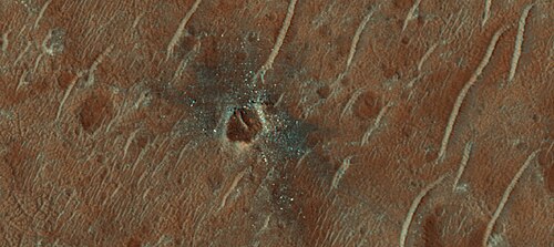 Crater with colorful ejecta, as seen by HiRISE The ejecta represents samples of material from underground. Craters allow us to study underlying material.
Pedestal craters
A pedestal crater is a crater with its ejecta sitting above the surrounding terrain and thereby forming a raised platform (like a pedestal). They form when an impact crater ejects material which forms an erosion-resistant layer, thus causing the immediate area to erode more slowly than the rest of the region. Some pedestals have been accurately measured to be hundreds of meters above the surrounding area. This means that hundreds of meters of material were eroded away. The result is that both the crater and its ejecta blanket stand above the surroundings. Pedestal craters were first observed during the Mariner missions.[73][74][75][76]
-
 Pedestal crater, as seen by HiRISE under HiWish program. Top layer has protected the lower material from being eroded. The location is Casius quadrangle.
 -
 Pedestal crater, as seen by HiRISE under HiWish program. Location is Hellas quadrangle.
 -
 Pedestal crater, as seen by HiRISE under HiWish program. Location is Casius quadrangle.
 -
 Pedestal crater, as seen by HiRISE under HiWish program. Location is Cebrenia quadrangle.
Ring mold craters
Ring mold craters are believed to be formed from asteroid impacts into ground that has an underlying layer of ice. The impact produces an rebound of the ice layer to form a "ring-mold" shape.
Another, later idea, for their formation suggests that the impacting body goes through layers of different densities. Later, erosion could have helped shape them. It was thought that ring-mold craters could only exist in areas with large amounts of ground ice. However, with more extensive analysis of larger areas, it was found the ring mold craters are sometimes formed where there is not as much ice underground.[77] [78]
-
 Ring mold craters of various sizes on floor of a crater, as seen by HiRISE under HiWish program. Location is Ismenius Lacus quadrangle.
 -
 Wide view of a field of ring mold craters, as seen by HiRISE under HiWish program
 -
 Close view of ring mold crater, as seen by HiRISE under HiWish program. Note: this is an enlargement of the previous image of a field of ring mold craters.
-
 Wide view of ring-mold craters on floor of larger crater, as seen by HiRISE under HiWish program
 -
 Ring-mold craters, as seen by HiRISE under HiWish program
 -
 Close view of ring-mold craters and brain terrain, as seen by HiRISE under HiWish program
Halo craters
-
![Pedestal crater with boulders along rim. Such craters are called "halo craters".[79] Picture taken with HiRISE under HiWish program.](https://img-server.japedia.wiki/wikipedia/commons/thumb/7/78/ESP_044939_2390pedestalhalocrater.jpg/500px-ESP_044939_2390pedestalhalocrater.jpg) Pedestal crater with boulders along rim. Such craters are called "halo craters".[79] Picture taken with HiRISE under HiWish program.
Pedestal crater with boulders along rim. Such craters are called "halo craters".[79] Picture taken with HiRISE under HiWish program. -
 Close view of boulders on lower left of crater rim Box is the size of a football field, so boulders are roughly the size of cars or small houses. Picture taken with HiRISE under HiWish program.
 -
 Close view of boulders along crater rim Boulders are roughly the size of cars or small houses. Picture taken with HiRISE under HiWish program.
Boulders
-
 Boulders, as seen by HiRISE under HiWish program. Location is Ismenius Lacus quadrangle.
 -
 Boulder and boulder tracks, as seen by HiRISE under HiWish program. The arrow shows a boulder that has made a track in the sand as it rolled down dune. Location is Mare Boreum quadrangle.
 -
 Boulders and tracks, as seen by HiRISE under HiWish program. The arrows show a boulders that have produced a track by rolling down dune. Location is Mare Boreum quadrangle.
 -
 Boulders and their tracks from rolling down a slope, as seen by HiRISE under HiWish program. Arrows show two boulders at the end of their tracks. Location is Arabia quadrangle.
Dust devil tracks
Dust devil tracks can be very pretty. They are caused by giant dust devils removing bright colored dust from the Martian surface; thereby exposing a dark layer. Dust devils on Mars have been photographed both from the ground and high overhead from orbit. They have even blown dust off the solar panels of two Rovers on Mars, thereby greatly extending their useful lifetime.[80] The pattern of the tracks has been shown to change every few months.[81] A study that combined data from the High Resolution Stereo Camera (HRSC) and the Mars Orbiter Camera (MOC) found that some large dust devils on Mars have a diameter of 700 metres (2,300 ft) and last at least 26 minutes.[82]
-
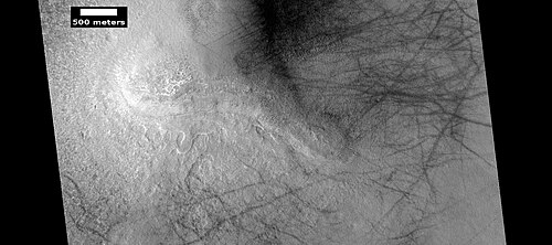 Dust devil tracks, as seen by HiRISE under HiWish program
 -
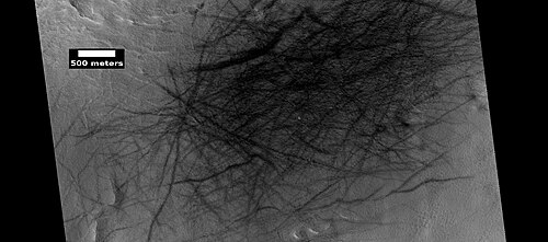 Dust devil tracks, as seen by HiRISE under HiWish program
 -
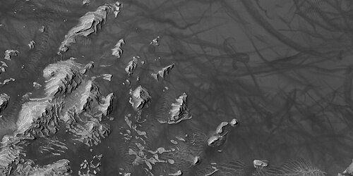 Layers in Danielson Crater with dust devil tracks at the top of the picture, as seen by HiRISE under HiWish program. Location is Oxia Palus quadrangle.
 -
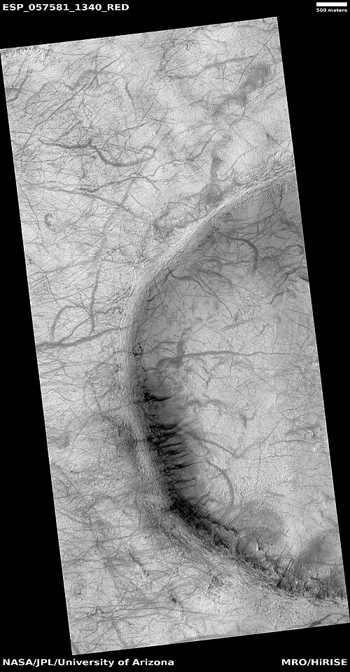 Wide view of dust devil tracks, as seen by HiRISE under HiWish program. Location is the Phaethontis quadrangle.
Yardangs
Yardangs are common in some regions on Mars, especially in what is called the "Medusae Fossae Formation". This formation is found in the Amazonis quadrangle and near the equator.[83] They are formed by the action of wind on sand sized particles; hence they often point in the direction that the winds were blowing when they were formed.[84] Because they exhibit very few impact craters they are believed to be relatively young.[85]
-
 Yardangs, as seen by HiRISE under HiWish program. Location is near Gordii Dorsum in the Amazonis quadrangle. These yardangs are in the upper member of the Medusae Fossae Formation.
 -
 Yardangs, as seen by HiRISE under HiWish program. Location is near Gordii Dorsum in the Amazonis quadrangle. Note: this is an enlargement of previous image.
 -
 Yardangs, as seen by HiRISE under HiWish program. Location is near Gordii Dorsum in the Amazonis quadrangle. Note: this is an enlargement of previous image.
-
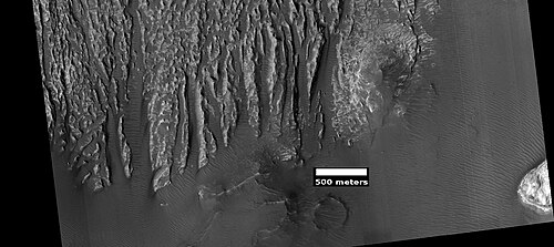 Yardangs formed in light-toned material and surrounded by dark, volcanic basalt sand, as seen by HiRISE under HiWish program. Loacation is Margaritifer Sinus quadrangle.
 -
 Close-up image of yardangs, as seen by HiRISE under HiWish program. Arrows point to transverse aeolian ridges (TARs), a type of dune. Note this is an enlargement of the previous image from HiRISE.
Plumes and spiders
At certain times in the Martian, dark eruptions of gas and dust occur. Wind often blows the material into a fan or a tail-like shape. During the winter, much frost accumulates. It freezes out directly onto the surface of the permanent polar cap, which is made of water ice covered with layers of dust and sand. The deposit begins as a layer of dusty CO2 frost. Over the winter, it recrystallizes and becomes denser. The dust and sand particles caught in the frost slowly sink. By the time temperatures rise in the spring, the frost layer has become a slab of semi-transparent ice about 3 feet thick, lying on a substrate of dark sand and dust. This dark material absorbs light and causes the ice to sublimate (turn directly into a gas). Eventually much gas accumulates and becomes pressurized. When it finds a weak spot, the gas escapes and blows out the dust. Speeds can reach 100 miles per hour.[86] Calculations show that the plumes are 20–80 meters high.[87][88] Dark channels can sometimes be seen; they are called "spiders".[89][90][91] The surface appears covered with dark spots when this process is occurring.[86][92]
Many ideas have been advanced to explain these features.[93][94][95][96][97][98] [99] These features can be seen in some of the pictures below.
-
 Wide view of plumes, as seen by HiRISE under HiWish program. Many of the plumes show spiders when enlarged.
 -
 Plumes, as seen by HiRISE under HiWish program. Arrow shows a double plume. This may have been because of shifting winds.
 -
 Long plume, as seen by HiRISE under HiWish program
 -
 Spiders, as seen by HiRISE under HiWish program
 -
 Plumes and spiders, as seen by HiRISE under HiWish program
 -
 Plumes and spiders, as seen by HiRISE under HiWish program
 -
 Plumes and spiders, as seen by HiRISE under HiWish program
 -
 Wide view of plumes and spiders, as seen by HiRISE under HiWish program
 -
 Plumes and spiders, as seen by HiRISE under HiWish program
Upper plains unit
Remnants of a 50–100 meter thick mantling, called the upper plains unit, has been discovered in the mid-latitudes of Mars. First investigated in the Deuteronilus Mensae (Ismenius Lacus quadrangle) region, but it occurs in other places as well. The remnants consist of sets of dipping layers in craters and along mesas.[100] Sets of dipping layers may be of various sizes and shapes—some look like Aztec pyramids from Central America. Dipping layers are common in some regions of Mars. They may be the remains of mantle layers. Another idea for their origin was presented at 55th LPSC (2024) by an international team of researchers. They suggest that the layers are from past ice sheets.[101]
-
 Layered structure in crater that is probably what is left of a layered unit that once covered a much larger area. Material for this unit fell from the sky as ice-coated dust. The picture was taken by HiRISE, under the HiWish program. Picture is from Hellas quadrangle.
-
 Tilted layers, as seen by HiRISE under HiWish program. Location is Hellas quadrangle.
 -
 Tilted layers, as seen by HiRISE under HiWish program. Location is Hellas quadrangle.
 -
 Tilted layers, as seen by HiRISE under HiWish program. Location is Hellas quadrangle.
-
 Dipping layers, as seen by HiRISE under HiWish program
 -
 Layered features in crater, as seen by HiRISE under HiWish program
 -
 Layered structures, as seen by HiRISE under HiWish program
 -
 Close view of dipping layers along a mesa wall, as seen by HiRISE under HiWish program. Location is Ismenius Lacus quadrangle.
 -
 Close view of dipping layers in Ismenius Lacus quadrangle, as seen by HiRISE under HiWish program
 -
 Wide view of dipping layers in Ismenius Lacus quadrangle, as seen by HiRISE under HiWish program. Gullies are also visible at the bottom of the image.
This unit also degrades into brain terrain. Brain terrain is a region of maze-like ridges 3–5 meters high. Some ridges may consist of an ice core, so they may be sources of water for future colonists.
-
 Brain terrain, as seen by HiRISE under HiWish program. Location is Ismenius Lacus quadrangle.
 -
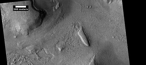 Layered features and brain terrain, as seen by HiRISE under HiWish program. The upper plains unit often changes into brain terrain.
 -
 Brain terrain is forming from the breakdown of upper plains unit, as seen by HiRISE under HiWish program. Arrow points to a place where fractures are forming that will turn into brain terrain.
 -
 Brain terrain is forming from the breakdown of upper plains unit, as seen by HiRISE under HiWish program. Arrow points to a place where fractures are forming that will turn into brain terrain.
-
 Wide view of brain terrain being formed, as seen by HiRISE under HiWish program
 -
 Brain terrain being formed, as seen by HiRISE under HiWish program. Note: this is an enlargement of the previous image using HiView. Arrows indicate spots where brain terrain is beginning to form.
 -
 Brain terrain being formed, as seen by HiRISE under HiWish program. Note: this is an enlargement of a previous image using HiView. Arrows indicate spots where brain terrain is beginning to form.
 -
 Brain terrain being formed, as seen by HiRISE under HiWish program. Note: this is an enlargement of a previous image using HiView.
 -
 Brain terrain being formed, as seen by HiRISE under HiWish program. Note: this is an enlargement of a previous image using HiView.
 -
 Open and closed brain terrain with labels, as seen by HiRISE under HiWish program. Location is Ismenius Lacus quadrangle.
 -
 Brain terrain being formed, as seen by HiRISE under HiWish program. Location is Ismenius Lacus quadrangle.
-
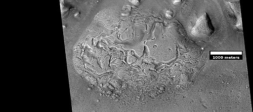 Wide view of brain terrain being formed, as seen by HiRISE under HiWish program
 -
 Brain terrain being formed, as seen by HiRISE under HiWish program. Note: this is an enlargement of the previous image using HiView.
 -
 Brain terrain being formed, as seen by HiRISE under HiWish program. Note: this is an enlargement of a previous image using HiView.
Some regions of the upper plains unit display large fractures and troughs with raised rims; such regions are called ribbed upper plains. Fractures are believed to have started with small cracks from stresses. Stress is suggested to initiate the fracture process since ribbed upper plains are common when debris aprons come together or near the edge of debris aprons—such sites would generate compressional stresses. Cracks exposed more surfaces, and consequently more ice in the material sublimates into the planet's thin atmosphere. Eventually, small cracks become large canyons or troughs.
-
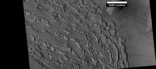 Well developed ribbed upper plains material. These start with small cracks that expand as ice sublimates from the surfaces of the crack. Picture was taken with HiRISE under HiWish program.
 -
 Dipping layers, as seen by HiRISE under HiWish program. Also, Ribbed Upper plains material is visible in the upper right of the picture. It is forming from the upper plains unit, and in turn is being eroded into brain terrain.
-
 Wide view showing ribbed terrain and brain terrain, as seen by HiRISE under HiWish program
 -
 Ribbed terrain being formed from upper plains unit, as seen by HiRISE under HiWish program. Formation begins with cracks that enhance sublimation. Box shows the size of football field.
 -
 Wide view of upper plains with many hollows
 -
 Close view of upper plains unit showing hollows--where ice left the ground. Picture is about 1 Km across. This is part of an image named HiRISE picture of the day for October 21, 2024.
 -
 Close view of upper plains unit showing hollows--where ice left the ground. Picture is about 1 Km across. This is part of an image named HiRISE picture of the day for October 21, 2024.
 -
 Close view of upper plains unit showing hollows--where ice left the ground. Picture is about 1 Km across. This is part of an image named HiRISE picture of the day for October 21, 2024.
Small cracks often contain small pits and chains of pits; these are thought to be from sublimation of ice in the ground.[102][103] Large areas of the Martian surface are loaded with ice that is protected by a meters thick layer of dust and other material. However, if cracks appear, a fresh surface will expose ice to the thin atmosphere.[104][105] In a short time, the ice will disappear into the cold, thin atmosphere in a process called sublimation. Dry ice behaves in a similar fashion on the Earth. On Mars sublimation has been observed when the Phoenix lander uncovered chunks of ice that disappeared in a few days.[39][106] In addition, HiRISE has seen fresh craters with ice at the bottom. After a time, HiRISE saw the ice deposit disappear.[107]
The upper plains unit is thought to have fallen from the sky. It drapes various surfaces, as if it fell evenly. As is the case for other mantle deposits, the upper plains unit has layers, is fine-grained, and is ice-rich. It is widespread; it does not seem to have a point source. The surface appearance of some regions of Mars is due to how this unit has degraded. It is a major cause of the surface appearance of lobate debris aprons.[103] The layering of the upper plains mantling unit and other mantling units are believed to be caused by major changes in the planet's climate. Models predict that the obliquity or tilt of the rotational axis has varied from its present 25 degrees to maybe over 80 degrees over geological time. Periods of high tilt will cause the ice in the polar caps to be redistributed and change the amount of dust in the atmosphere.[108][109][110]
Linear ridge networks
Linear ridge networks are found in various places on Mars in and around craters.[111] Ridges often appear as mostly straight segments that intersect in a lattice-like manner. They are hundreds of meters long, tens of meters high, and several meters wide. It is thought that impacts created fractures in the surface, these fractures later acted as channels for fluids. Fluids cemented the structures. With the passage of time, surrounding material was eroded away, thereby leaving hard ridges behind. Since the ridges occur in locations with clay, these formations could serve as a marker for clay which requires water for its formation. Water here could have supported life.[112][113][114]
-
 Network of ridges, as seen by HiRISE under HiWish program. Ridges may be formed in various ways.
 -
 Color, close-up of ridges seen in previous image, as seen by HiRISE under HiWish program
 -
 Close-up and color image of linear ridge network, as seen by HiRISE under HiWish program
 -
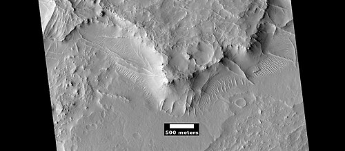 More linear ridge networks from same location as previous image, as seen by HiRISE under HiWish program
 -
 Linear ridge networks, as seen by HiRISE under HiWish program. Location is Amazonis quadrangle.
 -
 Linear ridge network, as seen by HiRISE under HiWish program. Location is Mare Tyrrhenum quadrangle.
 -
 Linear ridge network, as seen by HiRISE under HiWish program. Location is Casius quadrangle.
 -
 Wide view of ridge network, as seen by HiRISE under HiWish program. Location is Arcadia quadrangle.
 -
 Close view of ridge networks, as seen by HiRISE under HiWish program. Arrow points to small, straight ridge. Location is Arcadia quadrangle.
-
 Wide view of network of ridges, as seen by HiRISE under HiWish program. Portions of this image are enlarged in following images.
 -
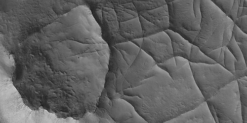 Close view of network of ridges, as seen by HiRISE under HiWish program. This is an enlargement of a previous image.
 -
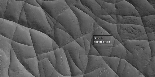 Close view of network of ridges, as seen by HiRISE under HiWish program. This is an enlargement of a previous image. Box shows the size of a football field.
 -
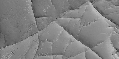 Close view of network of ridges, as seen by HiRISE under HiWish program. This is an enlargement of a previous image.
 -
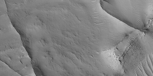 Close view of ridges, as seen by HiRISE under HiWish program. This is an enlargement of a previous image. A small mesa in the image displays layers.
 -
 Close, color view of network of ridges, as seen by HiRISE under HiWish program. This is an enlargement of a previous image.
-
 Wide view of large ridge network, as seen by HiRISE under HiWish program
 -
 Close view of ridge network, as seen by HiRISE under HiWish program. Box shows size of football field.
 -
 Close, color view of ridges, as seen by HiRISE under HiWish program
Fractured ground
Some places on Mars break up with large fractures that created a terrain with mesas and valleys. Some of these can be quite pretty.
-
 Wide view of fractured ground, as seen by HiRISE under HiWish program
 -
 Close view of fractured ground, as seen by HiRISE under HiWish program
 -
 Close view of fractured ground, as seen by HiRISE under HiWish program. Box shows size of football field. The boulders are the size of houses.
 -
 Close, color view of fractured ground, as seen by HiRISE under HiWish program
Mesas
-
 Mesa, as seen by HiRISE under HiWish program. This may make for a good race around a mesa someday in the far future.
-
 Mesa with layers, as seen by HiRISE under HiWish program. Location is Mare Acidalium quadrangle.
 -
 Close view of layers in mesa, as seen by HiRISE under HiWish program
-
 Wide view of layered buttes and small mesas, as seen by HiRISE under HiWish program. Some dark slope streaks are visible. Location is Aeolis quadrangle. Parts of this image are enlarged in next three pictures.
 -
 Layered mesa and mounds with dark slope streaks, as seen by HiRISE under HiWish program
 -
 Close view of layered small mesa with dark slope streak, as seen by HiRISE under HiWish program. Box shows the size of a football field.
 -
 Very close view of individual blocks breaking off layer in a butte, as seen by HiRISE under HiWish program. Blocks have angular shapes. Box shows size of football field.
 -
 Layered mesa, as seen by HiRISE under HiWish program
 -
 Layered mesa, as seen by HiRISE under HiWish program Box is the size of a football field.
Mesas formed by ground collapse
-
 Group of mesas, as seen by HiRISE under HiWish program. Oval box contains mesas that may have moved apart.
 -
 Enlarged view of a group of mesas, as seen by HiRISE under HiWish program. One surface is forming square shapes.
 -
 Mesas breaking up forming straight edges, as seen by HiRISE under HiWish program
Volcanoes under ice
There is evidence that volcanoes sometimes erupt under ice, as they do on Earth at times. What seems to happen it that much ice melts, the water escapes, and then the surface cracks and collapses. These exhibit concentric fractures and large pieces of ground that seemed to have been pulled apart.[115] Sites like this may have recently had held liquid water, hence they may be fruitful places to search for evidence of life.[116][117]
-
![Large group of concentric cracks, as seen by HiRISE, under HiWish program. Location is Ismenius Lacus quadrangle. Cracks were formed by a volcano under ice.[116]](https://img-server.japedia.wiki/wikipedia/commons/thumb/9/93/25755concentriccracks.jpg/500px-25755concentriccracks.jpg) Large group of concentric cracks, as seen by HiRISE, under HiWish program. Location is Ismenius Lacus quadrangle. Cracks were formed by a volcano under ice.[116]
Large group of concentric cracks, as seen by HiRISE, under HiWish program. Location is Ismenius Lacus quadrangle. Cracks were formed by a volcano under ice.[116] -
 Tilted layers formed when ground collapsed, as seen by HiRISE, under HiWish program
 -
 Tilted layers formed from ground collapse, as seen by HiRISE, under HiWish program
 -
 Mesas breaking up into blocks, as seen by HiRISE, under HiWish program
Fractures forming blocks
In places large fractures break up surfaces. Sometimes straight edges are formed and large cubes are created by the fractures.
-
 Wide view of mesas that are forming fractures, as seen by HiRISE under HiWish program
 -
 Enlarged view of a part of previous image, as seen by HiRISE under HiWish program. The rectangle represents the size of a football field.
 -
 Close-up of blocks being formed, as seen by HiRISE under HiWish program
 -
 Close-up of blocks being formed, as seen by HiRISE under HiWish program. The rectangle represents the size of a football field, so blocks are the size of buildings.
 -
 Close-up of blocks being formed, as seen by HiRISE under HiWish program. Many long fractures are visible on the surface.
 -
 Surface breaking up, as seen by HiRISE under HiWish program. Near the top the surface is eroding into brain terrain.
 -
 Wide view showing light-toned feature that is breaking into blocks, as seen by HiRISE under HiWish program
 -
 Close view showing blocks being formed, as seen by HiRISE under HiWish program. Note: this is an enlargement of the previous image. Box represents size of football field.
Lava flows
-
 Lava flow in Tharsis quadrangle, as seen by HiRISE under HiWish program
 -
 Close-up of lava flow with labels, as seen by HiRISE under HiWish program. Note: this is an enlargement of the previous image of lava flows.
 -
 Lava flows with older and younger flows labeled, as seen by HiRISE under HiWish program
 -
 Edge of lava flow, as seen by HiRISE under HiWish program. Location is Solis Planum in Phoenicis Lacus quadrangle.
 -
 Wide view of streamlined shape and rafts of lava, as seen by HiRISE under HiWish program
 -
 Close view of lava rafts from previous image, as seen by HiRISE under HiWish program
Rootless cones
So-called "rootless cones" are caused by explosions of lava with ground ice under the flow.[118][119] The ice melts and turns into a vapor that expands in an explosion that produces a cone or ring. Featureslike these are found in Iceland, when lavas cover water-saturated substrates.[120][118][121]
-
 Wide view of field of rootless cones, as seen by HiRISE under HiWish program. Location is Elysium quadrangle.
 -
 Close view of rootless cones with tails that suggest lava was moving toward the Southwest over ice-rich ground, as seen by HiRISE under HiWish program
 -
 Close view of cones with the size of a football field shown, as seen by HiRISE under HiWish program
 -
 Close view of cones, as seen by HiRISE under HiWish program. These cones probably formed when hot lava flowed over ice-rich ground. The location is the Elysium quadrangle.
 -
 Rootless Cones, as seen by HiRISE under HiWish program. These group of rings or cones are believed to be caused by lava flowing over water ice or ground containing water ice. The ice quickly changes to steam which blows out a ring or cone. Here the kink in the chain may have been caused by the lava changing direction. Some of the forms do not have the shape of rings or cones because maybe the lava moved too quickly; thereby not allowing a complete cone shape to form. The location is the Elysium quadrangle.
Mud volcanoes
Some features look like volcanoes. Some of them may be mud volcanoes where pressurized mud is forced upward forming cones. These features may be places to look for life as they bring to the surface possible life that has been protected from radiation.
-
 Large field of cones that may be mud volcanoes, as seen by HiRISE under HiWish program. Location is Mare Acidalium quadrangle.
 -
 Close-up of possible mud volcanoes, as seen by HiRISE under HiWish program. Note: this is an enlargement of the previous image.
-
 Mud volcanoes, as seen by HiRISE under HiWish program. The location is Mare Acidalium quadrangle. There are many mud volcanoes in Mare Acidalium quadrangle.
 -
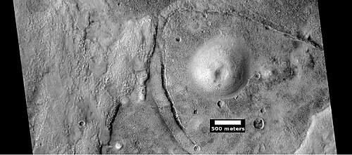 Possible mud volcano, as seen by HiRISE under HiWish program. The location is Mare Acidalium quadrangle.
-
 Wide view of field of mud volcanoes, as seen by HiRISE under HiWish program
 -
 Close view of mud volcanoes, as seen by HiRISE under HiWish program
 -
 Close view of mud volcanoes and boulders, as seen by HiRISE under HiWish program
 -
 Close view of mud volcano, as seen by HiRISE. Picture is about 1 km across. This mud volcano has a different color than the surroundings because it consists of material brought up from depth. These structures may be useful to explore for remains of past life since they contain samples that would have been protected from the strong radiation at the surface.
Hellas floor features
Strange terrain was discovered on parts of the floor of Hellas Planitia. Scientists are not sure of how it formed.
-
 Twisted bands on the floor of Hellas Planitia, as seen by HiRISE under HiWish program
 -
 Floor features in Hellas Planitia, as seen by HiRISE under HiWish program
 -
 Floor features in Hellas Planitia, as seen by HiRISE under HiWish program
 -
 Close view of groups of ridges on Hellas floor, as seen by HiRISE under HiWish program
Exhumed craters
Exhumed craters seem to be in the process of being uncovered.[122] It is believed that they formed, were covered over, and now are being exhumed as material is being eroded. When a crater forms, it will destroy what is under it. In the example below, only part of the crater is visible. if the crater came after the layered feature, it would have removed part of the feature and we would see the entire crater.
-
 Wide view of exhumed craters, as seen by HiRISE under HiWish program
 -
 Close view of exhumed crater, as seen by HiRISE under HiWish program. This crater is and was under a set of dipping layers.
How to suggest image
To suggest a location for HiRISE to image visit the site at http://www.uahirise.org/hiwish
In the sign up process you will need to come up with an ID and a password. When you choose a target to be imaged, you have to pick an exact location on a map and write about why the image should be taken. If your suggestion is accepted, it may take 3 months or more to see your image. You will be sent an email telling you about your images. The emails usually arrive on the first Wednesday of the month in the late afternoon.
See also
- Climate of Mars
- Common surface features of Mars
- Geology of Mars
- Glaciers
- Glaciers on Mars
- Barchan
- Groundwater on Mars
- Martian gullies
- Mud volcano
- Linear ridge networks
- Water on Mars
- Yardangs on Mars
References
- ^ "Public Invited To Pick Pixels On Mars". Mars Daily. January 22, 2010. Retrieved January 10, 2011.
- ^ "Take control of a Mars orbiter". 28 August 2018.
- ^ "HiWishing for 3D Mars images, part II".
- ^ Interview with Alfred McEwen on Planetary Radio, 3/15/2010
- ^ "Your Personal Photoshoot on Mars?". www.planetary.org. Retrieved 20 November 2018.
- ^ "NASA releases first eight "HiWish" selections of people's choice Mars images". TopNews. April 2, 2010. Archived from the original on March 12, 2012. Retrieved January 10, 2011.
- ^ McEwen, A. et al. 2016. THE FIRST DECADE OF HIRISE AT MARS. 47th Lunar and Planetary Science Conference (2016) 1372.pdf
- ^ Milliken, R.; Mustard, J.; Goldsby, D. (2003). "Viscous flow features on the surface of Mars: Observations from high-resolution Mars Orbiter Camera (MOC) images". J. Geophys. Res. 108 (E6): 5057. Bibcode:2003JGRE..108.5057M. doi:10.1029/2002JE002005.
- ^ Arfstrom, J; Hartmann, W. (2005). "Martian flow features, moraine-like ridges, and gullies: Terrestrial analogs and interrelationships". Icarus. 174 (2): 321–335. Bibcode:2005Icar..174..321A. doi:10.1016/j.icarus.2004.05.026.
- ^ Hubbard, B.; Milliken, R.; Kargel, J.; Limaye, A.; Souness, C. (2011). "Geomorphological characterisation and interpretation of a mid-latitude glacier-like form: Hellas Planitia, Mars". Icarus. 211 (1): 330–346. Bibcode:2011Icar..211..330H. doi:10.1016/j.icarus.2010.10.021.
- ^ "HiRISE - Spider Webs (ESP_046359_1250)". www.uahirise.org. Retrieved 20 November 2018.
- ^ Soare, E., et al. 2019. Possible (closed system) pingo and ice-wedge/thermokarst complexes at the mid latitudes of Utopia Planitia, Mars. Icarus. https://doi.org/10.1016/j.icarus.2019.03.010
- ^ Baker, V. 1982. The Channels of Mars. Univ. of Tex. Press, Austin, TX
- ^ NASA.gov
- ^ "HiRISE - Candidate Landing Site for 2020 Mission in Firsoff Crater (ESP_039404_1820)". hirise.lpl.arizona.edu. Retrieved 20 November 2018.
- ^ Pondrelli, M., A. Rossi, L. Deit, S. van Gasselt, F. Fueten, E. Hauber, B. Cavalazzi, M. Glamoclija, and F. Franchi. 2014. A PROPOSED LANDING SITE FOR THE 2020 MARS MISSION: FIRSOFF CRATER. http://marsnext.jpl.nasa.gov/workshops/2014_05/33_Pondrelli_Firsoff_LS2020.pdf
- ^ Golombek, J. et al. 2016. Downselection of landing Sites for the Mars 2020 Rover Mission. 47th Lunar and Planetary Science Conference (2016). 2324.pdf
- ^ McEwen, A.; et al. (2014). "Recurring slope lineae in equatorial regions of Mars". Nature Geoscience. 7 (1): 53–58. Bibcode:2014NatGe...7...53M. doi:10.1038/ngeo2014.
- ^ McEwen, A.; et al. (2011). "Seasonal Flows on Warm Martian Slopes". Science. 333 (6043): 740–743. Bibcode:2011Sci...333..740M. doi:10.1126/science.1204816. PMID 21817049. S2CID 10460581.
- ^ "recurring slope lineae - Red Planet Report". redplanet.asu.edu. Retrieved 20 November 2018.
- ^ Bishop, J. L.; Yeşilbaş, M.; Hinman, N. W.; Burton, Z. F. M.; Englert, P. A. J.; Toner, J. D.; McEwen, A. S.; Gulick, V. C.; Gibson, E. K.; Koeberl, C. (2021). "Martian subsurface cryosalt expansion and collapse as trigger for landslides". Science Advances. 7 (6). Bibcode:2021SciA....7.4459B. doi:10.1126/sciadv.abe4459. PMC 7857681. PMID 33536216. S2CID 231805052.
- ^ Bishop, J., et al. 2021. Martian subsurface cryosalt expansion and collapse as trigger for landslides. Science Advances. Vol. 7, no. 6, eabe4459 DOI: 10.1126/sciadv.abe4459
- ^ "Lines on Mars could be created by salty water triggering landslides".
- ^ "HiRISE | Transient Slope Lineae Formation in a Well-Preserved Crater (ESP_023184_1335)".
- ^ Stillman, D., et al. 2017. Characteristics of the numerous and widespread recurring slope lineae (RSL) in Valles Marineris, Mars. Icarus. Volume 285. Pages 195-210
- ^ "HiRISE | High Resolution Imaging Science Experiment". Hirise.lpl.arizona.edu?psp_008437_1750. Retrieved 2012-08-04.
- ^ Malin, M.; Edgett, K. (2000). "Evidence for recent groundwater seepage and surface runoff on Mars". Science. 288 (5475): 2330–2335. Bibcode:2000Sci...288.2330M. doi:10.1126/science.288.5475.2330. PMID 10875910.
- ^ a b Hecht, M (2002). "Metastability of water on Mars". Icarus. 156 (2): 373–386. Bibcode:2002Icar..156..373H. doi:10.1006/icar.2001.6794.
- ^ a b Mustard, J.; et al. (2001). "Evidence for recent climate change on Mars from the identification of youthful near-surface ground ice". Nature. 412 (6845): 411–414. Bibcode:2001Natur.412..411M. doi:10.1038/35086515. PMID 11473309. S2CID 4409161.
- ^ Pollack, J.; Colburn, D.; Flaser, F.; Kahn, R.; Carson, C.; Pidek, D. (1979). "Properties and effects of dust suspended in the martian atmosphere". J. Geophys. Res. 84: 2929–2945. Bibcode:1979JGR....84.2929P. doi:10.1029/jb084ib06p02929.
- ^ "HiRISE - Layered Mantling Deposits in the Northern Mid-Latitudes (ESP_048897_2125)". www.uahirise.org. Retrieved 20 November 2018.
- ^ Boynton, W.; et al. (2002). "Distribution of hydrogen in the nearsurface of Mars: Evidence for sub-surface ice deposits". Science. 297 (5578): 81–85. Bibcode:2002Sci...297...81B. doi:10.1126/science.1073722. PMID 12040090. S2CID 16788398.
- ^ Kuzmin, R; et al. (2004). "Regions of potential existence of free water (ice) in the near-surface martian ground: Results from the Mars Odyssey High-Energy Neutron Detector (HEND)". Solar System Research. 38 (1): 1–11. Bibcode:2004SoSyR..38....1K. doi:10.1023/b:sols.0000015150.61420.5b. S2CID 122295205.
- ^ Mitrofanov, I. et al. 2007a. Burial depth of water ice in Mars permafrost subsurface. In: LPSC 38, Abstract #3108. Houston, TX.
- ^ Mitrofanov, I.; et al. (2007b). "Water ice permafrost on Mars: Layering structure and subsurface distribution according to HEND/Odyssey and MOLA/MGS data". Geophys. Res. Lett. 34 (18): 18. Bibcode:2007GeoRL..3418102M. doi:10.1029/2007GL030030. S2CID 45615143.
- ^ Mangold, N.; et al. (2004). "Spatial relationships between patterned ground and ground ice detected by the neutron spectrometer on Mars" (PDF). J. Geophys. Res. 109 (E8): E8. Bibcode:2004JGRE..109.8001M. doi:10.1029/2004JE002235.
- ^ Feldman, W.; et al. (2002). "Global distribution of neutrons from Mars: Results from Mars Odyssey". Science. 297 (5578): 75–78. Bibcode:2002Sci...297...75F. doi:10.1126/science.1073541. PMID 12040088. S2CID 11829477.
- ^ Feldman, W.; et al. (2008). "North to south asymmetries in the water-equivalent hydrogen distribution at high latitudes on Mars". J. Geophys. Res. 113 (E8). Bibcode:2008JGRE..113.8006F. doi:10.1029/2007JE003020. hdl:2027.42/95381.
- ^ a b Bright Chunks at Phoenix Lander's Mars Site Must Have Been Ice Archived 2016-03-04 at the Wayback Machine – Official NASA press release (19.06.2008)
- ^ "Confirmation of Water on Mars". Nasa.gov. 2008-06-20. Archived from the original on 2008-07-01. Retrieved 2012-07-13.
- ^ Mutch, T.A., and 24 colleagues, 1976. The surface of Mars: The view from the Viking2 lander Science 194 (4271), 1277–1283.
- ^ Mutch, T.; et al. (1977). "The geology of the Viking Lander 2 site". J. Geophys. Res. 82 (28): 4452–4467. Bibcode:1977JGR....82.4452M. doi:10.1029/js082i028p04452.
- ^ Levy, J.; et al. (2009). "Thermal contraction crack polygons on Mars: Classification, distribution, and climate implications from HiRISE observations". J. Geophys. Res. 114 (E1). Bibcode:2009JGRE..114.1007L. doi:10.1029/2008JE003273.
- ^ Washburn, A. 1973. Periglacial Processes and Environments. St. Martin's Press, New York, pp. 1–2, 100–147.
- ^ Mellon, M. 1997. Small-scale polygonal features on Mars: Seasonal thermal contraction cracks in permafrost J. Geophys. Res. 102, 25,617-25,628.
- ^ a b Mangold, N (2005). "High latitude patterned grounds on Mars: Classification, distribution and climatic control". Icarus. 174 (2): 336–359. Bibcode:2005Icar..174..336M. doi:10.1016/j.icarus.2004.07.030.
- ^ Marchant, D.; Head, J. (2007). "Antarctic dry valleys: Microclimate zonation, variable geomorphic processes, and implications for assessing climate change on Mars". Icarus. 192 (1): 187–222. Bibcode:2007Icar..192..187M. doi:10.1016/j.icarus.2007.06.018.
- ^ "Refubium - Suche" (PDF). www.diss.fu-berlin.de. Retrieved 20 November 2018.
- ^ Kostama, V.-P.; Kreslavsky, Head (2006). "Recent high-latitude icy mantle in the northern plains of Mars: Characteristics and ages of emplacement". Geophys. Res. Lett. 33 (11): L11201. Bibcode:2006GeoRL..3311201K. doi:10.1029/2006GL025946. S2CID 17229252.
- ^ Malin, M.; Edgett, K. (2001). "Mars Global Surveyor Mars Orbiter Camera: Interplanetary cruise through primary mission". J. Geophys. Res. 106 (E10): 23429–23540. Bibcode:2001JGR...10623429M. doi:10.1029/2000je001455.
- ^ Milliken, R.; et al. (2003). "Viscous flow features on the surface of Mars: Observations from high-resolution Mars Orbiter Camera (MOC) images". J. Geophys. Res. 108 (E6): E6. Bibcode:2003JGRE..108.5057M. doi:10.1029/2002JE002005.
- ^ Kreslavsky, M.; Head, J. (2000). "Kilometer-scale roughness on Mars: Results from MOLA data analysis". J. Geophys. Res. 105 (E11): 26695–26712. Bibcode:2000JGR...10526695K. doi:10.1029/2000je001259.
- ^ Seibert, N.; Kargel, J. (2001). "Small-scale martian polygonal terrain: Implications for liquid surface water". Geophys. Res. Lett. 28 (5): 899–902. Bibcode:2001GeoRL..28..899S. doi:10.1029/2000gl012093. S2CID 129590052.
- ^ Kreslavsky, M.A., Head, J.W., 2002. High-latitude Recent Surface Mantle on Mars: New Results from MOLA and MOC. European Geophysical Society XXVII, Nice.
- ^ Head, J.W.; Mustard, J.F.; Kreslavsky, M.A.; Milliken, R.E.; Marchant, D.R. (2003). "Recent ice ages on Mars". Nature. 426 (6968): 797–802. Bibcode:2003Natur.426..797H. doi:10.1038/nature02114. PMID 14685228. S2CID 2355534.
- ^ Steep Slopes on Mars Reveal Structure of Buried Ice. NASA Press Release. 11 January 2018.
- ^ Ice cliffs spotted on Mars. Science News. Paul Voosen. 11 January 2018.
- ^ "Exposed subsurface ice sheets in the Martian mid-latitudes". www.slideshare.net. 13 January 2018. Retrieved 20 November 2018.
- ^ "Steep Slopes on Mars Reveal Structure of Buried Ice - SpaceRef". spaceref.com. 11 January 2018. Retrieved 20 November 2018.[permanent dead link]
- ^ Dundas, Colin M.; et al. (2018). "Exposed subsurface ice sheets in the Martian mid-latitudes". Science. 359 (6372): 199–201. Bibcode:2018Sci...359..199D. doi:10.1126/science.aao1619. PMID 29326269. S2CID 206662378.
- ^ a b Supplementary Materials Exposed subsurface ice sheets in the Martian mid-latitudes Colin M. Dundas, Ali M. Bramson, Lujendra Ojha, James J. Wray, Michael T. Mellon, Shane Byrne, Alfred S. McEwen, Nathaniel E. Putzig, Donna Viola, Sarah Sutton, Erin Clark, John W. Holt
- ^ Lefort, A.; Russell, P. S.; Thomas, N.; McEwen, A. S.; Dundas, C. M.; Kirk, R. L. (2009). "Observations of periglacial landforms in Utopia Planitia with the High Resolution Imaging Science Experiment (HiRISE)". Journal of Geophysical Research. 114 (E4): E04005. Bibcode:2009JGRE..114.4005L. doi:10.1029/2008JE003264. S2CID 129442086.
- ^ Morgenstern, A; Hauber, E; Reiss, D; van Gasselt, S; Grosse, G; Schirrmeister, L (2007). "Deposition and degradation of a volatile-rich layer in Utopia Planitia, and implications for climate history on Mars" (PDF). Journal of Geophysical Research: Planets. 112 (E6): E06010. Bibcode:2007JGRE..112.6010M. doi:10.1029/2006JE002869. Archived from the original (PDF) on 2011-10-04.
- ^ Lefort, A.; Russell, P.S.; Thomas, N. (2010). "Scalloped terrains in the Peneus and Amphitrites Paterae region of Mars as observed by HiRISE". Icarus. 205 (1): 259. Bibcode:2010Icar..205..259L. doi:10.1016/j.icarus.2009.06.005.
- ^ Zanetti, M.; Hiesinger, H.; Reiss, D.; Hauber, E.; Neukum, G. (2009). "Scalloped Depression Development on Malea Planum and the Southern Wall of the Hellas Basin, Mars" (PDF). Lunar and Planetary Science. 40. p. 2178, abstract 2178. Bibcode:2009LPI....40.2178Z.
- ^ http://hiroc.lpl.arizona.edu/images/PSP?diafotizo.php?ID=PSP_002296_1215[permanent dead link]
- ^ "Huge Underground Ice Deposit on Mars Is Bigger Than New Mexico". Space.com. 22 November 2016. Retrieved 20 November 2018.
- ^ Staff (November 22, 2016). "Scalloped Terrain Led to Finding of Buried Ice on Mars". NASA. Retrieved November 23, 2016.
- ^ "Lake of frozen water the size of New Mexico found on Mars – NASA". The Register. November 22, 2016. Retrieved November 23, 2016.
- ^ Bramson, A, et al. 2015. Widespread excess ice in Arcadia Planitia, Mars. Geophysical Research Letters: 42, 6566-6574
- ^ "Widespread, Thick Water Ice found in Utopia Planitia, Mars | Cassie Stuurman". Archived from the original on 2016-11-30. Retrieved 2016-11-29.
- ^ Stuurman, C., et al. 2016. SHARAD detection and characterization of subsurface water ice deposits in Utopia Planitia, Mars. Geophysical Research Letters: 43, 9484_9491.
- ^ http://hirise.lpl.eduPSP_008508_1870[permanent dead link]
- ^ Bleacher, J. and S. Sakimoto. Pedestal Craters, A Tool For Interpreting Geological Histories and Estimating Erosion Rates. LPSC
- ^ "Mars Odyssey Mission THEMIS: Feature Image: Pedestal Craters in Utopia". Archived from the original on 2010-01-18. Retrieved 2010-03-26.
- ^ McCauley, J. F. (1973). "Mariner 9 evidence for wind erosion in the equatorial and mid-latitude regions of Mars". Journal of Geophysical Research. 78 (20): 4123–4137. Bibcode:1973JGR....78.4123M. doi:10.1029/JB078i020p04123.
- ^ Baker, David M.H.; Carter, Lynn M. (2019). "Probing supraglacial debris on Mars 2: Crater morphology". Icarus. 319: 264–280. Bibcode:2019Icar..319..264B. doi:10.1016/j.icarus.2018.09.009. S2CID 126156734.
- ^ Baker, D. and L. Carter. 2019. Probing supraglacial debris on Mars 2: Crater morphology. Icarus. Volume 319. Pages 264-280
- ^ Levy, J. et al. 2008. Origin and arrangement of boulders on the martian northern plains: Assessment of emplacement and modification environments> In 39th Lunar and Planetary Science Conference, Abstract #1172. League City, TX
- ^ Mars Exploration Rover Mission: Press Release Images: Spirit. Marsrovers.jpl.nasa.gov. Retrieved on 7 August 2011.
- ^ "HiRISE - Dust Devils Dancing on Dunes (PSP_005383_1255)". hirise.lpl.arizona.edu. Retrieved 20 November 2018.
- ^ Reiss, D.; et al. (2011). "Multitemporal observations of identical active dust devils on Mars with High Resolution Stereo Camera (HRSC) and Mars Orbiter Camera (MOC)". Icarus. 215 (1): 358–369. Bibcode:2011Icar..215..358R. doi:10.1016/j.icarus.2011.06.011.
- ^ Ward, A. Wesley (20 November 1979). "Yardangs on Mars: Evidence of recent wind erosion". Journal of Geophysical Research. 84 (B14): 8147–8166. Bibcode:1979JGR....84.8147W. doi:10.1029/JB084iB14p08147.
- ^ esa. "'Yardangs' on Mars". Retrieved 20 November 2018.
- ^ "Medusae Fossae Formation - Mars Odyssey Mission THEMIS". themis.asu.edu. Retrieved 20 November 2018.
- ^ a b "Gas jets spawn dark 'spiders' and spots on Mars icecap - Mars Odyssey Mission THEMIS". themis.asu.edu. Retrieved 20 November 2018.
- ^ Thomas, N., G. Portyankina, C.J. Hansen, A. Pommerol. 2011. HiRISE observations of gas sublimation-driven activity in Mars' southern polar regions: IV. Fluid dynamics models of CO2 jets Icarus: 212, pp. 66–85
- ^ Buhler, Peter, Andrew Ingersoll, Bethany Ehlmann, Cale Fassett, James Head. 2017. How the martian residual south polar cap develops quasi-circular and heart-shaped pits, troughs, and moats. Icarus: 286, 69–93
- ^ Benson, M. 2012. Planetfall: New Solar System Visions
- ^ "Spiders invade Mars". Astrobiology Magazine. 17 August 2006. Retrieved 20 November 2018.
- ^ Kieffer H, Christensen P, Titus T. 2006 Aug 17. CO2 jets formed by sublimation beneath translucent slab ice in Mars' seasonal south polar ice cap. Nature: 442(7104):793-6.
- ^ "Thawing 'Dry Ice' Drives Groovy Action on Mars". NASA/JPL. Retrieved 20 November 2018.
- ^ Kieffer, H. H. (2000). "Mars Polar Science 2000 - Annual Punctuated CO2 Slab-ice and Jets on Mars" (PDF). Retrieved 6 September 2009.
{{cite journal}}: Cite journal requires|journal=(help) - ^ Kieffer, Hugh H. (2003). "Third Mars Polar Science Conference (2003)- Behavior of Solid CO" (PDF). Retrieved 6 September 2009.
{{cite journal}}: Cite journal requires|journal=(help) - ^ Portyankina, G., ed. (2006). "Fourth Mars Polar Science Conference - Simulations of Geyser-Type Eruptions in Cryptic Region of Martian South" (PDF). Retrieved 11 August 2009.
{{cite journal}}: Cite journal requires|journal=(help) - ^ Sz. Bérczi; et al., eds. (2004). "Lunar and Planetary Science XXXV (2004) - Stratigraphy of Special Layers – Transient Ones on Permeable Ones: Examples" (PDF). Retrieved 12 August 2009.
{{cite journal}}: Cite journal requires|journal=(help) - ^ "NASA Findings Suggest Jets Bursting From Martian Ice Cap". Jet Propulsion Laboratory. NASA. 16 August 2006. Archived from the original on 25 February 2021. Retrieved 11 August 2009.
- ^ C.J. Hansen; N. Thomas; G. Portyankina; et al. (2010). "HiRISE observations of gas sublimation-driven activity in Mars' southern polar regions: I. Erosion of the surface" (PDF). Icarus. 205 (1): 283–295. Bibcode:2010Icar..205..283H. doi:10.1016/j.icarus.2009.07.021. Retrieved 26 July 2010.
- ^ "'Spiders on Mars' fully awakened on Earth for 1st time — and scientists are shrieking with joy". Live Science. 16 September 2024.
- ^ Carr, M. 2001.
- ^ Blanc, E., et al. 2024. ORIGIN OF WIDESPREAD LAYERED DEPOSITS ASSOCIATED WITH MARTIAN DEBRIS COVERED GLACIERS. 55th LPSC (2024). 1466.pdf
- ^ Morgenstern, A., et al. 2007
- ^ a b Baker, D.; Head, J. (2015). "Extensive Middle Amazonian mantling of debris aprons and plains in Deuteronilus Mensae, Mars: Implication for the record of mid-latitude glaciation". Icarus. 260: 269–288. Bibcode:2015Icar..260..269B. doi:10.1016/j.icarus.2015.06.036.
- ^ Mangold, N (2003). "Geomorphic analysis of lobate debris aprons on Mars at Mars Orbiter Camera scale: Evidence for ice sublimation initiated by fractures". J. Geophys. Res. 108 (E4): 8021. Bibcode:2003JGRE..108.8021M. doi:10.1029/2002je001885.
- ^ Levy, J. et al. 2009. Concentric
- ^ "NASA - Bright Chunks at Phoenix Lander's Mars Site Must Have Been Ice". www.nasa.gov. Archived from the original on 4 March 2016. Retrieved 20 November 2018.
- ^ Byrne, S.; et al. (2009). "Distribution of Mid-Latitude Ground Ice on Mars from New Impact Craters". Science. 325 (5948): 1674–1676. Bibcode:2009Sci...325.1674B. doi:10.1126/science.1175307. PMID 19779195. S2CID 10657508.
- ^ Head, J. et al. 2003.
- ^ Madeleine, et al. 2014.
- ^ Schon; et al. (2009). "A recent ice age on Mars: Evidence for climate oscillations from regional layering in mid-latitude mantling deposits". Geophys. Res. Lett. 36 (15): L15202. Bibcode:2009GeoRL..3615202S. doi:10.1029/2009GL038554. S2CID 18570952.
- ^ Head, J.; Mustard, J. (2006). "Breccia dikes and crater-related faults in impact craters on Mars: Erosion and exposure on the floor of a crater 75 km in diameter at the dichotomy boundary". Meteorit. Planet Science. 41 (10): 1675–1690. Bibcode:2006M&PS...41.1675H. doi:10.1111/j.1945-5100.2006.tb00444.x. S2CID 12036114.
- ^ Mangold; et al. (2007). "Mineralogy of the Nili Fossae region with OMEGA/Mars Express data: 2. Aqueous alteration of the crust". J. Geophys. Res. 112 (E8). Bibcode:2007JGRE..112.8S04M. doi:10.1029/2006JE002835. S2CID 15188454.
- ^ Mustard; et al. (2007). "Mineralogy of the Nili Fossae region with OMEGA/Mars Express data: 1. Ancient impact melt in the Isidis Basin and implications for the transition from the Noachian to Hesperian". J. Geophys. Res. 112 (E8). Bibcode:2007JGRE..112.8S03M. doi:10.1029/2006JE002834.
- ^ Mustard; et al. (2009). "Composition, Morphology, and Stratigraphy of Noachian Crust around the Isidis Basin" (PDF). J. Geophys. Res. 114 (7). Bibcode:2009JGRE..114.0D12M. doi:10.1029/2009JE003349.
- ^ Smellie, J., B. Edwards. 2016. Glaciovolcanism on Earth and Mars. Cambridge University Press.
- ^ a b Levy, J., et al. 2017. Candidate volcanic and impact-induced ice depressions on Mars. Icarus: 285, 185-194.
- ^ University of Texas at Austin. "A funnel on Mars could be a place to look for life." ScienceDaily. ScienceDaily, 10 November 2016. <sciencedaily.com/releases/2016/11/161110125408.htm>.
- ^ a b "PSR Discoveries: Rootless cones on Mars". www.psrd.hawaii.edu. Retrieved 20 November 2018.
- ^ Lanagan, P., A. McEwen, L. Keszthelyi, and T. Thordarson. 2001. Rootless cones on Mars indicating the presence of shallow equatorial ground ice in recent times, Geophysical Research Letters: 28, 2365-2368.
- ^ S. Fagents1, a., P. Lanagan, R. Greeley. 2002. Rootless cones on Mars: a consequence of lava-ground ice interaction. Geological Society, Londo. Special Publications: 202, 295-317.
- ^ Jaeger, W., L. Keszthelyi, A. McEwen, C. Dundas, P. Russell, and the HiRISE team. 2007. EARLY HiRISE OBSERVATIONS OF RING/MOUND LANDFORMS IN ATHABASCA VALLES, MARS. Lunar and Planetary Science XXXVIII 1955.pdf.
- ^ "Exhumed Craters near Kaiser".
Further reading
- Lorenz, R. 2014. The Dune Whisperers. The Planetary Report: 34, 1, 8-14
- Lorenz, R., J. Zimbelman. 2014. Dune Worlds: How Windblown Sand Shapes Planetary Landscapes. Springer Praxis Books / Geophysical Sciences.
- Grotzinger, J. and R. Milliken (eds.). 2012. Sedimentary Geology of Mars. SEPM.
External links
- HiRISE images from HiWish Program
- /0:48 Zooming in on Mars with HiRISE images from HiWish program
- Features of Mars with HiRISE under HiWish program Shows nearly all major features discovered on Mars. This would be good for teachers covering Mars.
- A trip to Mars with Hubble, Viking, and HiRISE
- Mars through HiRISE under the HiWish program
- Beautiful Mars as seen by HiRISE under HiWish program
- Martian Ice - Jim Secosky - 16th Annual International Mars Society Convention
- Martian Geology - Jim Secosky - 16th Annual International Mars Society Convention
- Walks on Mars - Jim Secosky - 16th Annual International Mars Society Convention
- How to Explore Mars without Leaving Your Chair - Jim Secosky - 23rd Annual Mars Society Convention
- Stillman, D., et al. 2017. Characteristics of the numerous and widespread recurring slope lineae (RSL) in Valles Marineris, Mars. Icarus. Volume 285. Pages 195-210
- McEwen, A., et al. 2024. The high-resolution imaging science experiment (HiRISE) in the MRO extended science phases (2009–2023). Icarus. Available online 16 September 2023, 115795. In Press.