
Loading article…
Breitscheid (German pronunciation:[ˈbʁaɪtˌʃaɪt]) is a municipality in the Lahn-Dill-Kreis in Hesse, Germany.
Breitscheid lies from 266 to 600 m above sea level on the eastern slope of the Westerwald range at the point shared by three German states: Hesse, Rhineland-Palatinate and North Rhine-Westphalia.
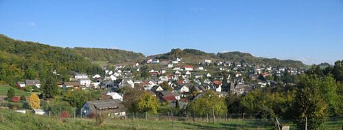
Erdbach, a constituent municipality, lies in an interesting place with regards to Earth's history, in the eastern part of the Westerwald, near that range's highest peak, Fuchskauten (657 m).
In the Erdbach area are noteworthy limestone deposits from various geological time periods. "Erdbach limestone" from Lower Carboniferous times gave an era the name "Erdbachium". The Erdbach – the village's namesake brook – disappears into a karst system, and does not appear again for 1.5 km where it can be seen in a quarry.
Not far from there, the "Homberg" fossil reserve was instituted, which serves some university institutes from Jena to the Rhine as a research area. The older limestone formation near Breitscheid (main centre) stems from a subtropicalcoral reef from the Devonian period (mid-Palaeozoic, 400,000,000 years ago).
In the "stone chambers" of the Rolsbach valley, some gravesites from Hallstatt times (about 550 BC) were unearthed in 1884. In archaeology, there is a special burial ornament called an "Erdbach coil torc" (Erdbacher Wendelhalsring). It is also believed that Neanderthal people once lived nearby, but this belief awaits further discovery.
ブライトシャイトは、北はブルバッハ市(ノルトライン=ヴェストファーレン州ジーゲン=ヴィトゲンシュタイン郡)、ハイガー市、ディレンブルク市に、東はヘルボルン市に、南はドリードフ市(いずれもラーン=ディル郡)に、西はヴィリンゲン市、リーベンシャイト市(いずれもラインラント=プファルツ州ヴェスターヴァルト郡)に接している。
中心部は全体と同じ名前を持つが、それ以外にエルドバッハ、グスターンハイン、メデンバッハ、ラーベンシャイトといった郊外の中心地がある。この自治体は、ヘッセン州の地方自治体改革の一環として1977年1月1日に設立された。構成自治体は、以前は独立した自治体であった。
2021年3月14日に行われた市町村選挙の結果は以下のとおりです。
注:FWGは市民連合です。