Loading article…
 火星探査機レーザー高度計(MOLA) データから取得したヘラス四角形の地図。最高標高は赤、最低標高は青で示されています。 | |
| 座標 | 南緯47度30分 西経270度00分 / 南緯47.5度 西経270度 / -47.5; -270 |
|---|---|

ヘラス四角形は、米国地質調査所(USGS)の天体地質学研究プログラムが使用する火星の30枚の四角形地図のうちの1つである。ヘラス四角形はMC-28(火星チャート-28)とも呼ばれる。[1]ヘラス四角形は、火星 の西経240度から300度、南緯30度から65度の領域をカバーしている。ヘラス四角形内には、ヘラス平原とプロメテイ大陸という典型的な地形がある。ヘラス四角形からは、ダオ渓谷、ニジェール渓谷、ハルマキス渓谷、レウル渓谷といった巨大な川の谷など、多くの興味深く神秘的な地形が発見されており、これらはすべて、はるか昔にヘラス盆地の湖に水を供給していた可能性がある。[2] [3] [4]ヘラス四角形の多くの場所、特に氷河のような流れの特徴がある場所では、地面に氷の兆候が見られます。
ヘラス盆地
ヘラス四角形には、火星表面で最大かつ太陽系で2番目に大きい既知の衝突クレーターであるヘラス盆地の一部が含まれています。クレーターの深さは、火星の標準地形基準面より7152メートル[5] (23,000フィート)下にあります。この盆地は火星の南部高地にあり、約39億年前の後期重爆撃期に形成されたと考えられています。研究によると、衝突によってヘラス盆地が形成されたとき、火星の表面全体が数百度加熱され、70メートルの溶けた岩石が火星に落下し、ガス状の岩石の大気が形成されたことが示唆されています。この岩石の大気は、地球の大気の10倍の厚さでした。数日のうちに、岩石は凝縮し、さらに10メートルの溶けた岩石で火星全体を覆ったと考えられます。[2]ヘラス平原 の北西部には、複雑な縞模様の地形またはタフィープル地形と呼ばれる奇妙な地形があります。その形成過程はまだほとんどわかっていませんが、硬い堆積物と柔らかい堆積物の侵食と延性変形によるものと思われます。延性変形は、地層がひずみを受けることで発生します。[6]
惑星の歴史の初期には、ヘラス盆地に巨大な湖が存在したと考えられている。[7] 海岸線と思われるものが発見されている。これらは、火星周回カメラの狭角画像に映る交互に現れる台地と断崖で明らかである。さらに、火星周回レーザー高度計 (MOLA) のデータによると、これらの堆積単位の接触部は、数千 km にわたって一定の標高の等高線を描き、あるケースでは盆地の周囲全体に広がっている。水によって形成されたと考えられる水路が盆地に入り込んでいる。ヘラスの流域は、北部平原全体のほぼ 5 分の 1 の広さである可能性がある。今日の火星の気候では、ヘラスに湖があると、その上部に厚い氷が形成され、最終的には昇華する。つまり、氷は固体から直接ガスに変化する。これは、地球上のドライアイス (固体二酸化炭素) の挙動に似ている。[3]水が凍ったときに形成された可能性のある氷河地形(末端モレーン、ドラムリン、エスカー)が発見されています。 [2] [8]
-
下にあります。](https://img-server.japedia.wiki/wikipedia/commons/thumb/f/fc/Hellas_basin_topo.jpg/500px-Hellas_basin_topo.jpg) ヘラス盆地地域の地形。クレーターの深さは火星の標準地形基準面より7152メートル[5] (23,000フィート)下にあります。
ヘラス盆地地域の地形。クレーターの深さは火星の標準地形基準面より7152メートル[5] (23,000フィート)下にあります。 -
![ヘラス盆地のクレーターの深さを示すグラフ。火星で最も深いクレーターで、表面圧力は1155 Pa[5] (11.55 mbar、0.17 psi、または0.01 atm) と最も高い。](https://img-server.japedia.wiki/wikipedia/commons/thumb/f/f0/False_color_of_Hellas_Planitia.jpeg/500px-False_color_of_Hellas_Planitia.jpeg)
-
 HiRISEが捉えたギリシャのねじれた地面。これは火星を歩くのがいかに難しいかを示すもう一つの例です。
葉状破片エプロン
東ギリシャに共通する非常に重要な特徴の 1 つは、崖を囲む物質の山です。この構造は、ローブ状デブリエプロン(LDA) と呼ばれています。最近、マーズ・リコネッサンス・オービターの浅いレーダーによる研究により、LDA は薄い岩の層で覆われた氷河であるという強力な証拠が得られました。 [9] [10] [11] [12] [13] LDA には大量の水氷があると考えられています。入手可能な証拠は、過去にギリシャ東部に雪が積もっていたことを強く示唆しています。火星の傾き (黄道傾斜角) が増加すると、南の氷冠から大量の水蒸気が放出されます。気候モデルでは、これが起こると、水蒸気が凝縮して LDA がある場所に落下すると予測されています。地球の傾きはほとんど変化しません。これは、比較的大きな月が安定しているためです。2 つの小さな火星の衛星は惑星を安定させないため、火星の自転軸は大きく変動します。[14] ロベート・デブリ・エプロンは、将来の火星移住者にとって主要な水源となる可能性がある。火星の他の水源に比べて大きな利点は、軌道上から簡単に地図を作成できることと、有人ミッションが着陸する可能性が高い赤道に近いことである。
-
 葉状のデブリエプロンの表面のクローズアップ。地球上の岩石氷河によく見られる線に注目してください。画像はヘラス四角形にあります。
 -
 瓦礫の山の周りの瓦礫置き場の次の 2 つの画像の CTX コンテキスト画像
 -

-
 HiWish プログラムで HiRISE が撮影した、テラ・キメリアのデブリ・エプロンの表面。色のついた部分は霜の堆積物である可能性があります。
線状の床堆積物
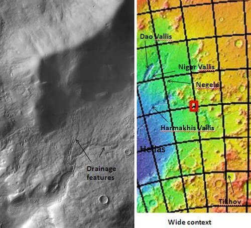
いくつかの水路の底には、線状底堆積物または線状谷底堆積物と呼ばれる特徴があります。これらは、障害物を迂回するように見える隆起と溝のある物質です。これらは氷を豊富に含んでいると考えられています。地球上のいくつかの氷河には、このような特徴が見られます。線状底堆積物は、大量の氷が含まれていることが証明されている葉状の堆積物エプロンに関連している可能性があります。下の写真のように、ルール渓谷にはこれらの堆積物が見られます。[15]
-
-
 THEMIS が捉えた、線状の底堆積物を持つレウル渓谷。画像をクリックすると、他の地形との関係が表示されます。
 -
 HiWish プログラムの HiRISE で見られる線状の谷埋め
 -
 HiWish プログラムの HiRISE で撮影された、上部に線状の谷底が見られ、下部に窪みがある Reull Vallis の谷底。
 -
 HiWish プログラムの HiRISE で撮影された、線状の谷埋めのクローズアップ カラー画像
 -
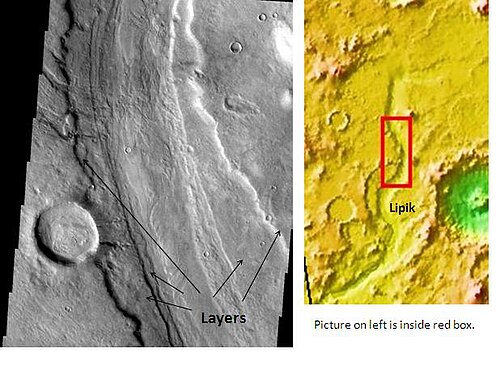 THEMIS が見たReull Vallisの層
 -
 HiRISEが見たレウル渓谷近くのフレッツ地形
 -
 HiRISE が撮影した、Reull Vallis 近くの Fretted Terrain のクローズアップ。このエリアを歩いて渡るのは大変でしょう。
 -
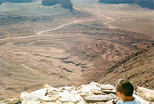 モニュメントバレーの地層。これらは、少なくとも部分的には水の堆積によって形成されたと考えられています。火星にも同様の地層があるため、火星の地層形成の主な原因は水です。
氷に富んだマントル

火星の表面の大部分は、氷と塵の混合物であると考えられる厚くて滑らかなマントルで覆われています。数ヤードの厚さのこの氷を多く含んだマントルは、陸地を滑らかにしていますが、場所によってはバスケットボールの表面のような凹凸のある質感を示しています。このマントルにはクレーターがほとんどないため、マントルは比較的新しいものです。右の画像は、HiRISEで観測された、ニジェール渓谷周辺のこの滑らかなマントルの良好な画像を示しています。火星の軌道と傾きの変化により、極地からテキサス州に相当する緯度までの水氷の分布に大きな変化が生じます。特定の気候期間には、水蒸気が極地の氷から大気圏に入ります。水は、塵とたっぷりと混ざった霜や雪の堆積物として、低緯度の地面に戻ります。火星の大気には、微細な塵粒子が大量に含まれています。水蒸気は粒子上で凝縮し、水のコーティングによる追加の重量により、粒子は地面に落ちます。マントル層上部の氷が大気中に戻ると、残った氷を断熱する塵が残ります。[16]
-
 HiWish プログラムの HiRISE で見られる、層状の滑らかなマントル
 -
 HiWish プログラムの HiRISE で撮影されたマントルのクローズアップ画像
 -
 HiWish プログラムの HiRISE によって撮影された、クレーターのマントルの厚さを示す画像
 -
 HiWish 計画の HiRISE が捉えたマントルの端のクローズアップ画像
上平原ユニット
火星の中緯度で、上部平原ユニットと呼ばれる厚さ50~100メートルのマントルの残骸が発見された。最初に調査されたのはデウテロニラス・メンサエ地域だが、他の場所でも発見されている。残骸はクレーター内や台地に沿った傾斜層の集合体である。 [17]傾斜層は様々な大きさや形をしており、中央アメリカのアステカのピラミッドに似たものもある。その起源に関する一つの考えが、第55回火星探査会議(2024年)で国際研究チームによって発表された。彼らは、その層が過去の氷床からのものであると示唆している。[18]
-
 HiWish プログラムの HiRISE で見られる傾斜層
 -
 HiWish プログラムの HiRISE で見られる傾斜層
 -
 HiWish プログラムの HiRISE で見られる傾斜層
-
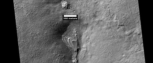 HiWish プログラムの HiRISE によって観測された、おそらく上部平原部の侵食によって形成された層状の地形
 -
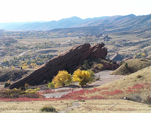 コロラド州レッドロックス公園の地層構造。火星のものとは起源は異なりますが、形状は似ています。レッドロックス地域の特徴は、山の隆起によって生じました。
 -
 HiWish プログラムの HiRISE によって撮影された、空から落ちてきたかつて広く普及していたユニットの残骸と思われる層状の地形
 -
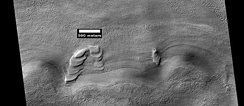 HiWish プログラムで HiRISE が示す階層化機能
 -
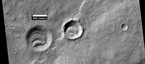 HiWish プログラムの HiRISE が捉えたクレーターの層状構造
 -
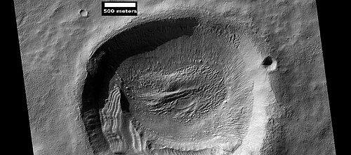 HiWish プログラムの HiRISE が捉えたクレーターの層状構造
 -
 HiWish プログラムの HiRISE が捉えたクレーターの層
 -
 HiWish プログラムの HiRISE が捉えたクレーターの層状構造
-
 HiWish プログラムの HiRISE が捉えたクレーターの層状構造
 -
 HiWish プログラムの HiRISE が撮影した、クレーター内の層状の地形のクローズアップ カラー画像。色の違いは鉱物の違いによるものです。
-
 クレーター内の層状構造。これはおそらく、かつてはもっと広い範囲を覆っていた層状のユニットの残骸です。このユニットの材料は、氷で覆われた塵として空から降ってきました。この写真は、HiWish プログラムのもと、HiRISE によって撮影されました。
このユニットはブレイン テレインにも分解されます。ブレイン テレインは、高さ 3 ~ 5 メートルの迷路のような尾根の領域です。尾根の中には氷床コアで構成されているものもあり、将来の入植者にとって水源となる可能性があります。
-
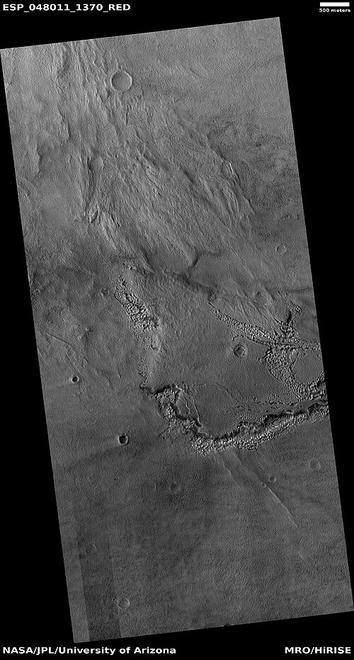 HiWish プログラムの HiRISE が捉えた、脳地形に分解する上部平原ユニットの広域画像
 -
 HiWish プログラムの HiRISE が撮影した、上部平原ユニットが崩壊して脳状地形になる様子のクローズアップ画像。氷が地面から離れると、地面が崩壊し、風が残った塵を吹き飛ばします。
 -
 HiWish プログラムで HiRISE が観察した小さな層状構造。画像には脳の地形形成も示されています。
上部平原の一部の領域には、縁が盛り上がった大きな亀裂や谷が見られ、このような領域はリブ付き上部平原と呼ばれています。亀裂は、応力による小さな亀裂から始まったと考えられています。リブ付き上部平原は、デブリエプロンが集まったときやデブリエプロンの端の近くにあるときによく見られるため、応力が亀裂プロセスを開始したことが示唆されています。このような場所では圧縮応力が発生します。亀裂によってより多くの表面が露出し、その結果、物質内のより多くの氷が惑星の薄い大気中に昇華します。最終的に、小さな亀裂は大きな峡谷または谷になります。小さな亀裂には、小さな穴や穴の連鎖が含まれることが多く、これらは地中の氷が昇華したものと考えられています。[19] [20] 火星の表面の大部分は、1メートルの厚さの塵やその他の物質の層で保護された氷で覆われています。しかし、亀裂が現れると、新しい表面が氷を薄い大気にさらします。[21] [22] 短時間で、氷は昇華と呼ばれるプロセスで冷たく薄い大気中に消えていきます。ドライアイスは地球上でも同様の挙動を示します。火星では、フェニックス着陸船が数日で消えた氷の塊を発見したときに昇華が観測されました。[23] [24] さらに、HiRISEは底に氷がある新鮮なクレーターを観測しました。しばらくすると、HiRISEは氷の堆積物が消えるのを観測しました。[25]
-
![拡大された「ドードー・ゴルディロックス」海溝にあったサイコロ大の明るい物質の塊は4日間で消えた。これは、それらが露出後に昇華した氷で構成されていたことを示唆している。[24][26]](https://img-server.japedia.wiki/wikipedia/commons/thumb/1/1d/Ice_sublimating_in_the_Dodo-Goldilocks_trench.gif/500px-Ice_sublimating_in_the_Dodo-Goldilocks_trench.gif) 拡大された「ドードー・ゴルディロックス」海溝にあったサイコロ大の明るい物質の塊は4日間で消えた。これは、それらが露出後に昇華した氷で構成されていたことを示唆している。[24] [26]
拡大された「ドードー・ゴルディロックス」海溝にあったサイコロ大の明るい物質の塊は4日間で消えた。これは、それらが露出後に昇華した氷で構成されていたことを示唆している。[24] [26] -
 氷の昇華を示す写真のカラー版。画像の右上の挿入図では、海溝の左下隅が拡大されている。
上部平原ユニットは空から落ちてきたと考えられている。まるで均等に落ちてきたかのように、さまざまな表面を覆っている。他のマントル堆積物と同様に、上部平原ユニットは層状で、細粒で、氷に富んでいる。広範囲に広がっており、点源があるようには見えない。火星の一部の地域の表面の外観は、このユニットの劣化によるものである。これは、ローブ状のデブリエプロンの表面外観の主な原因である。[20] 上部平原マントルユニットと他のマントルユニットの層状化は、惑星の気候の大きな変化によって引き起こされたと考えられている。モデルは、自転軸の傾斜角または傾きが、地質学的時間の経過とともに現在の25度からおそらく80度以上に変化したと予測している。傾斜が大きい期間は、極冠の氷が再分配され、大気中の塵の量を変える。[27] [28] [29]
気候変動により氷の多い地形が生じた
火星の多くの地形、ヘラス四角形を含む地形には、大量の氷が含まれていると考えられています。氷の起源に関する最も一般的なモデルは、惑星の自転軸の傾きの大きな変化による気候変動です。時には、傾きが80度を超えることさえありました[30] [31] 大きな傾きの変化は、火星の多くの氷の多い地形を説明しています。
研究によると、火星の傾斜が現在の 25 度から 45 度に達すると、氷は極で安定しなくなることが示されています。[32] さらに、この高い傾斜では、固体二酸化炭素 (ドライアイス) の貯蔵庫が昇華し、それによって大気圧が上昇します。この上昇した圧力により、より多くの塵が大気中に保持されるようになります。大気中の水分は、雪または塵の粒子に凍った氷として降り注ぎます。計算によると、この物質は中緯度に集中します。[33] [34] 火星大気の一般循環モデルは、氷を多く含む地形が見られるのと同じ領域に氷を多く含む塵が蓄積すると予測しています。[31] 傾斜が低い値に戻り始めると、氷は昇華し (直接ガスに変化し)、塵のラグを残します。[35] [36] ラグ堆積物は下にある物質を覆っているため、高い傾斜レベルの各サイクルで、いくらかの氷を多く含むマントルが残ります。[37] 滑らかな表面のマントル層は、おそらく比較的最近の物質のみを表していることに注意してください。
ダオ渓谷の起源
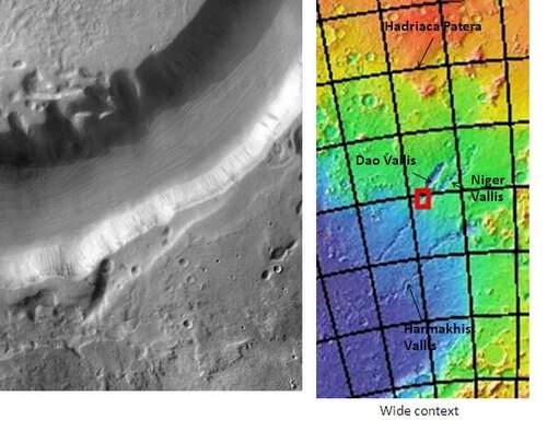
ダオ渓谷はハドリアカ・パテラと呼ばれる大きな火山の近くから始まるため、熱いマグマが凍った地面の大量の氷を溶かしたときに水が供給されたと考えられています。[2] 隣の画像にある溝の左側にある部分的に円形の窪みは、地下水の浸出によっても水が供給されたことを示唆しています。[38]
砂嵐の軌跡
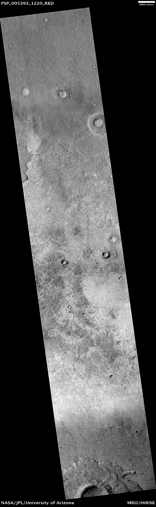
ヘラス四角形を含む火星の多くの地域では、巨大な砂嵐が起こります。火星の表面のほとんどを、薄く薄く輝く細かい塵が覆っています。砂嵐が通過すると、その層が吹き飛ばされ、その下にある暗い表面が露出します。砂嵐は地上からも、また軌道上の宇宙船からも観測されています。砂嵐は、火星の2台のローバーの太陽電池パネルの塵を吹き飛ばし、ローバーの寿命を大幅に延ばしました。[39] 双子のローバーは3か月間持続するように設計されていましたが、実際には5年以上も持続しています。砂嵐の軌跡のパターンは、数か月ごとに変化することが示されています。[40]高解像度ステレオカメラ(HRSC)と火星探査カメラ(MOC) のデータを組み合わせた研究では、火星の大きな砂嵐の中には直径が700メートルあり、少なくとも26分間続くものがあることがわかりました。[41]砂嵐の中には 、地球の平均的な竜巻よりも高いものもあります。[42]
-
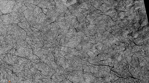 CTX カメラ (火星探査機搭載) が捉えた、ウォレス クレーターの底にある砂塵旋風の跡
 -
 HIWish プログラムの HiRISE が観測した砂塵旋風の軌跡
 -
 HIWish プログラムの HiRISE が撮影した砂塵旋風の跡と岩石
 -
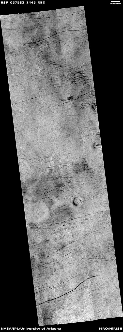 HIWish プログラムの HiRISE が捉えた砂塵旋風の軌跡の広域画像
 -
 HIWish プログラムの HiRISE が観測した砂塵旋風の軌跡のクローズアップ カラー画像
 -
 HIWish プログラムの HiRISE が観測した砂塵旋風の軌跡のクローズアップ カラー画像
 -
 HIWish プログラムの HiRISE で観測された砂塵旋風の軌跡のクローズアップカラー画像。背景には地面の模様が見えます。
最近まで液体の水が存在していた可能性を示す証拠

火星探査機マーズ・リコネッサンス・オービターは、 1999年から2004年の間にペンティクトンクレーターの壁の変化を発見した。この変化の原因の一つは、表面を流れる水によるものだという解釈があった。[43]約1年後に発表されたさらなる分析では、堆積物は重力によって斜面を流れ落ちる物質(地滑り) によって生じた可能性があることが明らかになった。堆積物が発見された斜面は、乾燥した未固結物質の安定限界に近かった。[44]
その他のクレーター
衝突クレーターは一般的に縁があり、その周囲に噴出物があるが、火山クレーターには通常縁も噴出物堆積物もない。クレーターが大きくなると(直径10km以上)、中央に山が現れることが多い。[45]山は衝突後にクレーター底が跳ね返ったことでできる。[46] クレーターには層が現れることもある。クレーターは地表の奥深くに何があるのかを見せてくれる。
-
 HiWish プログラムの HiRISE が撮影した台座クレーター
 -
![台座クレーターは、衝突による噴出物がその下の物質を浸食から守ることで形成される。この過程の結果、クレーターは周囲よりも高い位置に浮かんでいるように見える。[47] [48]](https://img-server.japedia.wiki/wikipedia/commons/thumb/d/d2/Pedestal_crater3.jpg/500px-Pedestal_crater3.jpg) 台座クレーターは、衝突による噴出物がその下の物質を浸食から守ることで形成される。この過程の結果、クレーターは周囲よりも高い位置に浮かんでいるように見える。[47] [48]
台座クレーターは、衝突による噴出物がその下の物質を浸食から守ることで形成される。この過程の結果、クレーターは周囲よりも高い位置に浮かんでいるように見える。[47] [48] -
 この図は、台座クレーターの形成に関する後期の考えを示しています。この考え方では、衝突した弾丸は氷の多い層に入り、それ以上は進みません。衝突による熱と風が表面を硬化させ、侵食を防ぎます。この硬化は、氷が溶けて塩分/ミネラル溶液が生成され、表面が固まることによって実現されます。
 -
 HiWish プログラムの HiRISE が撮影した台座クレーター
 -
-
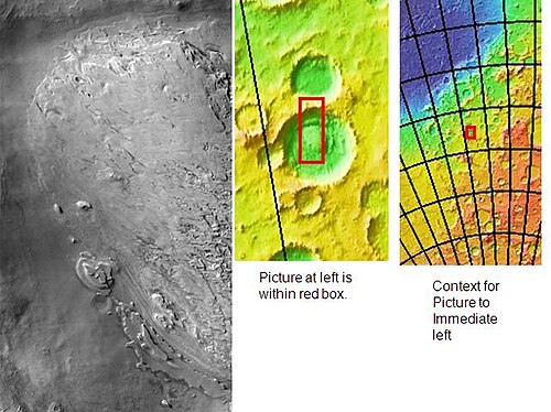
 HiWish プログラムの HiRISE が撮影した、壁によって切り取られたクレーターの側面図。この画像には他のクレーターも写っています。
 -

-
-
-
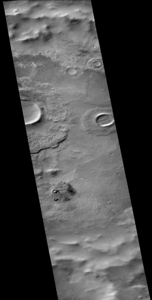
 CTX カメラ (火星探査機搭載) が撮影したウォレス クレーターの底
 -
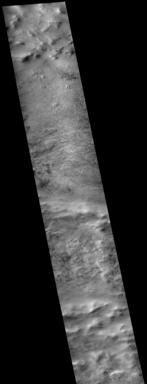
CTX カメラ (火星探査機搭載) が捉えた、ウォレス クレーターの底にある砂塵旋風の跡。これはウォレス クレーターの底の以前の画像の拡大版であることに注意してください。
-
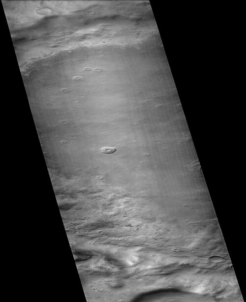 CTX カメラ (火星探査機搭載) が撮影したハクスリー クレーター
 -
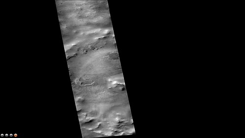 CTX カメラ (火星探査機搭載) が撮影したグレッドヒル クレーター
 -
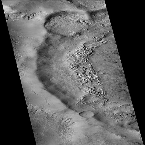 CTX カメラ (火星探査機搭載) が撮影したレディ クレーター
 -
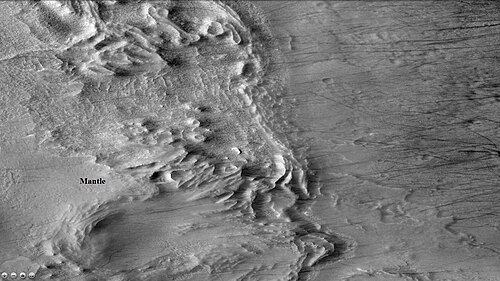 CTX カメラ (火星探査機搭載) が捉えた、ダストデビルの跡とマントルが見えるレディ クレーター。注: これはレディ クレーターの以前の画像の拡大です。
氷河の特徴
氷河は、現在または最近流れている氷の塊として大まかに定義され、現代の火星表面の広いが限られた地域に存在すると考えられており、過去にはより広範囲に分布していたと推測されています。[49] [50]粘性流特徴として知られる表面の葉状の凸状特徴と、非ニュートン流の特徴を示す葉状のデブリエプロンは、現在ではほぼ満場一致で真の氷河と見なされています。[49] [51] [52] [53] [54] [55] [56] [57] [58]
2006年にサイエンス誌に発表された気候モデルによると、氷河が見られるギリシャ地域に大量の氷が蓄積するはずだという。水は南極地域からギリシャ北部に運ばれ、降水として降り注ぐ。[59]
-
 HiWishプログラムにおけるHiRISEから見たフロー
 -
 HIWish プログラムで HiRISE が見たフローのクローズアップ カラー ビュー
 -
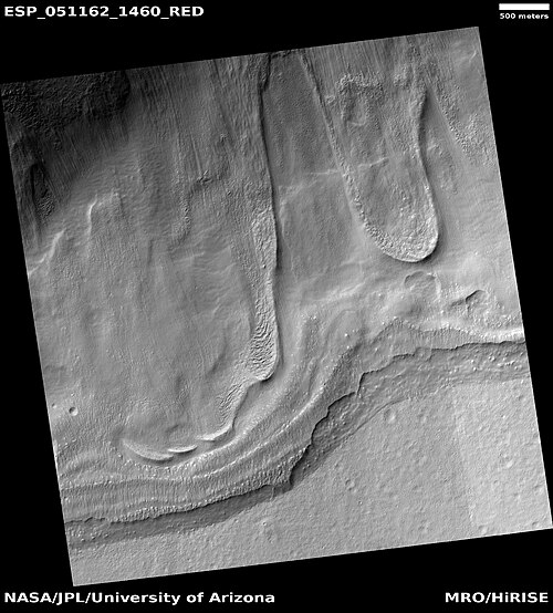 HiWishプログラムにおけるHiRISEから見たフロー
 -
 HiWishプログラムにおけるHiRISEから見たフロー
 -
 HiWish プログラムの HiRISE で見た流れのクローズアップ カラー ビュー。写真には模様のある地面が見えます。
 -
 HiWishプログラムにおけるHiRISEから見たフロー
 -
 HiWishプログラムにおけるHiRISEから見たフロー
 -
 HiWishプログラムにおけるHiRISEから見たフロー
 -
 HiWishプログラムにおけるHiRISEから見たフロー
 -
 HiWish プログラムの HiRISE で見た、流れの先端のクローズアップ画像。 多角形の模様の地面が見えます。
 -
 HiWish プログラムの HiRISE が捉えた舌状氷河の広域画像
 -
 HiWish プログラムの HiRISE が捉えた舌状氷河のクローズアップ画像。多角形が見えます。
 -
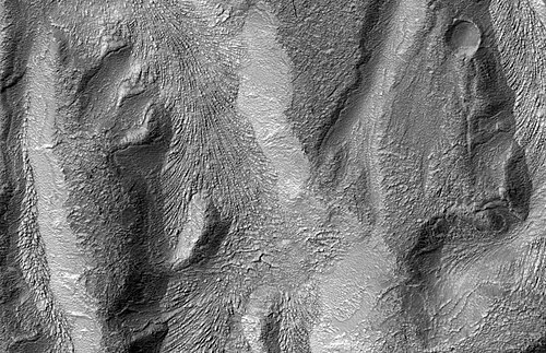 HiRISE で見た下り坂の動きを示す表面の特徴
 -
 次の 2 つの画像の位置を示す Hellas Planitia の CTX コンテキスト画像
 -
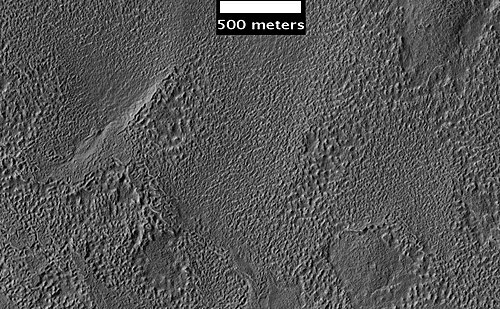 HiWish 計画のもと、HiRISE が撮影したヘラス四角形の表面
 -
 HiWish プログラムの HiRISE が捉えた、ヘラス平原の氷河圏谷の可能性がある。線はおそらく下降運動によるものと思われる。
 -
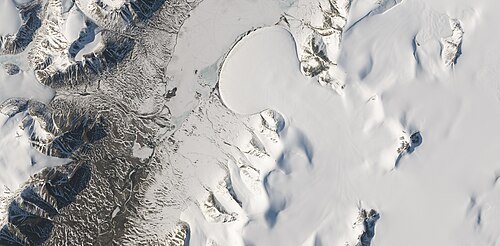 ランドサット 8 号が捉えた、地球の北極にあるローマー湖のエレファント フット氷河。この写真には、火星にある氷河だと考えられている多くの地形と同じ形をした複数の氷河が写っています。
 -
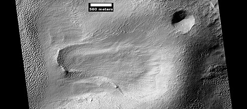 HiWish プログラムの HiRISE で撮影された、おそらく氷河であった流動特性
 -
 HiWish プログラムの HiRISE で撮影された流れの尾根。尾根はおそらく古い氷河の端に形成されたものと思われます。
 -
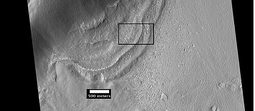 流れの特徴または氷河の端の次の画像のコンテキスト。場所はヘラス四角形です。
 -
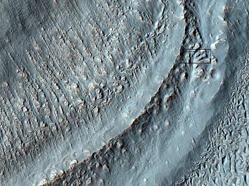 前の画像のボックス内の領域のクローズアップ。これは氷河の末端モレーンと呼ばれることもあります。スケールとして、ボックスはフットボール競技場とほぼ同じ大きさを示しています。画像は HiWish プログラムの HiRISE で撮影されました。場所は Hellas 四角形です。
 -
 HiWish プログラムの HiRISE で撮影された、クレーターの縁を流れる物質。側方モレーンにはラベルが付けられています。
 -
 HiWish プログラムによる HiRISE で撮影された氷河。左側の氷河は、氷がかなり失われているため薄くなっています。一方、右側の氷河は厚く、土と岩の薄い層の下にまだ多くの氷が残っています。
 -
 HiWish プログラムの HiRISE が撮影した舌状の氷河。氷河には、現在でも、断熱層である土の下に氷が存在している可能性があります。
 -
 HiWish プログラムの HiRISE が捉えた舌状氷河のクローズアップ。解像度は約 1 メートルなので、この画像では数メートルの幅の物体を見ることができます。氷河には、今日でも、断熱層である土の下に氷が存在している可能性があります。
 -
 HiWish プログラムの HiRISE が捉えた、矢印で示された舌状氷河
 -
 HiWish プログラムの HiRISE が撮影した氷河の先端のクローズアップ画像。中央の高い多角形が見えます。ボックスはフットボール競技場のサイズを示しています。
 -
 HiWish プログラムの HiRISE が撮影した、氷河近くの高中心ポリゴンのクローズアップ画像
 -
 HiWish プログラムの HiRISE が撮影した、氷河近くの高中心ポリゴンのクローズアップ画像
 -
 HiWish プログラムの HiRISE が撮影した、氷河近くの高中心ポリゴンのクローズアップ画像。ボックスはフットボール競技場のサイズを示しています。
 -
 HiWish プログラムの HiRISE が撮影した、氷河近くの高中心ポリゴンのクローズアップ画像
 -
 HiWish プログラムの HiRISE が撮影した舌状氷河
 -
 HiWish プログラムの HiRISE で観測された舌状の流れの広域画像
 -
 HiWish プログラムの HiRISE で撮影された舌状の流れのクローズアップ画像
 -
 HiWish プログラムの HiRISE で観測された、舌状の流れと多角形の地形 (ラベル付き) のクローズ アップ画像
 -
 HiWish プログラムの HiRISE で撮影された、舌状の流れの近くの多角形地形のクローズアップ画像
 -
 HiWish プログラムの HiRISE で撮影された、氷河の動きによって生じた溝
 -
 HiWish プログラムの HiRISE が撮影したポリゴンのクローズアップ カラー画像。ポリゴンは氷の多い地面でよく見られます。
 -
 HiRISE が捉えた、火口壁を下る舌状の流れ
チャンネル
火星の川の谷にはかつて水が流れていたという膨大な証拠がある。[60] [61] 1970年代初頭に火星探査機マリナー9号が撮影した画像には、湾曲した水路の画像が見られる。[62] [63] [64] [65] 実際、2017年6月に発表された研究では、火星のすべての水路を刻むために必要な水の量は、火星にかつてあったとされる海よりもさらに多かったと計算されている。火星の周囲では、水は海から何度も循環して雨となっていたと考えられる。[66] [67]
-
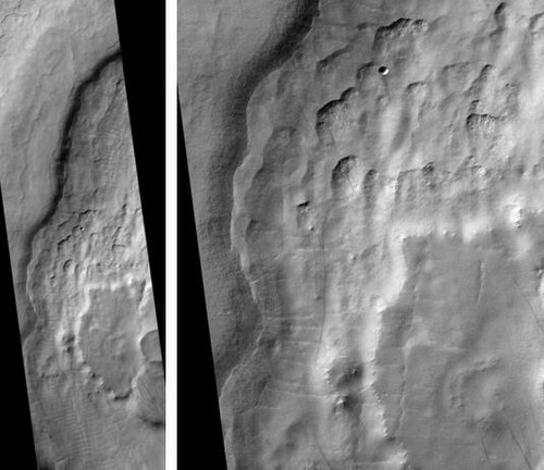 HiRISE から見たマッド・ヴァリス。右の写真は他の写真の一部を拡大したものです。
 -
 HiWish プログラムで HiRISE が見たチャンネル
 -
 HiWish プログラムの HiRISE が見た、古い川の谷の流線型の形状。流線型の形状は、水が流れている証拠です。
 -
 HiWish プログラムで HiRISE が見たチャンネル
 -
 HiWish プログラムで HiRISE が見たチャンネル
 -
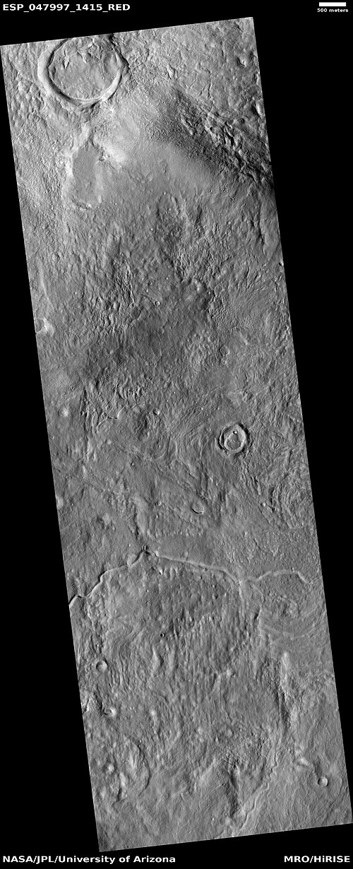 HiWish プログラムで HiRISE が見たチャンネル
-
 HiWish プログラムの HiRISE から見た小規模チャネルの広い視野
 -
 HiWish プログラムで HiRISE が見たチャネルのクローズ アップ ビュー
-
 HiWish プログラムの HiRISE から見たチャネル ネットワークの広域図。中央の色の帯の幅は約 1 km です。
 -
 HiWish プログラムにおける HiRISE から見たチャネル ネットワーク
 -
 HiWish プログラムで HiRISE が見た谷
 -
 HiWish プログラムの HiRISE が観測した水路。矢印は蛇行の証拠を示しています。
 -
 HiWish プログラムの HiRISE によって観測された、マントル層に起源を持つと思われる小さなチャネルのクローズアップ画像
 -
 HiWish プログラムで HiRISE が見たチャンネル
レイヤー
火星の多くの場所では、岩石が層状に並んでいます。岩石はさまざまな方法で層を形成します。火山、風、水などが層を形成します。[68]火星の多くの例を含む層構造の詳細な議論は、火星の堆積性地質学 に記載されています。[69]
-
 HiWish プログラムで HiRISE が見たレイヤー
 -
 HiWish プログラムで HiRISE が見たレイヤー
 -
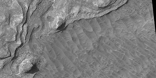 HiWish プログラムの HiRISE で見た地層のクローズアップ画像。画像には岩も写っています。
 -
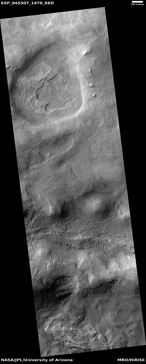 HiWish プログラムの HiRISE で見た、層の広い視野
 -
 HiWish プログラムの HiRISE が撮影したクレーター内の層状堆積物のクローズアップ画像
 -
 HiWish プログラムの HiRISE で見た層のクローズアップ画像
 -
 Layered formation, as seen by HiRISE under HiWish program
 -
 Close view of layers from previous image, as seen by HiRISE under HiWish program
 -
 Layers, as seen by HiRISE under HiWish program
 -
 Wide view of layers, as seen by HiRISE under HiWish program
 -
 Channel of a gully indicated with arrows. Picture enlarged from previous image.
 -
 Close view of layers, as seen by HiRISE under HiWish program
-
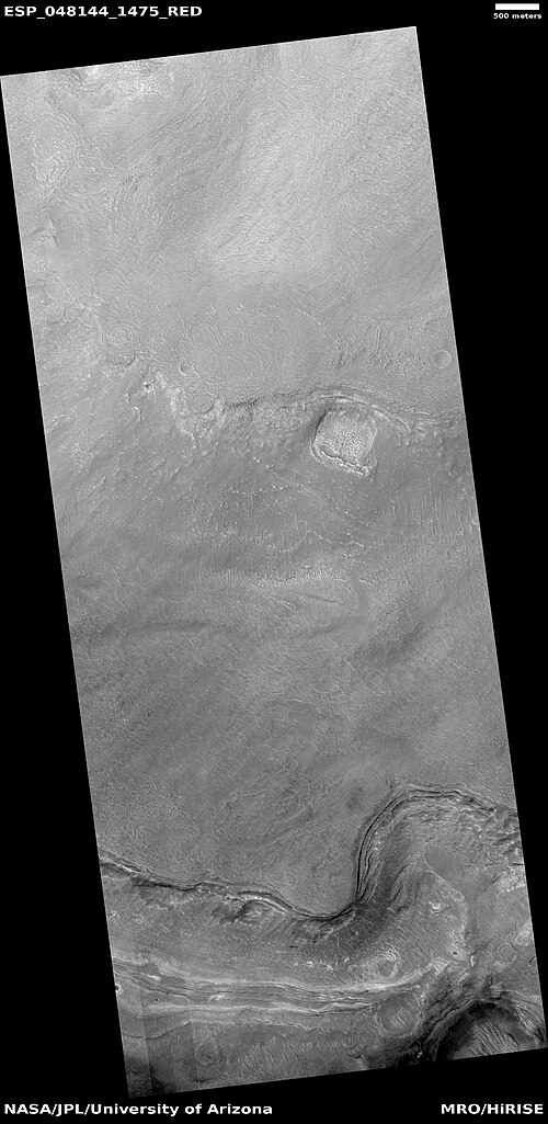 Wide view of layers, as seen by HiRISE under HiWish program
 -
 Close view of layers, as seen by HiRISE under HiWish program
 -
 Close view of layers, as seen by HiRISE under HiWish program. Some of the layers are breaking up into large blocks.
 -
 Close view of layers, as seen by HiRISE under HiWish program. Some of the layers are breaking up into large blocks.
 -
 Layers, as seen by HiRISE under HiWish program
-
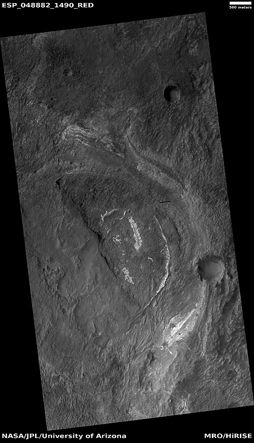 Layers, as seen by HiRISE under HiWish program. Some layers are light-toned which means that they may have been associated with water.
 -
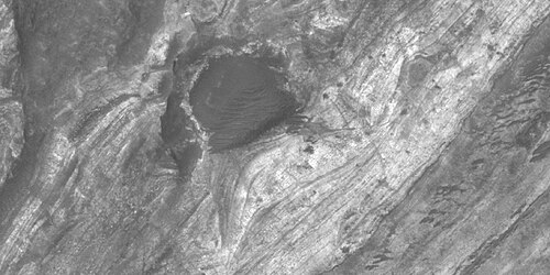 Close view of layers, as seen by HiRISE under HiWish program. Some layers are light-toned which means that they may have been associated with water.
 -
 Close view of light-toned materials, as seen by HiRISE under HiWish program. Light-toned materials have been associated with water.
-
 Wide view of light and dark toned layers, as seen by HiRISE under HiWish program
 -
 Close view of light and dark toned layers, as seen by HiRISE under HiWish program
 -
 Close view of light and dark toned layers, as seen by HiRISE under HiWish program
 -
 Close, color view of layers, as seen by HiRISE under HiWish program. The different colors represent different minerals.
-
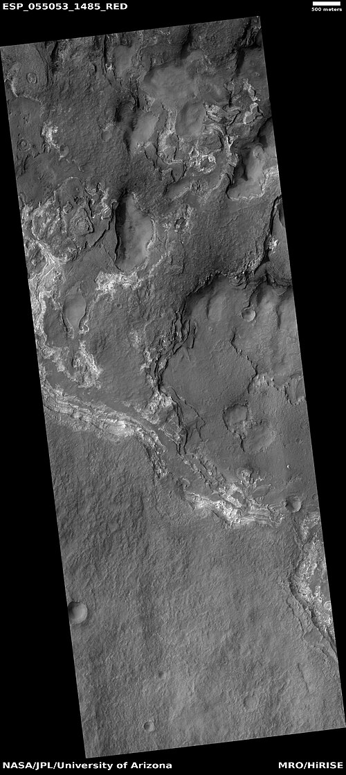 Wide view of light and dark toned layers, as seen by HiRISE under HiWish program
 -
 Close, color view of layers, as seen by HiRISE under HiWish program. The different colors represent different minerals.
 -
 Close, color view of layers, as seen by HiRISE under HiWish program
-
 Wide view of layers in mounds, as seen by HiRISE under HiWish program
 -
 Close view of layers in mound, as seen by HiRISE under HiWish program
Honeycomb terrain
These relatively flat-lying "cells" appear to have concentric layers or bands, similar to a honeycomb. This "honeycomb" terrain was first discovered in the northwestern part of Hellas.[70] The geologic process responsible for creating these features remains unresolved.[71] Some calculations indicate that this formation may have been caused by ice moving up through the ground in this region. The ice layer would have been between 100 m and 1 km thick.[72][73][70] When one substance moves up through another denser substance, it is called a diapir. So, it seems that large masses of ice have pushed up layers of rock into domes that were eroded. After erosion removed the top of the layered domes, circular features remained.
Diapirs are thought to be responsible for features on Neptune's moon Triton, Jupiter's moon Europa, Saturn's moon Enceladus, and Uranus's moon Miranda.[74]
-
 Concentric bands and layers that has been called "honeycomb terrain". Picture was taken by HiRISE under the HiWish program.
 -
 Circular layers, as seen by HiRISE under HiWish program
 -
 layers and ridges that form strange patterns, as seen by HiRISE under HiWish program
 -
 Close view of ridges forming strange patterns, as seen by HiRISE under HiWish program
-
 Honeycomb terrain, as seen by HiRISE under HiWish program
 -
 Close, color view of honeycomb terrain, as seen by HiRISE under HiWish program
 -
 Close view of honeycomb terrain, as seen by HiRISE under HiWish program
 -
 Close view of honeycomb terrain, as seen by HiRISE under HiWish program. This enlargement shows material breaking up into blocks. Arrow indicates a cube-shaped block.
 -
 Ridges, as seen by HiRISE under HiWish program
 -
 Close view of concentric and parallel ridges, as seen by HiRISE under HiWish program
 -
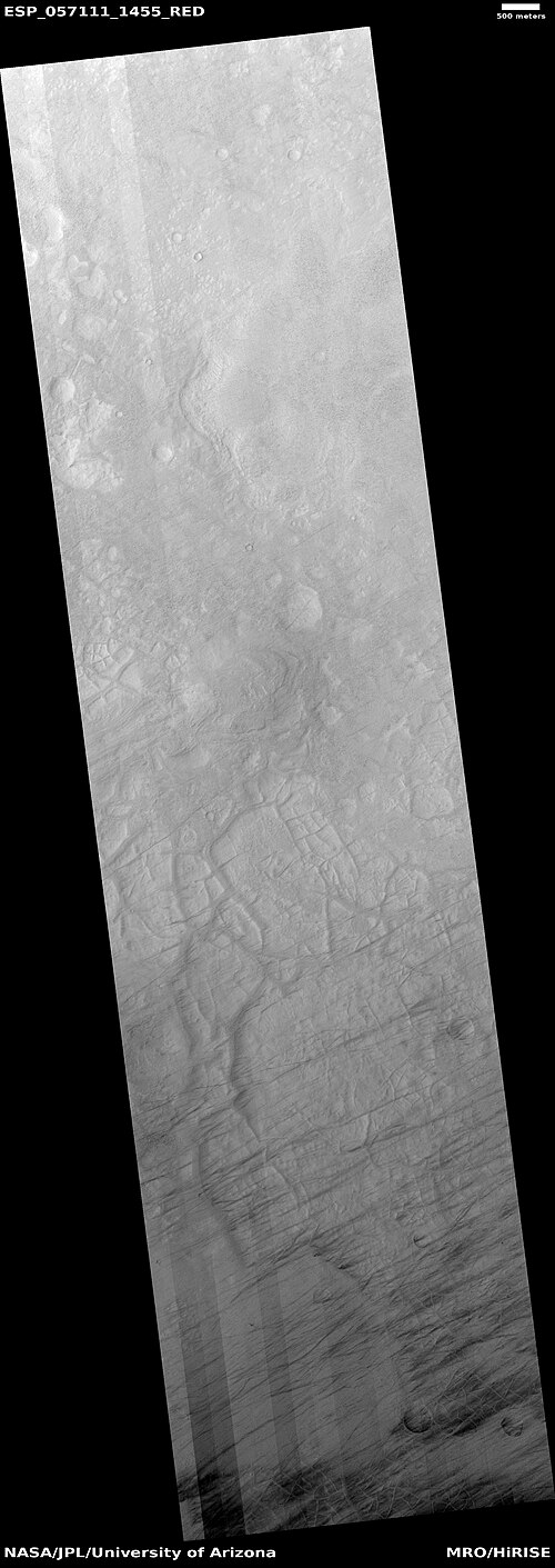 Wide view of ridge network, as seen by HiRISE under HiWish program
 -
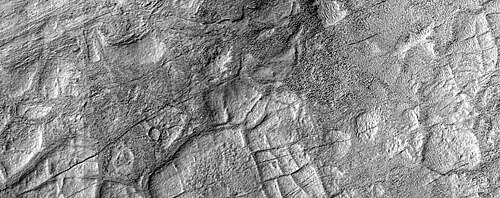 Close view of ridge network, as seen by HiRISE under HiWish program
 -
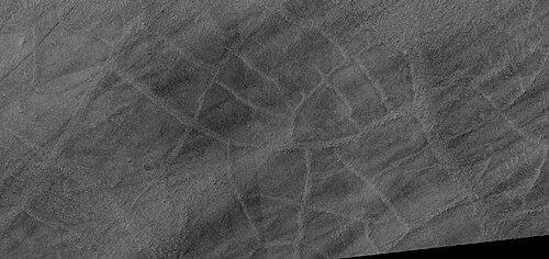 Close view of ridge network, as seen by HiRISE under HiWish program
Gullies
Gullies occur on steep slopes, especially on the walls of craters. Gullies are believed to be relatively young because they have few, if any craters. Moreover, they lie on top of sand dunes which themselves are considered to be quite young. Usually, each gully has an alcove, channel, and apron. Some studies have found that gullies occur on slopes that face all directions,[75] others have found that the greater number of gullies are found on poleward facing slopes, especially from 30-44 S.[76]
For years, many believed that gullies were formed by running water, but further observations demonstrate that they may be formed by dry ice. Recent studies describe using the High Resolution Imaging Science Experiment (HiRISE) camera on MRO to examine gullies at 356 sites, starting in 2006. Thirty-eight of the sites showed active gully formation. Before-and-after images demonstrated the timing of this activity coincided with seasonal carbon dioxide frost and temperatures that would not have allowed for liquid water. When dry ice frost changes to a gas, it may lubricate dry material to flow especially on steep slopes.[77][78][79] In some years frost, perhaps as thick as 1 meter, triggers avalanches. This frost contains mostly dry ice, but also has tiny amounts of water ice.[80]
-
 Gullies in crater, as seen by HiRISE under HiWish program
 -
 Close view of gullies in crater, as seen by HiRISE under HiWish program. Polygons are visible in this close view.
 -
 Wide view of layers and gullies, as seen by HiRISE under HiWish program. Arrows point to small gullies.
 -
 Close view of small gully, as seen by HiRISE under HiWish program
 -
 Wide view of gullies, as seen by HiRISE under HiWish program
 -
 Close, color view of gullies, as seen by HiRISE under HiWish program
 -
 Close view of gullies, as seen by HiRISE under HiWish program. Curves in channels are evidence that these gullies were not created by landslides.
 -
 Wide view of gullies, as seen by HiRISE. The gullies range from very samll to large, as such they may represent different stages in the formation of gullies. The colored strip is about 1 km wide.
 -
 Gullies, as seen by HiRISE. The gullies range from very samll to large, as such they may represent different stages in the formation of gullies. The colored strip is about 1 km wide.
 -
 Small gully This gully may be in its initial state of formation.
 -
 Gully, as seen by HiRISE
 -
 Wide view of gullies
 -
 Close view of gully alcoves Picture is about 1 km across.
 -
 Close view of gully alcoves Picture is about 1 km across.
 -
 Close view of gully channels Picture is about 1 km across.
Polygons
Some surfaces on Mars display polygons. These may be of different sizes. Polygons are an example of patterned ground. Polygonal, patterned ground is quite common in some regions of Mars.[81][82][83][84][85][86][87]
-
 Group of polygons, as seen by HiRISE under HiWish program
 -
 Patterned ground in Hellas, as seen by HiRISE under HiWish program. The rectangle shows the size of a football field.
-
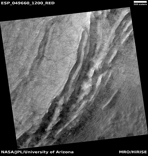 Wide view of polygons, as seen by HiRISE under HiWish program. Parts of this image are enlarged in following images.
 -
 Polygons, as seen by HiRISE under HiWish program
 -
 Close view of polygons, as seen by HiRISE under HiWish program. Arrow point to boulders that sit inside of small craters.
 -
 Close view of polygons, as seen by HiRISE under HiWish program
 -
 Close view of polygons, as seen by HiRISE under HiWish program
Exposed ice sheets
Thick deposits of ice were found by a team of researchers using instruments on board the Mars Reconnaissance Orbiter (MRO).[88] The scientists found eight eroding slopes showing exposed water ice sheets as thick as 100 meters. Seven of the locations were in the southern hemisphere. Much evidence of buried ice under the ground on vast regions of Mars has already been found by past studies, but this study found that the ice was only covered by a layer of about 1 or 2 meters thick of soil.[89][90][91] Shane Byrne of the University of Arizona Lunar and Planetary Laboratory, Tucson, one of the co-authors remarked that future colonists of the Red Planet would be able to gather up ice with just a bucket and shovel.[92] The layered ice is exposed in triangular shaped depressions. One wall is very steep and faces the pole. The fact that water-ice makes up the layers was confirmed by Compact Reconnaissance Imaging Spectrometer for Mars (CRISM) on board the Mars Reconnaissance Orbiter (MRO). The spectra gathered by CRISM showed strong signals of water.[93] The layers are especially prominent in depressions in Hellas quadrangle as shown in the enlarged views below.
-
![Wide view of triangular depression, as seen by HiRISE The colored strip shows the part of the image that can be seen in color. The wall at the top of the depression contains pure ice. This wall faces the south pole. Location is Hellas quadrangle.[94]](https://img-server.japedia.wiki/wikipedia/commons/thumb/5/5e/PIA22078_hireswideview.jpg/500px-PIA22078_hireswideview.jpg) Wide view of triangular depression, as seen by HiRISE The colored strip shows the part of the image that can be seen in color. The wall at the top of the depression contains pure ice. This wall faces the south pole. Location is Hellas quadrangle.[94]
Wide view of triangular depression, as seen by HiRISE The colored strip shows the part of the image that can be seen in color. The wall at the top of the depression contains pure ice. This wall faces the south pole. Location is Hellas quadrangle.[94] -
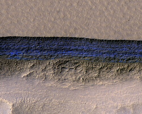 Close, color view of wall containing ice from previous image, as seen by HiRISE
-
![Wide view of triangular depression, as seen by HiRISE. The wall which faces the south pole contains ice in distinct layers that are visible in next image. Location is Hellas quadrangle.[94]](https://img-server.japedia.wiki/wikipedia/commons/thumb/8/8c/ESP_050345_1230icelayersangles.jpg/500px-ESP_050345_1230icelayersangles.jpg) Wide view of triangular depression, as seen by HiRISE. The wall which faces the south pole contains ice in distinct layers that are visible in next image. Location is Hellas quadrangle.[94]
Wide view of triangular depression, as seen by HiRISE. The wall which faces the south pole contains ice in distinct layers that are visible in next image. Location is Hellas quadrangle.[94] -
![Close view of wall of triangular depression, as seen by HiRISE layers are visible in the wall. The lower layers are tilted, while layers near the surface are more or less horizontal. Such an arrangement of layers is called an "angular unconformity."[94]](https://img-server.japedia.wiki/wikipedia/commons/thumb/7/7e/50345_1230icelayersangular.jpg/500px-50345_1230icelayersangular.jpg) Close view of wall of triangular depression, as seen by HiRISE layers are visible in the wall. The lower layers are tilted, while layers near the surface are more or less horizontal. Such an arrangement of layers is called an "angular unconformity."[94]
Close view of wall of triangular depression, as seen by HiRISE layers are visible in the wall. The lower layers are tilted, while layers near the surface are more or less horizontal. Such an arrangement of layers is called an "angular unconformity."[94] -
![Wide view of triangular depression, as seen by HiRISE. The wall which faces the south pole contains ice in distinct layers that are visible in next image. Location is Hellas quadrangle.[94]](https://img-server.japedia.wiki/wikipedia/commons/thumb/9/93/ESP_050477_1220icelayers.jpg/500px-ESP_050477_1220icelayers.jpg) Wide view of triangular depression, as seen by HiRISE. The wall which faces the south pole contains ice in distinct layers that are visible in next image. Location is Hellas quadrangle.[94]
Wide view of triangular depression, as seen by HiRISE. The wall which faces the south pole contains ice in distinct layers that are visible in next image. Location is Hellas quadrangle.[94] -
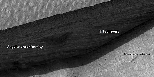 Close view of wall of triangular depression, as seen by HiRISE layers are visible in the wall. The lower layers are tilted, while layers near the surface are more or less horizontal. Such an arrangement of layers is called an "angular unconformity."
Besides being of great value to future explorers, these ice layers could help us better understand the climate history of Mars. They provide a record of the past. The large variations in the tilt of the planet cause dramatic climate variations. Mars does not possess a large moon to keep its tilt stable. Today, ice is concentrated at the poles, with a greater tilt, more ice will exist at mid-latitudes. These climate changes may be able to be measured with study of these layers.
These triangular depressions are similar to those in scalloped terrain. However scalloped terrain, displays a gentle equator-facing slope and is rounded.
Scalloped topography
Scalloped topography is common in the mid-latitudes of Mars, between 45° and 60° north and south. It is particularly prominent in the region of Utopia Planitia,[95][96] in the northern hemisphere, and in the region of Peneus and Amphitrites Paterae[97][98] in the southern hemisphere. Such topography consists of shallow, rimless depressions with scalloped edges, commonly referred to as "scalloped depressions" or simply "scallops". Scalloped depressions can be isolated or clustered and sometimes seem to coalesce. A typical scalloped depression displays a gentle equator-facing slope and a steeper pole-facing scarp.[99] Scalloped depressions are believed to form from the removal of subsurface material, possibly interstitial ice, by sublimation (direct transition of a material from the solid to the gas phase with no intermediate liquid stage). This process may still be happening at present.[100] This topography may be of great importance for future colonization of Mars because it may point to deposits of pure ice.[101]
-
![Stages in scalop formation, as seen by HiRISE. These formations probably form from the sublimation of ground rich in pure water ice many meters in depth.[102]](https://img-server.japedia.wiki/wikipedia/commons/thumb/d/d2/Scalop_formation.jpg/500px-Scalop_formation.jpg) Stages in scalop formation, as seen by HiRISE. These formations probably form from the sublimation of ground rich in pure water ice many meters in depth.[102]
Stages in scalop formation, as seen by HiRISE. These formations probably form from the sublimation of ground rich in pure water ice many meters in depth.[102] -
 Scalloped terrain, as seen by HiRISE under HIWish program. Dust devil tracks are also visible.
Pits
Some places on Mars display pits. It is believed that a void was created and material collapsed into the pits. These pits are probably most commonly formed when ice leaves the ground thereby creating a void. In the thin atmosphere of Mars, ice will sublimate, especially if a crack occurs. Sublimation is when a solid turns directly into a gas. Dry ice does this on the Earth. Some pits are associated with cracks in the surface.[103][104][105][106][107]
-
 Wide view of pits, as seen by HiRISE under HIWish program
 -
 Close view of pits, as seen by HiRISE under HIWish program. The box shows the size of the pits. Some pits are as wide as a football field is long.
-
 Wide view of pits and dust devil tracks, as seen by HiRISE under HiWish program
 -
 Close view of pits as seen by HiRISE under HiWish program. Box shows size of football field. Pits in image may be around 10–20 meters across.
 -
 Pits, as seen by HiRISE under HIWish program
Additional images
-
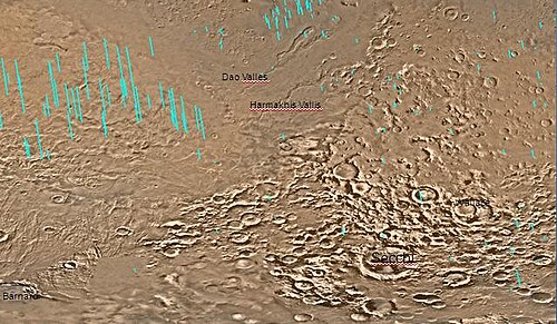 Hellas quadrangle map showing two large river valleys that slope left, toward the floor of the crater
 -
 Field of hollows, as seen by HiRISE under HiWish program
 -
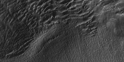 Surface features, as seen by HiRISE under HiWish program
 -
 Hollows on floor of Reull Vallis, as seen by HiRISE under HiWish program
 -
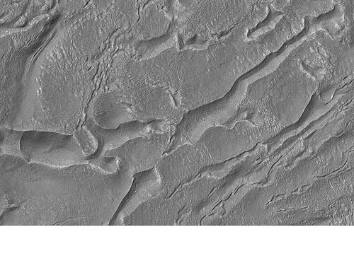 Banded or taffy-pull terrain in Hellas, as seen by Mars Global Surveyor. Origin is unknown at present.
 -
 Centauri Montes, as seen by HiRISE. Scale bar is 500 meters long. The original enlargement of the image at the left is full of rich detail on all parts of the picture.
 -
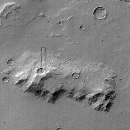 Ausonia Mensa, as seen by MGS, under the MOC Public Targeting Program. This eroded mensa has many channels.
 -
Stages in scalop formation, as seen by HiRISE. These formations probably form from the sublimation of ground rich in pure water ice many meters in depth.[102]
-
 Possible dike and troughs, as seen by HiRISE under HiWish program The arrows point to the possible dike along the left edge of picture. Straight features are rare in nature; they are often due to dikes and joints.
 -
 Odd shapes, as seen by HiRISE under HiWish program. Part of this image is enlarged in next image.
 -
 Ridges forming from cracks, as seen by HiRISE under HiWish program. Box in upper left shows size of football field.
 -
 Dunes, as seen by HiRISE under HiWish program
 -
 Wide view of brain terrain, as seen by HiRISE under HiWish program
 -
 Close, side view of brain terrain from previous image, as seen by HiRISE under HiWish program
-
 Out of place rock, as seen by HiRISE under HiWish program The arrow points to a large rock that is definitely out of place. It may be a meteorite or it may have been tossed here by a nearby impact.
 -
 Close view of out of place rock, as seen by HiRISE under HiWish program. It may be a meteorite or it may have been tossed here by a nearby impact.
Other Mars quadrangles
Interactive Mars map
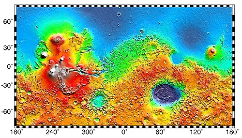
 Interactive image map of the global topography of Mars. Hover your mouse over the image to see the names of over 60 prominent geographic features, and click to link to them. Coloring of the base map indicates relative elevations, based on data from the Mars Orbiter Laser Altimeter on NASA's Mars Global Surveyor. Whites and browns indicate the highest elevations (+12 to +8 km); followed by pinks and reds (+8 to +3 km); yellow is 0 km; greens and blues are lower elevations (down to −8 km). Axes are latitude and longitude; Polar regions are noted.
 (See also: Mars Rovers map and Mars Memorial map) (view • discuss)
See also
- Brain terrain
- Climate of Mars
- Diapir
- Dust devil tracks
- Geology of Mars
- Glacier
- Glaciers on Mars
- HiRISE
- HiWish program
- Impact crater
- Latitude dependent mantle
- Lakes on Mars
- Lineated valley fill
- List of quadrangles on Mars
- Lobate debris apron
- Martian Gullies
- Ore resources on Mars
- Pedestal crater
- Phoenix (spacecraft)
- Polygonal patterned ground
- Scalloped topography
- Upper Plains Unit
- Vallis
- Water on Mars
References
- ^ Davies, M.E.; Batson, R.M.; Wu, S.S.C. (1992). "Geodesy and Cartography". In Kieffer, H.H.; Jakosky, B.M.; Snyder, C.W.; et al. (eds.). Mars. Tucson: University of Arizona Press. ISBN 978-0-8165-1257-7.
- ^ a b c d Carr, Michael H. (2006). The Surface of Mars. Cambridge University Press. p. [page needed]. ISBN 978-0-521-87201-0.
- ^ a b Moore, J; Wilhelms, Don E. (2001). "Hellas as a possible site of ancient ice-covered lakes on Mars". Icarus. 154 (2): 258–276. Bibcode:2001Icar..154..258M. doi:10.1006/icar.2001.6736. hdl:2060/20020050249. S2CID 122991710.
- ^ Cabrol, N. and E. Grim (eds). 2010. Lakes on Mars
- ^ a b c Martian Weather Observation Archived 2008-05-31 at the Wayback Machine MGS radio science measured 11.50 mbar at 34.4° S 59.6° E -7152 meters.
- ^ http://hirise.lpl.arizonai.edu/P/sP_008559_1405[permanent dead link]
- ^ Voelker, M., et al. 2016. DISTRIBUTION AND EVOLUTION OF LACUSTRINE AND FLUVIAL FEATURES IN HELLAS PLANITIA, MARS, BASED ON PRELIMINARY RESULTS OF GRID-MAPPING. 47th Lunar and Planetary Science Conference (2016) 1228.pdf.
- ^ Kargel, J.; Strom, R. (1991). "Terrestrial glacial eskers: analogs for martian sinuous ridges" (PDF). LPSC. XXII: 683–684. Bibcode:1991LPI....22..683K.
- ^ Head, JW; Neukum, G; Jaumann, R; Hiesinger, H; Hauber, E; Carr, M; Masson, P; Foing, B; et al. (2005). "Tropical to mid-latitude snow and ice accumulation, flow and glaciation on Mars". Nature. 434 (7031): 346–350. Bibcode:2005Natur.434..346H. doi:10.1038/nature03359. PMID 15772652. S2CID 4363630.
- ^ "Mars' climate in flux: Mid-latitude glaciers | Mars Today - Your Dail…". Archived from the original on 5 December 2012.
- ^ "Glaciers Reveal Martian Climate Has Been Recently Active".
- ^ Plaut, Jeffrey J.; Safaeinili, Ali; Holt, John W.; Phillips, Roger J.; Head, James W.; Seu, Roberto; Putzig, Nathaniel E.; Frigeri, Alessandro (2009). "Radar Evidence for Ice in Lobate Debris Aprons in the Mid-Northern Latitudes of Mars" (PDF). Geophysical Research Letters. 36 (2): n/a. Bibcode:2009GeoRL..36.2203P. doi:10.1029/2008GL036379. S2CID 17530607.
- ^ Holt, J.W.; Safaeinili, A.; Plaut, J. J.; Young, D. A.; Head, J. W.; Phillips, R. J.; Campbell, B. A.; Carter, L. M.; Gim, Y.; Seu, R.; Sharad Team (2008). "Radar Sounding Evidence for Ice within Lobate Debris Aprons near Hellas Basin, Mid-Southern Latitudes of Mars" (PDF). Lunar and Planetary Science. XXXIX (1391): 2441. Bibcode:2008LPI....39.2441H.
- ^ Holt, J. W.; Safaeinili, A.; Plaut, J. J.; Head, J. W.; Phillips, R. J.; Seu, R.; Kempf, S. D.; Choudhary, P.; et al. (2008). "Radar Sounding Evidence for Buried Glaciers in the Southern Mid-Latitudes of Mars". Science. 322 (5905): 1235–8. Bibcode:2008Sci...322.1235H. doi:10.1126/science.1164246. hdl:11573/67950. PMID 19023078. S2CID 36614186.
- ^ "Reull Vallis (Released 22 October 2002) | Mars Odyssey Mission THEMIS". Archived from the original on 2010-06-17. Retrieved 2010-12-19.
- ^ MLA NASA/Jet Propulsion Laboratory (December 18, 2003). "Mars May Be Emerging From An Ice Age". ScienceDaily. Retrieved February 19, 2009.
- ^ Carr, M. 2001.
- ^ Blanc, E., et al. 2024. ORIGIN OF WIDESPREAD LAYERED DEPOSITS ASSOCIATED WITH MARTIAN DEBRIS COVERED GLACIERS. 55th LPSC (2024). 1466.pdf
- ^ Morgenstern, A., et al. 2007
- ^ a b Baker, D., J. Head. 2015. Extensive Middle Amazonian mantling of debris aprons and plains in Deuteronilus Mensae, Mars: Implication for the record of mid-latitude glaciation. Icarus: 260, 269-288.
- ^ Mangold, N (2003). "Geomorphic analysis of lobate debris aprons on Mars at Mars Orbiter Camera scale: Evidence for ice sublimation initiated by fractures". J. Geophys. Res. 108 (E4): 8021. Bibcode:2003JGRE..108.8021M. doi:10.1029/2002je001885.
- ^ Levy, J. et al. 2009. Concentric
- ^ Bright Chunks at Phoenix Lander's Mars Site Must Have Been Ice Archived 2016-03-04 at the Wayback Machine – Official NASA press release (19.06.2008)
- ^ a b "NASA.gov". Archived from the original on 2016-03-04. Retrieved 2015-08-31.
- ^ Byrne, S. et al. 2009. Distribution of Mid-Latitude Ground Ice on Mars from New Impact Craters: 329.1674-1676
- ^ Smith, P., et al. 2009. H2O at the Phoenix Landing Site. Science: 325, 58-61.
- ^ Head, J. et al. 2003.
- ^ Madeleine, et al. 2014.
- ^ Schon; et al. (2009). "A recent ice age on Mars: Evidence for climate oscillations from regional layering in mid-latitude mantling deposits". Geophys. Res. Lett. 36 (15): L15202. Bibcode:2009GeoRL..3615202S. doi:10.1029/2009gl038554.
- ^ Touma, J.; Wisdom, J. (1993). "The Chaotic Obliquity of Mars". Science. 259 (5099): 1294–1297. Bibcode:1993Sci...259.1294T. doi:10.1126/science.259.5099.1294. PMID 17732249. S2CID 42933021.
- ^ a b Laskar, J.; Correia, A.; Gastineau, M.; Joutel, F.; Levrard, B.; Robutel, P. (2004). "Long term evolution and chaotic diffusion of the insolation quantities of Mars" (PDF). Icarus. 170 (2): 343–364. Bibcode:2004Icar..170..343L. doi:10.1016/j.icarus.2004.04.005. S2CID 33657806.
- ^ Levy, J.; Head, J.; Marchant, D.; Kowalewski, D. (2008). "Identification of sublimation-type thermal contraction crack polygons at the proposed NASA Phoenix landing site: Implications for substrate properties and climate-driven morphological evolution". Geophys. Res. Lett. 35 (4): L04202. Bibcode:2008GeoRL..35.4202L. doi:10.1029/2007GL032813. S2CID 1321019.
- ^ Levy, J.; Head, J.; Marchant, D. (2009). "Thermal contraction crack polygons on Mars: Classification, distribution, and climate implications from HiRISE observations". J. Geophys. Res. 114 (E1): E01007. Bibcode:2009JGRE..114.1007L. doi:10.1029/2008JE003273.
- ^ Hauber, E., D. Reiss, M. Ulrich, F. Preusker, F. Trauthan, M. Zanetti, H. Hiesinger, R. Jaumann, L. Johansson, A. Johnsson, S. Van Gaselt, M. Olvmo. 2011. Landscape evolution in Martian mid-latitude regions: insights from analogous periglacial landforms in Svalbard. In: Balme, M., A. Bargery, C. Gallagher, S. Guta (eds). Martian Geomorphology. Geological Society, London. Special Publications: 356. 111-131
- ^ Mellon, M.; Jakosky, B. (1995). "The distribution and behavior of Martian ground ice during past and present epochs". J. Geophys. Res. 100 (E6): 11781–11799. Bibcode:1995JGR...10011781M. doi:10.1029/95je01027. S2CID 129106439.
- ^ Schorghofer, N (2007). "Dynamics of ice ages on Mars". Nature. 449 (7159): 192–194. Bibcode:2007Natur.449..192S. doi:10.1038/nature06082. PMID 17851518. S2CID 4415456.
- ^ Madeleine, J., F. Forget, J. Head, B. Levrard, F. Montmessin. 2007. Exploring the northern mid-latitude glaciation with a general circulation model. In: Seventh International Conference on Mars. Abstract 3096.
- ^ "Dao Vallis | Mars Odyssey Mission THEMIS".
- ^ NASA.gov
- ^ "Mars Exploration: Features". Archived from the original on 2011-10-28. Retrieved 2012-01-19.
- ^ Reiss, D.; et al. (2011). "Multitemporal observations of identical active dust devils on Mars with High Resolution Stereo Camera (HRSC) and Mars Orbiter Camera (MOC)". Icarus. 215 (1): 358–369. Bibcode:2011Icar..215..358R. doi:10.1016/j.icarus.2011.06.011.
- ^ "How tall is a tornado?". 23 February 2023.
- ^ Malin, M. C.; Edgett, K. S.; Posiolova, L. V.; McColley, S. M.; Dobrea, E. Z. N. (2006). "Present-Day Impact Cratering Rate and Contemporary Gully Activity on Mars". Science. 314 (5805): 1573–1577. Bibcode:2006Sci...314.1573M. doi:10.1126/science.1135156. PMID 17158321. S2CID 39225477.
- ^ McEwen, AS; Hansen, CJ; Delamere, WA; Eliason, EM; Herkenhoff, KE; Keszthelyi, L; Gulick, VC; Kirk, RL; et al. (2007). "A Closer Look at Water-Related Geologic Activity on Mars". Science. 317 (5845): 1706–1709. Bibcode:2007Sci...317.1706M. doi:10.1126/science.1143987. PMID 17885125. S2CID 44822691.
- ^ "Stones, Wind, and Ice: A Guide to Martian Impact Craters".
- ^ Kieffer, Hugh H. (1992). Mars. Tucson: University of Arizona Press. pp. [, page needed], . ISBN 0-8165-1257-4.
- ^ S.J. Kadish, J.W. Head. 2011. Impacts into non-polar ice-rich paleodeposits on Mars: excess ejecta craters, perched craters and pedestal craters as clues to Amazonian climate history. Icarus, 215, pp. 34-46
- ^ S.J. Kadish, J.W. Head. 2014. The ages of pedestal craters on Mars: evidence for a late Amazonian extended periodic emplacement of decameters-thick mid-latitude ice deposits. Planet. Space Sci., 91, pp. 91-100
- ^ a b "The Surface of Mars" Series: Cambridge Planetary Science (No. 6) ISBN 978-0-511-26688-1 Michael H. Carr, United States Geological Survey, Menlo Park
- ^ Hugh H. Kieffer (1992). Mars. University of Arizona Press. ISBN 978-0-8165-1257-7. Retrieved March 7, 2011.
- ^ Milliken, R. E.; Mustard, J. F.; Goldsby, D. L. (2003). "Viscous flow features on the surface of Mars: Observations from high-resolution Mars Orbiter Camera (MOC) images". Journal of Geophysical Research. 108 (E6): 5057. Bibcode:2003JGRE..108.5057M. doi:10.1029/2002je002005. S2CID 12628857.
- ^ Squyres, S.W.; Carr, M.H. (1986). "Geomorphic evidence for the distribution of ground ice on Mars". Science. 213 (4735): 249–253. Bibcode:1986Sci...231..249S. doi:10.1126/science.231.4735.249. PMID 17769645. S2CID 34239136.
- ^ Head, J.W.; Marchant, D.R.; Dickson, J.L.; Kress, A.M. (2010). "Criteria for the recognition of debris-covered glacier and valley glacier landsystem deposits". Earth Planet. Sci. Lett. 294 (3–4): 306–320. Bibcode:2010E&PSL.294..306H. doi:10.1016/j.epsl.2009.06.041.
- ^ Holt, J.W.; et al. (2008). "Radar sounding evidence for buried glaciers in the southern mid-latitudes of Mars". Science. 322 (5905): 1235–1238. Bibcode:2008Sci...322.1235H. doi:10.1126/science.1164246. hdl:11573/67950. PMID 19023078. S2CID 36614186.
- ^ Morgan, G.A.; Head, J.W.; Marchant, D.R. (2009). "Lineated valley fill (LVF) and lobate debris aprons (LDA) in the Deuteronilus Mensae northern dichotomy boundary region, Mars: Constraints on the extent, age and episodicity of Amazonian glacial events". Icarus. 202 (1): 22–38. Bibcode:2009Icar..202...22M. doi:10.1016/j.icarus.2009.02.017.
- ^ Plaut, J.J.; Safaeinili, A.; Holt, J.W.; Phillips, R.J.; Head, J.W.; Sue, R.; Putzig, A. (2009). "Frigeri Radar evidence for ice in lobate debris aprons in the mid-northern latitudes of Mars". Geophys. Res. Lett. 36 (2): L02203. Bibcode:2009GeoRL..36.2203P. doi:10.1029/2008gl036379. S2CID 17530607.
- ^ Baker, D.M.H.; Head, J.W.; Marchant, D.R. (2010). "Flow patterns of lobate debris aprons and lineated valley fill north of Ismeniae Fossae, Mars: Evidence for extensive mid-latitude glaciation in the Late Amazonian". Icarus. 207 (1): 186–209. Bibcode:2010Icar..207..186B. doi:10.1016/j.icarus.2009.11.017.
- ^ Arfstrom, J. (2005). "Terrestrial analogs and interrelationships". Icarus. 174 (2): 321–335. Bibcode:2005Icar..174..321A. doi:10.1016/j.icarus.2004.05.026.
- ^ Forget, F., et al. 2006. Formation of Glaciers on Mars by Atmospheric Precipitation at High Obliquity. Science: 311, 368-371.
- ^ Baker, V.; et al. (2015). "Fluvial geomorphology on Earth-like planetary surfaces: a review". Geomorphology. 245: 149–182. Bibcode:2015Geomo.245..149B. doi:10.1016/j.geomorph.2015.05.002. PMC 5701759. PMID 29176917.
- ^ Carr, M. 1996. in Water on Mars. Oxford Univ. Press.
- ^ Baker, V. 1982. The Channels of Mars. Univ. of Tex. Press, Austin, TX
- ^ Baker, V.; Strom, R.; Gulick, V.; Kargel, J.; Komatsu, G.; Kale, V. (1991). "Ancient oceans, ice sheets and the hydrological cycle on Mars". Nature. 352 (6336): 589–594. Bibcode:1991Natur.352..589B. doi:10.1038/352589a0. S2CID 4321529.
- ^ Carr, M (1979). "Formation of Martian flood features by release of water from confined aquifers". J. Geophys. Res. 84: 2995–300. Bibcode:1979JGR....84.2995C. doi:10.1029/jb084ib06p02995.
- ^ Komar, P (1979). "Comparisons of the hydraulics of water flows in Martian outflow channels with flows of similar scale on Earth". Icarus. 37 (1): 156–181. Bibcode:1979Icar...37..156K. doi:10.1016/0019-1035(79)90123-4.
- ^ "How Much Water Was Needed to Carve Valleys on Mars? - SpaceRef". 5 June 2017.[permanent dead link]
- ^ Luo, W.; et al. (2017). "New Martian valley network volume estimate consistent with ancient ocean and warm and wet climate". Nature Communications. 8: 15766. Bibcode:2017NatCo...815766L. doi:10.1038/ncomms15766. PMC 5465386. PMID 28580943.
- ^ "HiRISE | High Resolution Imaging Science Experiment". Hirise.lpl.arizona.edu?psp_008437_1750. Retrieved 2012-08-04.
- ^ Grotzinger, J. and R. Milliken (eds.). 2012. Sedimentary Geology of Mars. SEPM.
- ^ a b Bernhardt, H.; et al. (2016). "The honeycomb terrain on the Hellas basin floor, mars: a case for salt or ice diapirism: hellas honeycombs as salt/ice diapirs". J. Geophys. Res. 121 (4): 714–738. Bibcode:2016JGRE..121..714B. doi:10.1002/2016je005007.
- ^ "HiRISE | to Great Depths (ESP_049330_1425)".
- ^ Weiss, D., J. Head. 2017. HYDROLOGY OF THE HELLAS BASIN AND THE EARLY MARS CLIMATE: WAS THE HONEYCOMB TERRAIN FORMED BY SALT OR ICE DIAPIRISM? Lunar and Planetary Science XLVIII. 1060.pdf
- ^ Weiss, D.; Head, J. (2017). "Salt or ice diapirism origin for the honeycomb terrain in Hellas basin, Mars?: Implications for the early martian climate". Icarus. 284: 249–263. Bibcode:2017Icar..284..249W. doi:10.1016/j.icarus.2016.11.016.
- ^ Cassini Imaging Central Laboratory for Operations, Enceladus Rev 80 Flyby: Aug 11 '08 Archived 2016-03-03 at the Wayback Machine. Retrieved 2008-08-15.
- ^ Edgett, K.; Malin, M. C.; Williams, R. M. E.; Davis, S. D. (2003). "Polar-and middle-latitude martian gullies: A view from MGS MOC after 2 Mars years in the mapping orbit" (PDF). Lunar Planet. Sci. 34. p. 1038, Abstract 1038. Bibcode:2003LPI....34.1038E.
- ^ Dickson, J; Head, J; Kreslavsky, M (2007). "Martian gullies in the southern mid-latitudes of Mars: Evidence for climate-controlled formation of young fluvial features based upon local and global topography" (PDF). Icarus. 188 (2): 315–323. Bibcode:2007Icar..188..315D. doi:10.1016/j.icarus.2006.11.020. Archived from the original (PDF) on 2017-07-06. Retrieved 2017-06-30.
- ^ NASA.gov
- ^ "HiRISE | Activity in Martian Gullies (ESP_032078_1420)".
- ^ "Gullies on Mars Carved by Dry Ice, Not Water". Space.com. 16 July 2014.
- ^ "Frosty Gullies on Mars - SpaceRef". 2 August 2014.[permanent dead link]
- ^ http://www.diss.fu-berlin.de/diss/servlets/MCRFileNodeSe[permanent dead link] rvlet/FUDISS_derivate_000000003198/16_ColdClimateLandforms-13-utopia.pdf?hosts=
- ^ Kostama, V.-P.; Kreslavsky, M.; Head, J. (2006). "Recent high-latitude icy mantle in the northern plains of Mars: Characteristics and ages of emplacement". Geophys. Res. Lett. 33 (11): L11201. Bibcode:2006GeoRL..3311201K. doi:10.1029/2006GL025946. S2CID 17229252.
- ^ Malin, M.; Edgett, K. (2001). "Mars Global Surveyor Mars Orbiter Camera: Interplanetary cruise through primary mission". J. Geophys. Res. 106 (E10): 23429–23540. Bibcode:2001JGR...10623429M. doi:10.1029/2000je001455.
- ^ Milliken, R.; et al. (2003). "Viscous flow features on the surface of Mars: Observations from high-resolution Mars Orbiter Camera (MOC) images". J. Geophys. Res. 108 (E6): 5057. Bibcode:2003JGRE..108.5057M. doi:10.1029/2002JE002005. S2CID 12628857.
- ^ Mangold, N (2005). "High latitude patterned grounds on Mars: Classification, distribution and climatic control". Icarus. 174 (2): 336–359. Bibcode:2005Icar..174..336M. doi:10.1016/j.icarus.2004.07.030.
- ^ Kreslavsky, M.; Head, J. (2000). "Kilometer-scale roughness on Mars: Results from MOLA data analysis". J. Geophys. Res. 105 (E11): 26695–26712. Bibcode:2000JGR...10526695K. doi:10.1029/2000je001259.
- ^ Seibert, N.; Kargel, J. (2001). "Small-scale martian polygonal terrain: Implications for liquid surface water". Geophys. Res. Lett. 28 (5): 899–902. Bibcode:2001GeoRL..28..899S. doi:10.1029/2000gl012093. S2CID 129590052.
- ^ Dundas, E., et al. 2018. Exposed subsurface ice sheets in the martian mid-latitudes. Science. 359. 199.
- ^ Steep Slopes on Mars Reveal Structure of Buried Ice. NASA Press Release. 11 January 2018.
- ^ Ice cliffs spotted on Mars. Science News. Paul Voosen. 11 January 2018.
- ^ "Exposed subsurface ice sheets in the Martian mid-latitudes". 13 January 2018.
- ^ "Steep Slopes on Mars Reveal Structure of Buried Ice - SpaceRef". 11 January 2018.[permanent dead link]
- ^ Dundas, Colin M.; et al. (2018). "Exposed subsurface ice sheets in the Martian mid-latitudes". Science. 359 (6372): 199–201. Bibcode:2018Sci...359..199D. doi:10.1126/science.aao1619. PMID 29326269.
- ^ a b c d Supplementary Materials Exposed subsurface ice sheets in the Martian mid-latitudes Colin M. Dundas, Ali M. Bramson, Lujendra Ojha, James J. Wray, Michael T. Mellon, Shane Byrne, Alfred S. McEwen, Nathaniel E. Putzig, Donna Viola, Sarah Sutton, Erin Clark, John W. Holt
- ^ Lefort, A.; Russell, P.; Thomas, N.; McEwen, A.S.; Dundas, C.M.; Kirk, R.L. (2009). "HiRISE observations of periglacial landforms in Utopia Planitia". Journal of Geophysical Research. 114 (E4): E04005. Bibcode:2009JGRE..114.4005L. doi:10.1029/2008JE003264. S2CID 129442086.
- ^ Morgenstern, A; Hauber, E; Reiss, D; van Gasselt, S; Grosse, G; Schirrmeister, L (2007). "Deposition and degradation of a volatile-rich layer in Utopia Planitia, and implications for climate history on Mars" (PDF). Journal of Geophysical Research: Planets. 112 (E6): E06010. Bibcode:2007JGRE..112.6010M. doi:10.1029/2006je002869.
- ^ Lefort, A.; Russell, P.; Thomas, N. (2009). "Scalloped terrains in the Peneus and Amphitrites Paterae region of Mars as observed by HiRISE". Icarus. 205 (1): 259–268. Bibcode:2010Icar..205..259L. doi:10.1016/j.icarus.2009.06.005.
- ^ Zanetti, M., Hiesinger,H., Reiss, D., Hauber, E. and Neukum, G. (2009), "Scalloped Depression Development on Malea Planum and the Southern Wall of the Hellas Basin, Mars", 40th Lunar and Planetary Science Conference, abstract 2178
- ^ "HiRISE | Pitted Landforms in Southern Hellas Planitia (ESP_038821_1235)".
- ^ "Scalloped Topography in Peneus Patera Crater". HiRISE Operations Center. 2007-02-28. Archived from the original on 2016-10-01. Retrieved 2014-11-24.
- ^ Dundas, C.; Bryrne, S.; McEwen, A. (2015). "Modeling the development of martian sublimation thermokarst landforms". Icarus. 262: 154–169. Bibcode:2015Icar..262..154D. doi:10.1016/j.icarus.2015.07.033.
- ^ a b Dundas, C., S. Bryrne, A. McEwen. 2015. Modeling the development of martian sublimation thermokarst landforms. Icarus: 262, 154-169.
- ^ Mangold, N. 2010. Ice sublimation as a geomorphic process: A planetary perspective. Geomorphology: 126, 1-17.
- ^ Sulci Collapse Pits | Mars Odyssey Mission THEMIS
- ^ Vamshi, G. T.; Martha, T. R.; Vinod Kumar, K. (28 November 2014). "Origin of collapsed pits and branched valleys surrounding the Ius chasma on Mars" (PDF). The International Archives of the Photogrammetry, Remote Sensing and Spatial Information Sciences. XL-8: 485–491. Bibcode:2014ISPAr.XL8..485V. doi:10.5194/isprsarchives-XL-8-485-2014. Retrieved 17 November 2022.
- ^ Vamshi, G., et al. 2014. Origin of collapsed pits and branched valleys surrounding the Ius chasma on Mars. ISPRS Technical Commission VIII Symposium
- ^ "HiRISE | Pits, Cracks, and Polygons in Western Utopia Planitia (PSP_002202_2250)".
- ^ Morton, Oliver (2002). Mapping Mars: Science, Imagination, and the Birth of a World. New York: Picador USA. p. 98. ISBN 0-312-24551-3.
- ^ "Online Atlas of Mars". Ralphaeschliman.com. Retrieved December 16, 2012.
- ^ "PIA03467: The MGS MOC Wide Angle Map of Mars". Photojournal. NASA / Jet Propulsion Laboratory. February 16, 2002. Retrieved December 16, 2012.
External links

Wikimedia Commons has media related to Hellas quadrangle.
- Lakes on Mars - Nathalie Cabrol (SETI Talks)
- Martian Ice - Jim Secosky - 16th Annual International Mars Society Convention
- T. Gordon Wasilewski - Water on Mars - 20th Annual International Mars Society Convention Describes how to get water from ice in the ground