","zoom":"16"},"body":{"extsrc":"[ { \"type\": \"FeatureCollection\", \"features\": [ { \"type\": \"Feature\", \"properties\": { \"title\": \"1
[[University House, Berkeley|University House]] (1911)
[[File:University House (Berkeley, California) 02.jpg|250px]]\", \"description\": \"University House is the only building on campus placed according to Benard's 1899 plan. It served as the residence of the President of the University of California (1911–1958), then as the residence of the Chancellor of the Berkeley campus (1965–2017). It is listed on the National Register of Historic Places. ([https://geohack.toolforge.org/geohack.php?params=37.87444;-122.26222_dim:2000 37.87444,-122.26222])\", \"marker-symbol\": \"-number-F84388\", \"marker-size\": \"medium\", \"marker-color\": \"#efdf4f\" }, \"geometry\": {\"type\": \"Point\", \"coordinates\": [-122.26222,37.87444] } }, { \"type\": \"Feature\", \"properties\": { \"title\": \"2
North Gate Hall (1906) and North Gate (1990)
[[File:UC Berkeley North Gate rear.JPG|250px]]\", \"description\": \"North Gate Hall originally was completed in 1906 for the Department of Architecture, nicknamed ''The Ark'' for its role and wooden shingle finish. It is listed on the National Register of Historic Places. North Gate was completed in 1990 as a gift of the Class of 1954, serving as a northern entrance to the campus akin to its southern counterpart, [[Sather Gate]]. ([https://geohack.toolforge.org/geohack.php?params=37.8749;-122.2601_dim:2000 37.8749,-122.2601])\", \"marker-symbol\": \"-number-F84388\", \"marker-size\": \"medium\", \"marker-color\": \"#0f0f8f\" }, \"geometry\": {\"type\": \"Point\", \"coordinates\": [-122.2601,37.8749] } }, { \"type\": \"Feature\", \"properties\": { \"title\": \"3
[[Founders' Rock]] (1860)
[[File:FoundersRock.JPG|250px]]\", \"description\": \"Founders' Rock is where the twelve trustees of the College of California dedicated the Berkeley campus site on April 16, 1860. It is listed on the National Register of Historic Places. ([https://geohack.toolforge.org/geohack.php?params=37.87533;-122.25688_dim:2000 37.87533,-122.25688])\", \"marker-symbol\": \"-number-F84388\", \"marker-size\": \"medium\", \"marker-color\": \"#0f0f8f\" }, \"geometry\": {\"type\": \"Point\", \"coordinates\": [-122.25688,37.87533] } }, { \"type\": \"Feature\", \"properties\": { \"title\": \"4
[[Evans Hall (UC Berkeley)|Evans Hall]] (1971)
[[File:Evans Hall from Sather Tower (52081220749).jpg|250px]]\", \"description\": \"Evans Hall has housed the departments of Mathematics, Computer Science, Economics, and Statistics since its completion. ([https://geohack.toolforge.org/geohack.php?params=37.87363;-122.25783_dim:2000 37.87363,-122.25783])\", \"marker-symbol\": \"-number-F84388\", \"marker-size\": \"medium\", \"marker-color\": \"#efdf4f\" }, \"geometry\": {\"type\": \"Point\", \"coordinates\": [-122.25783,37.87363] } }, { \"type\": \"Feature\", \"properties\": { \"title\": \"5
[[Hearst Memorial Mining Building]] (1907)
[[File:Hearst Memorial Mining Building at UC Berkeley (52081227414).jpg|250px]]\", \"description\": \"The Hearst Memorial Mining Building is named for [[George Hearst]], who had earned his fortune in mining, and houses the Materials Science and Engineering department. It is listed on the National Register of Historic Places. ([https://geohack.toolforge.org/geohack.php?params=37.8742;-122.2571_dim:2000 37.8742,-122.2571])\", \"marker-symbol\": \"-number-F84388\", \"marker-size\": \"medium\", \"marker-color\": \"#efdf4f\" }, \"geometry\": {\"type\": \"Point\", \"coordinates\": [-122.2571,37.8742] } }, { \"type\": \"Feature\", \"properties\": { \"title\": \"6
[[Hearst Greek Theatre]] (1903)
[[File:Hearst Greek Theatre project.jpg|250px]]\", \"description\": \"The Hearst Greek Theatre hosts concerts, commencement ceremonies, and the annual Bonfire Rally prior to [[The Big Game (American football)|The Big Game]], a rivalry game with Stanford. It is listed on the National Register of Historic Places. ([https://geohack.toolforge.org/geohack.php?params=37.87369;-122.25419_dim:2000 37.87369,-122.25419])\", \"marker-symbol\": \"-number-F84388\", \"marker-size\": \"medium\", \"marker-color\": \"#efdf4f\" }, \"geometry\": {\"type\": \"Point\", \"coordinates\": [-122.25419,37.87369] } }, { \"type\": \"Feature\", \"properties\": { \"title\": \"7
Crescent Lawn (1929) and Springer Plaza (1964)
\", \"description\": \"This area was designed by [[John Galen Howard]] as a parkland to buffer the campus from the city and completed in 1929; a pedestrian plaza was added in 1964, designed by [[Thomas D. Church]], as a western entrance to the campus. ([https://geohack.toolforge.org/geohack.php?params=37.8718;-122.26495_dim:2000 37.8718,-122.26495])\", \"marker-symbol\": \"-number-F84388\", \"marker-size\": \"medium\", \"marker-color\": \"#0f0f8f\" }, \"geometry\": {\"type\": \"Point\", \"coordinates\": [-122.26495,37.8718] } }, { \"type\": \"Feature\", \"properties\": { \"title\": \"8
Valley Life Sciences Building (1930)
[[File:T-Rex HDR MVZ (6695741245).jpg|250px]]\", \"description\": \"The Valley Life Sciences Building was remodeled extensively in 1994 and a cast from the fossil skeleton of a ''[[Tyrannosaurus rex]]'' is stationed at the foot of the circular stairwell. ([https://geohack.toolforge.org/geohack.php?params=37.8714;-122.2623_dim:2000 37.8714,-122.2623])\", \"marker-symbol\": \"-number-F84388\", \"marker-size\": \"medium\", \"marker-color\": \"#efdf4f\" }, \"geometry\": {\"type\": \"Point\", \"coordinates\": [-122.2623,37.8714] } }, { \"type\": \"Feature\", \"properties\": { \"title\": \"9
[[Doe Memorial Library]] (1917)
[[File:UCB Doe Memorial Library oblique view dllu.jpg|250px]]\", \"description\": \"Doe Memorial Library is the main library for the University of California, Berkeley. It is listed on the National Register of Historic Places. ([https://geohack.toolforge.org/geohack.php?params=37.8721;-122.2594_dim:2000 37.8721,-122.2594])\", \"marker-symbol\": \"-number-F84388\", \"marker-size\": \"medium\", \"marker-color\": \"#efdf4f\" }, \"geometry\": {\"type\": \"Point\", \"coordinates\": [-122.2594,37.8721] } }, { \"type\": \"Feature\", \"properties\": { \"title\": \"10
[[South Hall (UC Berkeley)|South Hall]] (1873)
[[File:South Hall--UC Berkeley--Panoramic.jpg|250px]]\", \"description\": \"South Hall is the oldest surviving building on the Berkeley campus and is listed on the National Register of Historic Places. It houses the [[UC Berkeley School of Information]]. ([https://geohack.toolforge.org/geohack.php?params=37.87133;-122.2585_dim:2000 37.87133,-122.2585])\", \"marker-symbol\": \"-number-F84388\", \"marker-size\": \"medium\", \"marker-color\": \"#efdf4f\" }, \"geometry\": {\"type\": \"Point\", \"coordinates\": [-122.2585,37.87133] } }, { \"type\": \"Feature\", \"properties\": { \"title\": \"11
[[Sather Tower]] (1914)
[[File:Sather Tower, University of California at Berkeley, California LCCN2013631784.jpg|250px]]\", \"description\": \"Sather Tower was erected in memory of [[Peder Sather]] by his wife [[Jane K. Sather|Jane]], serving the campus as a landmark, functioning [[clock tower]], [[carillon]] that plays regularly, and nest for [[Cal Falcons|peregrine falcons]]. It is listed on the National Register of Historic Places. ([https://geohack.toolforge.org/geohack.php?params=37.87194;-122.25778_dim:2000 37.87194,-122.25778])\", \"marker-symbol\": \"-number-F84388\", \"marker-size\": \"medium\", \"marker-color\": \"#0f0f8f\" }, \"geometry\": {\"type\": \"Point\", \"coordinates\": [-122.25778,37.87194] } }, { \"type\": \"Feature\", \"properties\": { \"title\": \"12
[[Haas School of Business]] (1995)
[[File:Haas School of Business central courtyard.JPG|250px]]\", \"description\": \"Named in 1989 for donor [[Walter A. Haas]], an alumnus and the former president and chairman of [[Levi Strauss & Co.]], the business school at Berkeley was established in 1898 as the first at a public university. ([https://geohack.toolforge.org/geohack.php?params=37.87168;-122.25357_dim:2000 37.87168,-122.25357])\", \"marker-symbol\": \"-number-F84388\", \"marker-size\": \"medium\", \"marker-color\": \"#efdf4f\" }, \"geometry\": {\"type\": \"Point\", \"coordinates\": [-122.25357,37.87168] } }, { \"type\": \"Feature\", \"properties\": { \"title\": \"13
[[Haas Pavilion]] (1933)
[[File:Haas Pavilion Exterior.jpg|250px]]\", \"description\": \"Haas Pavilion, originally named Harmon Gymnasium, is part of the athletic complex in the southwest corner of campus, hosting the men's and women's Golden Bear basketball teams. The original design is credited to [[George W. Kelham]], while Ellerbe Becket headed the 1997 redesign. ([https://geohack.toolforge.org/geohack.php?params=37.8694;-122.262_dim:2000 37.8694,-122.262])\", \"marker-symbol\": \"-number-F84388\", \"marker-size\": \"medium\", \"marker-color\": \"#efdf4f\" }, \"geometry\": {\"type\": \"Point\", \"coordinates\": [-122.262,37.8694] } }, { \"type\": \"Feature\", \"properties\": { \"title\": \"14
[[Sather Gate]] (1908)
[[File:Sather Gate at University of California, Berkeley, California LCCN2013633500 (edited).jpg|250px]]\", \"description\": \"Sather Gate is named in memory of [[Peder Sather]] by his wife [[Jane K. Sather|Jane]] and marked the original south entrance to campus. It is listed on the National Register of Historic Places. ([https://geohack.toolforge.org/geohack.php?params=37.87022;-122.25948_dim:2000 37.87022,-122.25948])\", \"marker-symbol\": \"-number-F84388\", \"marker-size\": \"medium\", \"marker-color\": \"#0f0f8f\" }, \"geometry\": {\"type\": \"Point\", \"coordinates\": [-122.25948,37.87022] } }, { \"type\": \"Feature\", \"properties\": { \"title\": \"15
[[Sproul Plaza]] (1962)
[[File:Berkeley15.jpg|250px]]\", \"description\": \"Sproul plaza was designed by [[Lawrence Halprin]] and the upper portion lies between the main administrative building (Sproul Hall) and the Martin Luther King, Jr. Student Union. It is used for both official and unofficial rallies. The [[Free Speech Movement]] is commemorated by a marker in upper Sproul Plaza, installed to commemorate its 25th anniversary in 1989. ([https://geohack.toolforge.org/geohack.php?params=37.8696;-122.25885_dim:2000 37.8696,-122.25885])\", \"marker-symbol\": \"-number-F84388\", \"marker-size\": \"medium\", \"marker-color\": \"#0f0f8f\" }, \"geometry\": {\"type\": \"Point\", \"coordinates\": [-122.25885,37.8696] } }, { \"type\": \"Feature\", \"properties\": { \"title\": \"16
Hearst Memorial Gymnasium (1927)
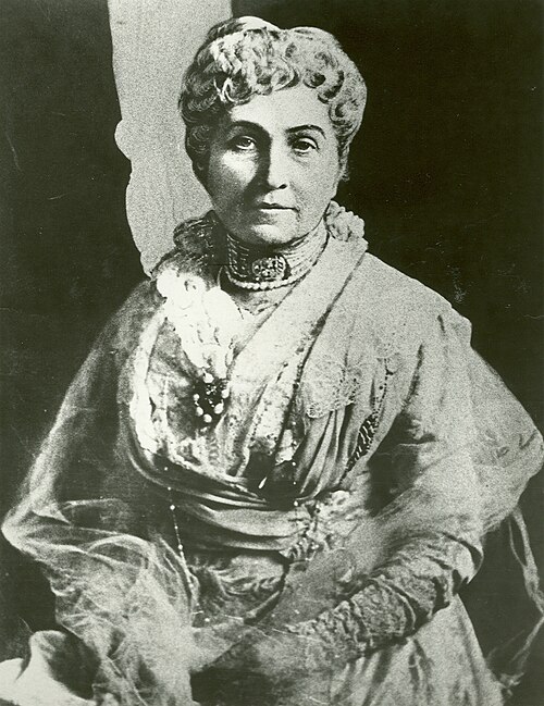
\", \"description\": \"Hearst Gymnasium was designed by [[Bernard Maybeck]] and [[Julia Morgan]] as a memorial to campus benefactor [[Phoebe Apperson Hearst]]; it was commissioned by her son, [[William Randolph Hearst]], to replace an earlier wooden gymnasium for women that had been destroyed by fire in 1922. ([https://geohack.toolforge.org/geohack.php?params=37.8694;-122.2569_dim:2000 37.8694,-122.2569])\", \"marker-symbol\": \"-number-F84388\", \"marker-size\": \"medium\", \"marker-color\": \"#efdf4f\" }, \"geometry\": {\"type\": \"Point\", \"coordinates\": [-122.2569,37.8694] } }, { \"type\": \"Feature\", \"properties\": { \"title\": \"17
[[UC Berkeley College of Environmental Design|College of Environmental Design]] (Bauer Wurster Hall, 1964)
[[File:9416 Wurster (28087873641).jpg|250px]]\", \"description\": \"Bauer Wurster Hall is named for husband and wife [[William Wurster]] and [[Catherine Bauer Wurster]], who both taught at the College of Environmental Design. ([https://geohack.toolforge.org/geohack.php?params=37.87055;-122.25488_dim:2000 37.87055,-122.25488])\", \"marker-symbol\": \"-number-F84388\", \"marker-size\": \"medium\", \"marker-color\": \"#efdf4f\" }, \"geometry\": {\"type\": \"Point\", \"coordinates\": [-122.25488,37.87055] } }, { \"type\": \"Feature\", \"properties\": { \"title\": \"18
[[UC Berkeley School of Law|School of Law]] (Boalt Hall, 1951)
[[File:Berkeley boalt hall exp.jpg|250px]]\", \"description\": \"The Berkeley Law school is housed in Boalt Hall, which is next to the Business School in the southeast corner of campus. ([https://geohack.toolforge.org/geohack.php?params=37.86986;-122.25339_dim:2000 37.86986,-122.25339])\", \"marker-symbol\": \"-number-F84388\", \"marker-size\": \"medium\", \"marker-color\": \"#efdf4f\" }, \"geometry\": {\"type\": \"Point\", \"coordinates\": [-122.25339,37.86986] } }, { \"type\": \"Feature\", \"properties\": { \"title\": \"19
[[California Memorial Stadium]] (1923)
[[File:Gameday at California Memorial Stadium.jpg|250px]]\", \"description\": \"California Memorial Stadium is the home venue of the [[California Golden Bears football]] team. It is listed on the National Register of Historic Places. ([https://geohack.toolforge.org/geohack.php?params=37.87111;-122.25083_dim:2000 37.87111,-122.25083])\", \"marker-symbol\": \"-number-F84388\", \"marker-size\": \"medium\", \"marker-color\": \"#efdf4f\" }, \"geometry\": {\"type\": \"Point\", \"coordinates\": [-122.25083,37.87111] } }, { \"type\": \"Feature\", \"properties\": { \"title\": \"20
[[People's Park (Berkeley)|People's Park]] (1969)
[[File:Peoples Park in Berkeley on April 1 2021.jpg|250px]]\", \"description\": \"The buildings on what would become People's Park were purchased by the university and demolished by 1968 in preparation for new student housing; however, the cleared land was claimed as an unofficial park in April 1969 and improved through plantings. Subsequent attempts to build housing there have not been successful. ([https://geohack.toolforge.org/geohack.php?params=37.86556;-122.25694_dim:2000 37.86556,-122.25694])\", \"marker-symbol\": \"-number-F84388\", \"marker-size\": \"medium\", \"marker-color\": \"#0f0f8f\" }, \"geometry\": {\"type\": \"Point\", \"coordinates\": [-122.25694,37.86556] } } ] } ]"}}">