
Loading article…
Härjedalen (Swedish:[ˈhæ̂rjɛˌdɑːlɛn]ⓘ) is a historical province (landskap) in the centre of Sweden. It borders the Norwegian county of Trøndelag, as well as the provinces of Dalarna, Hälsingland, Medelpad and Jämtland. The province originally belonged to Norway, but was ceded to Sweden in the Second Treaty of Brömsebro in 1645. The province forms the bulk of Härjedalen Municipality of which the village of Sveg is the seat.

The name Härjedalen, from Old West NorseHerjárdalr, literally means the "Valley of the Härje river". A Latinized transliteration is Herdalia although that name is hardly encountered in English today. More prominent are derivations such as Herjedalen or Haerjedalen. The more prosaic explanation of the name is that the word her or har means only "mound of stones" and refers to stones in the river Härjån.[2]
Härjedalen and Jämtland were provinces of Denmark-Norway until the mid-17th century.[3] Härjedalen came under the Norwegian king in the Middle Ages[3], ca. 1100. After the Treaty of Brömsebro in 1645, Härjedalen and Jämtland were ceded to Sweden.[3] They were commonly spelled Herjedalen and Jemtland until 1660.
The first population of Härjedalen is estimated to have migrated there circa 7,000 BC. The population lived from hunting and fishing, close to the inland ice which by then had started to melt. Ruändan, in the Flatruet mountains in northwestern Härjedalen, is the location of a large site of rock paintings. The rock paintings at Ruändan consists of some twenty figures depicting people, bear, moose and reindeer. The rock paintings were first reported in 1896 and are estimated to be over 4000 years old.

伝説によると、ハリエダーレンは、角笛でハルフダン・スヴァルテ王の家臣の一人を殺害した後、王の宮廷から東へ逃げなければならなかった強力なノルマン人にちなんで名付けられました。その後、彼はハリユルフ・ホルンブリタレ(文字通り「角笛を折るハリユルフ」)として知られるようになりました。彼はしばらくの間、スヴェア王アヌンドに仕えていましたが、王の妹ヘルガと駆け落ちし、二人は後に彼の名にちなんで名付けられた地域の辺鄙な場所に姿を消しました。今日、リルハルダル村には彼らに捧げられた像が立っています。ハリユルフとヘルガは、グリーンランドへの航海中に航路を外れて「新世界」を初めて目にしたノルマン人、アイスランド人のビャルニ・ヘルヨルフソンの祖先です。彼のボートは、約15年後にレイフ・エリクソンがヴィンランドへの有名な上陸のために入手したボートである。[ 4 ]
1030年のスティクレスタの戦いの後、ハリエダーレンのキリスト教化が行われた。農業は長い間ハリエダーレン最大の産業であり、製鉄業とトロンデラーグのローロスへの貿易がそれを補完していた。1850年代半ばに起こった工業化の結果、広大な林業もハリエダーレンで重要な役割を果たした。1800年代後半には、ハリエダーレンの住民の大部分がアメリカ、主にミネソタ州北西部に移住した。近年、ハリエダーレンはフナスダーレン、ヴェムダーレン、ロフスダーレンに大規模な山岳施設を備えた観光地としての地位をますます高めている。[ 5 ]
州の5分の4は標高500メートル以上に位置し、スカンジナビア山脈の一部を成している。スウェーデンで最も標高の高い村、ヘグヴォレン(標高835メートル)もこの州内にある。
ハリエダーレン地方には都市が全く存在しない。唯一、比較的規模の小さい村は市場町のスヴェグで、かつては同地方の行政中心地であった。
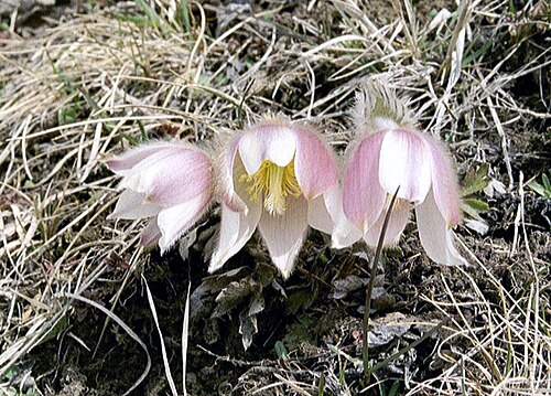
この州の州花は、ホッキョクスミレです。ヨーロッパの高地に多く見られ、アルプス山脈にも自生しています。
サンフィエレット国立公園は、この自治体を横断して広がっている。

スウェーデンの伝統的な州は、現在の行政上または政治的な目的には用いられておらず、歴史的・文化的実体として存在しています。ハリエダーレンの場合、イェムトランド県の南部に位置するハリエダーレン自治体(kommun)が存在します。この自治体は厳密には州と一致するものではなく、州よりも広い面積を有しています。
ヘリエダーレンは歴史的にいくつかの地区に分かれていました。
紋章は公爵冠で表現されています。紋章記述:「銀地に、黒地に赤の芯を持つ大槌、その間に銀色の刃先、そして銀色の柄で縦に飾られた2本のハンマー」。これは1660年に授与されました。1974年以降、ハリエダーレン自治体は同じ紋章を使用していますが、冠は含まれていません。
この州のサッカーはイェムトランド・ヘリダレンスサッカー連盟によって管理されている。
北緯62度15分、東経13度57分/北緯62.250度、東経13.950度/ 62.250; 13.950