
Loading article…
| カックミア川 | |
|---|---|
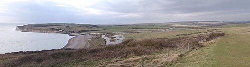 カックミア・ヘイブン方面を西に望む | |
 | |
| 位置 | |
| 国 | イングランド(イースト・サセックス) |
| 物理的 特性 | |
| ソース | |
| • 位置 | ヒースフィールド近郊 |
| 口 | |
• 位置 | イギリス海峡 |
| 長さ | 32 km (20 マイル) |
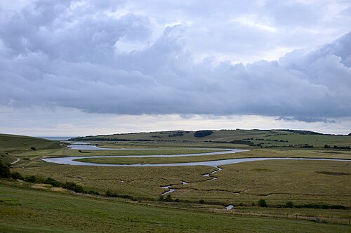

カックミア川は、イングランドのイースト・サセックス州ヒースフィールド近郊、ウィールド地方の南斜面に源を発する。川の名前は、おそらく「流れの速い」という意味の古英語に由来しており、最初の6.4キロメートル(4.0マイル)で100メートル(330フィート)以上も下る。イギリス海峡に注ぎ込み、サセックス海岸で唯一開発されていない河口を持つ。[ 1 ]
この川の上流には多くの支流があり、主な支流はブル川です。本流はヘリングリーから始まります。ロー・ウィールドの農地を横切った後、カックミア川は独自の谷を流れてサウス・ダウンズを切り開きます。シーフォードとセブン・シスターズの断崖の間にあるカックミア・ヘイブンでイギリス海峡に達します。氾濫原にある下流部は蛇行しています。[ 2 ]カックミア渓谷自然保護区は、川の下流の河口部に位置しています。この渓谷は自然保護にとって非常に重要です。特別科学的重要地区に指定されており、サウス・ダウンズ国立公園の一部となっています。[ 3 ]
The Cuckmere Valleycivil parish takes its name from the river. In the 19th century, defensive measures were taken to prevent flooding of the upper valley. Shingle was regularly dug from the mouth of the river and the banks were made higher. In 1846, the course of the river was straightened in an artificial cut; the cut mostly prevented flooding upstream, which used to reach to the village of Alfriston. It also provided support for irrigation.[4] In addition, raised river banks, or levees, were constructed to protect areas from flooding.
In recent decades, the area has become a major tourist destination, with tourism contributing to the local economy more than does agriculture. The river also stands at the foot of the current Litlington White Horse carved in 1924.
In 2001,[5] the Cuckmere Estuary Partnership was established as a collaboration of the National Trust, Natural England, Environment Agency, East Sussex County Council, Sussex Wildlife Trust, and various other environmental and conservation groups. They are working together to create long-term plans for the natural area. Government guidelines prohibit continuing to maintain hard flood defences where houses are not at risk. In addition, there is growing scientific evidence that the area would be more ecologically rich if allowed to return to its natural state. The partnership and the Environment Agency have proposed estuary restoration, and have been talking to residents, businesses, and visitors about how to proceed in the future. Presently, a shingle beach and raised river banks prevent seawater from penetrating the uppermost areas of the Cuckmere Valley. But the Environment Agency projects that an expected sea level rise due to climate change will increase the already steep costs of physical reinforcement, and current measures will not be sufficient. They intend to stop repair of the levees and to allow the cycle of natural processes, including periodic flooding of the area. The planning collaborators believe that in the long term, restoration of the saltwater estuary and marshes will enrich the ecological habitat, attract more wildlife and improve tourism.[6]
環境庁の計画は、特に一部の不動産所有者の間で谷で論争を引き起こしている。一部の住民は、提案されている季節的な洪水に代わる代替案を作成しようと、「クックミア渓谷を救え」というグループを結成した。[ 6 ] [ 7 ] 2008年初頭、クックミア教区評議会は、環境庁に対し、短期的にはより穏当な措置を取り、今後25~50年かけて長期計画を策定しながら、カットを保護するよう求める声明を発表した。[ 4 ]
北緯50度45分34.1秒、東経0度8分54秒/北緯50.759472度、東経0.14833度/北緯50.759472度、東経0.14833度