Loading article…
The Teteriv (Ukrainian: Тетерiв) is a right tributary of the Dnieper River in Ukraine. It has a length of 365 kilometres (227 mi) and a drainage basin of 15,300 square kilometres (5,900 sq mi).[2][3][1][4]
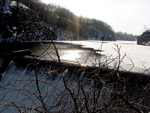
The Teteriv flows generally in northeastern direction through geographic regions of Podolian Upland, Dnieper Upland, and Polesia. The river starts near a populated place of Nosivky (previously Nosivka) near administrative border with Vinnytsia Oblast at 299 m (981 ft) over the sea level. Flowing through Podolian Upland in some areas it has characteristics of mountainous stream. In the underflow the valley of the Teteriv in Polissia on up to 4 kilometres (2.5 mi), the width of the river widens up to 40-90 meter, before it flows into the Dnieper.[4] The midstream of Teteriv from Zhytomyr to Radomyshl has predominantly rocky banks. Few kilometers east of Radomyshl turns into fully flatland river within Kyiv Oblast. Further east of Ivankiv turns into a swampy wetland. The river drains into the Dnieper in the Kyiv Reservoir just south of the Prypiat river estuary and the Chernobyl exclusion zone.
The Teteriv is replenished predominantly by snow and rain. It usually freezes over from December to March.
Large cities located on the river are: Zhytomyr, the administrative center of the Zhytomyr Oblast, Korostyshiv, and Radomyshl.[4]
ジトーミル市内では、20世紀初頭にテテリウ川右岸に、地元の貴族でロシア帝国動物保護協会の会長であったショドゥアル男爵によって市立公園が設立された。[ 5 ]ソビエト政権の樹立に伴い、男爵の遺体は家族の墓から投げ出された。[ 6 ]後にこの公園はロシアのパイロット、ユーリイ・ガガーリンにちなんで名付けられた。
この川の重要な支流は